What is a Bridge? Chicago Edition II

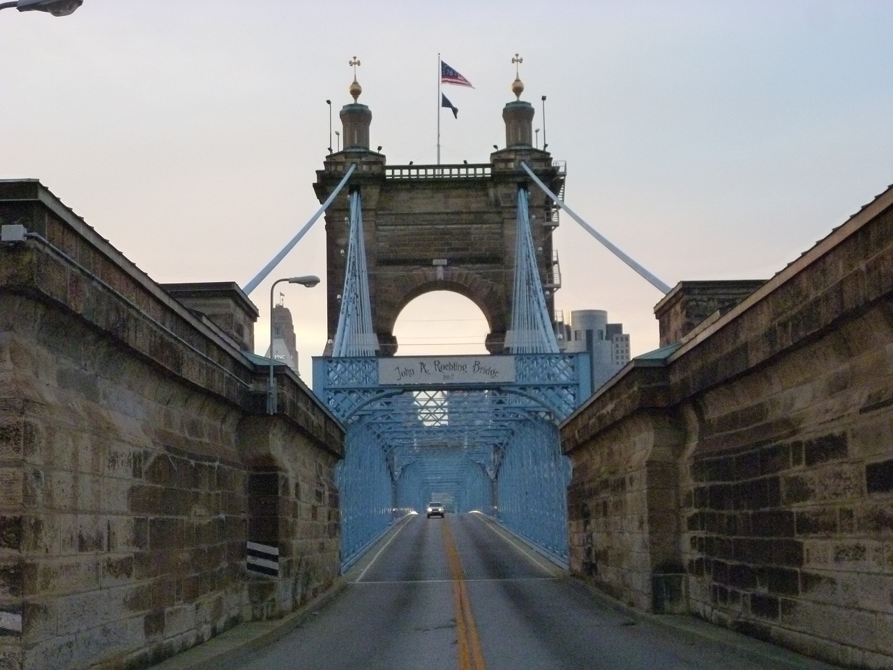
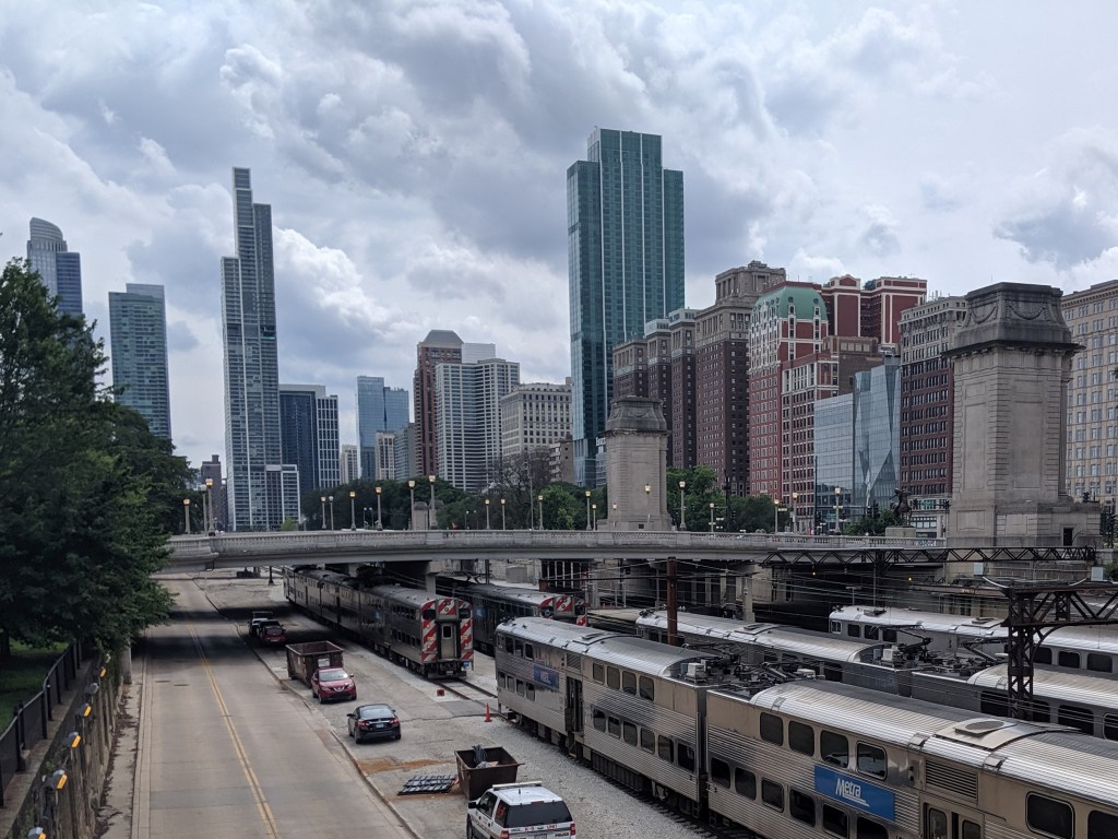
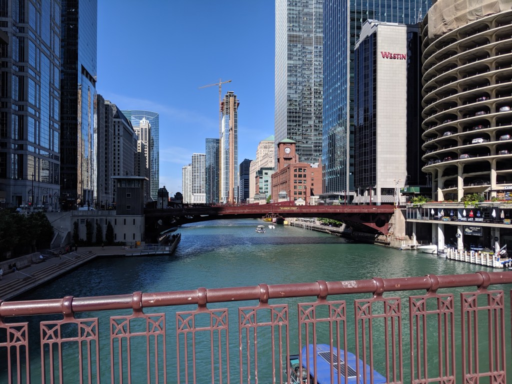
While poking around the map collection at Chicago’s Public Library, I discovered that the structures carrying roads over the railroad tracks in Grant Park are considered viaducts. The word viaduct brings to my mind a Roman structure soaring over a valley floor and conveying a flat road on top of towering stone arches. The Chicago “viaducts” do not fit that image. To me, they look like bridges with no striking difference between them and Chicago’s river bridges other than color and style of ornamentation. Both groups of structures have fairly flat roadbeds supported by piers. I am puzzled why one set of structures is called bridges and the other viaducts.

The main difference seems to be that the bridges are crossing a body of water while the viaducts are crossing an obstacle on land. This doesn’t feel like the answer, though. I’ve walked over 50 bridges in Pittsburgh, the majority of which are over land. Not one of these structures is called a viaduct. To help find clues to solve this puzzle, I looked up the definitions of bridge and viaduct.

Merriam-Webster’s definitions are not much help:

Viaduct: a long elevated roadway usually consisting of a series of short spans supported by arches, piers, or columns

Bridge: a structure carrying a pathway or roadway over a depression or obstacle

The Oxford English Dictionary has similar definitions:

Viaduct: an elevated structure consisting of a series of arches or spans, by means of which a railroad or road is carried over a valley, road, river, or marshy low-lying ground

Bridge: a structure forming or carrying a road, path, or (in later use) a railroad, etc., which spans a body of water, a roadway, a valley, or some other obstacle or gap, and allows a person or vehicle to pass unimpeded over or across it

Based on these definitions, the features that seem to distinguish a viaduct from a bridge are elevation and short spans. This still doesn’t help solve the question of why the Grant Park structures are viaducts and the Chicago River structures are bridges.

Next, I turned to “How to Read Bridges” by Edward Denison and Ian Stewart. The glossary defines viaduct as “a type of bridge over land formed by a series of small (usually arched) spans.” This definition seems to work best for the viaducts in Chicago. They are over land and have a series of spans, though the spans are not arched.

To further develop my understanding, I paged through the nine examples of viaducts in “How to Read Bridges.” All nine examples are elevated (such as the 330-foot high Goltzsch Viaduct and the 407-foot high Garabit Viaduct) and have multiple arches or piers (such as the 21-arch Glenfinnan Viaduct, the 8-arch Wharncliffe Viaduct, and the 5-pier Busseau Sur Grusse Viaduct). All, but one, have no support system above the road deck. The exception is the Millau Viaduct, which uses a cable-stayed deck on top of seven piers that range from 253 feet to 800 feet tall. All, but one, are over land. The Garabit Viaduct spans the Truyère Valley and one-third of its length crosses the Truyère River. In another example, the approaches to the Cubzac-les-Ponts over the River Dordogne are considered viaducts, but it is a bridge that crosses the river.

I find myself again at a loss. While the definition in this book seems to work for the Chicago viaducts, the examples do not look like the Chicago structures. To help the Chicago viaducts fit in, I propose a new definition built from the three definitions and nine examples above:

Viaduct: an elevated roadway, supported by many arches or piers over land.

Yet, there are exceptions to every rule. The nine examples in “How to Read Bridges” include exceptions to the support system of the viaduct and to the obstacle spanned by a viaduct. Expanding upon this, the Chicago viaducts, which are supported by multiple piers over land, become the exception to the elevated part of the rule or definition.

My biggest take away is that it is no easier to define a viaduct than it is to define a bridge. In most cases, as with bridges, a viaduct is something you know when you see it, even if you cannot define it. However, sometimes it takes a label or a sign, such as the maps of Chicago’s viaducts and, prior to its restoration, the maps of Heth’s Run Bridge, to know what you are seeing.


Additional Posts in Series:

Keeping an Eye on the Lower Hill: Jan. 2020


Lower Hill Redevelopment in the news:

October 8, 2019, Post-Gazette: Lacing the skates: Former Civic Arena redevelopment may be ready to roll

October 9, 2019, Post-Gazette: First wave of ex-Civic Arena site redevelopment would add garage, music and maybe money for Hill projects

October 10, 2019, KDKA: Urban Redevelopment Authority To Vote On Civic Arena Site Plans

October 10, 2019, Tribune-Review: Pittsburgh redevelopment authority postpones vote on construction at Civic Arena site

October 18, 2019, Tribune-Review: Pittsburgh authority gives preliminary OK for development of former Civic Arena site

October 18, 2019, WESA: URA Vote Sets the Stage for Lower Hill Development in Spring 2020

October 18, 2019, WPXI: City board green lights former Civic Arena site redevelopment

October 21, 2019, Arena Digest: Civic Arena Redevelopment Plan Moves Forward


Lower Hill Redevelopment project sites:

Lower Hill Redevelopment

Sports and Exhibition Authority

Urban Redevelopment Authority


Keeping an Eye on Uptown: Nov. 2019


Keeping an Eye on Uptown: Introduction

Inspired by my post from this summer, I decided to start a photographic series of Pittsburgh’s Uptown neighborhood. This neighborhood is a hodgepodge of abandoned and renovated townhomes, parking lots, car-oriented businesses, corner stores, industrial uses, and new construction residential buildings. It is predicted to be on a tipping point from being mostly ignored to experiencing intense growth fueled by activities in and around the neighborhood. These activities include:

  • UPMC Mercy hospital is currently building a 410,000 sq ft vision and rehabilitation center in the middle of Uptown.
  • The Penguins hockey team is supposed to be finally getting off the ground with their redevelopment of the Lower Hill neighborhood, which is adjacent to Uptown.
  • June 2019 saw the groundbreaking for the CAP project to reconnect the Lower Hill to Downtown over the freeway that bisected the two in the 1960s.
  • The Bus Rapid Transit system currently in the planning stage will one day connect Downtown and Oakland through Uptown.

As these projects move forward, there will likely be more investment and changes to Uptown. This photographic series is intended to capture these changes by revisiting the same sites at regular intervals over the next several years.

In the coming months, I intend to release two related series to record the progress of the CAP and the Lower Hill redevelopment.

Moral Economics

The strongest impression from my last trip to Cardiff was the feeling that it is morally wrong to invest heavily in touristy neighborhoods while skipping the neighborhoods of the residents. Tourists may provide a bigger return per touch point, but residents have many more touch points (including voting). Perhaps I have become jaded since that trip, but I now accept that economics and morals rarely work together.

Pittsburgh’s Uptown neighborhood is trying a different approach to see if economic investment can be leveraged for the greater good. Uptown experienced disinvestment and decay for decades, despite being located between and within walking distance of Oakland and downtown, two of the largest economic engines in the state. Not to mention the main roads connecting these prosperous and growing areas run directly through Uptown. Zipping down Fifth Avenue from Oakland to downtown, it is easy to overlook or ignore the ruined home foundations turning back to forest, the wide-spread vacant lots and parking lots, and the intricate architectural details on the remaining old structures.

Former Rialto Theatre

The bland brick and glass facade on Fifth Avenue identifies this building as another mid-century warehouse. Turning the corner, the decorative parapet wall and bricked over arched opening tell the story of an older, more interesting building.

One such structure was one of the many movie theaters dotting the city in the 1920s. In the 1950s, the adjacent buildings were demolished, and an addition was added to the theater to turn it into a storeroom. After a time as a plasma center in the 1980s and 1990s, the building sat vacant and dusty for many years. Now, it is undergoing renovations for its next life. This is just one of the many signs that investment is coming to Uptown.

The community of Uptown that held on through the economically rough times prepared for this moment. In collaboration with many partners, including local institutions such as Duquesne University and UPMC Mercy as well as the City of Pittsburgh, the community created a new neighborhood plan. This designated Uptown and West Oakland as an EcoInnovation District. One of the first actions from this plan developed a new zoning district, the first progressive zoning district in Pittsburgh. The goal of the plan and the zoning district is to leverage the coming economic investment to create an inclusive and environmentally sustainable neighborhood.

It will be interesting to watch this neighborhood over the next few years to see if the plans are successful at introducing some moral components to the economic investment.

Layers of the City: Chicago Edition

The first place to show me how a city can be stacked like a layer cake, Chicago provided ample opportunities to explore all levels of the city. The experience of noticing the expansion joints in roads that I assumed were on solid ground opened my eyes to the possibilities of stacking uses.

Underground Life

A vacant lot two stories below street level solved the mystery of the expansion joints, by exposing the inner guts.  Two more roads sit below street level to segregate trash pick-up and deliveries from the flow of traffic.  These lover levels also provide some opportunities for parking without monopolizing valuable real estate above.  Retail shops connected by pedestrian passageways are also interspersed in these layers.

River Life

At the same elevation as the “underground life,” the Chicago River flows through the heart of the city.  On and along the river are a variety of activities.  Pedestrian paths, cafes, housing, parks, industrial uses, and homeless encampments line the shores.  Meanwhile, the river abounds with ducks, boat tours, water taxis, construction staging, and marinas.

Street Level

Back up on the street level, life buzzes.  Vehicular and pedestrian traffic rush passed, occasionally pealing off to visit the numerous shops, offices, museums, restaurants, cafes, parks, and trails.

Pie in the Sky

Yet, more life looms above.  Several of the skyscrapers have penthouse, or nearly penthouse, restaurants.  Others have rooftop observation platforms.  Between these and the street are many other opportunities for enjoying life including a religious sanctuary, the “L”, gardens, art, pedestrian bridges, and of course, offices, apartments, hotel rooms, and shops.

Unlike Pittsburgh, in Chicago, the public is welcome in some form on every level to gain a full experience of the city.

In Search of Roebling

P1070036

Last summer’s search for Roebling bridges (see Market St, Steubenville and Wheeling Suspension Bridge) came to a successful end as a golden sunset spread over Cincinnati.  The reason we struck out earlier in the day is that the Cincinnati-Covington Bridge is one of the two remaining Roebling suspension bridges.  The other is, of course, his most famous bridge: the Brooklyn Bridge.  The first of Roebling’s five suspension bridges was built in Pittsburgh at the site of the current Smithfield Street Bridge, but lasted less than 40 years before the increased river and road traffic made it obsolete.

P1060937

Between Roebling’s two remaining bridges, I found the Cincinnati bridge more appealing.  Its character feels like it would fit right in on the Thames in London.  I also appreciated the engaging green spaces at either end.  The birds liked this bridge, too.

P1070038

Sunset from the Roebling Bridge


Heth’s Run Bridge: Redux

Heth’s Run Bridge, the first bridge I posted about in my Pittsburgh bridges project, is scheduled to be replaced by the end of next year.  The notice to proceed was expected to be issued last week with construction beginning on Sept. 24 with the installation of a temporary road around the bridge, through the zoo’s parking lot.  According to the schedule that was passed out at a community meeting at the end of August, the bridge is expected to close with all car traffic being diverted to the temporary road on Nov. 1st.  Due to the turning radius constraints with the temporary road, trucks will not be permitted and will instead be by way of the Highland Park Bridge, Route 28 and the 62nd Street Bridge.  If all goes according to schedule the bridge should reopen to all traffic on October 1, 2014.  Additional road work will continue through October.  After final inspections, the project is expected to be officially completed by December 8, 2014.

Heth's Run Bridge's hazardous sidewalk

This is a PennDOT project expected to cost over $18.5 million and is definitely needed.  As I discuss in my Heth’s Run Bridge Part II and Highland Park Bridge posts, the sidewalks here are in desperate need of repair and the proportion of sidewalk to road across the bridge is at least 50 years out of date.  All this is going to be addressed in the reconstruction.  The new bridge is going to have two lanes in each direction to match the roadway on either end.  Additional features of the new bridge will be decorative railing, period lighting, entrance pylons, and “architectural features on the abutments with form liners” (which I believe refers to new urns).  At the community meeting, it was mentioned that the current urns will be saved and kept in a warehouse until a new home is found for them.

In addition to the bridge, about 870 feet of Butler Street are going to be reconstructed including sidewalks.  My understanding is that this is the part of Butler from the Heth’s Run Bridge to the ramps of the Highland Park Bridge, which should take care of my complaints about the condition of the sidewalk for those of us trying to cross the Highland Park Bridge without a car.  This should also clear up the confusion for the outbound traffic of whether this part of the road is one lane or two as the plans include removing the “kink” from the existing alignment.

New signals and ADA ramps will be installed at the intersections of Butler with One Wild Place and with Baker Streets.

Another major part of the project is the excavation under the bridge to an elevation of 762.  According to GoogleEarth, the bridge is at an elevation of 800 ft. I’m not sure if this will restore the bridge to its exact historic height, but it will be close (see the photo of the previous bridge from 1912).  This will also pave the way for connecting this area to the proposed Allegheny Riverfront Green Boulevard project.

This project will no doubt cause some inconveniences during the construction process, but the construction of the temporary road will significantly cut down on this even though it adds over a month to the process.  Imagine instead, everyone having to go on the truck detour or all the Zoo traffic coming down Morningside Ave and Baker Street instead of One Wild Place and Butler Street.  That would be a true nightmare.  Thank you, PennDOT and the Pittsburgh Zoo & PPG Aquarium for the temporary road.  Thank you, PennDOT and any other funders, Sen. Jim Ferlo, Rep. Dom Costa, and anyone else who had a hand in helping bring about this long overdue project.

I can’t wait to walk over the new bridge when it’s finished!

More information about the project including the design of the temporary road can be found here: http://morningside-pa.org/wp-content/uploads/2013/08/hethsrunbridge.pdf

PGH’s Expanding Bicycle Infrastructure

The Green Bike Lane

This week was an exciting one for bike infrastructure in the city of Pittsburgh.  The first green bike lane was installed.  I’ve been waiting for this for two years and it surpassed my expectations! (I am sure others, such as the city’s Bike Planner who brought the project about, waited for this moment much longer me.)

Installing the Green Bike Lane

The road here used to be three lanes (left-turn only and two straight), but the right lane was rarely used because just after the next intersection it merges into the left lane.  The lines for the green bike lane were painted late last fall, but I assume the green wasn’t laid then due to weather issues.  As I passed through this area regularly on the bus, I noticed that there were some motorists who either ignored the solid line running along the side and down the middle of the lane or didn’t notice them.  This lane did not have the bike symbol in it yet, so I motorists being a little confused here.  However, in other parts of the city, I have often witnessed cars driving along in clearly designated bike lanes (meaning there are signs posted and the bike symbol painted in the road).  Soon I hope to be able to report that motorists recognize they don’t belong where the green paint is, giving bikers a clearly recognized portion of the road.

Green stands out

One of the really neat things about this bike lane is that it stands out from quite a distance.  I was initially skeptical when I heard it was going to be a green lane–I pictured a grass or forest green color–but this neon green is very eye catching.