Layers of the City: Chicago Edition

The first place to show me how a city can be stacked like a layer cake, Chicago provided ample opportunities to explore all levels of the city. The experience of noticing the expansion joints in roads that I assumed were on solid ground opened my eyes to the possibilities of stacking uses.

Underground Life

A vacant lot two stories below street level solved the mystery of the expansion joints, by exposing the inner guts.  Two more roads sit below street level to segregate trash pick-up and deliveries from the flow of traffic.  These lover levels also provide some opportunities for parking without monopolizing valuable real estate above.  Retail shops connected by pedestrian passageways are also interspersed in these layers.

River Life

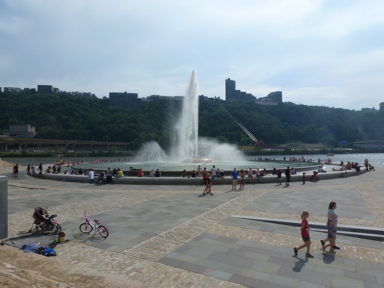
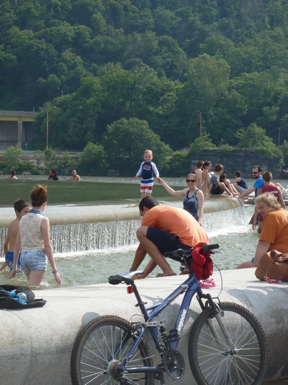
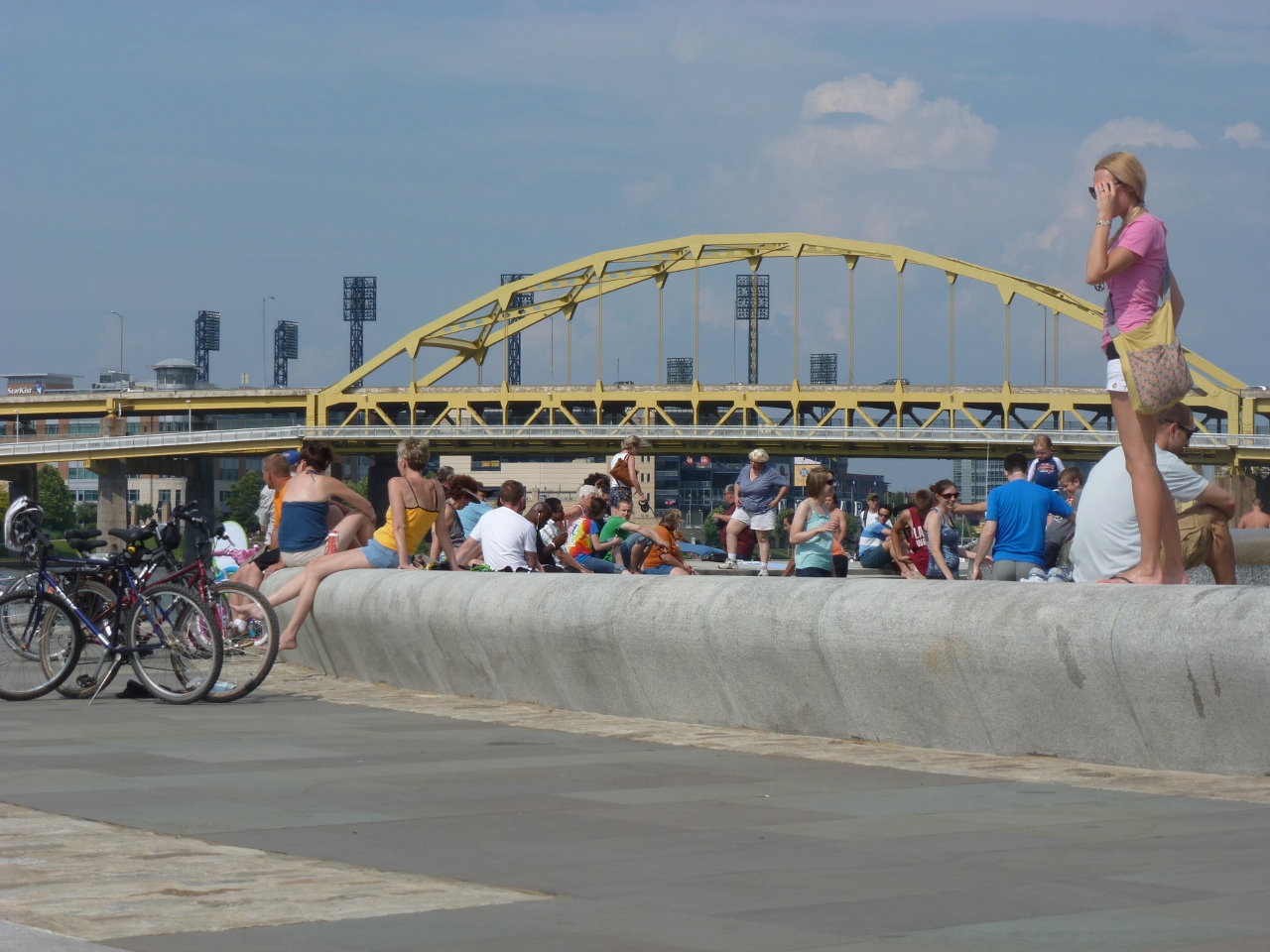
At the same elevation as the “underground life,” the Chicago River flows through the heart of the city.  On and along the river are a variety of activities.  Pedestrian paths, cafes, housing, parks, industrial uses, and homeless encampments line the shores.  Meanwhile, the river abounds with ducks, boat tours, water taxis, construction staging, and marinas.

Street Level

Back up on the street level, life buzzes.  Vehicular and pedestrian traffic rush passed, occasionally pealing off to visit the numerous shops, offices, museums, restaurants, cafes, parks, and trails.

Pie in the Sky

Yet, more life looms above.  Several of the skyscrapers have penthouse, or nearly penthouse, restaurants.  Others have rooftop observation platforms.  Between these and the street are many other opportunities for enjoying life including a religious sanctuary, the “L”, gardens, art, pedestrian bridges, and of course, offices, apartments, hotel rooms, and shops.

Unlike Pittsburgh, in Chicago, the public is welcome in some form on every level to gain a full experience of the city.

Brooklyn Bridge

119 (1024x768)

Yesterday, as I was writing my post about the Wheeling Suspension Bridge by Roebling’s competitor, I was fascinated to discover that I never wrote a post about my walk across the Brooklyn Bridge. I decided to rectify the situation. The more I worked on it; the more fascinated I became. At this point, nearly 5 years after having walked it, all I can surmise is that I must have been very tired and/or hungry while crossing it.

In my post on the Manhattan Bridge, I mention how much more I liked that bridge than the Brooklyn Bridge. I can remember how much more thought provoking I found the Manhattan Bridge, but in looking back at my photos, I am shocked at how uninspiring I found the Brooklyn Bridge. I think it may hold the record for the fewest number of photos I’ve taken of any of the bridges I have walked. Especially, if we look at number of photos versus the length of the bridge. I suppose there may have been some other factors such as the construction zone on parts of the bridge.

144 (1024x768)

Another factor may have been the fact that the walkway is in the center of the bridge and above level of the traffic. While I remember this as a highlight and an intriguing part of the bridge, I also seem to recall that it may have caused interference with framing any potential photos.

156 (768x1024)

I will take back some of my comments on the Wheeling Suspension Bridge. While both bridges do have a lot of structural parts holding them up, those of the Wheeling bridge were much more fascinating. This may in part have been because you were able to get up close with them.

Below are the views of the surroundings. On one side you have the Manhattan Bridge and on the other the Statue of Liberty. That is just about the extent of the photos I took from the Brooklyn Bridge.

154 (1024x768)

166 (1024x768)

I feel that I ought to give this bridge a second chance. If/when I ever make it back to New York City, I think I will have to walk it again (maybe after a good meal). The problem here is that my last trip there in 2012 when I first walked the bridge confirmed for me that New York is really not the city for me and I have no plans to make a trip back anytime soon.


Big Dam Bridge

Big Dam Bridge signThe name says it all. This bridge was built as the longest pedestrian- and bicycle-built bridge in the country spanning 4,226 feet across the Arkansas River, connecting Little Rock and North Little Rock. It is part of the Arkansas River Trail.

Big Dam Bridge

On a trip to Arkansas this winter, I discovered this bridge and naturally had to add it to my list of bridges I’ve walked across. The intention of my trip to Arkansas was to visit friends but also to get a break from the cold northern winter by heading south. When I bought my tickets in January, the Little Rock region was having 60 degree weather. A month later when I arrived, the high was 26.

View of Pinnacle Mountain from the Big Dam Bridge

View of Pinnacle Mountain from the Big Dam Bridge

View toward downtown Little Rock showing Rebsaman Park

View toward downtown Little Rock showing Rebsaman Park

By the time we reached the half-way point of the bridge, we were frozen stiff. The farther we got on the bridge the stronger the wind got, probably creating a wind chill factor closer to 20 degrees or less. After admiring the views from the midpoint for a minute, the cold and wind forced us to turn back toward the car.On the Big Dam Bridge

Top 10 Bridge Travel SitesWhile I didn’t make it all the way across, I can still say I’ve been on one of the Top 10 Bridge Travel Sites in the US. Now I just have to find the other 9 sites.

The Point…of Gathering

A renewed downtown Pittsburgh attraction is a great place on a hot day.  With last weekend’s temperatures reaching near 90, the revitalized Fountain on the point of Point State Park was a popular place to be.

The Fountain

The new “wading” portion of the fountain was enjoyed by families, friends, couples, and pets.

Bathers

Families and Pets

Pittsburghers and Icons

The fountain was also a gathering point for bikers enjoying the Three Rivers Heritage Trail System and Pittsburgh’s bike rental program and kayakers taking advantage of Venture Outdoors’ Kayak Pittsburgh rentals.

Kayakers and Bikers enjoy the Point

The Point is one of the key geographical features that influenced the creation and history of Pittsburgh.  With the rebirth of the fountain, it will continue to be an important attraction in the city.

The Point of...


PGH’s Expanding Bicycle Infrastructure

The Green Bike Lane

This week was an exciting one for bike infrastructure in the city of Pittsburgh.  The first green bike lane was installed.  I’ve been waiting for this for two years and it surpassed my expectations! (I am sure others, such as the city’s Bike Planner who brought the project about, waited for this moment much longer me.)

Installing the Green Bike Lane

The road here used to be three lanes (left-turn only and two straight), but the right lane was rarely used because just after the next intersection it merges into the left lane.  The lines for the green bike lane were painted late last fall, but I assume the green wasn’t laid then due to weather issues.  As I passed through this area regularly on the bus, I noticed that there were some motorists who either ignored the solid line running along the side and down the middle of the lane or didn’t notice them.  This lane did not have the bike symbol in it yet, so I motorists being a little confused here.  However, in other parts of the city, I have often witnessed cars driving along in clearly designated bike lanes (meaning there are signs posted and the bike symbol painted in the road).  Soon I hope to be able to report that motorists recognize they don’t belong where the green paint is, giving bikers a clearly recognized portion of the road.

Green stands out

One of the really neat things about this bike lane is that it stands out from quite a distance.  I was initially skeptical when I heard it was going to be a green lane–I pictured a grass or forest green color–but this neon green is very eye catching.

Pedestrian Bridges: Bates Street

The trail bridge over Bates Street, which opened in 2011, is the second newest bridge in Pittsburgh.  The newest is the pedestrian bridge in East Liberty (see Taking the Long Way Round post).  The East Liberty bridge was a completely new bridge, whereas there was a trail bridge over Bates Street before.  This bridge carries the Eliza Furnace Trail.  This trail is part of the larger Three Rivers Heritage Trail.  I believe that this is the only bridge over a road along the Three Rivers Trail system.  There is a converted railroad bridge that carries the trial over part of the Allegheny River (see July 15 post).  The Hot Metal (Aug 9 post), Smithfield Street and Fort Duquesne (June 19 post) bridges are also considered part of the trail system according to the trail map.

As I mentioned in the Birmingham Bridge post, the part of the Three Rivers Trail system that travels on the northern side of the Monongahela is not a very pleasant stretch.  This area around the Bates Street Bridge is one of the worst sections.  The trail is caught between a freeway and the high traffic, through way of Second Avenue.  There is no vegetation or anything else to act as barriers to the noise of the traffic on these two roads and to the sun on a hot day.

Further away from town (in the direction the picture above looks), the trail improves some as it comes to an elevation between that of the freeway and Second Avenue and there is more space between the trail and the roads.  I’ve traveled on this trail toward town only once or twice, so I don’t remember specifics about it.  I do remember that it does continue to lean toward being unpleasant.  The times I traveled on it, I was biking.  From that experience I know I would never choose to walk it.  On a bike, you go fast enough to ignore much of the harshness of the trail, but walking you would be forced to take it all in.

Perhaps the biggest problem with this part of the trail system is that it doesn’t approach anywhere near the river.  This is a significant flaw for a trail considered part of a river trail system.  At the Bates Street Bridge, the trail is separated from the Monongahela River by Second Avenue and the office/technology park I reference in the Birmingham Bridge post.

One of my original fascinations with my walking bridge project was the different views of the city captured from the various bridges.  The Bates Street Bridge adds to the views of downtown I’ve collected so far: