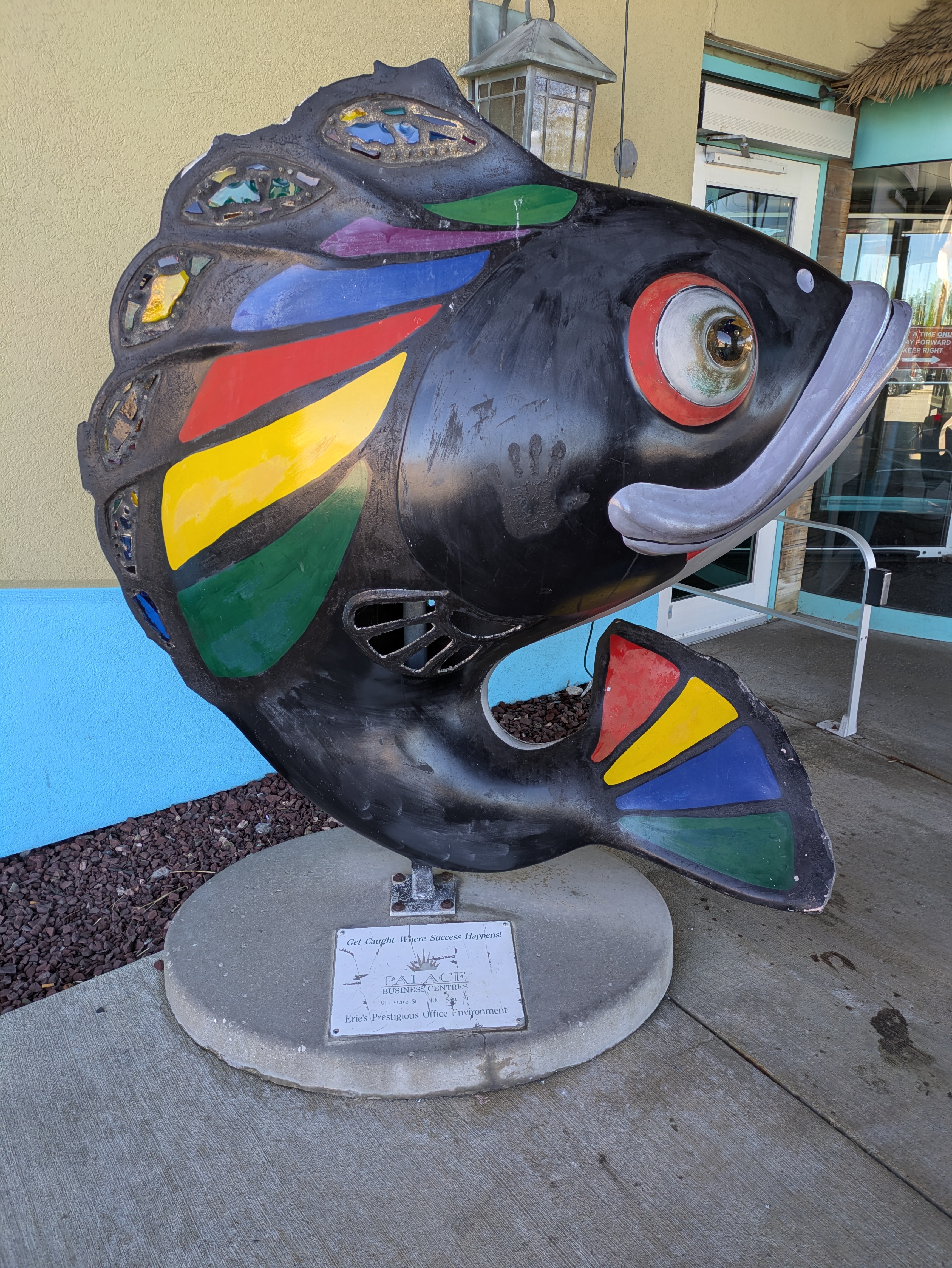
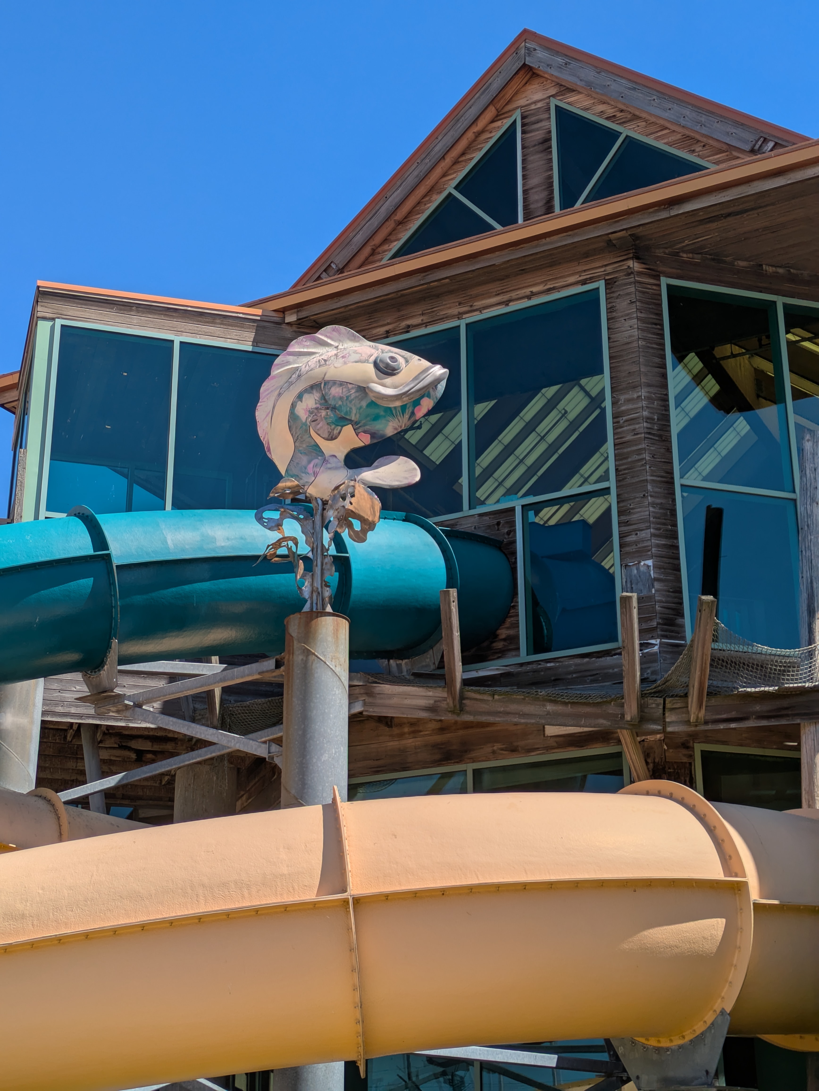
GoFish! was a fundraiser in Erie, PA, in 2001. “Stained Glass Bass” by Ed Grout & Creators from the Black Lagoon was one of the fish I caught at Splash Lagoon summer 2025.

GoFish! was a fundraiser in Erie, PA, in 2001. “Stained Glass Bass” by Ed Grout & Creators from the Black Lagoon was one of the fish I caught at Splash Lagoon summer 2025.
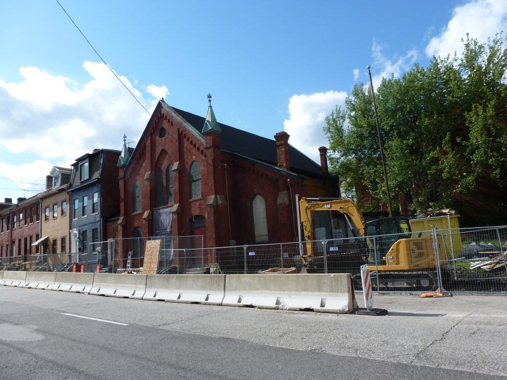
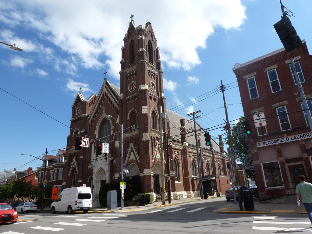
“Bluff” is the name used on the official map of city-designated neighborhoods, but the local community organization calls it “Uptown” and the city used “Uptown” for the special zoning districts inspired by the EcoInnovation District Plan for “Uptown/West Oakland.”
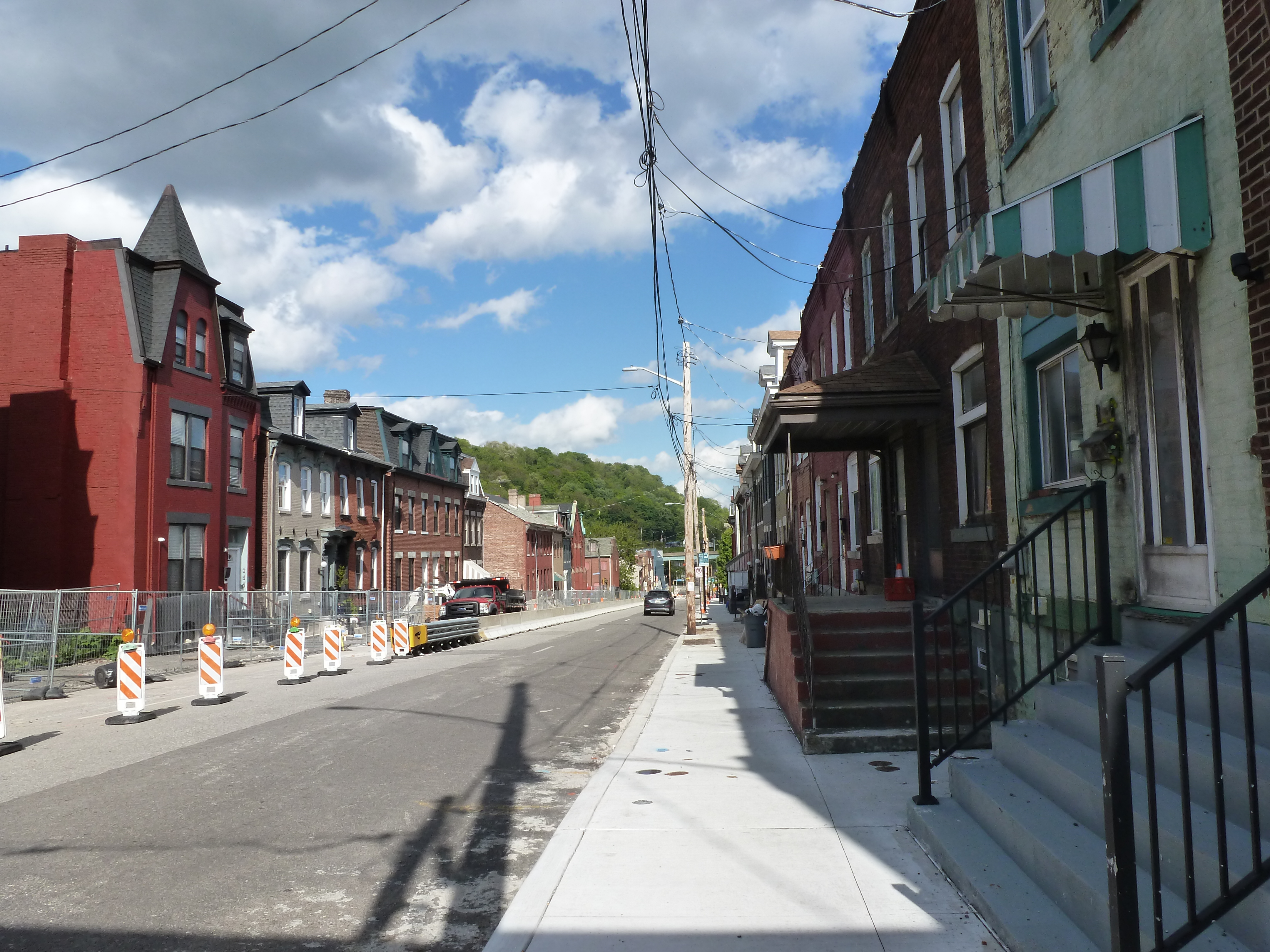
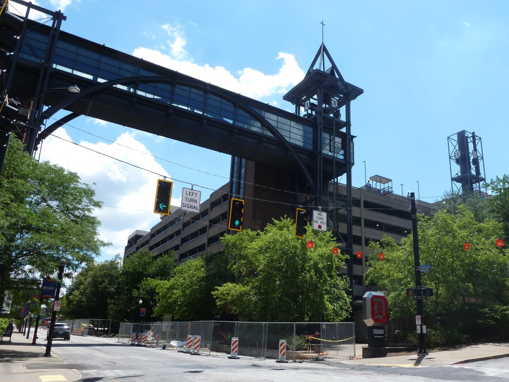
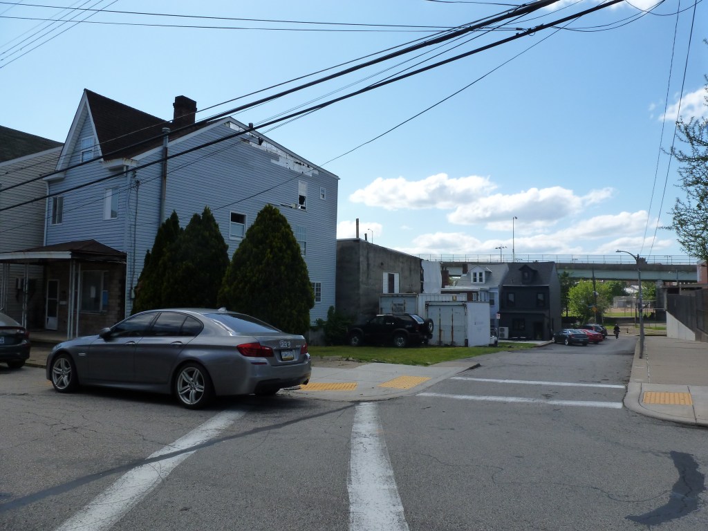
Both names are descriptive of different aspects of the neighborhood. Located upriver from downtown Pittsburgh, “Uptown” is a logical (and attractive) name. On the other hand, near the southern border of the neighborhood, Bluff Street blends into Blvd of the Allies. Both streets line the edge of a sheer cliff and provide sweeping vistas across and down the Monongahela River to South Side Flats and Slopes neighborhoods and beyond.
Uptown suggests a dense and vibrant community, while Bluff suggests a steep, potentially tough, sparsely populated area. Between Bluff Street and Fifth Avenue, Uptown/Bluff is a densely developed neighborhood. Between Bluff Street and the Monongahela River, Uptown/Bluff is currently predominately freeways and parking lots where there used to be numerous railroad lines, rail yards, and a handful of small industries.
While Uptown/Bluff was densely built out in 1926, the neighborhood has experienced disjointed investment and disinvestment in the decades since.
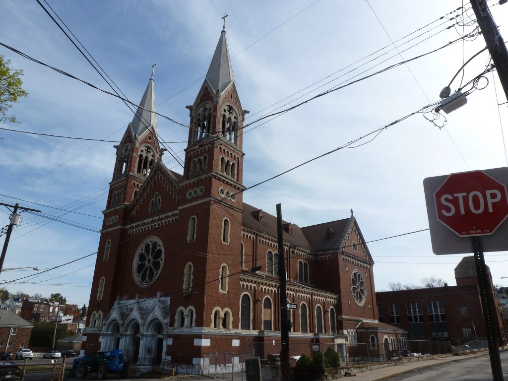
The Bluff Street Urban Renewal project was investment for the expansion of Duquesne University. As of 1970, the city relocated 219 families, 252 individuals, and 101 businesses for this expansion, and had 288 new units of housing under construction. Another 5 families, 200 individuals, and 9 businesses were expected to be displaced before the end of the project. Another investment was planned for a different institution’s expansion. The Mercy Hospital Expansion Urban Renewal project was proposed to cover 20 acres, but no projections were provided in the 1970 report for any displacement in this dense neighborhood.
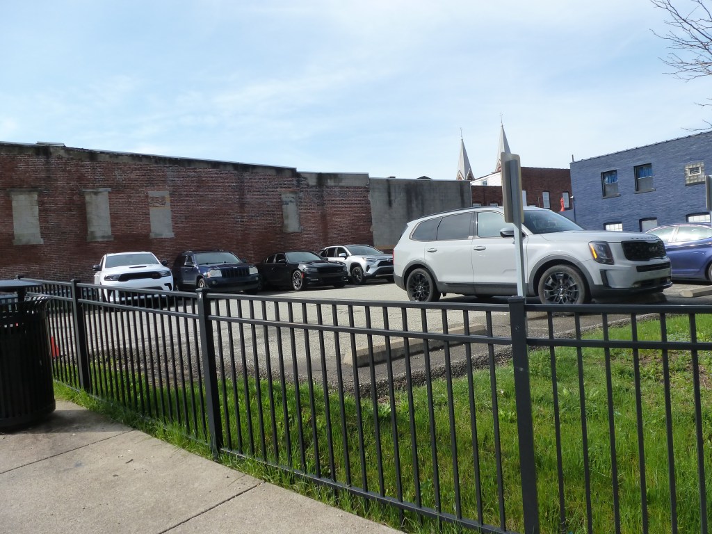
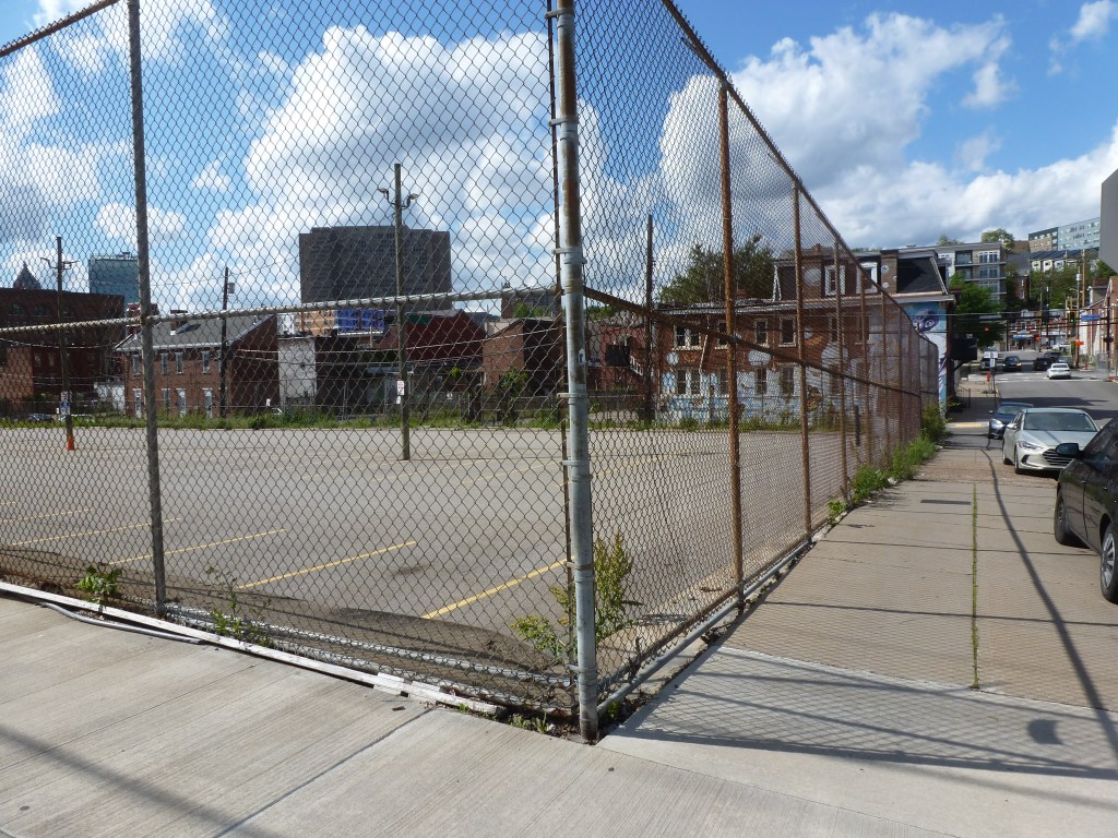
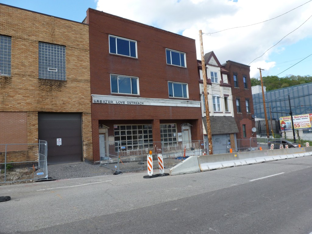
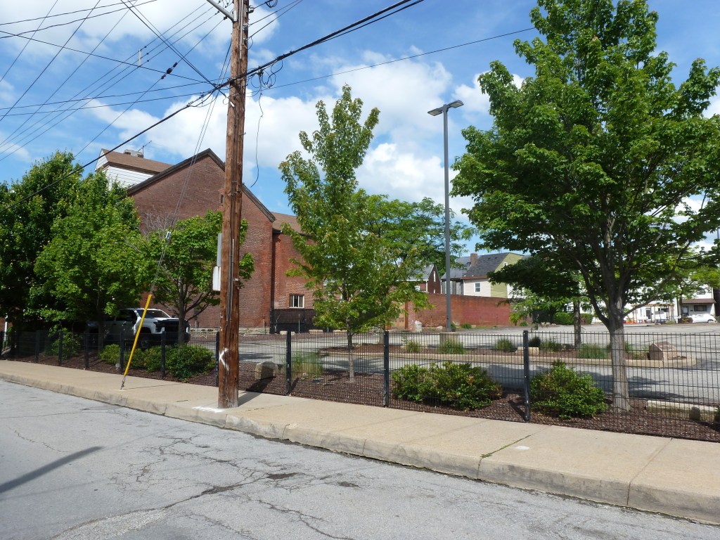
Decades of disinvestment are apparent in the number of vacant lots and vacant buildings. Many lots had been bought up and converted into surface parking lots, something the EcoInnovation Plan and subsequent zoning districts strongly curtail.
In the last 10 years, reinvestment in the neighborhood has grown significantly, shifting from small efforts of individuals who purchased homes and restored them to large developers filling in new, large, multi-story buildings. UPMC Mercy and Duquesne University also continue to expand and build large new institutional buildings in the neighborhood. The neighborhood’s infrastructure is also seeing investment now as Forbes and Fifth Avenues have been undergoing a multi-year reconstruction to support a future bus rapid transit line through the neighborhood.
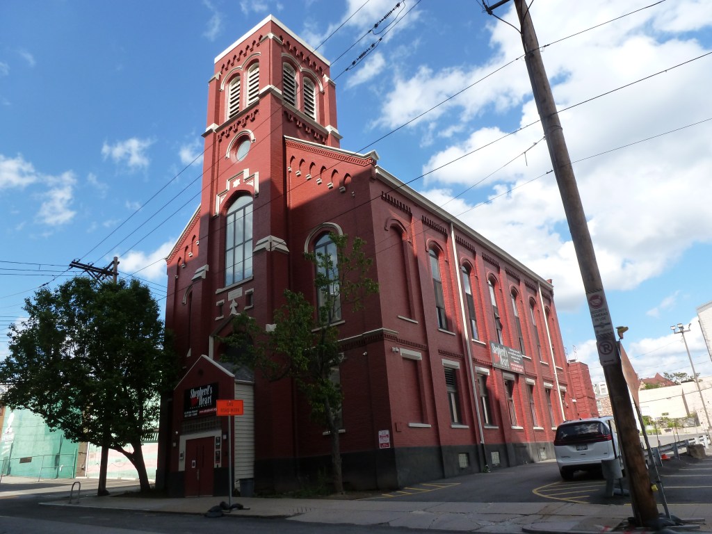
What these patterns have in common is change. The religious sites from the 1926 directory reflect that change as none of them are what they were 100 years ago, except for the hospital chapel.
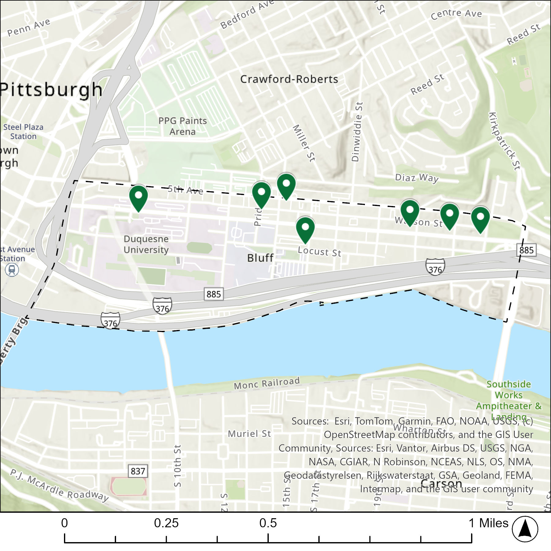
The map below shows the locations for 9 of the 10 congregations listed in the 1926 directory for the Bluff (the dotted line marks the neighborhood boundary). I’m intentionally leaving out the Mercy Hospital Chapel as a religious center that doesn’t fit the typology of what I’m studying. There are only 7 pins because some congregations appear to have shared buildings.
The table below matches the 10 congregations listed in the 1926 directory with the current use of the site.
| 1926 Congregation Name | By 2026 the Congregation’s Building is: |
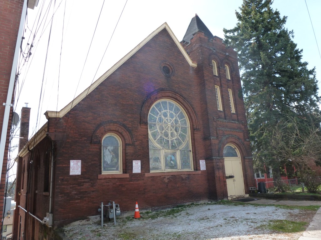
| Central Presbyterian Church | being redeveloped into housing |
| Corinthian Baptist Church | vacant |
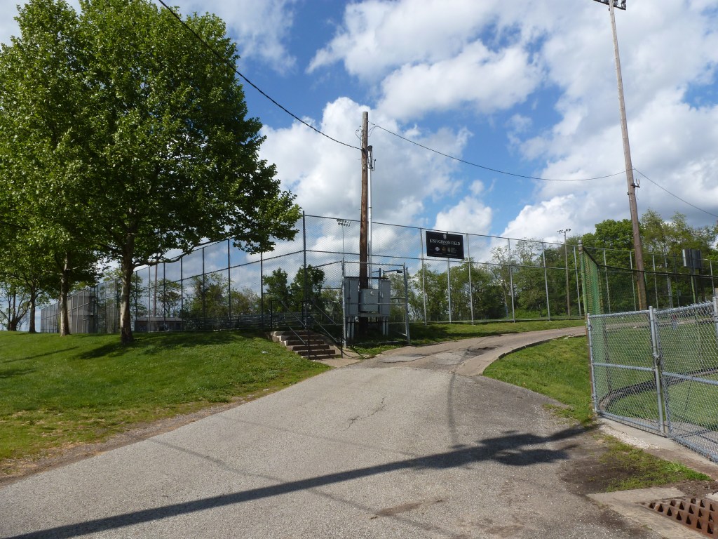
| Eighth United Presbyterian Church | replaced with a parking lot |
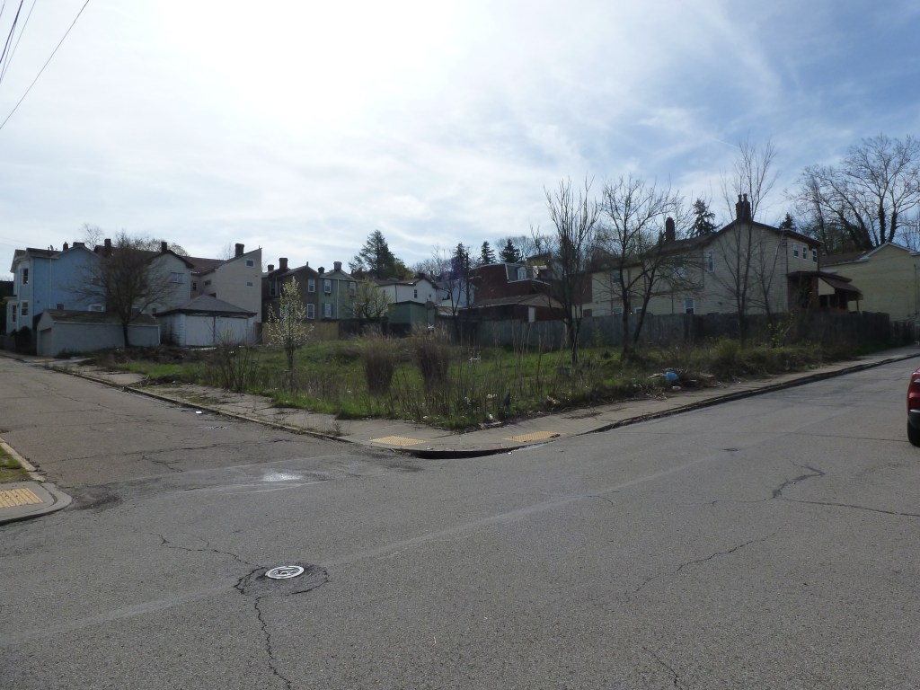
| First Pentecostal Church | location unclear, may be a parking lot |
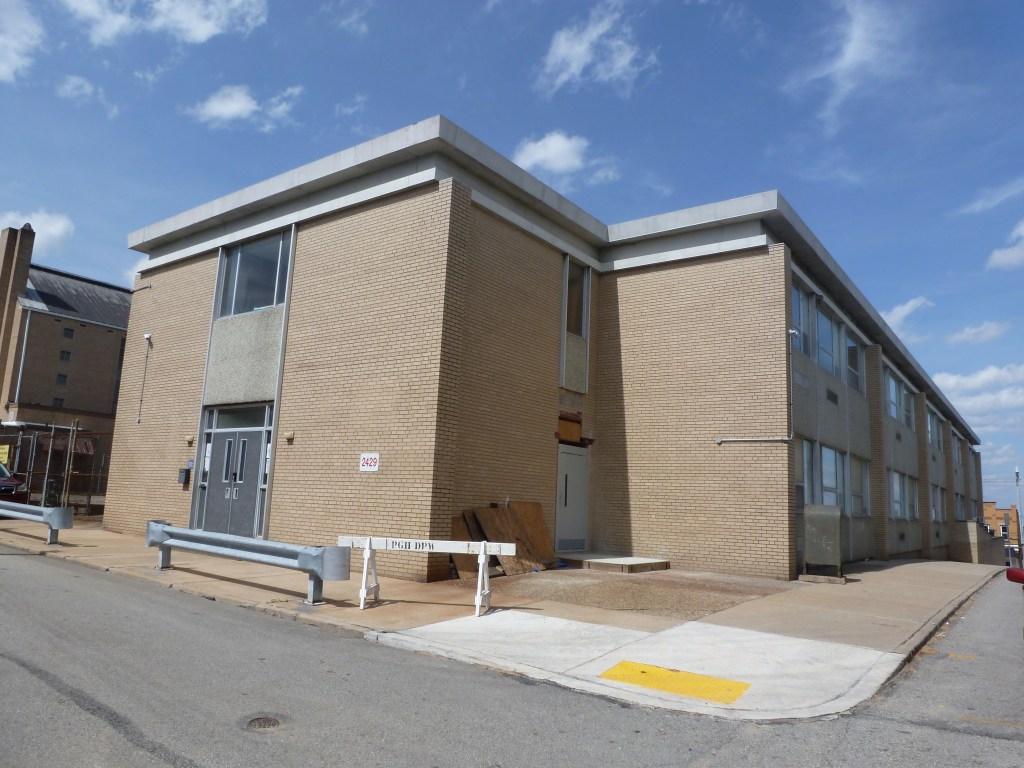
| Jesus Saves Mission | replaced with a parking garage for a Catholic university |
| Mercy Hospital Chapel (no photo) | still Mercy Hospital Chapel |
| Russian Mission | being redeveloped into housing |
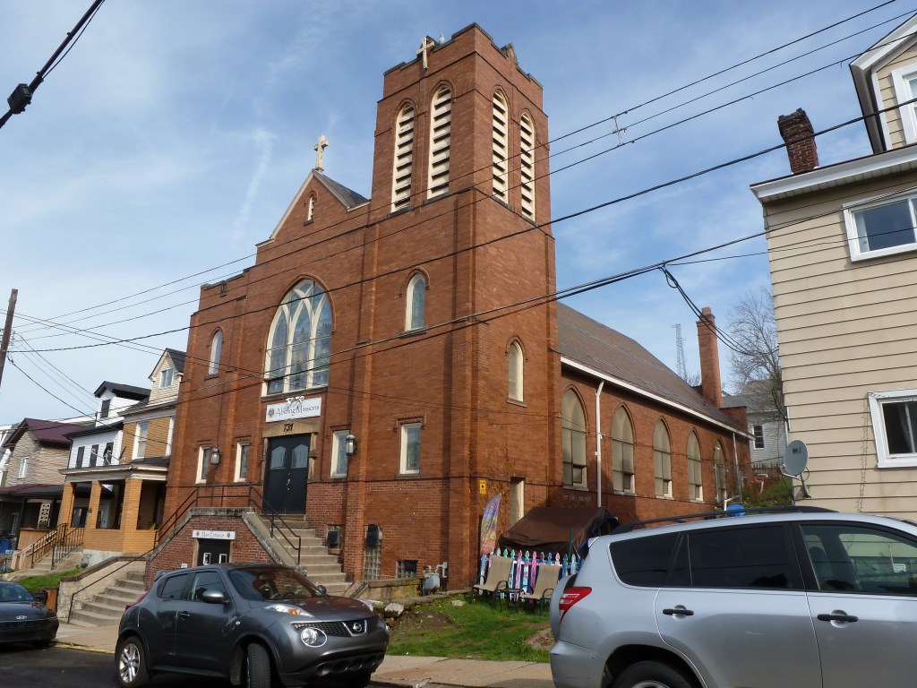
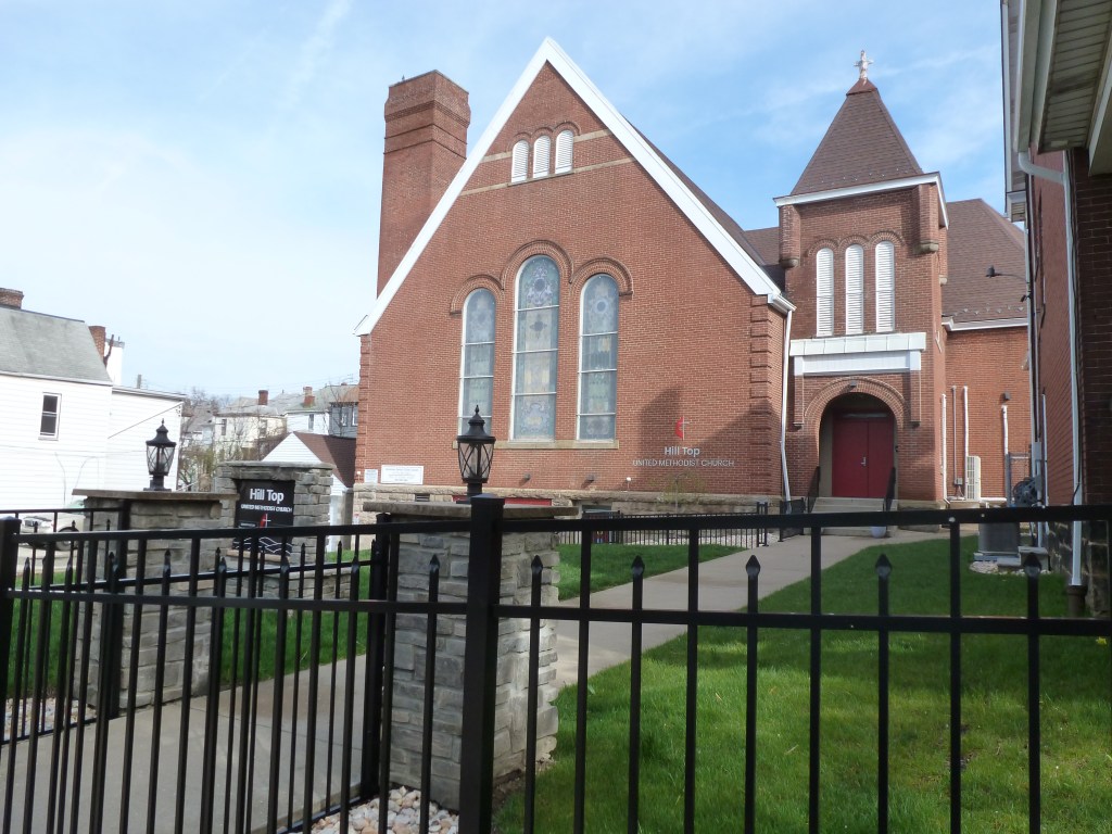
| Second Methodist Protestant | replaced with a commercial building that is now used by a religious institution |
| Second St. Paul Evangelical Lutheran (Missouri) Church | converted to a religion-based community service organization |
| St. John’s Evangelical Lutheran Church | replaced with a parking lot |
For more on this series, visit our introductory post.
Sources:
G. M. Hopkins & Co. Bluff. Plate 14. 1914. https://historicpittsburgh.org/islandora/object/pitt:20090804-hopkins-0016
G. M. Hopkins & Co. Central Business District, Bluff. Plate 8. 1914. https://historicpittsburgh.org/islandora/object/pitt:20090804-hopkins-0010
Pittsburgh Department of City Planning. A Development and Renewal Program for Pittsburgh, Summary Documentation, Pittsburgh Community Renewal Program. Pittsburgh, 1970. https://pittsburgharchives.access.preservica.com/uncategorized/IO_d1f07da0-9303-4aee-a162-04c83a0eaaa0/
Pittsburgh Department of City Planning. EcoInnovation District: Uptown/West Oakland. September 2017. https://www.pittsburghpa.gov/files/assets/city/v/1/dcp/documents/3494_ecoinnovation_plan.pdf
Polk’s Pittsburgh City Directory, 1926. Pittsburgh: R. L. Polk & Co. https://digital.library.pitt.edu/islandora/object/pitt%3A31735056286846/viewer#page/4/mode/1up
The boundaries of Bloomfield are defined differently depending on who you’re talking to. This may be partially attributed to the two distinct patterns of residential development found within the city’s official boundary of the neighborhood. Much of the residential portion of Bloomfield, and the part I always picture when someone says they live in Bloomfield, is filled with small homes perched shoulder-to-shoulder at the sidewalk’s edge. The rest of the residential portion of Bloomfield features larger homes with modest front and rear lawns. The Liberty Avenue commercial corridor cuts through the middle of the neighborhood. Vacancy is low for both the residential and commercial properties.
While vacancy is low and most of the buildings present 100 years ago remain standing, Bloomfield still experienced change in that time. This is most clearly illustrated by its religious sites. Some remain religious site, though not for the congregations that worshipped there in 1926. Others have been converted to new uses. Several have been demolished. Three sites closed in the last two decades; two of which experienced strong contention between the former congregants and the religious entity owners over the fates of the buildings. One was demolished (not what the former congregants wanted) and the other was sold to a developer who restored it for secular uses (the former congregants’ preferred outcome).
The map below shows the locations of the 15 congregations listed in the 1926 directory for Bloomfield (the dotted line marks the neighborhood boundary).

The table below matches the 15 congregations listed in the 1926 directory with the current use of the site.
| 1926 Congregation Name | By 2026 the Congregation’s Building is: |
| Christ Methodist Episcopal Church | now First United Methodist Church |
| First Evangelical Lutheran Church | converted to a secular use, may be vacant |
| Fourth United Presbyterian Church | converted to a faith-based community service use |
| Friendship Park Methodist Episcopal Church | replaced with a hospital building |
| Gospel Hall Mission | converted to a secular use |
| Gustavus Adolphus Evangelical Lutheran Church | now Evaline Lutheran Church |
| Holy Calvary Mission | converted to a secular use, possibly abandoned |
| Immaculate Conception Catholic Church | demolished |
| Luther Memorial Evangelical Lutheran Church | replaced with new building, now the East End Assembly of God |
| Mt. Olive Baptist Church | demolished |
| Olivet Mission | demolished |
| Shadyside United Presbyterian Church | replaced with a drive-thru restaurant |
| St. John’s (German) Evangelical Lutheran Church | converted to residential |
| St. Joseph’s (German) Catholic Church | vacant |
| St. Luke’s Episcopal Church | replaced with a parking lot |


For more on this series, visit our introductory post.
Sources:
Polk’s Pittsburgh City Directory, 1926. Pittsburgh: R. L. Polk & Co. https://digital.library.pitt.edu/islandora/object/pitt%3A31735056286846/viewer#page/4/mode/1up
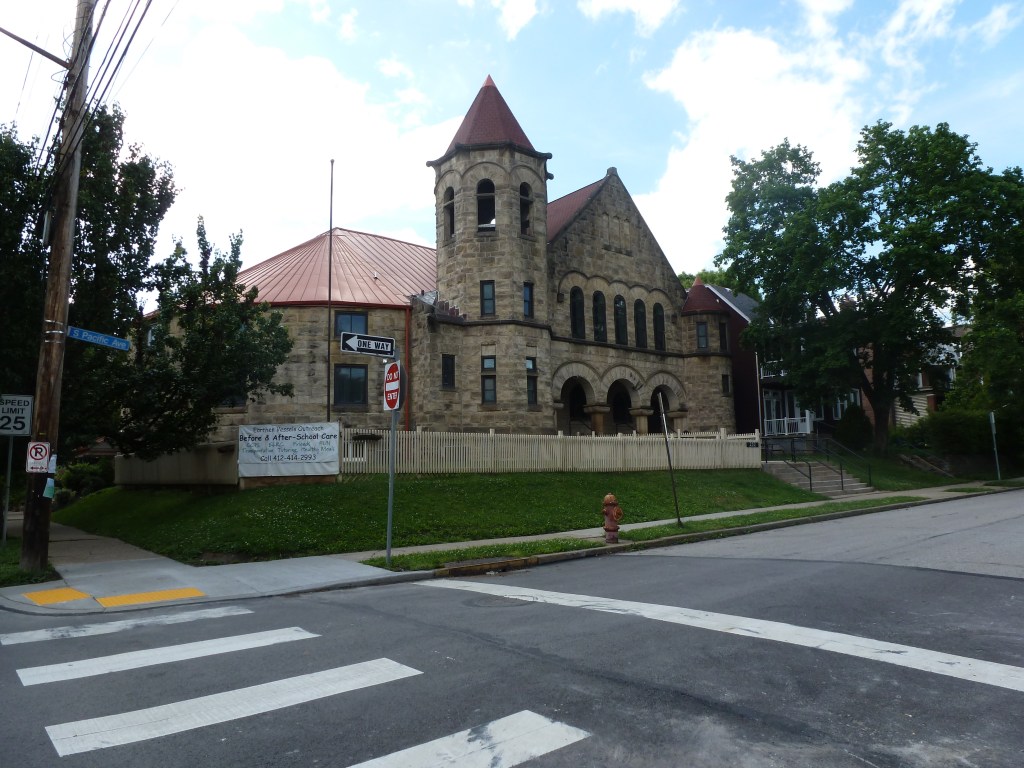
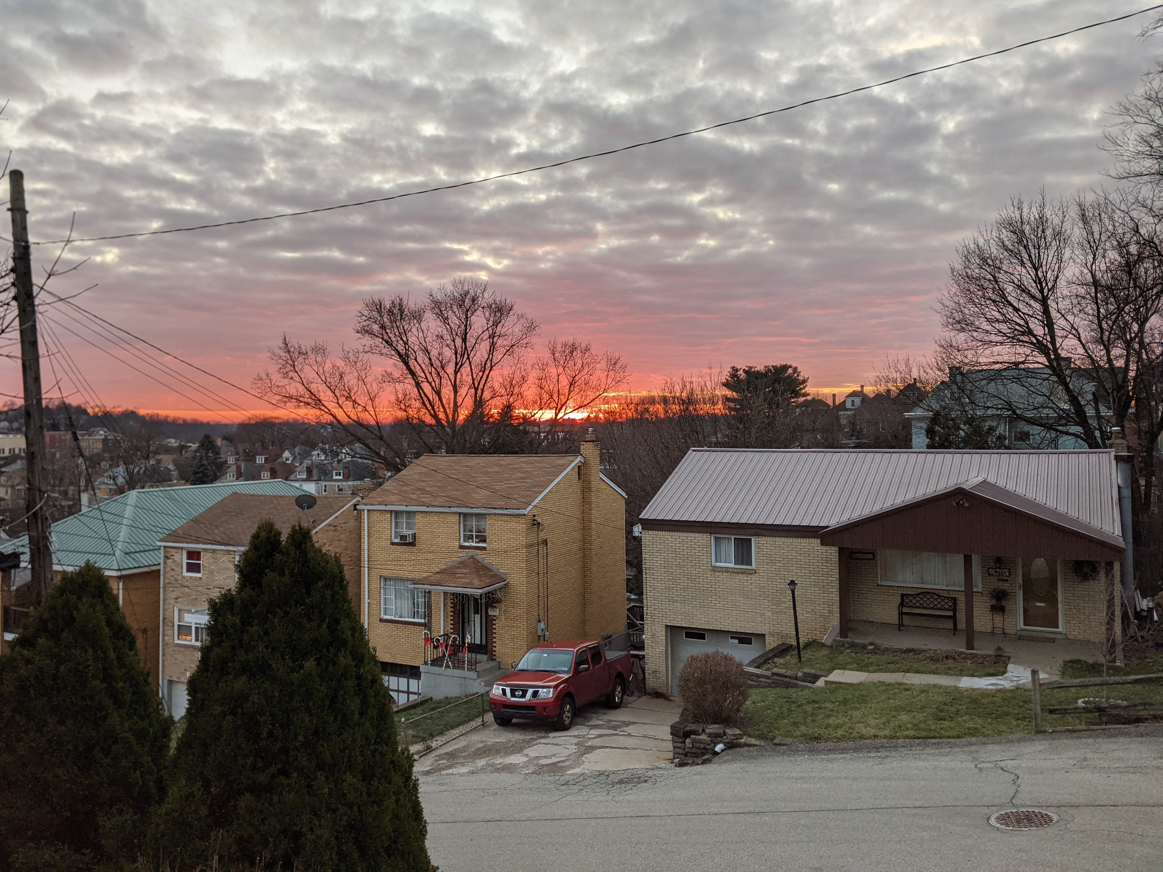
Beltzhoover is a neighborhood I am interested in learning more about. It usually doesn’t come up in the discourse around the intentional disinvestment and destruction of the buildings in Pittsburgh’s majority-minority neighborhoods. While it was not targeted with the traditional block-scale demolition and redevelopment of Urban Renewal, it was designated as an area needing “restoration” under the City’s Neighborhood Improvement Program in 1966 to “hold and stabilize declining area.”
Since that time, Beltzhoover has seen significantly more lot-by-lot disinvestment and demolition than the surrounding neighborhoods that have higher percentages of white residents. In 2010, Beltzhoover’s population was 83% Black, while it’s northeastern neighbor, Allentown, was 35% Black and it’s southeastern neighbor, Knoxville, was 52% Black.1 Between 1974 and 2010, Beltzhoover lost approximately 700 housing units while Allentown and Knoxville each lost only about 200 units.
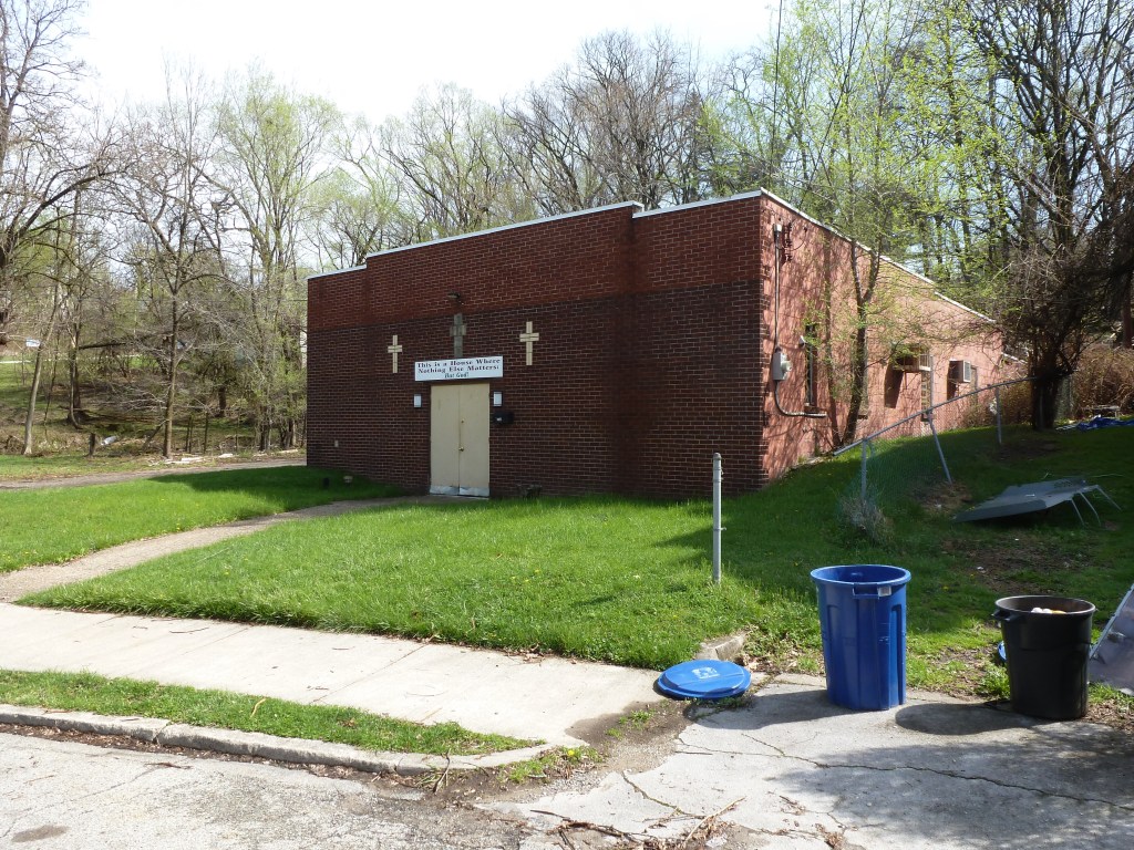
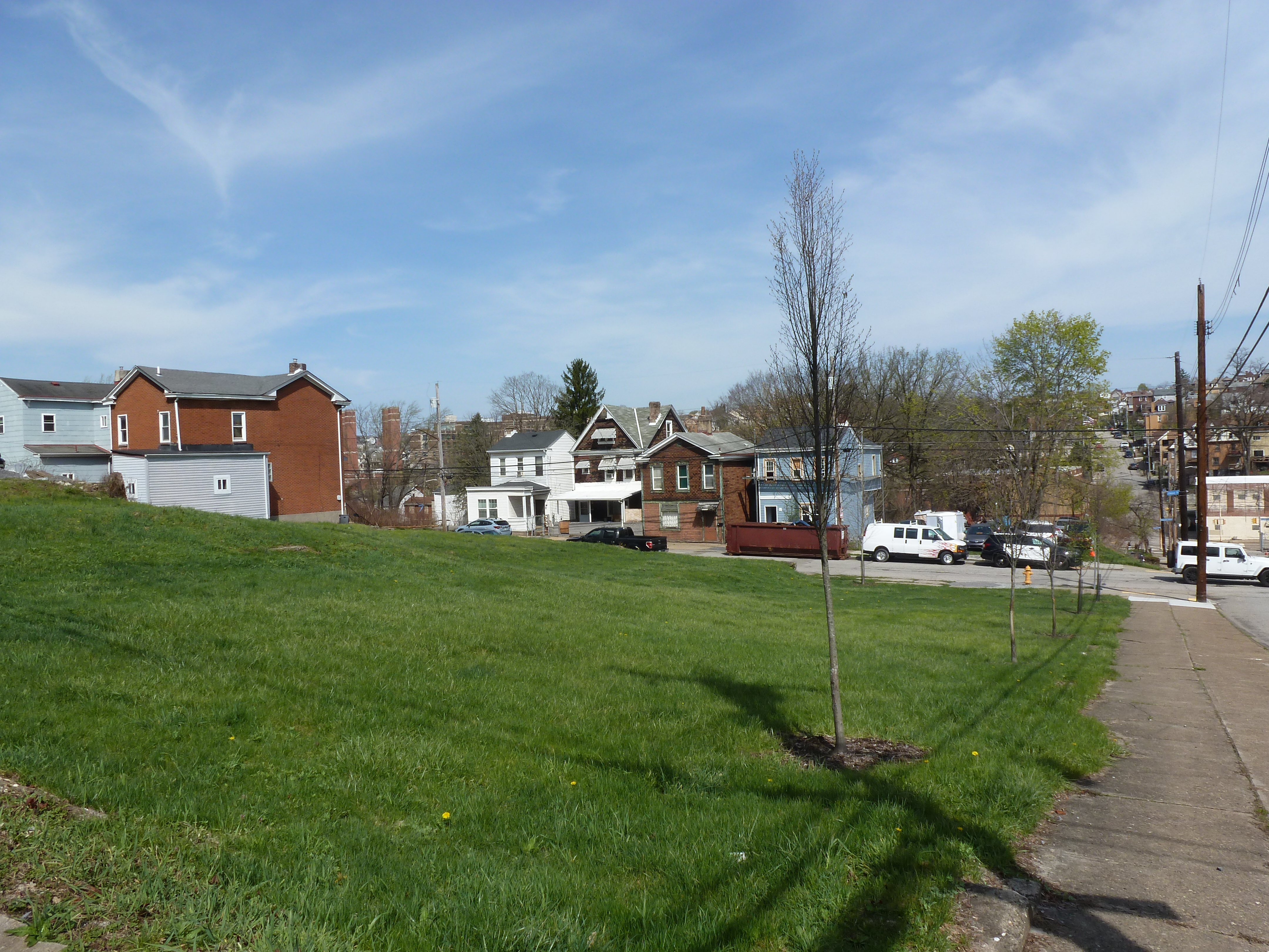
Walking the streets, the lines between these three neighborhoods are not apparent except that once you get into Beltzhoover, the exponentially higher number of vacant lots is very noticeable. Given the high rate of demolition in this neighborhood, it is interesting to note that only 1 of the 6 religious sites from 1926 is no longer actively used for religious purposes. However, two of these buildings indicate a different kind of story than the other neighborhoods we’ve visited in this series so far. The bunker-like appearance of the buildings on the sites of the former Montooth Methodist Episcopal Church and South Hills Baptist Church suggests perseverance in the face of financial struggles or social struggles or both. The recent renovations to McKinley Park and the strong blocks of housing edging the park also tell a story of community perseverance and success.
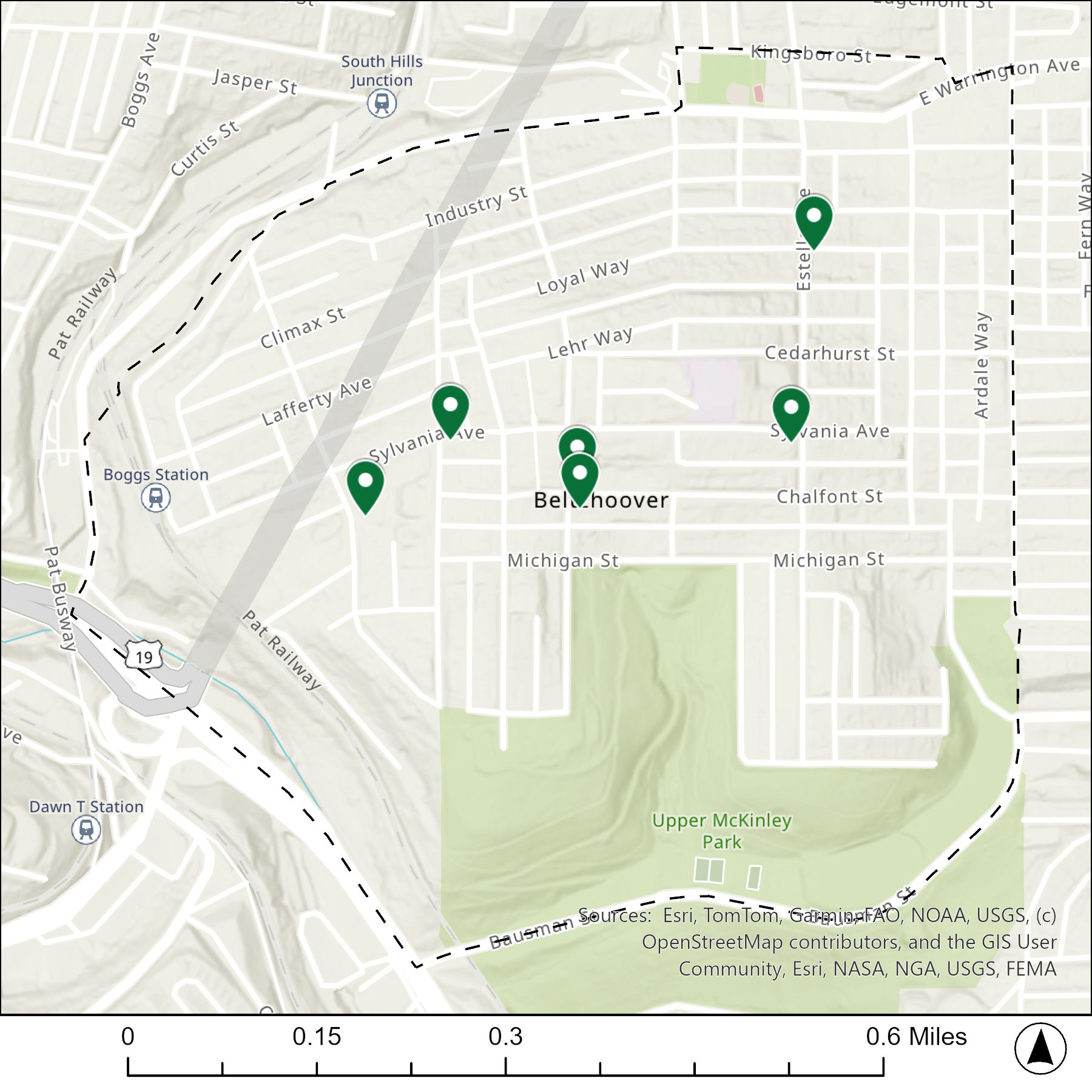
The map below shows the locations of the 6 congregations listed in the 1926 directory for Beltzhoover (the dotted line marks the neighborhood boundary).
The table below matches the 6 congregations listed in the 1926 directory with the current use of the site.
| 1926 Congregation Name | By 2026 the Congregation’s Building is: |
| Belulah Baptist Church | new Belulah Baptist Church |
| Church of Christ | demolished |
| McKinley Park Presbyterian Church | changed to a different religious institution |
| Montooth Methodist Episcopal Church | unclear, a different religious institution now uses the site |
| South Hills Baptist Church | unclear, a different religious institution now uses the site |
| St. Paul African Methodist Episcopal Church | changed to a different religious institution |
For more on this series, visit our introductory post.
Sources:
Pittsburgh Department of City Planning. A Development and Renewal Program for Pittsburgh, Summary Documentation, Pittsburgh Community Renewal Program. Pittsburgh, 1970. https://pittsburgharchives.access.preservica.com/uncategorized/IO_d1f07da0-9303-4aee-a162-04c83a0eaaa0/
Pittsburgh Neighborhood Alliance. An Atlas of the Allentown Neighborhood of Pittsburgh, 1977. https://historicpittsburgh.org/islandora/object/pitt%3A31735070288703/viewer#page/1/mode/1up
Pittsburgh Neighborhood Alliance. An Atlas of the Beltzhoover Neighborhood of Pittsburgh, 1977. https://historicpittsburgh.org/islandora/object/pitt%3A31735070288679/viewer#page/1/mode/2up
Pittsburgh Neighborhood Alliance. An Atlas of the Knoxville Neighborhood of Pittsburgh, 1977. https://historicpittsburgh.org/islandora/object/pitt%3A31735070288976/viewer#page/1/mode/1up
Pittsburgh Department of City Planning. Planning Commission Minutes 1966. City of Pittsburgh. (page 363) https://pittsburgharchives.access.preservica.com/uncategorized/IO_48290996-fb3f-41b9-8873-1189a3642972/
Pittsburgh Department of City planning. PGHSnap. City of Pittsburgh. 2011.
Polk’s Pittsburgh City Directory, 1926. Pittsburgh: R. L. Polk & Co. https://digital.library.pitt.edu/islandora/object/pitt%3A31735056286846/viewer#page/4/mode/1up
GoFish! was a fundraiser in Erie, PA, in 2001. In 2023, Shelly and I took a long weekend in Erie with a goal to find as many fish as we could. We used Amy H.’s FourSquare map to locate probable locations. Several fish were shown as being at Splash Lagoon. I assumed they would be inside the amusement facility and so we did not try to collect photos of them. However, when I went to Erie in Summer 2025 and stayed at a hotel across the street from Splash Lagoon, I found that their fish and frogs were all outside (three fish and one frog, plus one frog at an adjacent business).
“Splash-the-Lagoon-A-Tuna” was designed by artist Dan Byler and sponsored by Scott Enterprises.
Beechview was its own borough until annexed by the city in 1909. It was a small community, mostly farms or other rural estates, until the Liberty Tubes opened in 1924 when it quickly transformed into one of the first bedroom communities in the region. The main street (Broadway Avenue) follows the crest of the main ridge while the rest of the neighborhood attempts to drape an urban grid over the steep, undulating terrain. Most of the housing south of Crane Avenue was built in the 1920s and 1930s and features a blend of small to moderate detached single-family homes, rowhouses, duplexes, and small apartment buildings. Several lots remained undeveloped until after WWII, but were quickly filled in at that time with the traditional detached post-war suburban house with integral garage. North of Crane Avenue remained largely rural until after WWII and features uniform blocks of post-war suburban housing, mostly single-family, but with an intentional, uniform pocket of duplexes separate from the single-family homes.
While the neighborhood has experienced population changes since then, population loss and demographic shifts, it’s housing stock has remained relatively stable. Urban renewal did not turn its sights onto Beechview and other demolition initiatives throughout the city also primarily passed by Beechview. Perhaps that is why only one and a half sites for the 9 congregations listed in the 1926 directory have since been demolished. Two have been converted to secular uses and the rest remain active as religious centers.
The map below shows the locations of the 9 congregations listed in the 1926 directory for Beechview (the dotted line marks the neighborhood boundary).

The table below matches the 9 congregations listed in the 1926 directory with the current use of the site.
| 1926 Congregation Name | By 2026 the Congregation’s Building is: |
| Beechview Christian Church | converted to secular use, healthcare |
| Beechview Methodist Episcopal Church | changed to a different religious institution |
| Beechview Presbyterian Church | partially demolished and replaced with a fire station |
| Beechview United Presbyterian Church | still Beechview United Presbyterian Church |
| Holy Trinity Lutheran Evangelical Church | still Trinity Lutheran Evangelical Church |
| Reorganized Church of Jesus Christ Latter Day Saints | changed to a different religious institution |
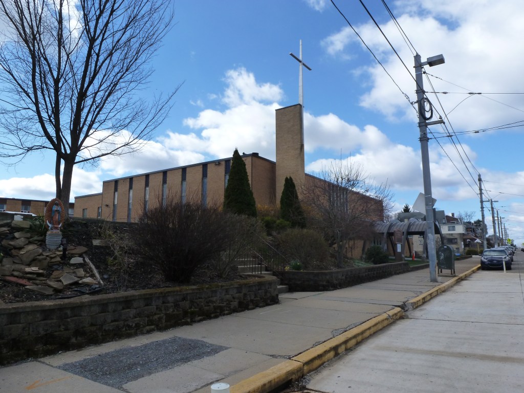
| St. Catherine Catholic Church | new St. Catherine of Siena Catholic Church |
| Third Christian Science Church | demolished, now a side yard |
| West Liberty Union Mission | converted to residential use |


For more on this series, visit our introductory post.
Sources:
Polk’s Pittsburgh City Directory, 1926. Pittsburgh: R. L. Polk & Co. https://digital.library.pitt.edu/islandora/object/pitt%3A31735056286846/viewer#page/4/mode/1up
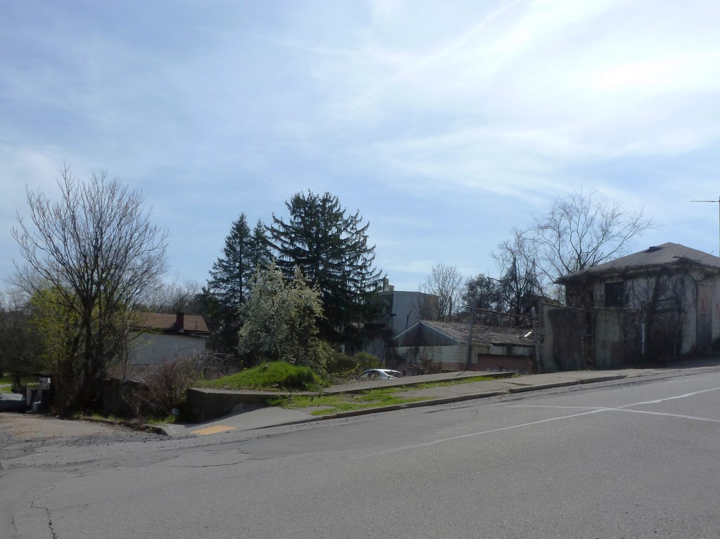
One of the five neighborhoods collectively known as The Hill District, Bedford Dwellings is a neighborhood named after a public housing project from the 1930s & 1940s. It is a strip of land, a block wide for most of its length, situated between Bedford Avenue and the cliff that overlooks the Strip District and Allegheny River. While no redevelopment projects were undertaken in this neighborhood during the official “Urban Renewal” era (approximately 1949-1970s) per the City’s 1970 report, the neighborhood has been erased and redeveloped multiple times in the last 100 years.
The 1923 G. M. Hopkins map shows a mix of uses along this 1-mile section of Bedford Avenue. There are blocks of small lots partially built out with homes, the Lincoln Memorial Cemetery, the Entress Brick Company and a few other small businesses, the Municipal Hospital, and the Tuberculosis League Hospital.
By April 1932, Entress Brick Company is replaced with Greenlee Field, the first baseball park built by a Black businessman. “At Forbes Field, Yankee Stadium, and every other major league stadium where Negroes played, they weren’t allowed to use the locker facilities. But tonight [opening night] the men of the [Pittsburgh] Crawfords and the Black Yankees didn’t have to change at a boardinghouse or on a bus. Tonight, thanks to Gus Greenlee, they slipped out of their sweaty uniforms and muddy cleats in the dignity of their own locker room.”2
Unfortunately, the city had a different vision for the use of the land and Greenlee Field closed after only 4 years. The “Housing Authority offered Greenless $38,000 for the land and threatened to seize it if he didn’t take the deal.”3 The Housing Authority then built its first public housing development.
Today, as the Housing Authority works to replace their 20th-Century housing units with 21st-Century housing units across the city, some parts of the Bedford Dwellings neighborhood have been redeveloped, again, using HUD HOPE grants and others are slated for their next redevelopment project funded by the federal Choice Neighborhoods grant program.
The two religious sites listed in the 1926 city directory were located near the part of the neighborhood most built out with housing per the 1923 G. M. Hopkins maps. One likely succumbed to the same project that erased Greenlee Field; the other survived and today shows a strong presence both in the church building and in nearby properties.
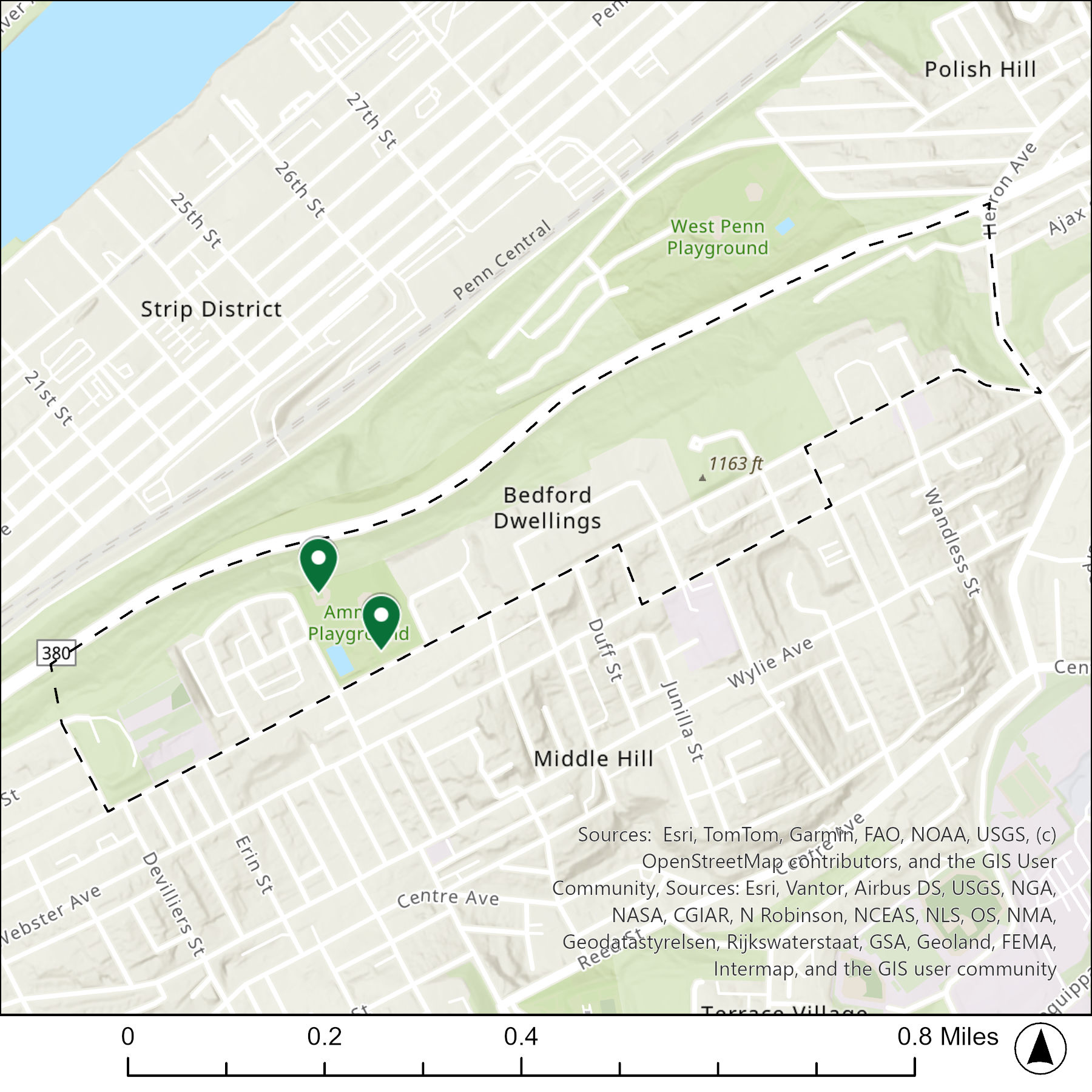
The map below shows the locations of the 2 congregations listed in the 1926 directory for Bedford Dwellings (the dotted line marks the neighborhood boundary).
The table below matches the 2 congregations listed in the 1926 directory with the current use of the site.
| 1926 Congregation Name | By 2026 the Congregation’s Building is: |
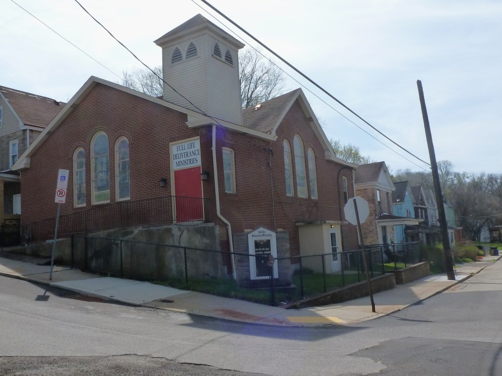
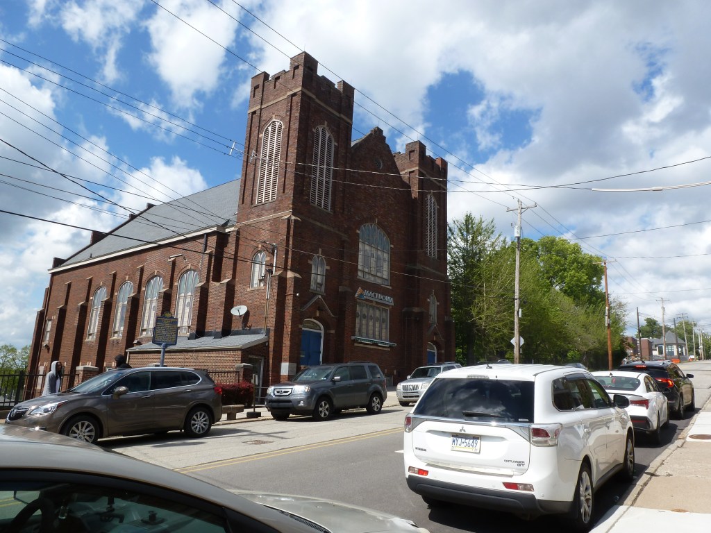
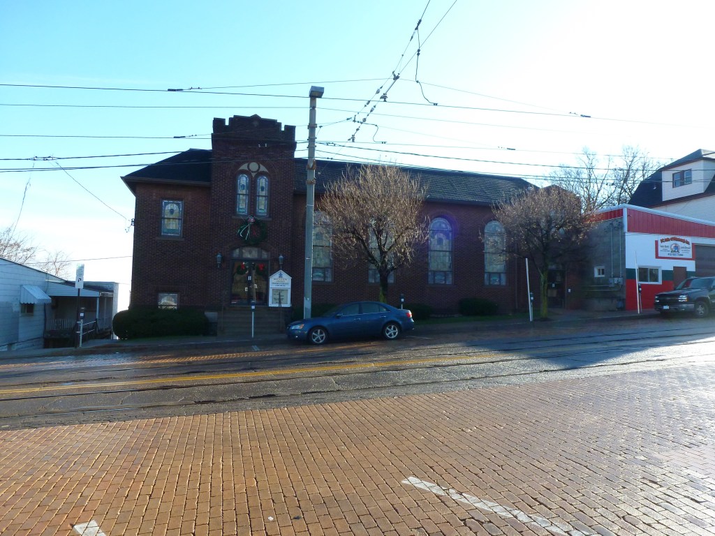
| Macedonia Baptist Church | still Macedonia Baptist Church |
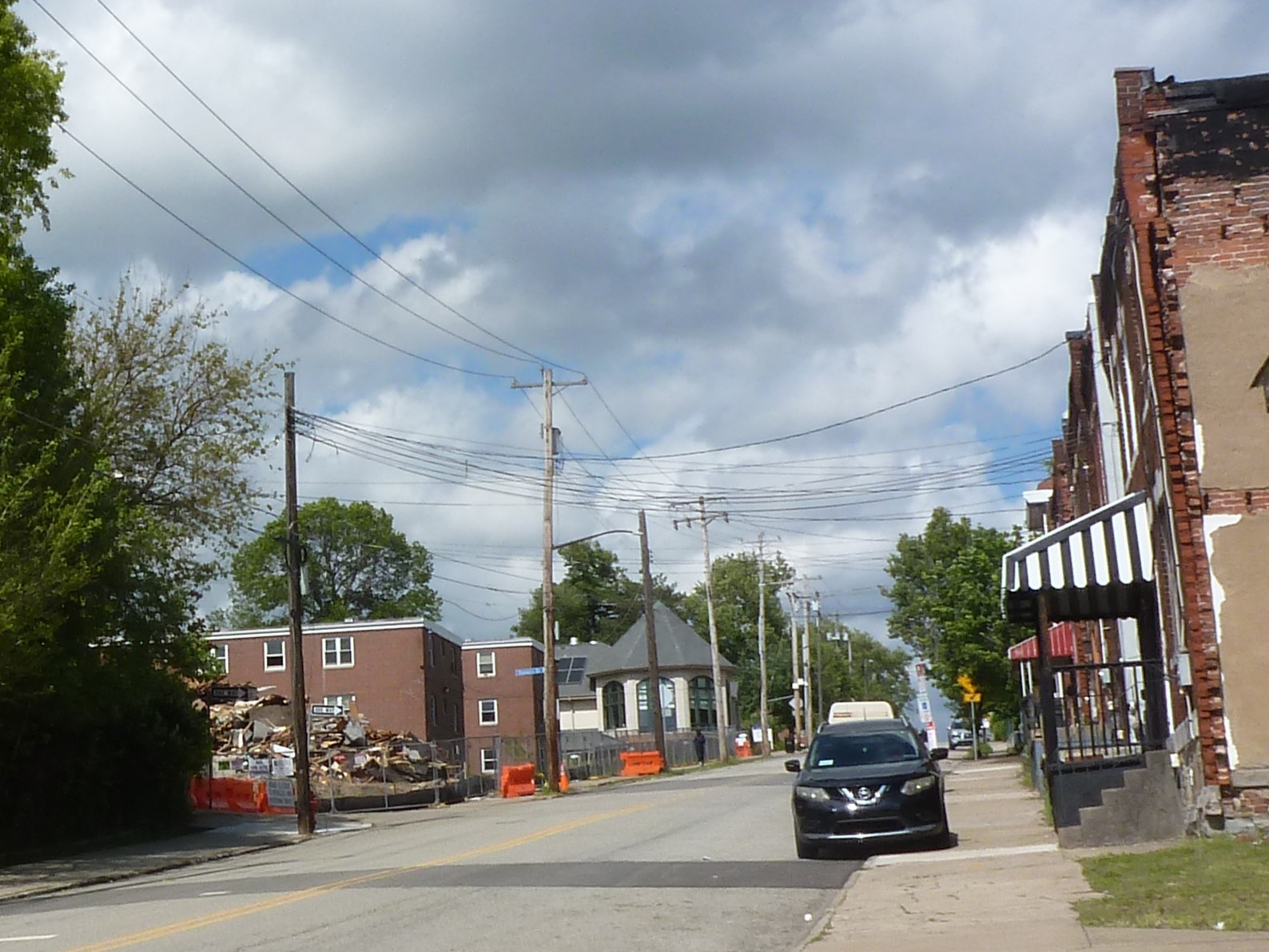
| New Light Baptist Church | replaced with a community baseball diamond |
Footnotes
For more on this series, visit our introductory post.
Sources:
G. M. Hopkins & Co. Bedford Dwellings. Plate 30A. 1923. https://historicpittsburgh.org/islandora/object/pitt%3A23v0130a
G. M. Hopkins & Co. Crawford-Roberts. Plate 11B. 1923. https://historicpittsburgh.org/islandora/object/pitt%3A23v0111b
G. M. Hopkins & Co. Middle Hill. Plate 29A. 1923. https://historicpittsburgh.org/islandora/object/pitt:23v0129a
Housing Authority of the City of Pittsburgh. A Report to the People: Public Housing in Pittsburgh, 1938-1953. Pittsburgh, 1953. https://pittsburgharchives.access.preservica.com/uncategorized/IO_b74e0198-8ee1-4b50-93d6-b631adc3dc44/
Housing Authority City of Pittsburgh. Bedford Dwellings Redevelopment Planning. https://hacp.org/bedfordconnects/
Pittsburgh Department of City Planning. A Community Profile of Bedford Dwellings. 1974. https://historicpittsburgh.org/islandora/object/pitt%3A31735070065887
Pittsburgh Department of City Planning. A Development and Renewal Program for Pittsburgh, Summary Documentation, Pittsburgh Community Renewal Program. Pittsburgh, 1970. https://pittsburgharchives.access.preservica.com/uncategorized/IO_d1f07da0-9303-4aee-a162-04c83a0eaaa0/
Polk’s Pittsburgh City Directory, 1926. Pittsburgh: R. L. Polk & Co. https://digital.library.pitt.edu/islandora/object/pitt%3A31735056286846/viewer#page/4/mode/1up
U.S. Department of Housing and Urban Development. “HUD Secretary Ben Carson Designates the Bedford Hope Center as New EnVision Center.” October 16, 2020. https://archives.hud.gov/news/2020/pr20-174.cfm?utm_source=chatgpt.com
Whitaker, Mark. The Untold Story of Smoketown: The Other Great Black Renaissance. New York: Simon & Schuster Paperbacks, 2018.

Arlington Avenue follows the crest of a ridge with the Arlington neighborhood draped over the southern slope and the South Side Slopes neighborhood draped over the northern slope. While I didn’t encounter any friendly local residents on the street to be nebby with, the style and density of the neighborhood suggests that it is a similar age to Allentown. Presumably built largely before cars, when people could have commuted to the industries on the river flats by street car or incline.
Neither of the two religious sites from the 1926 directory are still active. One was converted to a residential use. The site of the other one was replaced with a public school, though the congregation had moved to a newer church built next door. However, both the school and the church now sit vacant.
The map below shows the locations of the 2 congregations listed in the 1926 directory for Arlington (the dotted line marks the neighborhood boundary).
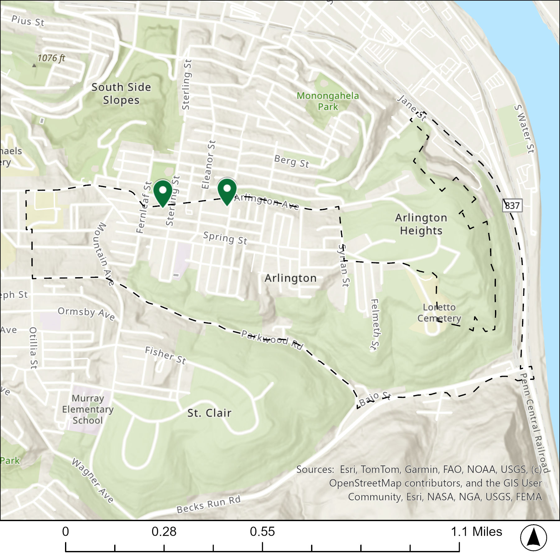
The table below matches the 2 congregations listed in the 1926 directory with the current use of the site.
| 1926 Congregation Name | By 2026 the Congregation’s Building is: |
| St. Henry Catholic Church | replaced with now vacant school |
| St. James Lutheran Evangalical Church | converted to residential |
For more on this series, visit our introductory post.
Sources:
Polk’s Pittsburgh City Directory, 1926. Pittsburgh: R. L. Polk & Co. https://digital.library.pitt.edu/islandora/object/pitt%3A31735056286846/viewer#page/4/mode/1up
LeapFrog! was a fundraiser in Erie, PA, in 2004. I had been aware for a few years that there was a frog at Splash Lagoon, but I didn’t capture a photo of it until Summer 2025. “Croaker Soaker” looks like he’s ready to splash into some fun!
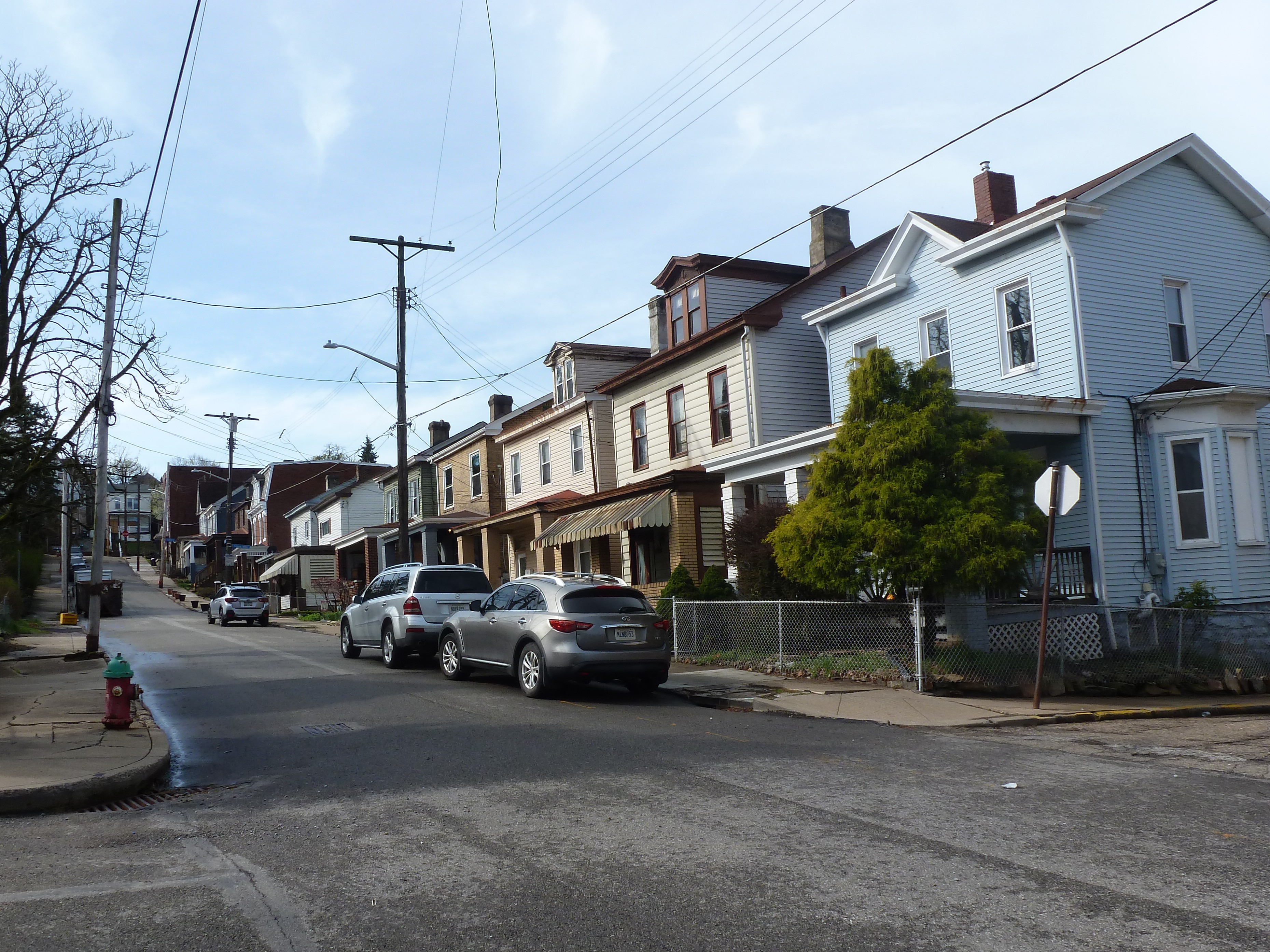
Allentown features a tight grid gently folded over undulating terrain. Densely-packed, modest houses line narrow roads. A resident across from one of the religious sites, who was interested in what I was photographing, shared that her house was built in the 1880s. In those pre-automobile days, residents may have commuted downhill to the industries along the river flats by way of the numerous inclines, one of which used to have a terminus not far from where we were standing and talking.
Three of the jobs I’ve held in my decades of working in Pittsburgh included some element of work in this neighborhood. Much of the neighborhood felt the same as I remembered it from my prior encounters. Long-standing neighborhood restaurants mixed in between vacant storefronts and newer ventures lined the commercial district. Vacant lots and vacant houses sit scattered among the residential blocks. However, I was impressed that some long vacant lots had new infill housing designed for those wanting to age-in-place or people with accessibility needs.
The neighborhood was never targeted for any large-scale Urban Renewal efforts, but individual properties that are vacant, abandoned, or tax delinquent have been demolished from time-to-time. This implies patterns of change, including population loss and disinvestment. The 5 religious sites from 1926 reflect that with each one featuring a unique outcome today: one remains religious, one is now a secular use, one sits vacant, one is a vacant lot, and one is a parking lot.
The map below shows the locations of the 5 congregations listed in the 1926 directory for Allentown (the dotted line marks the neighborhood boundary).
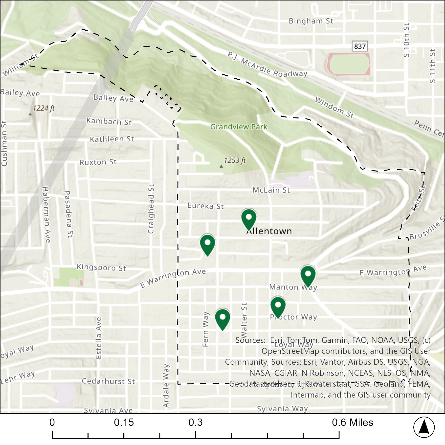
The table below matches the 5 congregations listed in the 1926 directory with the current use of the site.
| 1926 Congregation Name | By 2026 the Congregation’s Building is: |
| Bethlehem Lutheran Evangelical Church | converted to a community center |
| First Methodist Episcopal Church | demolished |
| Progressive Spiritualists Church | replaced with a parking lot |
| St. George (German) Catholic Church | vacant |
| Trinity Methodist Episcopal | changed to a different religious institution |
For more on this series, visit our introductory post.
Sources:
Polk’s Pittsburgh City Directory, 1926. Pittsburgh: R. L. Polk & Co. https://digital.library.pitt.edu/islandora/object/pitt%3A31735056286846/viewer#page/4/mode/1up