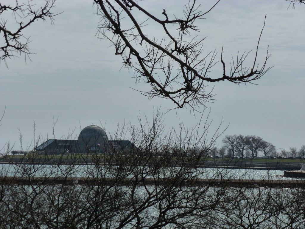
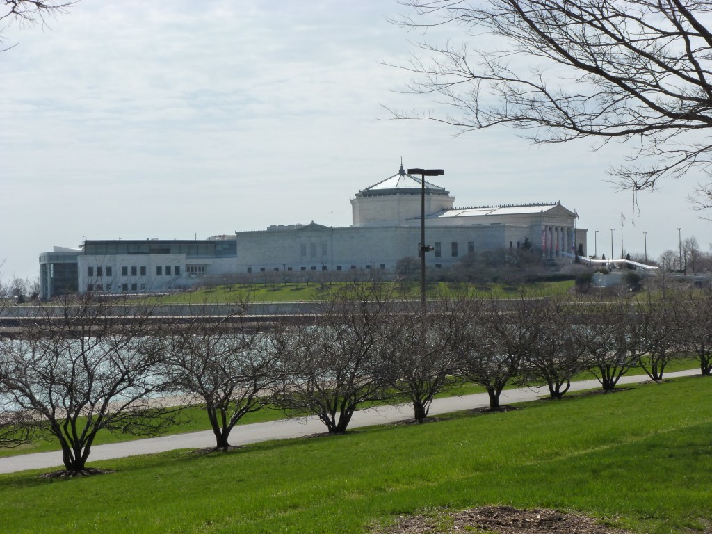
Unbeknownst to me at the time, on my aborted bike ride to the site of the White City in 2013, I rode right passed the site of Chicago’s other World’s Fair. The Century of Progress 1933 World’s Fair was located on what is now called Northerly Island. Adler Planetarium and Shedd Aquarium were the obligatory permanent museums opened in conjunction with or adjacent to the fair.
One of the interesting tidbits I’ve learned about this fair is that it used a rainbow of colors. Clearly, this was intended to be among the elements that would distinguish this fair from the previous one. However, it sounds to me more like Chicago was trying to imitate Buffalo’s Rainbow City, the 1901 World’s Fair.
My thanks to Zachary L. Brodt and his bookFrom the Steel City to the White City: Western Pennsylvania & the World’s Columbian Exposition for helping me to realize that I can say I’ve visited four former US hosted World’s Fair sites as of May 2024.
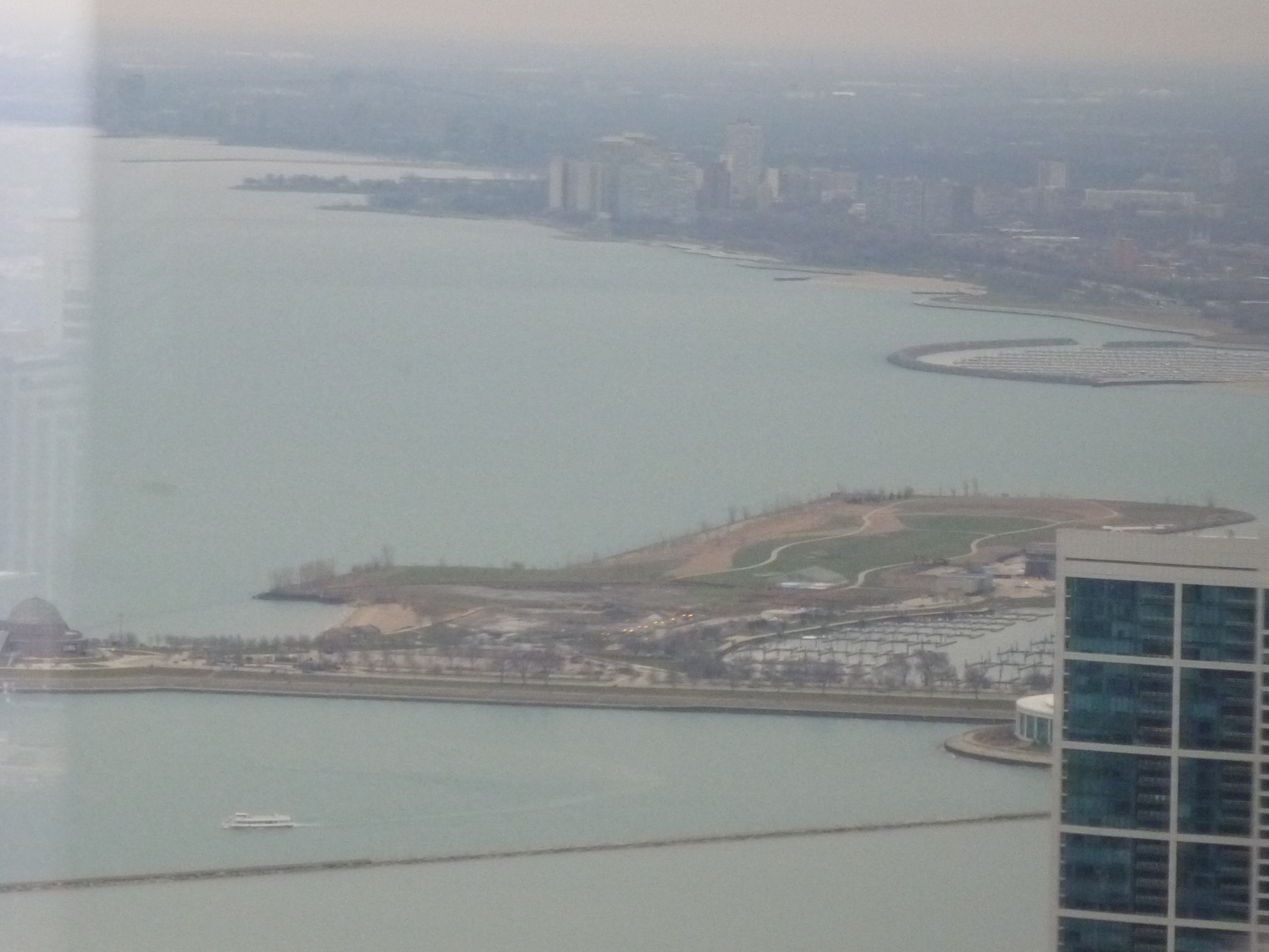
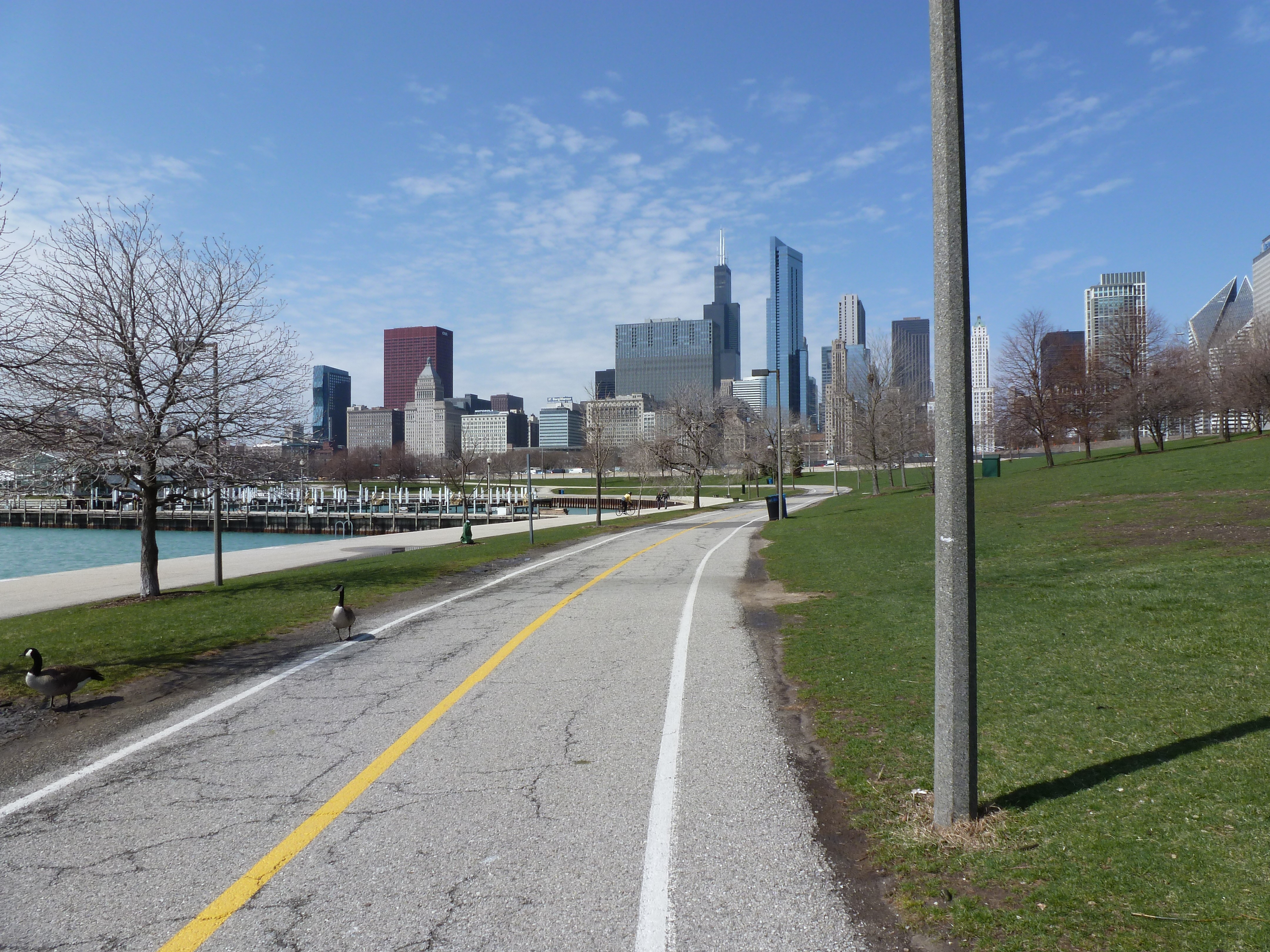
I’ve had multiple aborted experiences in Chicago. In 2013, I aborted an attempt to bike to the 1893 World’s Fair site. In 2019, I aborted an attempt to reach the waterfront. But during the eventually aborted bike ride, I experienced several miles of interesting waterfront. I don’t recall how I got to and from the waterfront for the bike ride as Chicago has the classic US urban problem of using highways to divide the waterfront from the rest of city. Once I was on the waterside, I enjoyed a variety of natural, architectural, and sculptural sights. I even unknowingly captured the remaining buildings from Chicago’s other World’s Fair (post pending).
Chicago is one of the US cities with perhaps the most well-known art parade fundraisers, though I’ve only found a few of the sculptures after the fact (two cows, a dog, and a dog). Jun Kaneko’s temporary installation of Dangos caught my eye in 2013 as a similar kind of artwork, but one that I didn’t have to go hunting down each individual piece.
My fascination with World’s Fairs was started when I was a child by Laura Ingalls Wilder and the San Francisco Panama-Pacific Exposition. It has continued as an adult. Chicago’s 1893 World’s Columbian Exposition is the World’s Fair for planners. The “White City” was the first major example of the City Beautiful Movement, an attempt to reduce or eliminate the unhealthy, overcrowded cities of the time.
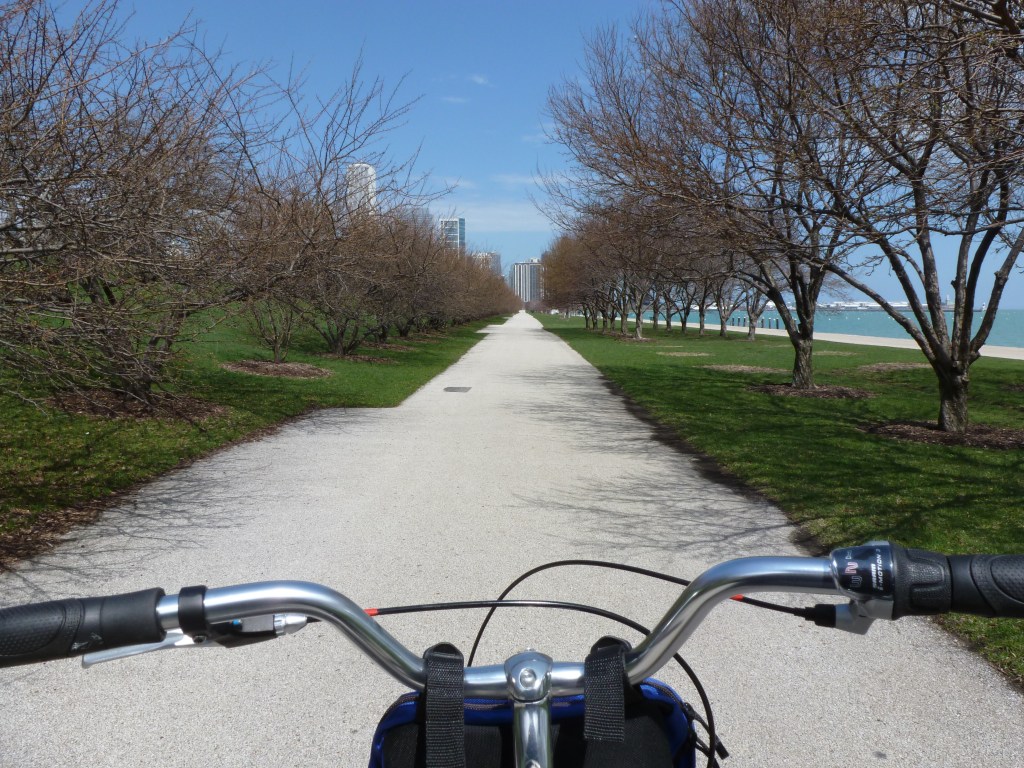
After years of hearing about the importance of the 1893 Chicago World’s Fair in planning and architecture and after reading Eric Larson’s The Devil in the White City, I made it a goal to visit the fair site. On one trip to Chicago when the weather was beautiful, I rented a bike and rode down the waterfront trail toward what was left of the White City. This was before I had a smart phone which meant I turned around and gave up because I feared that I had misjudged the distance by bike trail. Later, I realized I was probably pretty close and if I had only gone around one more curve, I would have seen my destination.
My next trip to Chicago was the same year I visited San Francisco. This time, I took a bus to the fair location. I picked the bus stop that on the map appeared to be the closest stop to the remaining places of interest from the fair. When I stepped off the bus onto a broken sidewalk, I found a desolate expanse of vacant land, scraggly trees, and pock-marked lawns. A weary walk presented itself every way I turned.
The bus didn’t run frequently out there. The roads that crossed the vacant expanse stretched far and wide, empty except for the random sudden appearance of a single speeding vehicle.
As soon as I had stepped off the bus and it drove off, I felt tired and scared. I wondered how to extricate myself from this horrible environment. I had some additional information that expanded the negative emotions stirred by the conditions around me. I had heard or read somewhere that the former Midway, which was where I got off the bus, was used as a sort of DMZ buffer to keep “those people” (in this case, primarily people with little income or people of color) away from the University of Chicago campus. I had clearly landed in the middle of a land of have-nots.
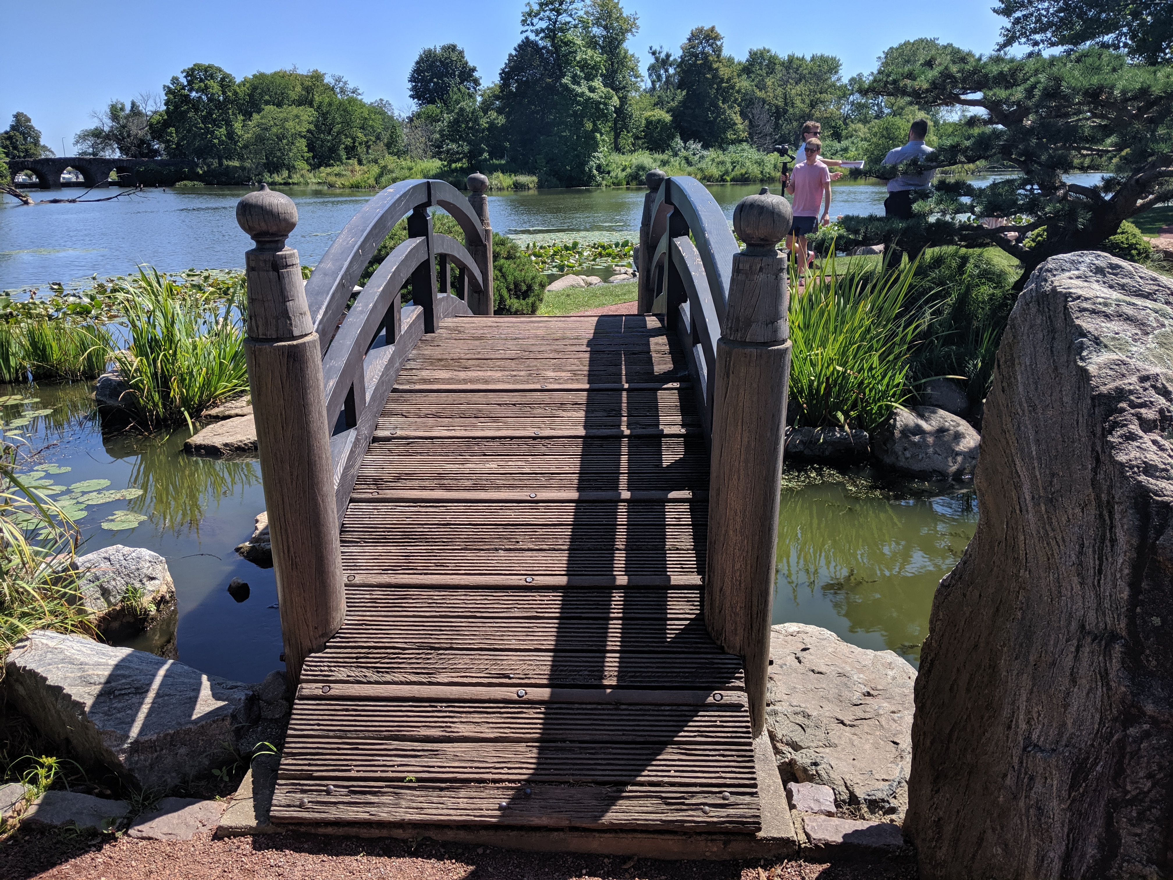
As I had come this far with a purpose and there seemed to be little else to do, I moved forward toward the lake. Migraine-inducing music was blaring from an unseen picnic far away and it followed me wherever I went. After feeling like I had taken my life in my hands by daring to cross the road where at any second a car could come speeding by, I reached a path among experimental plantings. Following random turns, I found the lagoon from the fair. The one white building that remained was on the opposite shore and was surrounded by scaffolding. The walk that once circumscribed the water was shut off by a menacing 6-foot high, chain link fence and a bridge that divided the lagoon seemed no longer safe to cross over, though passing under through the muck and mud was an option.
I eventually found a way forward and reached the Japanese Garden that was developed for the fair and remains a peaceful spot. Prior to that, at the moment of being confronted with a security fence and a broken bridge, the fear and doubt that often accompanies me on my explorations became overwhelming. What if I’m stopped? What if I’m questioned? Do I have a right to explore here and pass this way? Do I have a right to explore places and pass judgement?
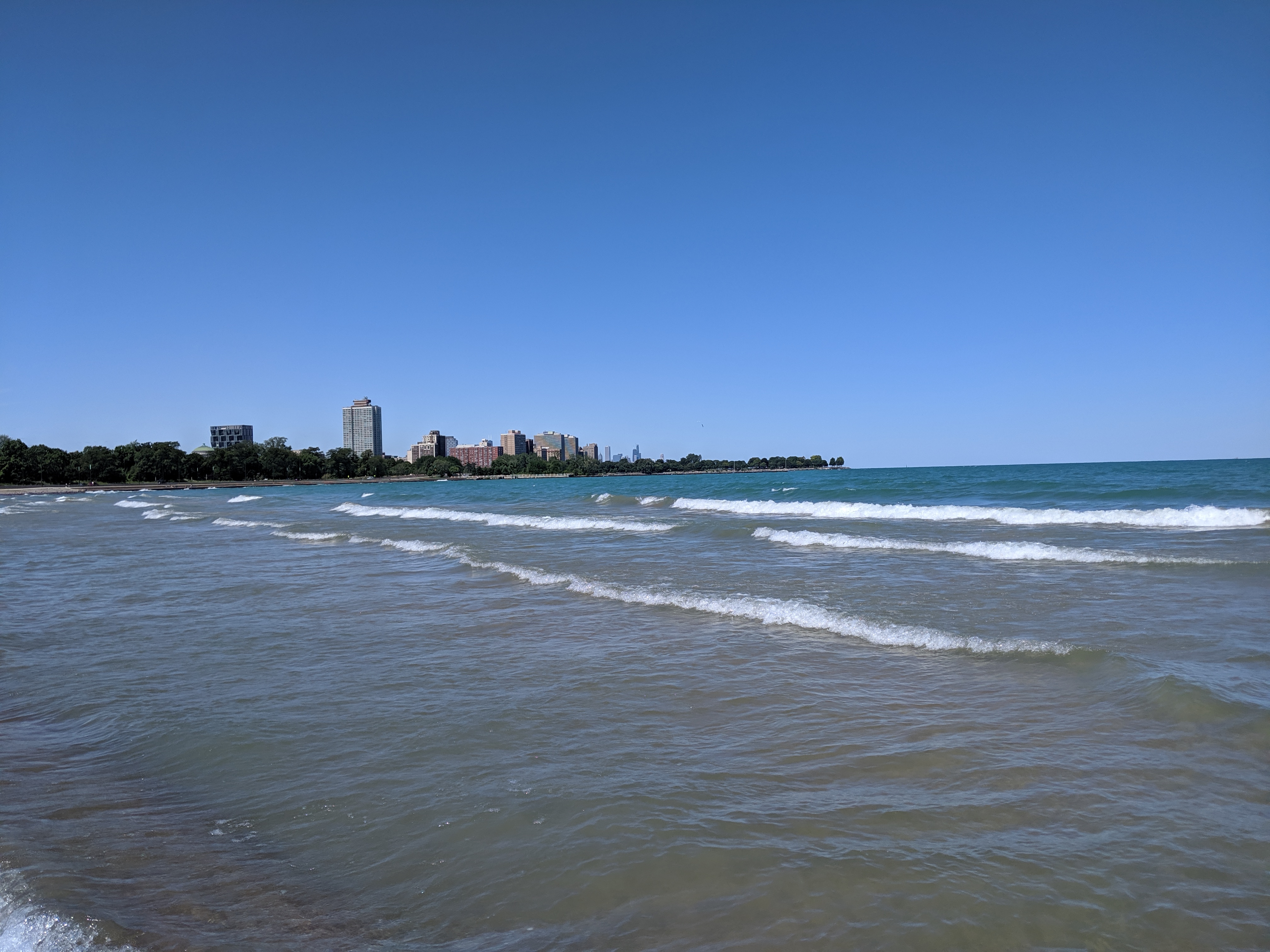
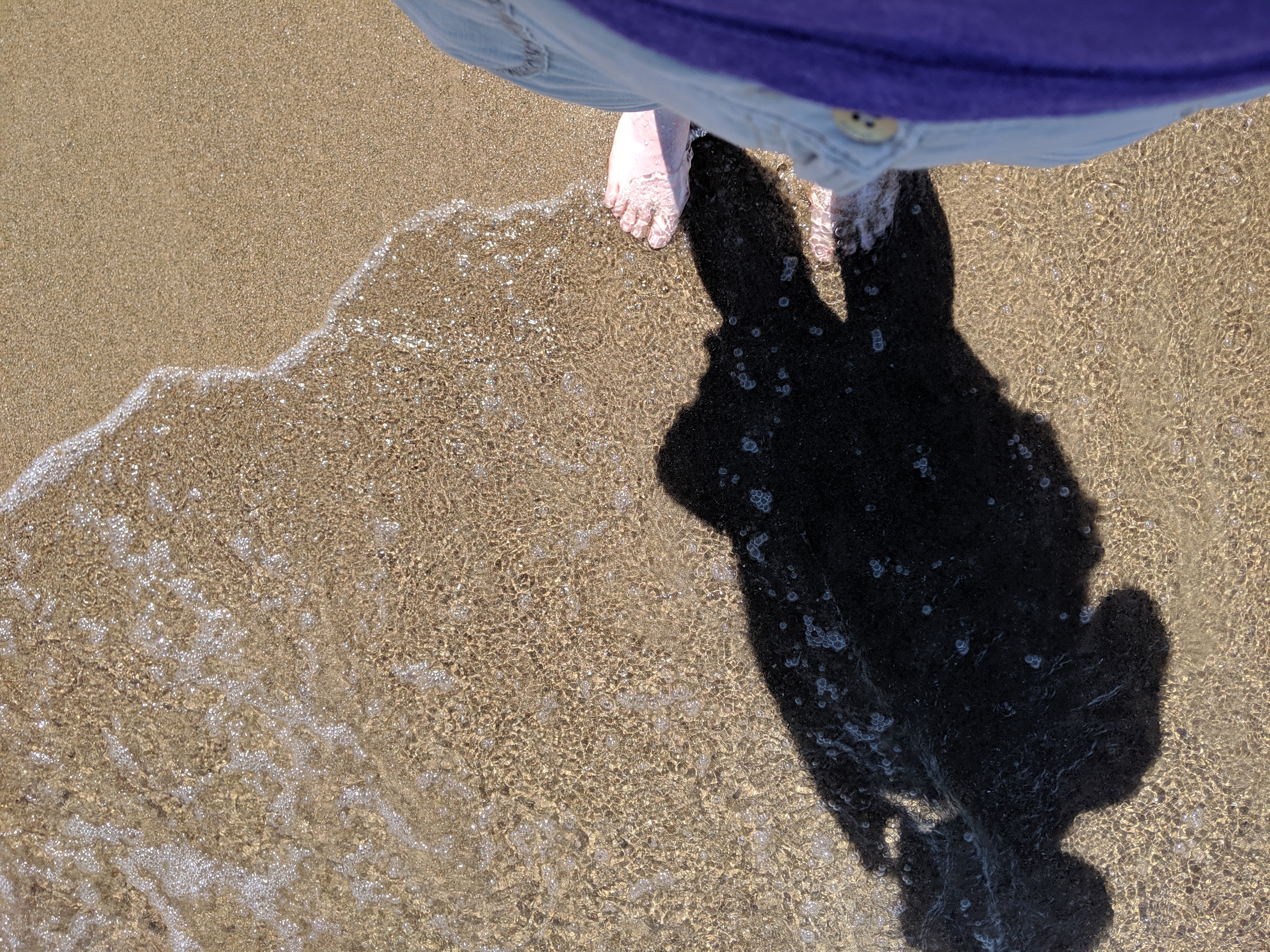
After my disappointment in trying to reach the lakefront at Grant Park, I had given up on reaching the shore on that trip. The weather had been perfect (being August instead of April), but it seemed I was fated to not wade in the lake.
However, after exploring the former site of the 1893 Chicago World’s Fair in Jackson Park, I was making my way to a bus stop to return to my hotel and found myself on a path to the 63rd Street Beach. Lake Shore Drive still continued along the lake’s shore, but it was not an obstacle here as it bridged over the pedestrian trail.
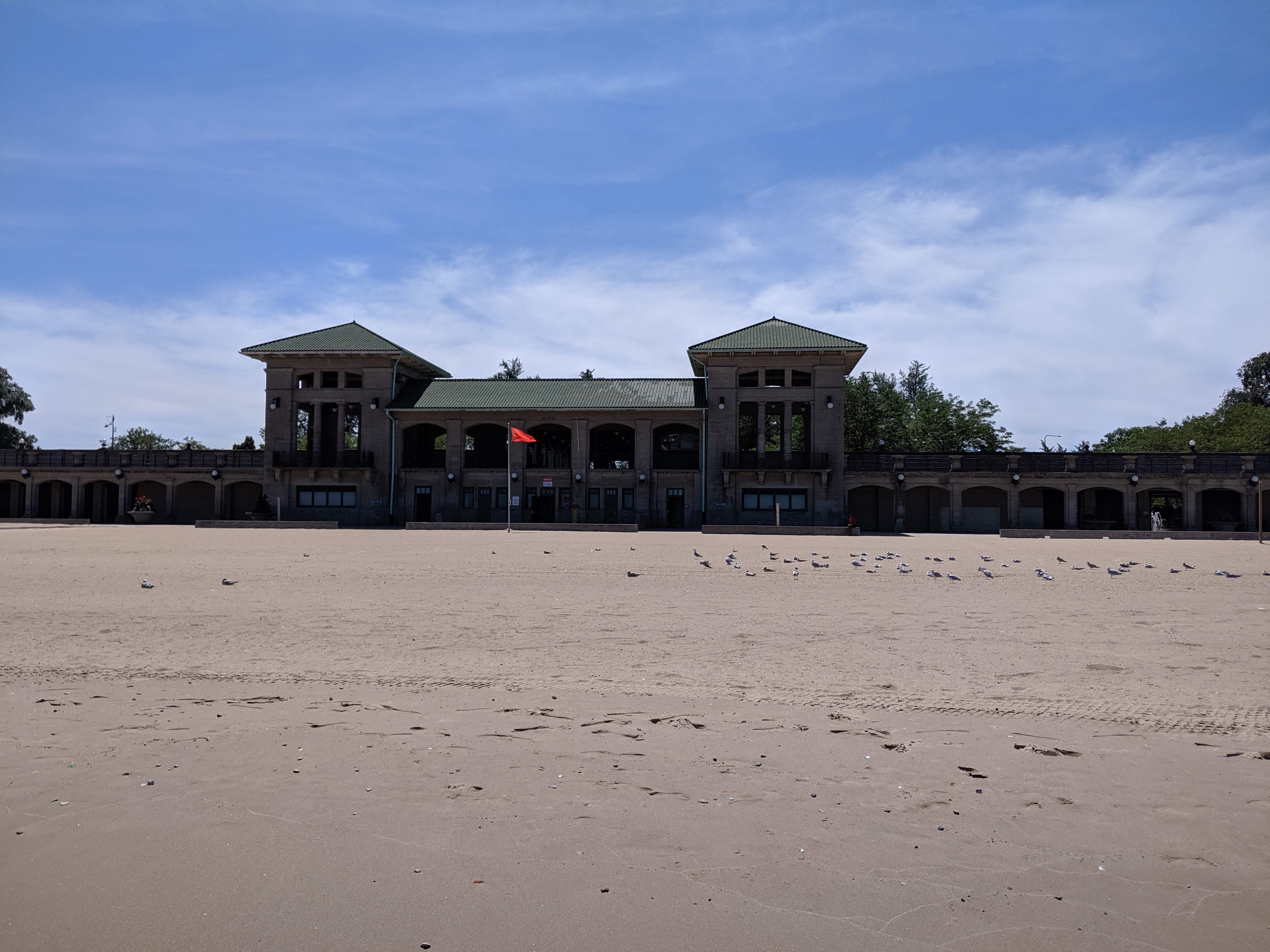
While mounting frustration had turned me back from the lake in Grant Park, the ease of following Jackson Park’s meandering trail turned me away from my original goal to add a stop at the lake beach. The beach house suggested days of better maintenance and greater usage, but the beach and adjoining greenspace appeared to be a pleasant amenity for local traffic.* While tourists may have found their way there in 1893, I seemed to be the only one when I visited.
*My tendency to take photos of things rather than people presented a missed opportunity when picking photos for this post. There were several small groups of people on the beach and more carloads of people enjoying picnics on the other side of the beach house. Yet, none of the photos I took that day included any of these people.
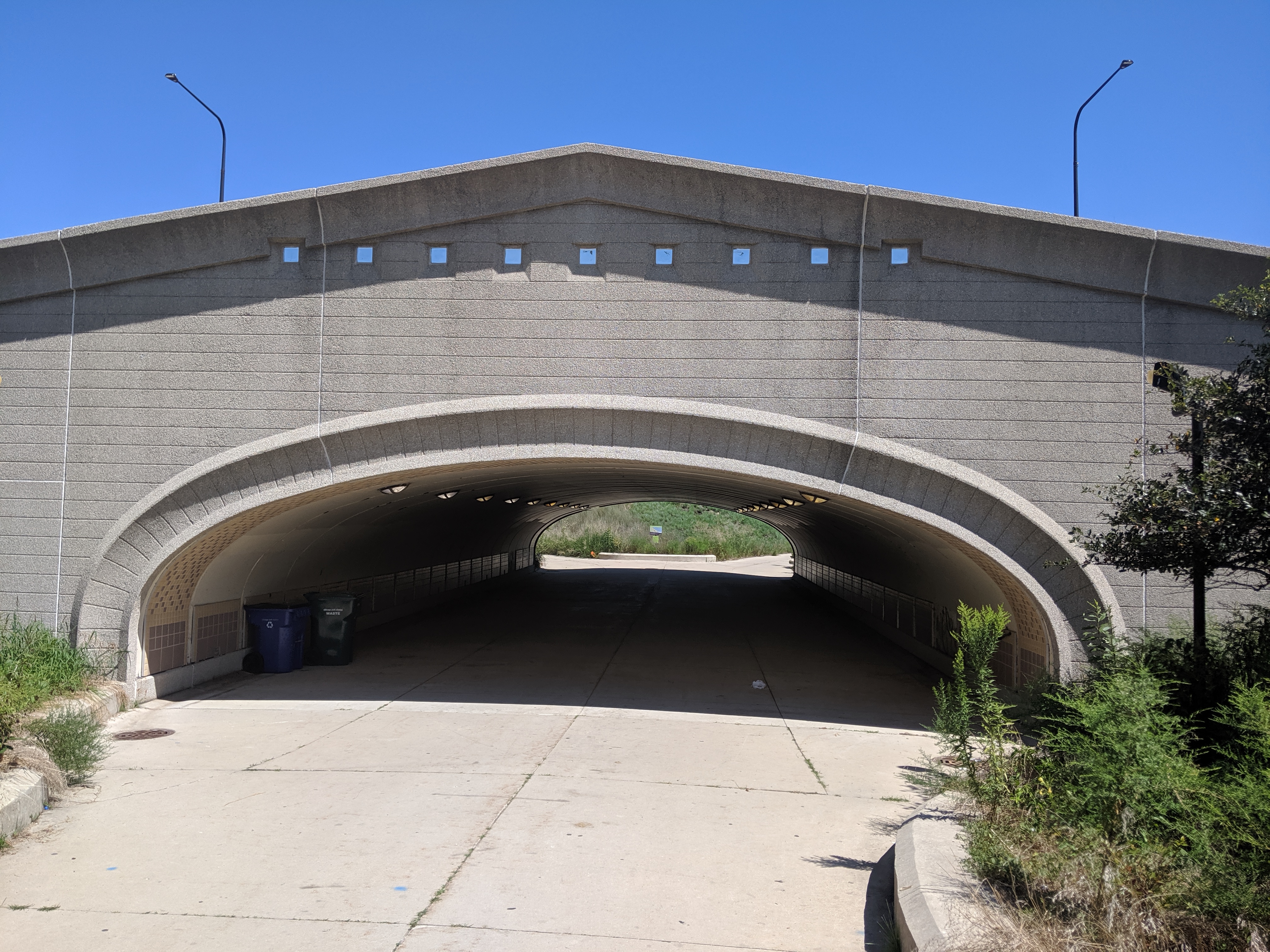
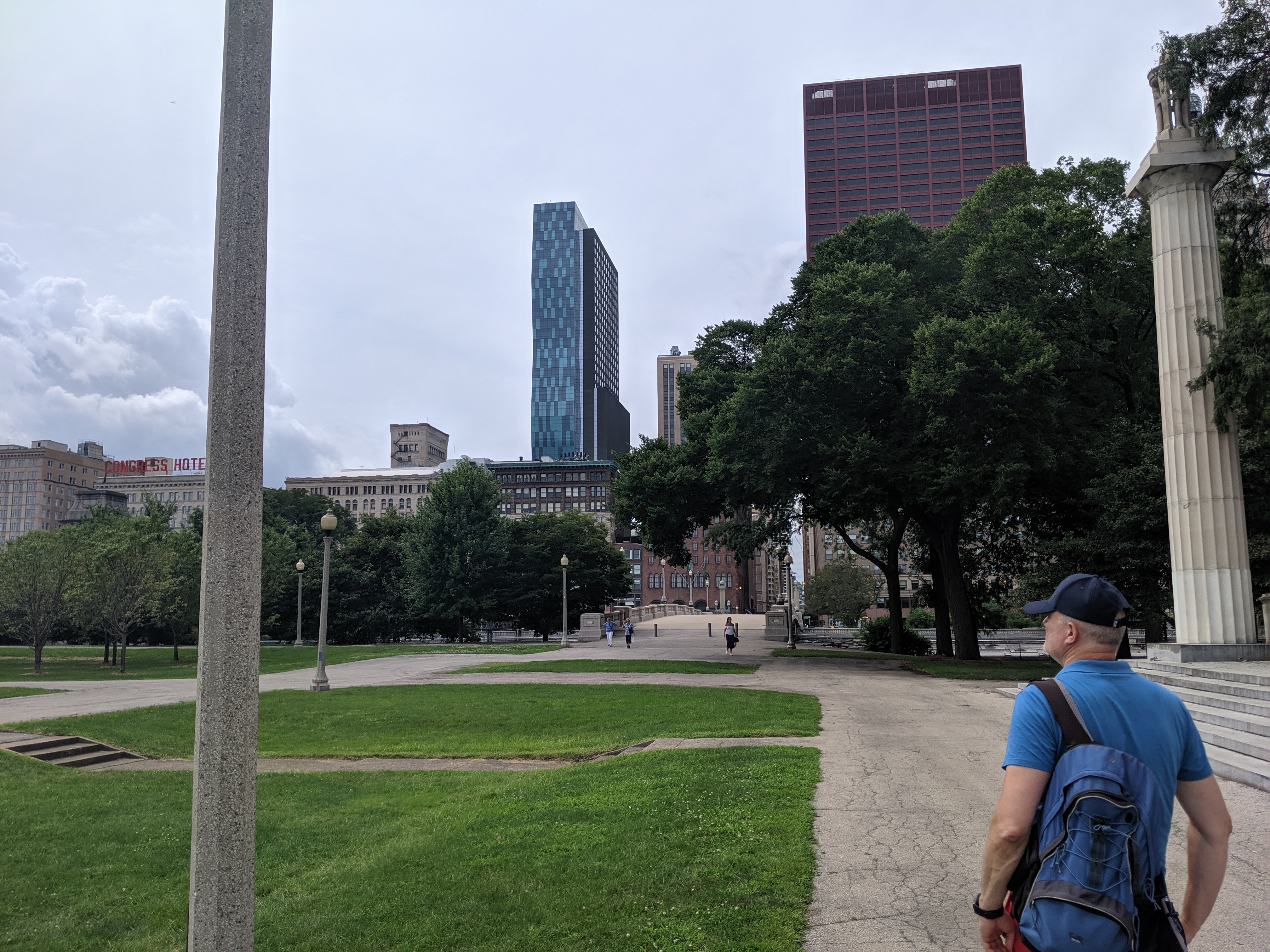
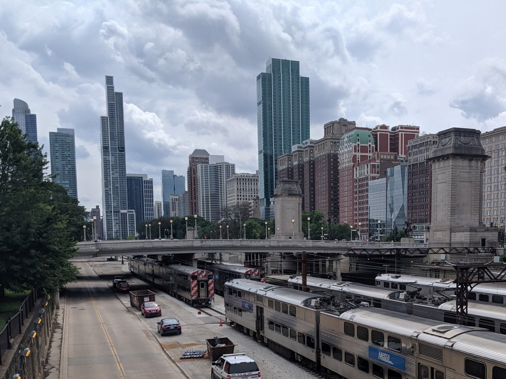
While exploring the Grant Park viaducts on my 2019 trip to Chicago, I discovered that they were connected to promenades leading to the lake. I decided to wend my way through Grant Park by strolling down one promenade to the lake and another back to Michigan Avenue and so on, weaving back and forth. It turns out that this is no longer an option.
On the 1920s map that inspired me to visit the viaducts, the only divider in Grant Park was the railroad tracks bridged by the viaducts. The rest of the park showed on the map as a vast open space where I assumed the promenades were designed for wealthy residents and visitors to take the air and see who else was in town (or perhaps that is just the influence of reading Jane Austen so much). While it didn’t matter to me who else was in town, strolling along the promenades seemed a nice way to take the air.
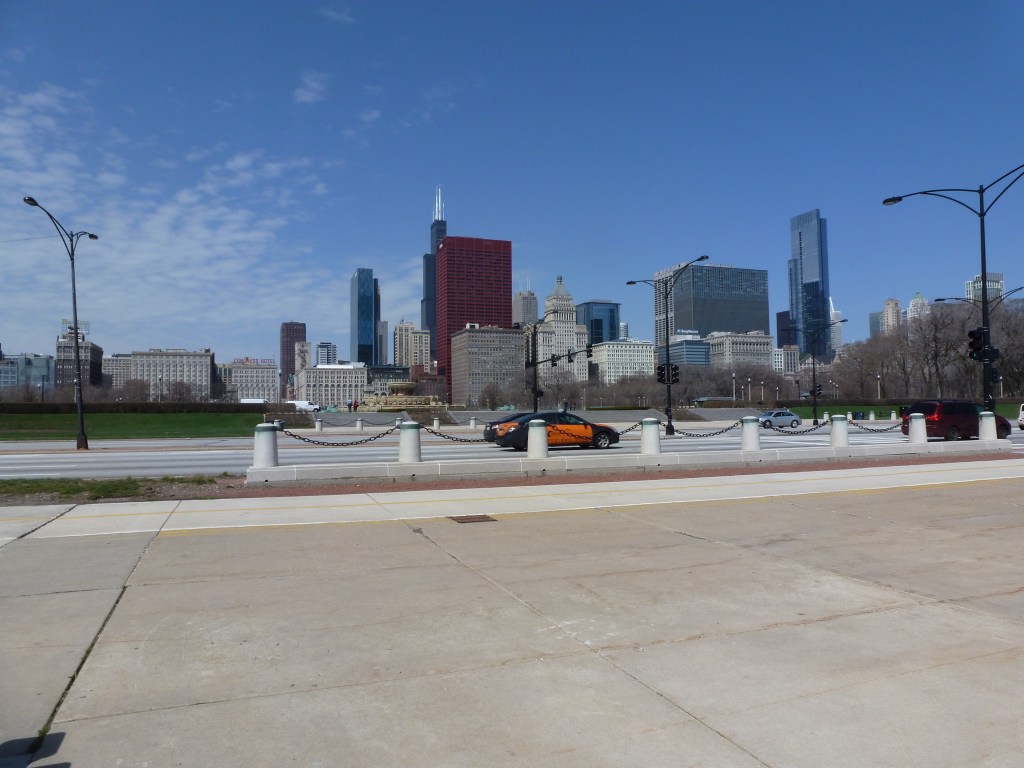
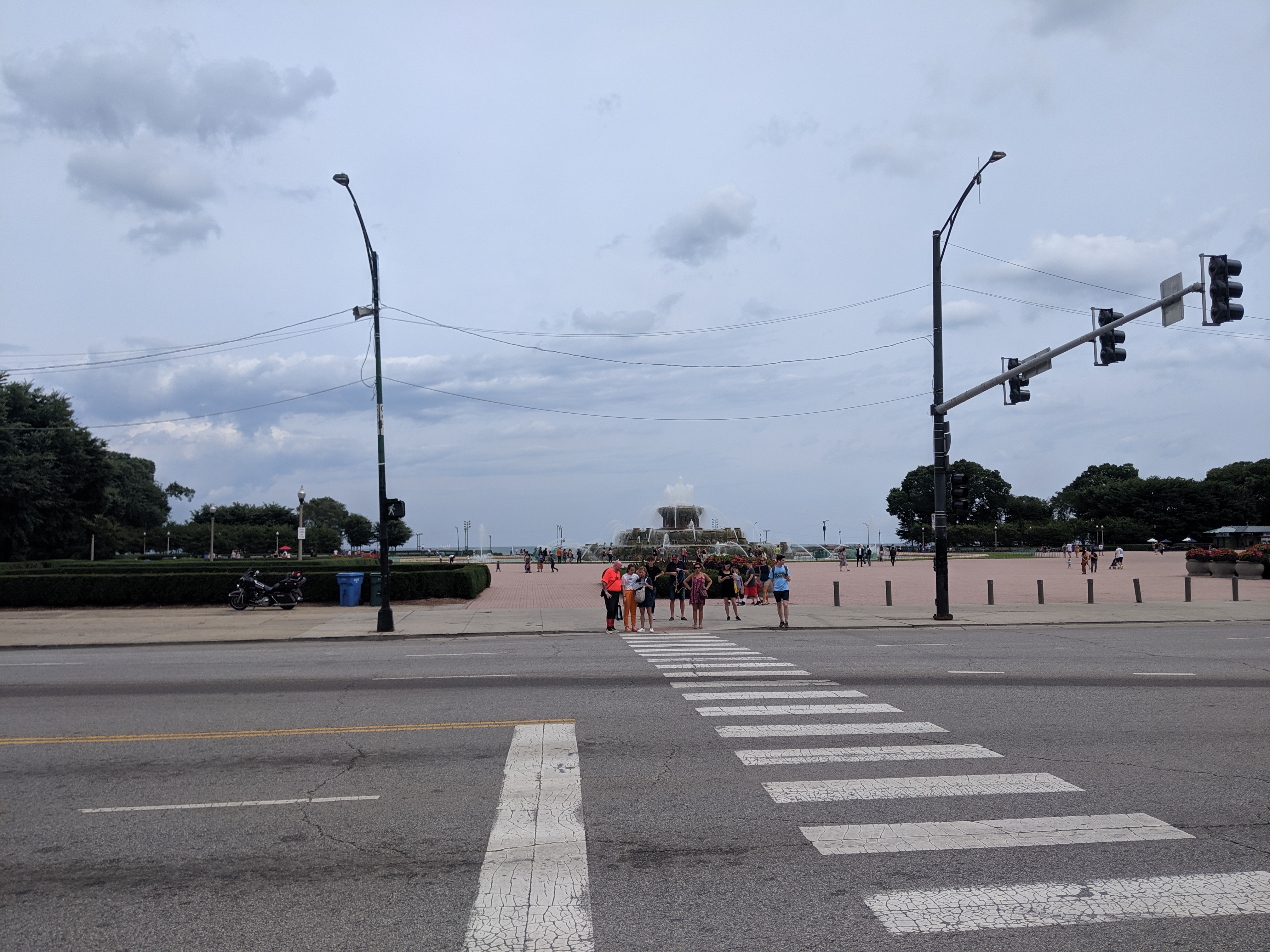
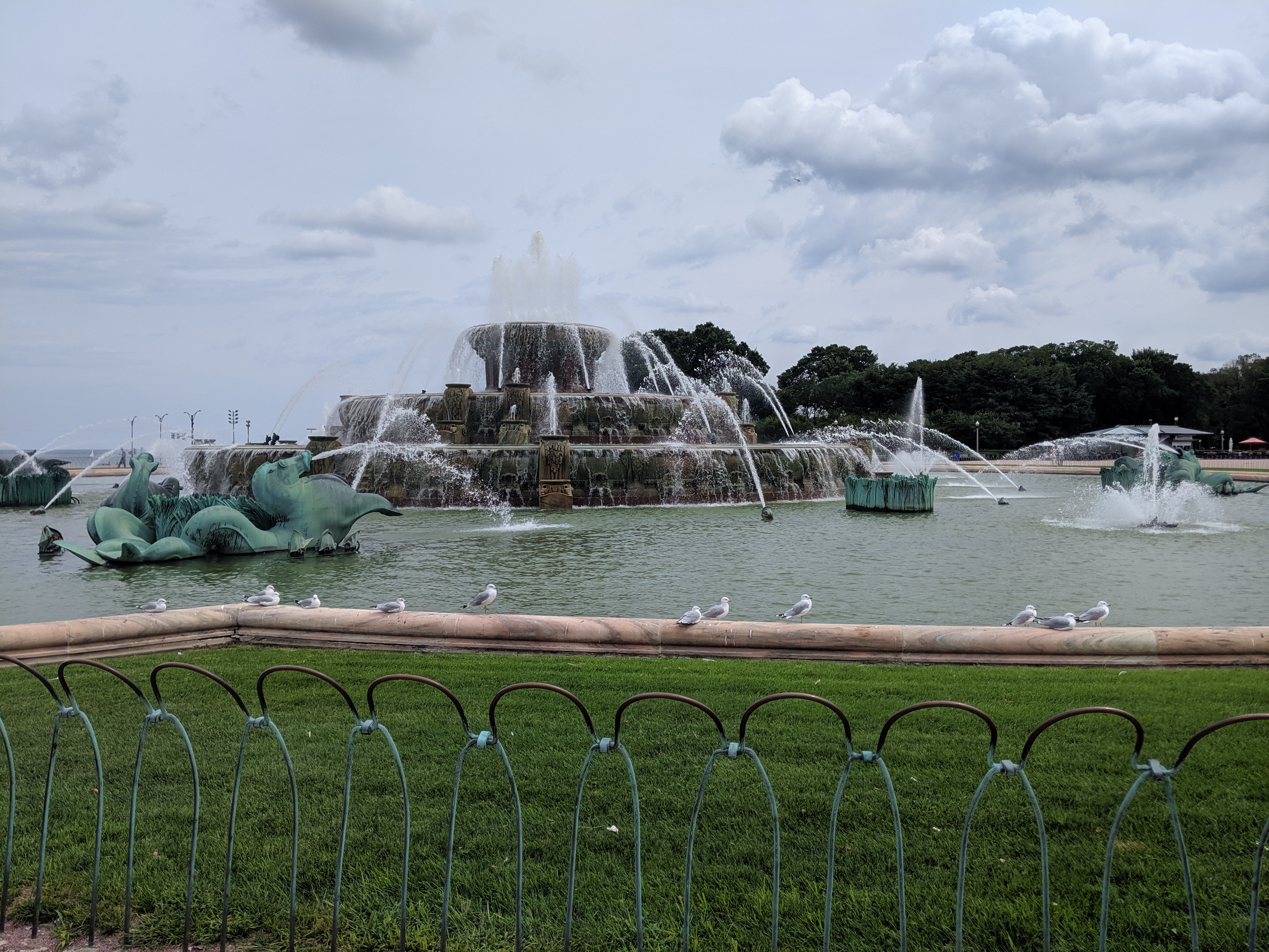
Whatever the original intent, today the promenades are chopped up by their modern antithesis – the multi-lane, high speed road. While there are several promenades spaced throughout the park, I only found one that had a protected pedestrian crossing over the many lanes of Columbus Drive. Clearly, this was the grand promenade. In addition to being the only one with a safe passage, past Columbus it featured an opulent water fountain.
Having already crossed a significant barrier, I assumed it would be a clear walk to the waterfront after that point. However, on the other side of the fountain, I found the even more formidable barrier of Lake Shore Drive, aka Route 41. All interest in continuing with my promenade evaporated even though the lights and crosswalks suggested the ability to cross safely. Instead, I spent some time admiring the fountain before returning to my hotel.
I was disappointed at discovering that the connection between the park and the lake was an optical illusion. Yet, it came as no surprise to find the lake front prioritized for cars. It is a recurring experience to find an urban waterfront cut off from the rest of the city by a major roadway barrier, or in this case two.
When I first saw this building from a distance, its rooftop ornamentation made it stand out from its surroundings. I didn’t have time to investigate on that trip, but my curiosity was peaked. I built up a story about the long history of this building that I surmised started out as a produce terminal in the 19th Century.
Six years later, I walked past the building on my way to my hotel. I was surprised to see it was a public library. It seemed unusual for a former marketplace to be converted to a library. As soon as I checked-in, I hurried back over to explore this unique building.
Despite entering immediately into a narrow, angular, white hallway, I held onto my belief that it was an old building. The hallway felt odd in that narrative, but I quickly forgot that feeling once I emerged into the main lobby with its high ceiling and sparkling white marble floors, counters, and walls. I found a directory and decided to make my way to the map room several floors above. This “room” turned out to be a corner in an open floor plan. The corner featured one row of computers and a full-service counter. Unable to browse a collection of maps, I made up a research question and asked the staff if they had maps to help. While one librarian looked in the back room for hard copy maps and another showed me their digital resources, our conversation ranged from how awesome maps are to the history of the building.
I was surprised and embarrassed to learn that the library was built in the 1990s. The rooftop sculptures of owls stand out so much in part because they were designed for a taller structure; the final floor of the library was cut from the project due to the financial crisis. I suggested it was nice that the designers included such details as the sculptures and marble countertops. The librarian pointed out that the marble was faux and did nothing to alleviate the industrial feel of the building.
Looking again, beyond the cleanliness and sparkle of the space, I noticed the low ceilings and uniform bright white light throughout the open floor plan. I also noticed the distortion of the wooden escalator enclosure. The proportions would have been better balanced if the enclosure reached twice as high to the next floor.
This discussion with the librarian made me question my default reactions to the space. My initial reaction of excitement for a unique example of adaptive reuse changed to awe when I thought that a new building, open to the public, incorporated expensive historical material. But this reaction did not match reality any more than the first. Both assumptions blinded me to the cramped spaces with migraine inducing lighting. This experience also taught me that it isn’t just the material that matters. Incorporating the materials, whether faux or real, while leaving out the related historic design elements such as natural lighting and high ceilings does not lead to a better building.
I came away with a better appreciation for my neighborhood library branch that combines modern materials (such as curtain wall windows and bamboo flooring) with thoughtful design. From the outside, I cringe at the modern angular look, but inside it is a warm and welcoming space. Apparently, the lesson of never judging a book by its cover applies to buildings, too. Never judge a building by its facade.
While poking around the map collection at Chicago’s Public Library, I discovered that the structures carrying roads over the railroad tracks in Grant Park are considered viaducts. The word viaduct brings to my mind a Roman structure soaring over a valley floor and conveying a flat road on top of towering stone arches. The Chicago “viaducts” do not fit that image. To me, they look like bridges with no striking difference between them and Chicago’s river bridges other than color and style of ornamentation. Both groups of structures have fairly flat roadbeds supported by piers. I am puzzled why one set of structures is called bridges and the other viaducts.
The main difference seems to be that the bridges are crossing a body of water while the viaducts are crossing an obstacle on land. This doesn’t feel like the answer, though. I’ve walked over 50 bridges in Pittsburgh, the majority of which are over land. Not one of these structures is called a viaduct. To help find clues to solve this puzzle, I looked up the definitions of bridge and viaduct.
Merriam-Webster’s definitions are not much help:
Viaduct: a long elevated roadway usually consisting of a series of short spans supported by arches, piers, or columns
Bridge: a structure carrying a pathway or roadway over a depression or obstacle
The Oxford English Dictionary has similar definitions:
Viaduct: an elevated structure consisting of a series of arches or spans, by means of which a railroad or road is carried over a valley, road, river, or marshy low-lying ground
Bridge: a structure forming or carrying a road, path, or (in later use) a railroad, etc., which spans a body of water, a roadway, a valley, or some other obstacle or gap, and allows a person or vehicle to pass unimpeded over or across it
Based on these definitions, the features that seem to distinguish a viaduct from a bridge are elevation and short spans. This still doesn’t help solve the question of why the Grant Park structures are viaducts and the Chicago River structures are bridges.
Next, I turned to “How to Read Bridges” by Edward Denison and Ian Stewart. The glossary defines viaduct as “a type of bridge over land formed by a series of small (usually arched) spans.” This definition seems to work best for the viaducts in Chicago. They are over land and have a series of spans, though the spans are not arched.
To further develop my understanding, I paged through the nine examples of viaducts in “How to Read Bridges.” All nine examples are elevated (such as the 330-foot high Goltzsch Viaduct and the 407-foot high Garabit Viaduct) and have multiple arches or piers (such as the 21-arch Glenfinnan Viaduct, the 8-arch Wharncliffe Viaduct, and the 5-pier Busseau Sur Grusse Viaduct). All, but one, have no support system above the road deck. The exception is the Millau Viaduct, which uses a cable-stayed deck on top of seven piers that range from 253 feet to 800 feet tall. All, but one, are over land. The Garabit Viaduct spans the Truyère Valley and one-third of its length crosses the Truyère River. In another example, the approaches to the Cubzac-les-Ponts over the River Dordogne are considered viaducts, but it is a bridge that crosses the river.
I find myself again at a loss. While the definition in this book seems to work for the Chicago viaducts, the examples do not look like the Chicago structures. To help the Chicago viaducts fit in, I propose a new definition built from the three definitions and nine examples above:
Viaduct: an elevated roadway, supported by many arches or piers over land.
Yet, there are exceptions to every rule. The nine examples in “How to Read Bridges” include exceptions to the support system of the viaduct and to the obstacle spanned by a viaduct. Expanding upon this, the Chicago viaducts, which are supported by multiple piers over land, become the exception to the elevated part of the rule or definition.
My biggest take away is that it is no easier to define a viaduct than it is to define a bridge. In most cases, as with bridges, a viaduct is something you know when you see it, even if you cannot define it. However, sometimes it takes a label or a sign, such as the maps of Chicago’s viaducts and, prior to its restoration, the maps of Heth’s Run Bridge, to know what you are seeing.
Amid writing my posts about how the wealth gap manifests itself in the built environment and the morality of unequal economic investment in cities, I took another trip to Chicago. I spent most of my stay in the downtown areas within a mile of Grant Park. I love the old stone buildings, established green parks, ornate fountains, and modern glass skyscrapers with interesting architectural embellishments. Yet this trip, I felt hypocritical as I walked around soaking it all in. All these elements that I enjoy are the result of significant financial outlay that I know is not evenly distributed throughout the city. So where was my moral indignation at this display of deeply entrenched wealth unequally spread?
Chicago’s display of wealth isn’t gaudy like Tijuana or Las Vegas. The message I absorb in places like those with their flashing lights is “come on in, so we can suck all the money out of your pockets.” Chicago businesses identified their presence on the street with regular signs leaving it up to the passers to decide whether to engage.
One bar did add a layer of enticement to their sidewalk advertising. I was searching for a place for dinner, with this bar in mind as the one that looked most appealing from Google maps. I was looking around to see if there were any other better options. The smell of the burgers from this first bar convinced me that it was the best option in that vicinity. It was only after I had sat down and ordered that I realized the smell wasn’t coming from the open window, but rather it came from pipes pumping the kitchen smells to the sidewalk. Still it was a subtle inducement and unlike flashing lights it did not have a nefarious undertone.
By pumping out the smell to the sidewalk, it also felt indiscriminate. Anyone passing was invited to enjoy. This was unlike my experience in Cardiff where if I couldn’t afford the items in the business, I felt I shouldn’t be walking past in the public space. I never felt like I didn’t belong in Chicago. There were economic barriers to certain experiences, but those places that I encountered still did not feel exclusionary. One example is the lounge on the 96th floor of Chicago’s Hancock Building. The stunning views are only accessible to those who can afford a $17 cocktail, but those who can afford one only once in a blue moon were just as welcome as those who can afford one or more every night.
In Chicago, I never saw that strong line, as in Tijuana and Cardiff, that divided those with and those without financial resources. Everywhere I went, there was a mix of people with different economic statuses, skin colors, and first languages. This diversity gave me the feeling that anyone is welcome to enjoy the well-maintained investment in public spaces with or without hitting a minimum financial threshold.