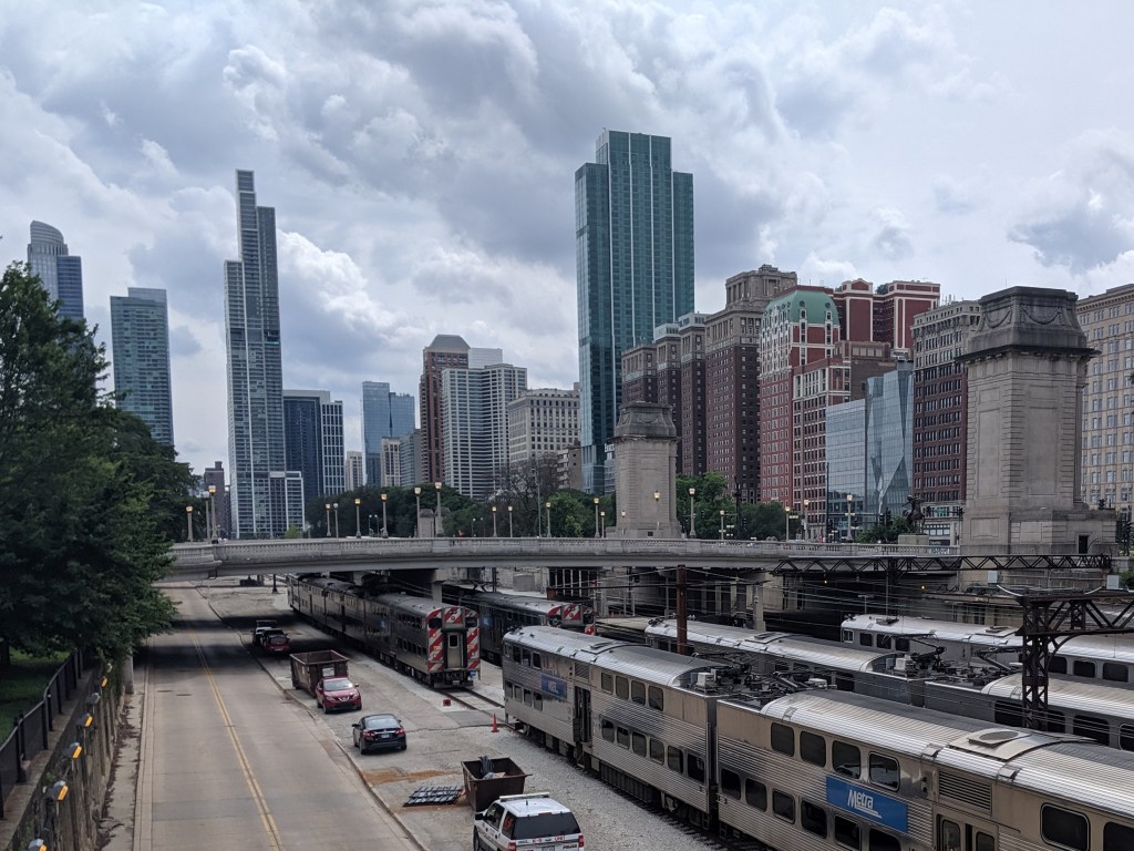
While exploring the Grant Park viaducts on my 2019 trip to Chicago, I discovered that they were connected to promenades leading to the lake. I decided to wend my way through Grant Park by strolling down one promenade to the lake and another back to Michigan Avenue and so on, weaving back and forth. It turns out that this is no longer an option.
On the 1920s map that inspired me to visit the viaducts, the only divider in Grant Park was the railroad tracks bridged by the viaducts. The rest of the park showed on the map as a vast open space where I assumed the promenades were designed for wealthy residents and visitors to take the air and see who else was in town (or perhaps that is just the influence of reading Jane Austen so much). While it didn’t matter to me who else was in town, strolling along the promenades seemed a nice way to take the air.
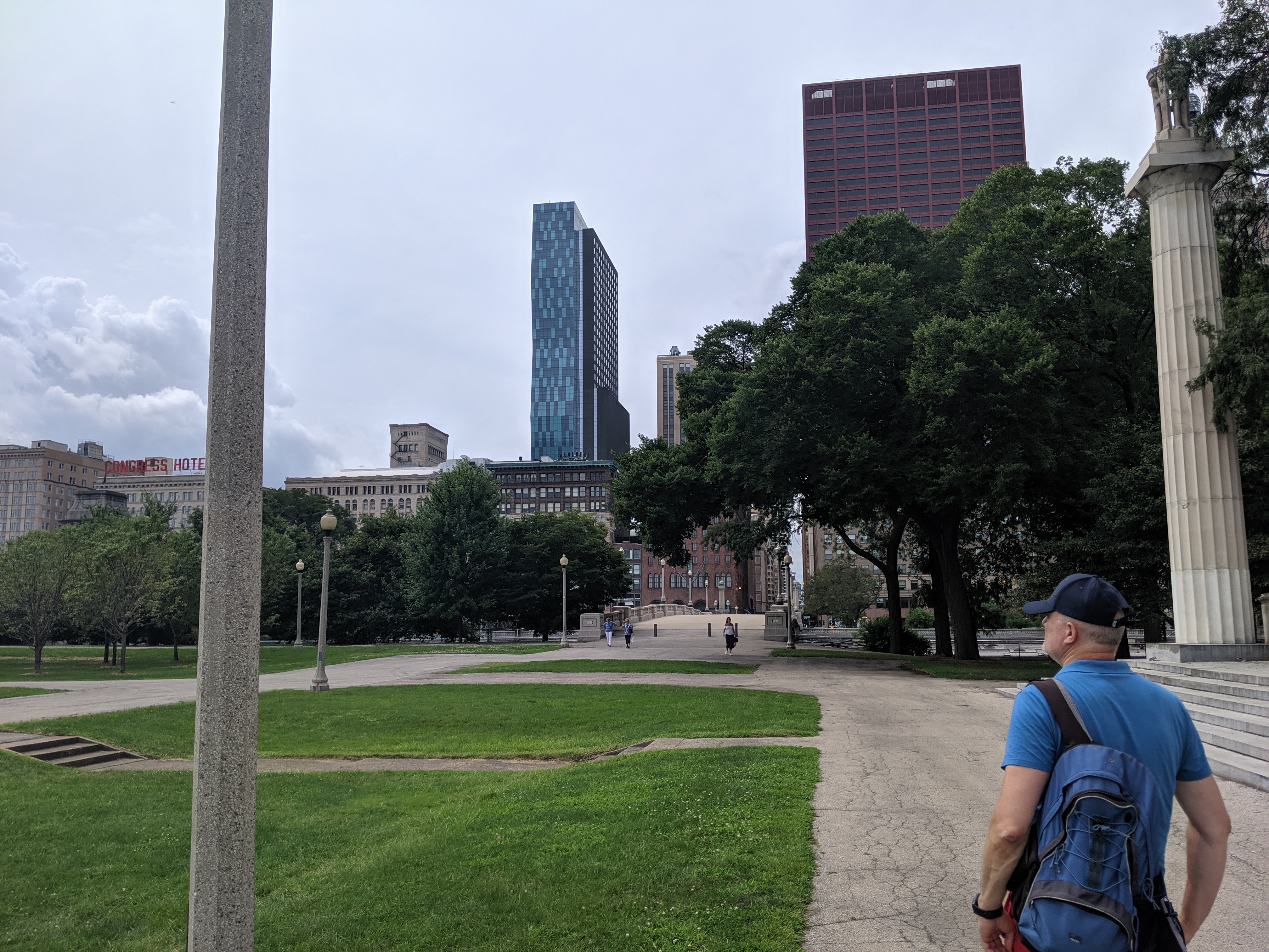
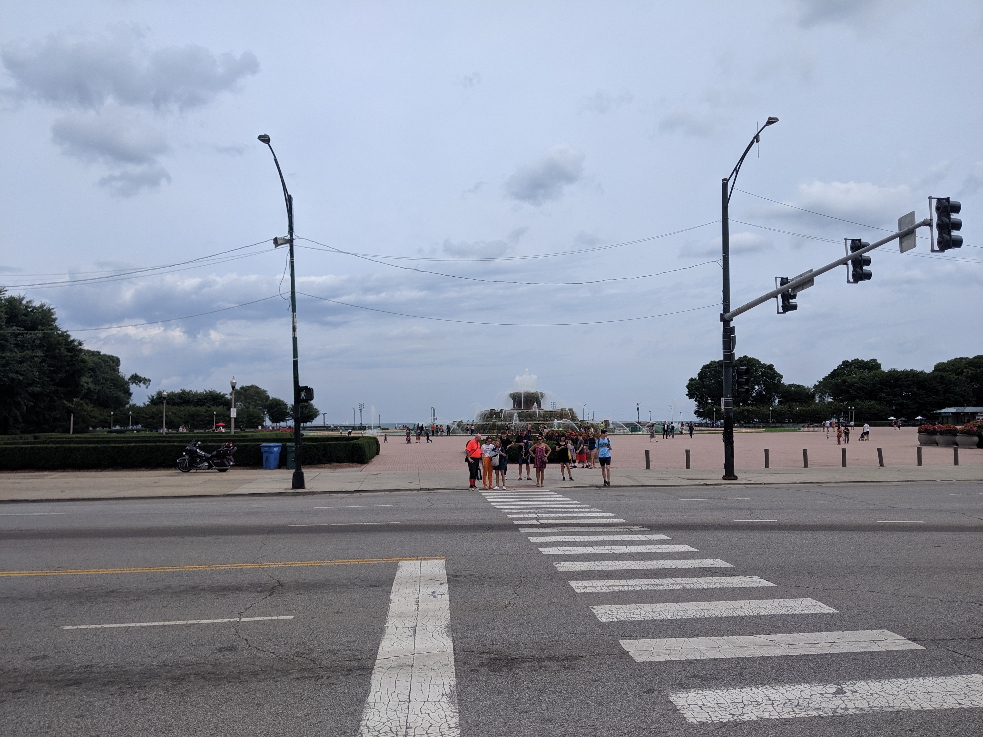
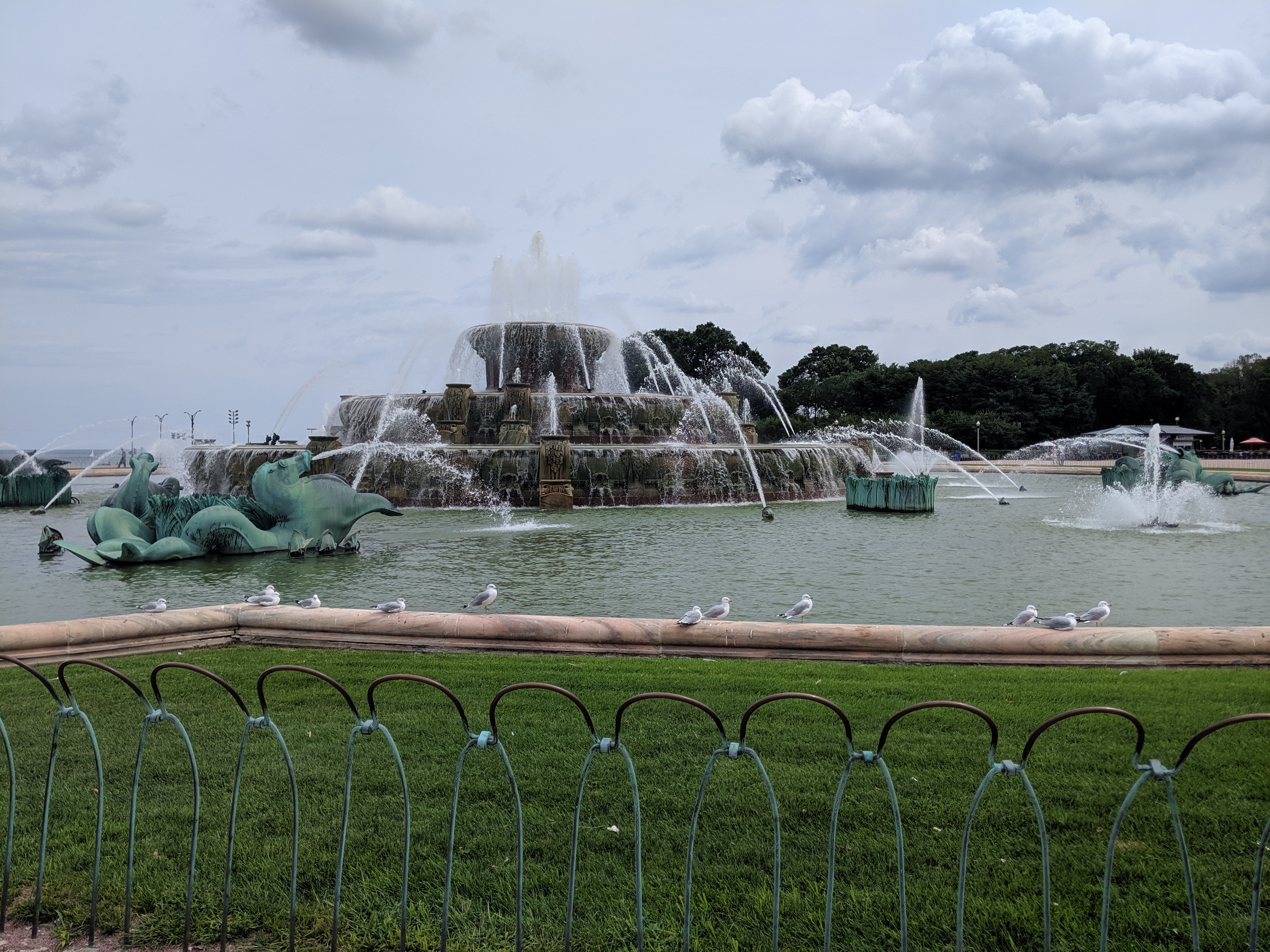
Whatever the original intent, today the promenades are chopped up by their modern antithesis – the multi-lane, high speed road. While there are several promenades spaced throughout the park, I only found one that had a protected pedestrian crossing over the many lanes of Columbus Drive. Clearly, this was the grand promenade. In addition to being the only one with a safe passage, past Columbus it featured an opulent water fountain.
Having already crossed a significant barrier, I assumed it would be a clear walk to the waterfront after that point. However, on the other side of the fountain, I found the even more formidable barrier of Lake Shore Drive, aka Route 41. All interest in continuing with my promenade evaporated even though the lights and crosswalks suggested the ability to cross safely. Instead, I spent some time admiring the fountain before returning to my hotel.
I was disappointed at discovering that the connection between the park and the lake was an optical illusion. Yet, it came as no surprise to find the lake front prioritized for cars. It is a recurring experience to find an urban waterfront cut off from the rest of the city by a major roadway barrier, or in this case two.
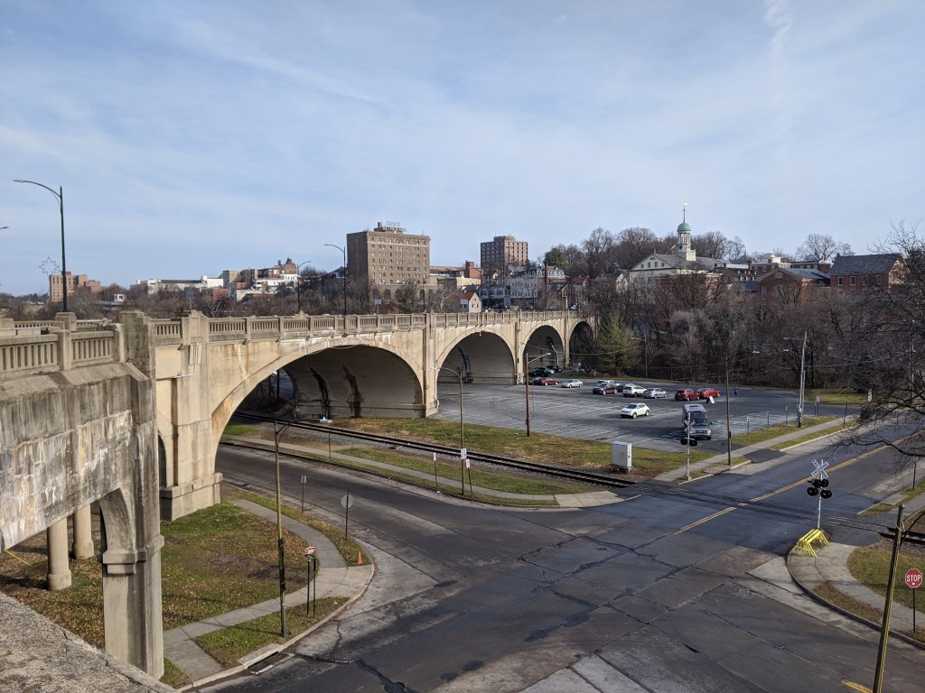
I was in the midst of trying to understand what is a viaduct when I traveled to Bethlehem, PA, with my family. One of our activities was to explore the bridges (see also Cage-free Bridges). As we walked the Hill-to-Hill Bridge, my initial reaction was “now here is a viaduct.” I hadn’t reached the point of developing a semi-clear definition for viaduct but looking at the flat roadbed supported by multiple arches over the floodplain, viaduct seemed the most appropriate word for the structure.
As we kept walking, it turned out that the viaduct was only a portion of the Hill-to-Hill Bridge. In fact, it would be more appropriately called the Hill-to-Hill-to-Hill-to-Hill Bridge. There are two approaches to the main span on the south end and three on the north end, including the viaduct and one approach permanently closed to through traffic. When the bridge was built in 1924, there were a total of seven approaches at various points along the main span. With so many components, this structure brings me back to the question of how many is one bridge?
Unlike when I asked this question of the 30th and 31st Street bridges in Pittsburgh, here the main bridge, the intersecting viaduct, and the numerous connections seem to be considered one bridge. They are together called the Hill-to-Hill Bridge while the structure in Pittsburgh has three distinct names (including River Avenue Ramp). Perhaps the deciding factor in whether it is one or more bridges is the original intent. The Hill-to-Hill Bridge was designed as a multifaceted structure whereas the 30th and 31st Street bridges were developed independently.
The best indication of the original intent seems to be the name. The Hill-to-Hill Bridge has a single name whereas the 30th and 31st Street bridges have separate names. The other examples I looked at in 2012 were the Veterans Bridge (Pittsburgh), the Fort Duquesne Bridge (Pittsburgh), and what I called the Jubilee Bridge (London).
The Veterans Bridge joins three approaches into one bridge, all under a single name. Therefore, it is one bridge, not three.
The pedestrian walkway of the Fort Duquesne Bridge was built decades after the vehicular portion but does not have a separate name. Therefore, it is one bridge, not two.
What I called the Jubilee Bridge (despite the photo I took at the time of the dedication plaque stating otherwise) is actually called the Golden Jubilee Bridges. While these bridges share the support structure of the underground’s Hungerford Bridge due to concerns about unexploded WWII bombs in the area, they have separate names. Therefore, it is three bridges, not one nor two.
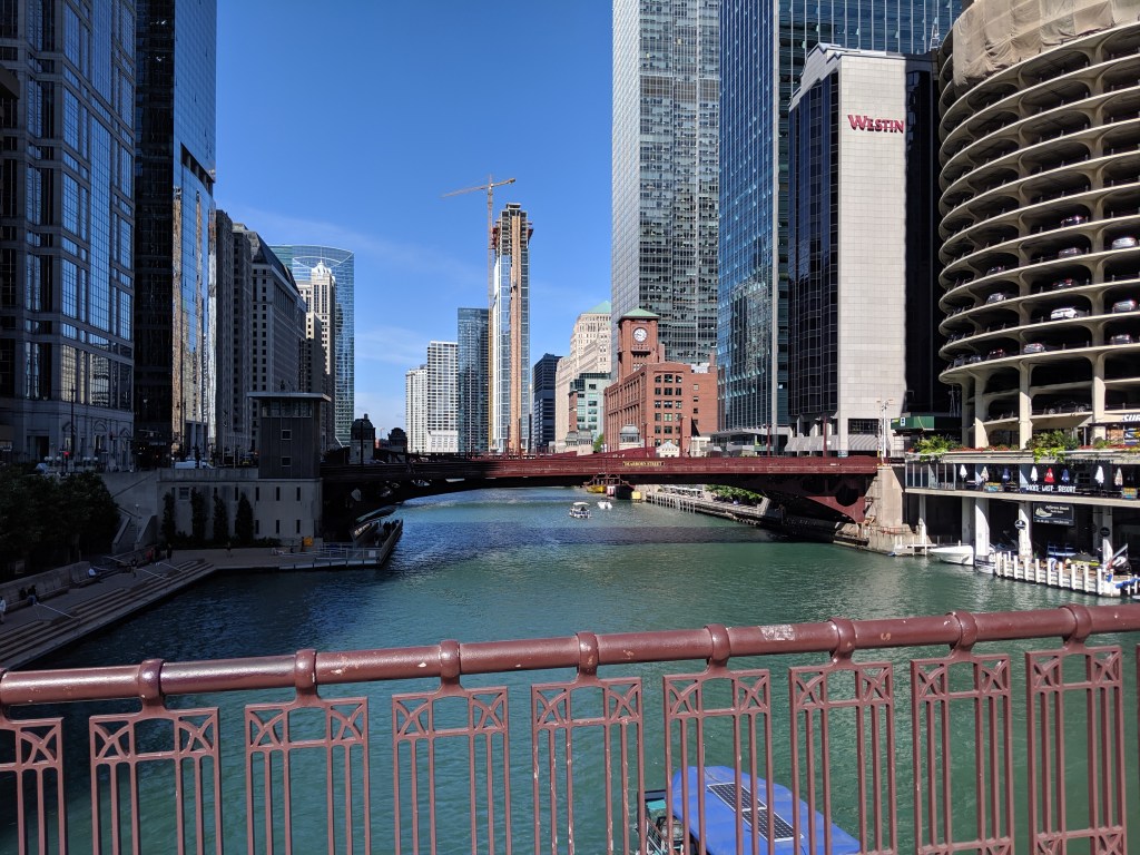
While poking around the map collection at Chicago’s Public Library, I discovered that the structures carrying roads over the railroad tracks in Grant Park are considered viaducts. The word viaduct brings to my mind a Roman structure soaring over a valley floor and conveying a flat road on top of towering stone arches. The Chicago “viaducts” do not fit that image. To me, they look like bridges with no striking difference between them and Chicago’s river bridges other than color and style of ornamentation. Both groups of structures have fairly flat roadbeds supported by piers. I am puzzled why one set of structures is called bridges and the other viaducts.
The main difference seems to be that the bridges are crossing a body of water while the viaducts are crossing an obstacle on land. This doesn’t feel like the answer, though. I’ve walked over 50 bridges in Pittsburgh, the majority of which are over land. Not one of these structures is called a viaduct. To help find clues to solve this puzzle, I looked up the definitions of bridge and viaduct.
Merriam-Webster’s definitions are not much help:
Viaduct: a long elevated roadway usually consisting of a series of short spans supported by arches, piers, or columns
Bridge: a structure carrying a pathway or roadway over a depression or obstacle
The Oxford English Dictionary has similar definitions:
Viaduct: an elevated structure consisting of a series of arches or spans, by means of which a railroad or road is carried over a valley, road, river, or marshy low-lying ground
Bridge: a structure forming or carrying a road, path, or (in later use) a railroad, etc., which spans a body of water, a roadway, a valley, or some other obstacle or gap, and allows a person or vehicle to pass unimpeded over or across it
Based on these definitions, the features that seem to distinguish a viaduct from a bridge are elevation and short spans. This still doesn’t help solve the question of why the Grant Park structures are viaducts and the Chicago River structures are bridges.
Next, I turned to “How to Read Bridges” by Edward Denison and Ian Stewart. The glossary defines viaduct as “a type of bridge over land formed by a series of small (usually arched) spans.” This definition seems to work best for the viaducts in Chicago. They are over land and have a series of spans, though the spans are not arched.
To further develop my understanding, I paged through the nine examples of viaducts in “How to Read Bridges.” All nine examples are elevated (such as the 330-foot high Goltzsch Viaduct and the 407-foot high Garabit Viaduct) and have multiple arches or piers (such as the 21-arch Glenfinnan Viaduct, the 8-arch Wharncliffe Viaduct, and the 5-pier Busseau Sur Grusse Viaduct). All, but one, have no support system above the road deck. The exception is the Millau Viaduct, which uses a cable-stayed deck on top of seven piers that range from 253 feet to 800 feet tall. All, but one, are over land. The Garabit Viaduct spans the Truyère Valley and one-third of its length crosses the Truyère River. In another example, the approaches to the Cubzac-les-Ponts over the River Dordogne are considered viaducts, but it is a bridge that crosses the river.
I find myself again at a loss. While the definition in this book seems to work for the Chicago viaducts, the examples do not look like the Chicago structures. To help the Chicago viaducts fit in, I propose a new definition built from the three definitions and nine examples above:
Viaduct: an elevated roadway, supported by many arches or piers over land.
Yet, there are exceptions to every rule. The nine examples in “How to Read Bridges” include exceptions to the support system of the viaduct and to the obstacle spanned by a viaduct. Expanding upon this, the Chicago viaducts, which are supported by multiple piers over land, become the exception to the elevated part of the rule or definition.
My biggest take away is that it is no easier to define a viaduct than it is to define a bridge. In most cases, as with bridges, a viaduct is something you know when you see it, even if you cannot define it. However, sometimes it takes a label or a sign, such as the maps of Chicago’s viaducts and, prior to its restoration, the maps of Heth’s Run Bridge, to know what you are seeing.