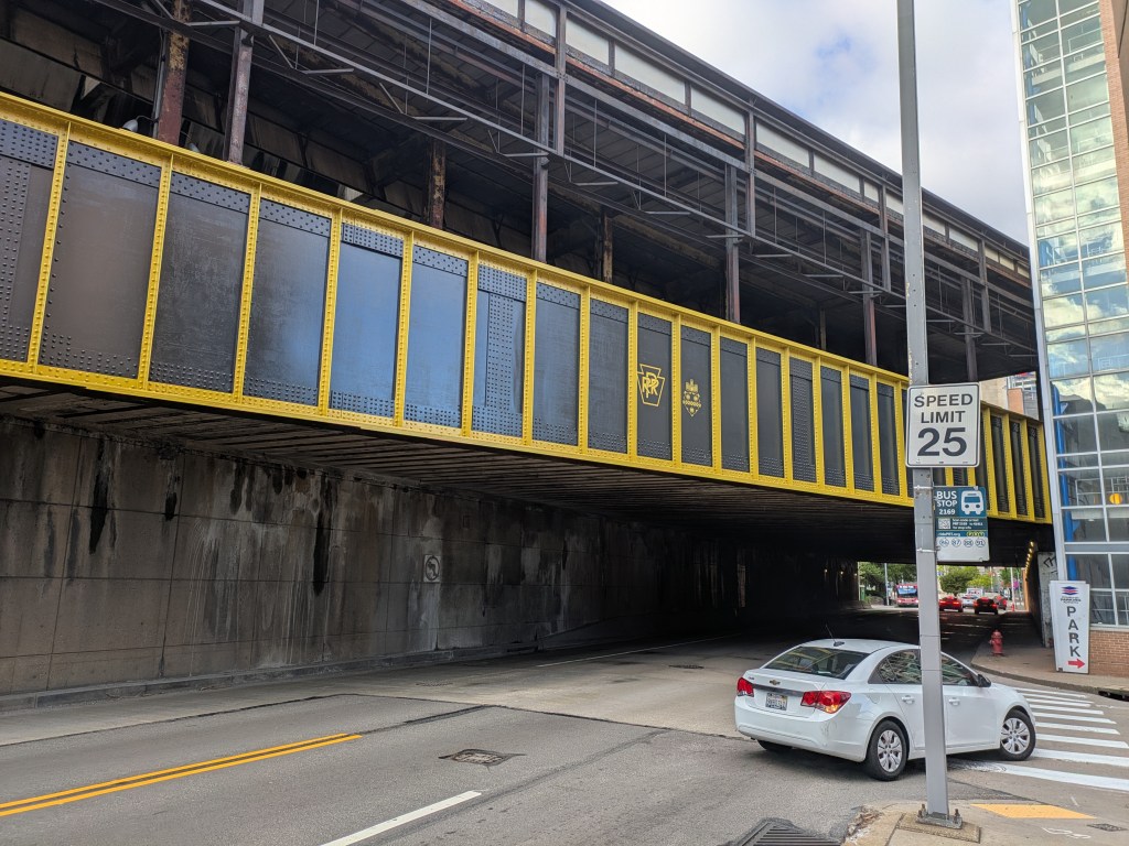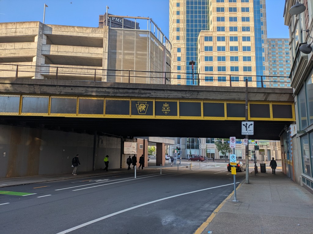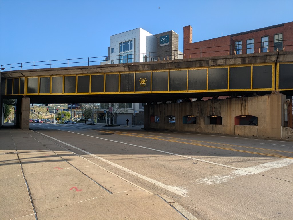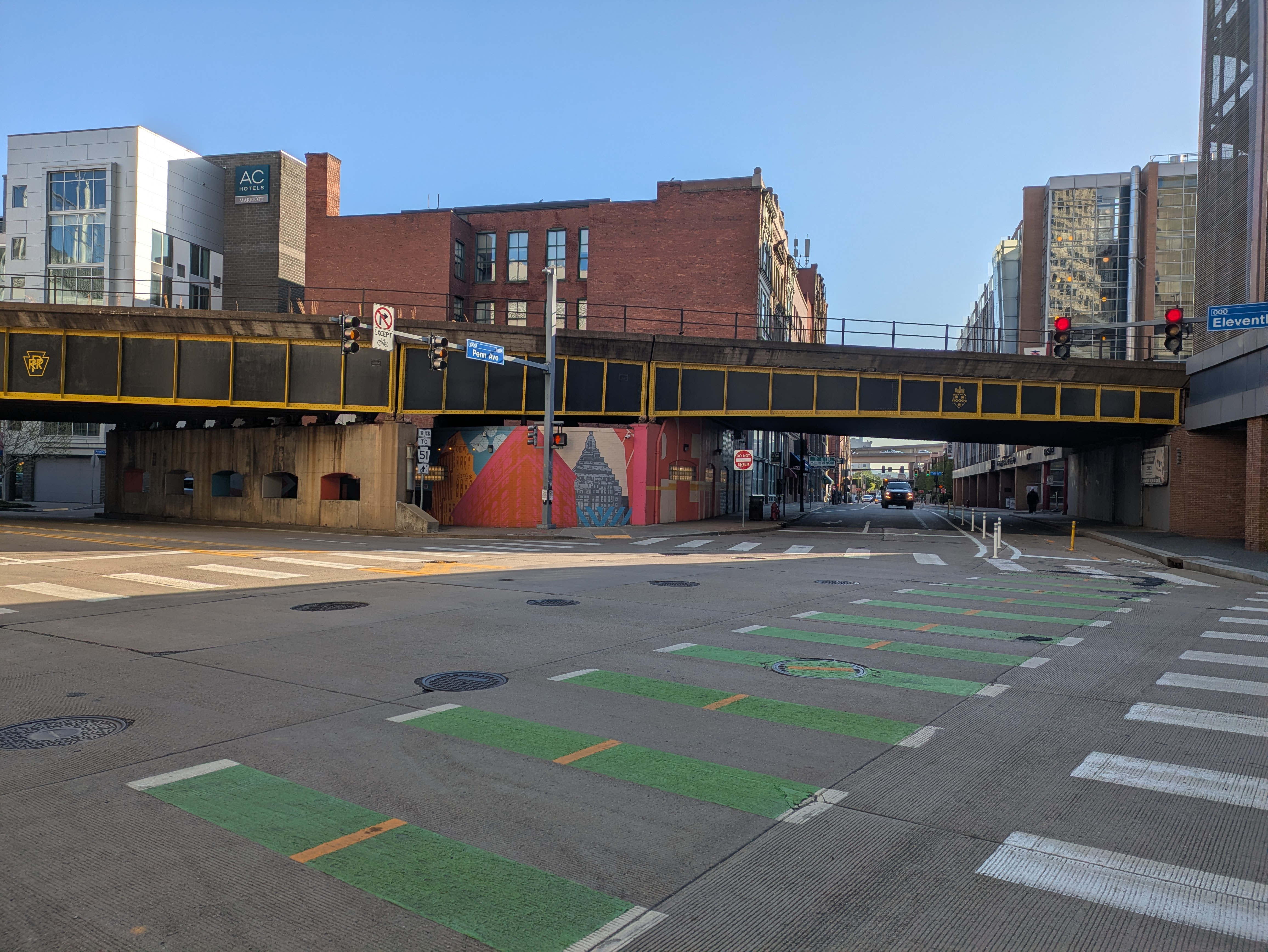
Pittsburgh has been redding up for the NFL Draft with increasing fervor over the last several weeks. Among the actions taken was painting a series of railroad trestles that pass over a number of streets downtown. I was prepared to say, “how cool, but why couldn’t we spruce up the pedestrian experience with these trestles while we’re at it?”
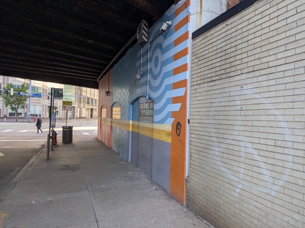
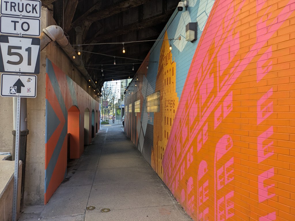
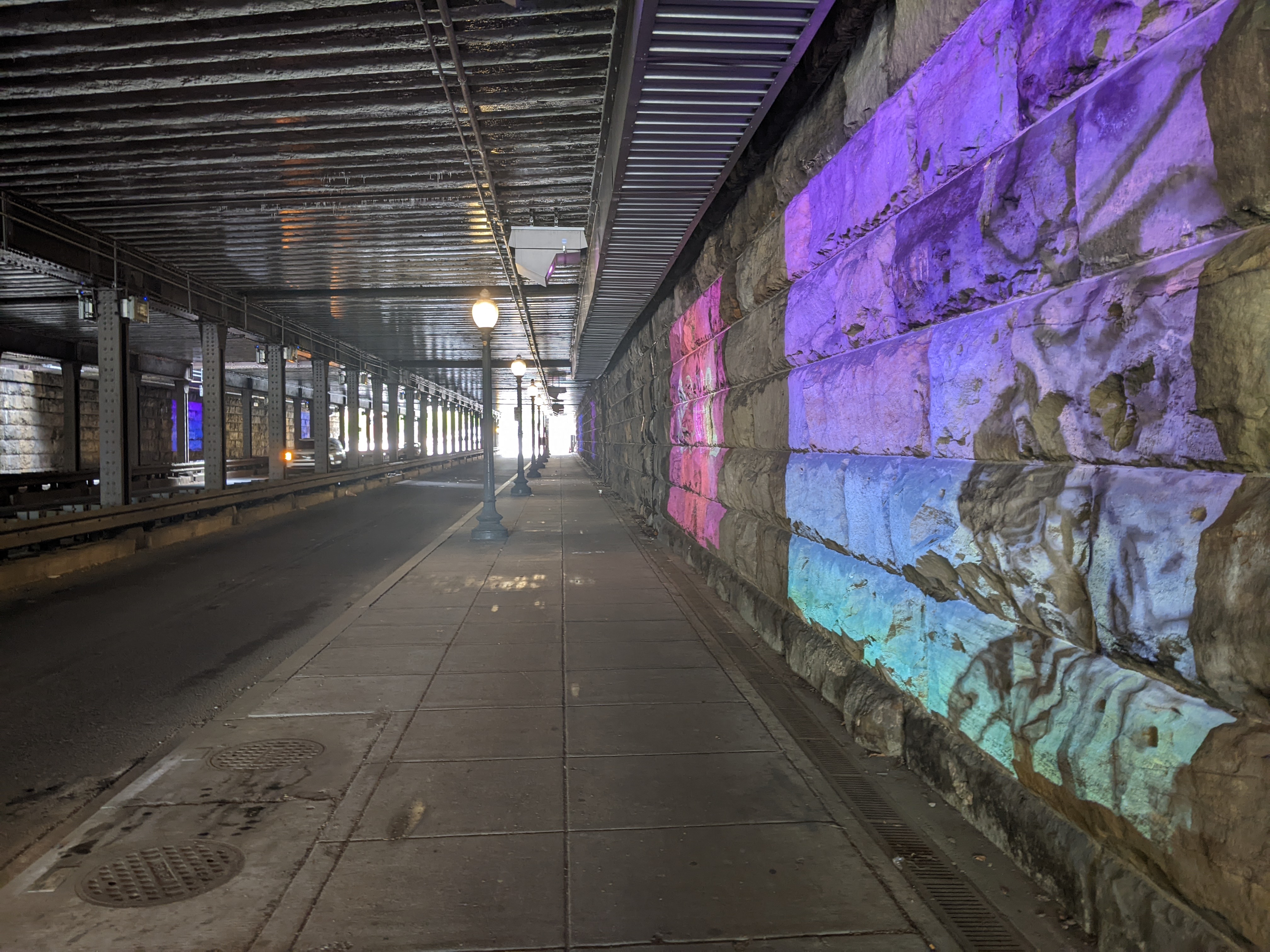
However, gearing up to make that compliant, I finally noticed that two of them already have murals, despite my rant a few months ago about the lack of murals to spruce up the pedestrian experience when passing underneath railroad bridges in Pittsburgh compared to other cities. One takes it a step further and also has a series of lights strung over the sidewalk. I don’t know how long the mural or the lights have been in place, but my reaction to the mural this week was “oh yeah, I forgot this was there.”
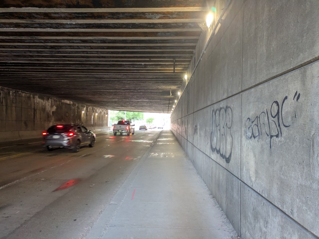
In my defense, the third of the newly painted trestles I explored this week is the longest and darkest of these three, and the one I’ve walked under the most. It is also one of the top three I pictured when making my compliant in February. The other two being the one where this same railroad crosses over Merchant Street on the North Side and the one carrying the T tracks over First Avenue on the opposite side of downtown. I still maintain that these would benefit from the addition of a mural or other intervention.
In the meantime, I will enjoy the approach to our new black & gold trestles.