
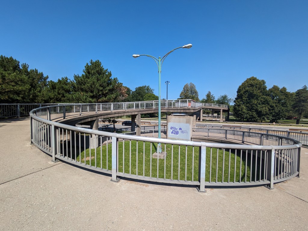
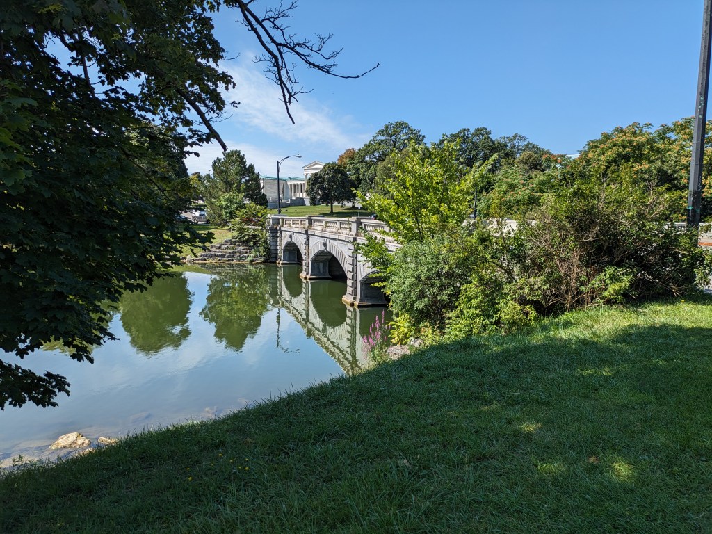
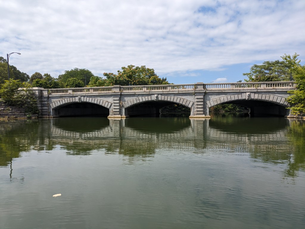
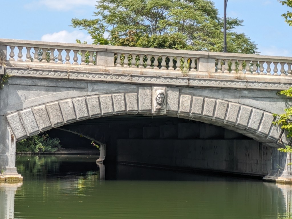
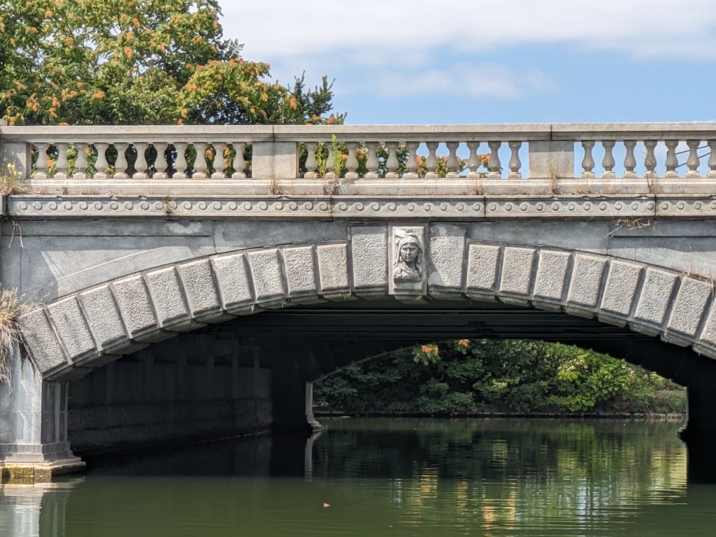
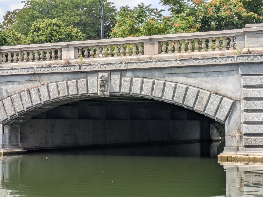
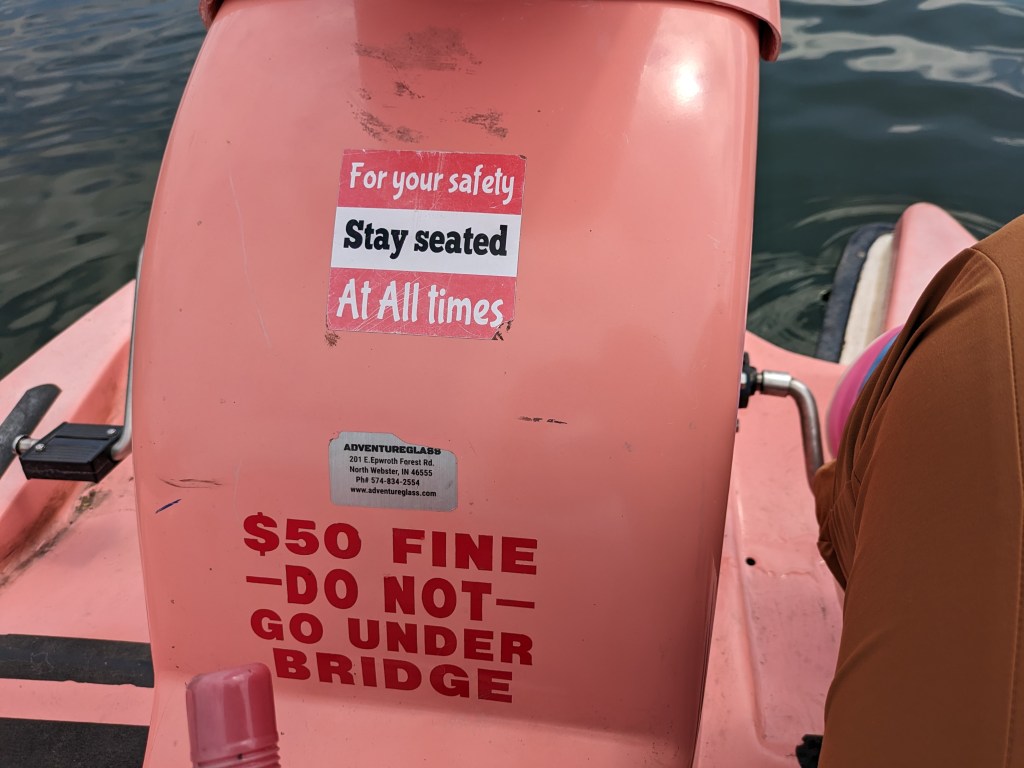
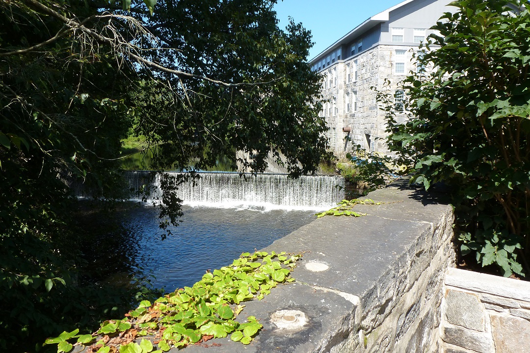
In my meanderings in Delaware Park as part of my exploration of World’s Fair sites, I walked over two interesting bridges: the Whirly-Twirly Bridge and the Lincoln Parkway Bridge. The Whirly-Twirly Bridge is the best named bridge of the 100+ bridges that I’ve encountered since I started walking bridges (even beating out the Big Dam Bridge). It also provides one of the few pedestrian links across the Scajaquada Expressway which divides Delaware Park. The Lincoln Parkway Bridge was built in 1900, perhaps as part of the 1901 Pan-American World’s Fair. If so, the story of this bridge gets drowned out in the attention paid to the temporary Triumphal Bridge with its massive pylons that lasted only as long as the fair. From my observation, the Lincoln Parkway Bridge is a nice, modest scale, stone arch bridge that acknowledges the indigenous people of the area in its sculpture. I was able to get a nice lake-eye view of these sculptures from a rented paddle boat that sadly included a prohibition on paddling underneath the bridge.
Tag Archives: pedestrian bridge
Then & Now: East Liberty Pedestrian Bridge
Just after I began my 10-year anniversary celebration of bridge walking, the Forbes Ave Bridge over Fern Hollow collapsed on January 28, 2022. This accident shone a light on a pattern of infrastructure funding in the time since I became a bridge person. Ten years ago, there were several bridges built, repaired, or replaced in Pittsburgh. Five years later, the flurry of long overdue investment in our infrastructure stopped – before all the bridges that needed help received it. An article on the aftermath of last month’s bridge collapse reminded me that federal funds were allocated toward infrastructure under the Obama administration. As a result, many bridges that were falling apart were fixed or replaced. It seems that when that funding stopped, so did the repairs. Now that new funding has been allocated under the Biden administration, we should see a similar spurt of investment in our infrastructure, starting with the now missing Fern Hollow Bridge.
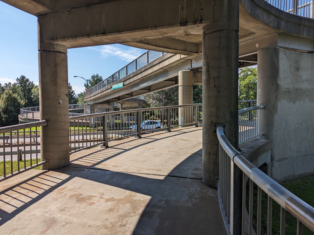
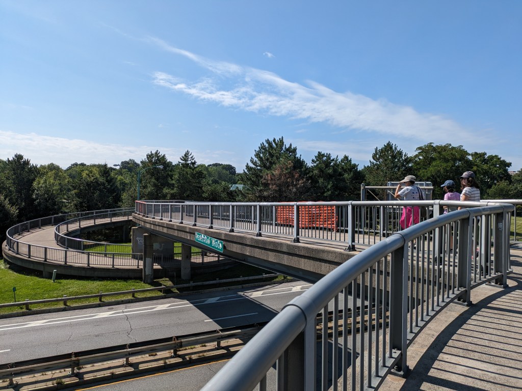
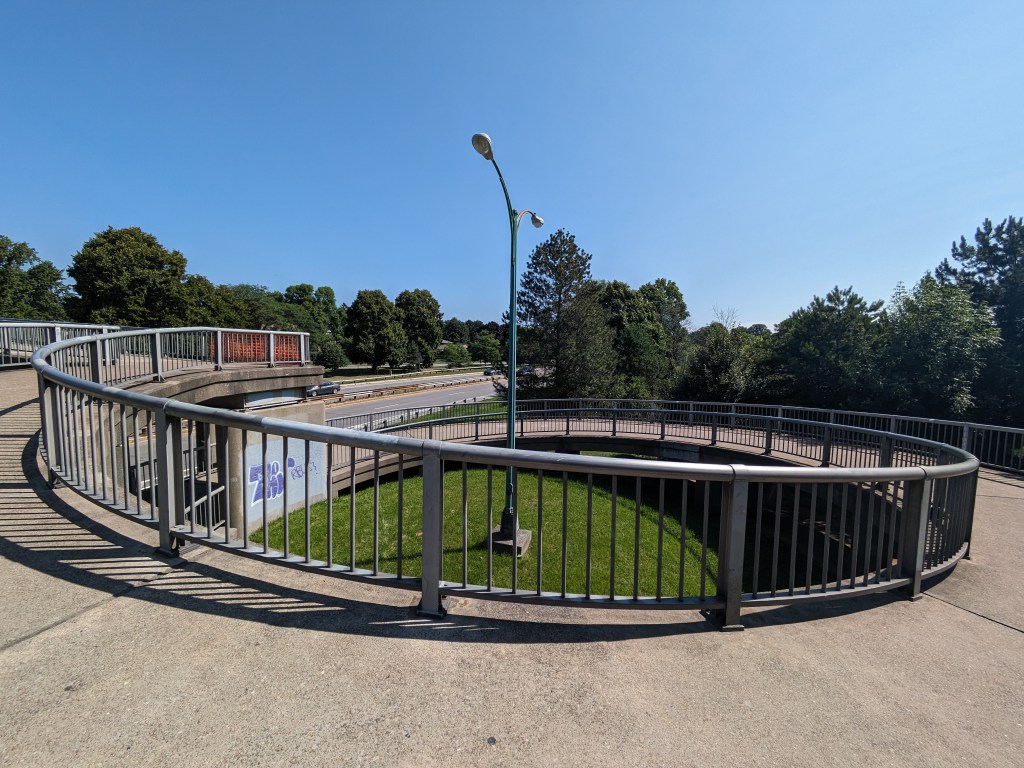
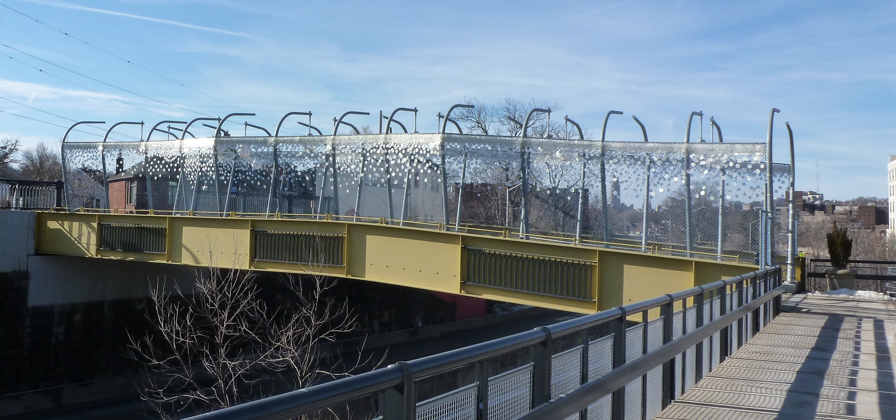
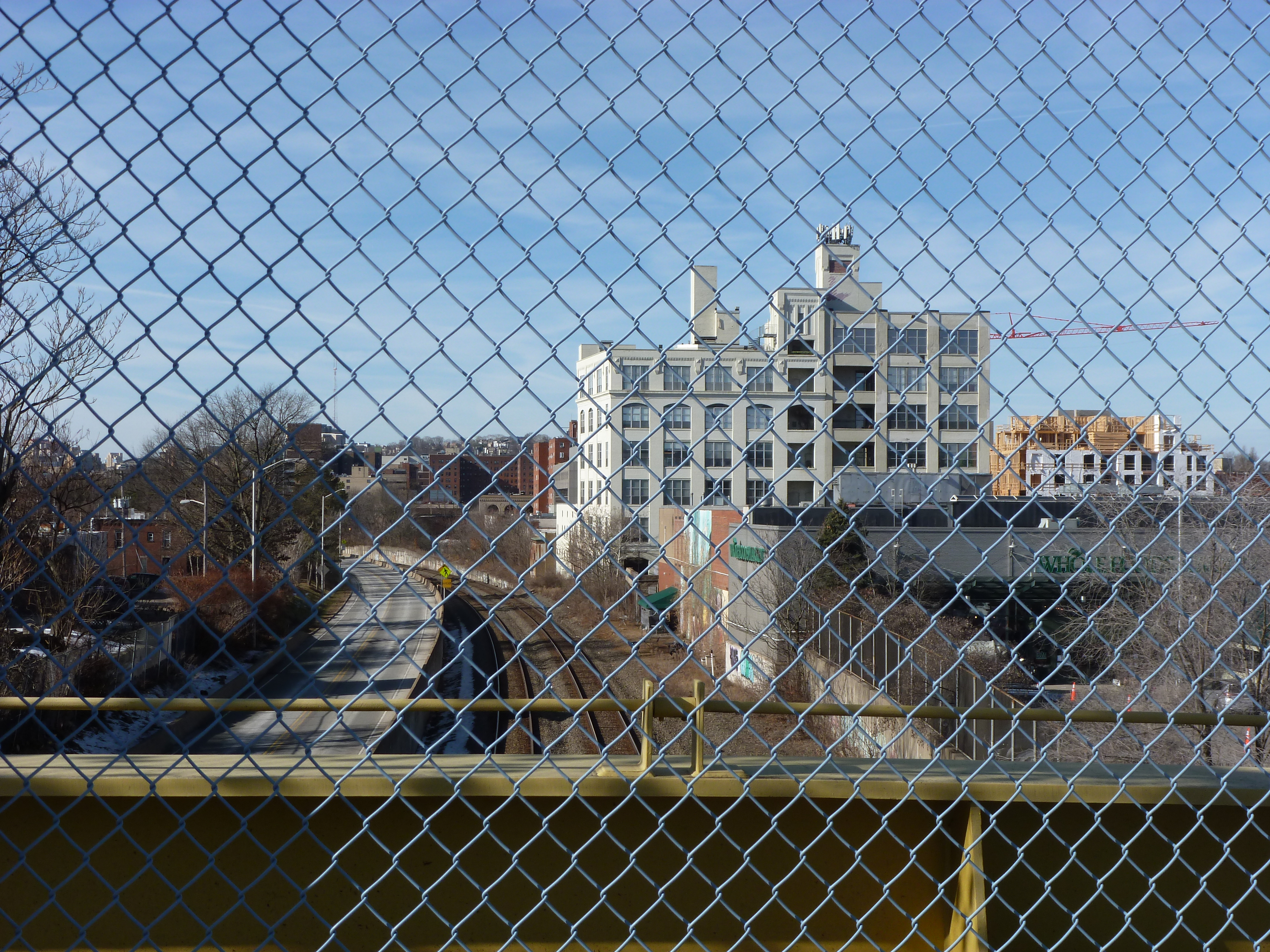
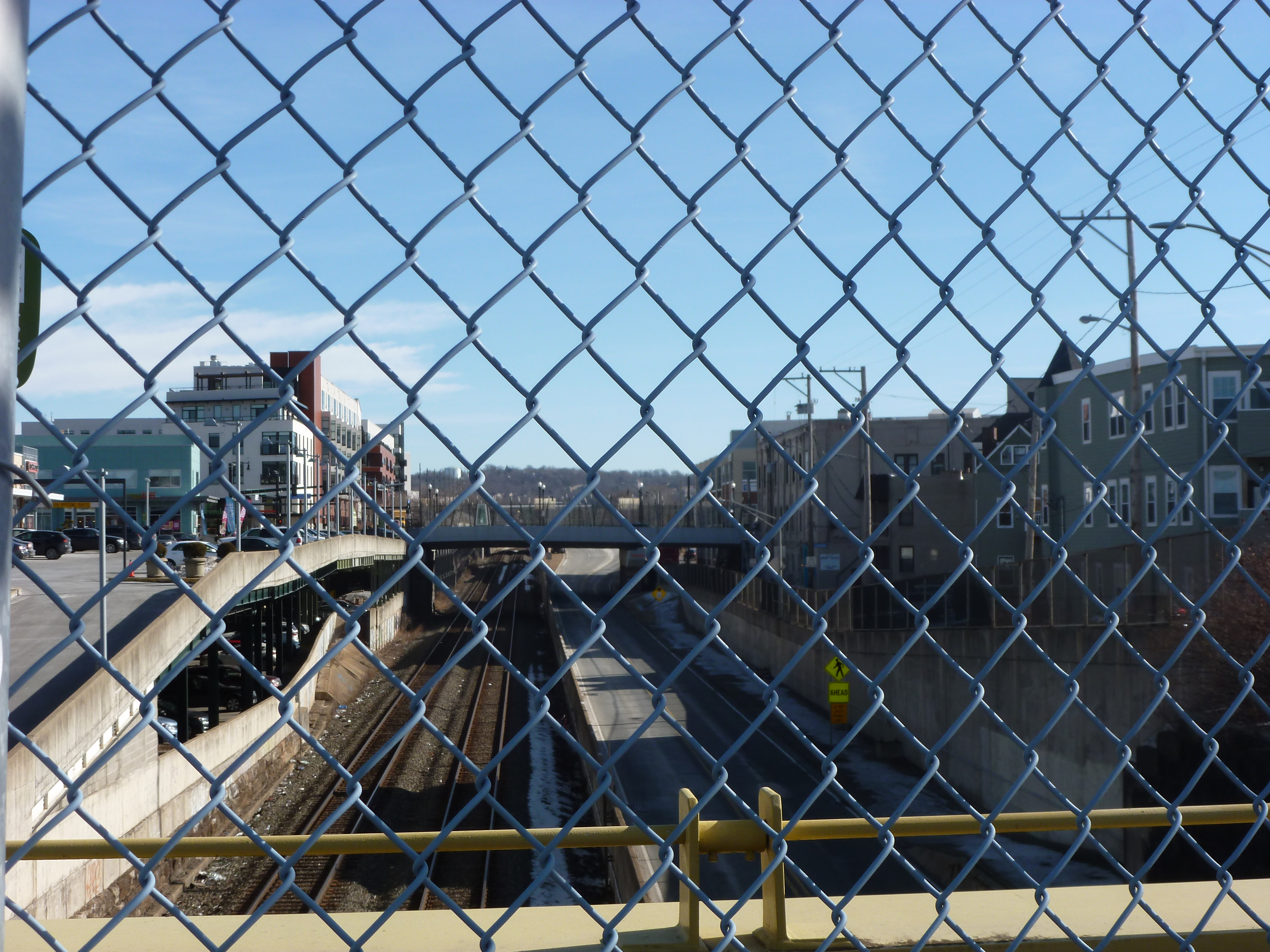
One of the bridges presumably supported by the Obama infrastructure funding was the brand-new pedestrian bridge across the East Busway connecting the Shadyside and East Liberty neighborhoods. This bridge is 10-years old this month. The “road” surface of the bridge hasn’t held up very well: the paint was faded and the top surface was patchy when I returned this month. On the other hand, the over-the-top lamps and giant glitter looked like they have held up well. Though it’s hard to say in wintertime, the landscaping between the cage and the bridge walls also appeared to be well maintained.
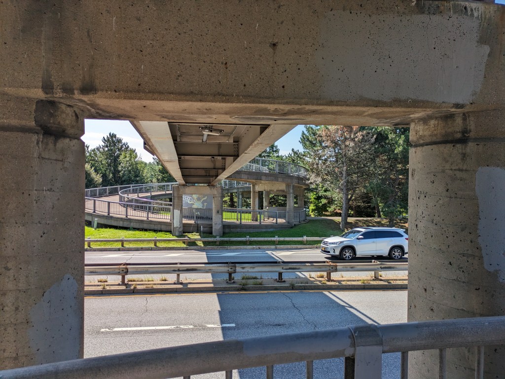
From the bridge, some of the new developments in East Liberty are visible. Looking southwest toward the current location of Whole Foods (soon to relocate), one of the several new apartment buildings along the Baum-Centre corridor is visibly under construction in the far right of the second set of photos. In the third set, the northeast view shows the new South Highland Avenue Bridge and (to the left of the bridge) the final phase of the East Side Bond development that brought several buildings of first floor commercial with residences above.
I was surprised to find that the highly controversial and massive redevelopment of the former Penn Plaza affordable housing complex was not visible from this bridge. Despite being only a quarter mile apart, the first phase of redevelopment is blocked from the bridge’s view by the iconic Motor Square Gardens building. One of the controversies of this new development is that affordable housing units were demolished without replacement for a series of commercial buildings which include the feature anchor of the pricey Whole Foods grocery store.
The pedestrian bridge was controversial when it was proposed and built. It connects the wealthy Shadyside neighborhood to the expensive Whole Foods, a high-end liquor store, and other luxury shops. It is also redundant as the South Highland Avenue bridge is only 0.1 miles away. A quarter mile away, is the neighborhood of Larimar whose residents are primarily living on low-incomes and do not have a walkable route to the lower cost Giant Eagle grocery store or Trader Joes that are just on the other side of the busway from their homes. For years, the residents have been asking for a pedestrian bridge over the busway to give them better access to these stores. Instead of a bridge serving those who need it, an ornamental bridge was built to provide access for those who already have abundant options.
Around the same time that this bridge was built, the Port Authority altered its bus service by eliminating the 94B bus that connected the low-income residents of Larimar with a shopping center featuring Walmart, Giant Eagle, TJ Maxx and similar clothing retailers, and other stores. In addition to providing shopping opportunities for necessities, these locations provided jobs. The 94B bus was never less than half-full (an unusual condition for Pittsburgh buses outside of rush hour). This bus was replaced by the 75 bus, which connected the higher-end shopping centers of South Side Works and Bakery Square through the wealthy residential neighborhood of Shadyside. For years, it was common to be the only person or one of a handful of people riding the 75. Eventually, the Port Authority acknowledged the value of the 94B route and tact it on to the end of the 75 route.
Presumably both the pedestrian bridge and bus route changes of 2012 were supported at least in part by the federal infrastructure funds of the time. With the current round of federal funding, it would be nice to see a greater focus of infrastructure investment for those who need it and not on additional luxury options.


What is a Bridge? Bethlehem Edition I
I was in the midst of trying to understand what is a viaduct when I traveled to Bethlehem, PA, with my family. One of our activities was to explore the bridges (see also Cage-free Bridges). As we walked the Hill-to-Hill Bridge, my initial reaction was “now here is a viaduct.” I hadn’t reached the point of developing a semi-clear definition for viaduct but looking at the flat roadbed supported by multiple arches over the floodplain, viaduct seemed the most appropriate word for the structure.
As we kept walking, it turned out that the viaduct was only a portion of the Hill-to-Hill Bridge. In fact, it would be more appropriately called the Hill-to-Hill-to-Hill-to-Hill Bridge. There are two approaches to the main span on the south end and three on the north end, including the viaduct and one approach permanently closed to through traffic. When the bridge was built in 1924, there were a total of seven approaches at various points along the main span. With so many components, this structure brings me back to the question of how many is one bridge?
Unlike when I asked this question of the 30th and 31st Street bridges in Pittsburgh, here the main bridge, the intersecting viaduct, and the numerous connections seem to be considered one bridge. They are together called the Hill-to-Hill Bridge while the structure in Pittsburgh has three distinct names (including River Avenue Ramp). Perhaps the deciding factor in whether it is one or more bridges is the original intent. The Hill-to-Hill Bridge was designed as a multifaceted structure whereas the 30th and 31st Street bridges were developed independently.
The best indication of the original intent seems to be the name. The Hill-to-Hill Bridge has a single name whereas the 30th and 31st Street bridges have separate names. The other examples I looked at in 2012 were the Veterans Bridge (Pittsburgh), the Fort Duquesne Bridge (Pittsburgh), and what I called the Jubilee Bridge (London).
The Veterans Bridge joins three approaches into one bridge, all under a single name. Therefore, it is one bridge, not three.
The pedestrian walkway of the Fort Duquesne Bridge was built decades after the vehicular portion but does not have a separate name. Therefore, it is one bridge, not two.
What I called the Jubilee Bridge (despite the photo I took at the time of the dedication plaque stating otherwise) is actually called the Golden Jubilee Bridges. While these bridges share the support structure of the underground’s Hungerford Bridge due to concerns about unexploded WWII bombs in the area, they have separate names. Therefore, it is three bridges, not one nor two.
Additional Posts in Series:


Cage-Free Bridges
The summer I spent walking Pittsburgh bridges, I complained about the cages on the Millvale Avenue Bridge, the Highland Park Bridge, and the Graham Street pedestrian bridge. The narrow sidewalk and chain link fences on the first two examples and the chain link cage on the third example made me feel yucky and claustrophobic. Thanks to one of my blog followers, I recently learned that people tend to throw things onto moving objects, which is why bridges like the Millvale bridge have higher fencing along portions over roads and railroads. I still wished there was a cage-free option to meet the same goals of the bridge builders.
In Bethlehem, PA, I found just such an option on the Fahy Bridge. It is a fairly plain concrete bridge saved from the ugliness and gloom of many concrete bridges by using a functional, yet decorative, railing instead of the more common functional, yet ugly, chain link fence. This railing was installed during the 2016-18 renovation of the Fahy Bridge. Recent bridge renovations and replacements in Pittsburgh also feature more decorative railings. While the first of these new bridges in Pittsburgh tried to dress-up a chain link fence cage, the later ones are successful cage-free bridges even when they incorporate chain link fencing.* These examples give me hope that the days of caged bridges may be a thing of the past.
*Note: I have a to-do item to go back and photograph these new bridges for future posts, but no set timeline for the completion of this task.
Pedestrian Bridges: Willimantic Footbridge

Pedestrian Bridges: Garden on the Bridge
Layers of the City: Chicago Edition
The first place to show me how a city can be stacked like a layer cake, Chicago provided ample opportunities to explore all levels of the city. The experience of noticing the expansion joints in roads that I assumed were on solid ground opened my eyes to the possibilities of stacking uses.
Underground Life
A vacant lot two stories below street level solved the mystery of the expansion joints, by exposing the inner guts. Two more roads sit below street level to segregate trash pick-up and deliveries from the flow of traffic. These lover levels also provide some opportunities for parking without monopolizing valuable real estate above. Retail shops connected by pedestrian passageways are also interspersed in these layers.
River Life
At the same elevation as the “underground life,” the Chicago River flows through the heart of the city. On and along the river are a variety of activities. Pedestrian paths, cafes, housing, parks, industrial uses, and homeless encampments line the shores. Meanwhile, the river abounds with ducks, boat tours, water taxis, construction staging, and marinas.
Street Level
Back up on the street level, life buzzes. Vehicular and pedestrian traffic rush passed, occasionally pealing off to visit the numerous shops, offices, museums, restaurants, cafes, parks, and trails.
Pie in the Sky
Yet, more life looms above. Several of the skyscrapers have penthouse, or nearly penthouse, restaurants. Others have rooftop observation platforms. Between these and the street are many other opportunities for enjoying life including a religious sanctuary, the “L”, gardens, art, pedestrian bridges, and of course, offices, apartments, hotel rooms, and shops.
Unlike Pittsburgh, in Chicago, the public is welcome in some form on every level to gain a full experience of the city.
Layers of the City: Pittsburgh Edition
I clench my teeth every time the “T”, Pittsburgh’s light rail system, slowly makes the first 90 degree bend leaving Gateway Station, squeaking like fingernails on a chalkboard. After traveling a few hundred yards, it turns back 90 degrees–squeak, scratch, squeak–before pulling into the Wood Street Station. As everyone knows that the shortest distance between two points is a straight line, I struggled to understand why the T was built with turns so sharp it is impossible for the trains not to screech, until my friend pointed out that there might be building foundations or basements that the underground tracks need to maneuver around.
Like many metropolises, the density of downtown Pittsburgh creates various physical layers of activity. Yet compared to other some other cities (see Layers of the City: Chicago Edition), Pittsburgh’s layers can be hard to notice. The T is perhaps the most obvious example. For most of it’s length through the southern neighborhoods and suburbs, the T travels at grade. Once it crosses the Monongahela River into Downtown, it becomes an elevated train for a few blocks before submerging underground until it passes under the Allegheny River to the North Shore, where it reemerges to end as an elevated train.
Underground Life
If you get off the T at Gateway Station and walk down a block to the start of 5th Ave, which actually feels like an alley, you might notice that the Highmark Building is built over an underground garage. I assume that this garage has multiple levels below grade and is at least part of the reason for the T’s sharp turns.
The new PNC Tower also has a garage below grade. Yet the most recent new construction project downtown, on the former site of Sax Fifth Avenue, places the garage between the first floor retail and proposed upper level residences.
The building I work in, the former Jones & Laughlin Steel Mill Headquarters, has at least 3 1/2 levels of basement. The building is long past its days of glory with peeling paint, cracked foundation, and elevators that you may never make it out of again. The mezzanine level of the basement is a maze of building supplies, file cabinets, discarded furniture and boxes upon boxes of documents. It is damp and dusty. Five minutes down there could lead to a severe allergy attack. Yet the stairs keep going down and down, plunging further into the dark depths. I’ve heard rumors of more documents being stored in the lower levels.
Street Level
Coming back above ground, most activity in downtown Pittsburgh takes place at street level. Pedestrians, bicyclists, buses, cars, delivery trucks, dumpsters, and more compete for space on the narrow streets and sidewalks. Most shopping and restaurants are located at street level. The Highmark Building and the Oxford Building still have some retail above the first floor.
Pie in the Sky
As you walk around downtown, if you look up, you might catch a rare sight of pedestrian sky bridges. The most famous of which is the Bridge of Sighs connecting the Allegheny County Courthouse with the former Jail. The second most famous (speaking with pure bias) is the bridge connecting the parking garage with what used to be the shoe section of the former Kaufmann’s Department Store (always a necessary stop when shopping for back to school). A handful of others are sprinkled throughout downtown. Indianapolis has got us beat though. That city has a network of pedestrian connections that enables you to walk for miles between the stadiums, office buildings, and other structures downtown without ever getting a taste of fresh air.
Higher up, there is a sprinkling of rooftop or penthouse restaurants. This is one of our complaints at work: while many new, good restaurants have opened downtown in recent years, there is still a dearth of restaurants and bars with views. Sienna Mercado’s Il Tetto, Harris Grill, and the Biergarten at Hotel Monaco all have rooftop decks, but they are surrounded by taller buildings limiting views. Ollie’s Gastropub on the top floor of the Oliver Building has some good views, but no fresh air.
There isn’t much connection or relationship between the different parts of these layers in Pittsburgh. It is like they are experiments, like the city is only dabbling. As if to say, it can’t make up its mind whether or not to let the public leave street level and participate in or explore all levels of the city.
Big Dam Bridge
 The name says it all. This bridge was built as the longest pedestrian- and bicycle-built bridge in the country spanning 4,226 feet across the Arkansas River, connecting Little Rock and North Little Rock. It is part of the Arkansas River Trail.
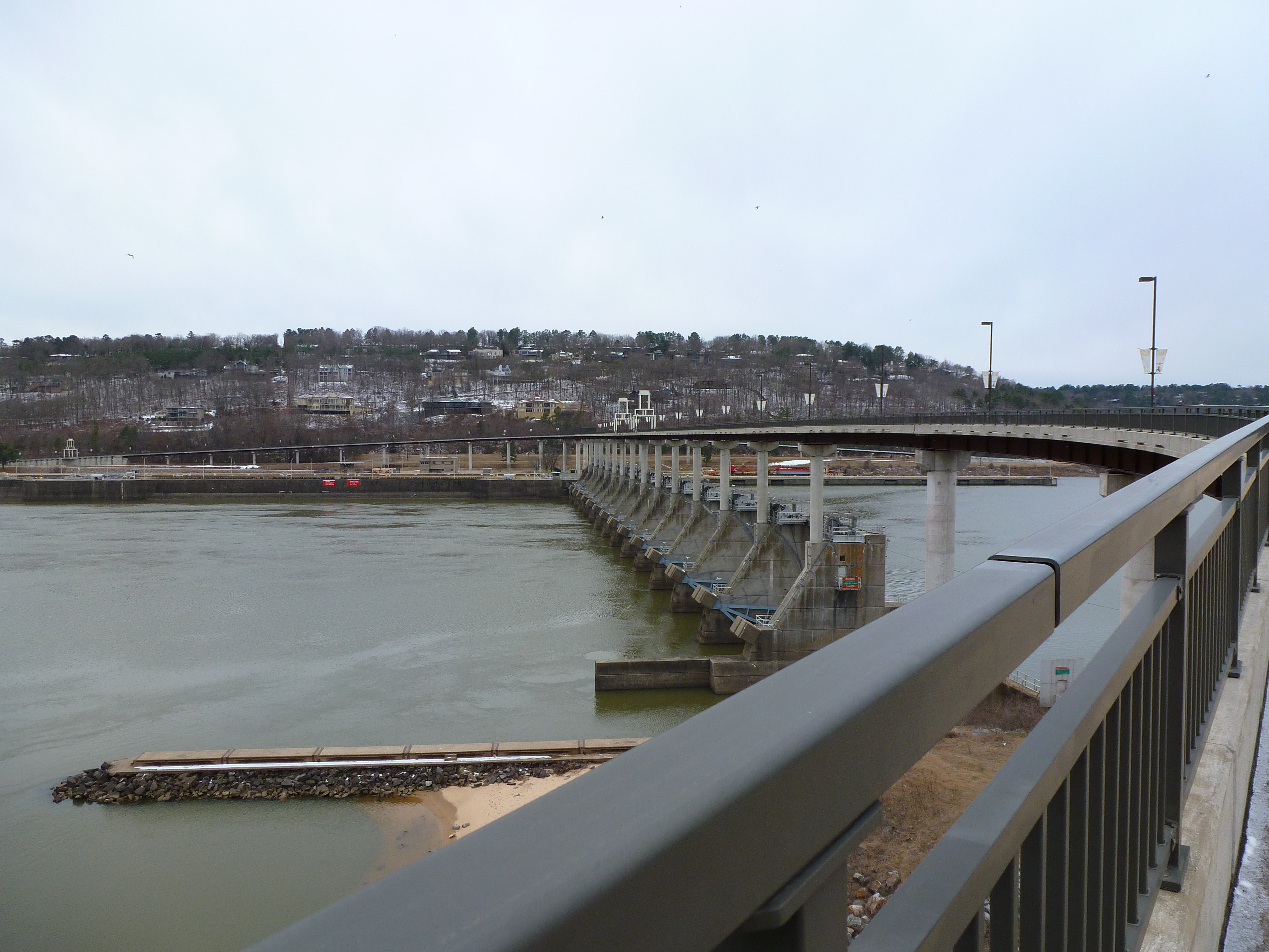
On a trip to Arkansas this winter, I discovered this bridge and naturally had to add it to my list of bridges I’ve walked across. The intention of my trip to Arkansas was to visit friends but also to get a break from the cold northern winter by heading south. When I bought my tickets in January, the Little Rock region was having 60 degree weather. A month later when I arrived, the high was 26.
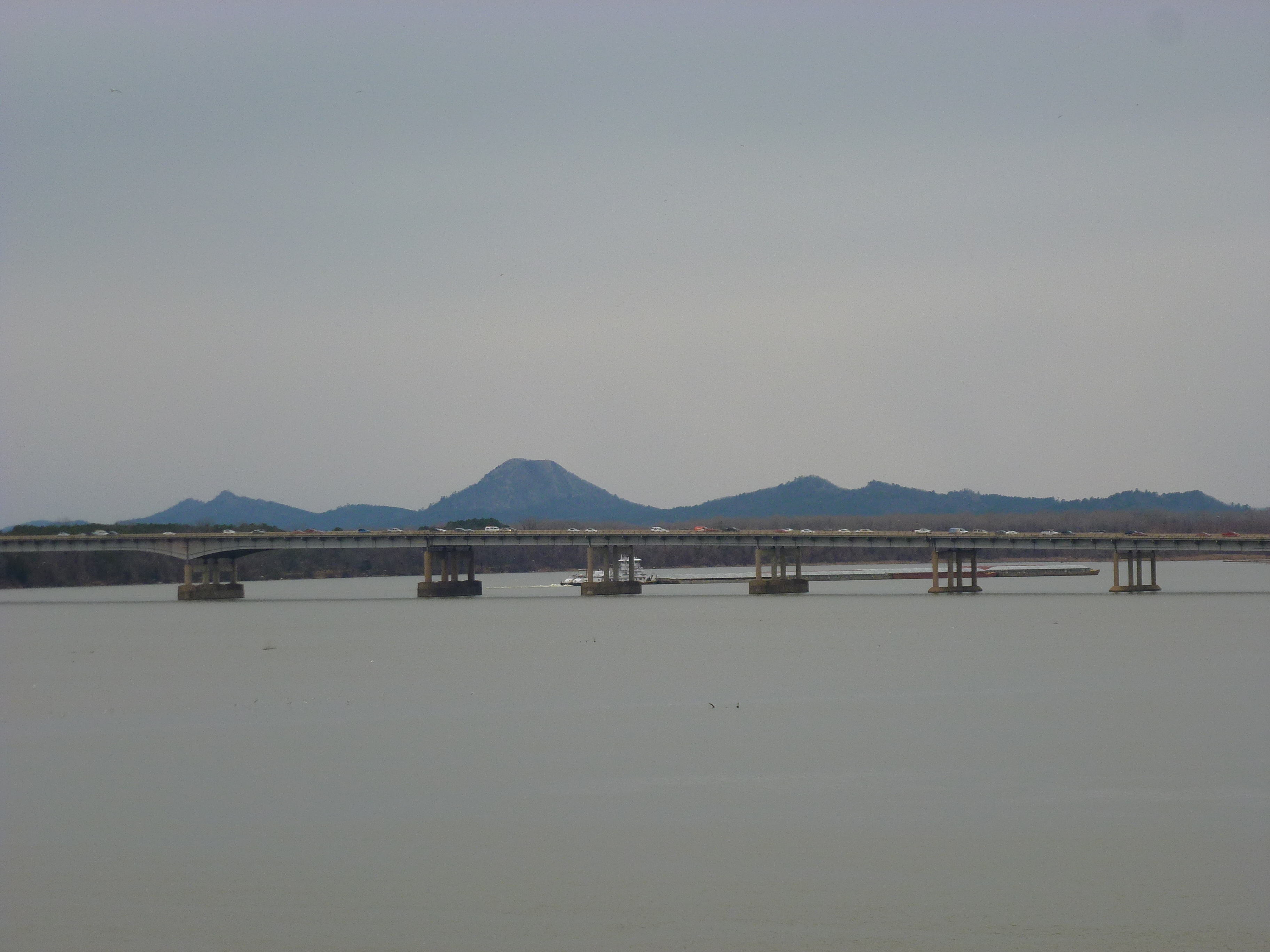
View of Pinnacle Mountain from the Big Dam Bridge

View toward downtown Little Rock showing Rebsaman Park
By the time we reached the half-way point of the bridge, we were frozen stiff. The farther we got on the bridge the stronger the wind got, probably creating a wind chill factor closer to 20 degrees or less. After admiring the views from the midpoint for a minute, the cold and wind forced us to turn back toward the car.
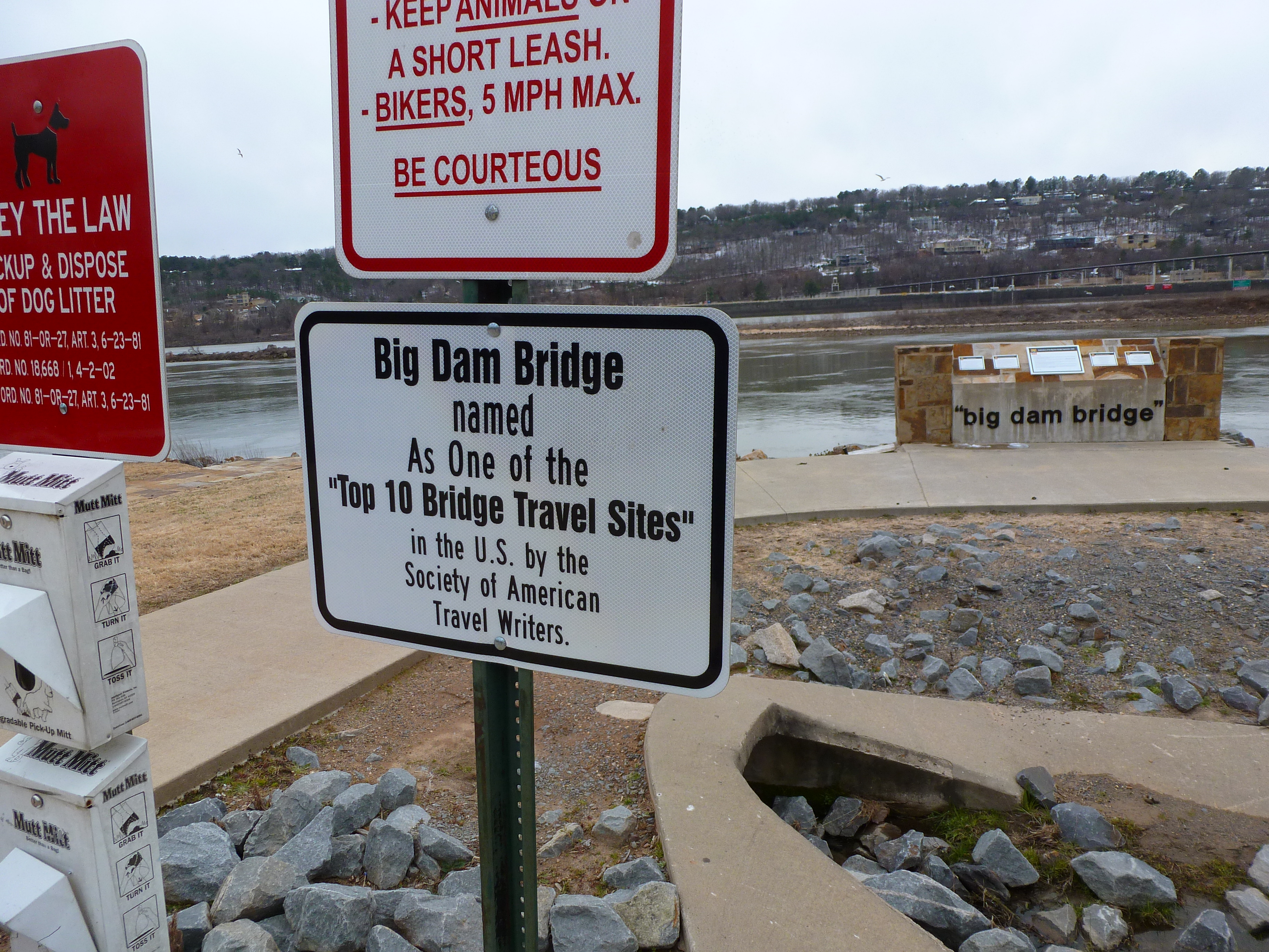 While I didn’t make it all the way across, I can still say I’ve been on one of the Top 10 Bridge Travel Sites in the US. Now I just have to find the other 9 sites.
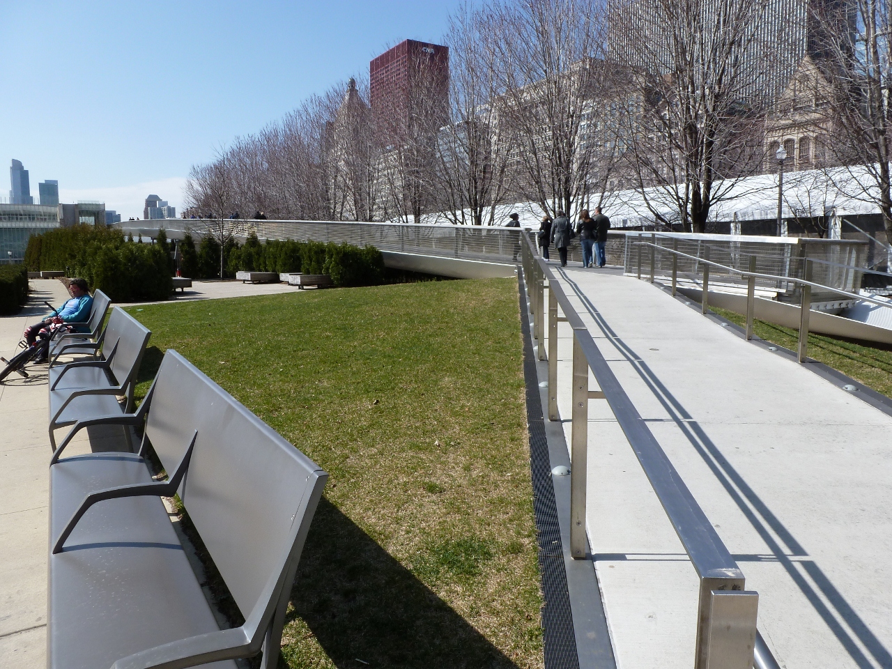
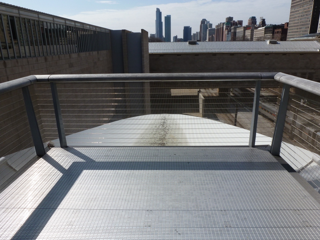
Pedestrian Bridges: Chicago
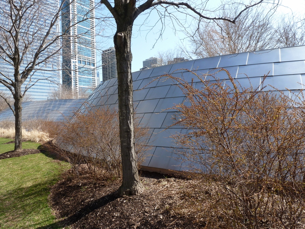
There are two pedestrian bridges connecting to Millennium Park in Chicago. The first I encountered was the BP Bridge. I admired the undulating silver sculpture above as I walked past and was thrilled to discover it was a pedestrian bridge. My excited was quickly crushed as the bridge was closed to traffic due to construction at the other end. I realized that I have become quite addicted to bridge-walking. I was on my way to see The Bean before renting a bike to ride along the lake, when seeing this bridge completely sidetracked me. I had a desperate urge to walk a bridge. Fortunately, there was another pedestrian bridge nearby and while it was not nearly as enticing, it had some interesting parts.
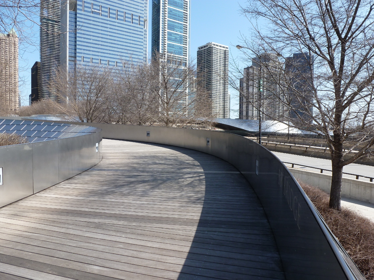
The Nichols Bridgeway connects Millennium Park with the Art Institute of Chicago. Both ends had space-age-like toughs, which I assumed were supposed to be a fancy drainage system. If their purpose is a drainage system, the upper end by the Institute has failed and been turned into a wishing well.

The part I liked best about this bridge was that while it looked like the surface was level, there were ridges or “speed-bumps” every few feet. I wondered if these were merely artistic or if they had a functional value like reducing the slipperiness of the bridge during icy conditions.


