


Inspired by my post from this summer, I decided to start a photographic series of Pittsburgh’s Uptown neighborhood. This neighborhood is a hodgepodge of abandoned and renovated townhomes, parking lots, car-oriented businesses, corner stores, industrial uses, and new construction residential buildings. It is predicted to be on a tipping point from being mostly ignored to experiencing intense growth fueled by activities in and around the neighborhood. These activities include:
As these projects move forward, there will likely be more investment and changes to Uptown. This photographic series is intended to capture these changes by revisiting the same sites at regular intervals over the next several years.
In the coming months, I intend to release two related series to record the progress of the CAP and the Lower Hill redevelopment.
The strongest impression from my last trip to Cardiff was the feeling that it is morally wrong to invest heavily in touristy neighborhoods while skipping the neighborhoods of the residents. Tourists may provide a bigger return per touch point, but residents have many more touch points (including voting). Perhaps I have become jaded since that trip, but I now accept that economics and morals rarely work together.
Pittsburgh’s Uptown neighborhood is trying a different approach to see if economic investment can be leveraged for the greater good. Uptown experienced disinvestment and decay for decades, despite being located between and within walking distance of Oakland and downtown, two of the largest economic engines in the state. Not to mention the main roads connecting these prosperous and growing areas run directly through Uptown. Zipping down Fifth Avenue from Oakland to downtown, it is easy to overlook or ignore the ruined home foundations turning back to forest, the wide-spread vacant lots and parking lots, and the intricate architectural details on the remaining old structures.
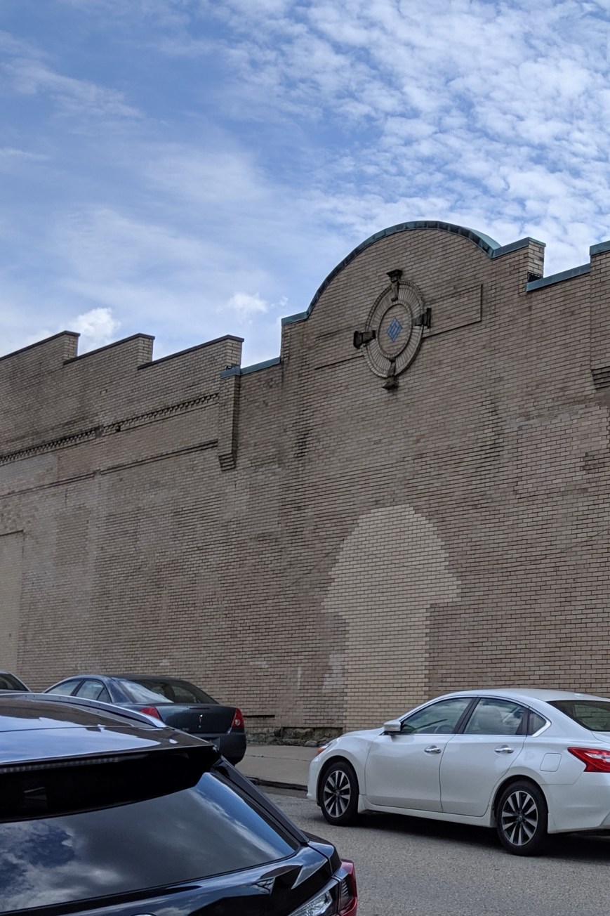
The bland brick and glass facade on Fifth Avenue identifies this building as another mid-century warehouse. Turning the corner, the decorative parapet wall and bricked over arched opening tell the story of an older, more interesting building.
One such structure was one of the many movie theaters dotting the city in the 1920s. In the 1950s, the adjacent buildings were demolished, and an addition was added to the theater to turn it into a storeroom. After a time as a plasma center in the 1980s and 1990s, the building sat vacant and dusty for many years. Now, it is undergoing renovations for its next life. This is just one of the many signs that investment is coming to Uptown.
The community of Uptown that held on through the economically rough times prepared for this moment. In collaboration with many partners, including local institutions such as Duquesne University and UPMC Mercy as well as the City of Pittsburgh, the community created a new neighborhood plan. This designated Uptown and West Oakland as an EcoInnovation District. One of the first actions from this plan developed a new zoning district, the first progressive zoning district in Pittsburgh. The goal of the plan and the zoning district is to leverage the coming economic investment to create an inclusive and environmentally sustainable neighborhood.
It will be interesting to watch this neighborhood over the next few years to see if the plans are successful at introducing some moral components to the economic investment.
With summer full upon us, I have pulled out all my summer straw hats. One I picked up as an emergency hat. I’ve squished it into a suitcase, sat on it, and abused it in other fashions for years, but it’s still a great plain soft straw hat. Another one is a broad brim straw hat with a plain black band I acquired in Old Town Sacramento to complete my 1860s costume. It’s a great hat, but without the hat pin, it blows off at the slightest provocation. The cream of the crop is a fine two-toned, straw hat with green and grey cords, peach-colored flowers, and an extra wide brim. This one came from Tijuana, Mexico.
I was fifteen or sixteen when my parents took me across the border for a day trip in Tijuana. My memory of this trip is fuzzy, but punctuated with sharp images of intense emotion. I vaguely remember booths and lots of lanes of cars, even by California standards, for crossing south, but lots of lines of people for crossing north. While we drove down, we had to leave our car somewhere along the border. All the tourists were funneled on foot onto the main drag, which was glitzy enough to rival Las Vegas. Shop owners stood on the sidewalk outside their stores to entice the US currency from our pocket to theirs.
I squinted at the glare and cringed at the solicitous fawning. After we visited several shops, my Dad asked a proprietor where he could find a CD of a particular kind of music. The proprietor gave us directions to a shop several blocks away from the main road. As soon as we stepped into the first side street, all the glitz and glamour vanished. Instead, we found blocks of small, plain adobe or stucco houses. The contrast turned my stomach.
The honest plainness of these blocks soothed my eyes, while throwing into sharp relief the fashionable begging of the tourist trap we temporarily left. I was surprised we were given directions that went outside the trap. I wondered how many tourists crossed that invisible line.
Though most of these buildings looked the same, we were able to locate the music shop without incident. My Dad found what he wanted and we went back the way we came. Not long after we returned to the border to cross back to the US.
We had to stay in a waiting area either for our car or for our turn to go through the border crossing. While there, my Mom had me try on hats for sale at a small kiosk. I suspect this was in part to distract me from the physical reaction I was having to the contrasts we saw and in part to encourage me to get a souvenir from this excursion. Having a weakness for hats, I ended up with a beautifully-crafted straw hat that I still wear for special summer occasions.
The first place to show me how a city can be stacked like a layer cake, Chicago provided ample opportunities to explore all levels of the city. The experience of noticing the expansion joints in roads that I assumed were on solid ground opened my eyes to the possibilities of stacking uses.
A vacant lot two stories below street level solved the mystery of the expansion joints, by exposing the inner guts. Two more roads sit below street level to segregate trash pick-up and deliveries from the flow of traffic. These lover levels also provide some opportunities for parking without monopolizing valuable real estate above. Retail shops connected by pedestrian passageways are also interspersed in these layers.
At the same elevation as the “underground life,” the Chicago River flows through the heart of the city. On and along the river are a variety of activities. Pedestrian paths, cafes, housing, parks, industrial uses, and homeless encampments line the shores. Meanwhile, the river abounds with ducks, boat tours, water taxis, construction staging, and marinas.
Back up on the street level, life buzzes. Vehicular and pedestrian traffic rush passed, occasionally pealing off to visit the numerous shops, offices, museums, restaurants, cafes, parks, and trails.
Yet, more life looms above. Several of the skyscrapers have penthouse, or nearly penthouse, restaurants. Others have rooftop observation platforms. Between these and the street are many other opportunities for enjoying life including a religious sanctuary, the “L”, gardens, art, pedestrian bridges, and of course, offices, apartments, hotel rooms, and shops.
Unlike Pittsburgh, in Chicago, the public is welcome in some form on every level to gain a full experience of the city.
I clench my teeth every time the “T”, Pittsburgh’s light rail system, slowly makes the first 90 degree bend leaving Gateway Station, squeaking like fingernails on a chalkboard. After traveling a few hundred yards, it turns back 90 degrees–squeak, scratch, squeak–before pulling into the Wood Street Station. As everyone knows that the shortest distance between two points is a straight line, I struggled to understand why the T was built with turns so sharp it is impossible for the trains not to screech, until my friend pointed out that there might be building foundations or basements that the underground tracks need to maneuver around.
Like many metropolises, the density of downtown Pittsburgh creates various physical layers of activity. Yet compared to other some other cities (see Layers of the City: Chicago Edition), Pittsburgh’s layers can be hard to notice. The T is perhaps the most obvious example. For most of it’s length through the southern neighborhoods and suburbs, the T travels at grade. Once it crosses the Monongahela River into Downtown, it becomes an elevated train for a few blocks before submerging underground until it passes under the Allegheny River to the North Shore, where it reemerges to end as an elevated train.
If you get off the T at Gateway Station and walk down a block to the start of 5th Ave, which actually feels like an alley, you might notice that the Highmark Building is built over an underground garage. I assume that this garage has multiple levels below grade and is at least part of the reason for the T’s sharp turns.
The new PNC Tower also has a garage below grade. Yet the most recent new construction project downtown, on the former site of Sax Fifth Avenue, places the garage between the first floor retail and proposed upper level residences.
The building I work in, the former Jones & Laughlin Steel Mill Headquarters, has at least 3 1/2 levels of basement. The building is long past its days of glory with peeling paint, cracked foundation, and elevators that you may never make it out of again. The mezzanine level of the basement is a maze of building supplies, file cabinets, discarded furniture and boxes upon boxes of documents. It is damp and dusty. Five minutes down there could lead to a severe allergy attack. Yet the stairs keep going down and down, plunging further into the dark depths. I’ve heard rumors of more documents being stored in the lower levels.
Coming back above ground, most activity in downtown Pittsburgh takes place at street level. Pedestrians, bicyclists, buses, cars, delivery trucks, dumpsters, and more compete for space on the narrow streets and sidewalks. Most shopping and restaurants are located at street level. The Highmark Building and the Oxford Building still have some retail above the first floor.
As you walk around downtown, if you look up, you might catch a rare sight of pedestrian sky bridges. The most famous of which is the Bridge of Sighs connecting the Allegheny County Courthouse with the former Jail. The second most famous (speaking with pure bias) is the bridge connecting the parking garage with what used to be the shoe section of the former Kaufmann’s Department Store (always a necessary stop when shopping for back to school). A handful of others are sprinkled throughout downtown. Indianapolis has got us beat though. That city has a network of pedestrian connections that enables you to walk for miles between the stadiums, office buildings, and other structures downtown without ever getting a taste of fresh air.
Higher up, there is a sprinkling of rooftop or penthouse restaurants. This is one of our complaints at work: while many new, good restaurants have opened downtown in recent years, there is still a dearth of restaurants and bars with views. Sienna Mercado’s Il Tetto, Harris Grill, and the Biergarten at Hotel Monaco all have rooftop decks, but they are surrounded by taller buildings limiting views. Ollie’s Gastropub on the top floor of the Oliver Building has some good views, but no fresh air.
There isn’t much connection or relationship between the different parts of these layers in Pittsburgh. It is like they are experiments, like the city is only dabbling. As if to say, it can’t make up its mind whether or not to let the public leave street level and participate in or explore all levels of the city.
Dismantling in progress (6/24/2018)
After continued observations, I need to modify some of my assumptions in the post Utility Siloes. It turns out that the existence of the other utility wires attached to the poles does not prevent the old poles from being removed. Instead, weeks after a new utility pole is installed, the remainder of the deteriorated pole is removed except for the chunk where the other wires are attached.

Close-up of the dismantling (6/24/2018)
Perhaps the crew that removes poles is different than the crew that installs them. Although, the installation team is able to lob off the top of the old pole after they transfer the wires to the new one. Why then can’t they dismantle the rest of the pole at the same time? And in the case of constricted locations, such as the feature of these posts, why can’t they located the new pole in the same location as the old one?
Dismantling Complete (6/30/2018)

View of another dismantled pole, the remaining chunk is secured to the new pole by a rope.

The obstruction from utility silos
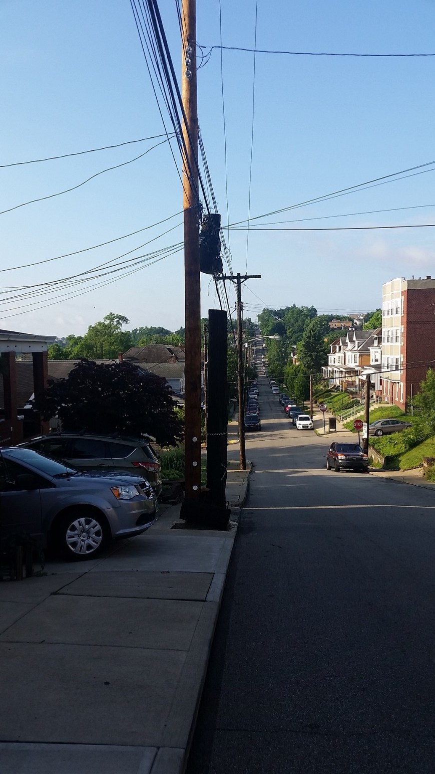
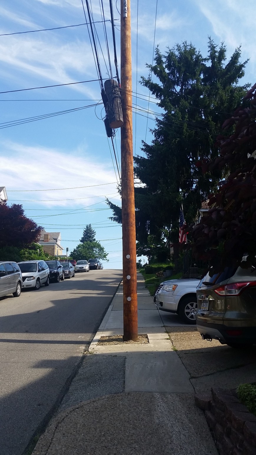
This spring, the electric company went around my neighborhood installing replacement utility poles where the existing ones were on their last leg. Watching them do this for a pole just down the street from me, I drew some conclusions about the interaction between the various companies that supply the different technologies available at our fingertips. The electrical company owns the poles and the electric wire, but other companies own the other fiber optics and cables that use the poles. The electric company installs new poles when the existing ones are deteriorated. Once installed, they transfer the electric lines to the new pole. The old pole is left with all the other lines in place, until the companies that own the rest of the lines transfer them to the new pole.
This arrangement seemed relatively harmless as I watched it in action near my house, but then I found the example above. In this case, the rigidity of the silos and jurisdictions of the various companies created a physical barrier in the neighborhood that will likely be in place for the next 35 years or so, until the pole is ready to be replaced. This is in direct contradiction to the City’s initiatives for greater accessibility illustrated by the sidewalk curb ramps installed within the last year at the intersections on either side of this pole.

Close-up showing the curb, the old pole, the new pole, the foot of sidewalk left, and the combined driveways
The choices were limited for siting this new utility pole. There are driveway curb cuts immediately adjacent on either side. Therefore, to place the new pole in line with the existing poles would have partially blocked someone’s driveway. Apparently, the silos are so entrenched that even under unusual circumstances such as these the various companies cannot work together so that a new pole can be placed in the exact same spot as the old pole. The sidewalk that was already narrow and could not accommodate the recommended 5-foot clearance around obstructions is now nearly impassible and requires pedestrians to cross partially on the driveways.
I do not know if anyone paused before installing this new utility pole to ask if there was a different or better way to approach the situation. From my experiences at my office in trying to work with others to design an approach that looks at the organization as a whole while still respecting and acknowledging each area of expertise and specialization, it is difficult to get all parties at the table to apply creative thinking and openness to how we can approach our work. No doubt, even if someone was able to get all relevant parties involved in this utility pole to the table, they would have encountered similar challenges.

Evidence that the old poles eventually get removed and an example of where a new pole was placed next to the old along side the curb

As I was walking down Penn Avenue this week, I stopped to take this picture before it was gone forever. Pittsburgh is joining the ranks of cities that use multispace meter systems. The city’s individual parking meters are slowly disappearing as they are replaced by the multispace system. Yet even before the transition began, Pittsburgh’s parking meters were suffering. A complete row of intact meters marching off into the distance, such as those pictured, has been a rare sight in the city for years. Usually there are at least a few with their heads chopped off or their stalks bent. On close inspection, this row did have graffiti on many of the heads and at least one meter was out of order. However, in the spring sunshine, these meters looked almost pristine with their gold heads gleaming.
