Unbeknownst to me at the time, on my aborted bike ride to the site of the White City in 2013, I rode right passed the site of Chicago’s other World’s Fair. The Century of Progress 1933 World’s Fair was located on what is now called Northerly Island. Adler Planetarium and Shedd Aquarium were the obligatory permanent museums opened in conjunction with or adjacent to the fair.
One of the interesting tidbits I’ve learned about this fair is that it used a rainbow of colors. Clearly, this was intended to be among the elements that would distinguish this fair from the previous one. However, it sounds to me more like Chicago was trying to imitate Buffalo’s Rainbow City, the 1901 World’s Fair.
My thanks to Zachary L. Brodt and his bookFrom the Steel City to the White City: Western Pennsylvania & the World’s Columbian Exposition for helping me to realize that I can say I’ve visited four former US hosted World’s Fair sites as of May 2024.
Having now been to two former World’s Fair sites, I felt compelled to round it out with a third. Weeks before COVID hit, I was in the planning phase for a trip to Buffalo when I discovered that they had held a World’s Fair in 1901. I had found my third site, though the visit was delayed several years from the fallout of COVID and life.
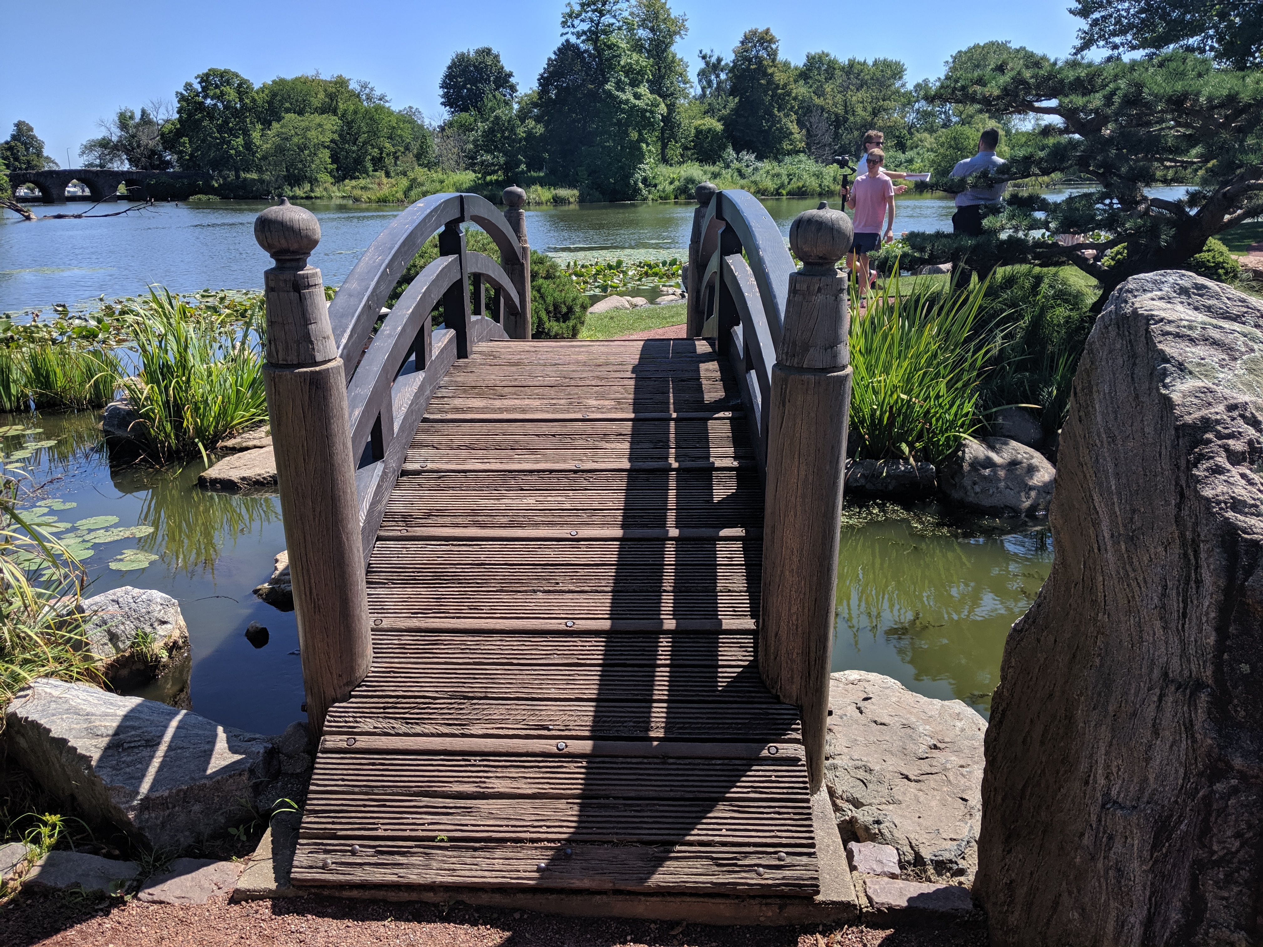
As I got off the bus at the end of a bridge over an expressway, I had moment of panic before seeing I was right next to the History Museum and a quiet residential neighborhood, just as I had intended. There were several parallels between this site and those I explored in San Francisco and Chicago, but the feel of the place was completely different. There was the characteristic lagoon, or in this case lake, surrounded by park, but the park and lake were designed by Frederick Law Olmsted long before the idea of the fair was born. Like Chicago, the remaining fair building(s) was used as a museum, and while the architecture is intended to inspire awe and perhaps intimidation, it is the normal awe and intimidation of the average temple to art or history seen in many cities and not the massive scale of San Francisco’s Palace. The park is also bisected by a road with dangerously fast traffic, but there are multiple safe pedestrian crossing points over and under (including the Whirly-Twirly Bridge). There was a Japanese Garden here as well, but it was installed decades after the fair and was illustrative of the fact that this site had a life before the fair and continues to have an on-going life after the fair.
The remainder of the fair site between the park and the railroad tracks where the fair had a station has been fully redeveloped. Over half of that area is now residential neighborhood(s) with a variety of housing types from modest single-family dwellings to large homes with security fencing and landscaping staff. (Passing these houses and taking photos, I again felt the potential for someone to approach and question my belonging and right to explore.) There were also two-family dwellings and apartments. I passed two schools, a former church, some industrial properties, a paddock, and a strip mall. One of the residential streets had a sign acknowledging the past as the site of the 1901 Pan American Exposition. Otherwise, I wouldn’t have know I was on the site of a former World’s Fair without having carefully studied the map of the fair beforehand. I felt as though I was in any other neighborhood of any other city that is flat and that has residents who have at least a little, though in many parts it was clear that the residents had a lot.
As I had unintentionally read about the World’s Fairs in San Francisco and Chicago before visiting those sites, I decided that I needed to intentionally read about Buffalo’s before going so that there would be some consistency in my approach. One of the points that Margaret Creighton reiterated in her book The Electrifying Fall of Rainbow City was that Buffalo was trying to outdo Chicago (they picked the Rainbow City theme and lighting scheme to be in direct contrast to Chicago’s White City). In the end, and certainly not helped by the fact that President McKinley was shot at the fair, Buffalo did not have the success they sought in receipts or in numbers of visitors.
Having now visited both Chicago and Buffalo’s fair sites, I would say that over 100 years later, Buffalo has had the greater long-term success on its fair site than Chicago. The entire area once covered by the fair is now, and has been for some time, an actively used location. From the park with a number of tourists and residents enjoying all the amenities (even in the middle of a Monday at the beginning of the school year) to the homes to the businesses, Buffalo’s fair site must by this point have long outstripped Chicago’s in number of visitors/residents/users and in tax revenue/receipts.
My fascination with World’s Fairs was started when I was a child by Laura Ingalls Wilder and the San Francisco Panama-Pacific Exposition. It has continued as an adult. Chicago’s 1893 World’s Columbian Exposition is the World’s Fair for planners. The “White City” was the first major example of the City Beautiful Movement, an attempt to reduce or eliminate the unhealthy, overcrowded cities of the time.
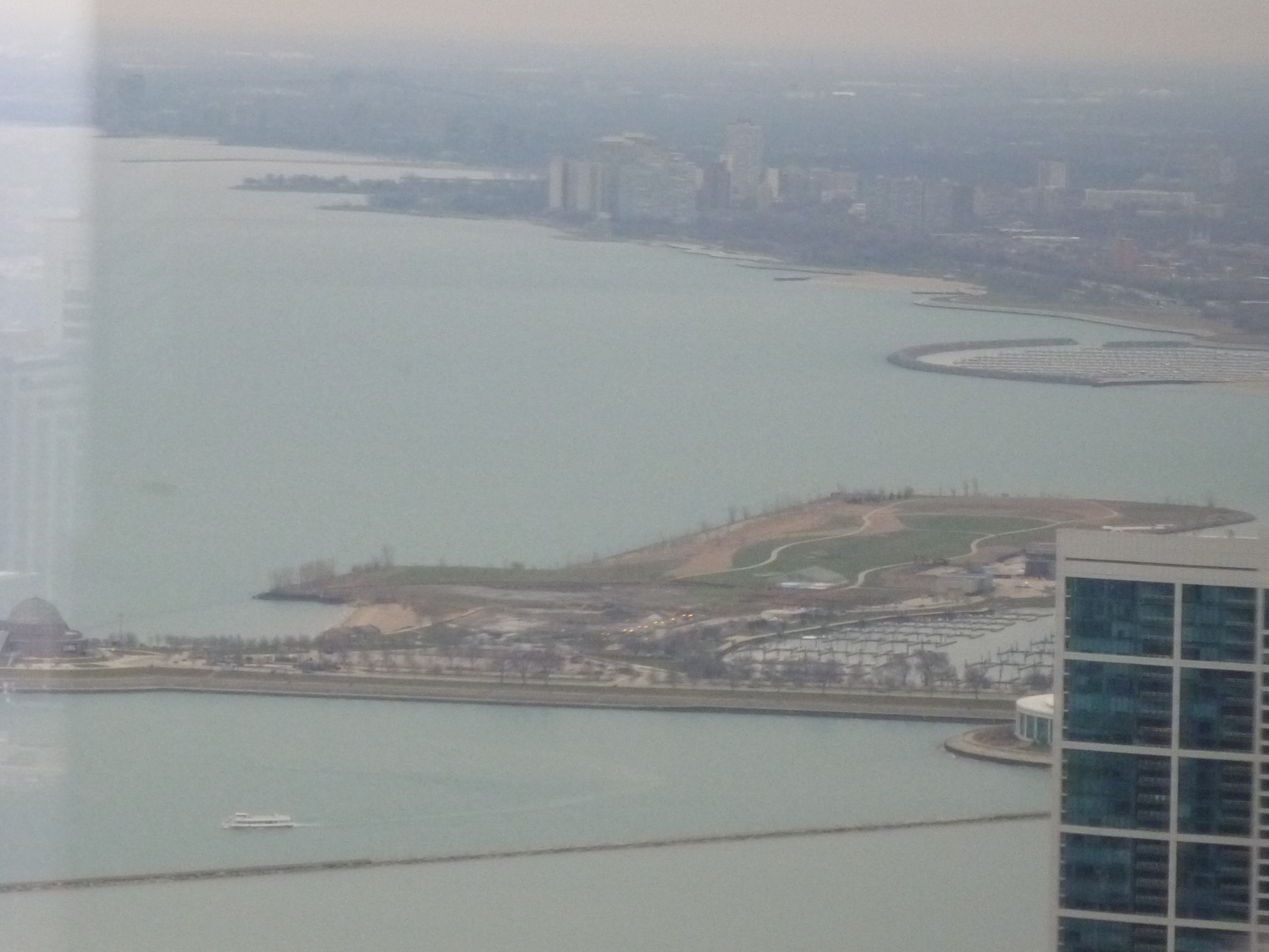
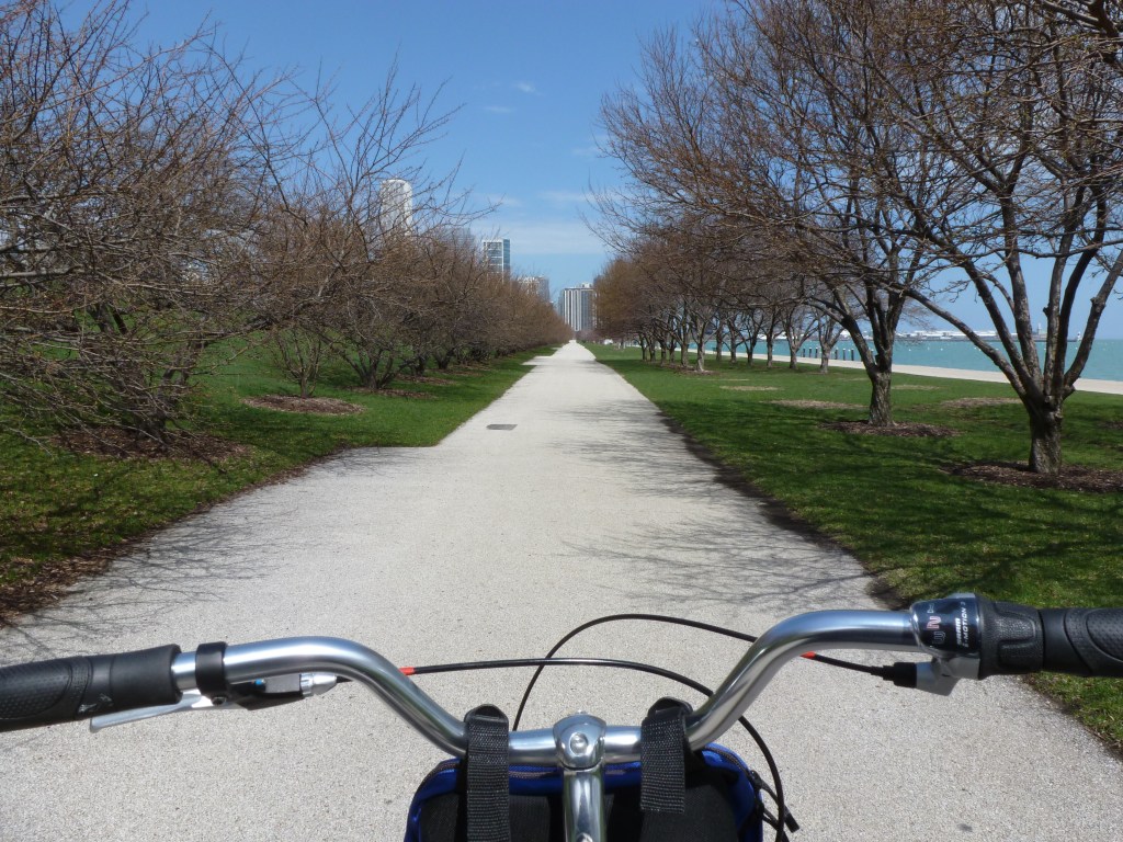
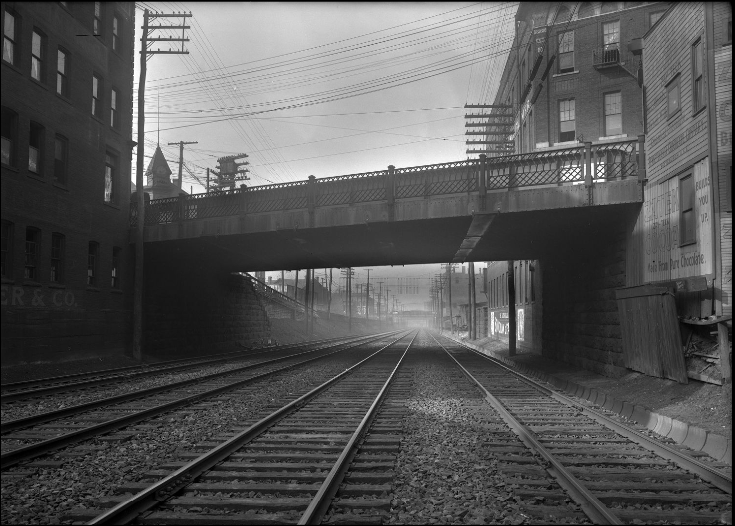
After years of hearing about the importance of the 1893 Chicago World’s Fair in planning and architecture and after reading Eric Larson’s The Devil in the White City, I made it a goal to visit the fair site. On one trip to Chicago when the weather was beautiful, I rented a bike and rode down the waterfront trail toward what was left of the White City. This was before I had a smart phone which meant I turned around and gave up because I feared that I had misjudged the distance by bike trail. Later, I realized I was probably pretty close and if I had only gone around one more curve, I would have seen my destination.
My next trip to Chicago was the same year I visited San Francisco. This time, I took a bus to the fair location. I picked the bus stop that on the map appeared to be the closest stop to the remaining places of interest from the fair. When I stepped off the bus onto a broken sidewalk, I found a desolate expanse of vacant land, scraggly trees, and pock-marked lawns. A weary walk presented itself every way I turned.
The bus didn’t run frequently out there. The roads that crossed the vacant expanse stretched far and wide, empty except for the random sudden appearance of a single speeding vehicle.
As soon as I had stepped off the bus and it drove off, I felt tired and scared. I wondered how to extricate myself from this horrible environment. I had some additional information that expanded the negative emotions stirred by the conditions around me. I had heard or read somewhere that the former Midway, which was where I got off the bus, was used as a sort of DMZ buffer to keep “those people” (in this case, primarily people with little income or people of color) away from the University of Chicago campus. I had clearly landed in the middle of a land of have-nots.
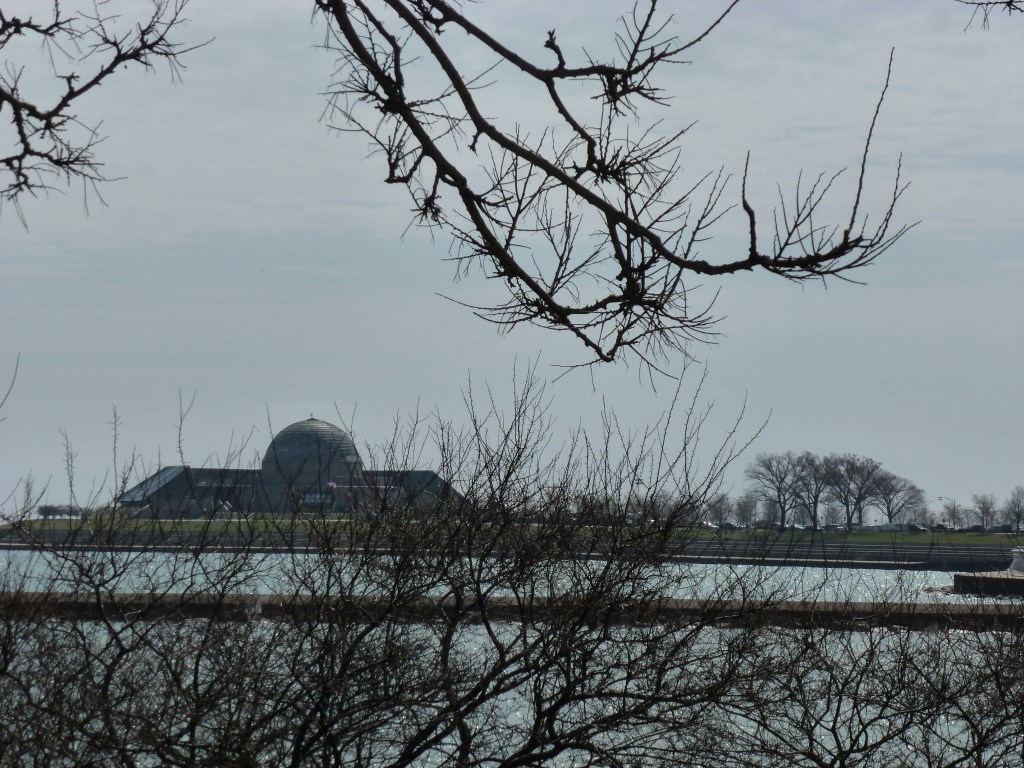
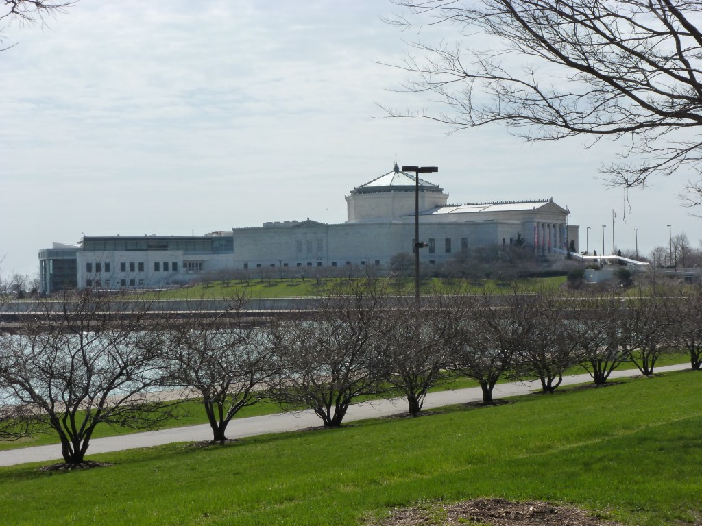
As I had come this far with a purpose and there seemed to be little else to do, I moved forward toward the lake. Migraine-inducing music was blaring from an unseen picnic far away and it followed me wherever I went. After feeling like I had taken my life in my hands by daring to cross the road where at any second a car could come speeding by, I reached a path among experimental plantings. Following random turns, I found the lagoon from the fair. The one white building that remained was on the opposite shore and was surrounded by scaffolding. The walk that once circumscribed the water was shut off by a menacing 6-foot high, chain link fence and a bridge that divided the lagoon seemed no longer safe to cross over, though passing under through the muck and mud was an option.
I eventually found a way forward and reached the Japanese Garden that was developed for the fair and remains a peaceful spot. Prior to that, at the moment of being confronted with a security fence and a broken bridge, the fear and doubt that often accompanies me on my explorations became overwhelming. What if I’m stopped? What if I’m questioned? Do I have a right to explore here and pass this way? Do I have a right to explore places and pass judgement?
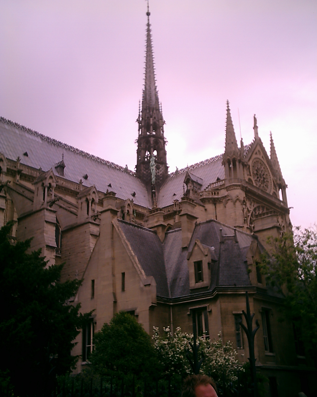
On April 15, 2019, the roof of Notre Dame caught fire and collapsed. The cathedral has been closed ever since. Almost immediately came promises to rebuild exactly as it was and reopen within 5 years. These promises are almost fulfilled. The new spire was recently uncovered and looks much like the one in my photo from 2005. The cathedral is scheduled to reopen in December 2024, five years and eight months after the fire. (Paris Je T’aime, Friends of Notre Dame; Mad White; World, April 4, 2024)
I was fascinated by the fire and commemorated it in 2019 with one of my architectural dessert masterpieces. 1 As I mentioned in that post, I visited Paris in 2005 and was fortunate to have a connection to a guest organist. We were invited to experience the cathedral from the organ loft. A unique experience that I was distracted from enjoying fully for a number of reasons.
This trip was before I officially began urbantraipsing, but was one of the first places I unknowingly tested out the habit. It was also the first time I liked a city, a foundational necessity for urbantraipsing which paved the way for my return trip to London in 2012 where I explored adaptively reused churches and bridges.
I enjoyed the Paris trip immensely and before we left was looking forward to returning. There was much I didn’t get to see on that trip and bridges that I didn’t know I would need to document walking. One day, I will return with a more advanced camera and improved photography skills.
Notre Dame organ pipes 2005Notre Dame woodwork from the organ loft 2005
Unfortunately, personal encounters with COVID have disrupted my intention to have an annual architectural dessert masterpiece over the last few years. I look forward to resuming the tradition one day. ↩︎
East Liberty Station Pedestrian Bridge, August 2020, Carolyn RistauSpahr Street Pedestrian Bridge, February 2022, Carolyn Ristau
The winner of the 2024 Bridge Madness tournament, the East Liberty Station Pedestrian Bridge, faced stiff competition in the Final Four round from the Spahr Street Pedestrian Bridge. Both of these bridges are relatively new, constructed with funding sources from the Obama Administration. When I moved to Pittsburgh 15 years ago, neither of these bridges existed. There was no pedestrian connection at Spahr Street and the pedestrian bridges at East Liberty Station were boxed-in bridges with no greenery. (For a side-by-side comparison of the prior and current East Liberty Station bridges see their Then and Now post.) These are not the only changes to bridges in this area. In fact, I suggest that East Liberty has seen more bridge turn-over in the last 100 years than any other part of Pittsburgh.
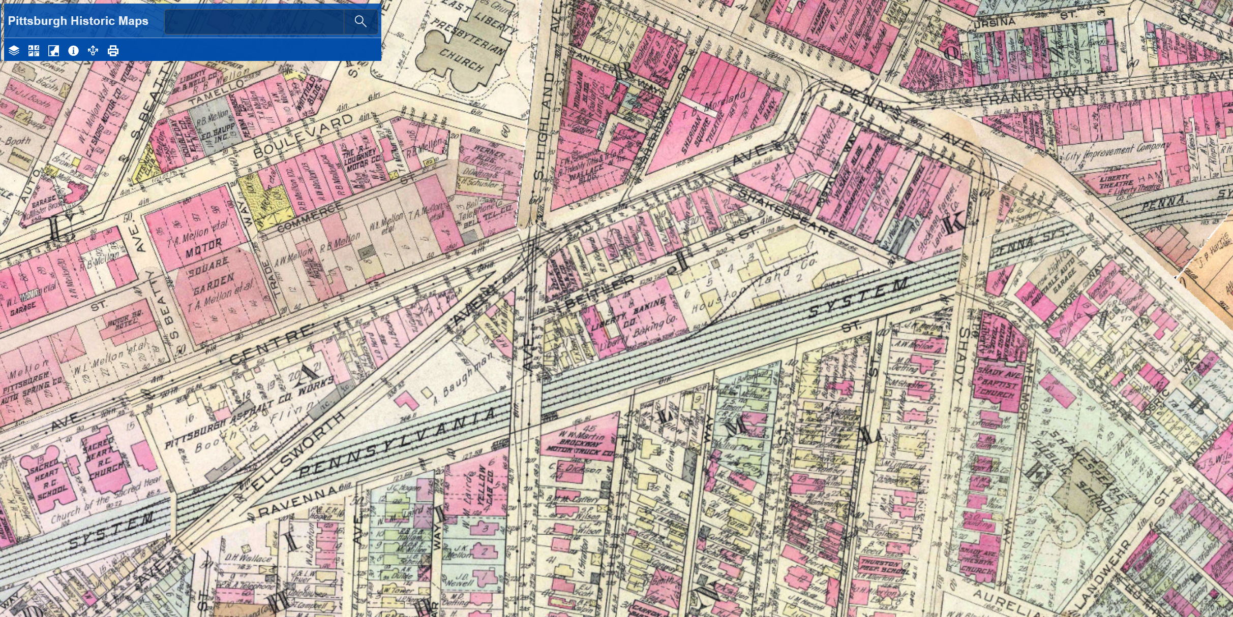
The Penn Avenue and South Highland Avenue Bridges have stayed fairly constant, at least as far as location is concerned. The South Highland Avenue Bridge was rebuilt and redesigned in the 15 years I’ve lived here. While the Spahr Street Pedestrian Bridge is new, the 1923 G. M. Hopkins map above shows that there used to be a pedestrian bridge at this same location. The historical precedent for a pedestrian bridge here may be another factor for why the bridge was located here and not further east where residents have been asking for a pedestrian bridge for years.
The other major bridge changes in this area are the former Ellsworth Avenue and Shady Avenue Bridges that show on the 1923 G. M. Hopkins map. Both of those are long gone. I assume they were casualties of the massive Urban Renewal of the neighborhood that significantly impacted the street grid of the area. The digital archives of Historic Pittsburgh include photos of these former bridges. The Shady Avenue Bridge seems to have been of a similar design to the former South Highland Avenue Bridge. The Ellsworth Avenue Bridge seems to have been of a similar design to the current South Negley Avenue Bridge that is just outside the map frame to the west. One key difference is that cages were added at some point to the South Highland and South Negley Bridges.
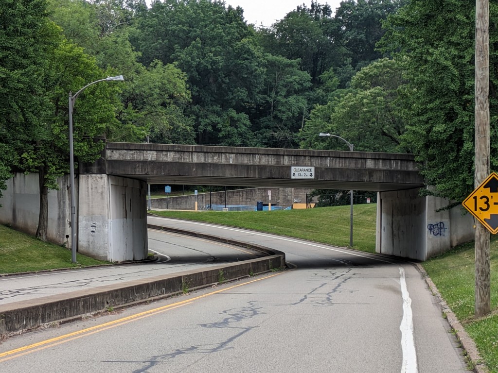
Thirteen months ago, Pittsburgh’s Fern Hollow Bridge reconstruction was declared finished eleven months after the previous bridge had collapsed. I scoffed at this announcement at the time as the side walk wasn’t yet open and the new bridge was closed again for a month during the summer to “complete all remaining bridge work.” (Mayor’s Press Release, June 8, 2023). However, David McCullough in The Great Bridge points out that there is never a clear completion date for a new bridge. He notes that when the Brooklyn Bridge was “finished:”
There was no one moment, no particular day, when he [Washington Roebling] could have said as much, nor would there be. Bridges did not end that way. There was always something more to finish up, some last detail to attend to. The final touches at Cincinnati, for example, had dragged on for nearly six months after the opening ceremonies and it looked as though the same might happen here. (505)
David McCullough, “The Great Bridge”
The Fern Hollow Bridge, therefore, was simply following the pattern established by other greater bridges. The bridge itself now seems to be fully complete and operational: all the multi-modal options to cross are open, the trail underneath is also open, and people crossing over or passing under can experience the public art installations. However, while the physical infrastructure has been repaired, the human physical and emotional fallout from the collapse continues.
Some of the people injured in the collapse are working with attorneys to seek transparency and a way to move forward following their experience. This fall, a judge ordered the release of documents relating to the bridge and its collapse (TribLive, November 16, 2023; TribLive, November 28, 2023; WPXI, November 28, 2023; WTAE, November 28, 2023; CBS News, November 29, 2023). In December, PennDOT released hundreds of pages of documents related to the collapse (CBS News, December 23, 2023).
News
Below are the news updates on the Fern Hollow Bridge and other bridge maintenance and replacement efforts in Pittsburgh and Allegheny County.
A year and a half after the City created a Commission on Infrastructure Asset Reporting and Investment, Mayor Gainey finally submitted nominations for the board seats to City Council (WESA, July 18, 2023). Council approved 12 commissioners on July 25, 2023, one commissioner on September 19, 2023, and one commissioner on December 18, 2023. The commission had its first meeting on December 5, 2023, (City of Pittsburgh Tweet, November 28, 2023; WPXI, December 5, 2023) but it hasn’t been added yet to the city’s website listing all Boards and Commissions. Presumably it will be added soon so that the agenda and minutes of the commission will be publicly available the same as all other city commissions. There have been no press leases regarding the long-overdue formation of this commission. I’ve only found the commissioners names by searching the City’s Legislative Center for “Appointment-Requiring Vote.” The approved commissioners are:
Lisa Frank
Zachary Workman
Tyler Watts
Tom Melisko
Patrick Cornell
Greg Bernarding
Eric Setzler
Doris Carson Williams
Darrin Kelley
Councilwoman Erika Strassburger
Chief Darryl Jones
Andy Waple
Samuel Miclot
Michele Miller Beener
The final designs for the rehabilitation of the Charles Anderson Bridge and the Panther Hollow Overpass are nearing completion and bids are expected to be released this month. (Pittsburgh Engage project page)
Pittsburgh’s Swindell Bridge, which closed initially from July to September 2022 due to falling debris, continues to have problems and the city is providing little to no information at this time. The expectation was that repairs over the summer would enable the bridge to fully reopen to traffic. Instead the latest repairs seem to have uncovered more issues. There is no evidence of a plan yet for addressing the situation. (TribLive, July 7, 2023; WPXI, August 7, 2023; Pittsburgh Engage page)
The “complete overhaul” of the South Negley Avenue Bridge announced in 2022 (CBS, February 25, 2022) has not been mentioned since and there is no project page for it to indicate that plans are in the works for it. The obvious deterioration on this bridge and lack of movement on repairs leaves the way open for speculation on whether we will have another bridge disaster in our city sooner rather than later.
Construction began on the 30th Street Bridge rehabilitation in April 2023 and finished in August. (WPXI, August 21, 2023; Pittsburgh Engage page)
Rehabilitation on the Swinburne Bridge remains on pause until after the Charles Anderson Bridge is reopened as the Swinburne Bridge is part of the detour route. (Pittsburgh Engage page)
Preliminary engineering is ongoing for the rehabilitation of the 28th Street Bridge. (Pittsburgh Engage page)
Temporary repairs, including protection from falling debris, were done on the California Avenue Bridge. Preliminary engineering is scheduled to start this year. Residents remain concerned about the falling debris and the condition of the bridge. This bridge is another possible candidate for the next bridge disaster in the city. (CBS, January 2, 2023; WPXI, June 29, 2023; WPXI, December 5, 2023; TribLive, September 8, 2023; Pittsburgh Engage page)
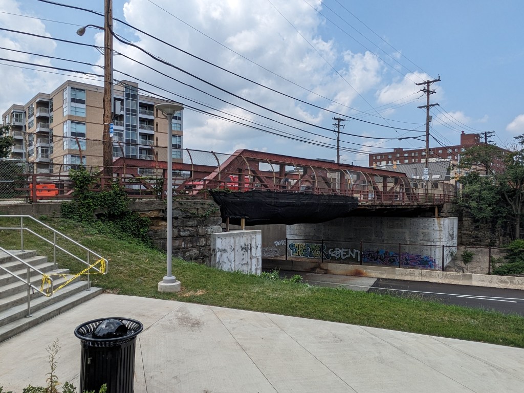
Photos: Other Bridges
Historic Pittsburgh Bridge Disasters
According to Bob Regan’s 2006 book “The Bridges of Pittsburgh,” Pittsburgh is no stranger to bridge disasters:
1845 – The original Smithfield Street Bridge burned down
1851 – The 16th Street Bridge burned down
1865 – Two spans of the 16th Street Bridge was washed away in a flood
late 1880s – The 6th Street/St. Clair Street Bridge burned down
1903 – The Wabash Bridge collapsed during construction
1918 – The 16th Street Bridge burned down (again)
1921 – The 30th Street Bridge burned down
1927 – The Mount Washington Roadway Bridge collapsed during construction
Map of bridges discussed in the Bridge Collapse series:
Walking toward the spires in Scranton, PA, I started and ended in Downtown and explored a portion of the Medical and University neighborhoods. Like Pittsburgh and Buffalo, the few religious buildings I found in the heart of downtown remained active. In the adjoining neighborhoods, I found several active religious buildings and others that had been converted to new uses.
Of the 10 total buildings built for religion that I encountered, six remained active while four had been converted to secular uses. One former synagogue is now used for housing. Two former churches are now university buildings. One former church is now a children’s library. This sampling seemed representative enough to contribute to my observations on trends in adaptive reuse and population change. Scranton has experienced a 47% drop in population since its peak population in the 1930s. Based on this information, I expected to find several vacant and reused religious buildings. The surprise finding was that none of them appeared vacant when I got out on the ground.
I also noticed several religious buildings as I drove through the southern neighborhoods on my way home. Because I was driving, I didn’t have the ability to stop and take notes or photos of these buildings, but those that I noticed appeared to be either active religious buildings or active in a secular reuse.
The lack of vacant buildings may perhaps be explained by the recent population trends. While overall, the population is significantly down from the peak, in the last couple decades the decline in population has slowed and the 2020 census showed a miniscule increase in population. It is, so far, the only one of my comparison cities that had a major population drop and a recent increase in population. While Bethlehem and Stroudsburg also saw population increases in the 2020 census, they did not have the same steep drop since the peak population that Scranton and most of the other cities in this survey did.
City
Population Loss Since Peak (Peak Year)
Population Change in 2020
Status of Religious Buildings
Bethlehem
1% (1960)
0.86%
Primarily active sacred uses
Erie
26% (1960)
-6.82%
Primarily active sacred uses
Homestead
85% (1920)
-9.04%
Significant numbers closed or converted to secular uses
Pittsburgh
55% (1950)
-0.96%
Significant numbers closed or converted to secular uses
Scranton
47% (1930)
0.30%
Significant numbers converted to secular uses
Stroudsburg
14% (1950)
6.47%
Primarily active sacred uses
Wilkinsburg
49% (1950)
-10%
Significant numbers closed or converted to secular uses
In addition to the religious and former religious buildings, I found 2 civic buildings and 1 school that sported spires.
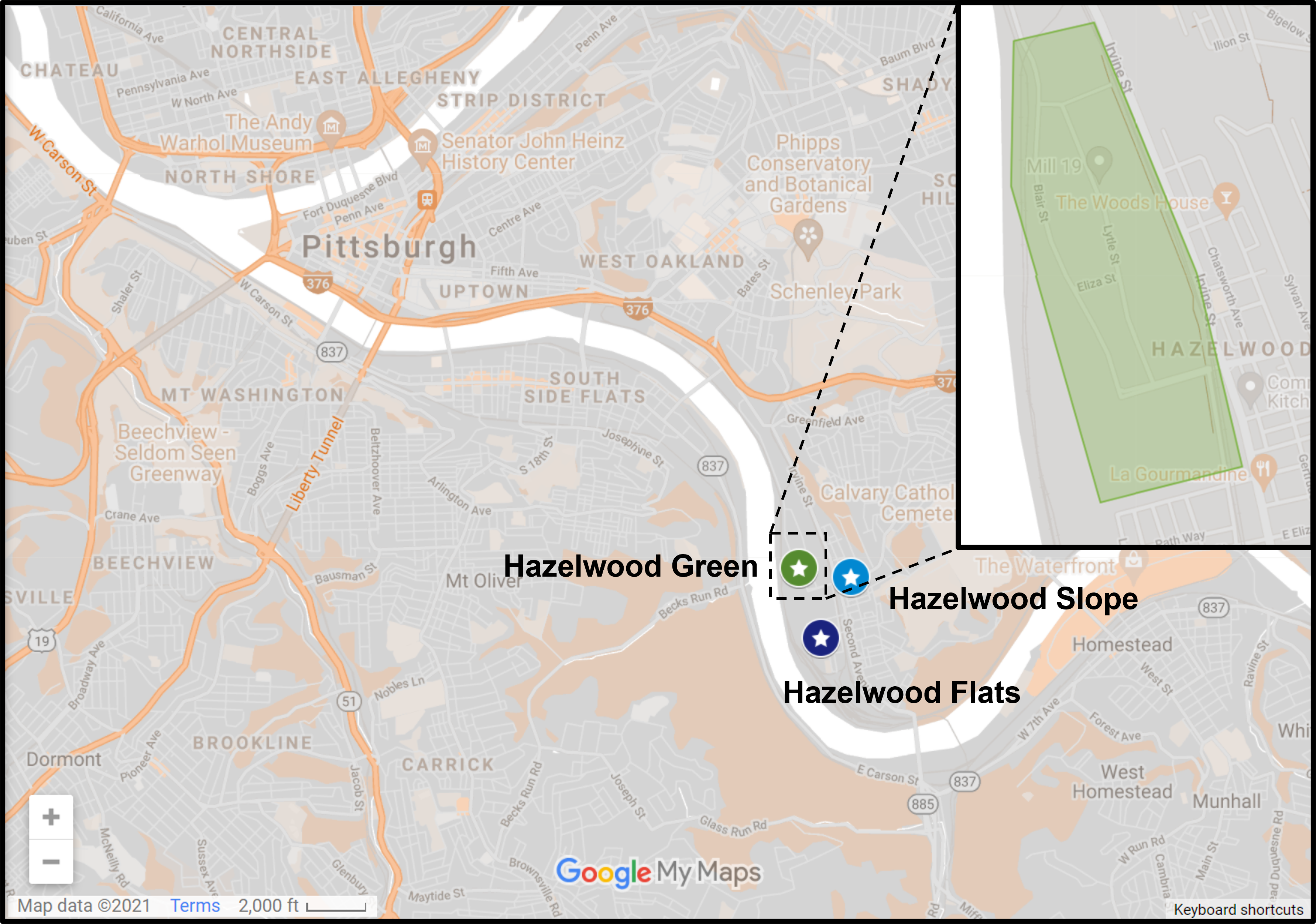
Hazelwood is a neighborhood about 4 miles down the Monongahela River from downtown Pittsburgh. It is currently experiencing significant change. Between Hazelwood’s main street (2nd Avenue) and the Monongahela River is a 178-acre site of the former Jones and Laughlin Steel Company. Most of the structures from the mill were demolished, leaving a large brownfield. In 2002, the site was purchased for redevelopment by Almono LP (at the time, an entity made up of four Pittsburgh foundations). After years of planning and a rebranding of the site as Hazelwood Green, a series of public streets and the first building opened for use in 2019. Construction is underway for more buildings and a public plaza.
During the planning and preparation stages, a question arose as to the effects of this redevelopment on the surrounding neighborhood. Hazelwood is one of Pittsburgh’s neighborhoods that has experienced high vacancy rates and subsequent demolition in its residential and business districts. While the building stock of the neighborhood has experienced a long downward trend, the community of people is strong. Only time will tell if the redevelopment of Hazelwood Green will connect with this community or if Hazelwood Green will become and isolated spot of prosperity for others.
Previously, I divided the approach to Keeping an Eye on Hazelwood into three series, Keeping an Eye on Hazelwood Green, Keeping an Eye on Hazelwood Flats, and Keeping an Eye on Hazelwood Slope. For this post and the 2023 post, I will be combining these into a single series. The goal of this series is to periodically document the physical changes to the former steel mill site and to the surrounding neighborhood.
The Photos
Due to a full schedule in 2022, I was not able to take any photographs of the neighborhood this year.
Hazelwood in the News
The big news of 2022 was the announcement of the plan for the current nonprofit owner (Almono LP) of Hazelwood Green to turn over management and eventually ownership of the site to a New York-based, for-profit development firm. (Pittsburgh Business Times, February 25, 2022, article 1 and article 2)
At the end of 2021, the plan and zoning regulations governing the redevelopment of Hazelwood Green was amended to respond to the current market. One of the changes was to allow more flexibility for temporary parking lots that the Planning Commission placed a condition that such parking lots must expire after 40 years. (Planning Commission agenda, Planning Commission minutes, City Council legislation page)
Public Source (October 27, 2021) discussed this amendment as well as community efforts to bring a grocery store to the neighborhood, to establish and maintain affordable housing, and to maintain and strengthen the ecosystem created by the greenway on the hill overlooking Hazelwood Green.
Also, toward the end of 2021, the One Valley innovation hub moved into the renovated Roundhouse (LinkedIn, July 20, 2021) and the University of Pittsburgh announced plans to build BioForge, a biomanufacturing facility, with funds from the Richard King Mellon Foundation (Pittsburgh Business Times, November 17, 2021, articles on funding and Pitt’s plans)
The City of Pittsburgh has a project page to track the restoration of the Hazelwood Greenway.
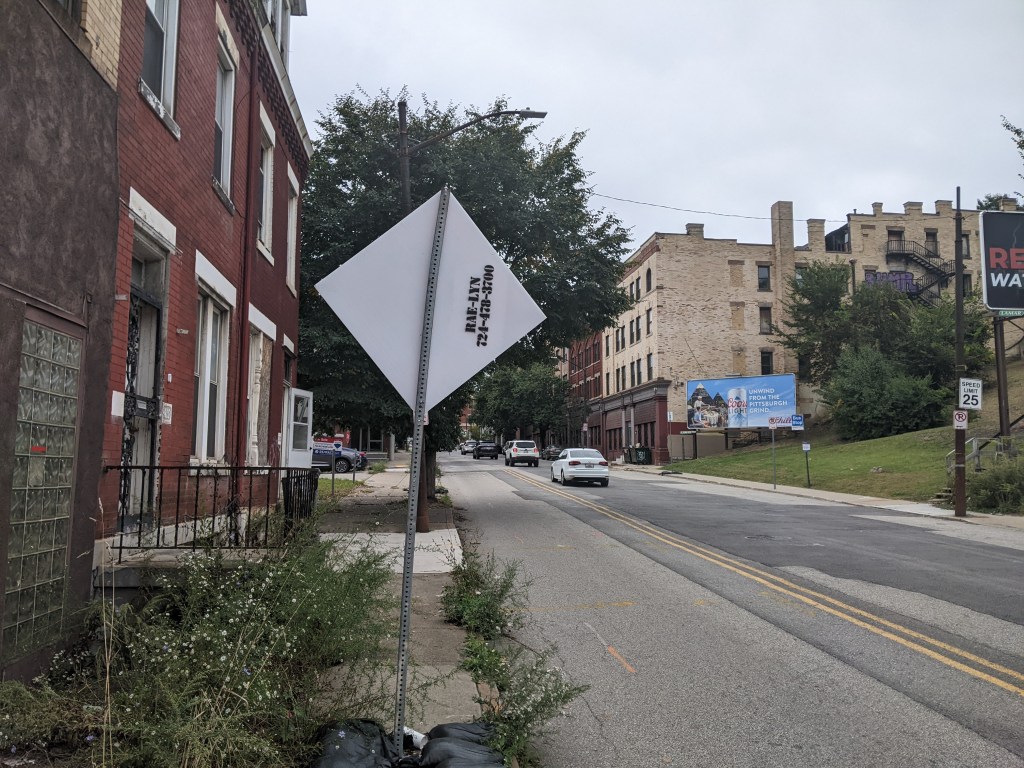
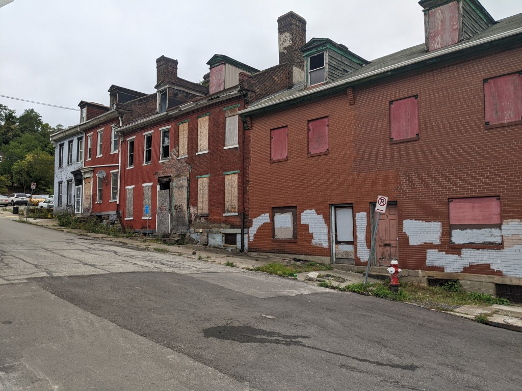
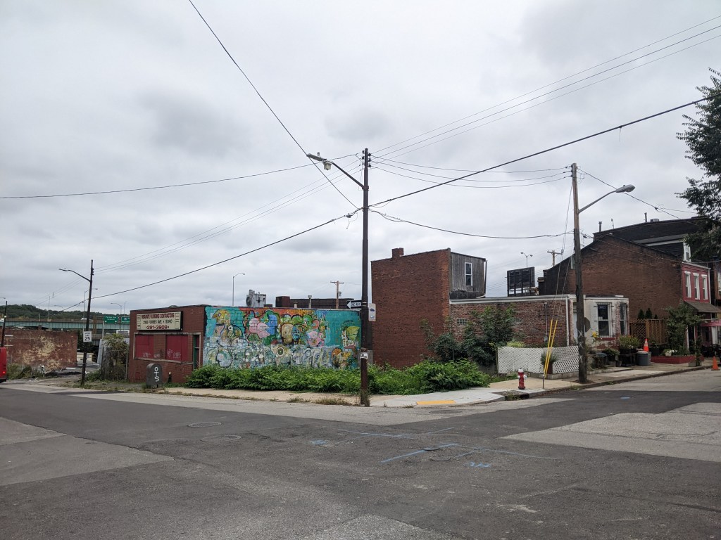
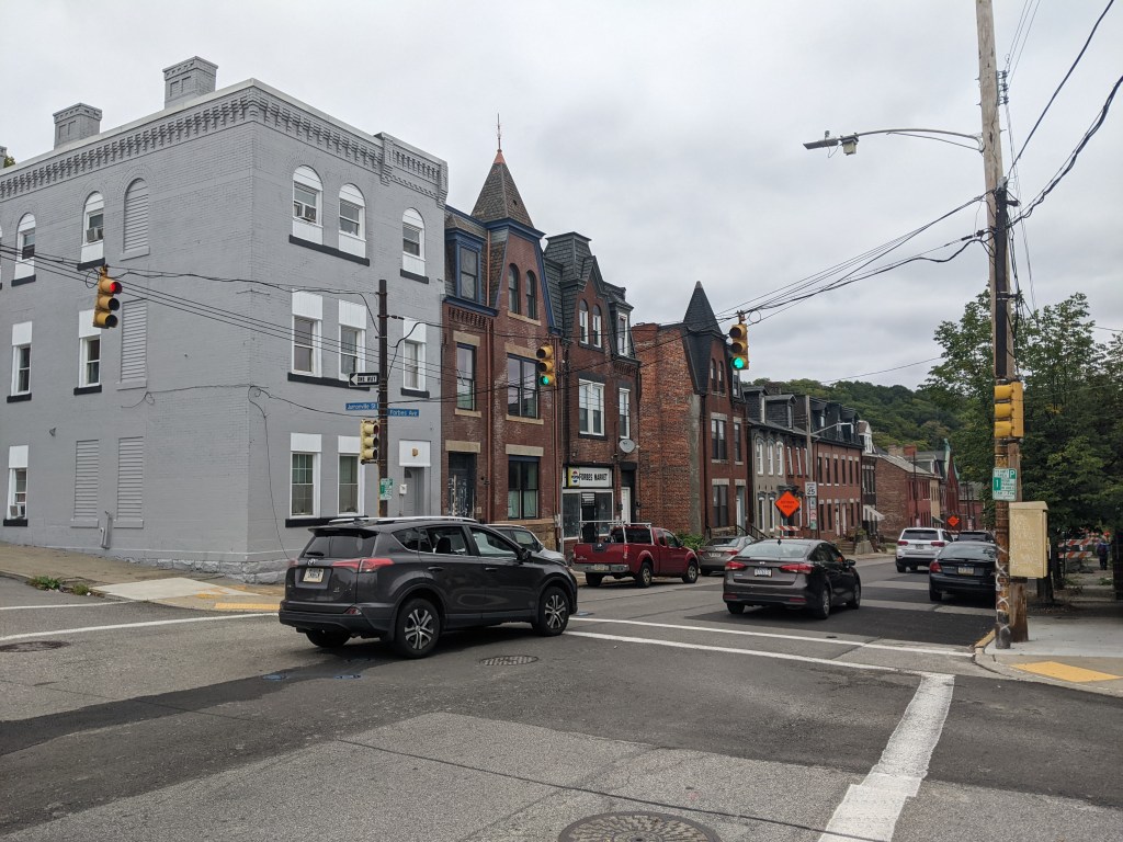
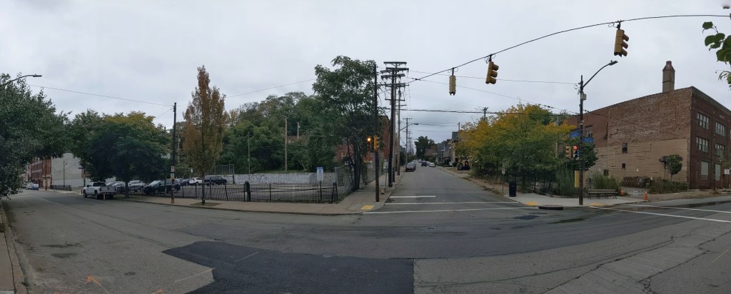
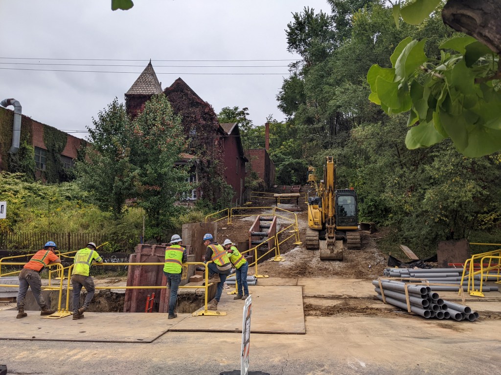
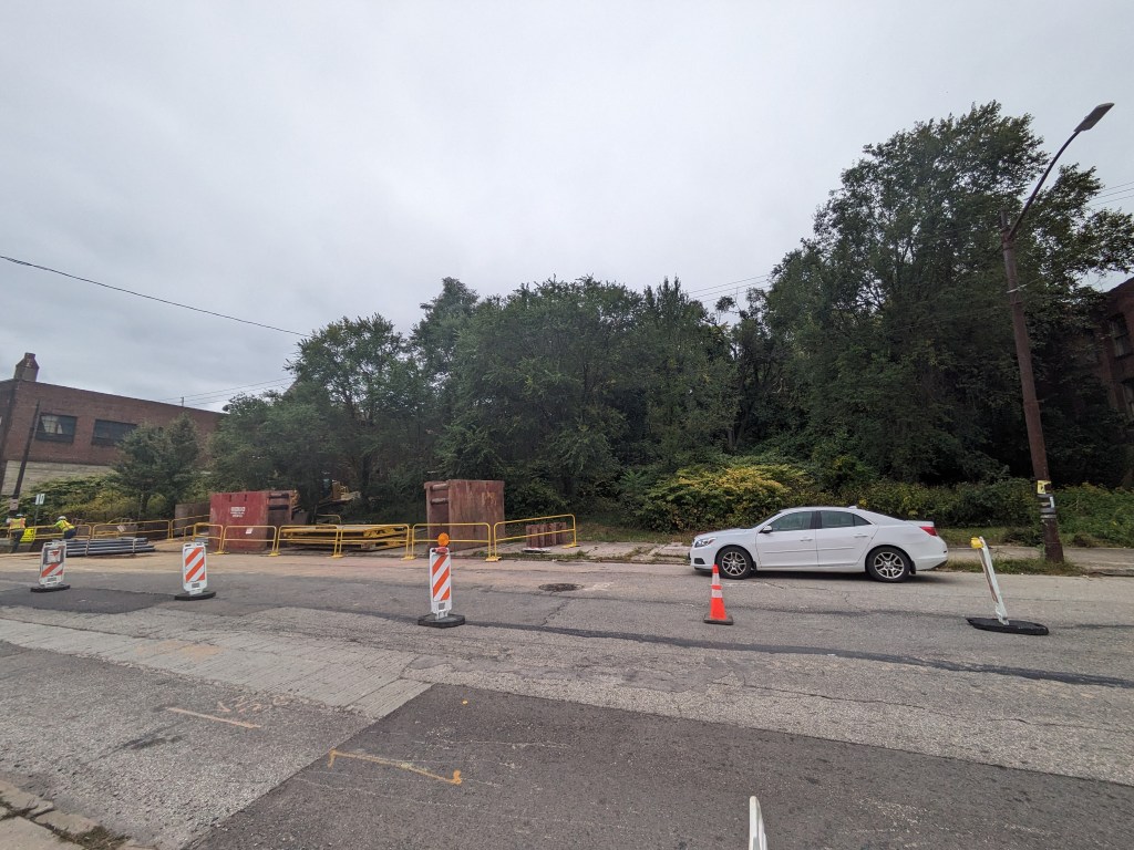
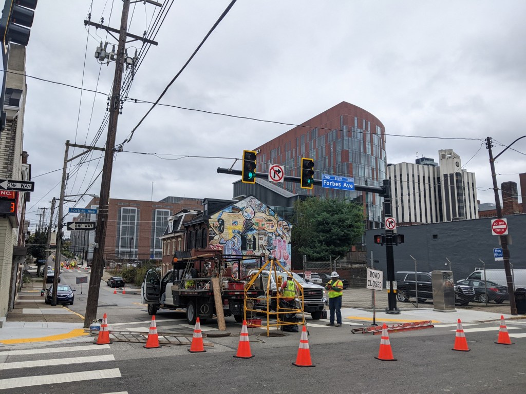
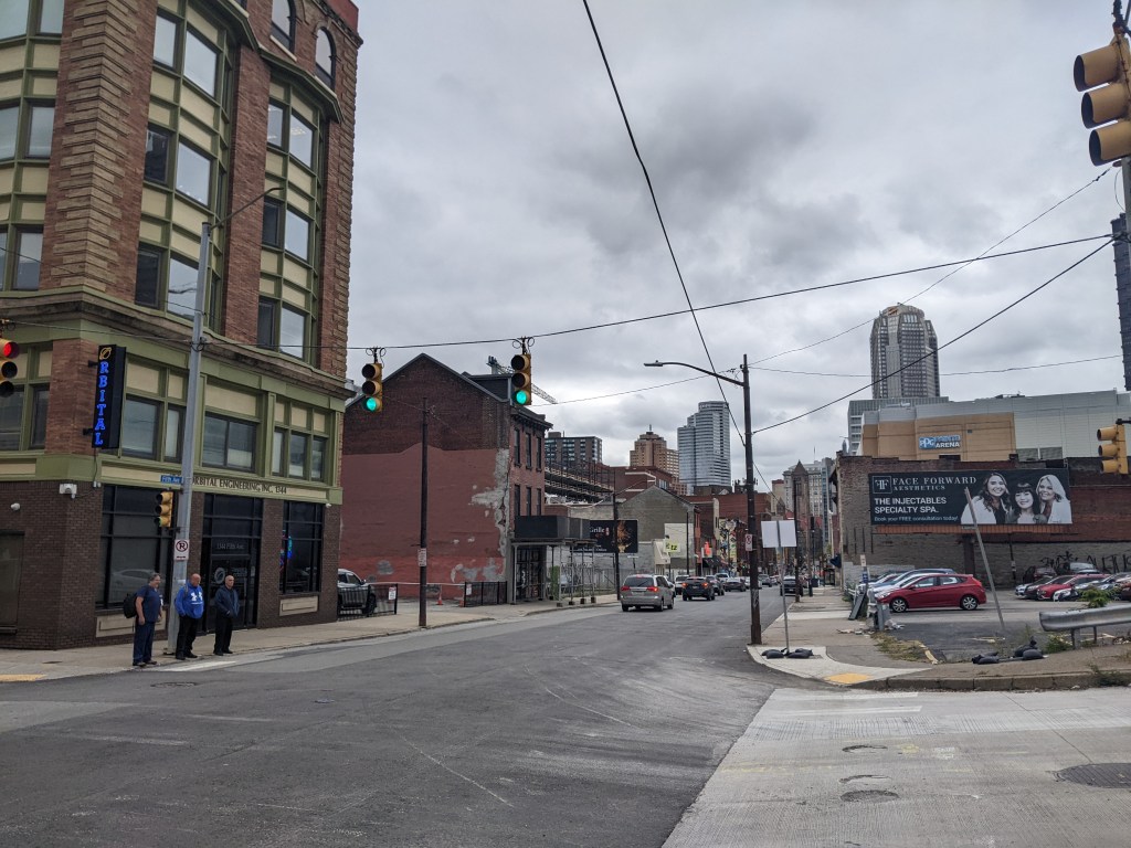
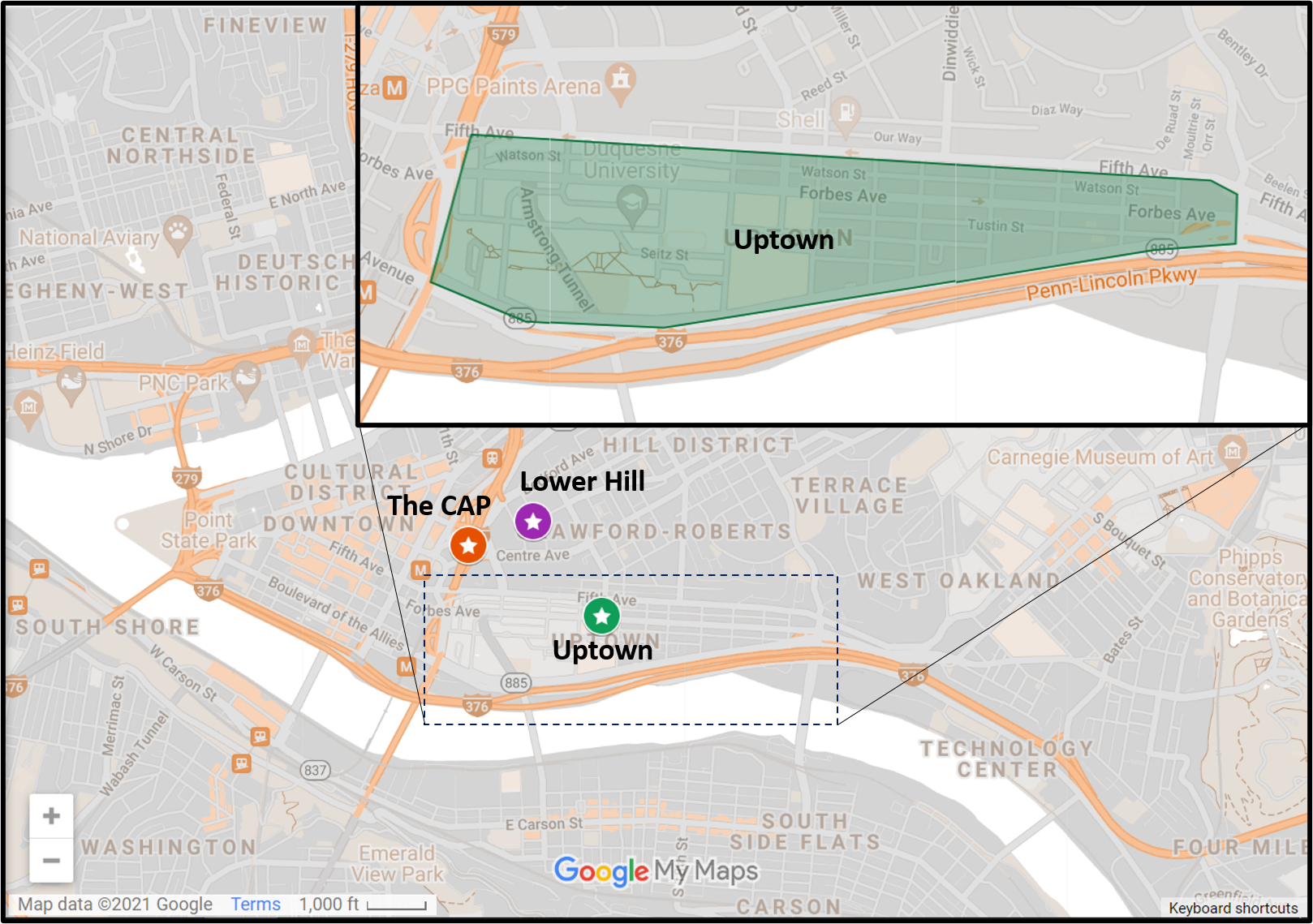
Uptown is one of the many neighborhoods in Pittsburgh that experienced decades of neglect. For this neighborhood, the neglect was despite Uptown being sandwiched between Oakland and downtown, two places among the state’s strongest economic regions. Zipping through Uptown from Oakland to downtown on Fifth Avenue or from downtown to Oakland on Forbes Avenue, it is easy to overlook or dismiss the hodgepodge of ruined home foundations turning back to forest; scattered vacant lots, parking lots, and industrial uses; and the intricate architectural details on abandoned and renovated townhomes.
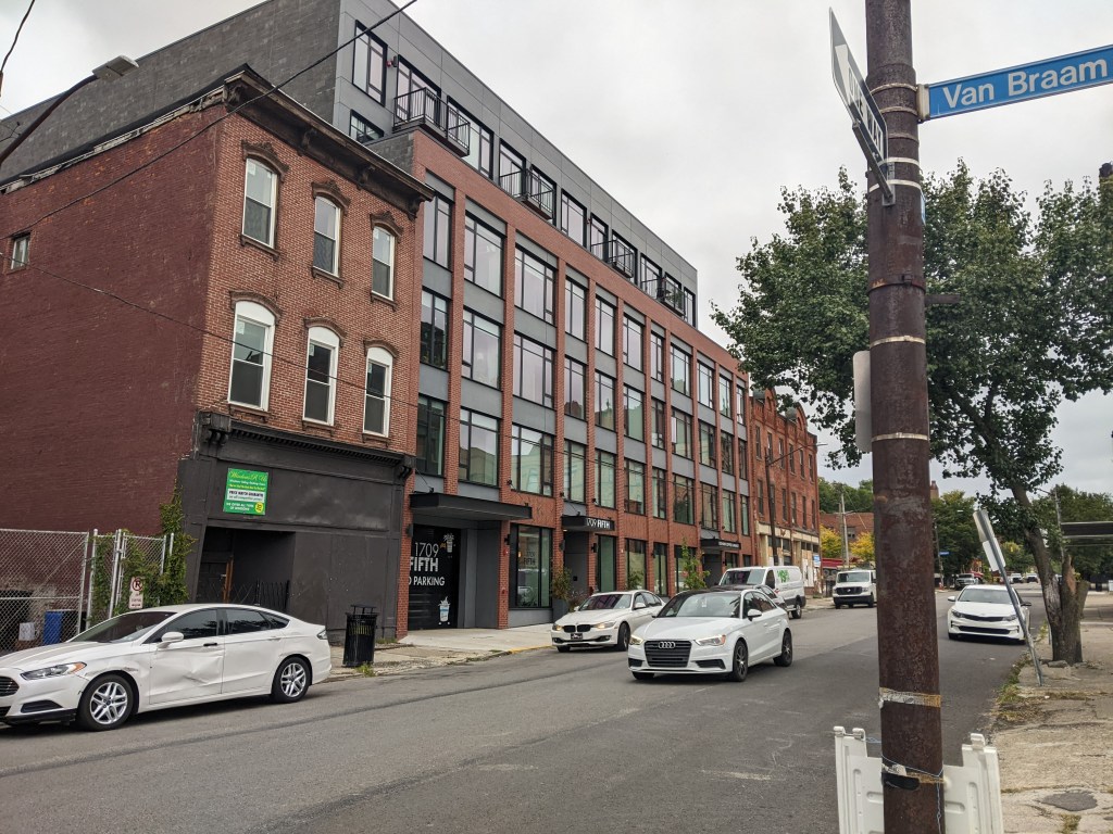
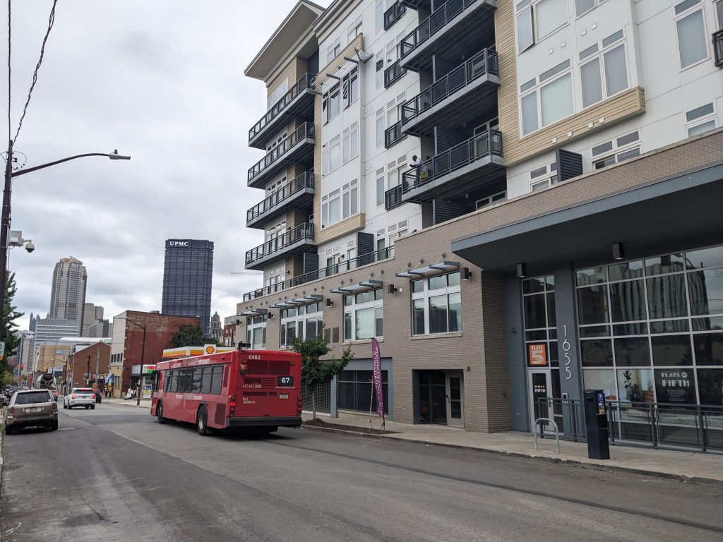
In recent years, new buildings started springing up here and there. Some of these new projects are the work of the two institutions in the neighborhood: UPMC Mercy Hospital and Duquesne University. Others are the work of a variety of commercial and residential developers. Two reasons for this recent investment are the proposed Bus Rapid Transit system, which will eventually run through the neighborhood, and the in-progress redevelopment of the Lower Hill, an adjacent neighborhood.
The Uptown community saw these changes coming and prepared. Between 2015 and 2017, the community organization Uptown Partners collaborated UPMC Mercy, Duquesne University, the City of Pittsburgh, and others to create the EcoInnovation District Plan and the Uptown Public Realm zoning district. The plan and new zoning district are intended to guide future development and leverage their economic investment for the greater good of the neighborhood. Ideally, this will reduce the number of those who will be left behind.
This blog post is part of an on-going series watching the changes in Uptown. Periodically, approximately once a year, I return to the neighborhood to take new photographs of the same areas. In addition, I include links to articles about the project that I’ve encountered since the previous post in the series. At the end of the post, there is a map showing the location of the neighborhood and links to the previous posts in the series.
What’s new
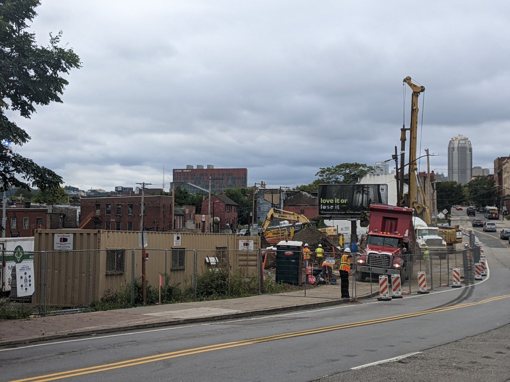
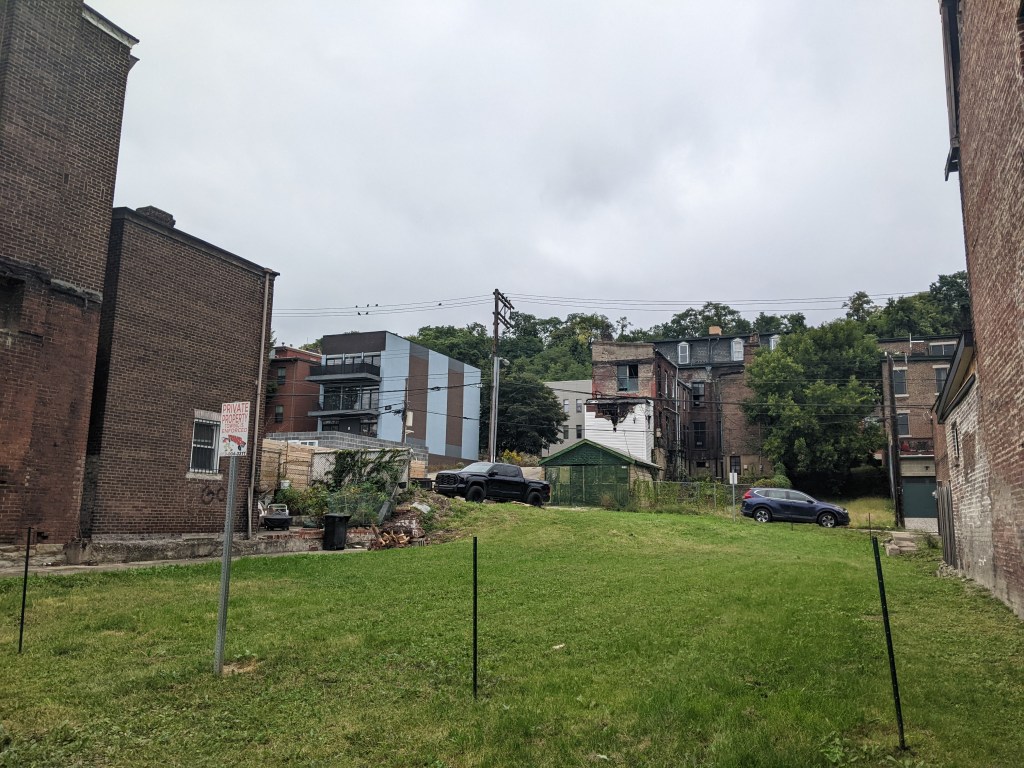
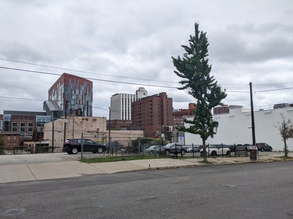
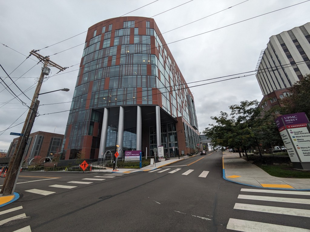
There’s been a lot of development in Uptown since the last on-the-ground photographs from December 2021. Several projects that were in progress at that time have since been completed (or at least appear completed) including the UPMC Mercy Pavilion for the new vision rehabilitation center. Many more projects have broken ground, including one near the Birmingham Bridge on a vacant lot that has an extreme grade change. The near cliff that ran through the middle of this site made me guess that it would take longer to develop that property than the vacant building across the street with the Burrell sign painted on the side. This suggests that it may be easier to develop a environmentally challenged site than to reuse an existing building – which is a disturbing thought.
In addition to the projects we can see developing in the photo series, several more have been announced for the neighborhood, which can be seen in the news section.
A small aside, as a picture tells a 1,000 words, the photo this year of the Shephard’s Heart Fellowship suggests an unfortunate story (slightly embellished from having ridden the bus past the building over the course of several months). While there is no good time to have a fire, it appears that Shephard’s Heart had a fire shortly after they finished putting a fresh coat of paint on their building. As it’s been at least four months since I first notice the damage and no exterior repairs are apparent, it seems they might be having difficulty in resolving the after affects.
The Photos
Uptown in the News & on the Web
Two projects in Uptown are listed in Next Pittsburgh‘s list of 8 major development projects to watch in 2023: UPMC Mercy’s Vision Rehabilitation Center and Duquesne University’s new 12-story student housing (January 11, 2023). The Pittsburgh Business Times got a first look at the new UPMC Mercy Pavilion – the home of the vision rehabilitation center – prior to its May 1 opening (April 19, 2023) and the University of Pittsburgh Health Sciences provided an description of the services that will be provided (May 10, 2023).
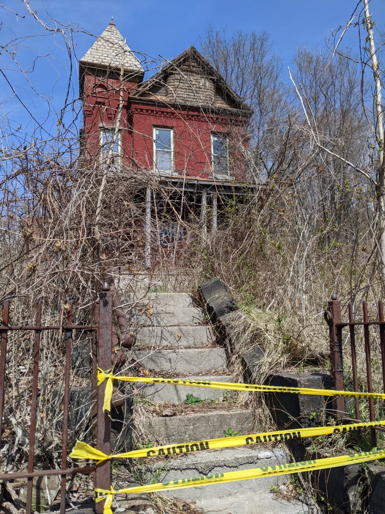
The Tito-Mecca-Zazza House continued to make the news. The developer and Uptown Partners reached an agreement that would donate the house to the nonprofit for restoration while the new construction multi-unit building would be built on the remaining parcels, including the one with the garage that is part of Rolling Rock’s origin story (Pittsburgh Business Times, July 21, 2023). A descendant of the Tito family has filed a lawsuit protesting the proposed demolition of the garage (Pittsburgh Business Times, August 28, 2023).
The Bethlehem Haven women’s shelter in Uptown sought and received approval from Planning Commission on its plans to renovate and expand (Public Source, April 4, 2023; TribLIVE, April 4, 2023; TribLIVE, April 19, 2023).
Several other housing projects received approvals or are moving forward in the neighborhood including:
a formerly stalled 110-unit mixed-use apartment building got an infusion of new funds from the URA (Pittsburgh Business Times, January 19, 2023)
a 240-unit apartment building proposed for a block that is primarily a parking lot today (Pittsburgh Business Times, February 21, 2023)
an affordable/workforce housing development that received approval from Planning Commission (Public Source, July 25, 2023)
Panelists were interviewed by the Pittsburgh Business Times prior to their talk about the projects and opportunities coming to Uptown and the Lower Hill and another Pittsburgh Business Times article focused on the prominent role of Black developers in these projects (both articles: June 8, 2023). Another article discusses the panel (Pittsburgh Business Times, June 13, 2023).
Tech companies are also interested in Uptown with a tech venture studio taking over part of the former Paramount Building in Uptown (Pittsburgh Business Times, March 31, 2023).
Uptown is one of the many neighborhoods in Pittsburgh that experienced decades of neglect. For this neighborhood, the neglect was despite Uptown being sandwiched between Oakland and downtown, two places among the state’s strongest economic regions. Zipping through Uptown from Oakland to downtown on Fifth Avenue or from downtown to Oakland on Forbes Avenue, it is easy to overlook or dismiss the hodgepodge of ruined home foundations turning back to forest; scattered vacant lots, parking lots, and industrial uses; and the intricate architectural details on abandoned and renovated townhomes.
In recent years, new buildings started springing up here and there. Some of these new projects are the work of the two institutions in the neighborhood: UPMC Mercy Hospital and Duquesne University. Others are the work of a variety of commercial and residential developers. Two reasons for this recent investment are the proposed Bus Rapid Transit system, which will eventually run through the neighborhood, and the in-progress redevelopment of the Lower Hill, an adjacent neighborhood.
The Uptown community saw these changes coming and prepared. Between 2015 and 2017, the community organization Uptown Partners collaborated UPMC Mercy, Duquesne University, the City of Pittsburgh, and others to create the EcoInnovation District Plan and the Uptown Public Realm zoning district. The plan and new zoning district are intended to guide future development and leverage their economic investment for the greater good of the neighborhood. Ideally, this will reduce the number of those who will be left behind.
This blog post is part of an on-going series watching the changes in Uptown. Periodically, approximately once a year, I return to the neighborhood to take new photographs of the same areas. In addition, I include links to articles about the project that I’ve encountered since the previous post in the series. At the end of the post, there is a map showing the location of the neighborhood and links to the previous posts in the series.
What’s new
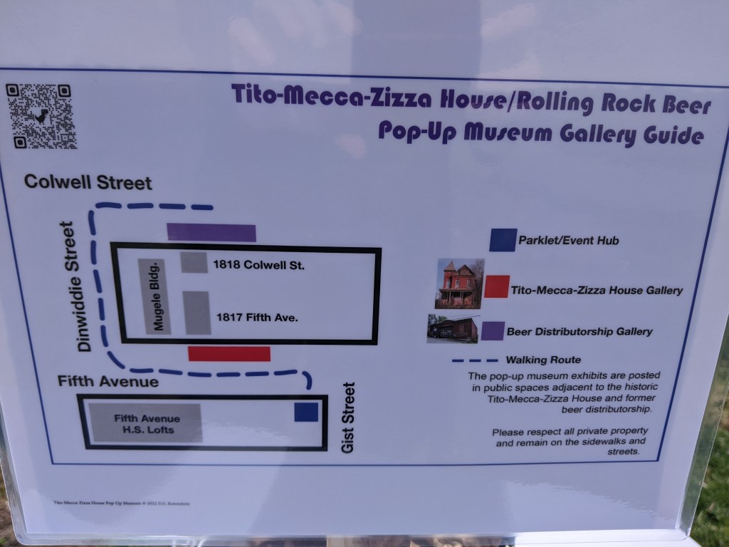
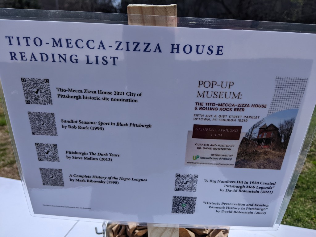
The big news of 2022 was the successful nomination of the Tito-Mecca-Zizza House for historic preservation. Despite a rocky road, in June, City Council voted to designate the house as a historic property. The property owners were vehemently opposed to the nomination throughout the process. The process to nomination involved two meetings at each of the Historic Commission, Planning Commission, and City Council. The Historic Commission did not recommend the nomination to City Council, but the Planning Commission did. The property is considered architectural significant and unique and it has ties to Rolling Rock beer, the Negro League, and the American-Italian community of Pittsburgh. I attended a pop-museum event at the site during the nomination process and include photos below.
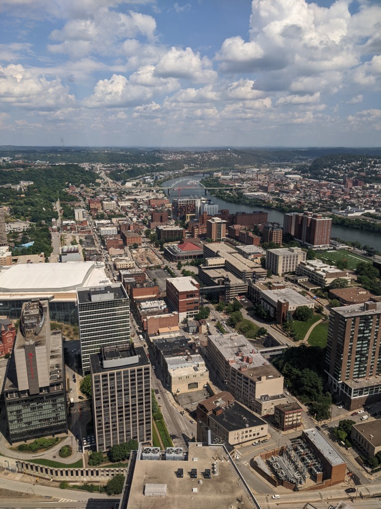
While this house is clearly unique – long before I knew its history, it had caught my eye as something completely different from its surroundings – I did not include it in the photographs I’ve been taking of the neighborhood in the this series. This is a clear illustration of one of the challenges of Keeping an Eye on a neighborhood – predicting which portions are going to be most illustrative of changes over time. Unfortunately, I was not able to get out in the neighborhood for the usual photos this year, though I do have a few bird’s eye view photos to share.
A developer proposed a project on 1.8 acres including the Tito House site that would be a new construction mixed-use project including 260 apartments (Pittsburgh Business Times, February 11, 2022) and another developer proposed a 51-unit building at the western end of the neighborhood (Pittsburgh Business Times, December 9, 2022)