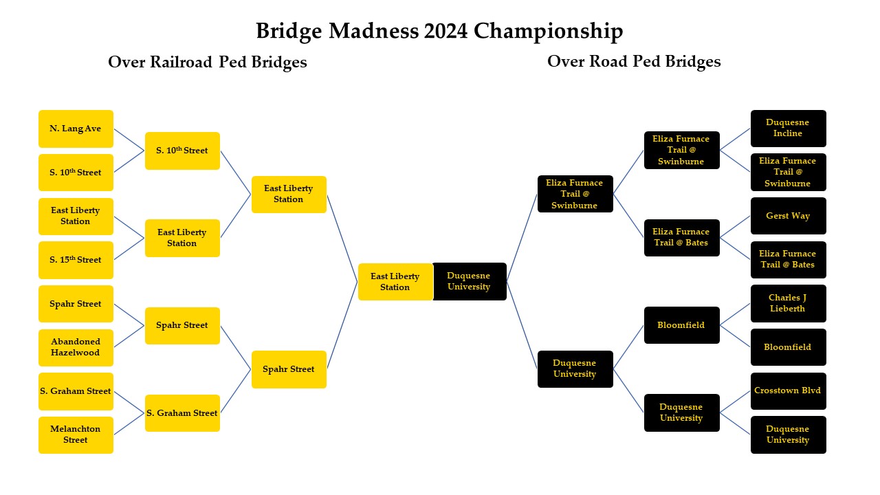
In the 2024 Bridge Madness Tournament, 16 pedestrian bridges go pier-to-pier in a reader’s choice tournament to pick the best one. This year’s tournament features pedestrian bridges within Pittsburgh that cross over roads or railroads. Below is the Championship contest. Vote for your favorite bridge by noon on Wednesday, March 27, and then return on March 29th to see the winner.
The bridges are divided into two conferences: Pedestrian Bridges over Railroads and Pedestrian Bridges over Roads.
Championship Bridges
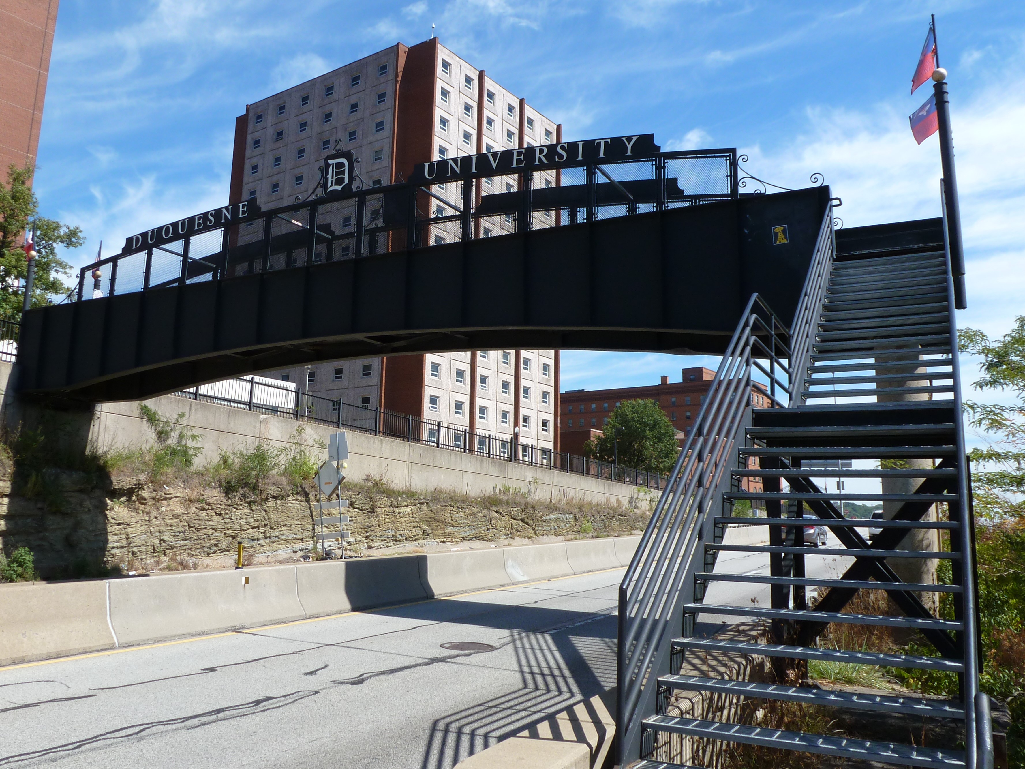
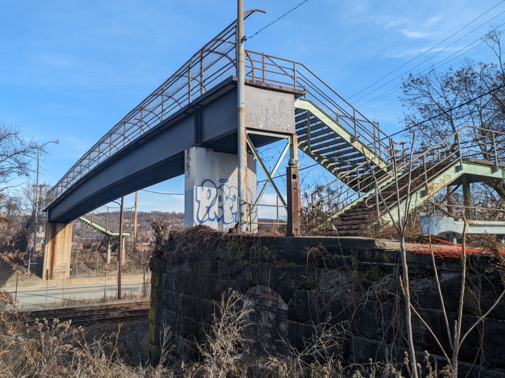
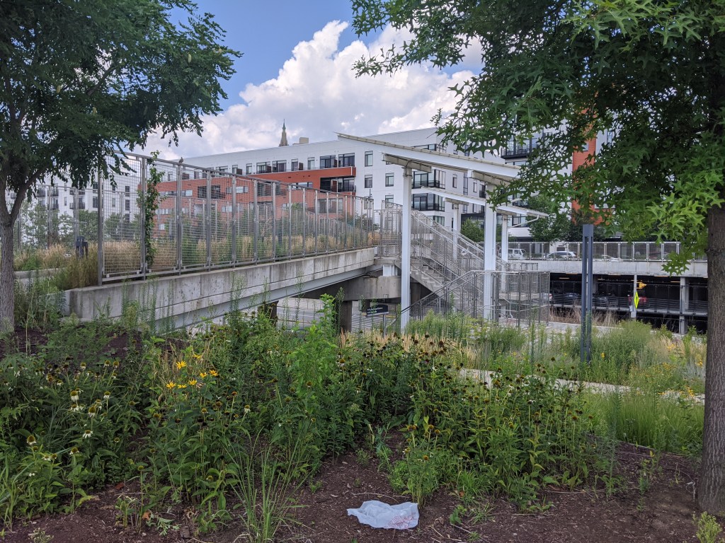
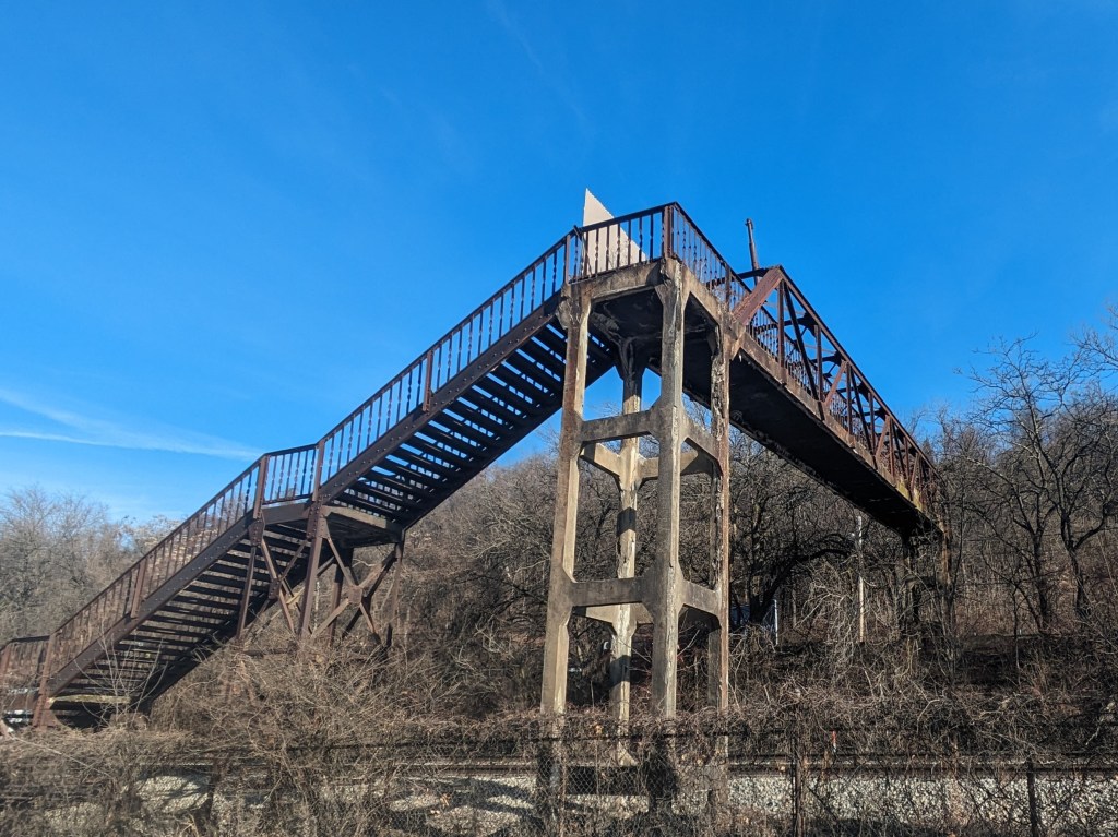
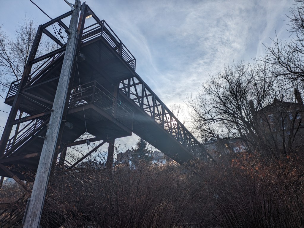
East Liberty Station Pedestrian BridgeDuquesne University Pedestrian Bridge
In the 2024 Bridge Madness Tournament, 16 pedestrian bridges go pier-to-pier in a reader’s choice tournament to pick the best one. This year’s tournament features pedestrian bridges within Pittsburgh that cross over roads or railroads. Below are the brackets for the Final Four. Remember to vote for one bridge in each bracket by noon on Wednesday, March 20, and then return on March 22nd to vote for the Champion.
The bridges are divided into two conferences: Pedestrian Bridges over Railroads and Pedestrian Bridges over Roads.
Pedestrian Bridges over Railroads
East Liberty Station Pedestrian BridgeSpahr Street Pedestrian Bridge
Pedestrian Bridges over Roads
Eliza Furnace Trail over Swinburne StreetDuquesne University Pedestrian Bridge
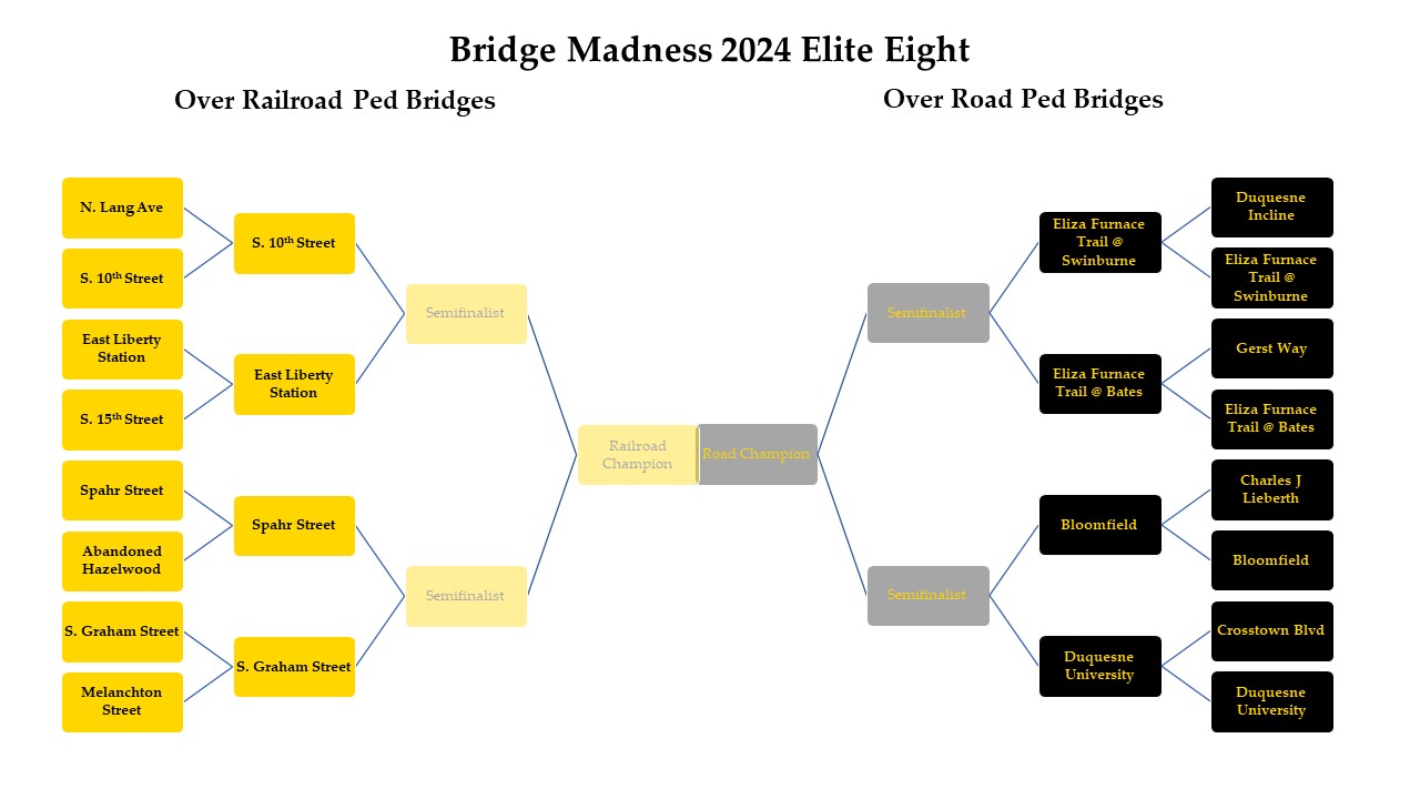
In the 2024 Bridge Madness Tournament, 16 pedestrian bridges go pier-to-pier in a reader’s choice tournament to pick the best one. This year’s tournament features pedestrian bridges within Pittsburgh that cross over roads or railroads. Below are the brackets for the Elite Eight. Remember to vote for one bridge in each bracket by noon on Wednesday, March 13, and then return on March 15th to vote for the Final Four.
The bridges are divided into two conferences: Pedestrian Bridges over Railroads and Pedestrian Bridges over Roads.
Pedestrian Bridges over Railroads
S. 10th Street Pedestrian BridgeEast Liberty Station Pedestrian BridgeSpahr Street Pedestrian BridgeS. Graham Street Pedestrian Bridge
Pedestrian Bridges over Roads
Eliza Furnace Trail over Swinburne StreetEliza Furnace Trail over Bates StreetBloomfield Pedestrian BridgeDuquesne University Pedestrian Bridge
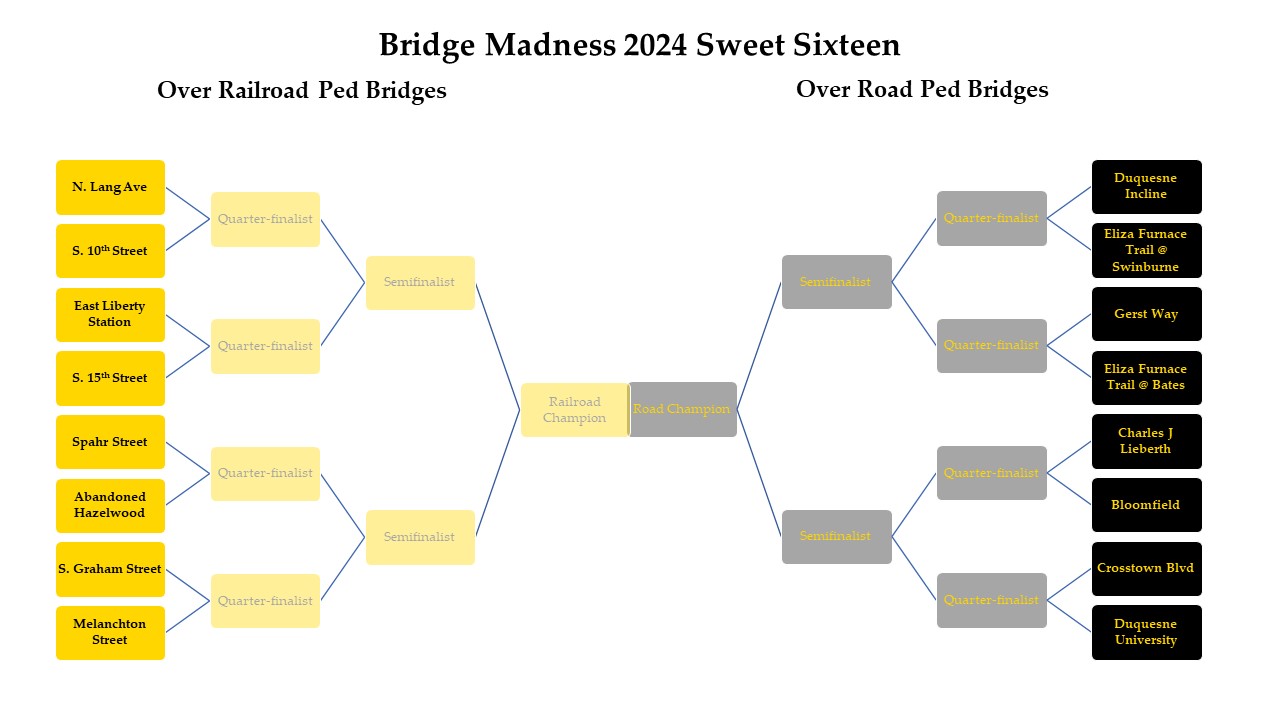
In the 2024 Bridge Madness Tournament, 16 pedestrian bridges go pier-to-pier in a reader’s choice tournament to pick the best one. This year’s tournament features pedestrian bridges within Pittsburgh that cross over roads or railroads. Below are the brackets for the Sweet Sixteen. Remember to vote for one bridge in each bracket by noon on Wednesday, March 6, and then return on March 8th to vote for the Elite Eight.
The bridges are divided into two conferences: Pedestrian Bridges over Railroads and Pedestrian Bridges over Roads.
Pedestrian Bridges over Railroads
N. Lang Street Pedestrian BridgeS. 10th Street Pedestrian BridgeEast Liberty Station Pedestrian BridgeS. 15th Street Pedestrian BridgeSpahr Street Pedestrian BridgeS. 15th Street Pedestrian BridgeS. Graham Street Pedestrian BridgeMelanchton Street Pedestrian Bridge
Pedestrian Bridges over Roads
Duquesne Incline Pedestrian BridgeEliza Furnace Trail over Swinburne StreetGerst Way Pedestrian BridgeEliza Furnace Trail over Bates StreetCharles J. Lieberth Pedestrian BridgeBloomfield Pedestrian BridgeCrosstown Blvd Pedestrian BridgeDuquesne University Pedestrian Bridge
In the 2024 Bridge Madness Tournament, 16 pedestrian bridges go pier-to-pier in a reader’s choice tournament to pick the best one. This year’s tournament features pedestrian bridges within Pittsburgh that cross over roads or railroads. Beginning March 1, you will be able to vote for your favorite bridge in each bracket. The champion bridge will be announced on March 29. Don’t forget to come back each week to vote your favorite bridge to #1!
Each round of voting will go live at 8 AM on the scheduled Friday and close at noon the following Wednesday. The schedule is:
March 1 – Sweet Sixteen
March 8 – Elite Eight
March 15 – Final Four
March 22 – Championship
March 29 – Winner announced
The bridges are divided into two conferences: Pedestrian Bridges over Railroads and Pedestrian Bridges over Roads.
Pedestrian Bridges over Railroads
From east to west, the bridges that pass over railroads are:
the North Lang Avenue Pedestrian Bridge
the East Liberty Station Pedestrian Bridge
the Spahr Street Pedestrian Bridge
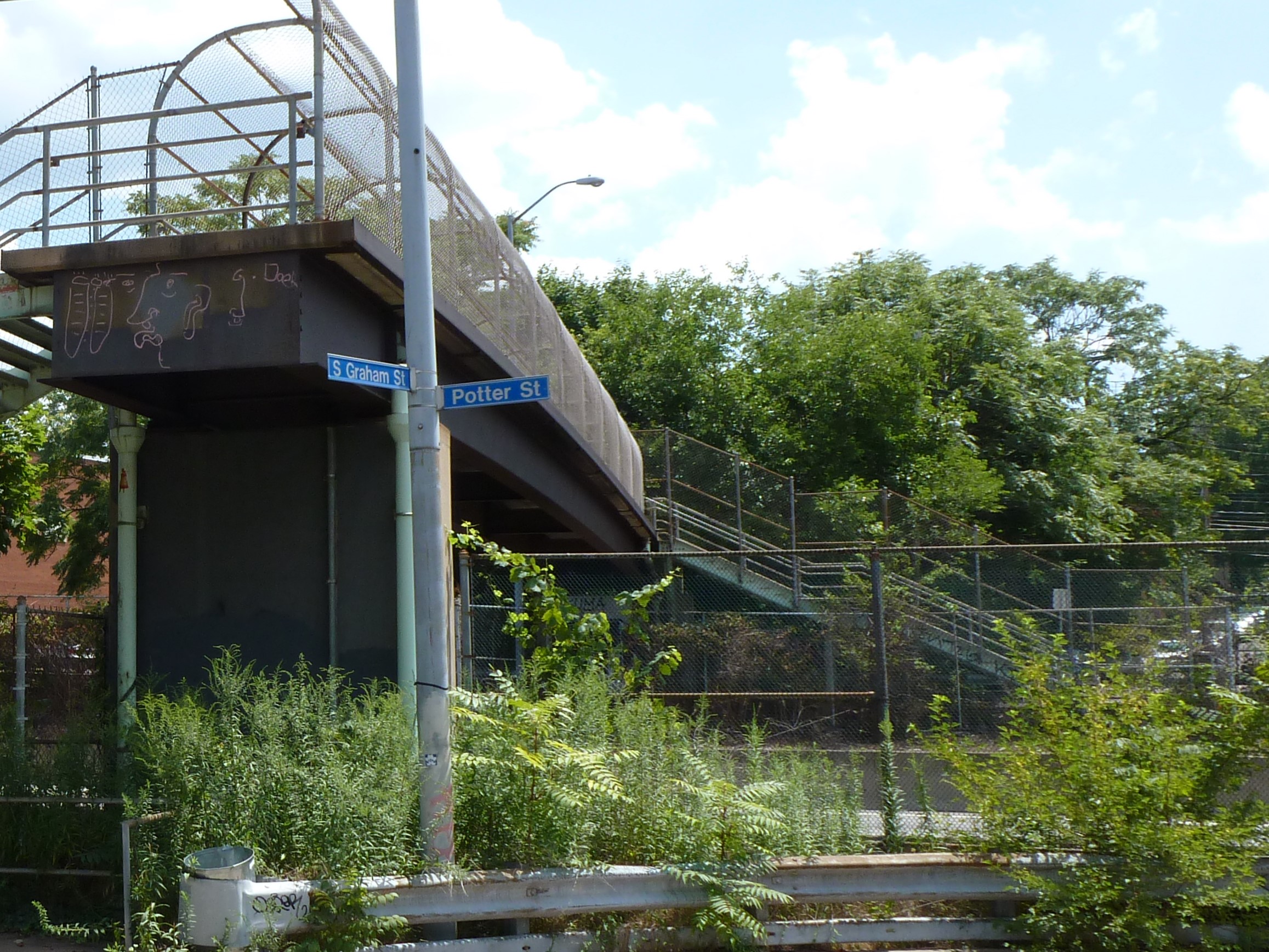
the South Graham Street Pedestrian Bridge
the Melanchton Street Pedestrian Bridge
an abandoned pedestrian bridge in Hazelwood
the South 15th Street Pedestrian Bridge
the South 10th Street Pedestrian Bridge
Pedestrian Bridges over Roads
From east to west, the bridges that pass over roads are:
the Eliza Furnace Trail Bridges over Swinburne Street
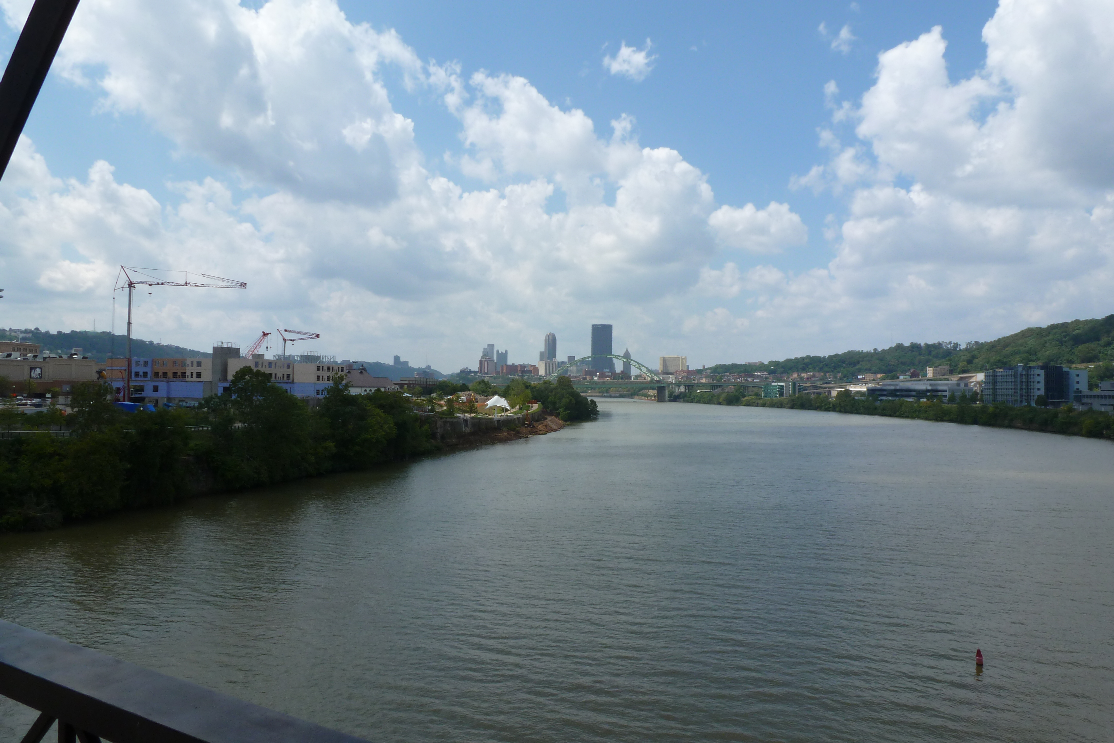
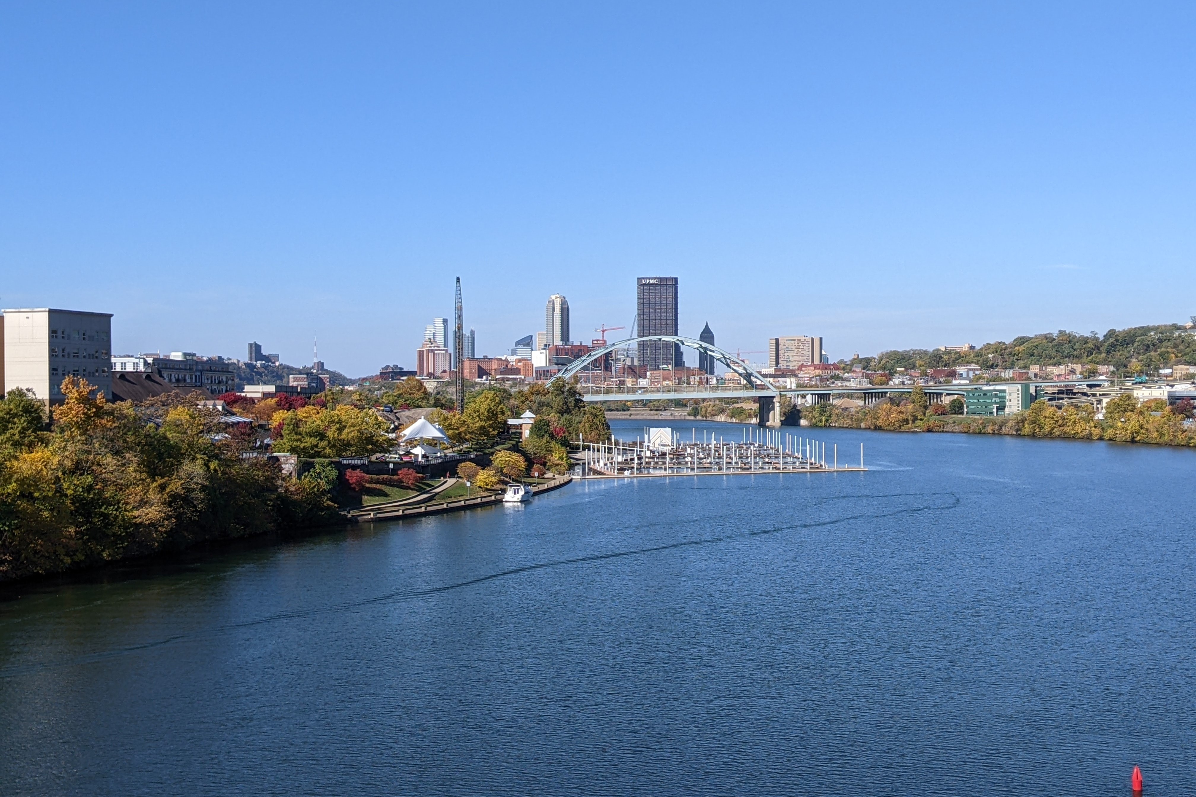
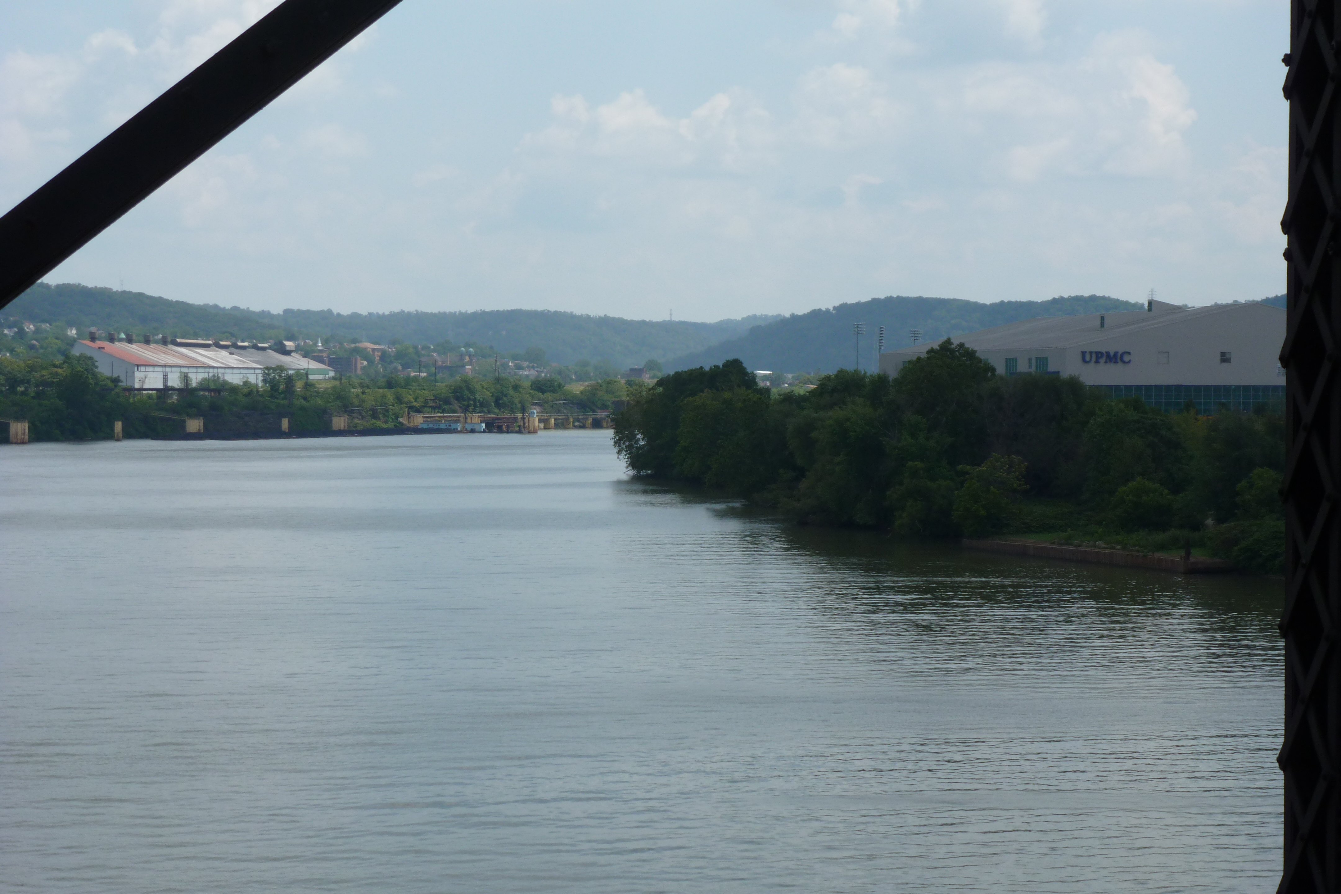
The final bridge in our 10-year anniversary look back at the Pittsburgh bridges and their environs is the Hot Metal Bridge. This is upriver from the Birmingham Bridge and the last bridge on the Monongahela before the big bend that hides downtown from view.
The Hot Metal Bridge was built to connect the Jones and Laughlin Steel Mill’s sites on opposite sides of the Monongahela River. With the industrial decline of Pittsburgh’s steelmaking industry in the mid- to late-20th century, Jones and Laughlin’s operations ceased over the 1980s. The first redevelopment of a portion of their property began in 1981. The redevelopment continues today.
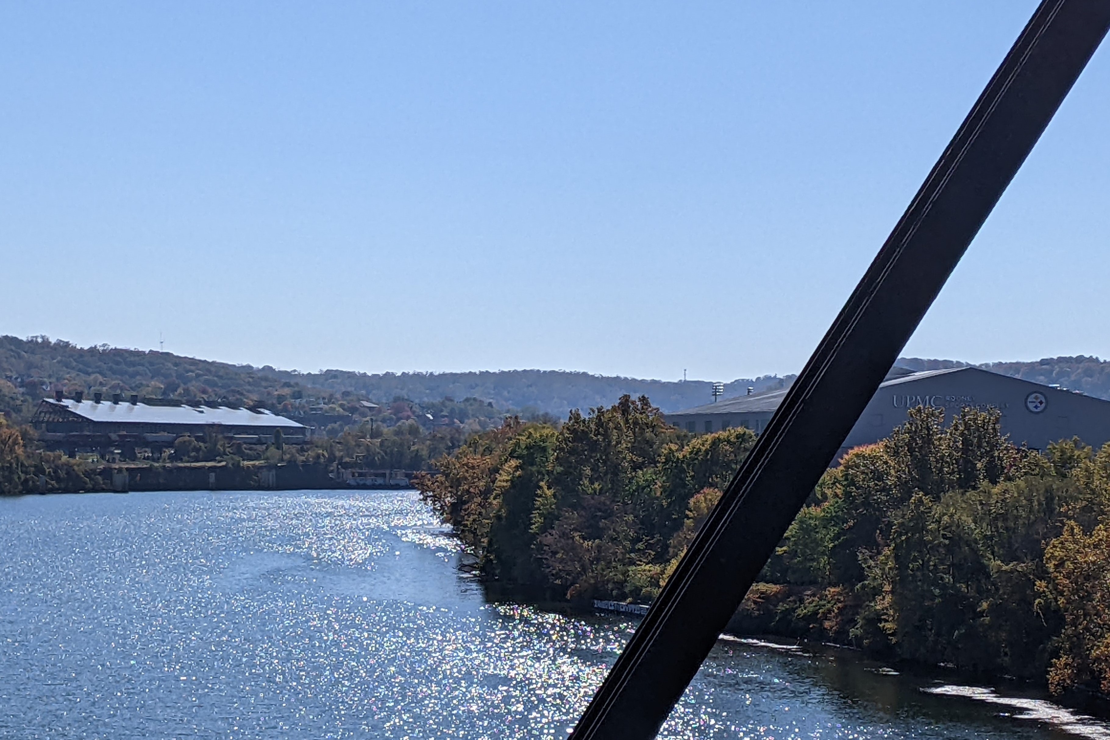
On the south side of the river, the former site of milling operations is now the South Side Works shopping, dining, and residential area. Since 2012, the first marina in the city limits was added here and buildings under construction have opened (first photo pair), other buildings not pictured have been added.
On the north side downriver, the former site of the blast furnaces is now the Pittsburgh Technology Park containing office buildings, parking, and a hotel. The hotel was added in the last ten years as well as several other buildings outside the frame in the second and third set of photos.
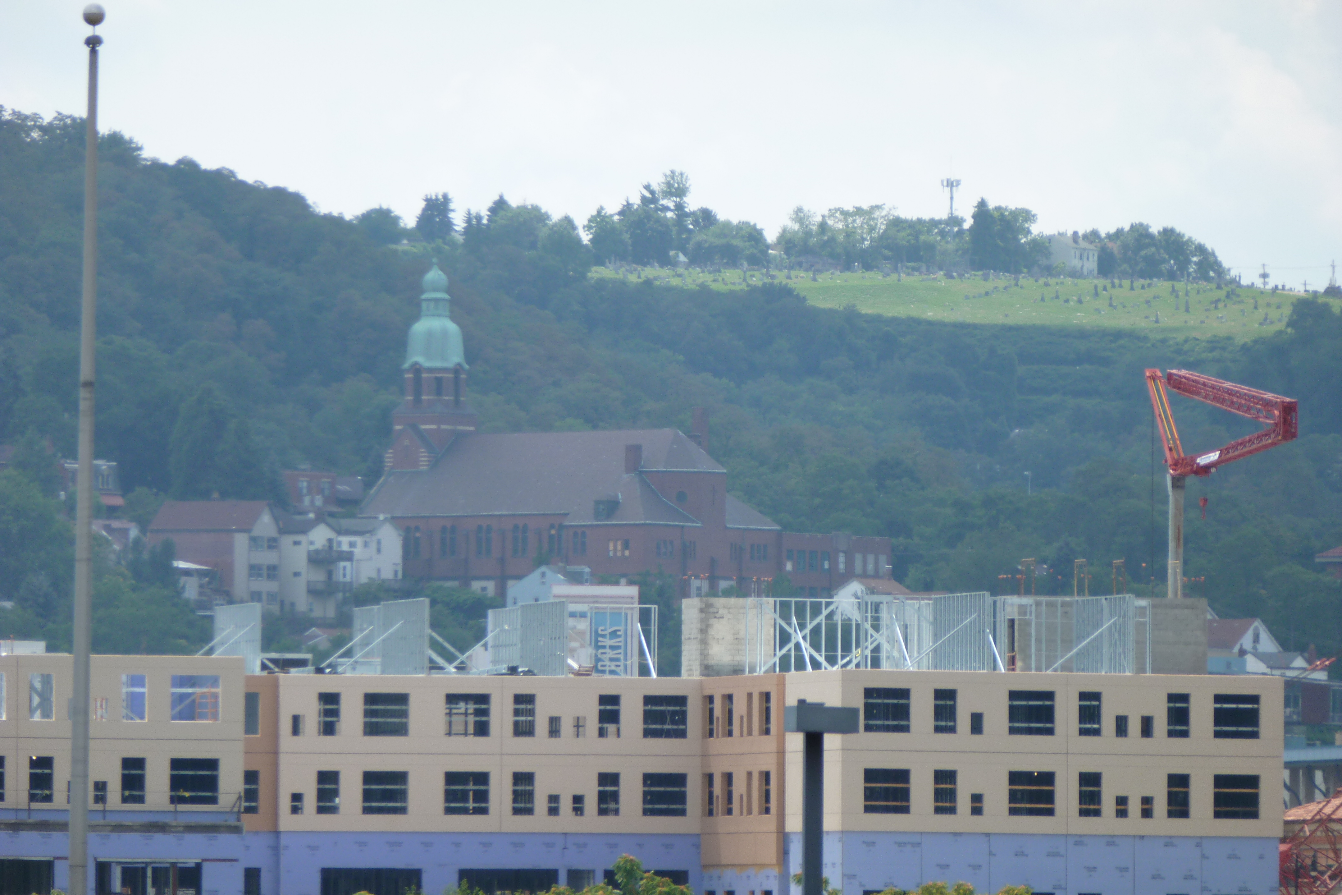
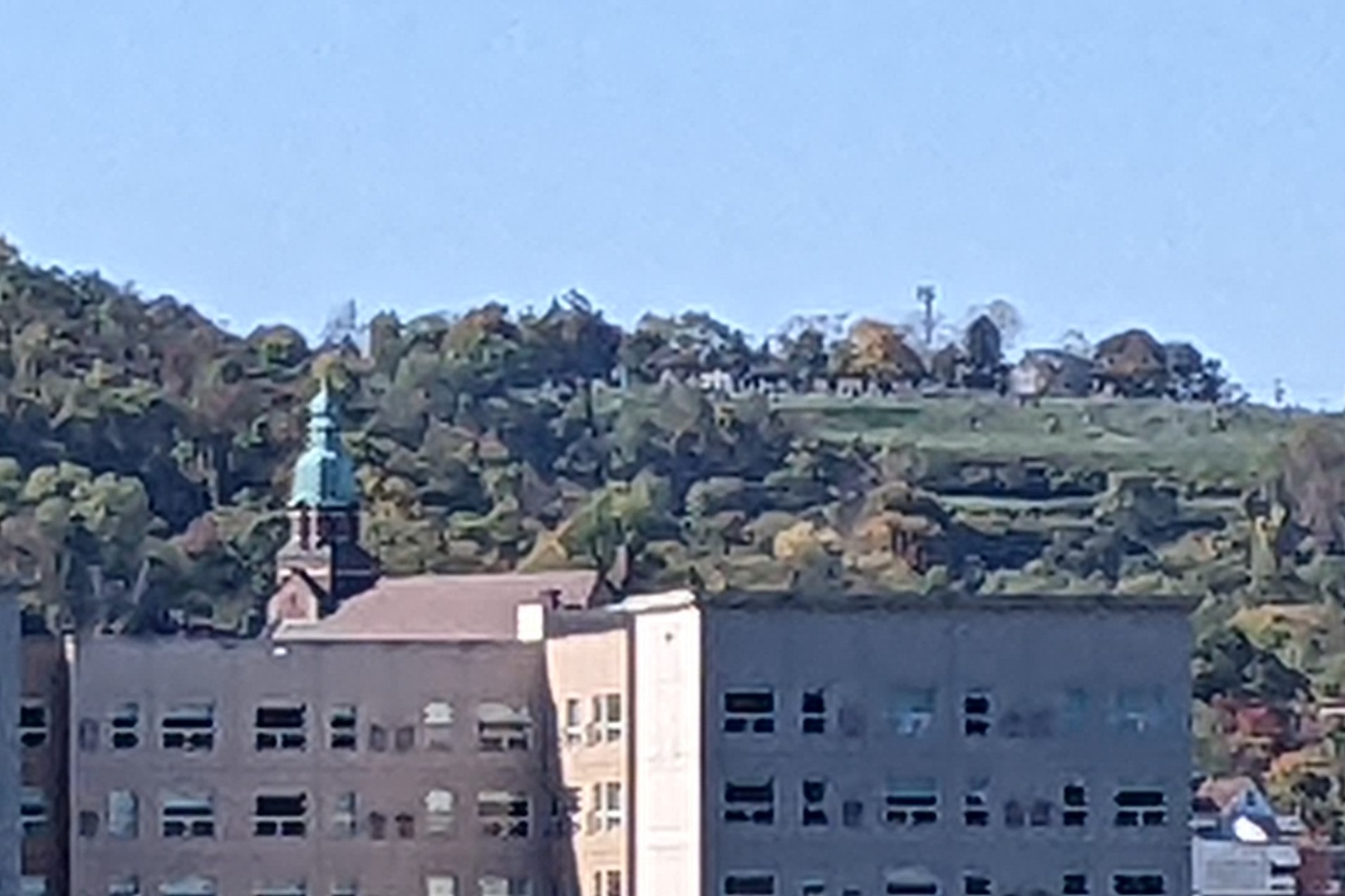
On the north side upriver, the former Hazelwood Works is now the Hazelwood Green site a planned mixed-use, multi-block redevelopment. The remaining mill buildings on the site have been redeveloped as office and research facilities with the Mill 19 building visible on the left side of the river in the fourth photo pairing. The space between and around these buildings is expected to be filled in with other buildings of a variety of uses in the coming years.
The final photo pair features the former St Josaphat’s Catholic Church on the South Side Slopes, which is a building I have an eye as one of Pittsburgh’s pending adaptively reused religious buildings. This view shows another angle of the growth of the South Side Works development.
While both South Side Works and the Pittsburgh Technology Park were substantially developed by 2012, they continue to expand. On the other hand, Hazelwood Green is just beginning to be developed and is still predominantly vacant land. In another 10 years, perhaps, the upriver view from the Hot Metal Bridge will be significantly altered.
View of South Side Work – July 2012View of South Side Works – October 2022View of Cathedral of Learning – July 2012View of Cathedral of Learning – October 2022View of Second Ave – July 2012View of Second Ave – October 2022View of Hazelwood Green – July 2012View of Hazelwood Green – October 2022View of former St Josaphat’s – July 2012View of former St Josaphat’s – October 2022
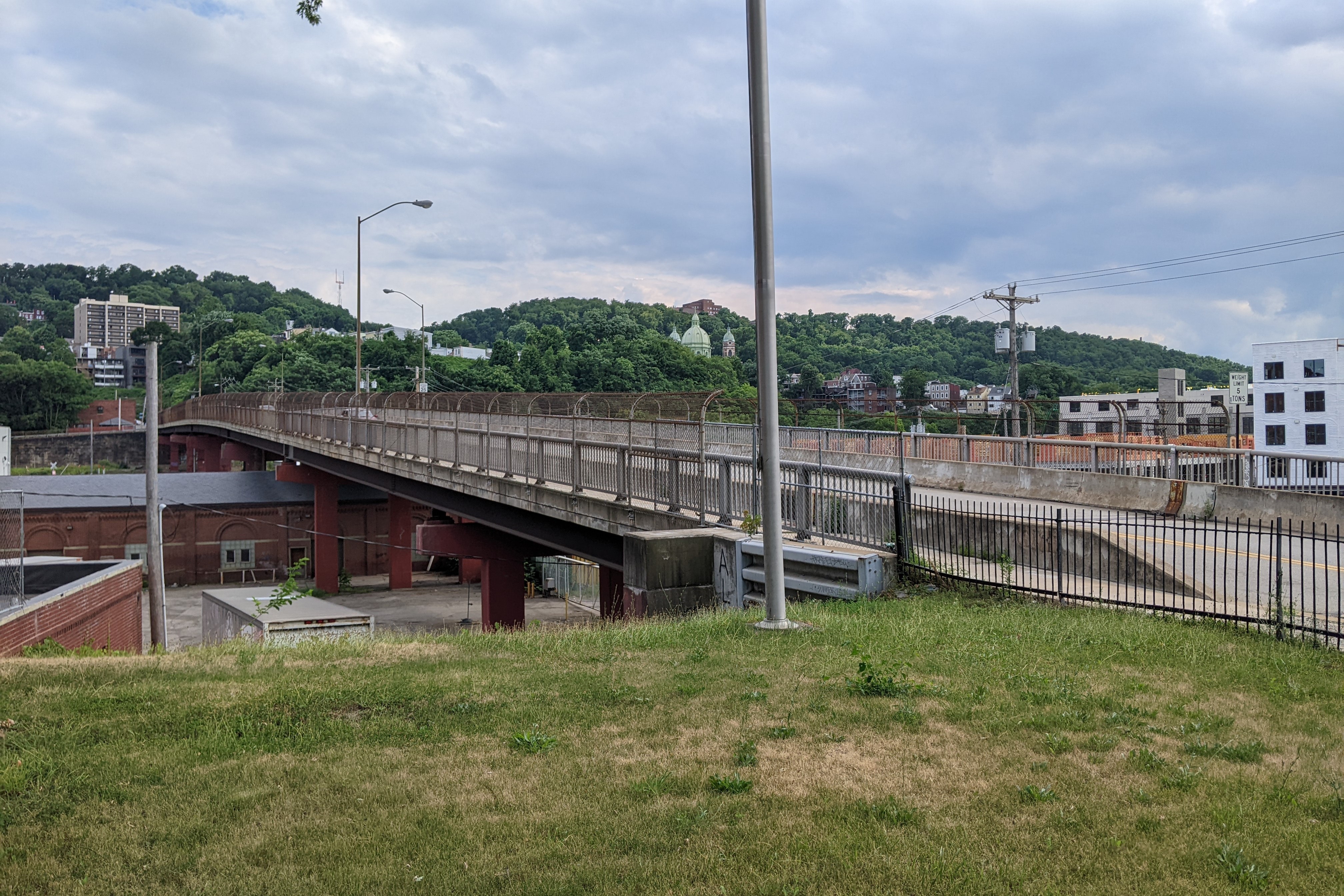
Our next stop on the 10-year anniversary series looking at the changes to and around Pittsburgh’s bridges is the Herron Avenue Bridge. This is another bridge that passes over the MLK Jr or East busway. Traveling down the busway toward downtown from the Baum and Centre Bridges we looked at last month, this bridge is three bridges closer to downtown. It connects the Polish Hill and Lawrenceville neighborhoods in Pittsburgh.
On the northeastern side of the bridge is the former Iron City Brewery. When I walked this bridge in 2012, there were plans in the works to redevelop this complex of 20 or so buildings. Ten years later, not much has changed on this site – other than the clearing away a large pile of dirt and debris near the loading docks (visible in the second photo pair below). According to new articles about the site published in 2019 and 2021, some exterior stabilization has occurred and there are still plans in the works to renovate the site (WPXI, CBS, City Paper, Pittsburgh Business Times).
One the other side of the bridge, a major transformation is underway changing from a warehouse with large parking lots to a dense mixed-use development. The new buildings are visible from many angles of and from the bridge (see all but the second photo pair below). Construction started last summer and the project website says that pre-leasing was to begin in spring of this year, but based on the information on the website it doesn’t look like this has begun yet. One of the amenities listed is the views, which include the views of downtown stolen from the bridge.
Herron Ave Bridge south view (August 2012)Herron Ave Bridge south view (July 2022)Iron City Brewery Loading from Herron Ave Bridge (August 2012)Iron City Brewery Loading from Herron Ave Bridge (July 2022)Herron Ave Bridge looking toward Downtown 1 (August 2012)Herron Ave Bridge looking toward Downtown 1 (July 2022)Herron Ave Bridge looking toward Downtown 2 (August 2012)Herron Ave Bridge looking toward Downtown 2 (July 2022)Herron Ave Bridge south view (August 2012)Herron Ave Bridge south view (July 2022)
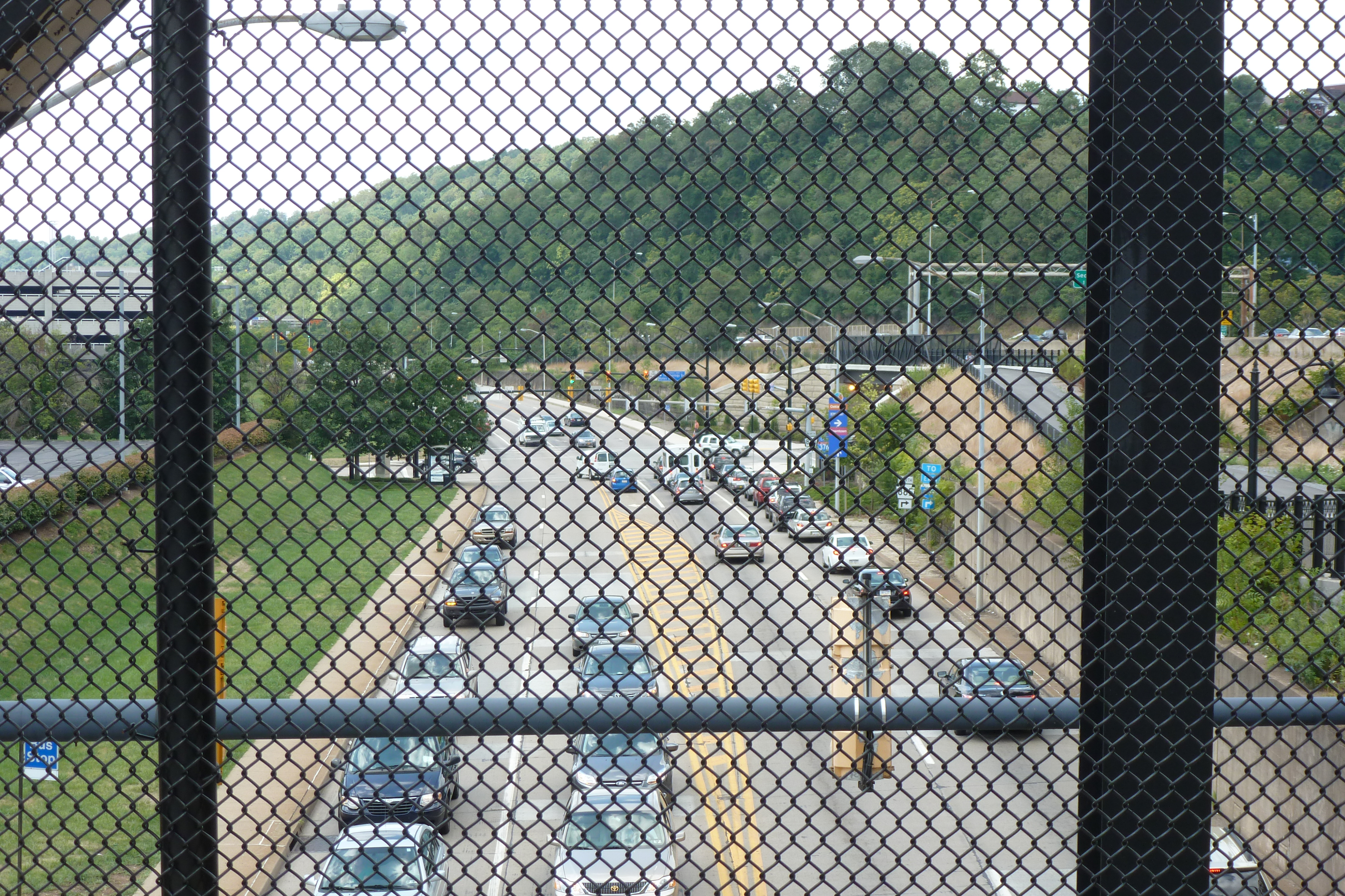
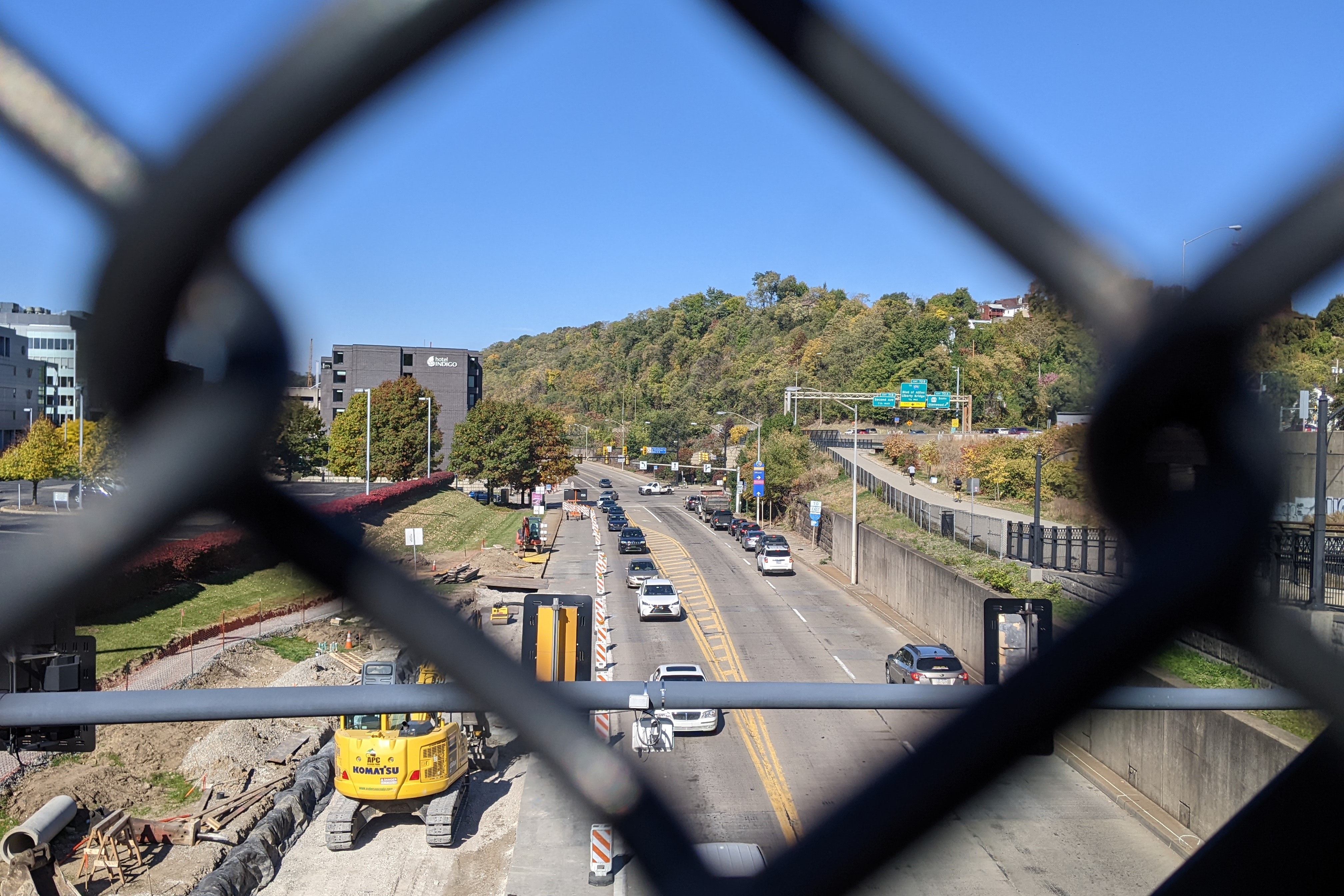
The next look back at the bridges I first walked 10 years ago moves “downstream” or toward downtown on the former riverbed now east busway and railroad route. From the East Liberty Pedestrian Bridge featured in February, the inbound buses and trains pass underneath three bridges in Pittsburgh’s Shadyside neighborhood (the South Negley Avenue and South Aiken Avenue Bridges and the Graham Street Pedestrian Bridge) before reaching the approximately parallel Centre Avenue and Baum Boulevard Bridges. The bus station next to the Negley Avenue bridge is currently under reconstruction, otherwise the three bridges and their surroundings in Shadyside are relatively unchanged – except perhaps for some deterioration due to long deferred maintenance. On the other hand, the surroundings of the Centre Avenue and Baum Boulevard Bridges have seen a couple new developments since I first walked these bridges.
The first of these developments is the Luna Parking Garage for employees of the local, ever-expanding hospital giant UPMC. UPMC Shadyside is on Centre Avenue two blocks away from this new(ish) garage on Baum Boulevard. Work had already begun on the parking garage when I walked by in 2012. The permit in the first photo in the then & now sets below is to finish the demolition of the structure formerly on the site. In the paired photo, the landscaping appears in good condition several years after completion of the construction. The second set of photos shows the formerly sloped site change into a massive retaining wall with multi-level garage. On a side note: the “Luna” in the garage’s name is a reference to the Luna Park amusement park that had a short life in the early 1900s on a site across the tracks and two blocks up the hill.
Between the Baum Boulevard and Centre Avenue Bridges is a site that has had a much longer life. Originally a Ford plant and showroom, this building and site were redeveloped by the University of Pittsburgh (Pitt) into a research and development space with laboratories, offices, an auditorium, and parking (Pittsburgh Business Times, May 5, 2022). Prior to the redevelopment, this site had caught my eye as I rode the bus by every day on my way to Pitt. The floating doorways and loading docks captured my imagination. My imagination now speculates that these openings were used to create connections with the new addition seen in the fourth photo pair. The pedestrian experience walking by the sloped parking lot in the early 2010s wasn’t pleasant. While the sidewalks felt larger now, the experience was still unpleasant as I felt like I was walking through a pedestrian unfriendly loading and service area while the cantilevered building towering over me felt oppressive. The final photo pair shows the sidewalk experience on both sides of the new addition.
Intersection of Luna Garage site and Baum Blvd Bridge (July 2012)Intersection of Luna Garage site and Baum Blvd Bridge (June 2022)Northwest view from Baum Blvd Bridge (July 2012)Northwest view from Baum Blvd Bridge (June 2022)Baum Blvd Bridge from Centre Ave Bridge (July 2012)Baum Blvd Bridge from Centre Ave Bridge (June 2022)Former Ford Plant from Centre Ave Bridge (July 2012)Former Ford Plant from Centre Ave Bridge (June 2022)Centre Ave Bridge from Baum Blvd Bridge (July 2012)Centre Ave Bridge from Baum Blvd Bridge (June 2022)Centre Ave side of new addition to former Ford Plant (June 2022)Morewood Ave side of new addition to former Ford Plant (June 2022)
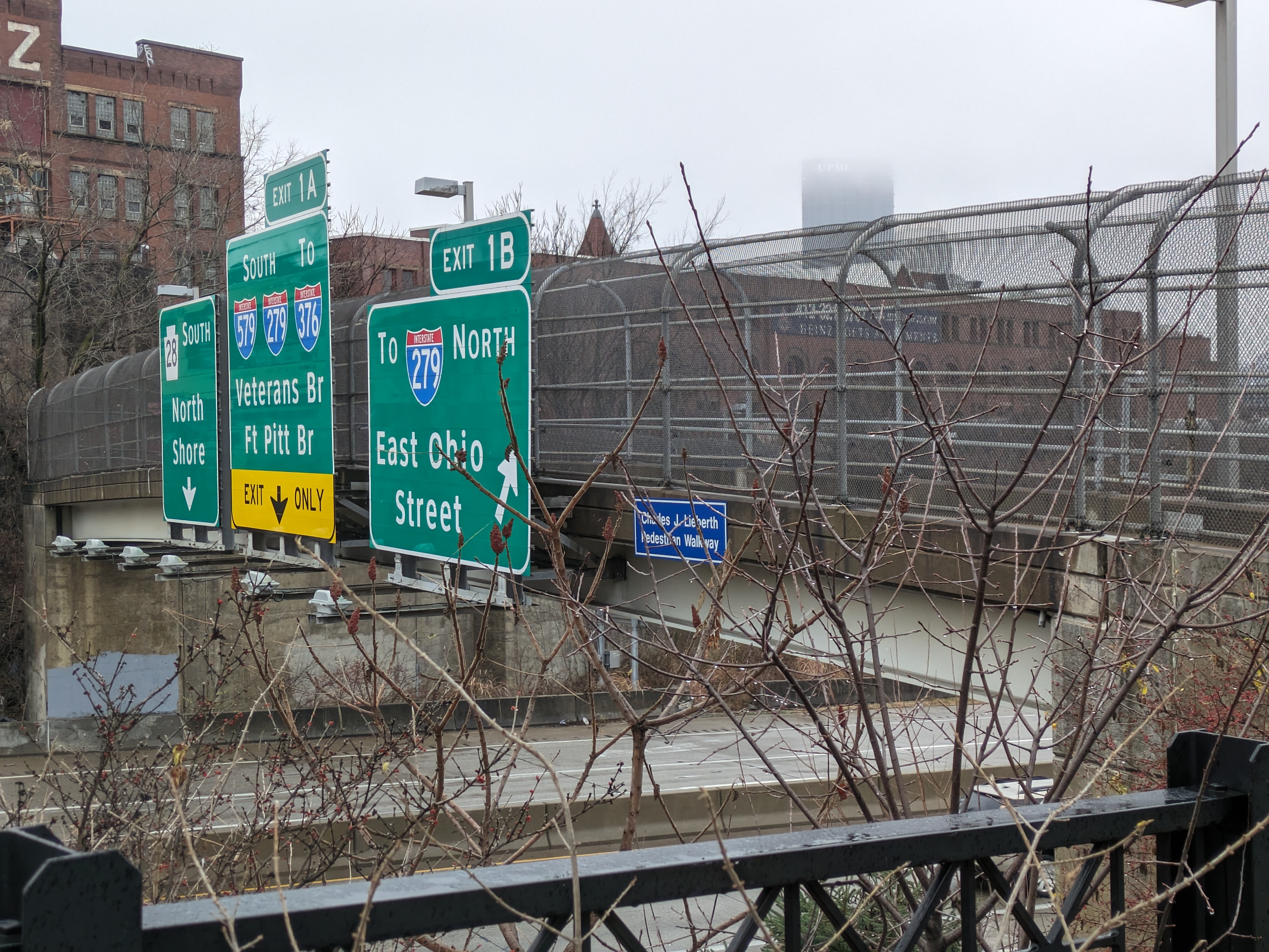
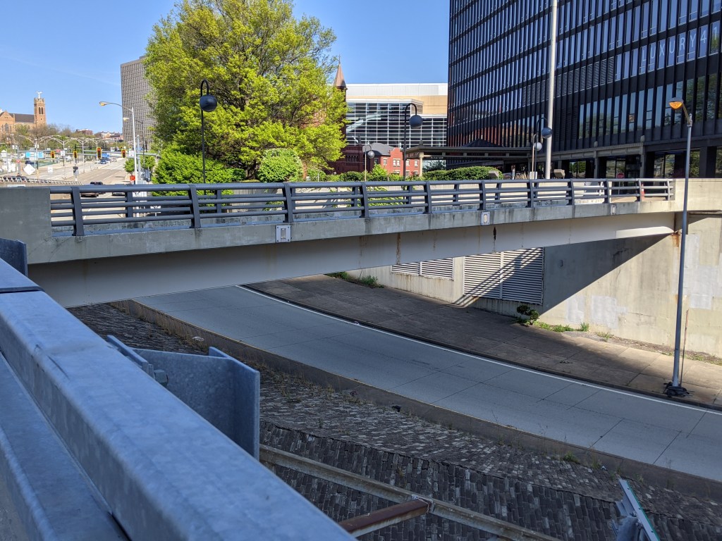
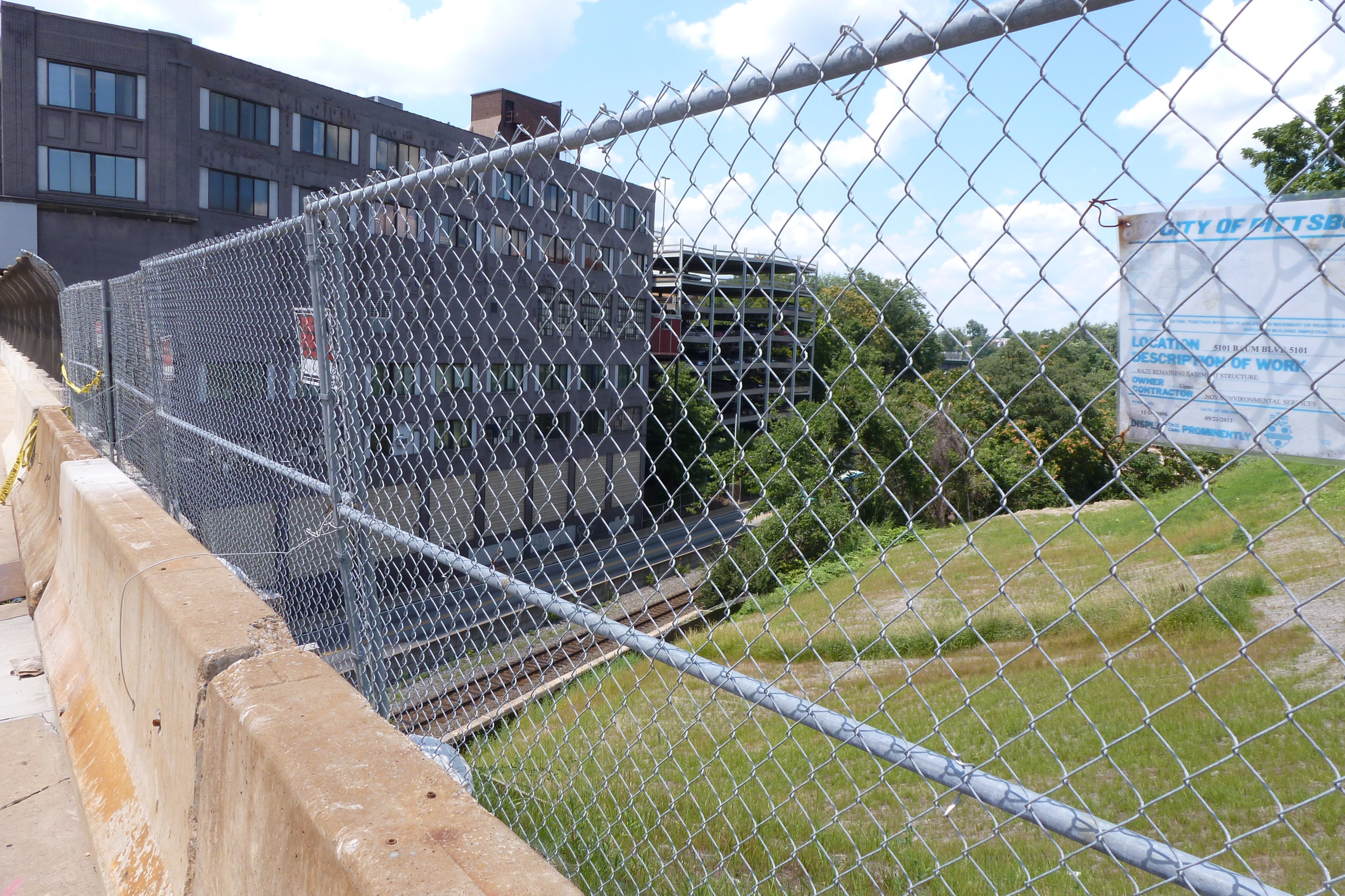
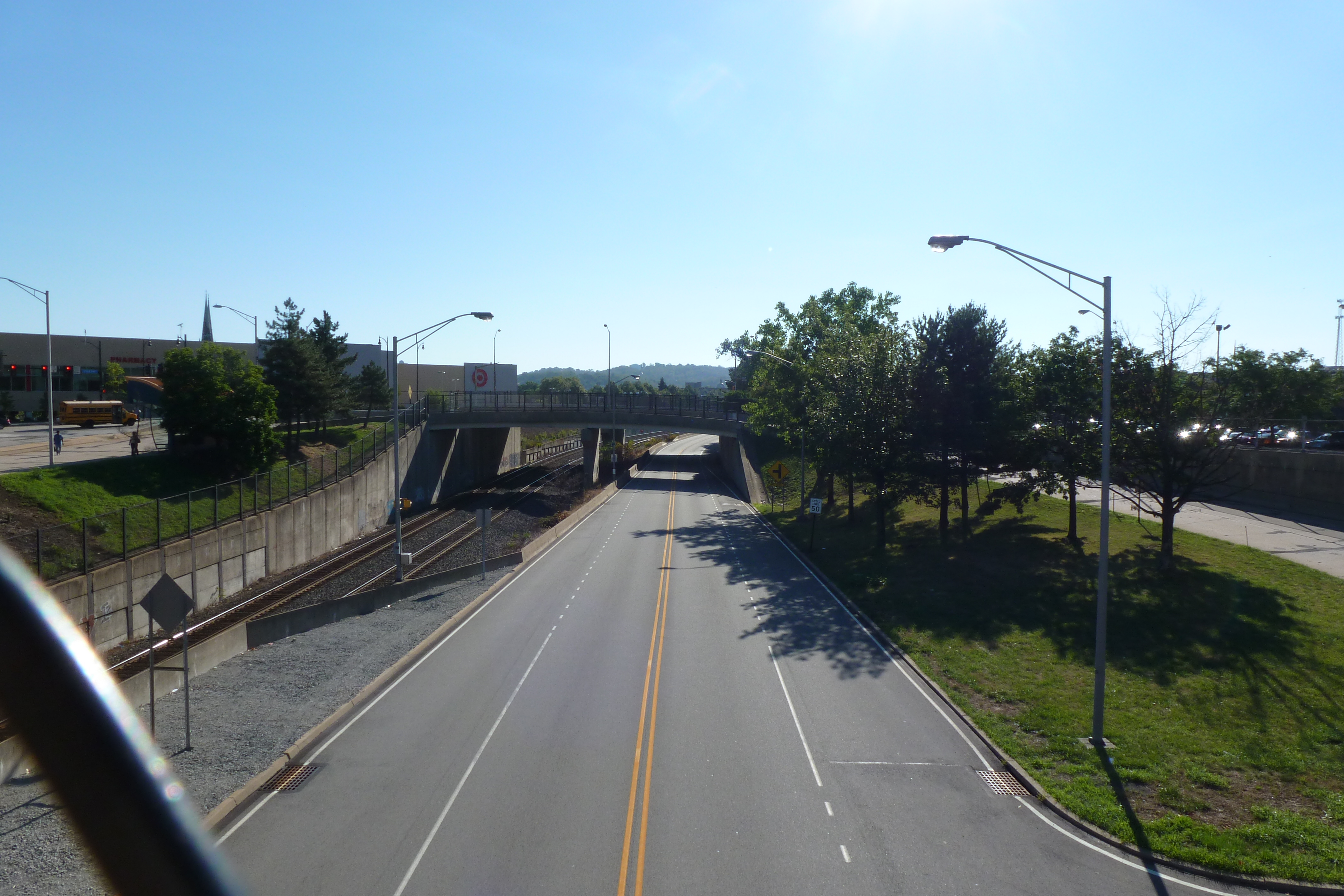
Closing out the East Liberty portion of the Then & Now 10-year anniversary series is the Penn Ave Bridge Ramp. This ramp inspired the second Pittsburgh edition of What is a Bridge?. As best as I can make out from the data on the National Bridge Inventory, the Federal Highway Commission does not consider the ramp a bridge. It is not marked as one of the bridges inventoried by the Commission. And the data for the Penn Avenue Bridge does not include any approach spans. This leaves me wondering who, if anyone, inspects the ramp.
As I cannot find a public source that shares inspection data of the ramp (if it is inspected), its condition rating is anyone’s guess. However, this lack of data may be attributable to the change the ramp underwent in the last ten years. It was originally a ramp for buses to travel from a major bus stop off Penn Avenue onto the East Busway. With the redevelopment of the East Busway Station, this bus stop was redesigned as a regular on-street stop and the ramp was converted to pedestrian access only (second photo set below). The National Bridge Inventory seems to skip over pedestrian bridges as the East Liberty Pedestrian Bridge featured in February is also not listed.
Regardless of the ramp’s condition, its fate now seems tied to the fate of the Penn Avenue Bridge as the gap between the two been filled in with much needed greenspace (first photo set below). The Penn Avenue Bridge was last inspected in May 2020 (which means it probably has been or will be inspected again this month). It received a “poor” condition rating in that inspection – a rating that is worrying for Pittsburghers since the collapse of the “poor” condition Fern Hollow Bridge, despite reassurances from the bridge engineering community that “poor” condition does not necessarily equate to imminent danger.
Penn Ave Bridge with ramp on left – July 2012 Penn Ave Bridge with ramp on left – August 2020Penn Ave Bridge & Ramp from Busway Ped Bridge – July 2012 Penn Ave Bridge & Ramp from Busway Ped Bridge – August 2020
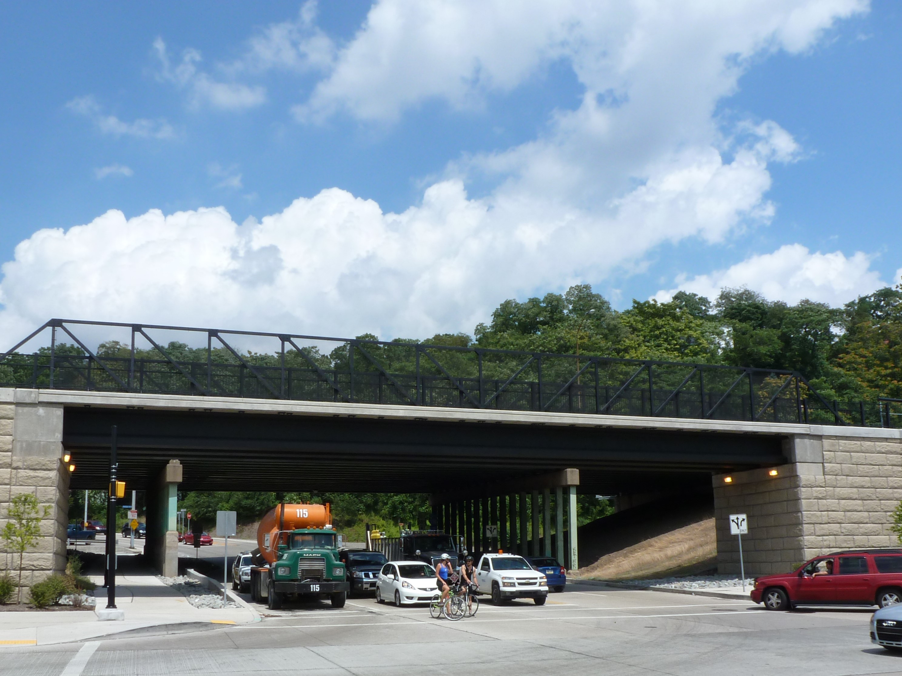
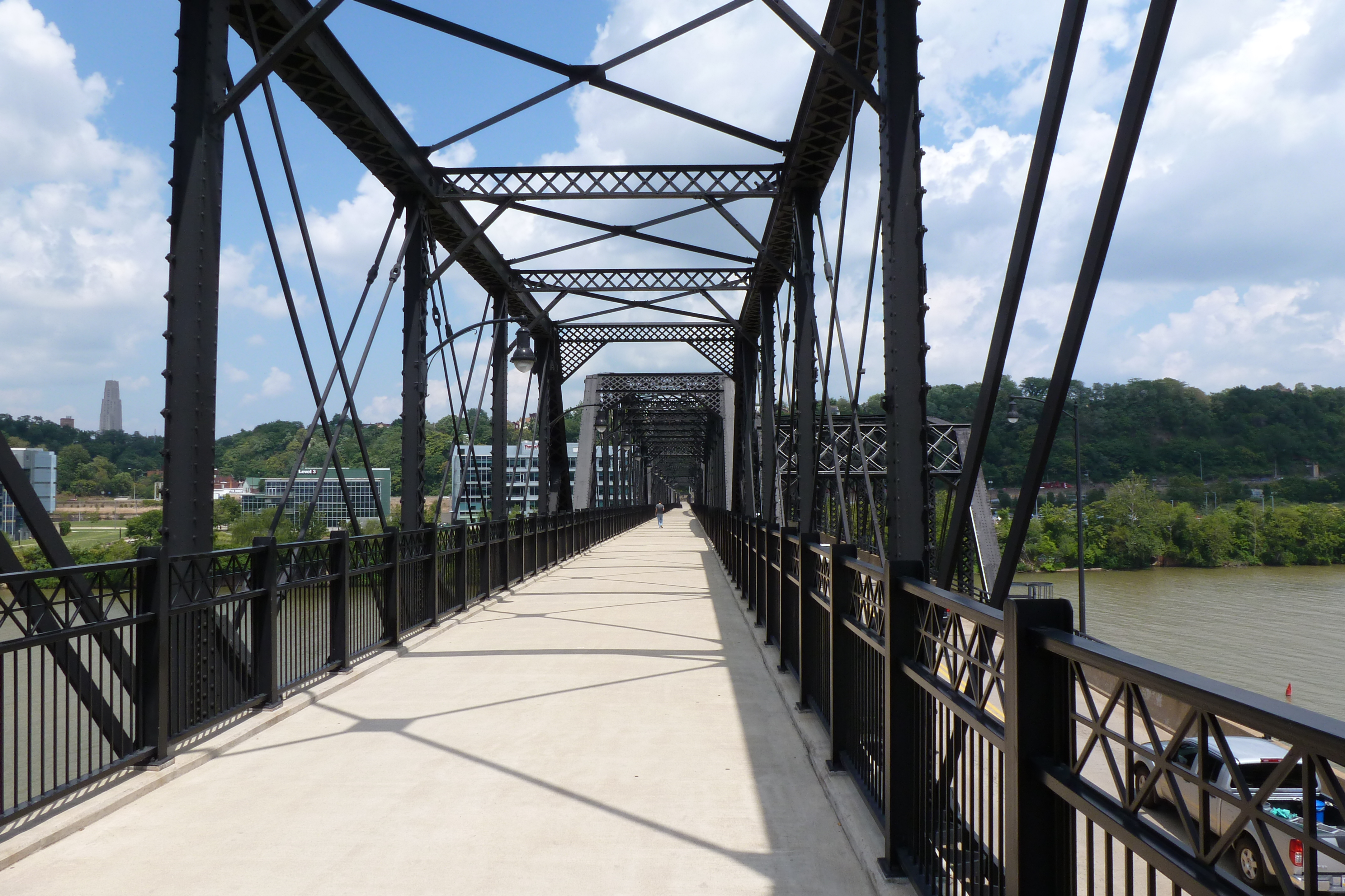
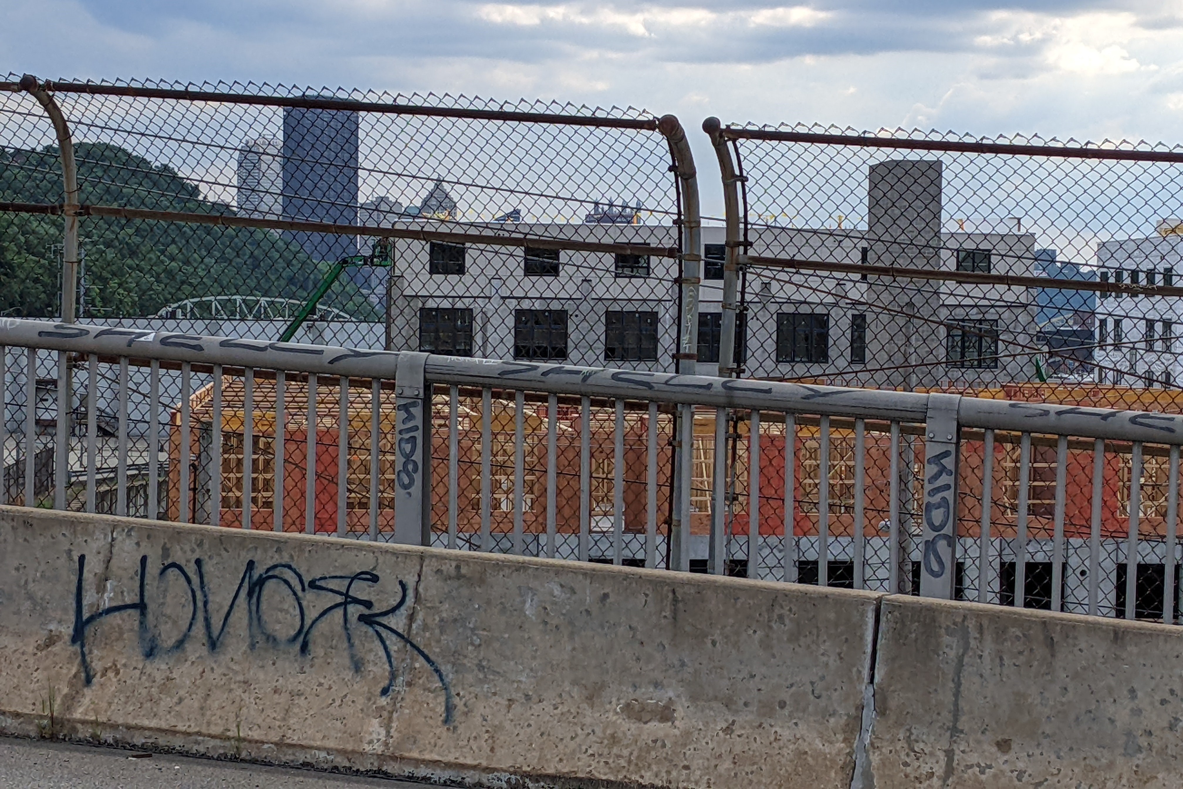
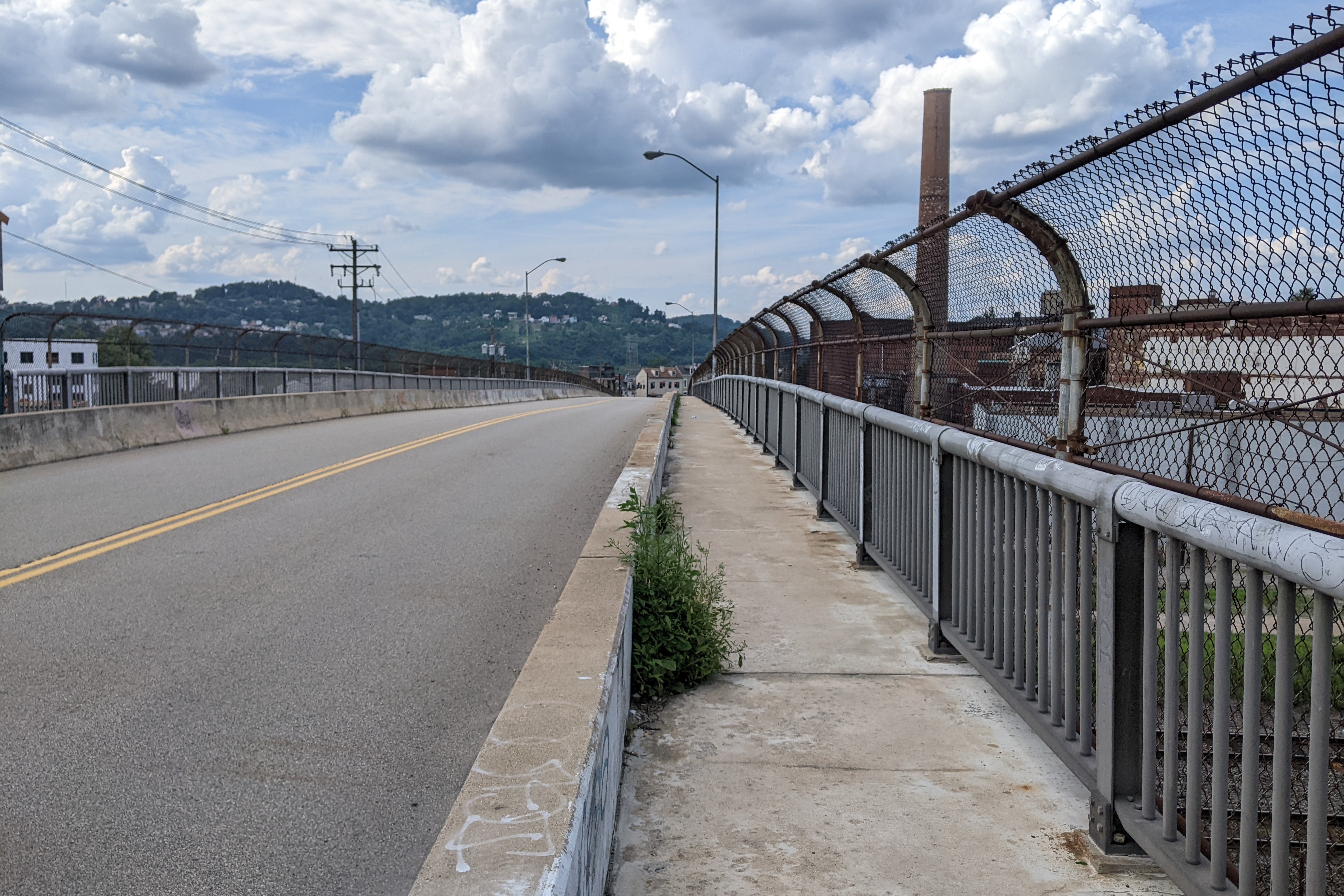
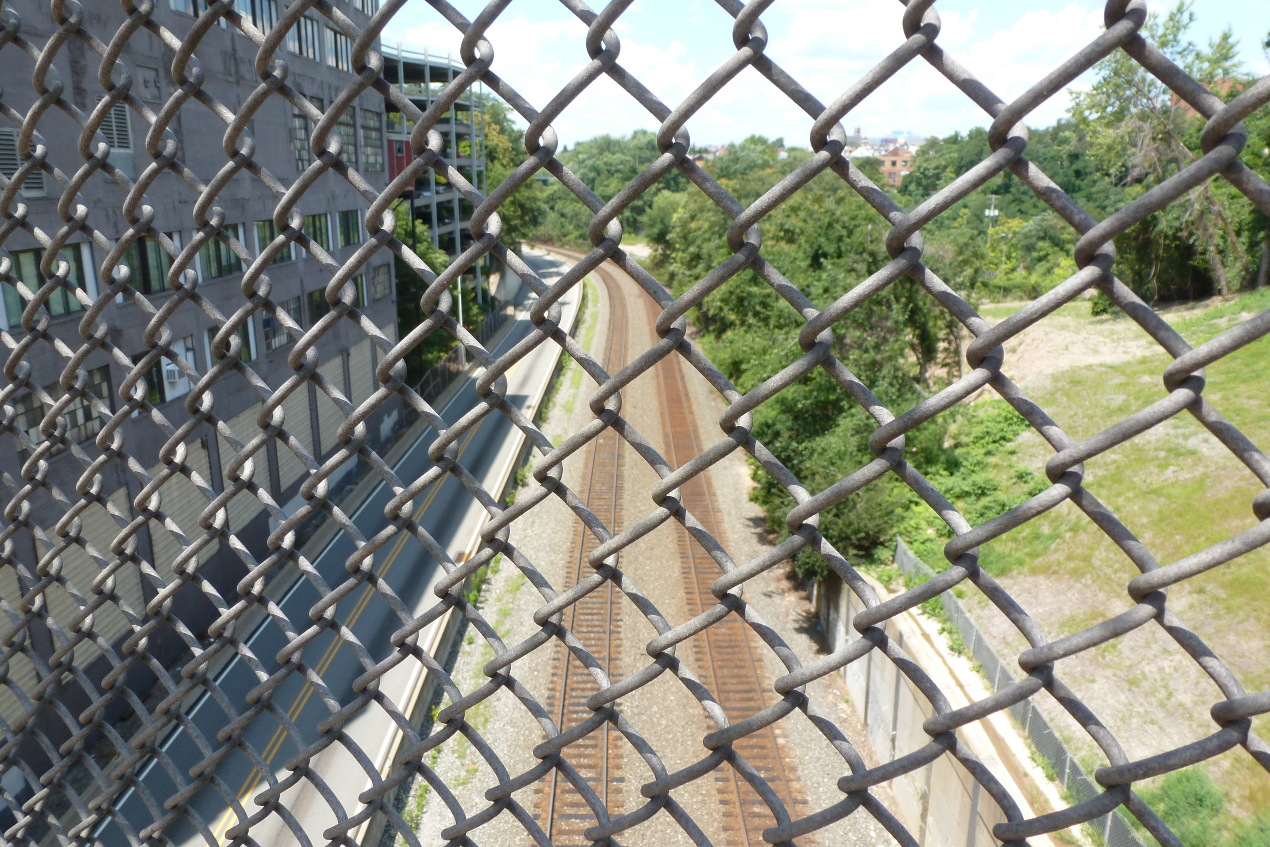
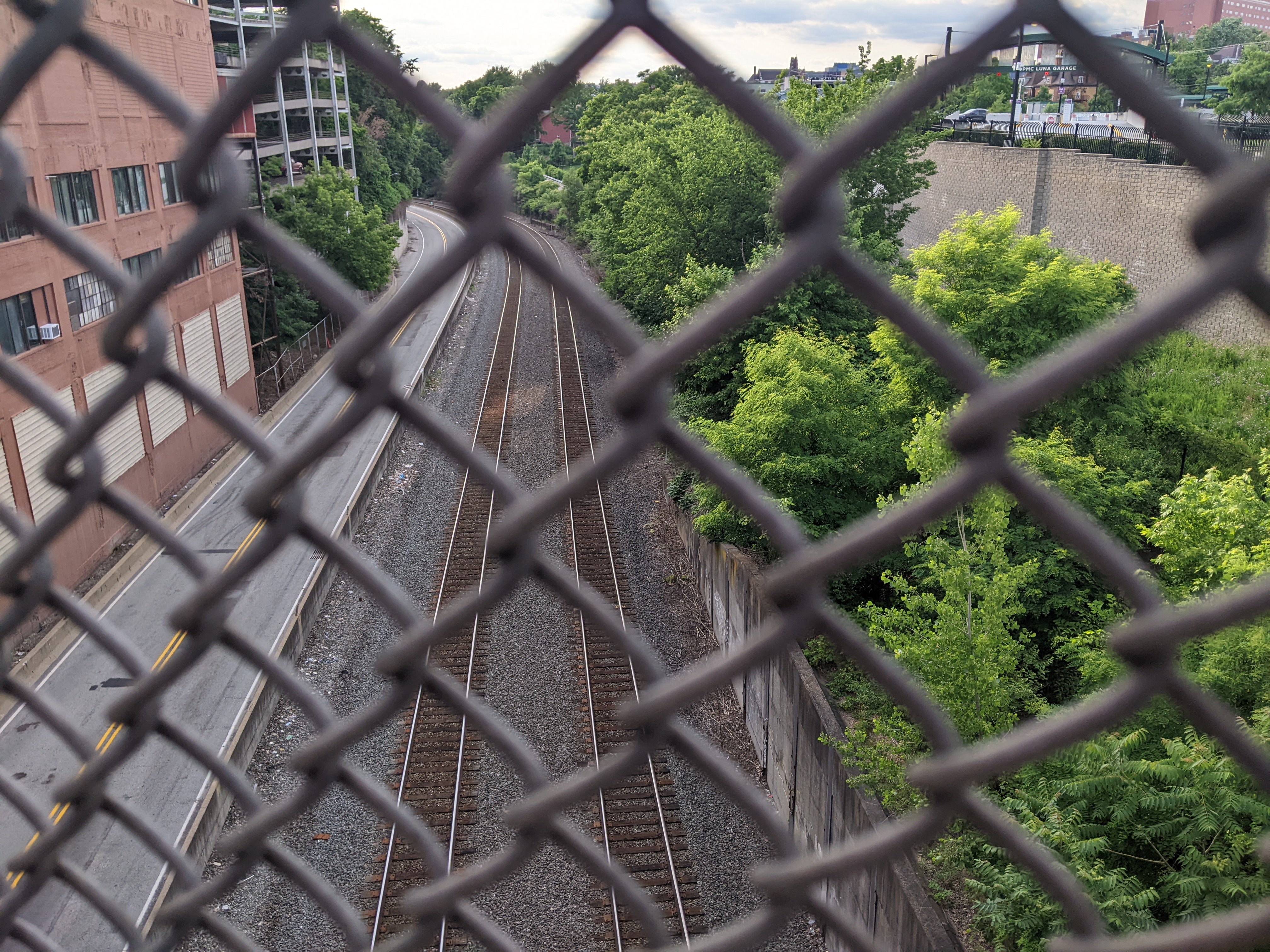
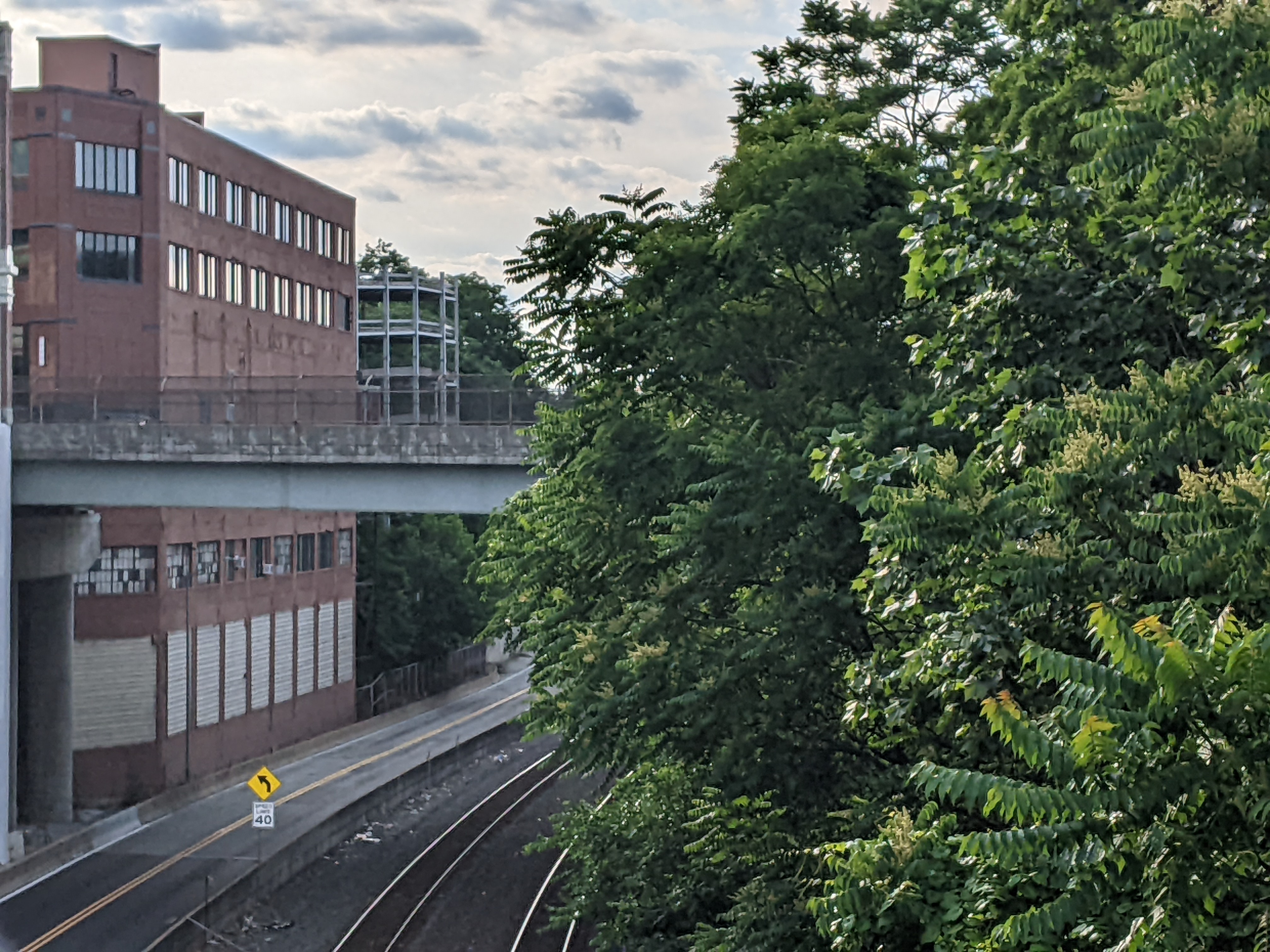
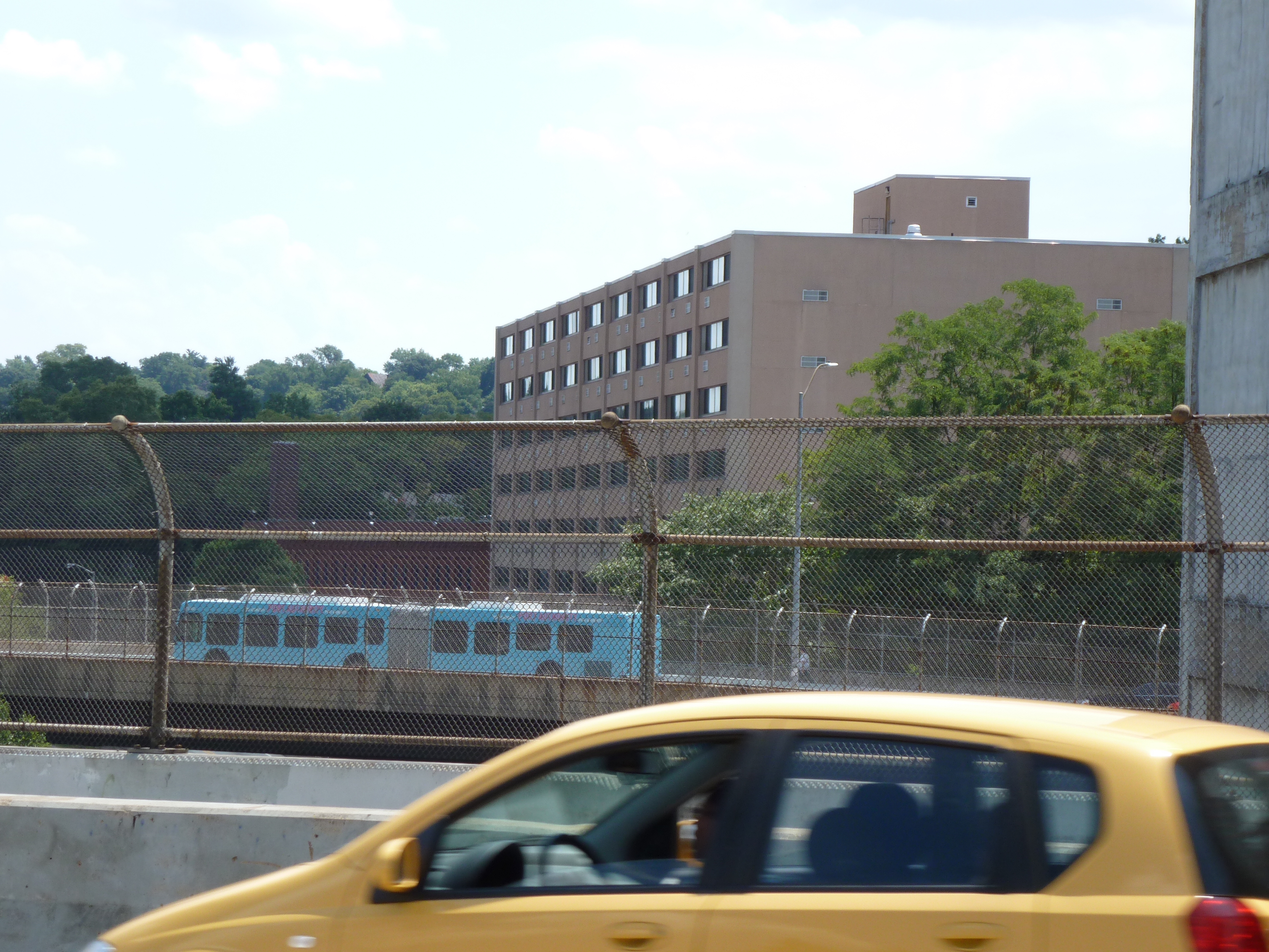
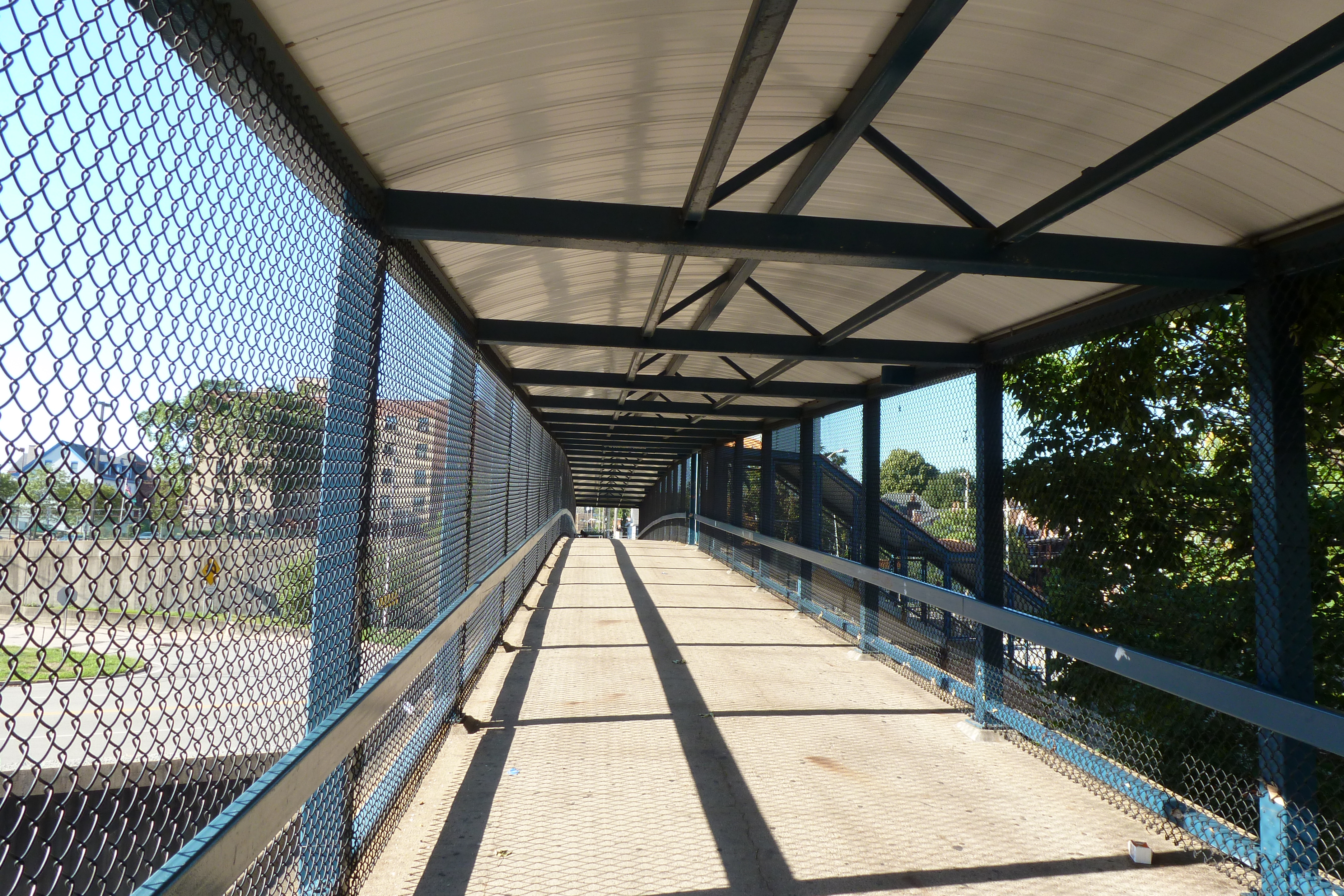
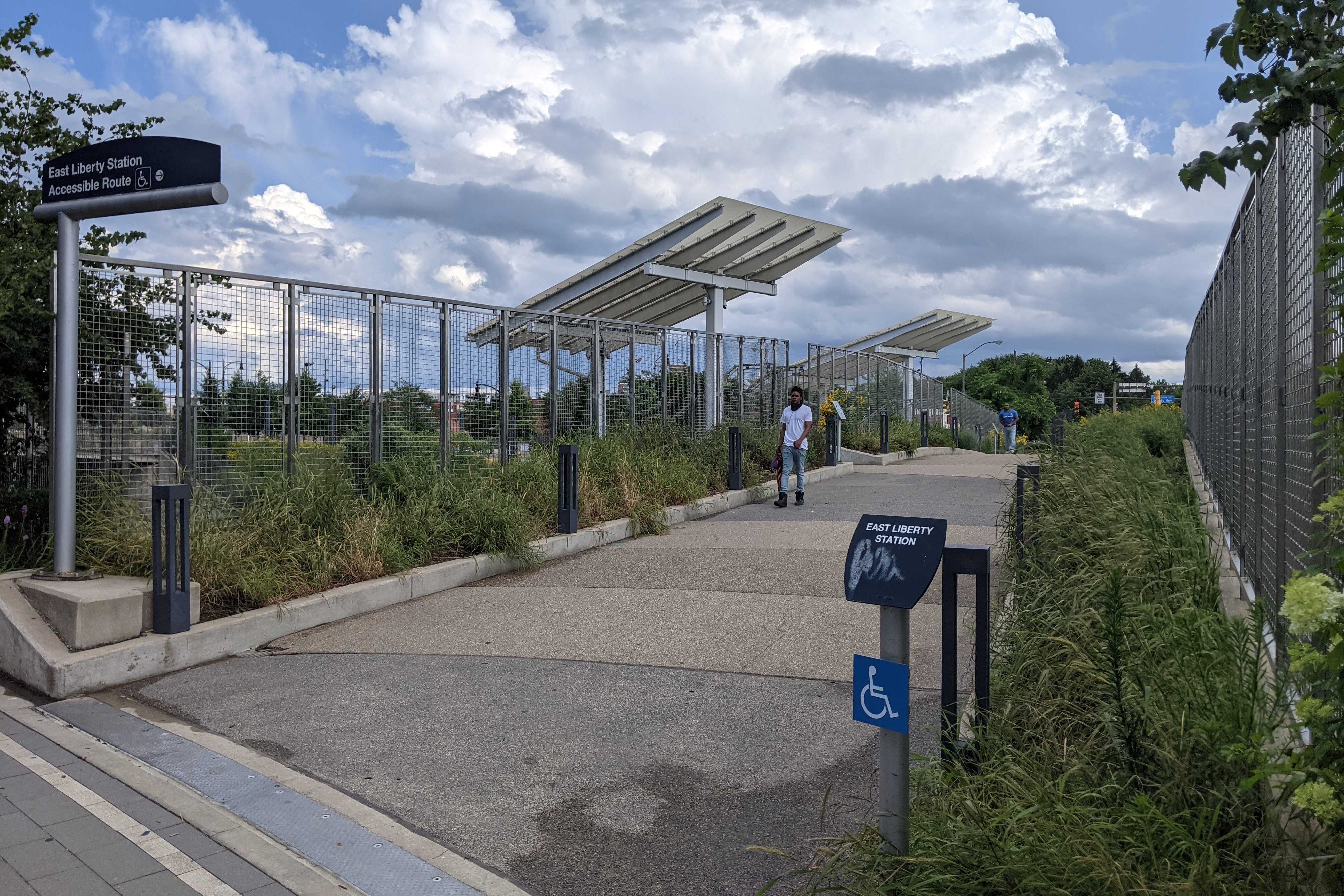
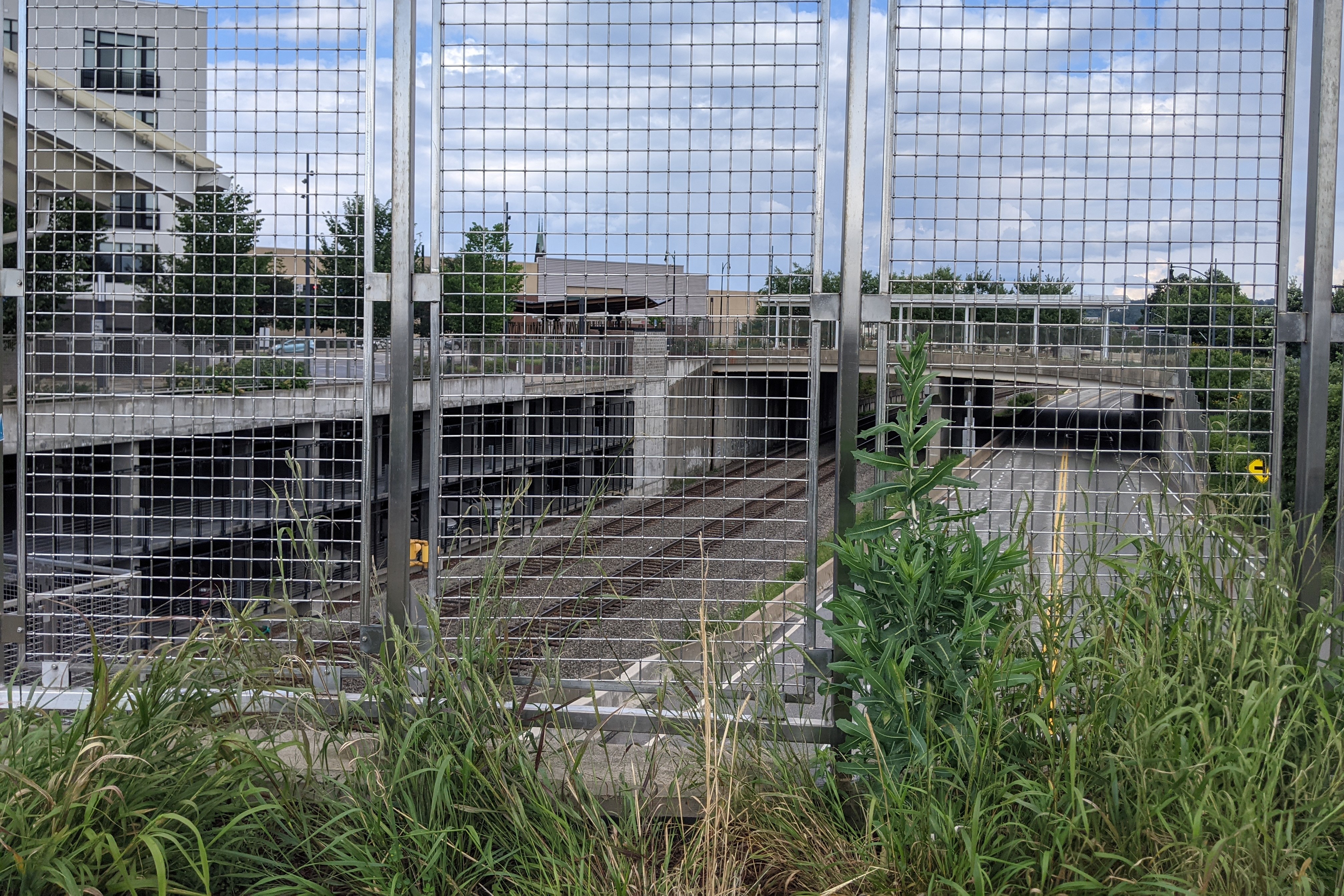
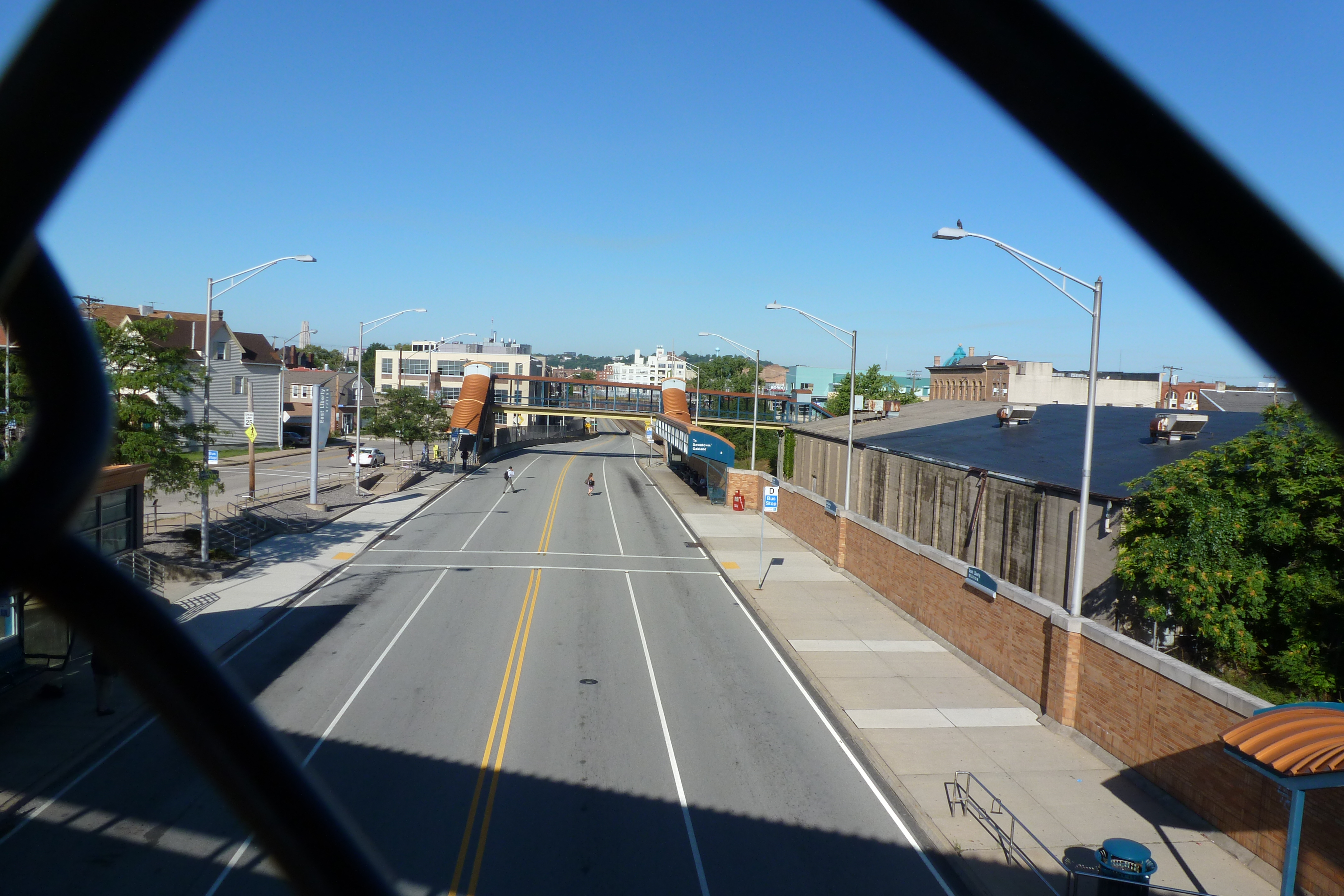
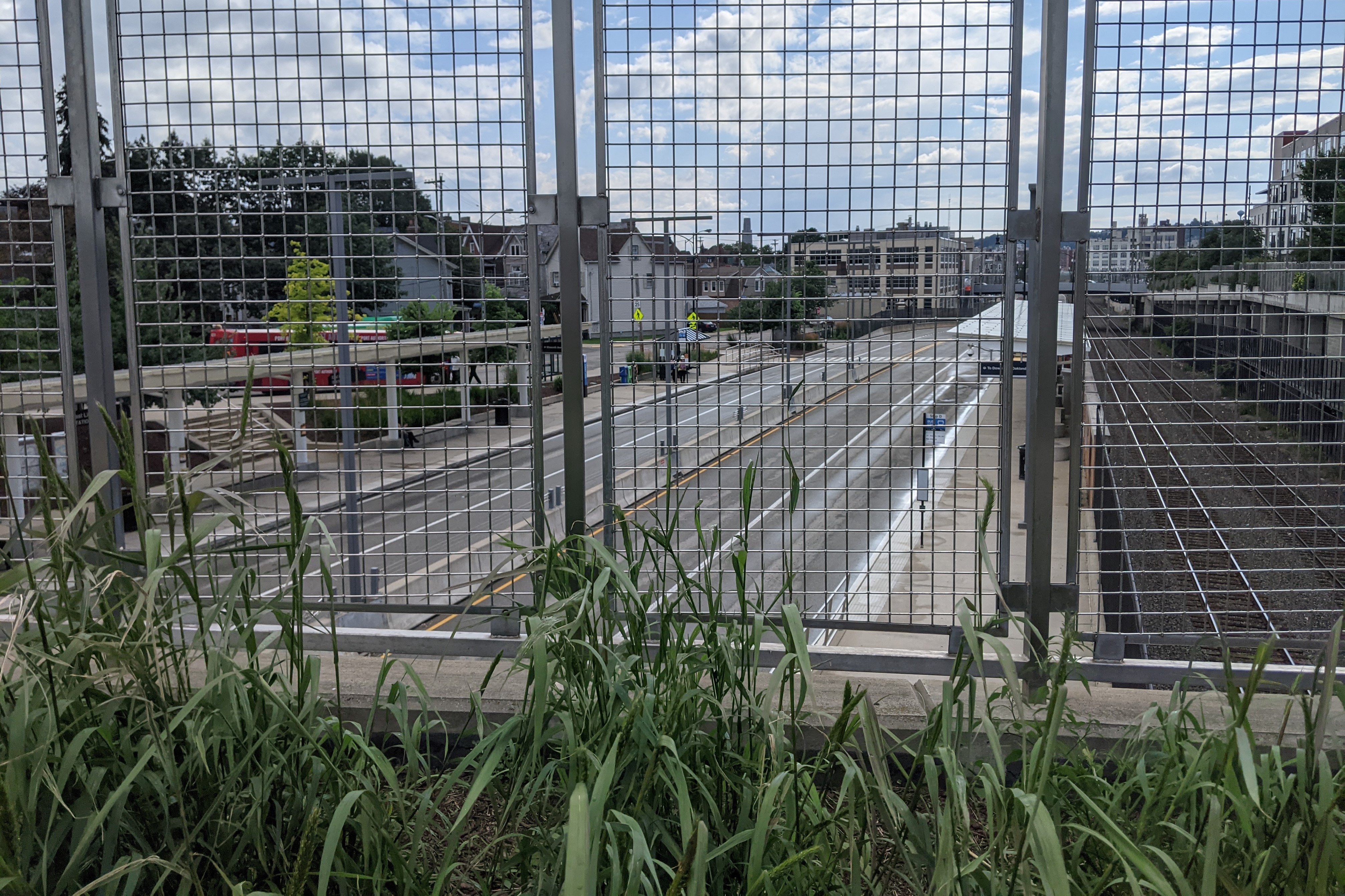
Just beyond the South Highland Bridge from the East Liberty Pedestrian bridge is the busway’s East Liberty Station. When I moved to Pittsburgh over a decade ago, there were two pedestrian bridges over the busway and train tracks – one at either end of the station – and a ramp providing buses on Penn Avenue access to the busway. Across the tracks from the busway was a one-story, graffiti-covered warehouse, a parking lot, and a drive-through bank. Along Penn Avenue and connected by the ramp to the busway was a major bus stop on its own governor’s drive.
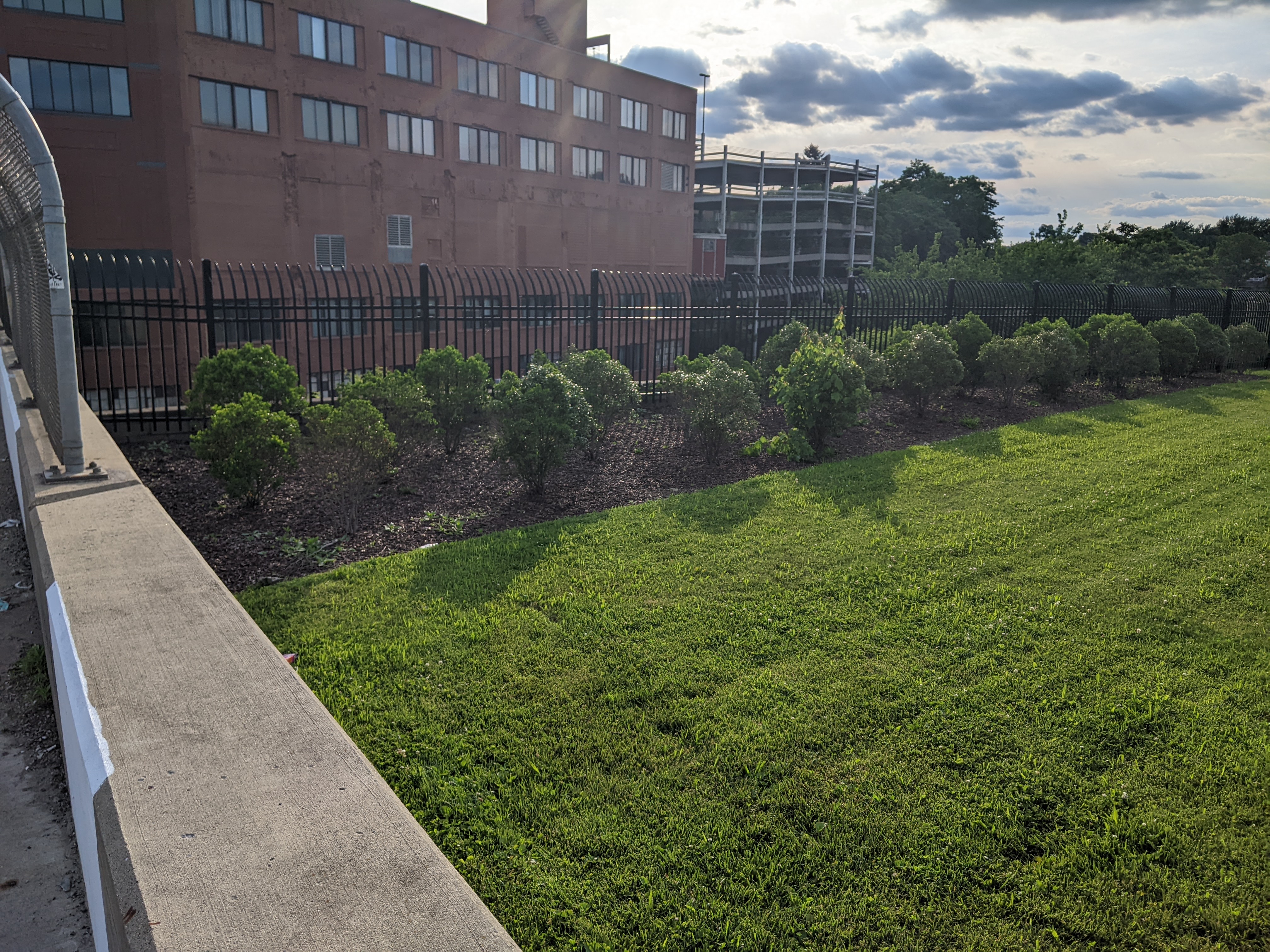
All of this was replaced in 2014-2015 with a transit-oriented development. The two boxed-in (a step beyond caged) pedestrian bridges were demolished and replaced by a new open bridge (first photo pair below) and a crosswalk on the busway. The bus ramp was renovated into an accessible pedestrian ramp (seen in the east view, second photo pair). Plantings were introduced on both the bridge and the ramp, changing this portion of the vast paved, treeless area into a desert oasis. It is still a hot and uncomfortable place to be in the summer months, but at least now there are black-eyed Susans to bring cheer.
The warehouse, parking lot, drive-through bank, and Penn Avenue bus stop were replaced with a massive mixed-use complex called EastSide Bond (glimpsed on the right in the final pair of photos, also visible in the South Highland Avenue Bridge Then & Now post). The new development features 360 residential units, 43,000 sq ft of retail (most of which is occupied, except for the promised anchor tenant), 554 parking spaces in a garage under the buildings, and a 120-space bike parking garage (which I’ve only ever seen a handful of bikes in, probably because Penn Avenue is not a bike-friendly thoroughfare).
Similar to the older, new developments near the East Liberty Pedestrian Bridge, this site and its uses cater to a White and moneyed demographic. However, in 2010, East Liberty had a population that was 67% Black (down from 72.5% a decade prior) and the median income was $23,000. This means the site is catering to an audience that currently makes up a minority of the neighborhood. Perhaps that is why whenever I pass by or stop at one of the retail locations at EastSide Bond, I feel like it has a luke-warm success. In contrast, the Target across the street is heavily trafficked as is the busway station – both are used by the current population.
Once upon a time, Black residents were pushed to East Liberty through Urban Renewal and the demolition of their previous lives. Now, we may be witnessing the pushing out of Black residents through redevelopment and the demolition of their current lives. The current proposed redevelopment of the shopping center south of the East Liberty Station promises to bring the grocery store back and to include 35 affordable units out of 232. There is no mention of whether any of the other smaller retail stores that catered to the current population will be returning. I also wonder if the grocery store will still carry beauty products for darker skin tones when it reopens. Down the street, the redevelopment of the former affordable and predominantly Black Penn Plaza apartments is the latest project that is definitely catering to people who are not the majority residents of the neighborhood, after permitting affordable housing units to deteriorate through neglect before demolishing them.
East Liberty Busway Pedestrian Bridge – July 2012East Liberty Busway Pedestrian Bridge – July 2021East Liberty Busway Pedestrian Bridge – East View – July 2012 East Liberty Busway Pedestrian Bridge – East View – July 2021 East Liberty Busway Pedestrian Bridge – West View – July 2012 East Liberty Busway Pedestrian Bridge – West View – July 2021