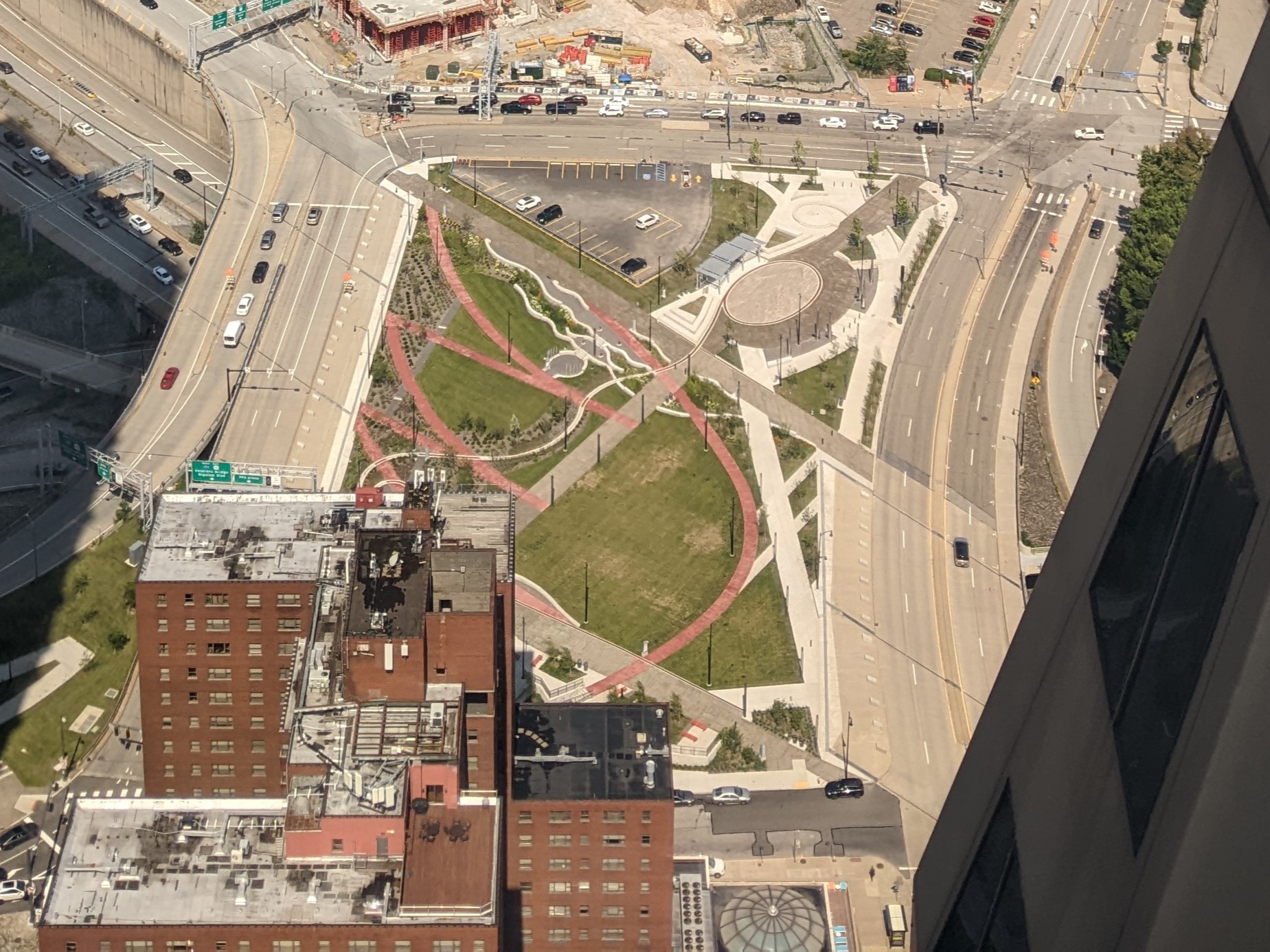
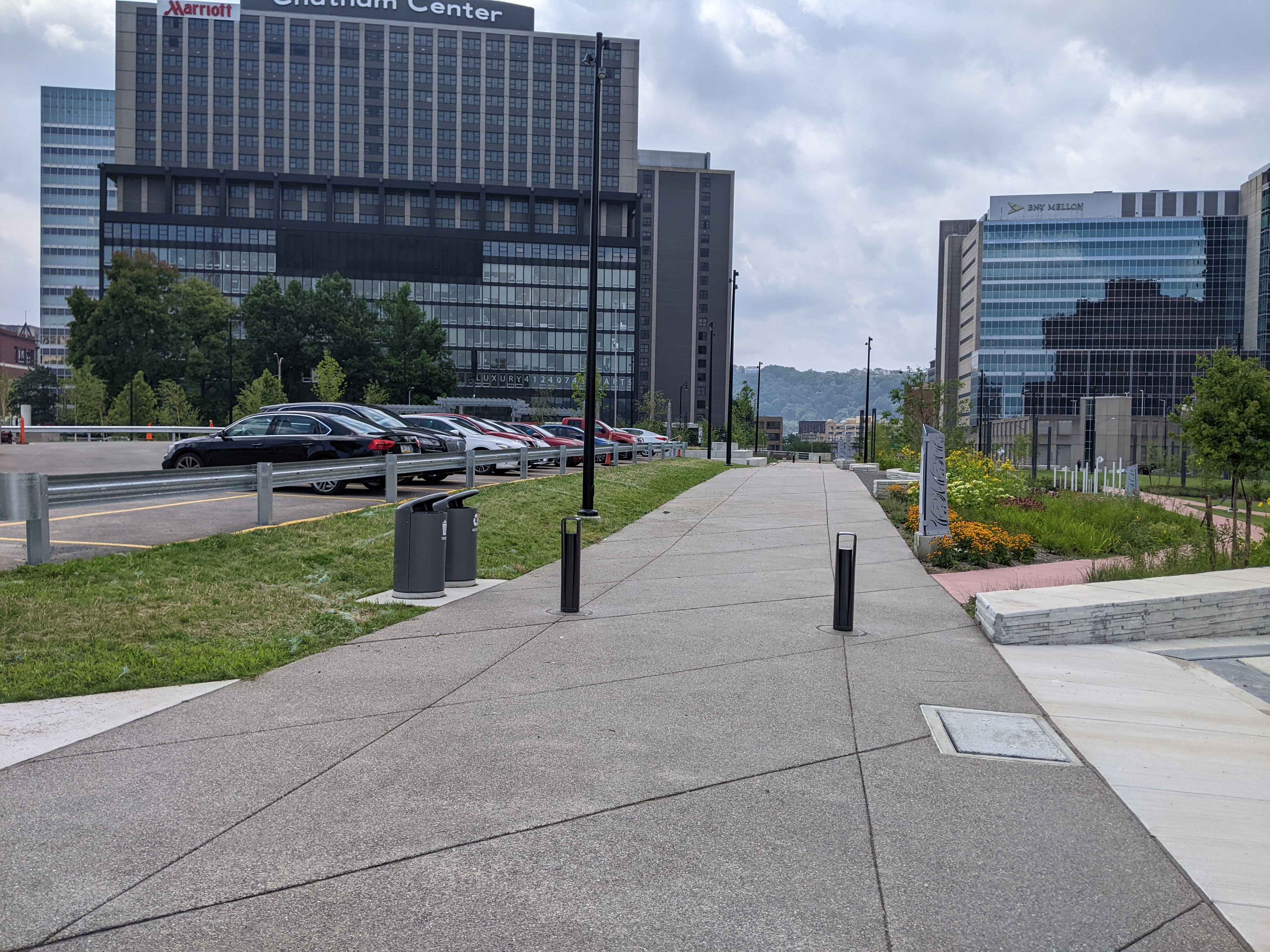
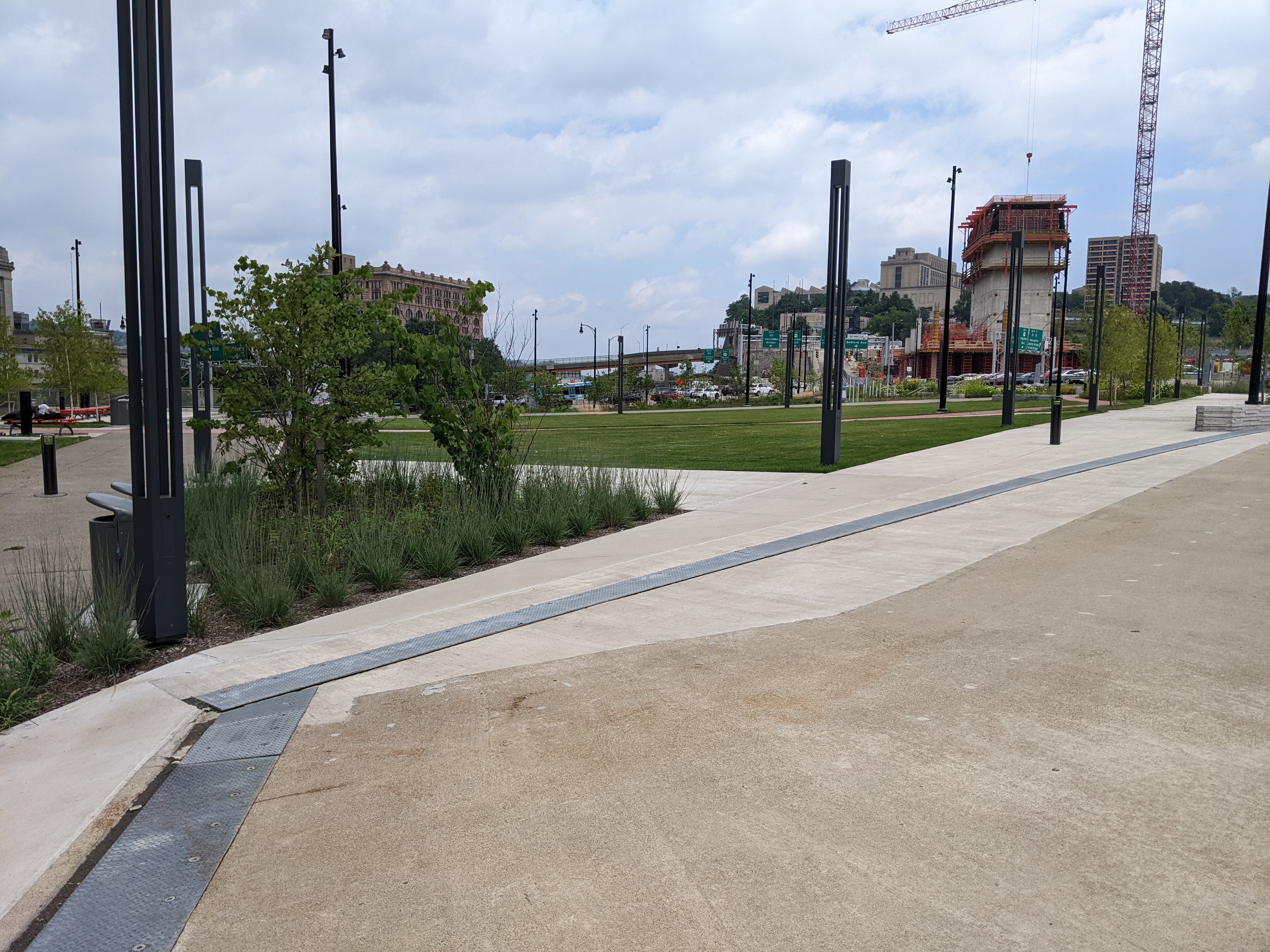
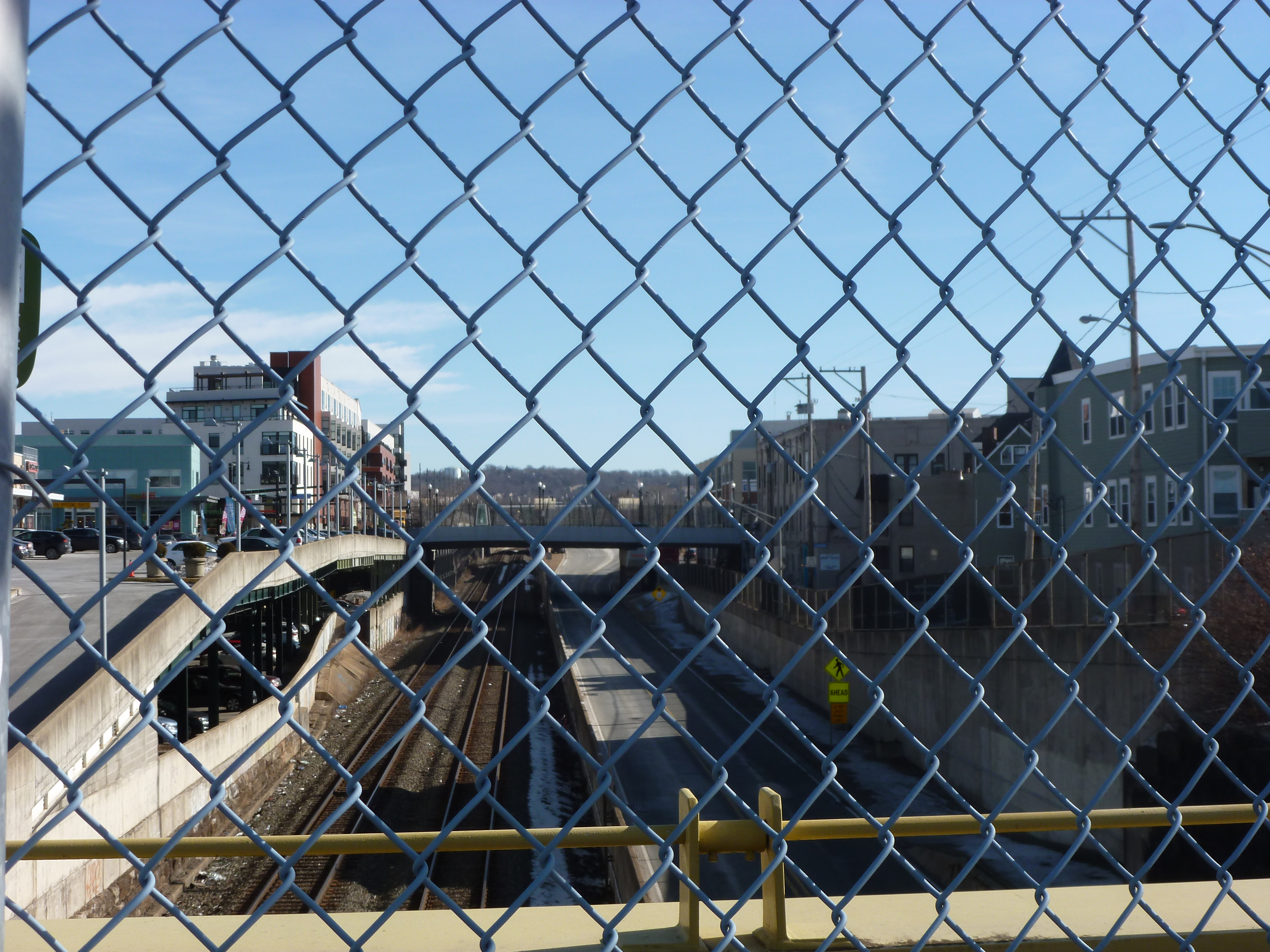
This week, I took a lunch-time walk through the new Frankie Pace Park to see what the completed CAP project looks like and how it is used. There were two men sleeping on benches in the park and a handful of other people walking the paths singly or in pairs. Prior to 2020, I would have interpreted this as a failure of the park to attract users because any green space downtown between 12 and 1 was always full of people. However, in the continuing fallout of the pandemic, a handful of people walking or using the seats is typical even of the parks that you used to need to arrive before 11:59 if you wanted to find a seat to eat your lunch.
The CAP is a project in Pittsburgh “fixing the mistakes” of Urban Renewal. The Crosstown Blvd was built in the 1960s creating a freeway in a canyon dividing the Lower Hill neighborhood from downtown. The Lower Hill neighborhood, formerly predominantly poor and black, had already been demolished by this point to make way for the Civic Arena and other cultural amenities that were never built.
The CAP is a park on a bridge built over the Crosstown Blvd and is intended to reconnect downtown and the Lower Hill, while the Lower Hill is being rebuilt by the Penguins hockey team. Construction began in June 2019 and was completed in November 2021.
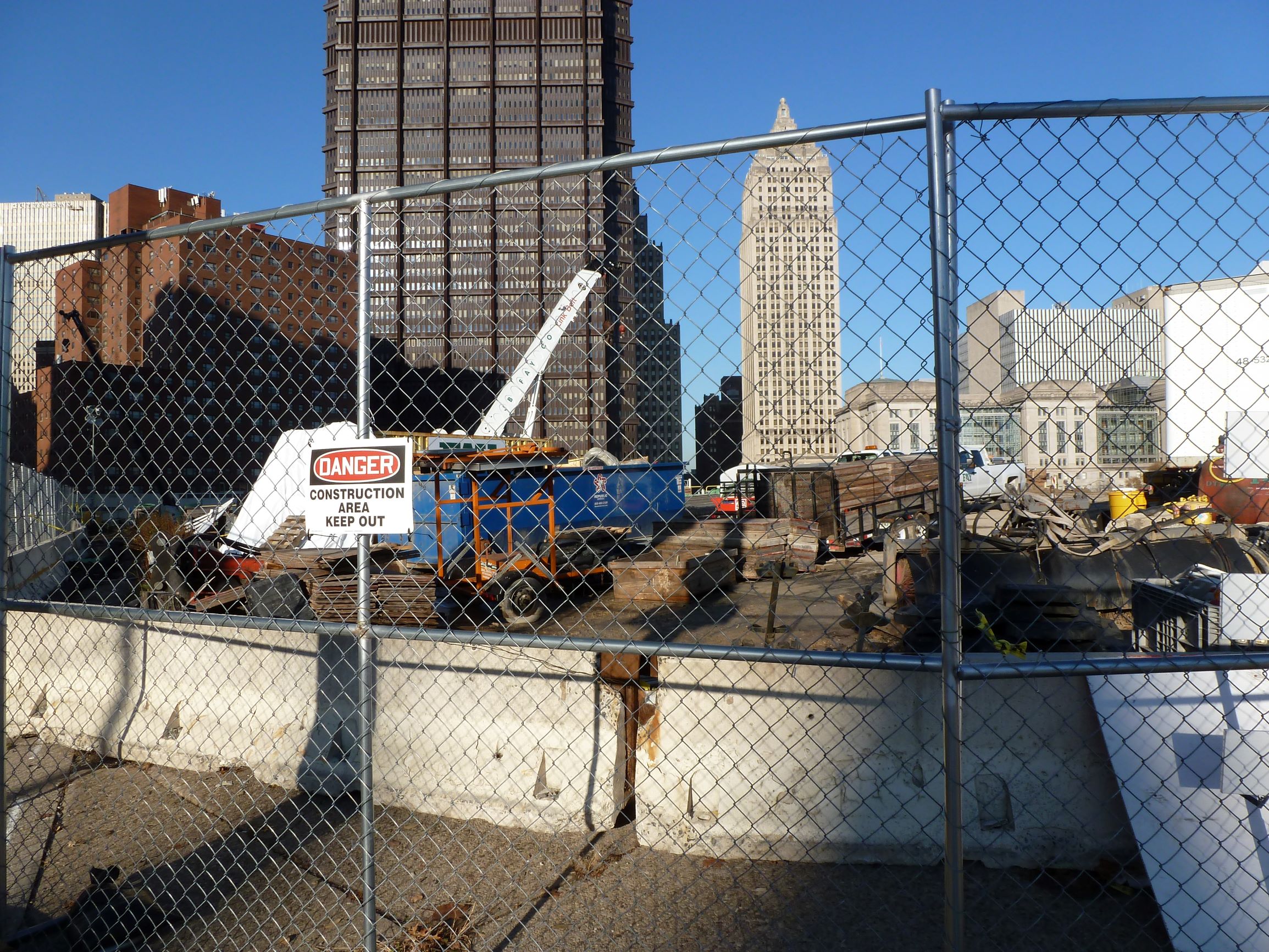
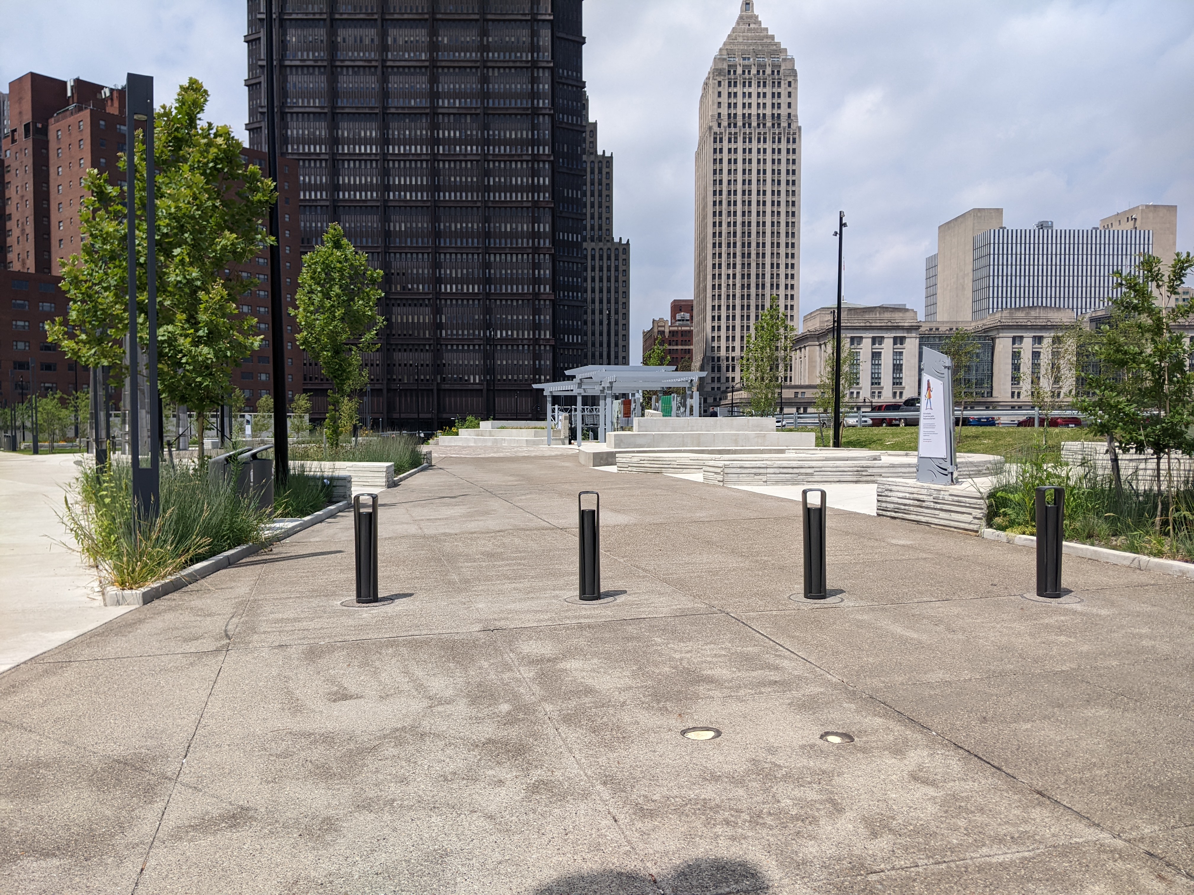
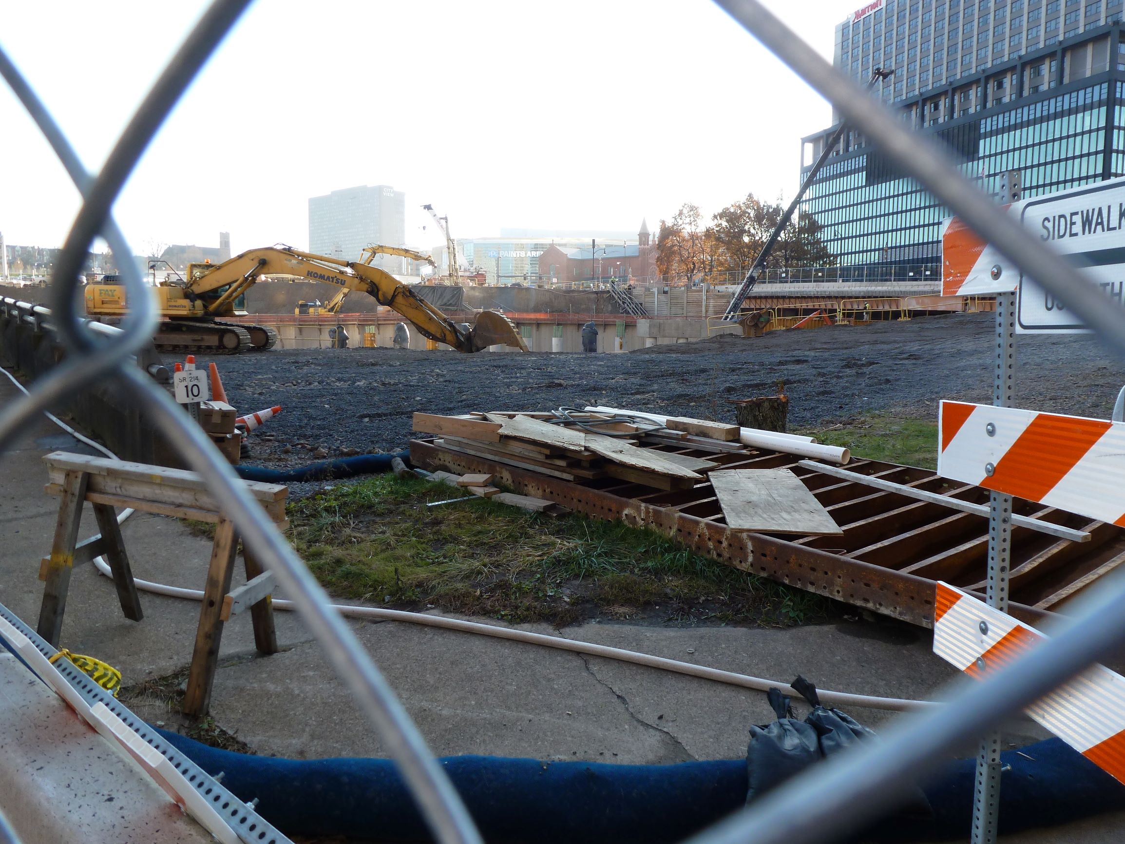
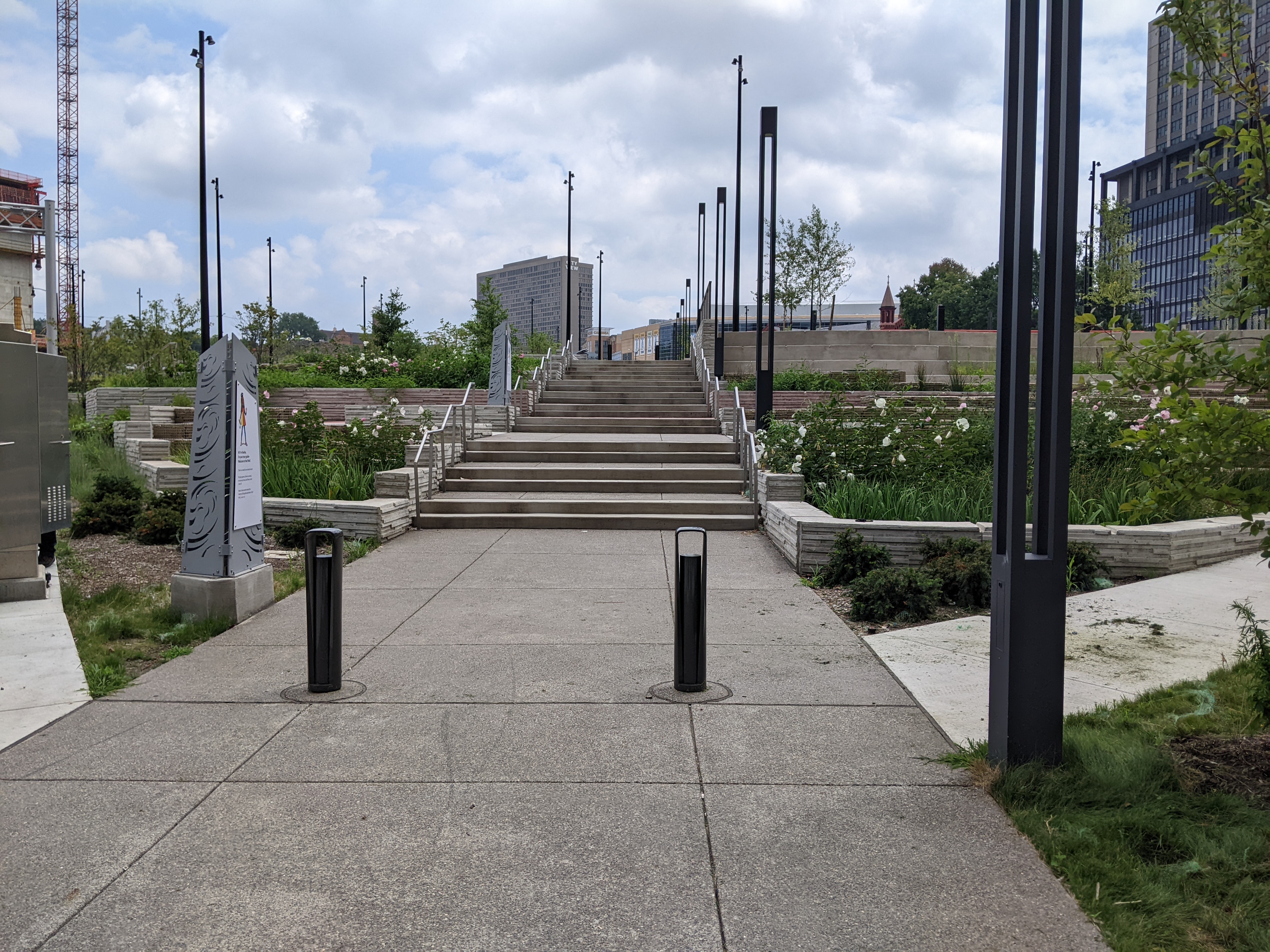
Below is a side-by-side comparison of the four corners of the CAP from November 2019 when I first started this photographic series and from my August 2022 walk. At the end of the post, there are links to all the previous posts in the series.
The Photos
CAP Northwest view – November 2019CAP Northwest view – August 2022CAP Southwest view – November 2019CAP Southwest view – August 2022CAP Southeast view – November 2019CAP Southeast view – August 2022CAP Northeast view – November 2019CAP Northeast view – August 2022
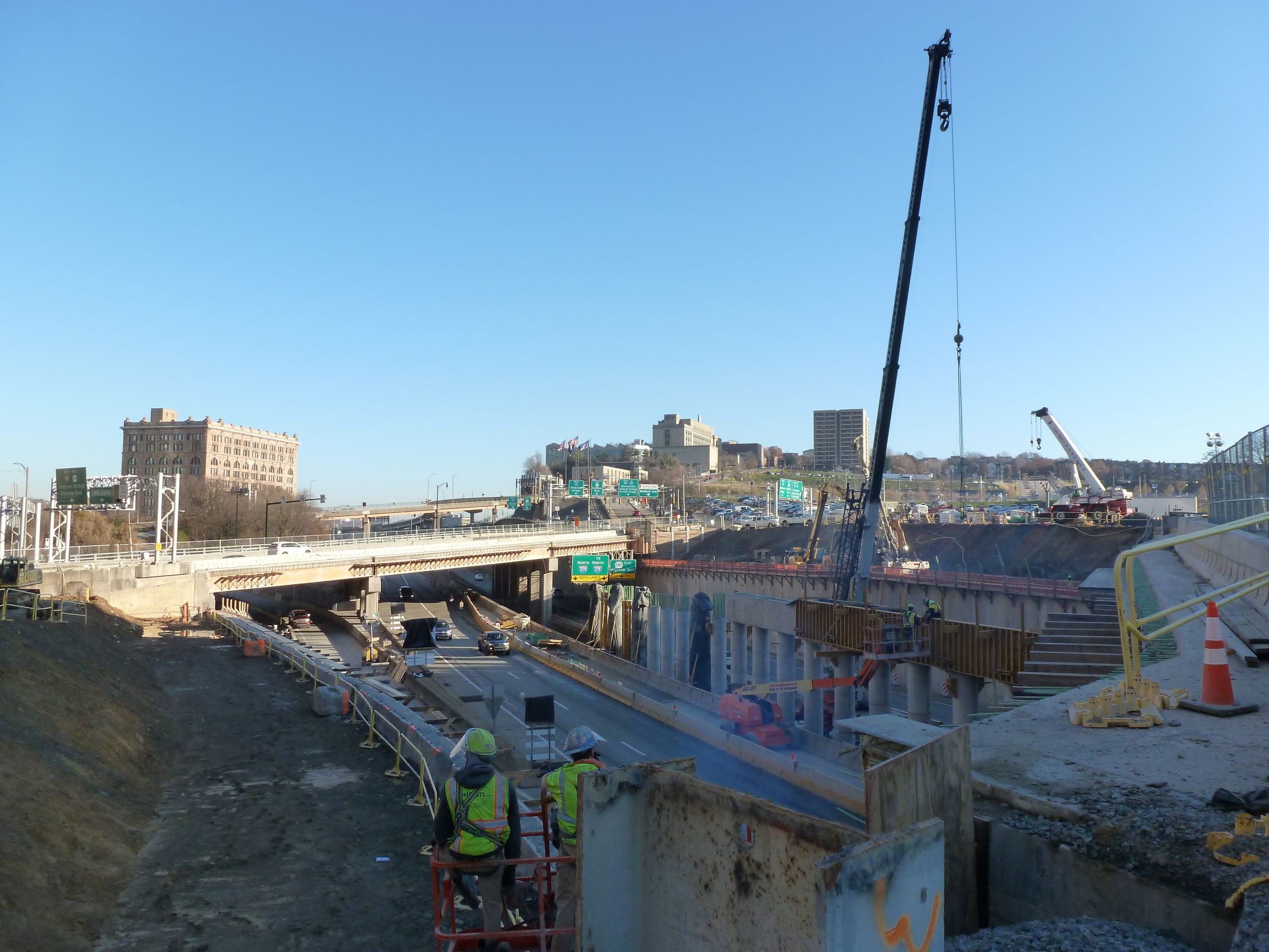
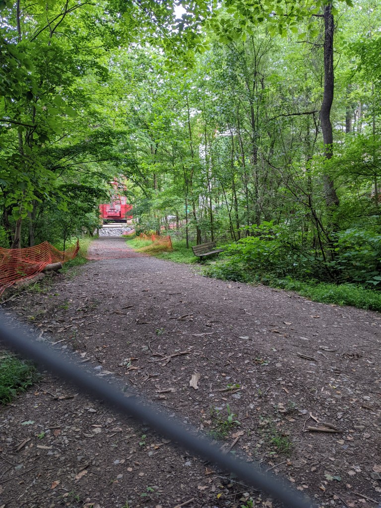
There was a lot of news about the bridge this month. PennDOT and the Mayor’s office held a press conference on Monday to announce that the bridge may be completed before the end of the year. This unusually fast pace is because construction is underway while the design is still being worked out. Inspired by the event, I went to Frick Park after work and explored the view of the bridge from the northern approach along the Tranquil Trail.
While the news is good for the Fern Hollow Bridge reconstruction, there were hiccups this month on the Swindell and Port Authority bridges.
Below is a slideshow of photos from my hike this month followed by the news updates on the Fern Hollow Bridge and other bridge maintenance and replacement efforts in Pittsburgh and Allegheny County.
Two artists were selected to provide artwork for the new Fern Hollow Bridge (City Press Release, July 25, 2022)
Despite the press conference, artist announcement, and beam delivery schedule, there are no new updates on PennDOT’s project page regarding the reconstruction of the bridge.
The City created a Commission on Infrastructure Asset Reporting and Investment in March 2022, but this commission has not been added yet to the city’s website listing all Boards and Commissions and I have not seen any announcements of any appointments to the new Commission. However, there was a press release this month asking for applicants interested in serving in any of the city’s boards and commissions.
WSP USA was selected to manage the City’s new Bridge Asset Management Program. (Tribune Review, July 19, 2022)
On Tuesday, Port Authority found a crack in one of the rails on the bridge that was just repaired. The inbound T service was discontinued for two days to enable the replacement of this portion of track.
On July 1, Pittsburgh’s Swindell Bridge was closed due to falling debris. The falling debris was noticed during the first phase of repairs, which was repaving the road. (City Press Release, July 1, 2022) The subsequent inspection found that the debris came from the repairs – material accumulated in one of the drainage troughs, putting unusual pressure on the trough and causing it to “tear open and spill” the debris onto route 279 – hours after I had driven under it. (City Press Release, July 5, 2022)
Additional Resources:
Both PennDOT and the Federal Highway Administration have interactive maps of bridges for the state and country respective, and their inspection statuses.
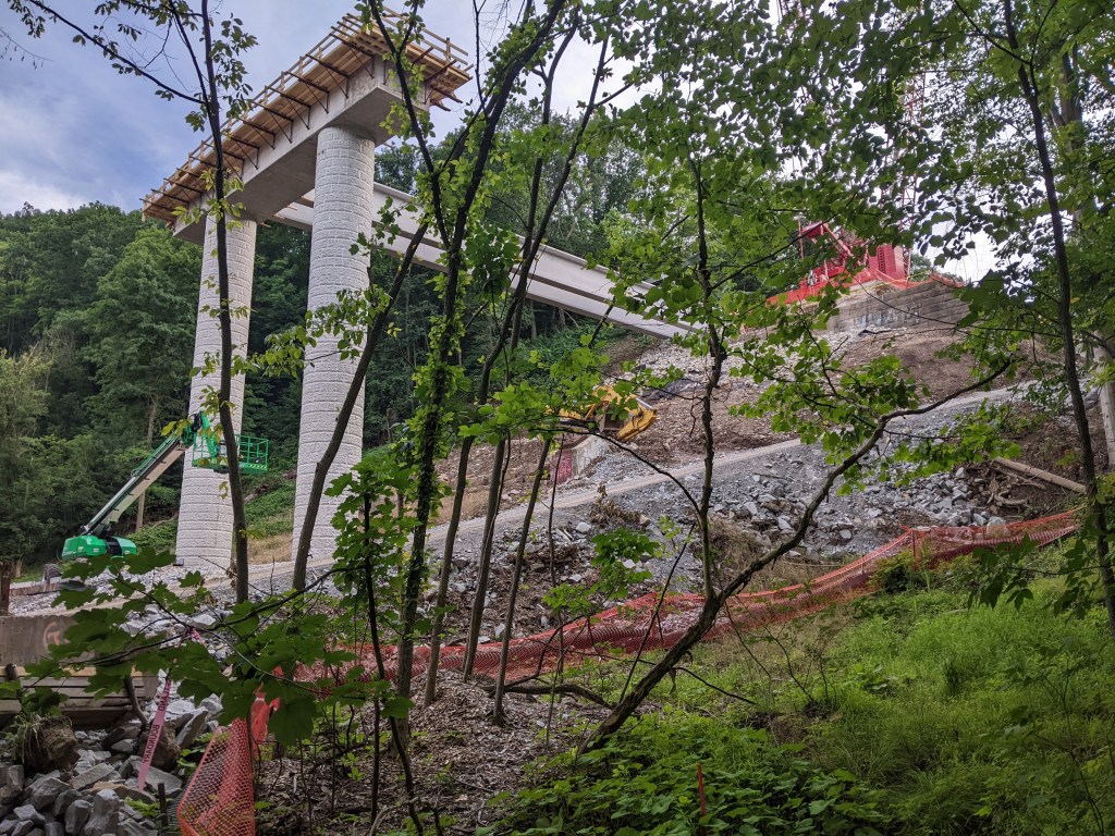
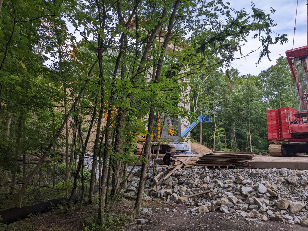
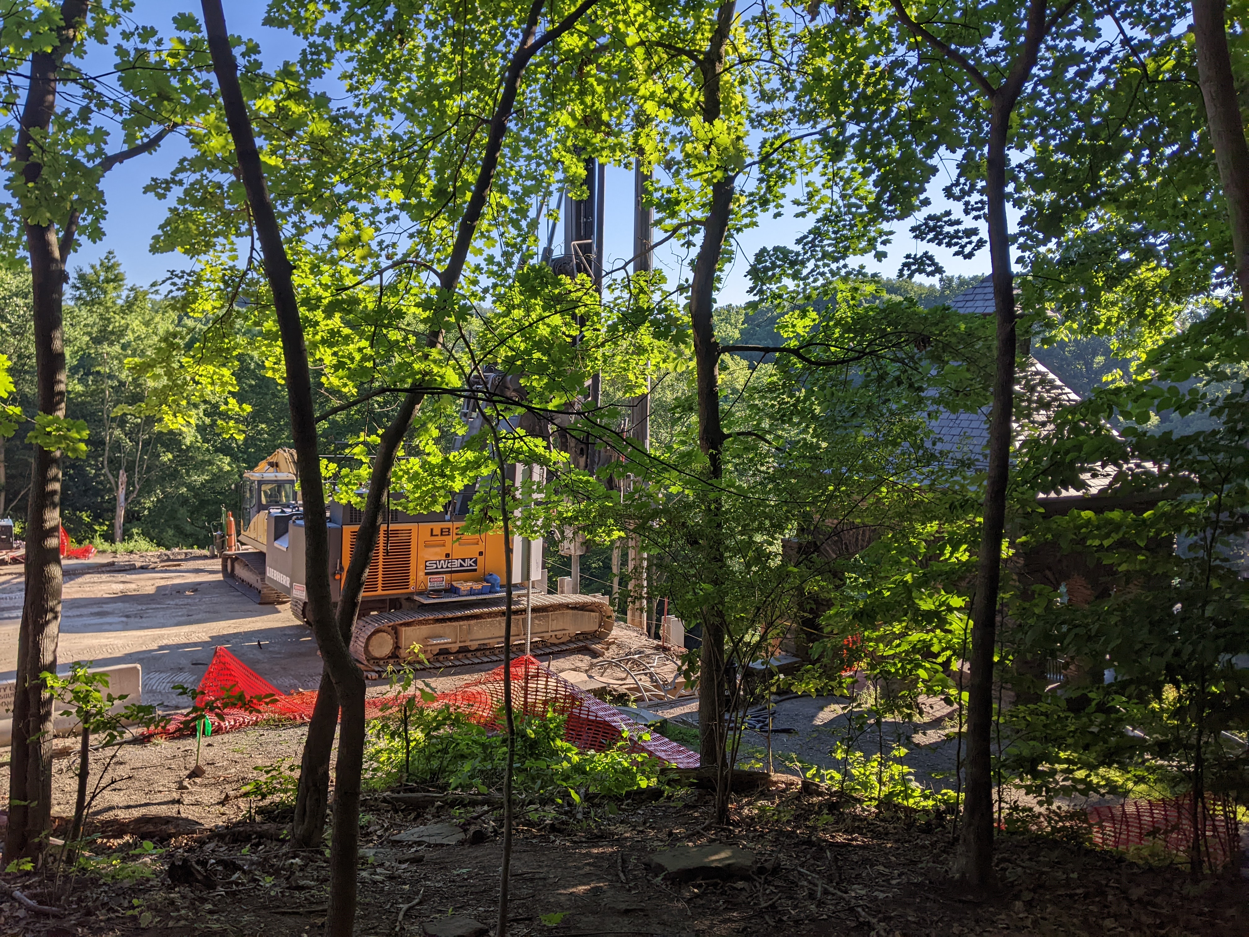
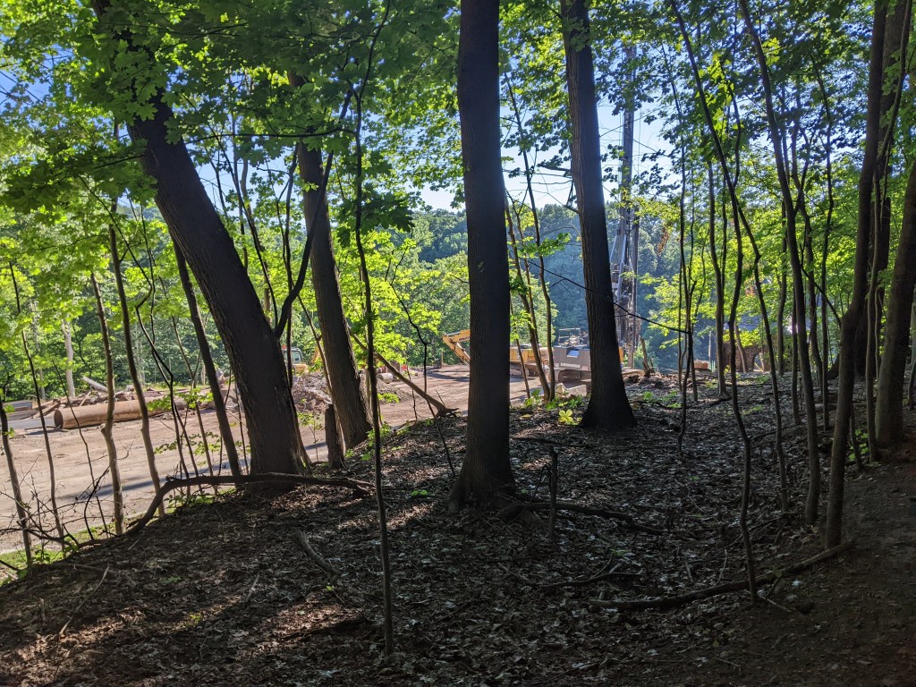
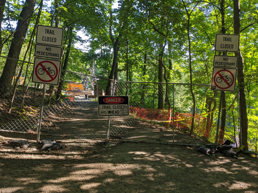
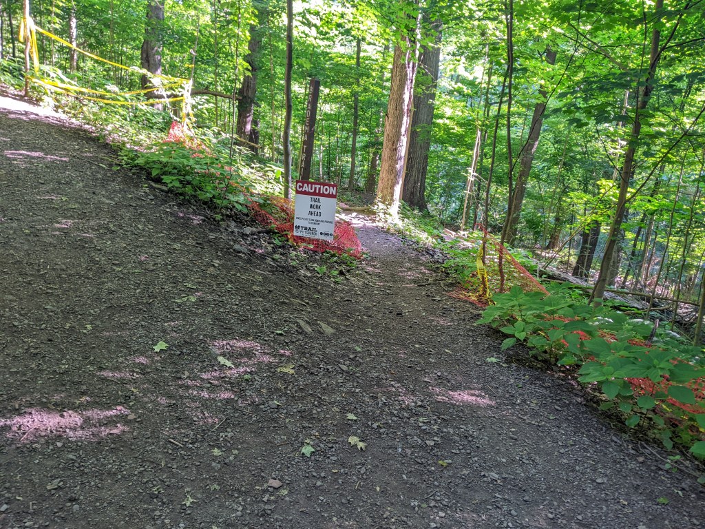
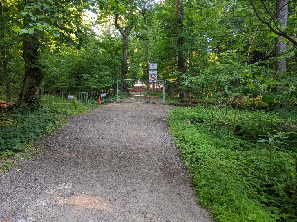
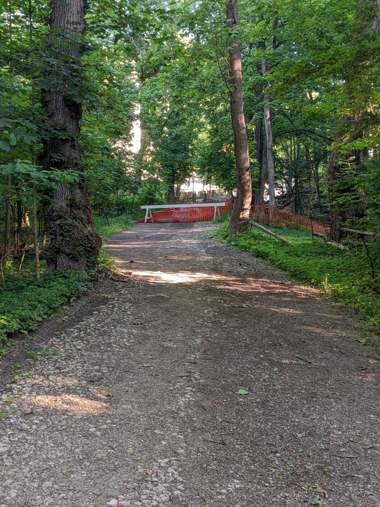
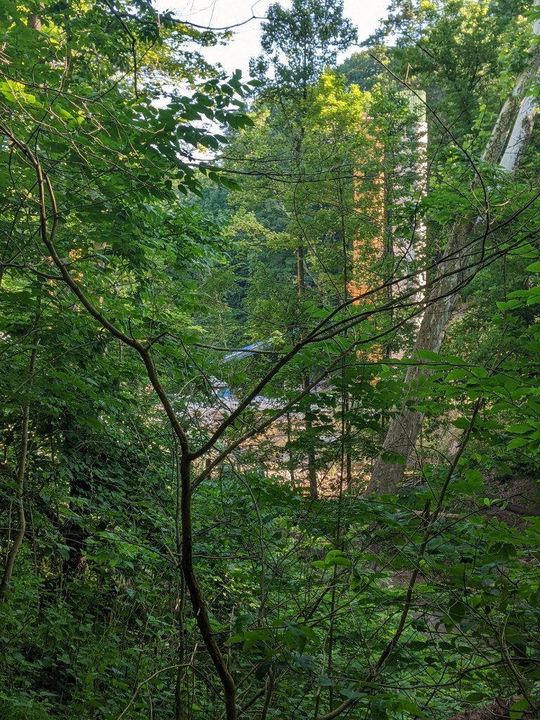
My foot is finally healed enough for me to begin to explore the site of the bridge collapse over Fern Hollow in Frick Park. I started at the Frick Environmental Center and explored the western slope into the hollow looking for gaps in the trees to see the progress on the bridge construction. The Clayton, Biddle, Bradema, and Tranquil trails all provided glimpses of the bridge site. According to the Hiking Project’s website, the elevation change between the highest and lowest points I encountered was 250′ and the steepest grades were between 13 and 16%.
It was pleasant hiking through the leafy forest, but the foliage hid most of the bridge site. From what I could see through the gaps in the leaves, construction seems well on its way with the four primary support columns erected. In future updates (barring further injury), I will explore the views from the park along the eastern slope and the northern trails.
Below is a slideshow of photos from this exploration followed by the news updates on the Fern Hollow Bridge and other bridge maintenance and replacement efforts in Pittsburgh and Allegheny County.
There are no new updates on PennDOT’s project page regarding the reconstruction of the bridge since my post last month.
The City created a Commission on Infrastructure Asset Reporting and Investment in March 2022, but this commission has not been added yet to the city’s website listing all Boards and Commissions and I have not seen any announcements of any appointments to the new Commission.
The RFP is now closed for the Bridge Asset Management Program that Mayor Gainey announced in early May. (Bidnet.com)
Port Authority’s bridge has been repaired and is back in service. The stop upgrades to the stations in Beechview and Dormont have reached a point where they have reopened to use, though repairs (including morning jackhammering) continue.
Earlier this month, Public Source published an article revisiting the first four months after the bridge collapse. From this article, I learned that the City has launched a separate investigation into the collapse, that the overworked and understaffed Department of Mobility and Infrastructure will need more staff and resources to implement better bridge management in the city, and that a table of the status of Allegheny County’s poor condition bridges was released in February shortly after the Fern Hollow Bridge collapse.
The Campbell’s Run Road bridge replacements identified in the County’s list of poor condition bridges are indeed happening this year. I have gotten caught up in traffic congestion caused by the detour for the work several times. (WTAE, February 3, 2022)
Pittsburgh’s Swindell Bridge is one that has been on the radar since the collapse of the Fern Hollow Bridge. The City announced this week that a first phase of repairs will be conducted over the next couple weeks. This initial phase consists of repaving the road surface. (City Press Release, June 24, 2022)
Additional Resources:
Both PennDOT and the Federal Highway Administration have interactive maps of bridges for the state and country respective, and their inspection statuses.
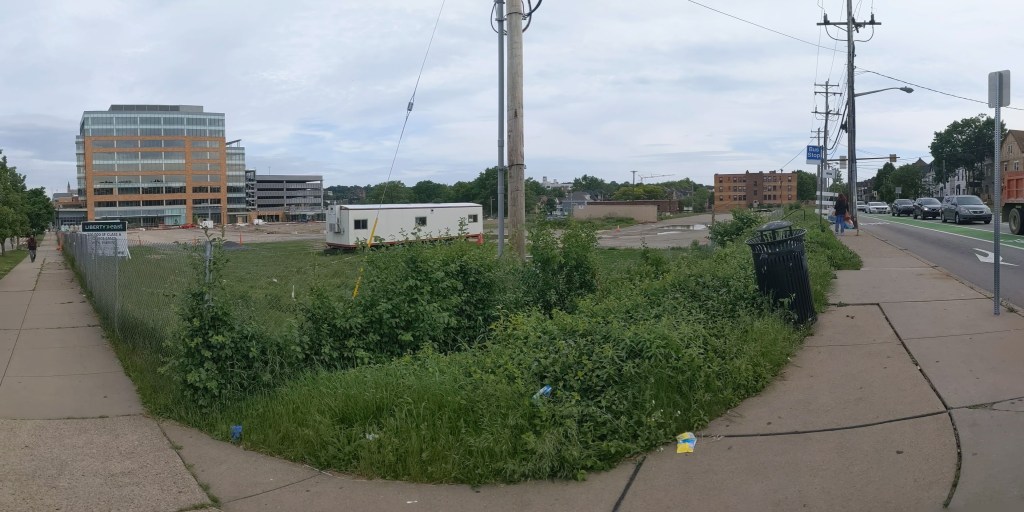
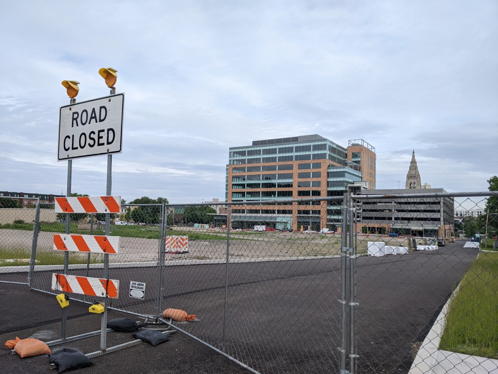
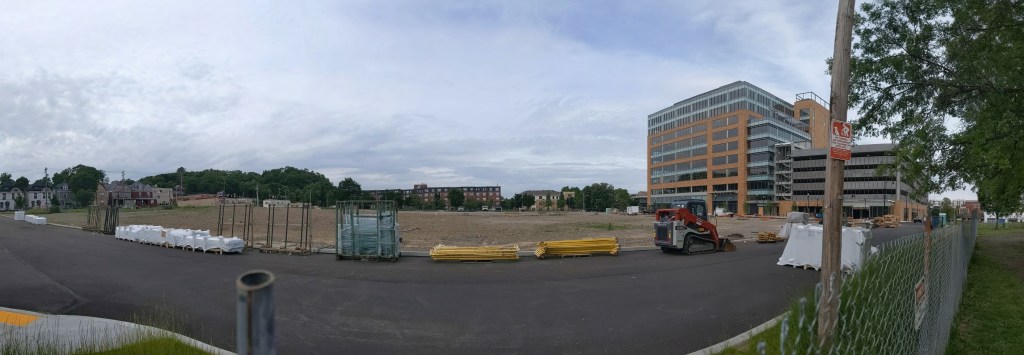
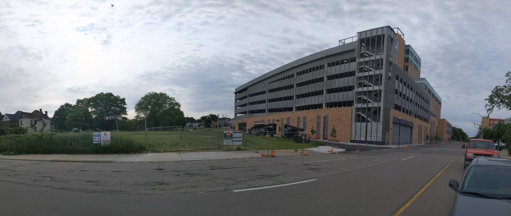
Seven years after the initial eviction notices went to the low-income residents of the former Penn Plaza Apartments, the mixed-use redevelopment of the size nears completion of Phase 1.
The former Penn Plaza Apartments was a group of large of apartments buildings that served a low-income population. After years of neglecting these apartments, the owner gave 200 residents notice to vacate within 90 days in the summer of 2015. By then, the surrounding neighborhood of East Liberty was a hopping place to live with low vacancy rates and the average rent much higher than what these residents could afford. There was a large outcry at the time, which only got worse as the owner’s plans for the site were understood. The owner wanted to swap some land with the City and change the zoning district to build a large scale mixed-use development: 54,600 sq ft of retail and 246,090 sq ft of office with accessory parking (see the application materials starting on page 54 from the final Planning Commission review and approval). After months of negotiation with the City and the community, the land and the zone change were given to the development while the affordable housing crisis in Pittsburgh only got worse and the former residents were forced to uproot their lives.
While the construction of Phase 1 of the new development appears to be nearing completion, I did not find any news items specifically about the site. News about affordable housing issues in Pittsburgh continue.
New affordable housing units opened and another project broke ground in October 2021 (Tribune Review).
A brief from the Federal Reserve Bank of Philadelphia on the homeownership gap in that city including findings applicable to Pittsburgh and other cities (East Liberty Development Inc, January 4, 2022).
On my way to check out the site of Pittsburgh’s collapsed bridge, I drove by Bill Dollarsaurus. He had received a makeover since the last time I saw him. His new look:
Just after I began my 10-year anniversary celebration of bridge walking, the Forbes Ave Bridge over Fern Hollow collapsed on January 28, 2022. This accident shone a light on a pattern of infrastructure funding in the time since I became a bridge person. Ten years ago, there were several bridges built, repaired, or replaced in Pittsburgh. Five years later, the flurry of long overdue investment in our infrastructure stopped – before all the bridges that needed help received it. An article on the aftermath of last month’s bridge collapse reminded me that federal funds were allocated toward infrastructure under the Obama administration. As a result, many bridges that were falling apart were fixed or replaced. It seems that when that funding stopped, so did the repairs. Now that new funding has been allocated under the Biden administration, we should see a similar spurt of investment in our infrastructure, starting with the now missing Fern Hollow Bridge.
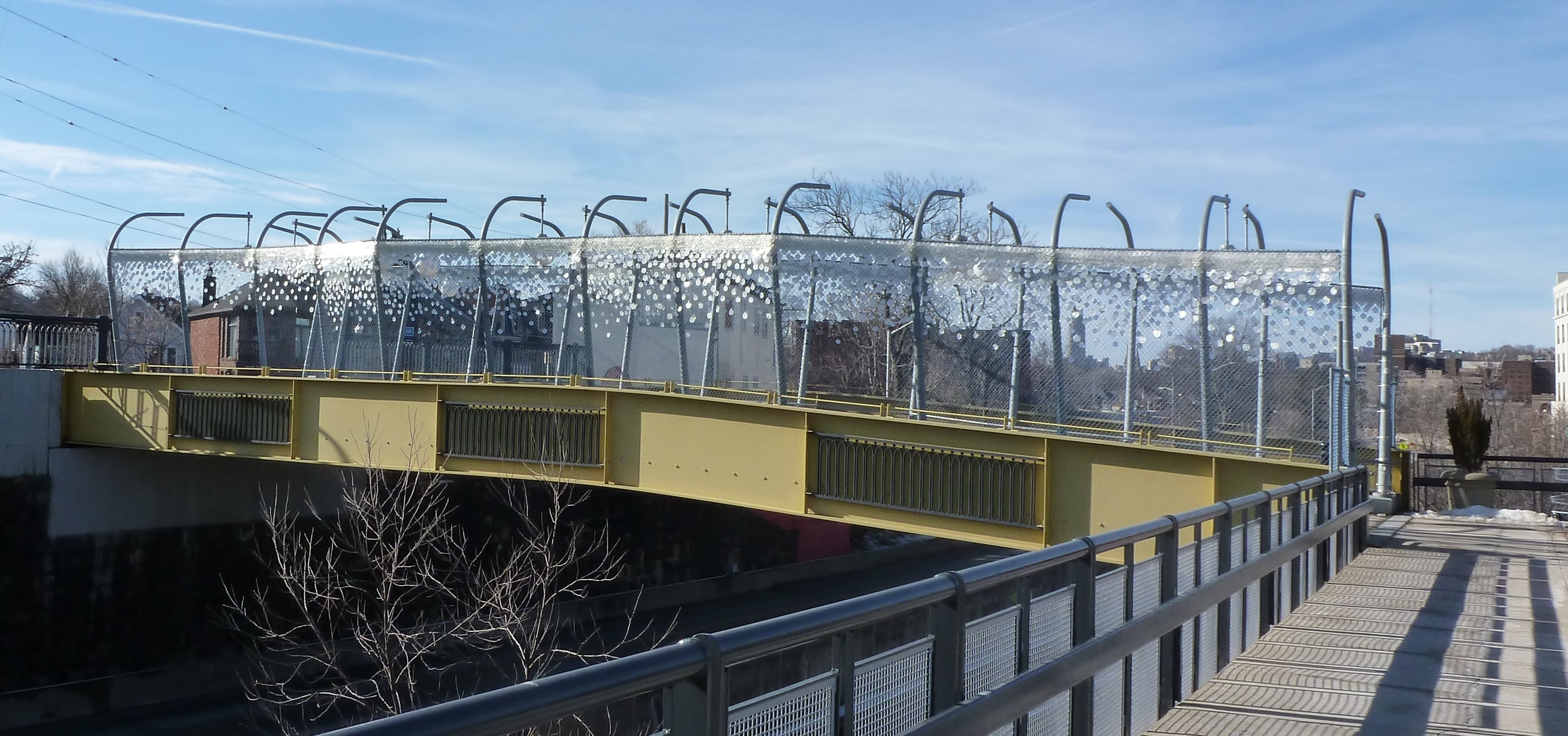
One of the bridges presumably supported by the Obama infrastructure funding was the brand-new pedestrian bridge across the East Busway connecting the Shadyside and East Liberty neighborhoods. This bridge is 10-years old this month. The “road” surface of the bridge hasn’t held up very well: the paint was faded and the top surface was patchy when I returned this month. On the other hand, the over-the-top lamps and giant glitter looked like they have held up well. Though it’s hard to say in wintertime, the landscaping between the cage and the bridge walls also appeared to be well maintained.
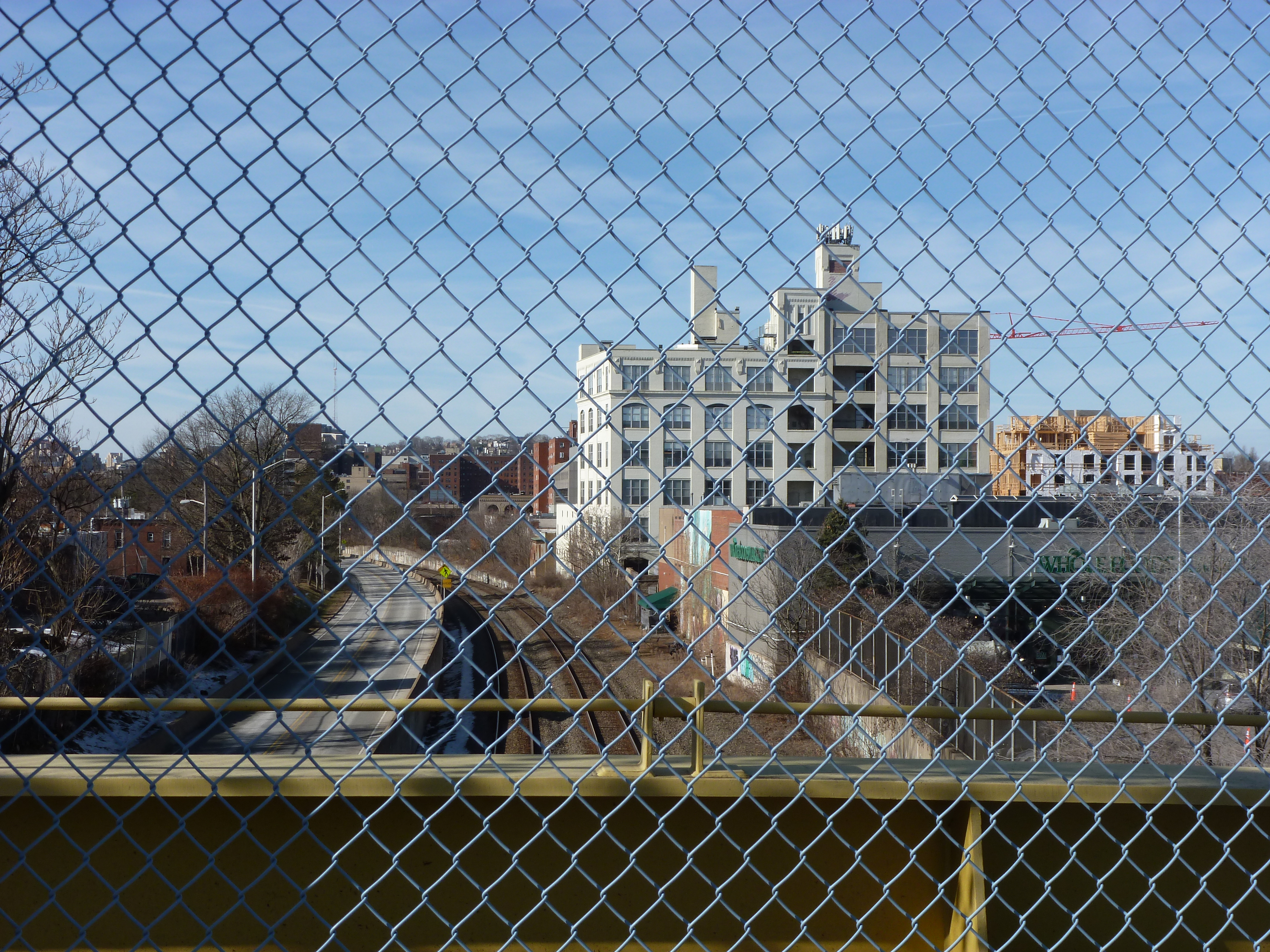
From the bridge, some of the new developments in East Liberty are visible. Looking southwest toward the current location of Whole Foods (soon to relocate), one of the several new apartment buildings along the Baum-Centre corridor is visibly under construction in the far right of the second set of photos. In the third set, the northeast view shows the new South Highland Avenue Bridge and (to the left of the bridge) the final phase of the East Side Bond development that brought several buildings of first floor commercial with residences above.
I was surprised to find that the highly controversial and massive redevelopment of the former Penn Plaza affordable housing complex was not visible from this bridge. Despite being only a quarter mile apart, the first phase of redevelopment is blocked from the bridge’s view by the iconic Motor Square Gardens building. One of the controversies of this new development is that affordable housing units were demolished without replacement for a series of commercial buildings which include the feature anchor of the pricey Whole Foods grocery store.
The pedestrian bridge was controversial when it was proposed and built. It connects the wealthy Shadyside neighborhood to the expensive Whole Foods, a high-end liquor store, and other luxury shops. It is also redundant as the South Highland Avenue bridge is only 0.1 miles away. A quarter mile away, is the neighborhood of Larimar whose residents are primarily living on low-incomes and do not have a walkable route to the lower cost Giant Eagle grocery store or Trader Joes that are just on the other side of the busway from their homes. For years, the residents have been asking for a pedestrian bridge over the busway to give them better access to these stores. Instead of a bridge serving those who need it, an ornamental bridge was built to provide access for those who already have abundant options.
Around the same time that this bridge was built, the Port Authority altered its bus service by eliminating the 94B bus that connected the low-income residents of Larimar with a shopping center featuring Walmart, Giant Eagle, TJ Maxx and similar clothing retailers, and other stores. In addition to providing shopping opportunities for necessities, these locations provided jobs. The 94B bus was never less than half-full (an unusual condition for Pittsburgh buses outside of rush hour). This bus was replaced by the 75 bus, which connected the higher-end shopping centers of South Side Works and Bakery Square through the wealthy residential neighborhood of Shadyside. For years, it was common to be the only person or one of a handful of people riding the 75. Eventually, the Port Authority acknowledged the value of the 94B route and tact it on to the end of the 75 route.
Presumably both the pedestrian bridge and bus route changes of 2012 were supported at least in part by the federal infrastructure funds of the time. With the current round of federal funding, it would be nice to see a greater focus of infrastructure investment for those who need it and not on additional luxury options.
East Liberty Pedestrian Bridge – July 2012East Liberty Pedestrian Bridge – February 2022View toward Whole Foods – July 2012View toward Whole Foods – February 2022View toward South Highland Ave Bridge – July 2012View toward South Highland Ave Bridge – February 2022