Then & Now: Hot Metal Bridge

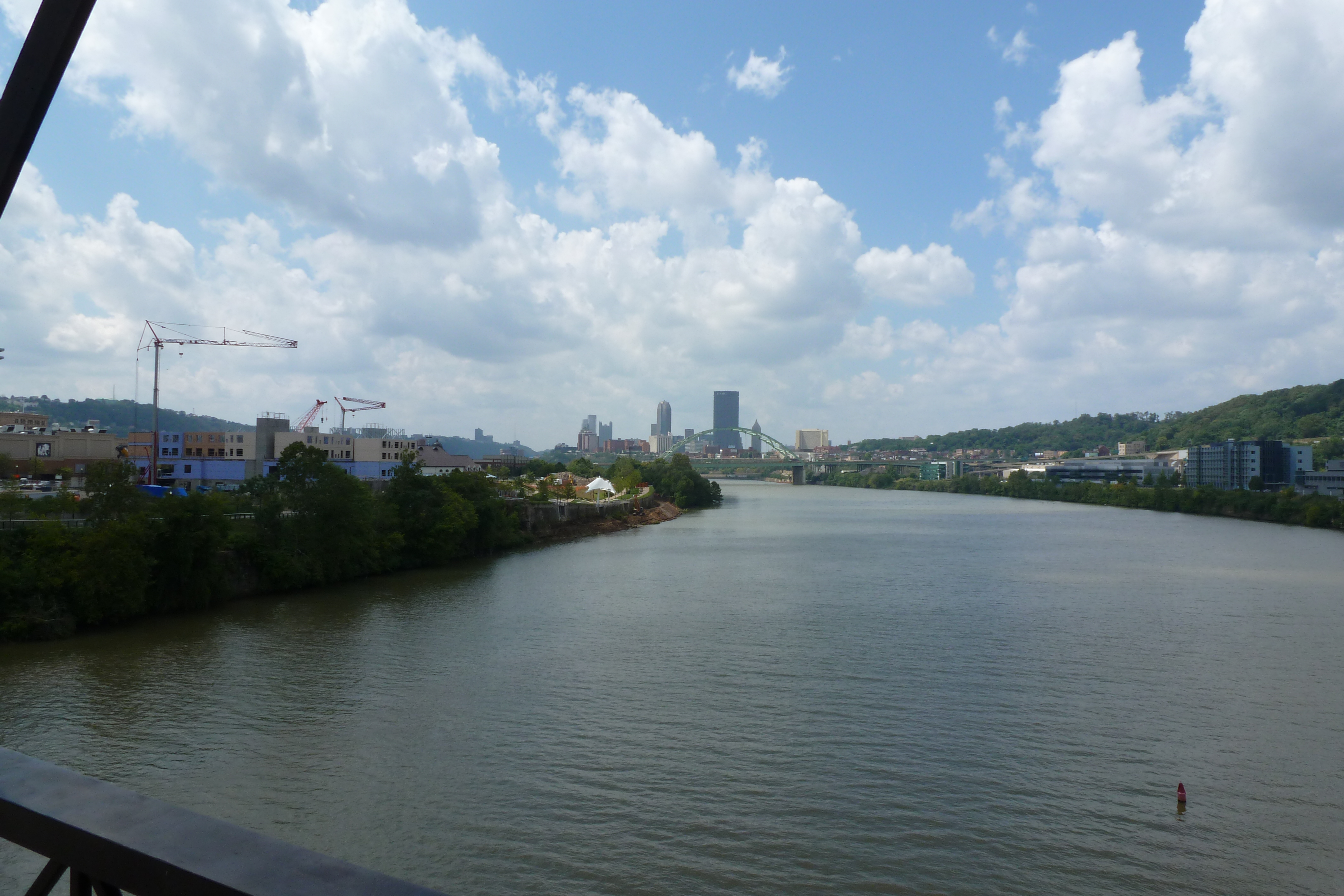
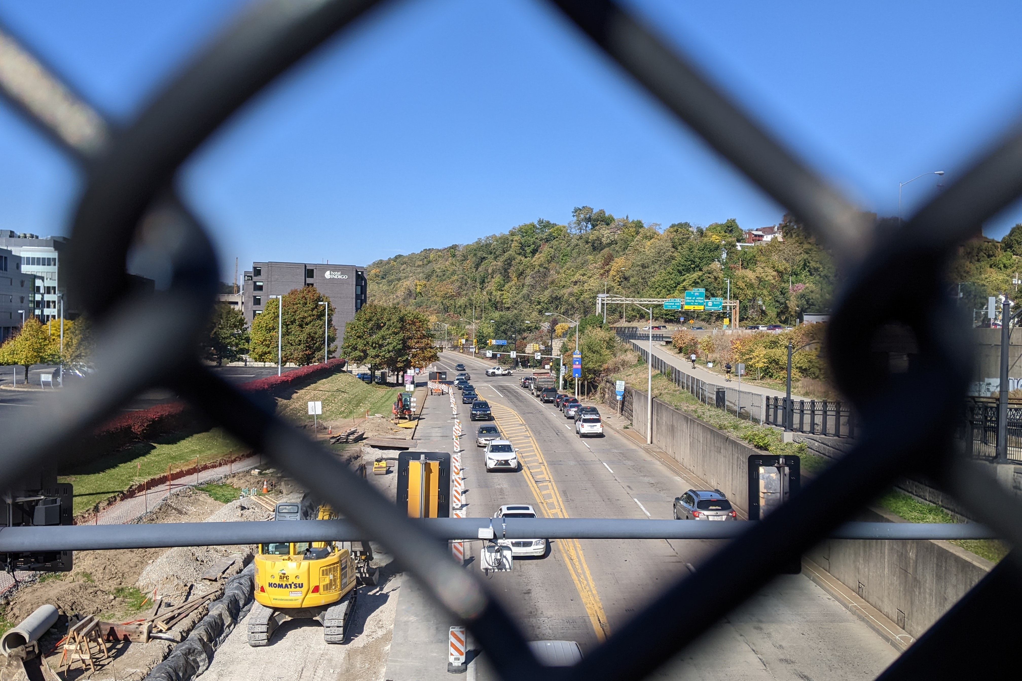
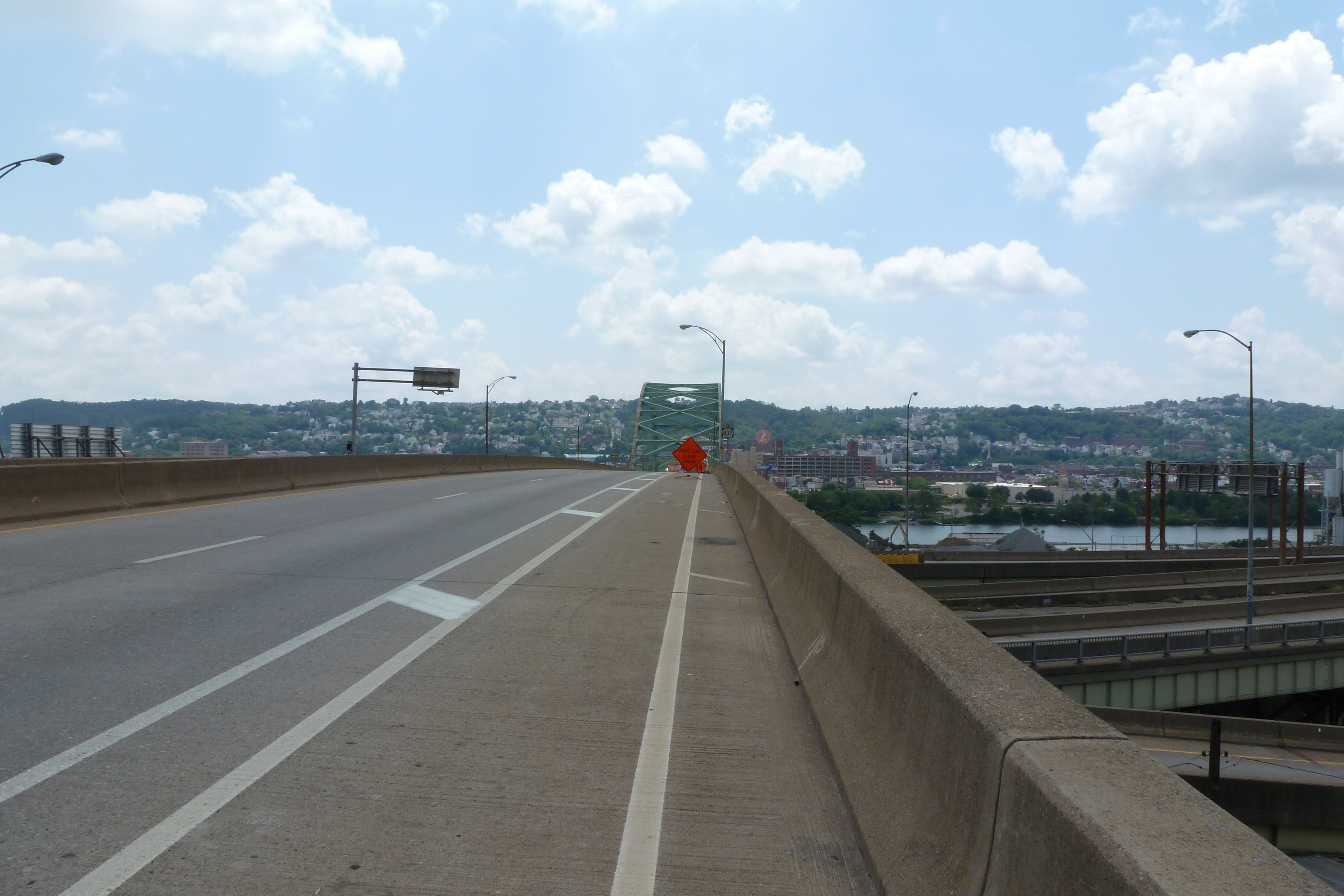
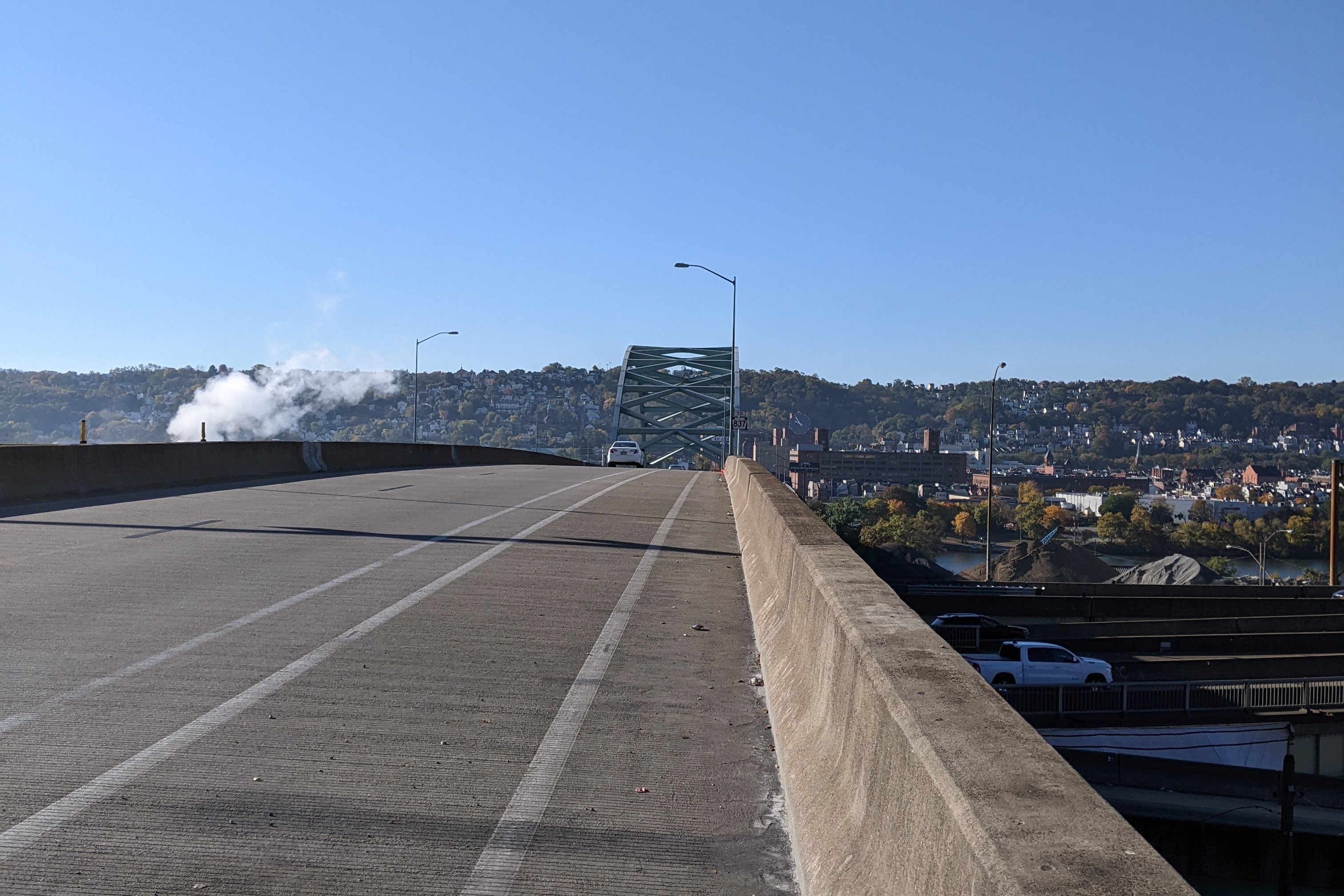
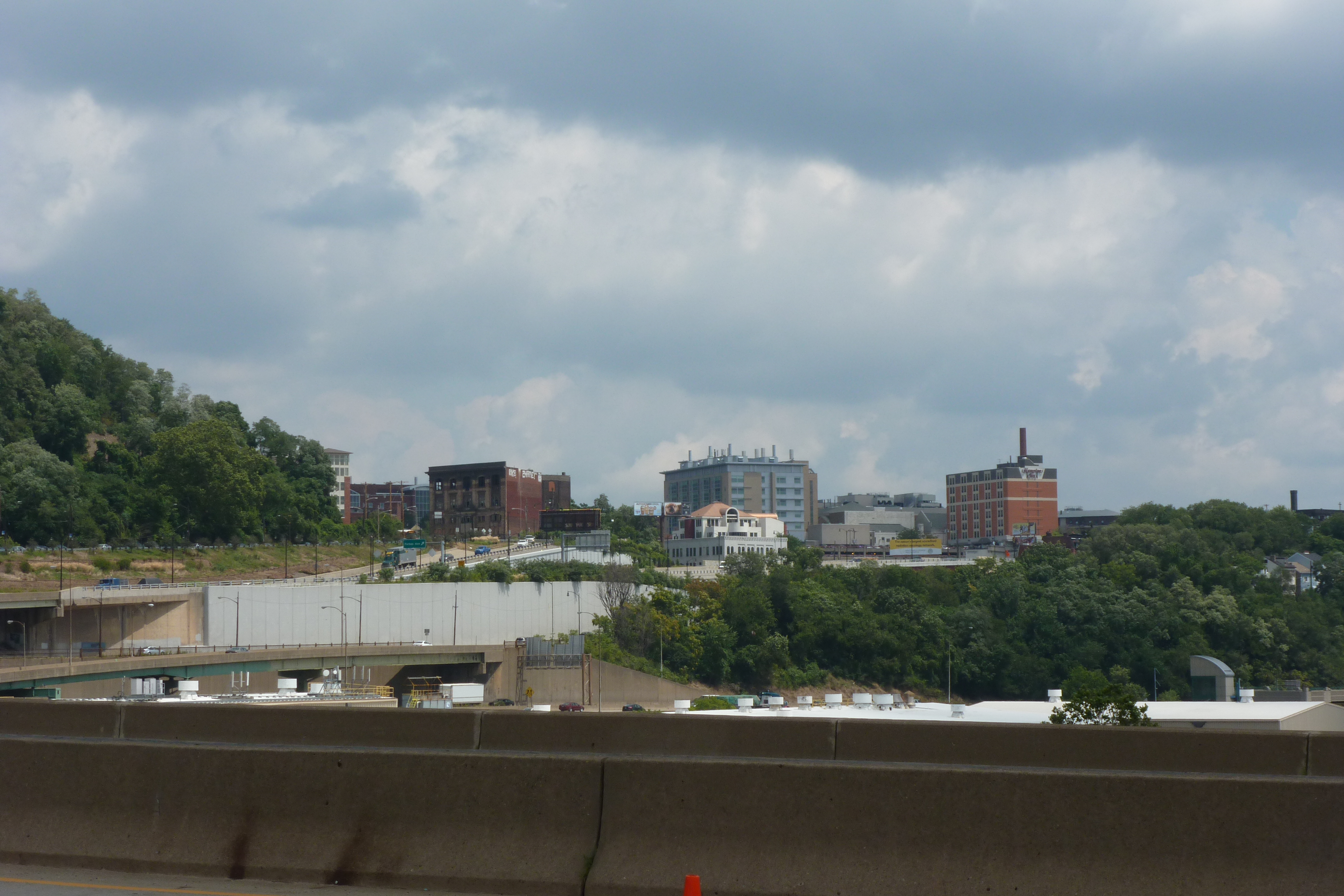
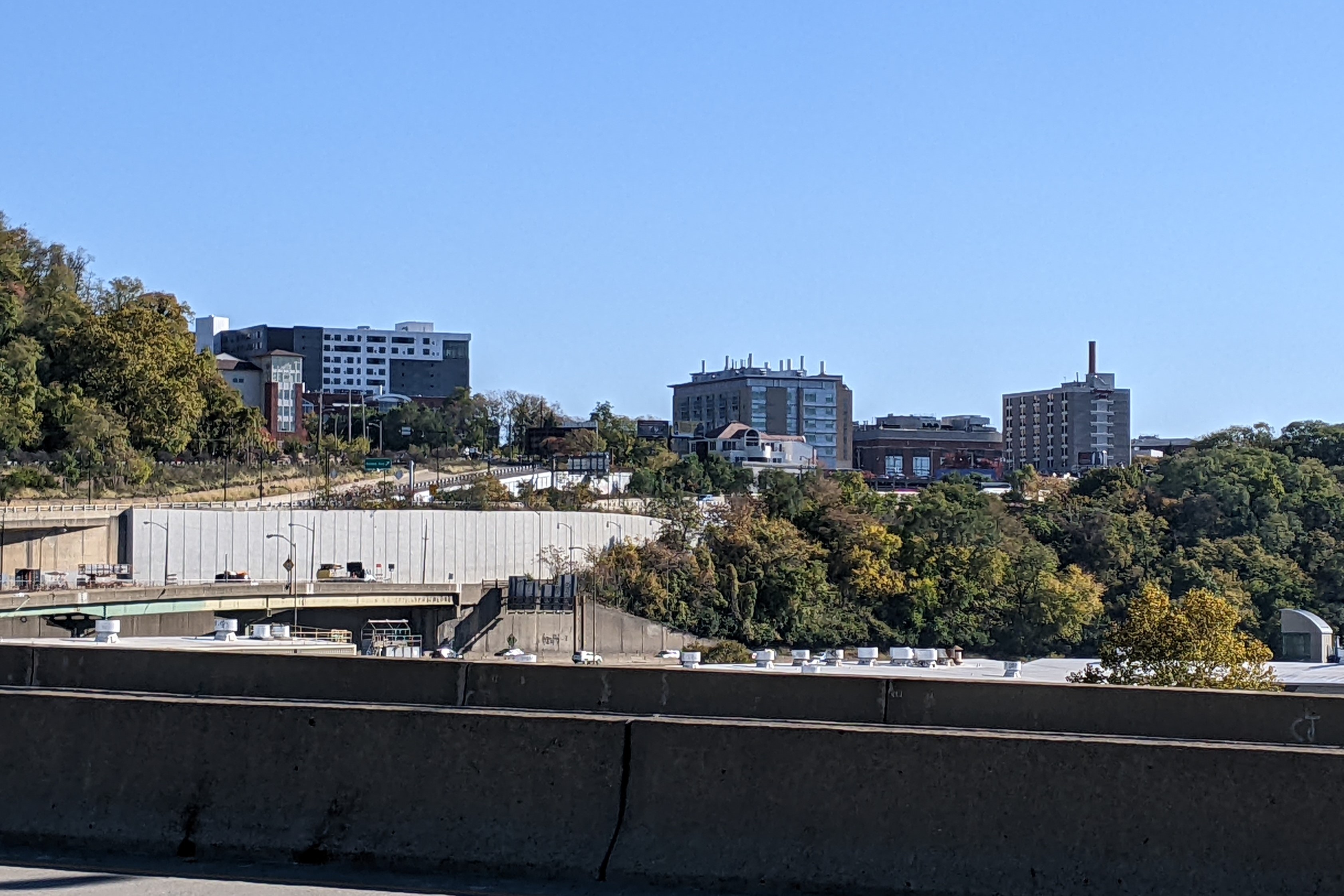
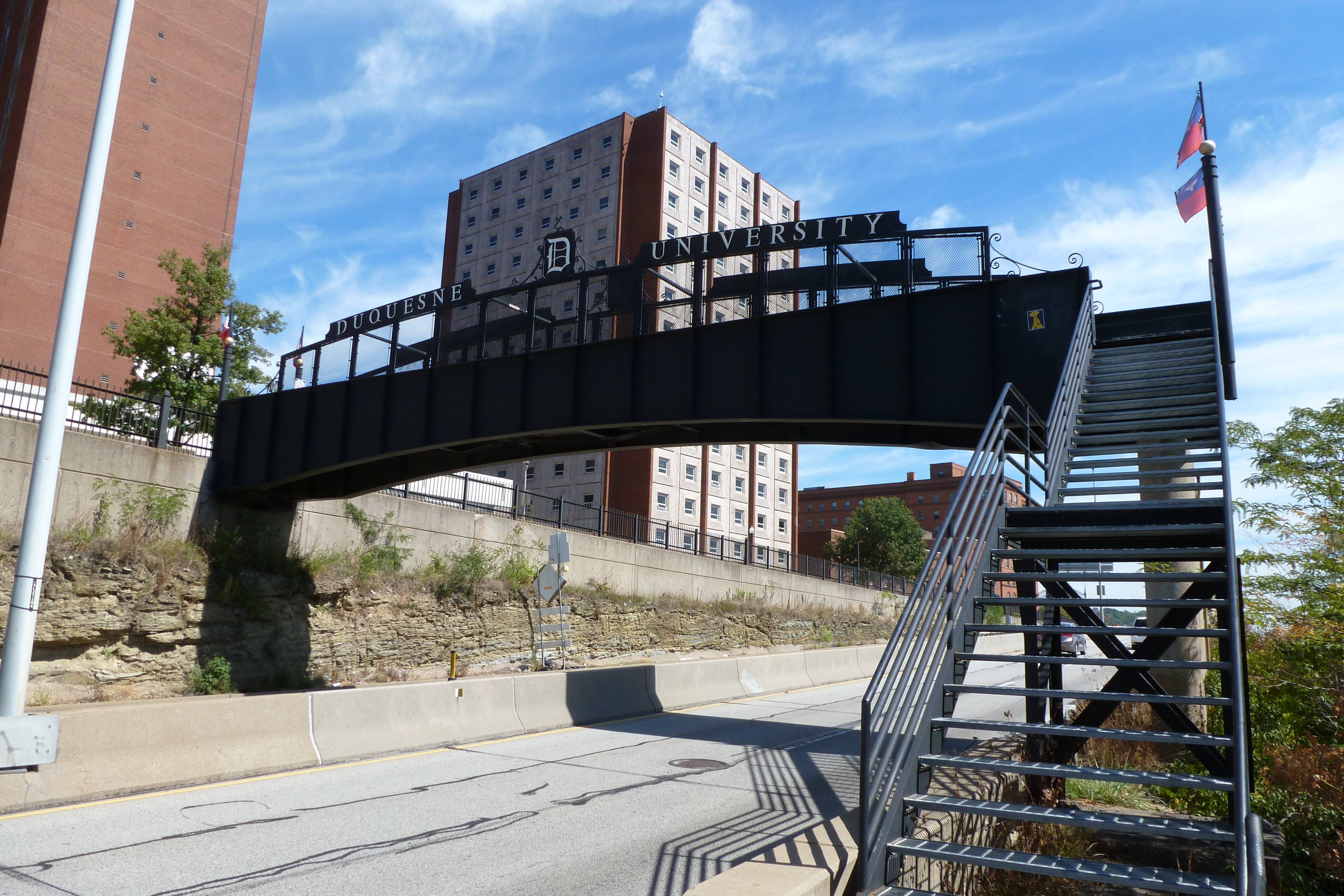
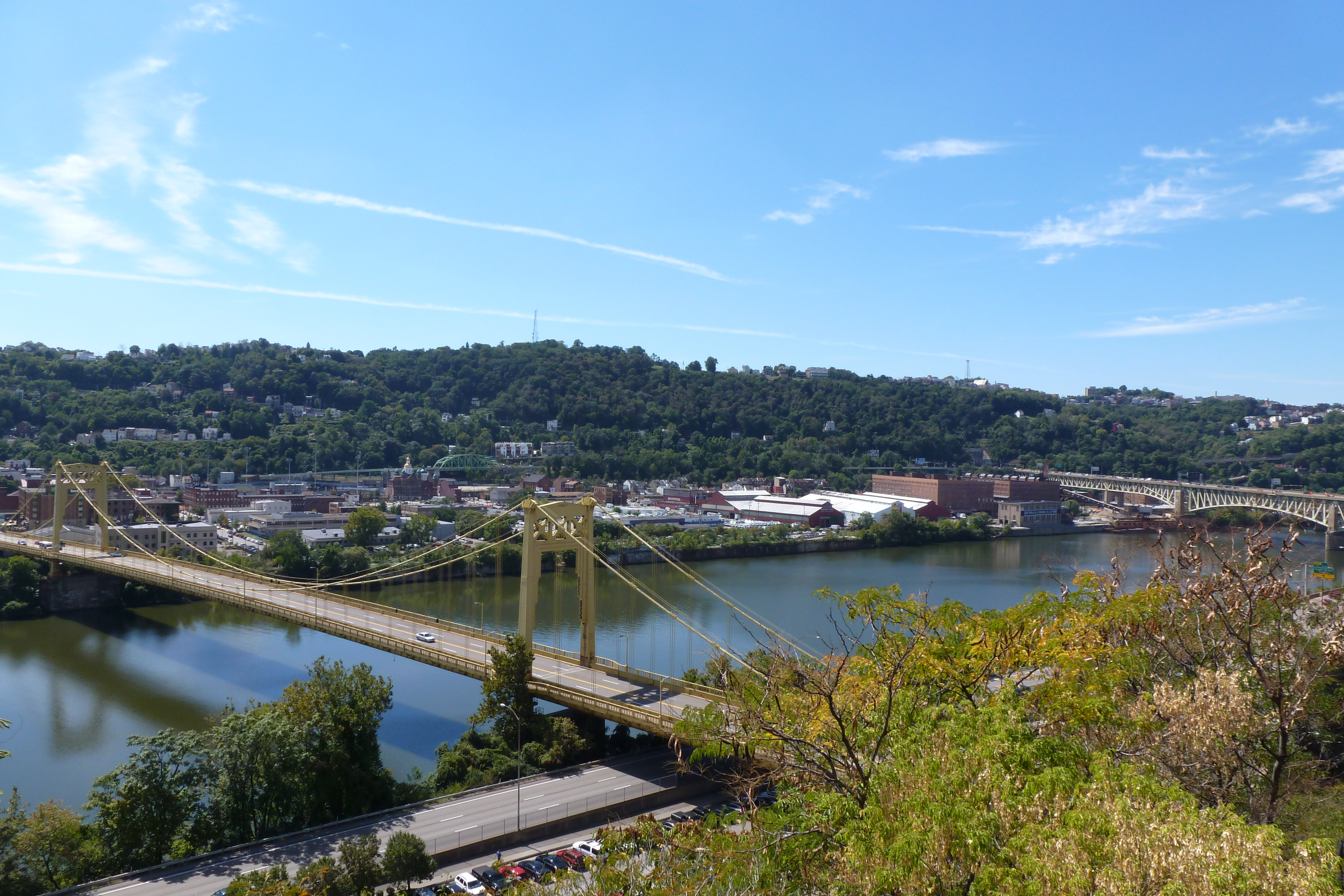
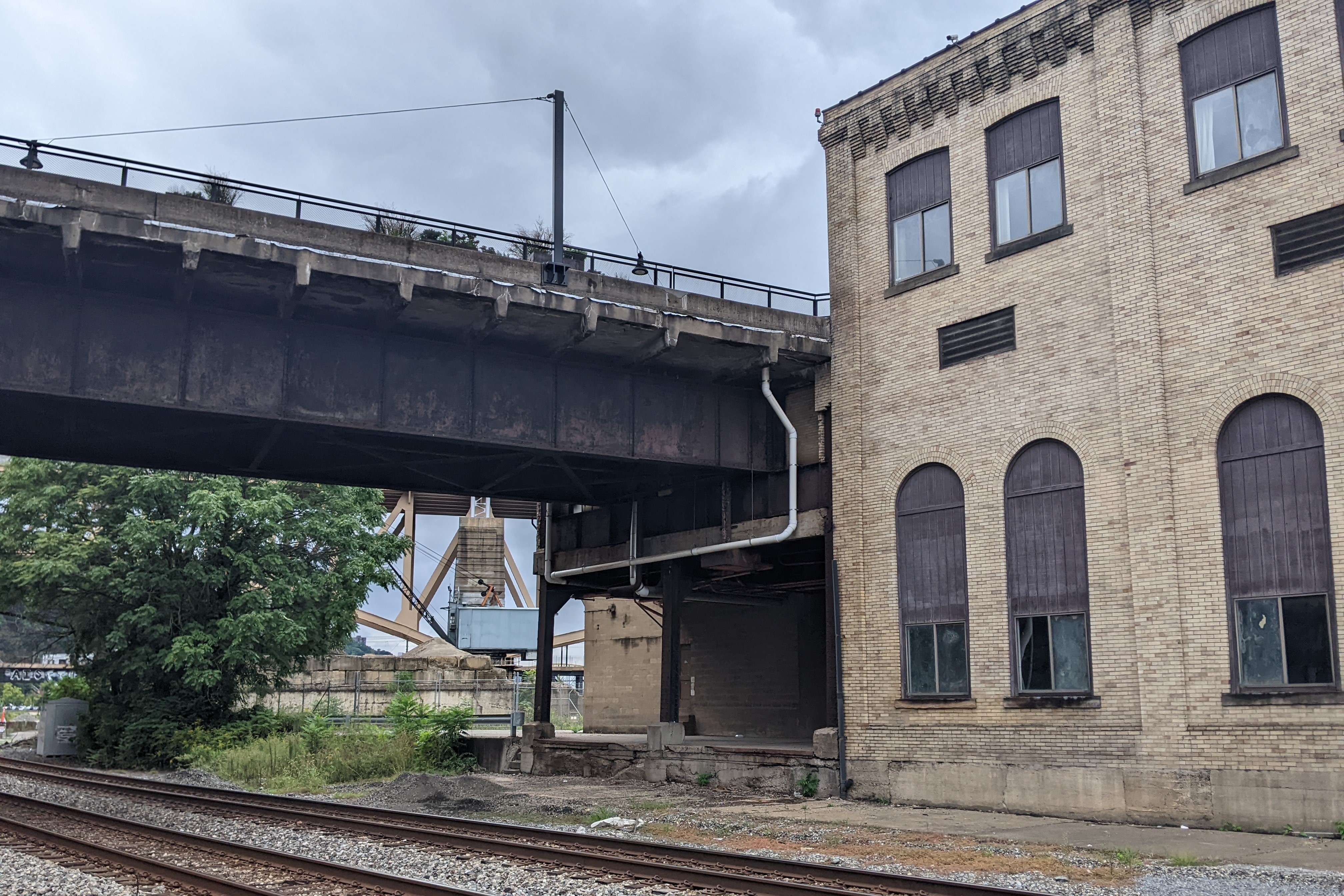
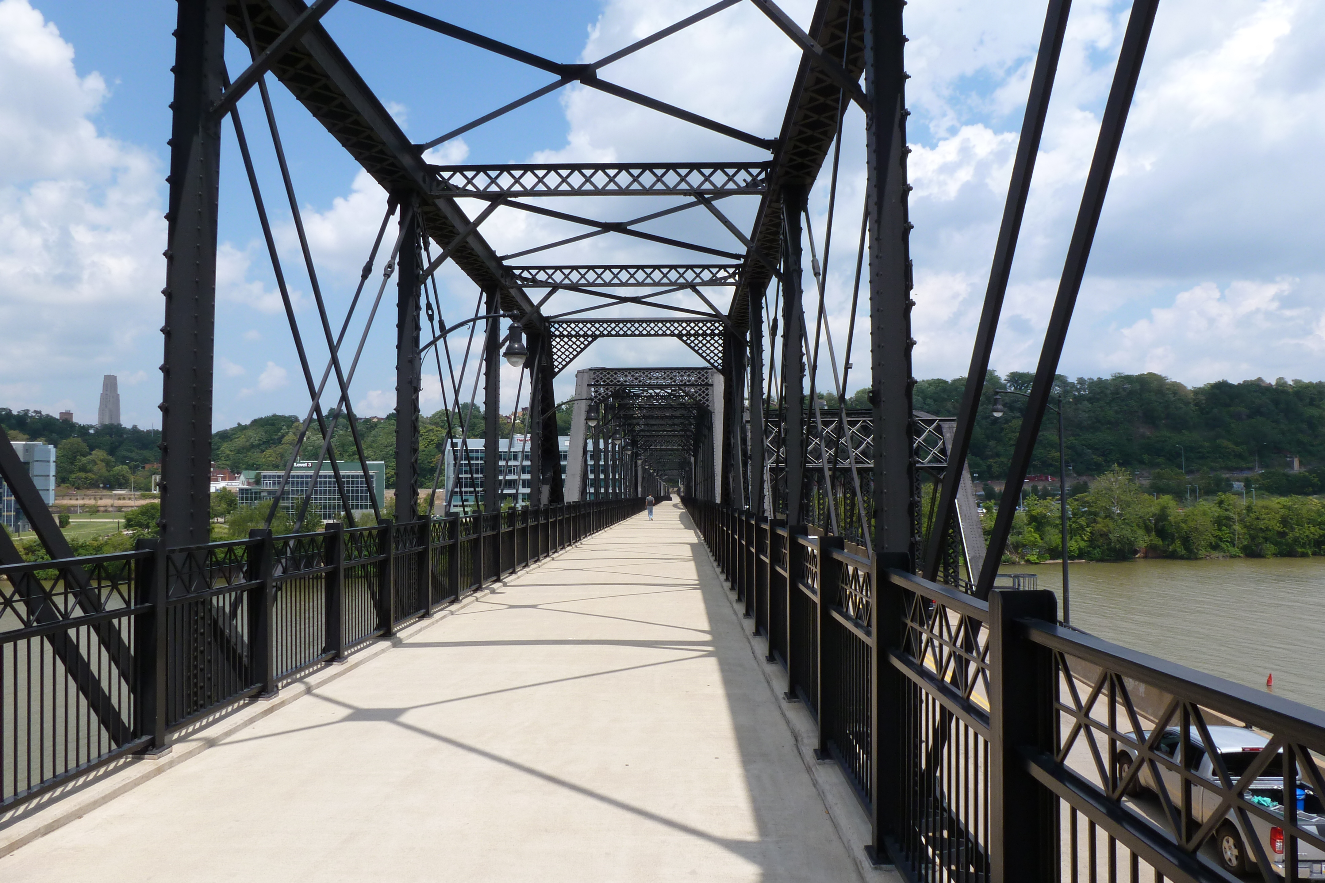
The final bridge in our 10-year anniversary look back at the Pittsburgh bridges and their environs is the Hot Metal Bridge. This is upriver from the Birmingham Bridge and the last bridge on the Monongahela before the big bend that hides downtown from view.

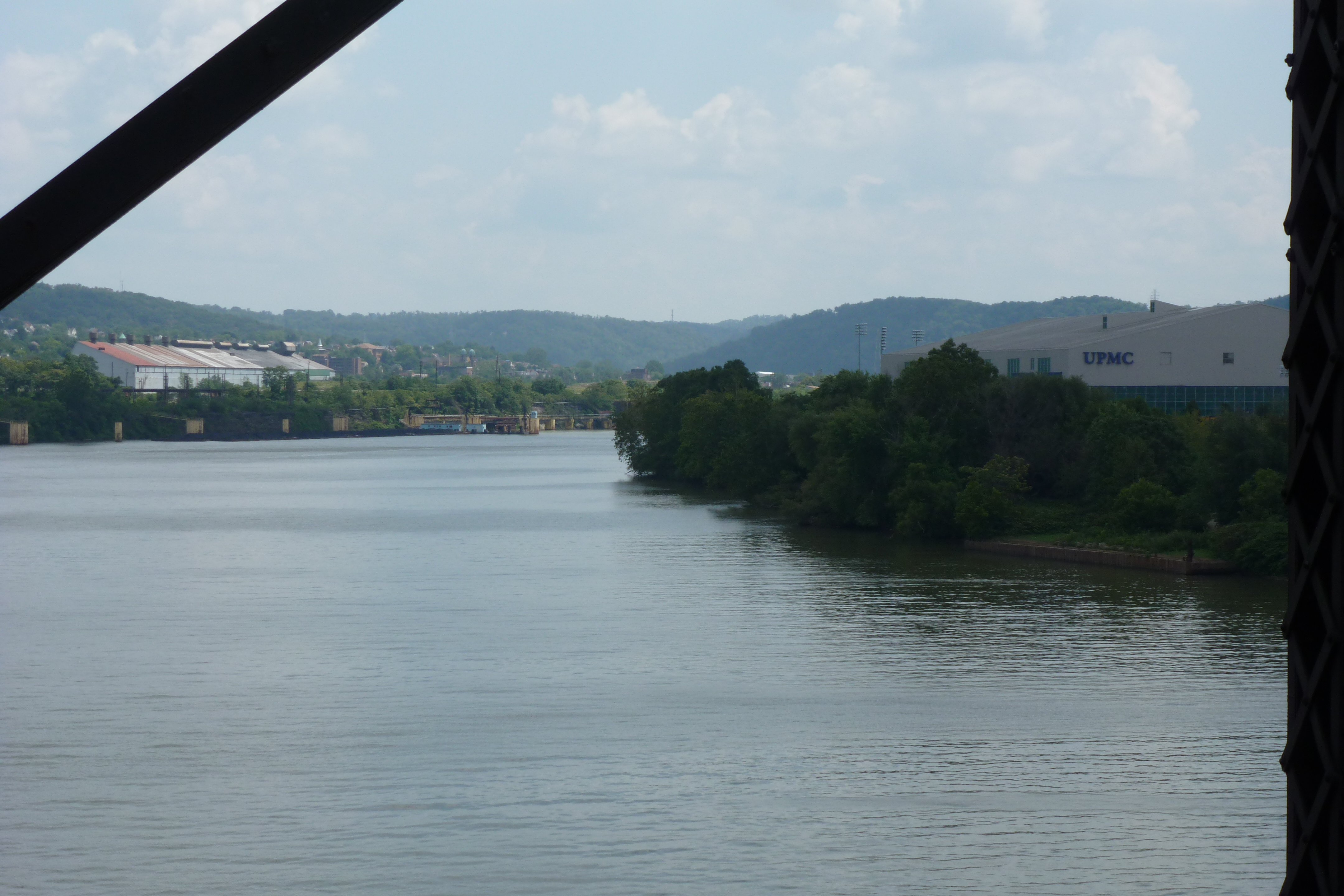
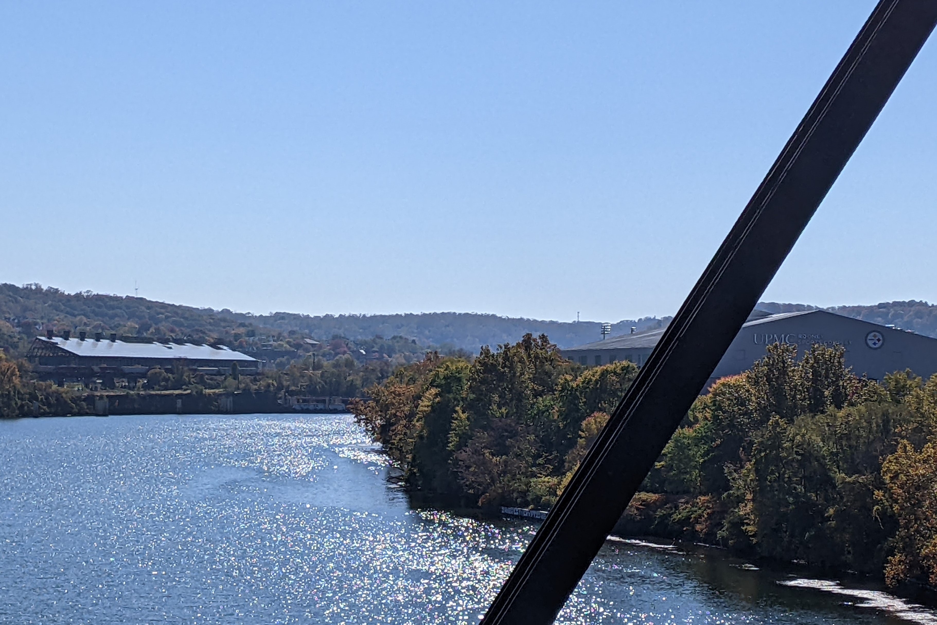
The Hot Metal Bridge was built to connect the Jones and Laughlin Steel Mill’s sites on opposite sides of the Monongahela River. With the industrial decline of Pittsburgh’s steelmaking industry in the mid- to late-20th century, Jones and Laughlin’s operations ceased over the 1980s. The first redevelopment of a portion of their property began in 1981. The redevelopment continues today.

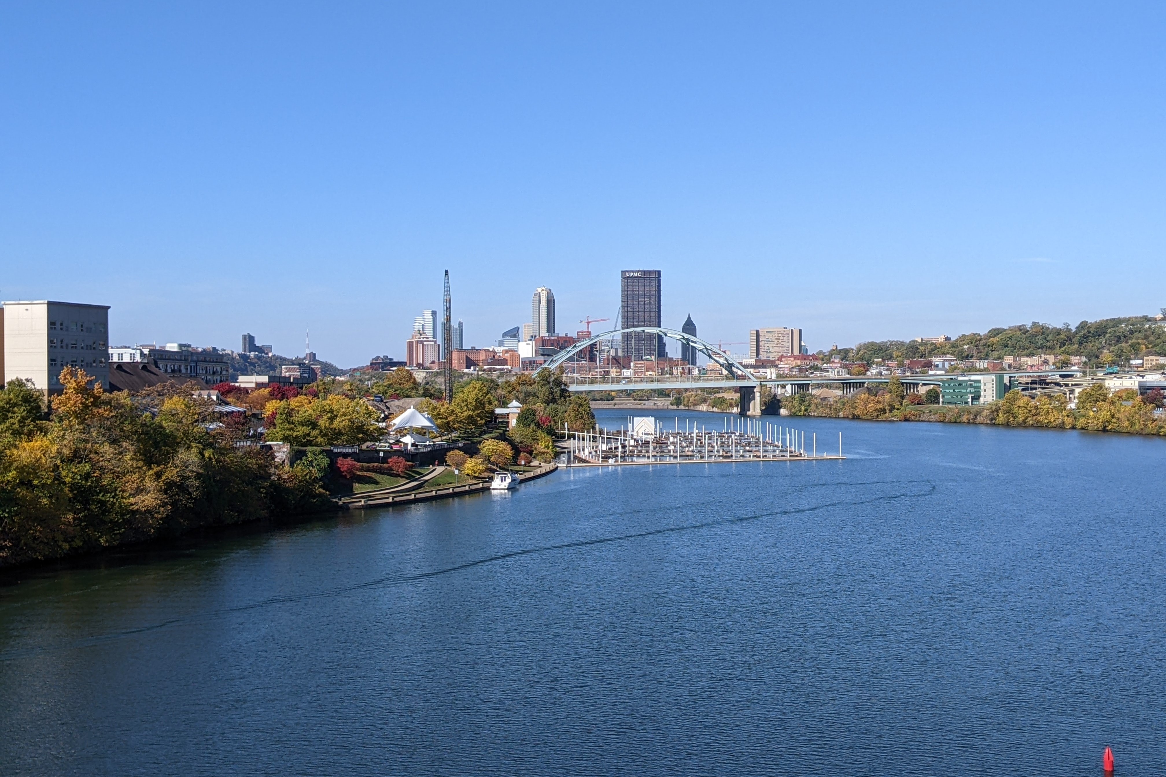
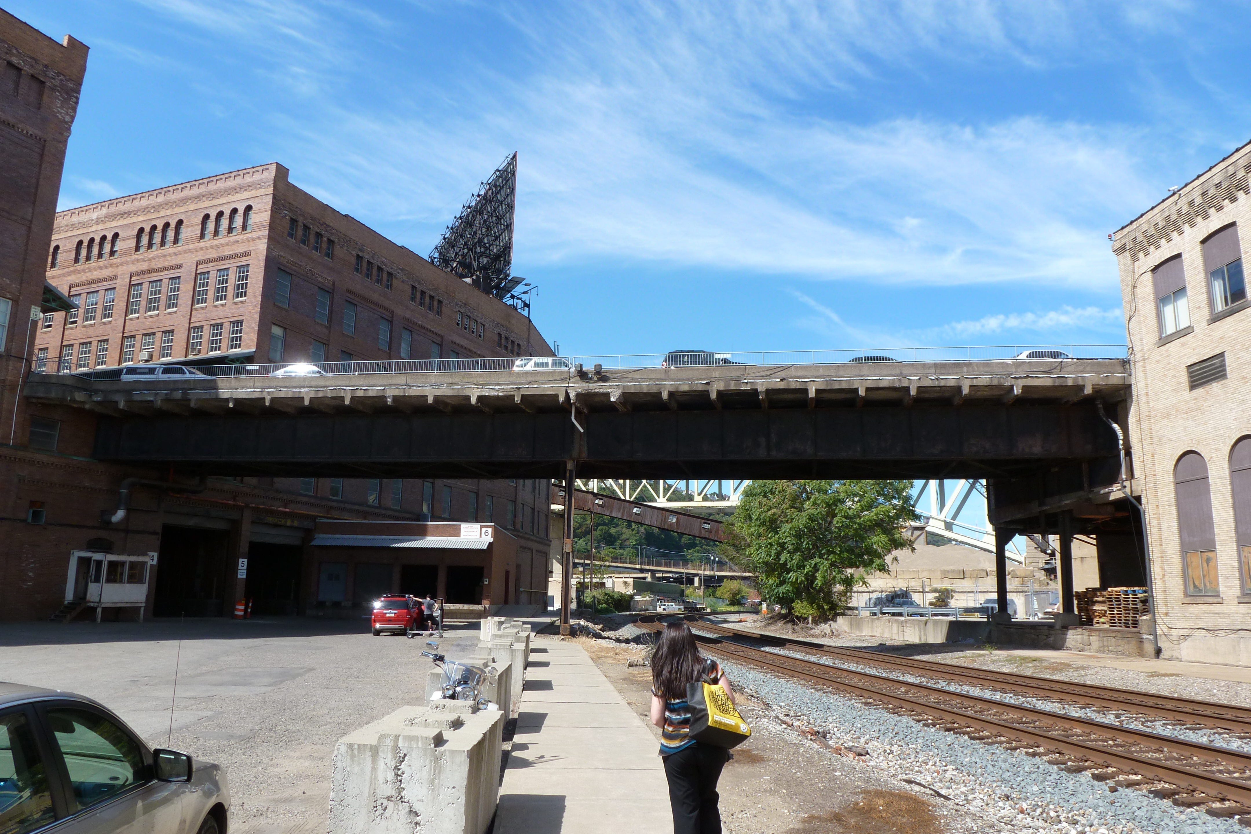
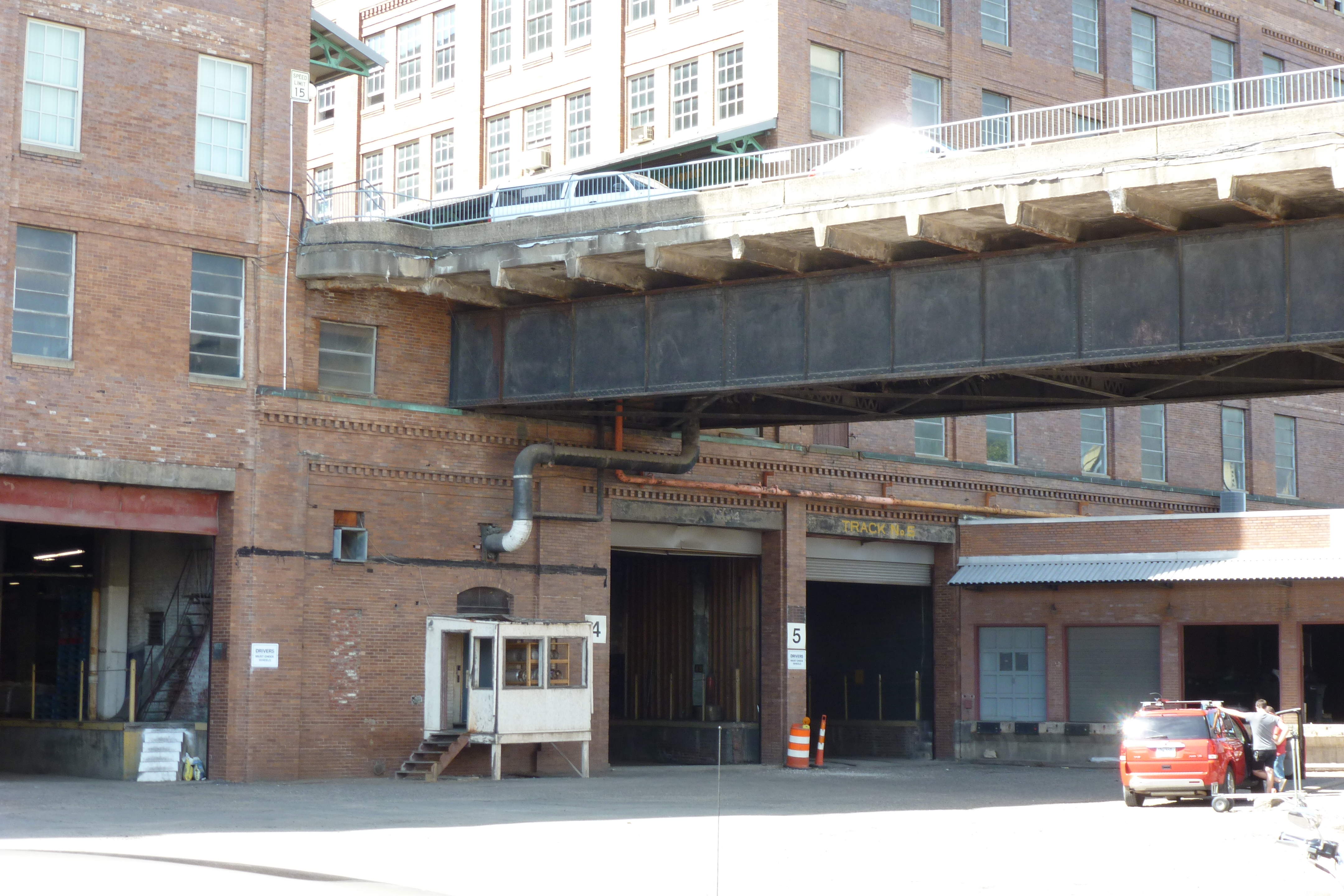
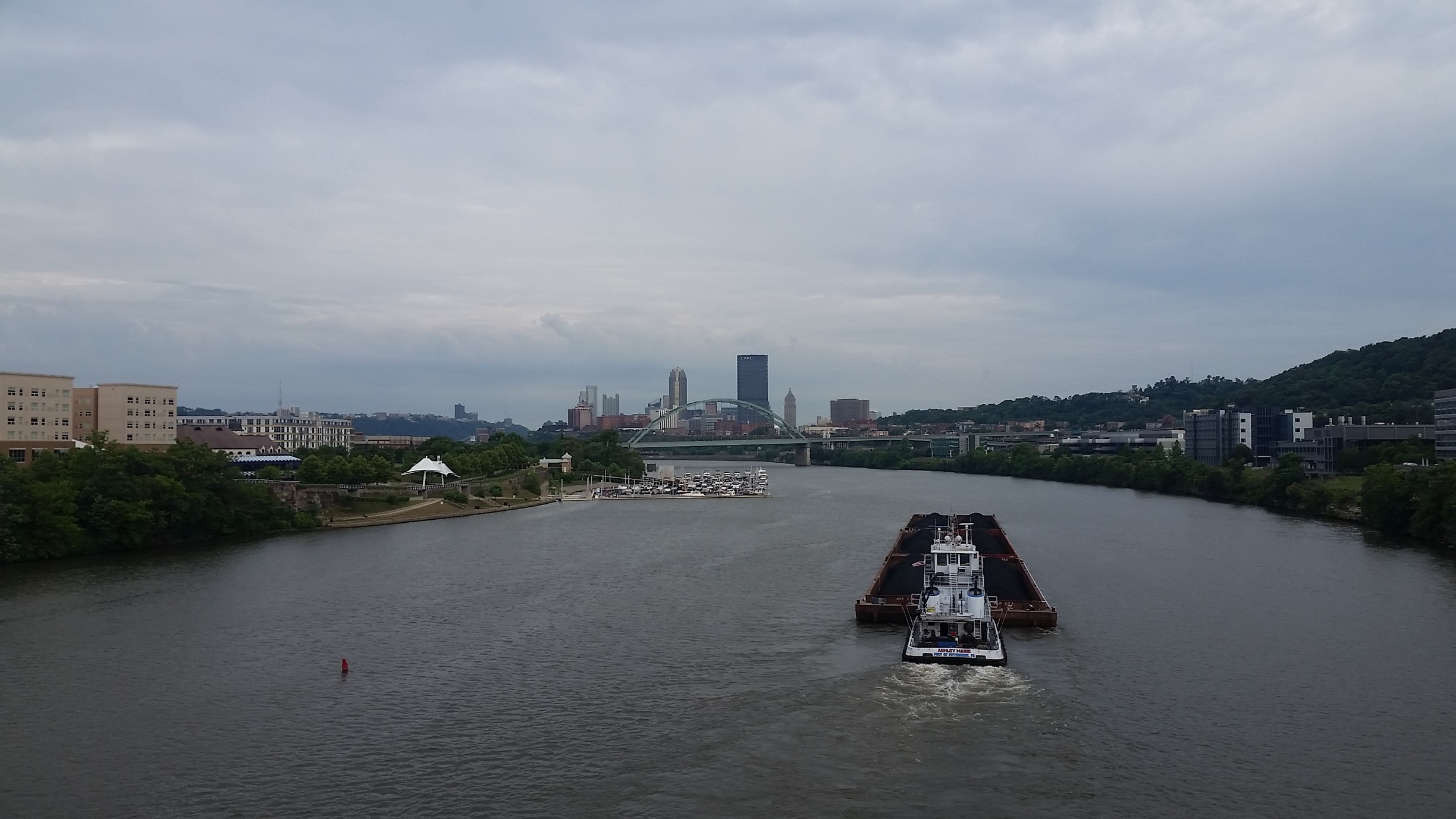
On the south side of the river, the former site of milling operations is now the South Side Works shopping, dining, and residential area. Since 2012, the first marina in the city limits was added here and buildings under construction have opened (first photo pair), other buildings not pictured have been added.

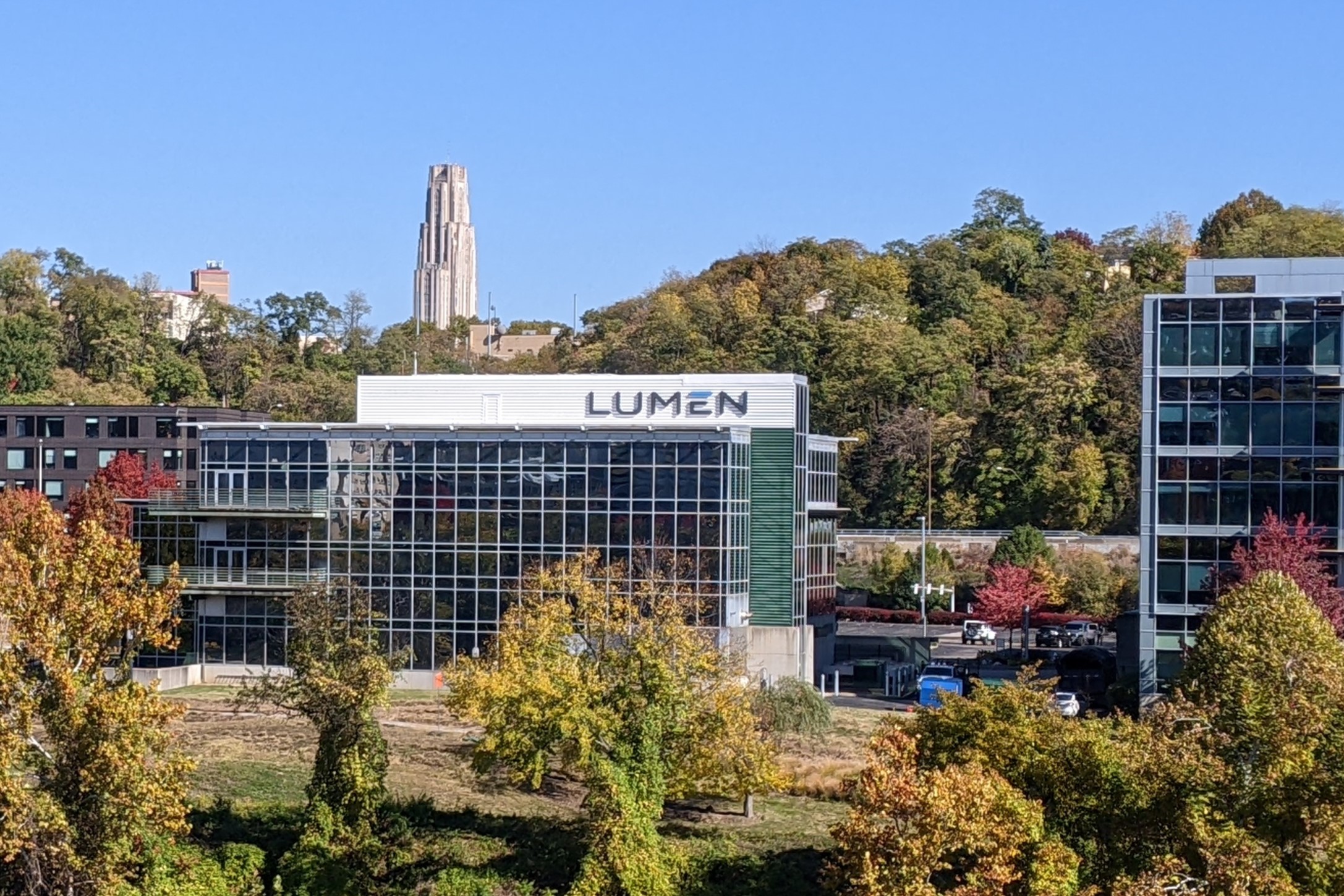
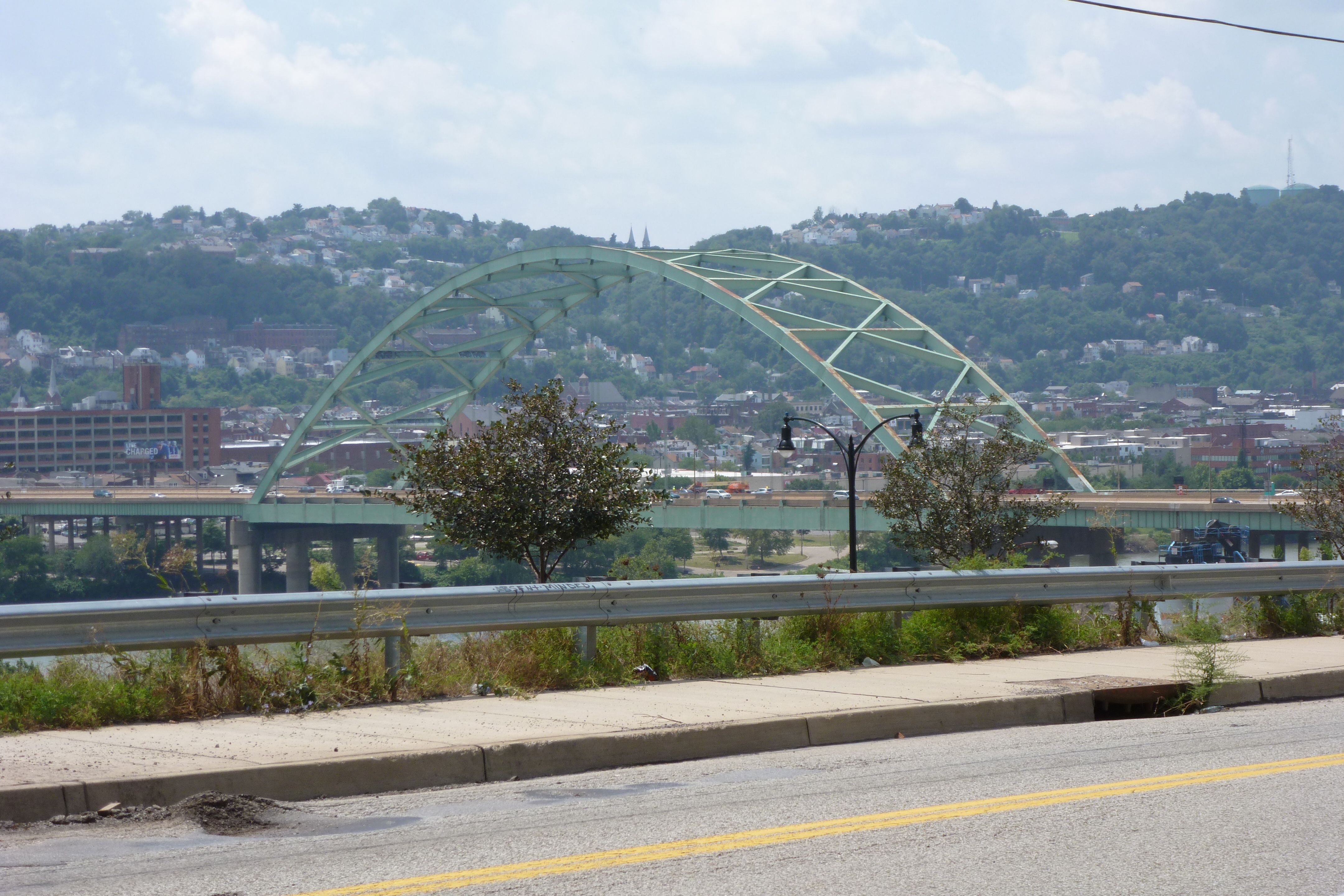
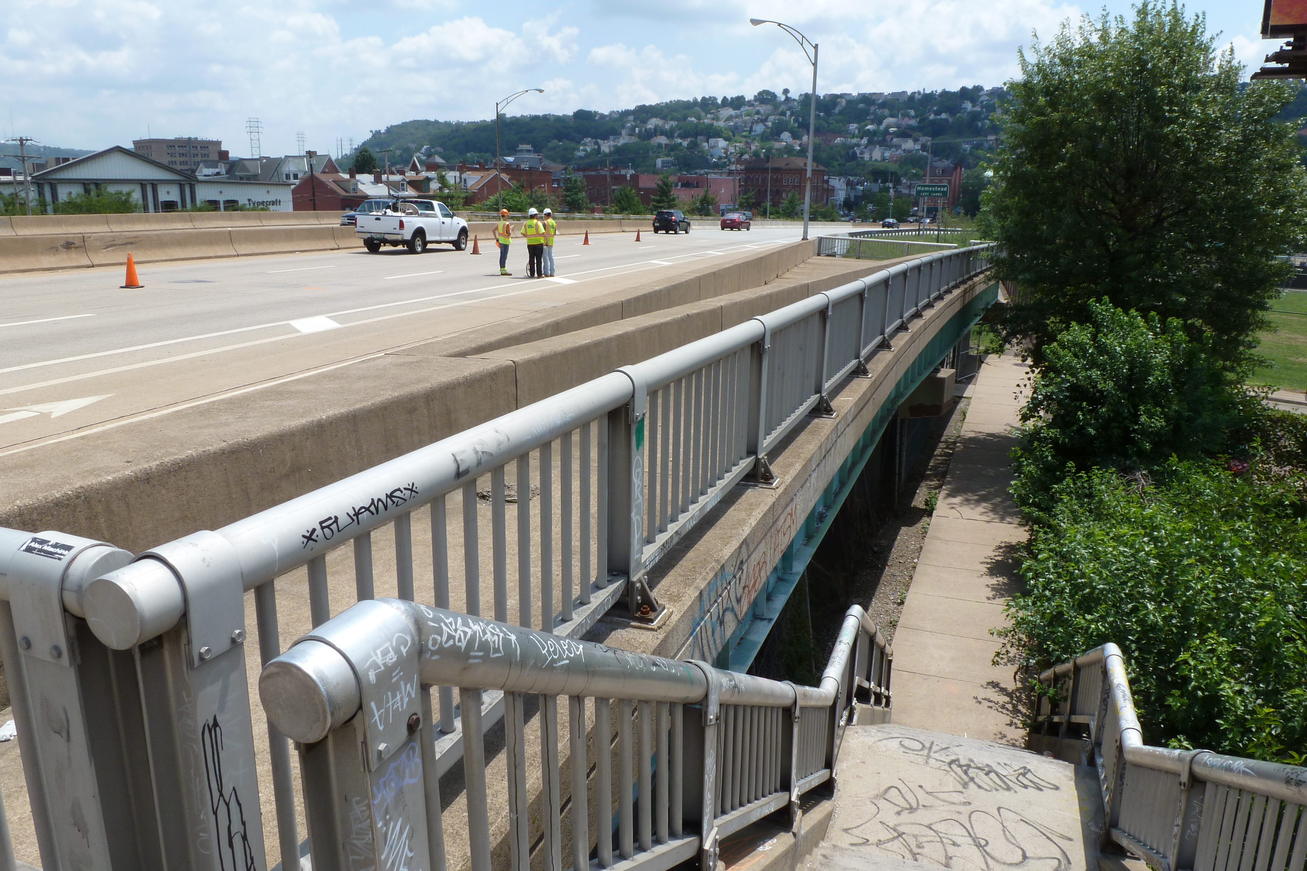
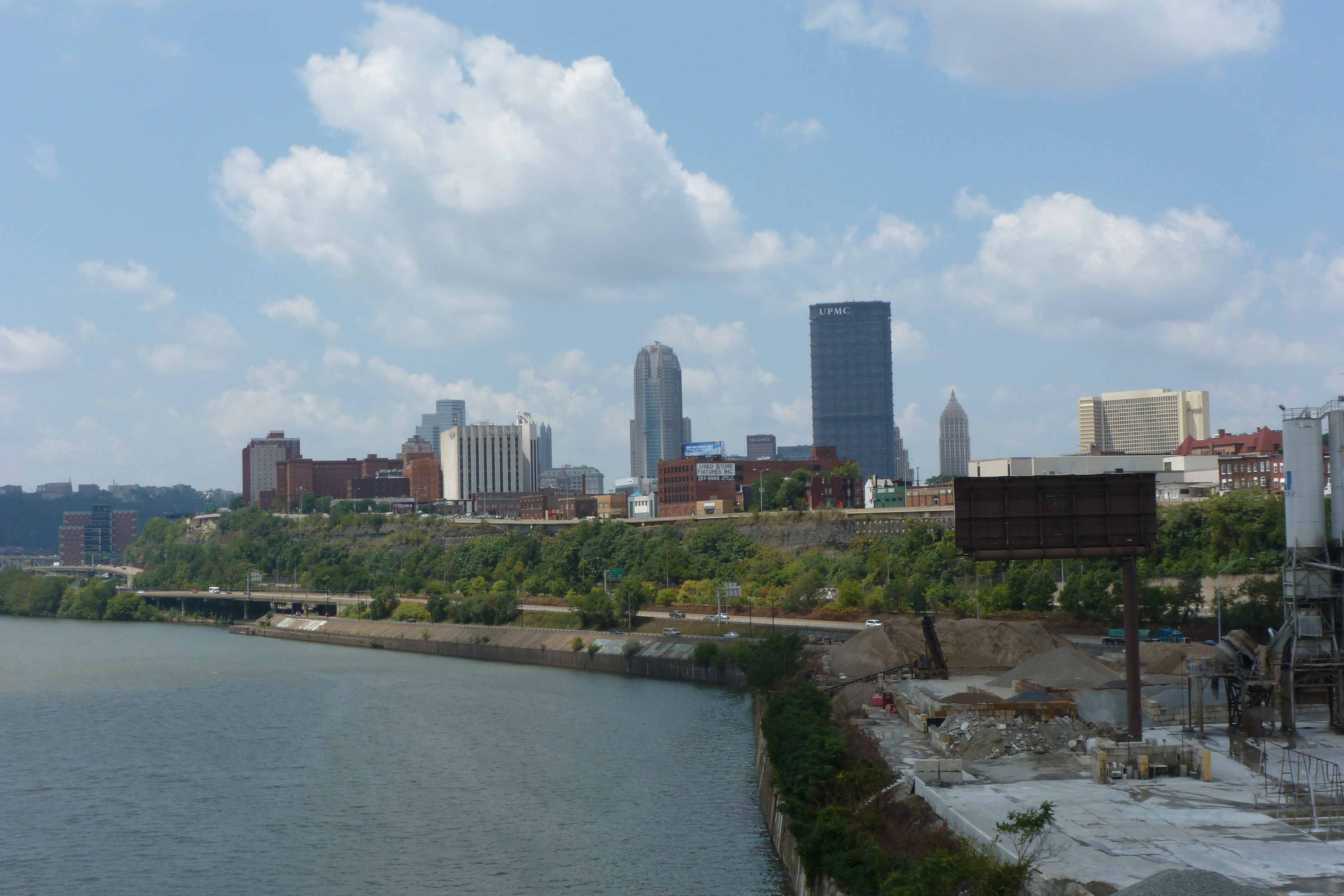
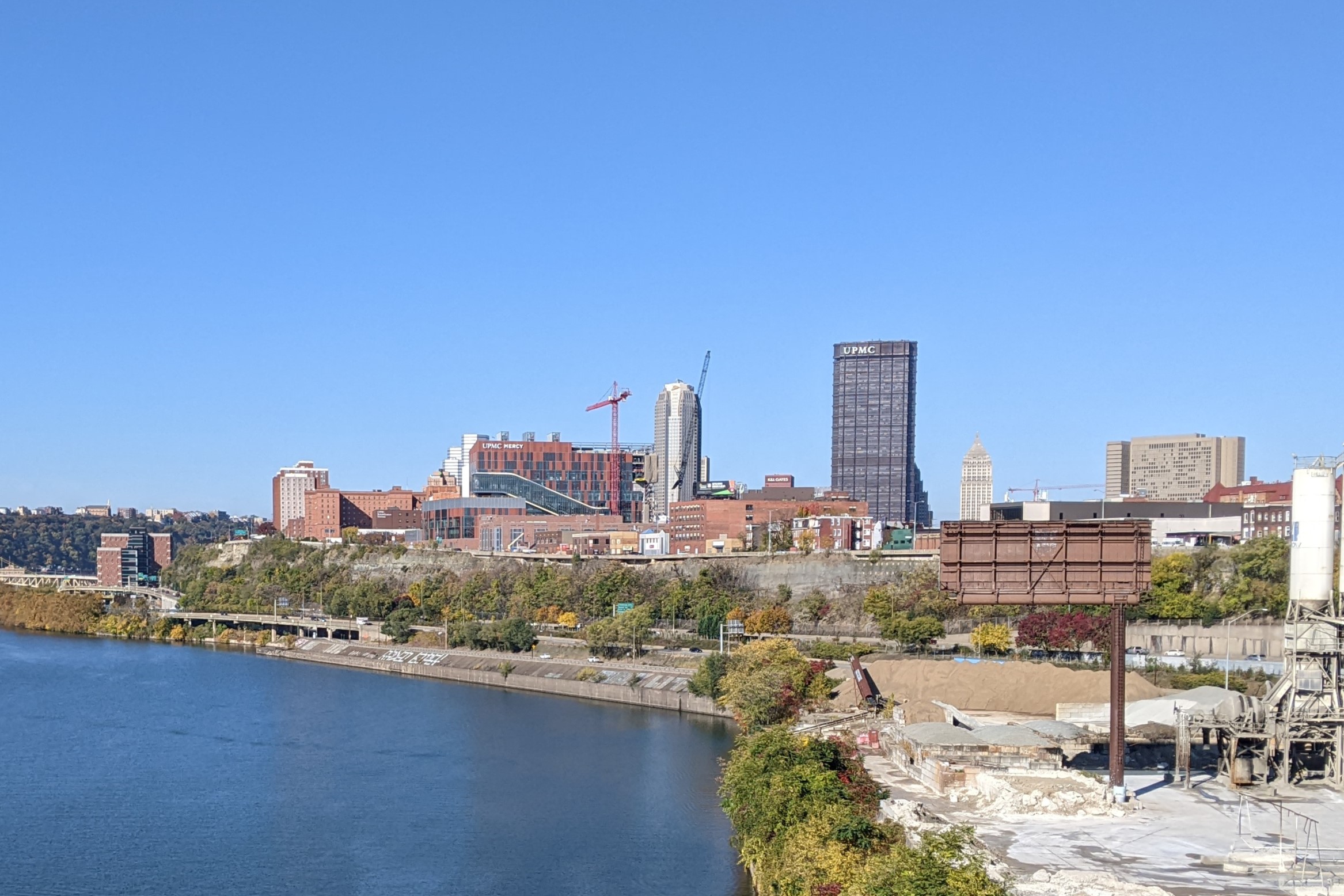
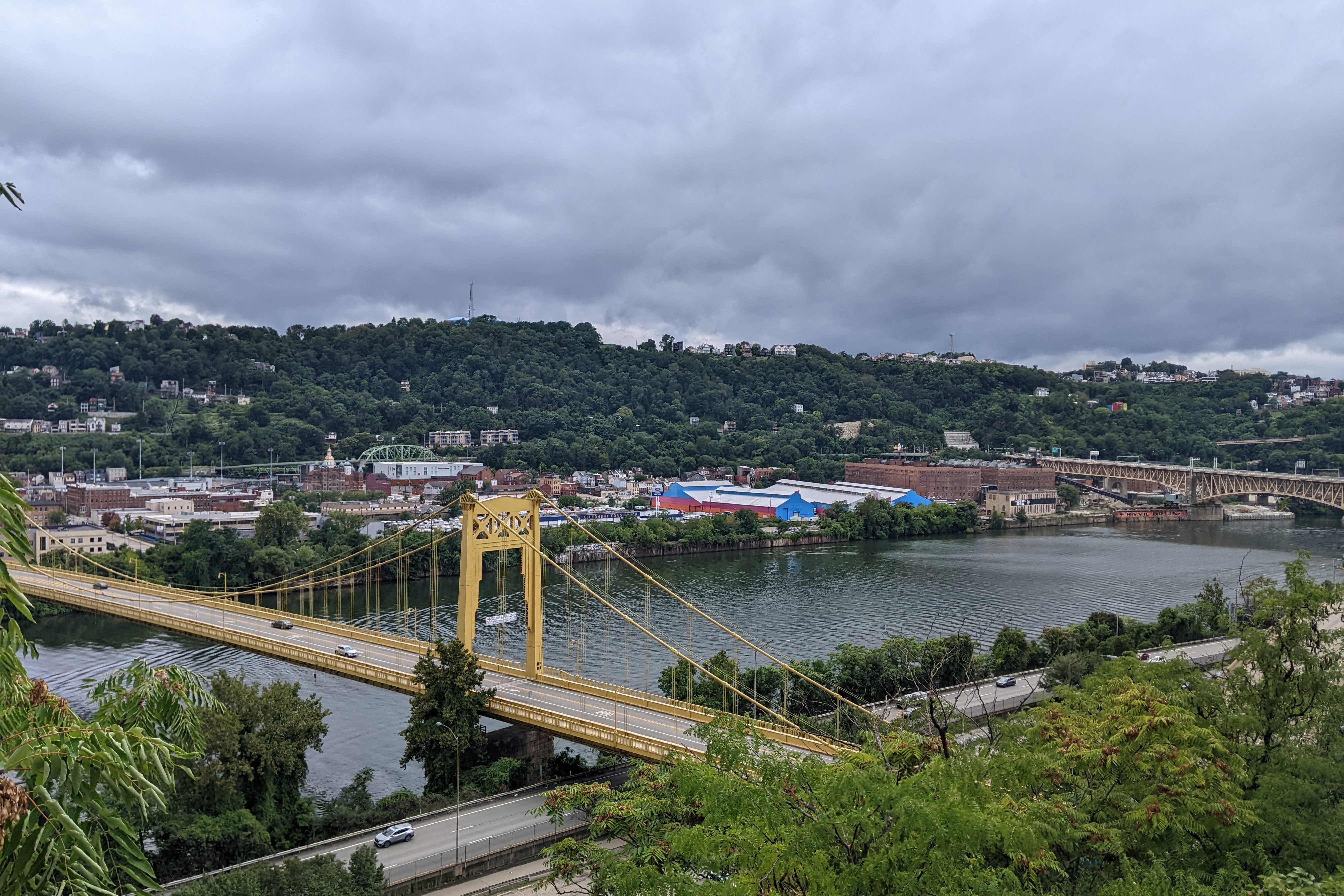
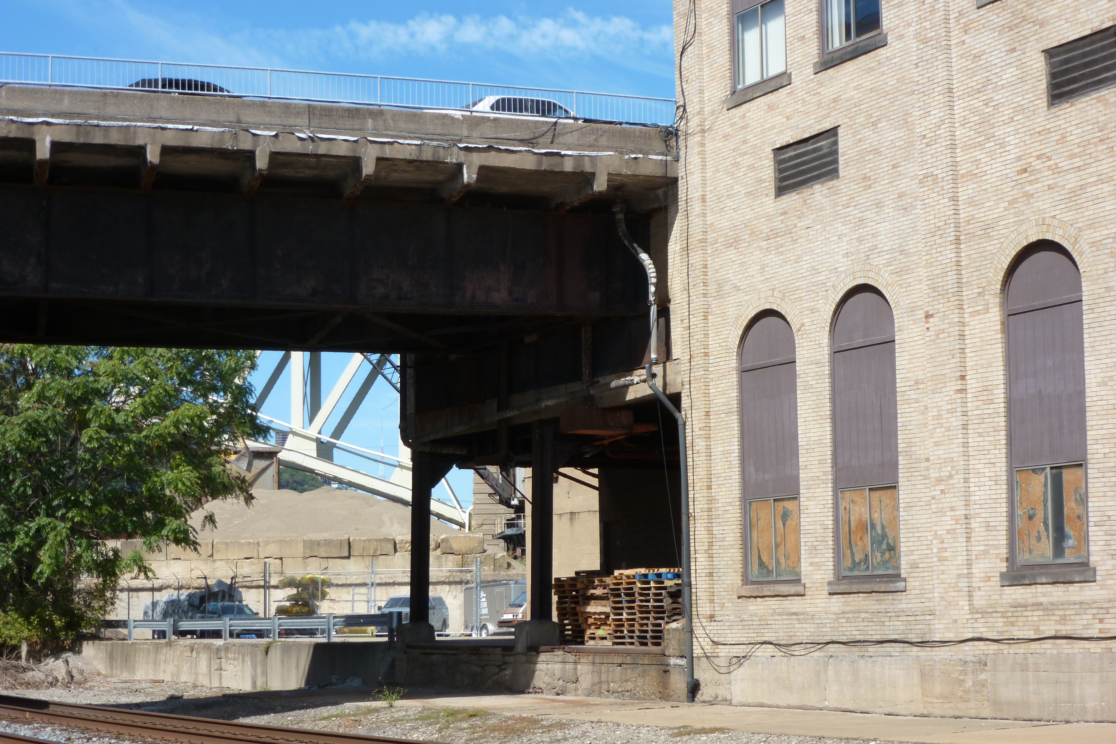
On the north side downriver, the former site of the blast furnaces is now the Pittsburgh Technology Park containing office buildings, parking, and a hotel. The hotel was added in the last ten years as well as several other buildings outside the frame in the second and third set of photos.

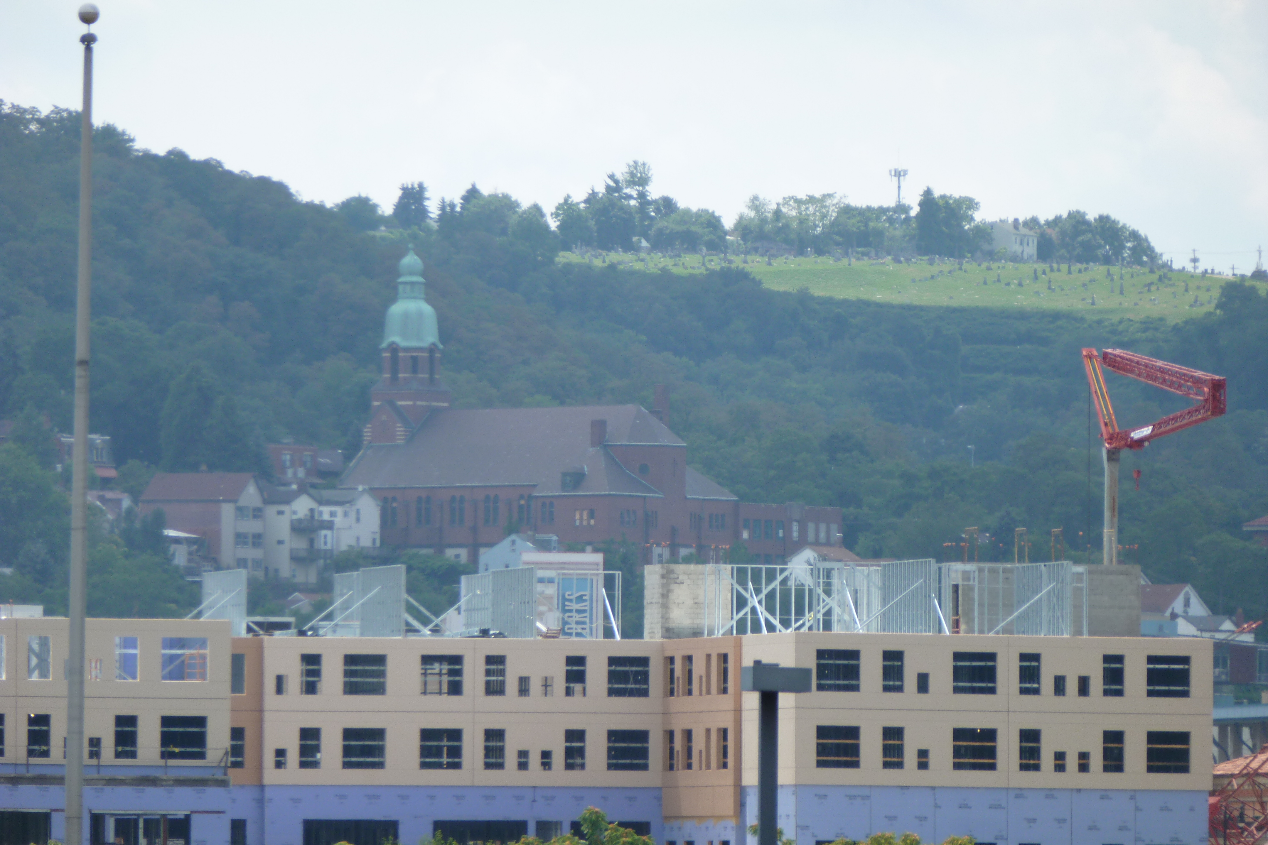
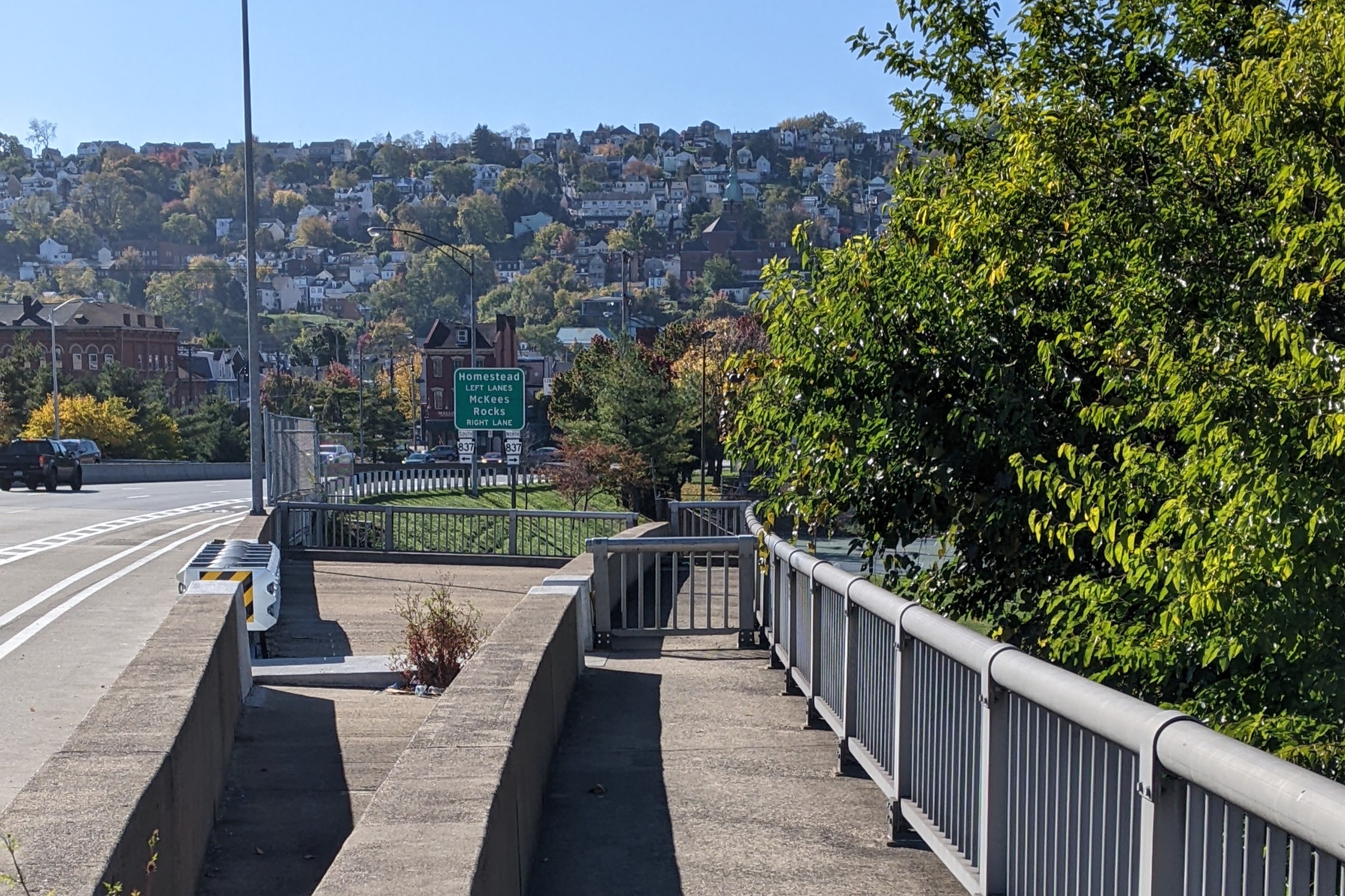
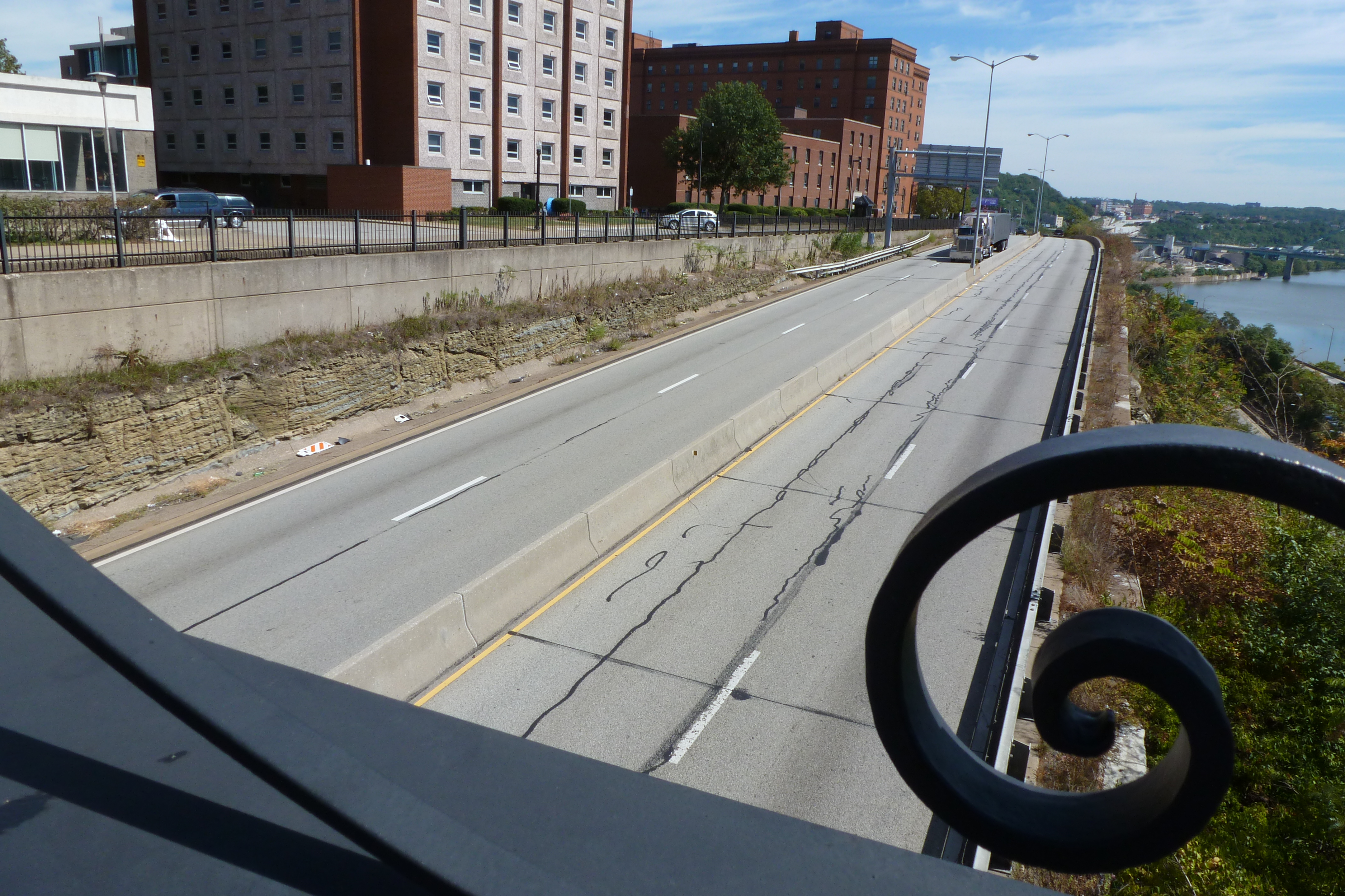
On the north side upriver, the former Hazelwood Works is now the Hazelwood Green site a planned mixed-use, multi-block redevelopment. The remaining mill buildings on the site have been redeveloped as office and research facilities with the Mill 19 building visible on the left side of the river in the fourth photo pairing. The space between and around these buildings is expected to be filled in with other buildings of a variety of uses in the coming years.

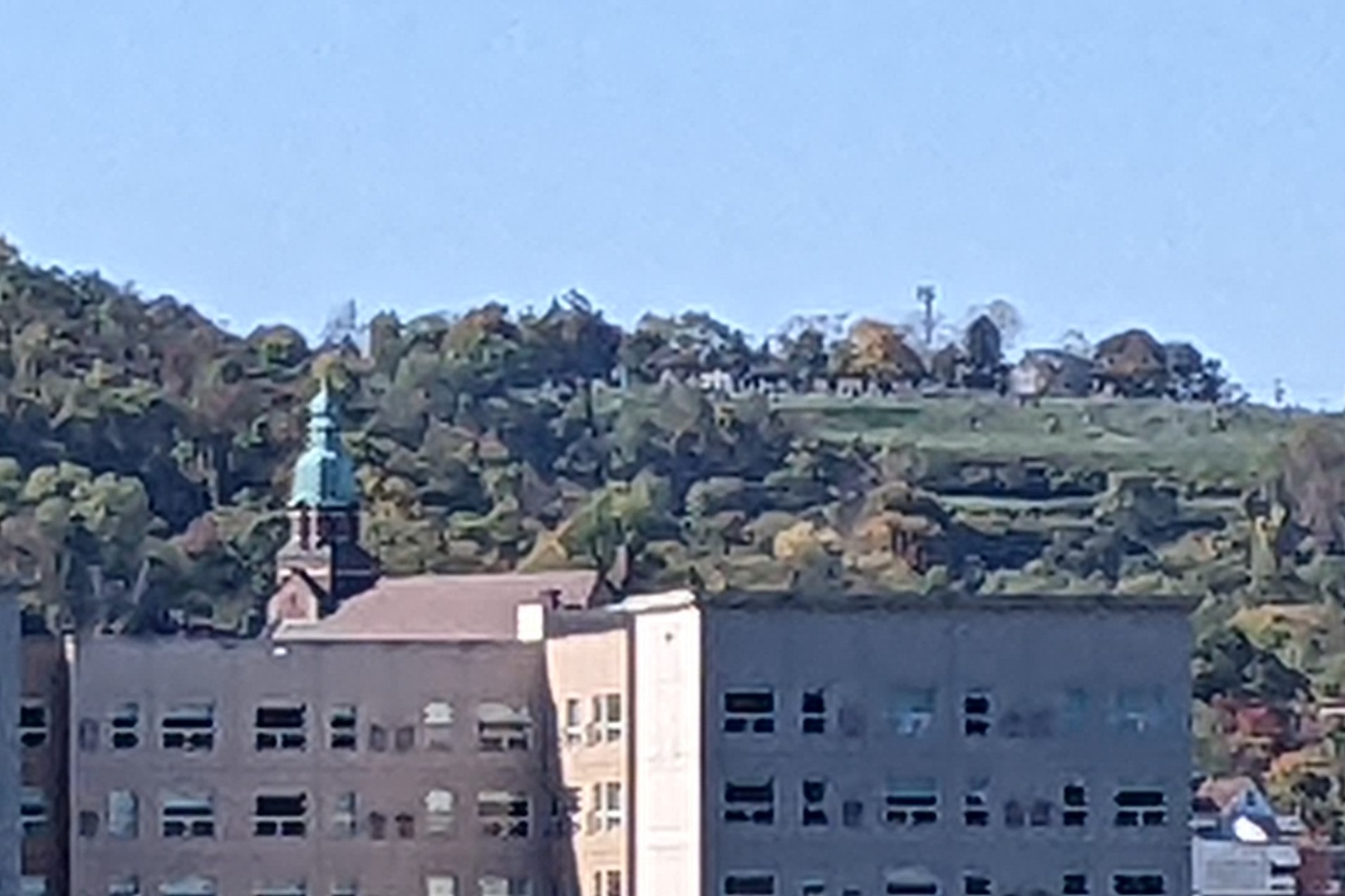
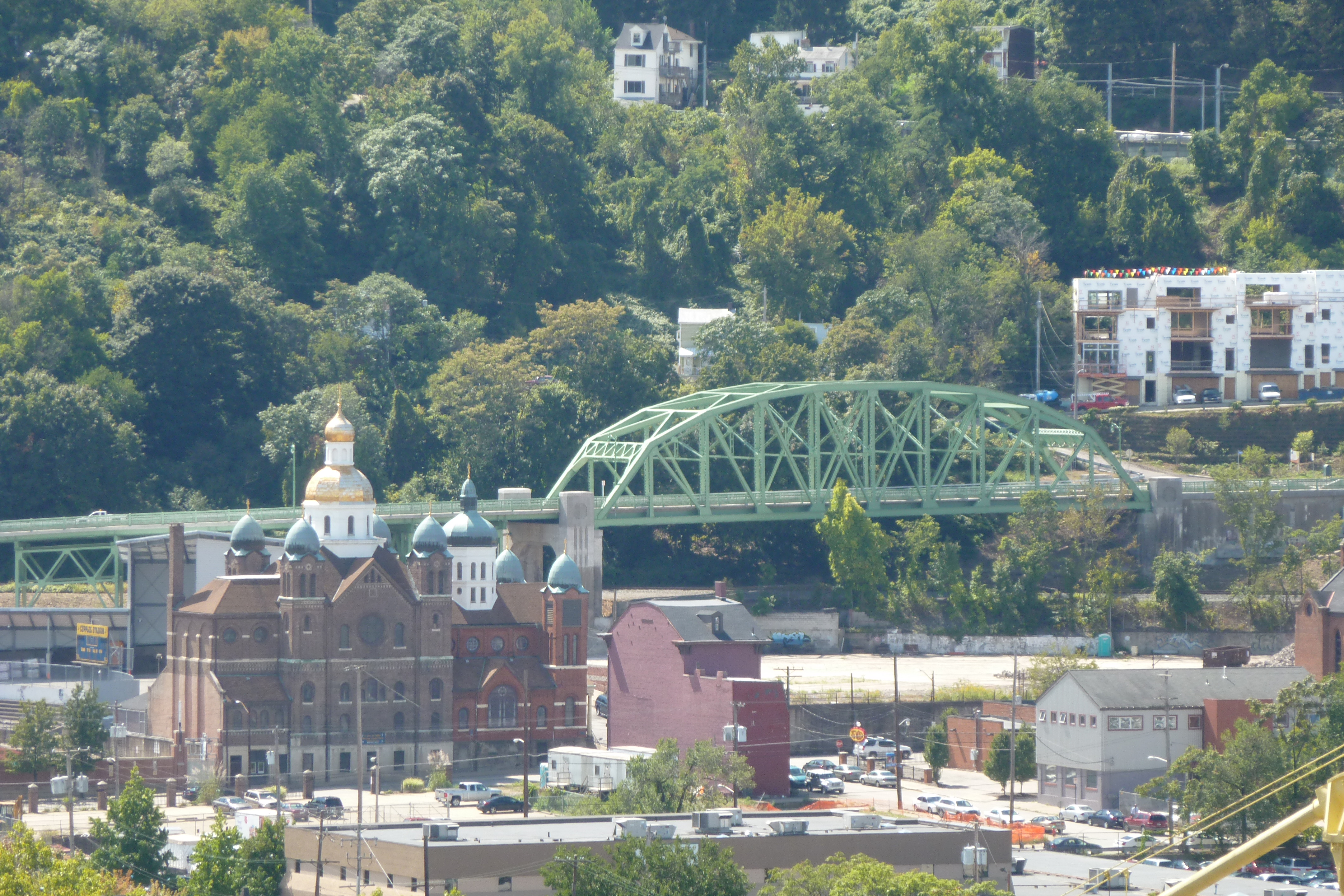
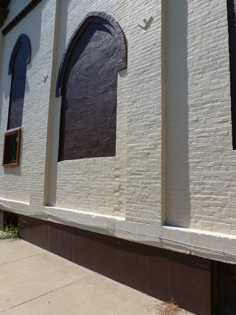
The final photo pair features the former St Josaphat’s Catholic Church on the South Side Slopes, which is a building I have an eye as one of Pittsburgh’s pending adaptively reused religious buildings. This view shows another angle of the growth of the South Side Works development.

While both South Side Works and the Pittsburgh Technology Park were substantially developed by 2012, they continue to expand. On the other hand, Hazelwood Green is just beginning to be developed and is still predominantly vacant land. In another 10 years, perhaps, the upriver view from the Hot Metal Bridge will be significantly altered.

Then & Now: Birmingham Bridge

The penultimate installment of the Then & Now series is the Birmingham Bridge just upriver from the Duquesne University Pedestrian Bridge. This is a bridge that I’ve walked multiple times from necessity despite the fact that it was not well-designed for pedestrians, which I complained about in my first post about the bridge.

It would be nice to think that the pedestrian access upgrade it underwent in 2021 was in response to my complaints of the accessibility issues with the bridge design. However, the upgrade only partly resolves those issues.

On the south end of the bridge, pedestrians are no longer forced to leave the bridge and take steps down into the park. Instead, there is an option to continue along the level of the bridge. (See the first pair of photos.) This new option at first pushes pedestrians into the edge of the pavement beside the bike lane with no physical separation from the bikes or speeding cars. Once the bridge reaches the ground, a raised sidewalk appears.

On the north end of the bridge, there was no change for pedestrian’s use of the bridge (second photo pair). The options remain to walk in the painted buffer of the bike lane from where the bridge leaves Fifth Avenue or walk several blocks out of the way down the equivalent of multiple stories only to walk back up them on the sidewalk on the ramp from Forbes Avenue.

The view of Oakland from the bridge (third photo pair) shows a building that I regretted not taking photos of before it was demolished and one of the new buildings built along Fifth and Forbes in recent years. Looking downriver toward downtown (final photo pair), the new vision center as part of UPMC Mercy Hospital is clearly visible, though its coloring blends in well from this distance. Both of these views are expected to change further in the coming years with additional growth in Oakland and the redevelopment of the Lower Hill adjacent to downtown.

Then & Now: Duquesne University Pedestrian Bridge

I first walked the Duquesne University Pedestrian Bridge as part of my 10th Street Bridge walk in September 2012. However, by that point I was walking bridges faster than I could post about them. This is one of the bridges that I hadn’t posted about until now. It is accessed by a multi-story staircase from the northern end of the 10th Street Bridge and it crosses the speedy Blvd of the Allies. Students who prefer walking (and climbing) to transit and who live or party on the South Side use the 10th Street Bridge-staircase-pedestrian bridge path to get to and from campus.

Because of this bridge’s perch on The Bluff, it has great views up and down the Monongahela River. Some of the developments that have happened since 2012 along this river are visible from this bridge. The first pair of photos show a new construction self-storage complex that was built on a vacant, but complex, industrial site. Zooming out some in the second pair, a now brightly colored set of warehouses stand out (which incidentally are next to the Highline/Terminal Way Bridge). Less clearly visible is the white smudge that is the extension into the river built by the gravel company just on the other side of the Liberty Bridge.

The most surprising thing to me on this return trip is that the new UPMC Mercy Vision Rehabilitation Center that is still under construction and looks massive from the views in my Keeping an Eye on Uptown series is not very visible from this bridge. If it had been a sunny day when I was out taking photos, perhaps the glass would have glinted a little more behind the freeway sign, but as it is, the dark spot visible under the freeway sign now isn’t much different than the dark spot from 10 years unless you zoom in close (final photo pair).

Then & Now: Terminal Way Bridge

Last month’s look back at the 40th Street Bridge wrapped up the Allegheny River watershed portion of our 10-year anniversary Then & Now series. This month, we start revisiting bridges in the Monongahela River watershed.

The Terminal Way Bridge – now called The Highline – is unique in the Pittsburgh bridges I’ve walked as it is not a through-way. It is an elevated passage that connects five buildings of a former large warehouse operation. The bridge was previously a car road and parking lot. Pure speculation based on the small factoids and selection of historic photos on the Highline website suggests that at one time, this road was were good were loaded onto local delivery vehicles. Now, it is closed to all vehicular traffic and is instead an outdoor amenity space, exclusively for pedestrians and bicyclists.

While I walked over the bridge multiple times before the renovation, I was never inspired to take a photo of the parking lot that it was. I did, however, take photos of it from below which are still able to show the change from car parking to planters. They also show the change from former warehouse to a place poised to become a hip place is town.

Sacred Row

P1050644 (1024x768)

This is a fascinating structure I discovered on the South Side Flats. A friend and I were going around the neighborhood looking at adaptively reused church buildings. While going from one building we knew of to another location, we stumbled upon this building. From what I’ve pulled together so far, this building was built sometime between 1876 and 1884 as four rowhouses. In 1926, the Second Greek Catholic St John the Baptist Church of the South Side purchased the property. The deed described the structure as four 4-room houses. When the Second Greek Catholic St John the Baptist Church sold the property in 1959, the deed described the property as four 2-story brick party wall houses.

P1050646 (768x1024)

However, when you look at the side of the building facing 23rd St, it appears that at one time, this property was used as a church. The middle of the three boarded up openings on this side looks like it used to be a door for an entrance into a church that has been partially bricked up. From this I assume that while the Second Greek Catholic St John the Baptist Church owned the property, they renovated to use as their place of worship with a main front door and two windows.

I look forward to learning more about this structure and its history. I suspect there is an interesting story that connects this building to the 1st St John the Baptist Greek Church which is still in operation at the corner of E Carson St and 7th and the 2nd St John the Baptist Greek Church that set up just down the block at 615 E Carson St before moving to Jane St. From the pieces I’ve found so far there was a severe split in the South Side congregation that involved boycotts and arrests of arguing members and former members.  I’m not sure yet how this rowhouse/church may have fit into that struggle.


Bridge Safety

The first time I walked across the Birmingham Bridge was before I came up with the idea of walking all the bridges in Pittsburgh.  I was going to an event on the South Side and according to the bus schedule, the best method for getting to this event was to take one of the Fifth Avenue buses to the Birmingham Bridge and walk across the bridge and down a few blocks on East Carson Street to the event.  I was quite dismayed when I got off the bus and saw that there was no sidewalk across the bridge–it turns out there is a sidewalk but it only connects to Forbes Avenue which is significantly lower than Fifth Avenue at this point.  Fortunately, there is a bike lane, clearly marked with a buffer zone across the bridge.  I kept as far to the right as I possibly could, hoping that cars recognized and honored the bike lane (I have noticed this is an issue for drivers in Pittsburgh at least in some areas), and headed across.  Nearly a quarter mile from Fifth Avenue, a ramp comes up from Forbes Avenue with a sidewalk.  I climbed over the cement barrier and crossed the core of the bridge on the sidewalk.  However on the southern half of the bridge, the sidewalk goes down a set of steps and comes out between the back of a parking lot and the underside of the bridge.  This seemed like a potentially unsafe place for a lone pedestrian, so I climbed back over the barrier and finished crossing the bridge as I had started, separated from the cars by only the painted lines of the bike lane.

I have walked this bridge a few times since then, employing this same method every time.  I have also observed other pedestrians using a similar method, though some don’t bother climbing over the barrier onto the sidewalk when that becomes an option.  This is truly the case of a bridge that may be pedestrian accessible, but is not at all pedestrian friendly.  In my post “One River Down,” I mention that Highland Park Bridge, Washington’s Crossing Bridge, and the 62nd Street Bridge are less than pedestrian friendly.  The Birmingham Bridge beats these bridges as the least pedestrian friendly bridge I’ve walked in Pittsburgh to the point that it is potentially unsafe for pedestrian use.

While the bridge is designed so that pedestrians can use a buffered sidewalk across the length of the bridge, the access points to this sidewalk are not convenient.  I discuss in “Taking the Long Way Round” that there are times and situations when pedestrians will go out of their way, but the Birmingham Bridge sidewalk does not meet them.  The northern access point is in a hollow surrounded by vacant or industrial-use lots and passes under several ramps/bridges/elevated roads carrying an interstate before reaching the level of the bridge.  Also there is no easy way to get there from Fifth Avenue at the bridge.  A pedestrian has to go down a block to a road that connects Fifth and Forbes avenues and then come back down toward the bridge to reach the sidewalk for it.  There is no incentive for a pedestrian on Fifth Avenue to go so far out of their way when the bridge is right in front of them.  The staircase at the other end of the bridge that I mentioned earlier makes about as much sense as this end’s inaccessible sidewalk access.  Not to mention that the staircase excludes anyone using a wheelchair from access to the sidewalk (it looks like there used to be a ramp on this end as well, but it is now sealed off and cut off).