Then & Now: East Liberty Pedestrian Bridge

Just after I began my 10-year anniversary celebration of bridge walking, the Forbes Ave Bridge over Fern Hollow collapsed on January 28, 2022. This accident shone a light on a pattern of infrastructure funding in the time since I became a bridge person. Ten years ago, there were several bridges built, repaired, or replaced in Pittsburgh. Five years later, the flurry of long overdue investment in our infrastructure stopped – before all the bridges that needed help received it. An article on the aftermath of last month’s bridge collapse reminded me that federal funds were allocated toward infrastructure under the Obama administration. As a result, many bridges that were falling apart were fixed or replaced. It seems that when that funding stopped, so did the repairs. Now that new funding has been allocated under the Biden administration, we should see a similar spurt of investment in our infrastructure, starting with the now missing Fern Hollow Bridge.

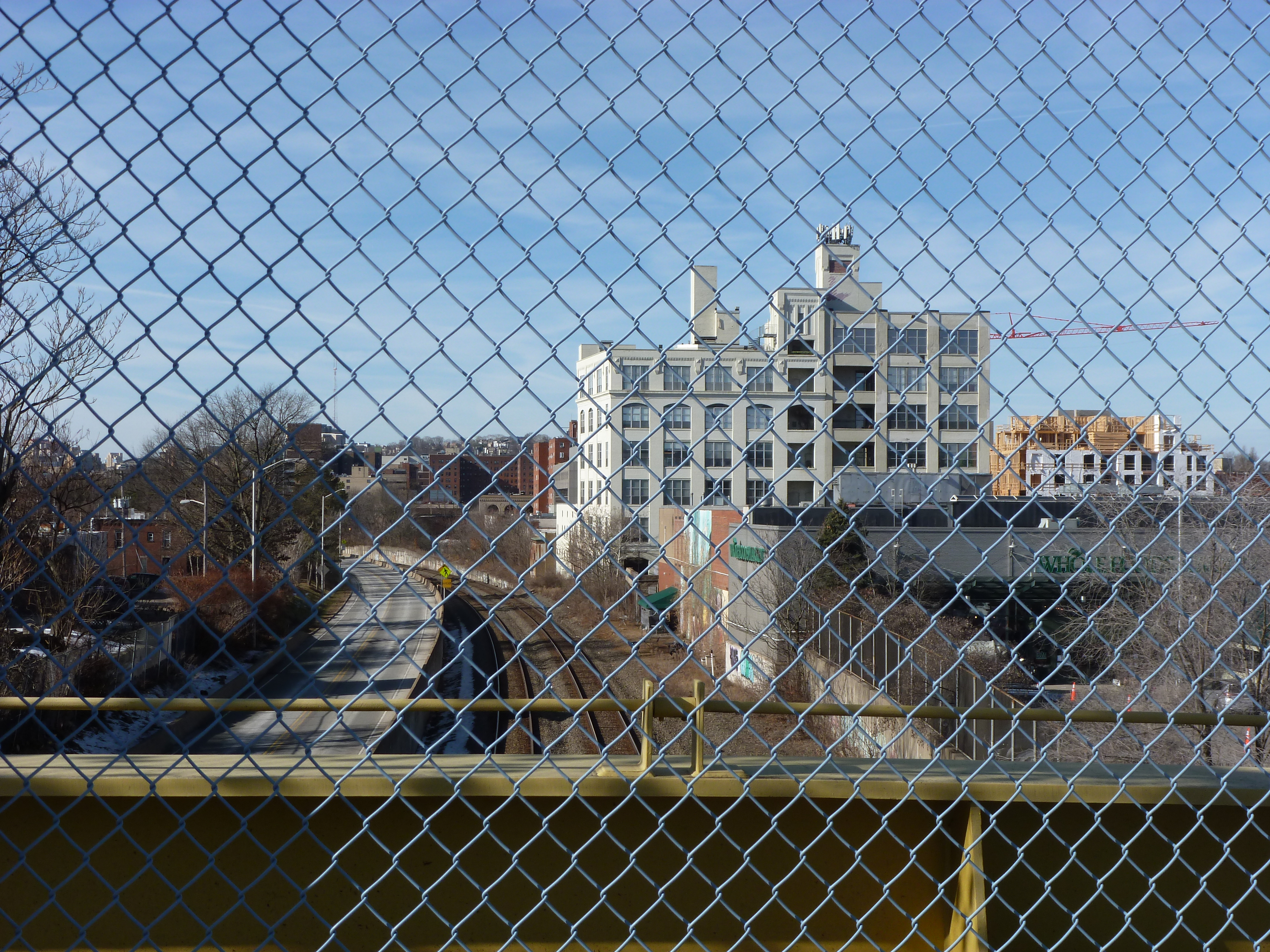
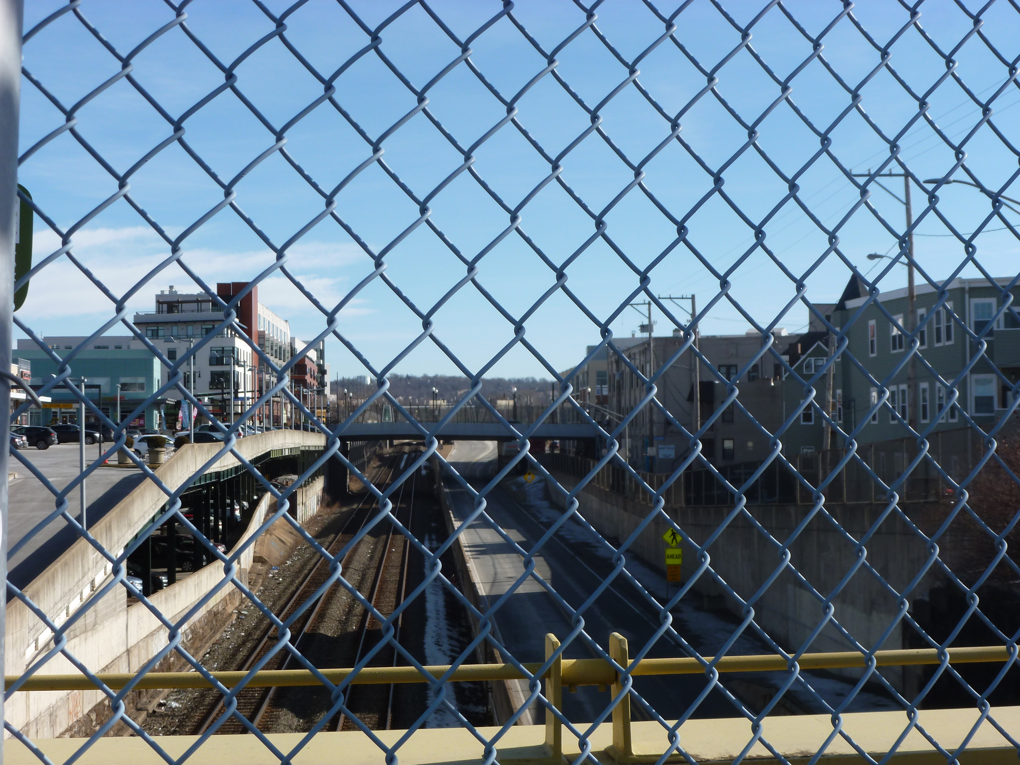
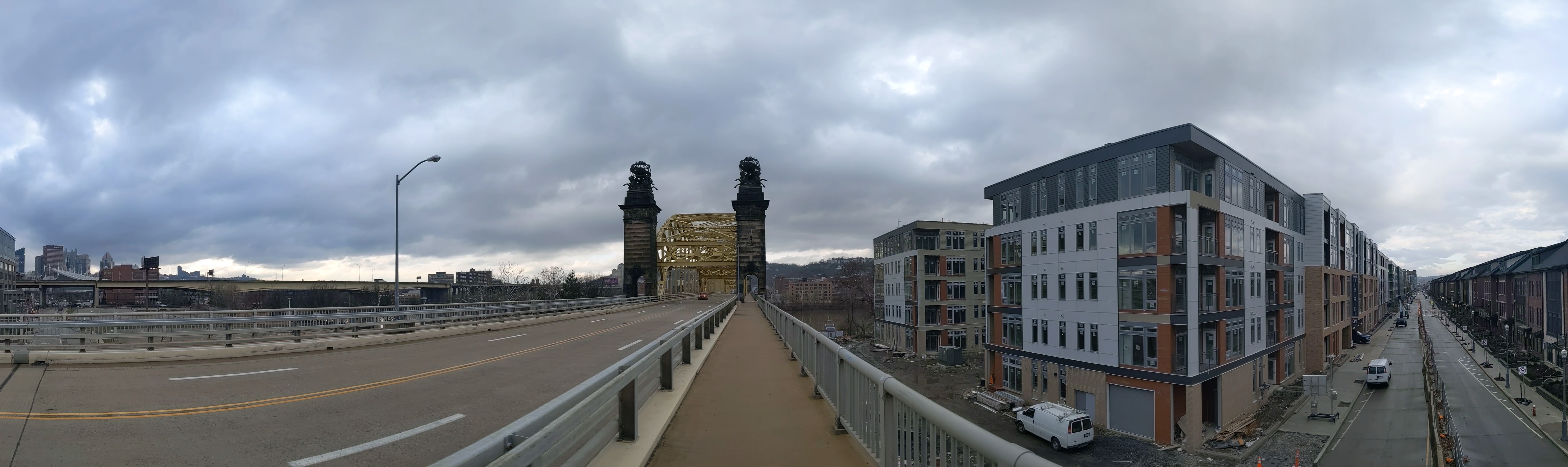
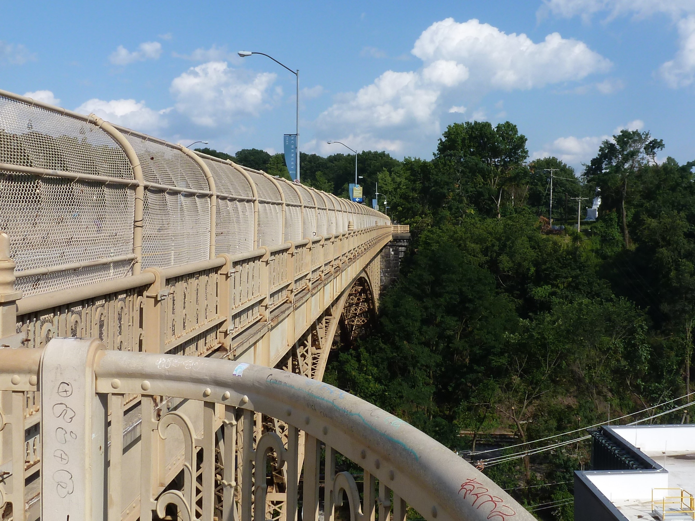
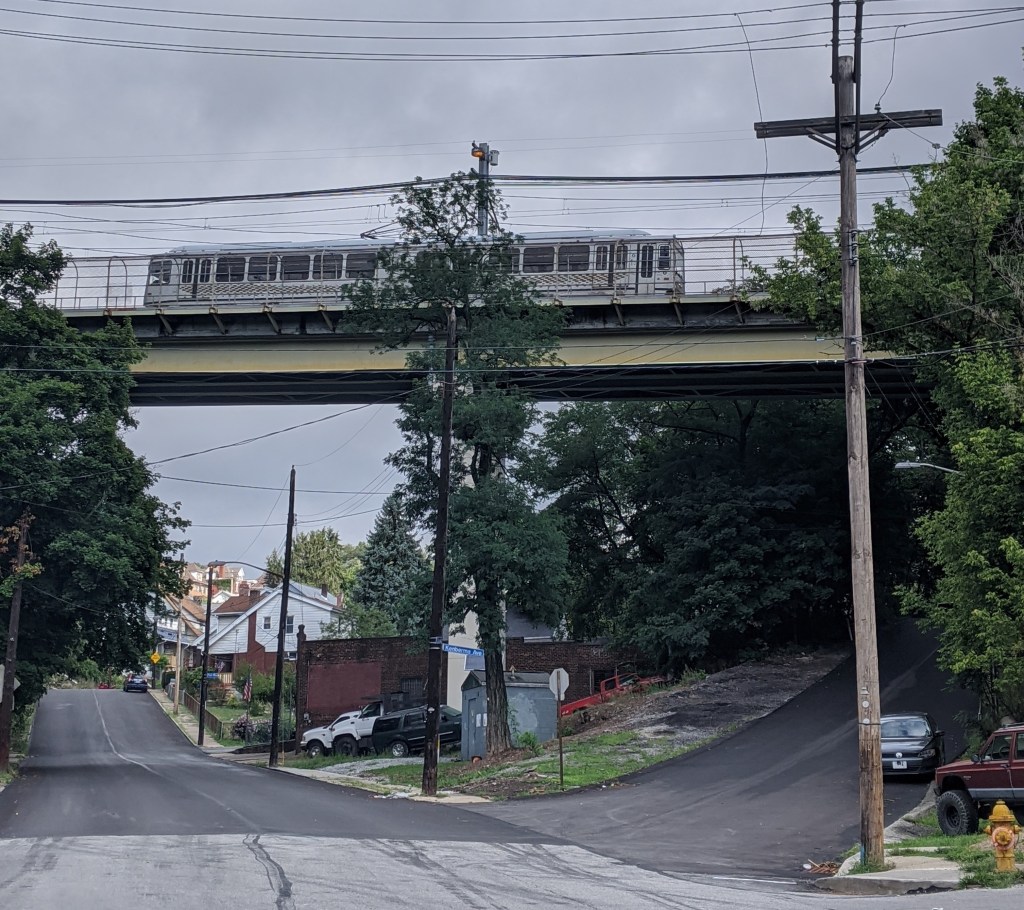
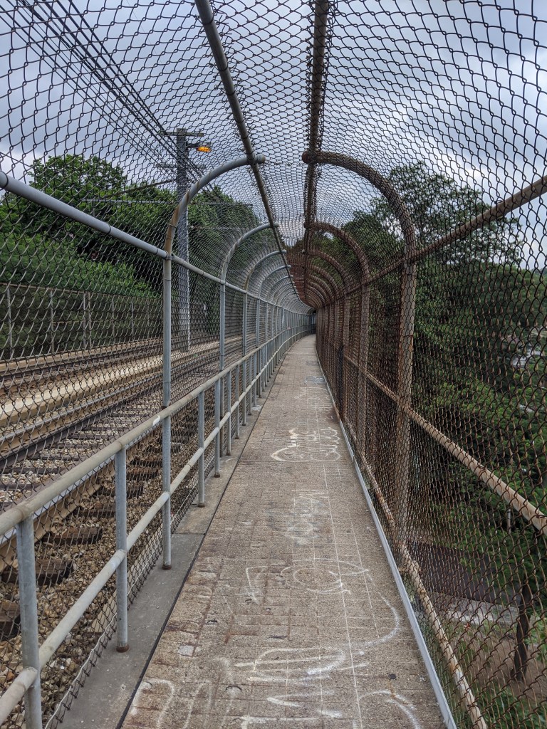
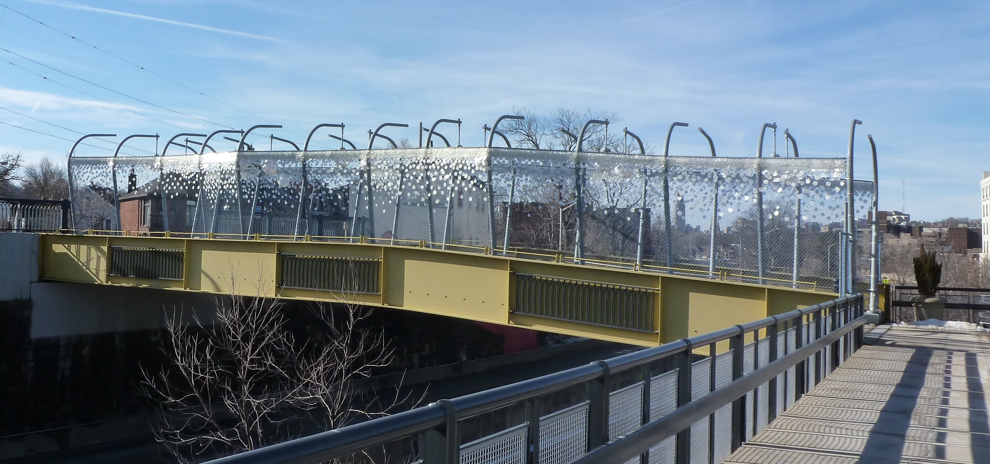
One of the bridges presumably supported by the Obama infrastructure funding was the brand-new pedestrian bridge across the East Busway connecting the Shadyside and East Liberty neighborhoods. This bridge is 10-years old this month. The “road” surface of the bridge hasn’t held up very well: the paint was faded and the top surface was patchy when I returned this month. On the other hand, the over-the-top lamps and giant glitter looked like they have held up well. Though it’s hard to say in wintertime, the landscaping between the cage and the bridge walls also appeared to be well maintained.

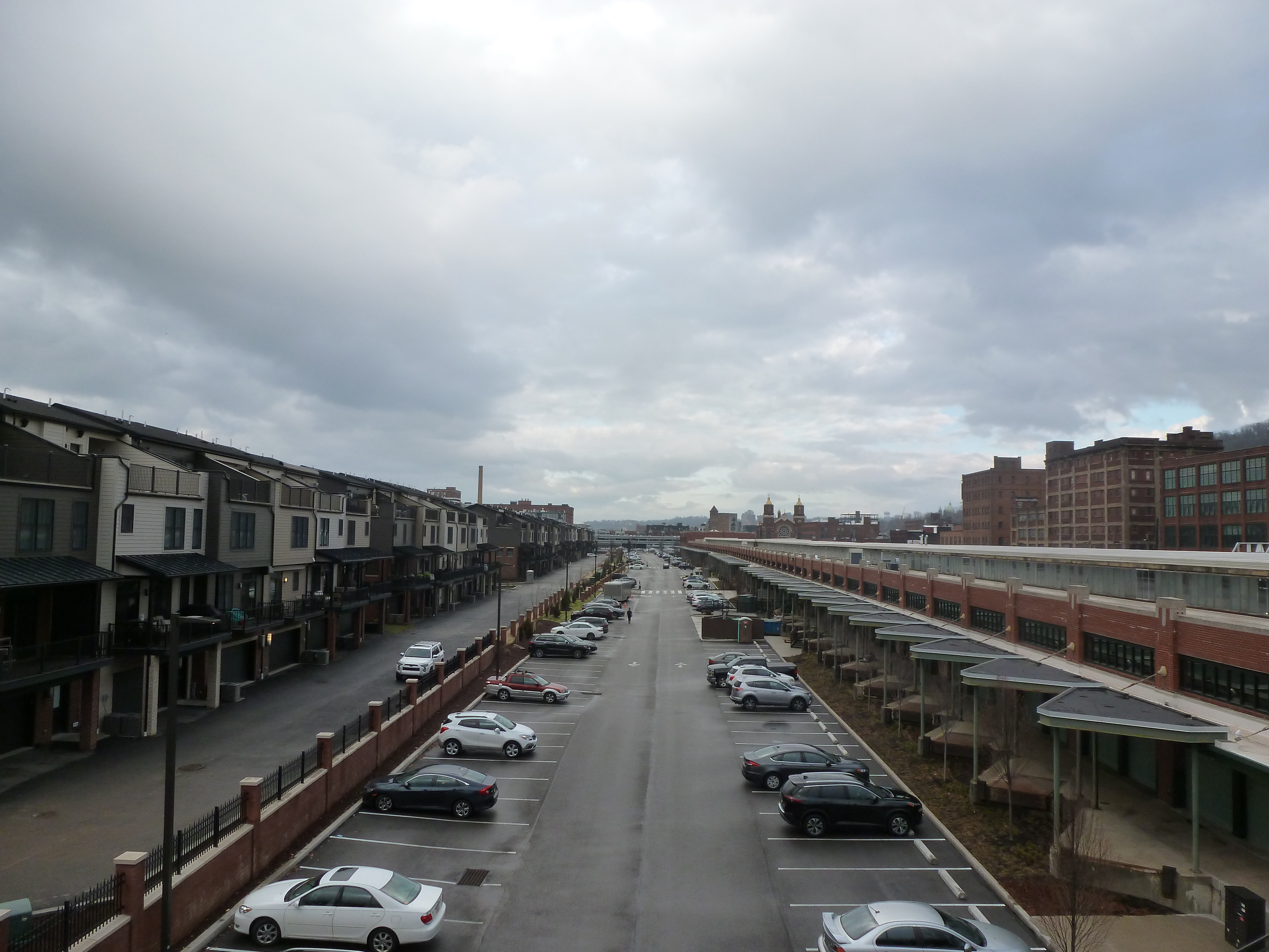
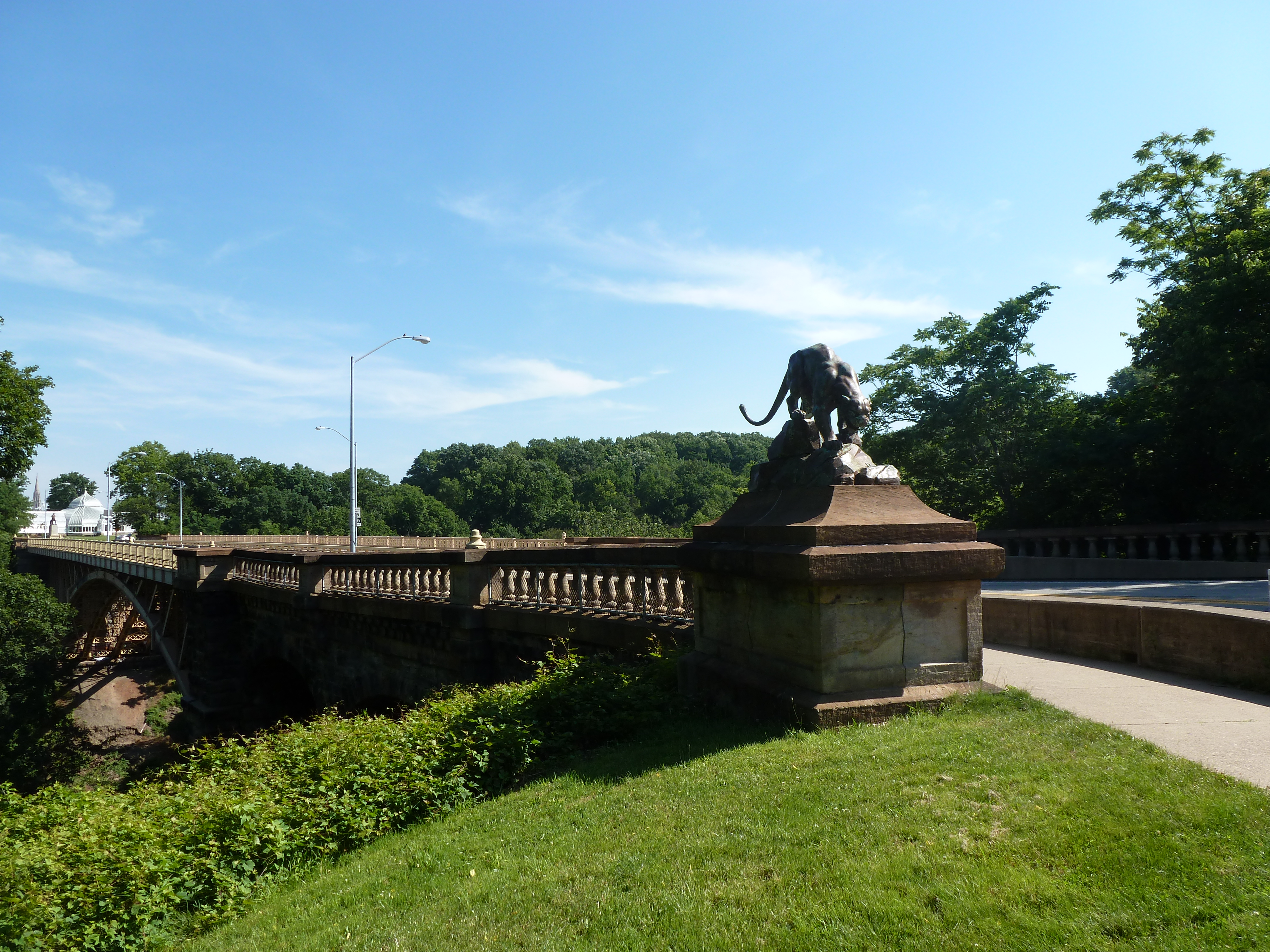
From the bridge, some of the new developments in East Liberty are visible. Looking southwest toward the current location of Whole Foods (soon to relocate), one of the several new apartment buildings along the Baum-Centre corridor is visibly under construction in the far right of the second set of photos. In the third set, the northeast view shows the new South Highland Avenue Bridge and (to the left of the bridge) the final phase of the East Side Bond development that brought several buildings of first floor commercial with residences above.

I was surprised to find that the highly controversial and massive redevelopment of the former Penn Plaza affordable housing complex was not visible from this bridge. Despite being only a quarter mile apart, the first phase of redevelopment is blocked from the bridge’s view by the iconic Motor Square Gardens building. One of the controversies of this new development is that affordable housing units were demolished without replacement for a series of commercial buildings which include the feature anchor of the pricey Whole Foods grocery store.

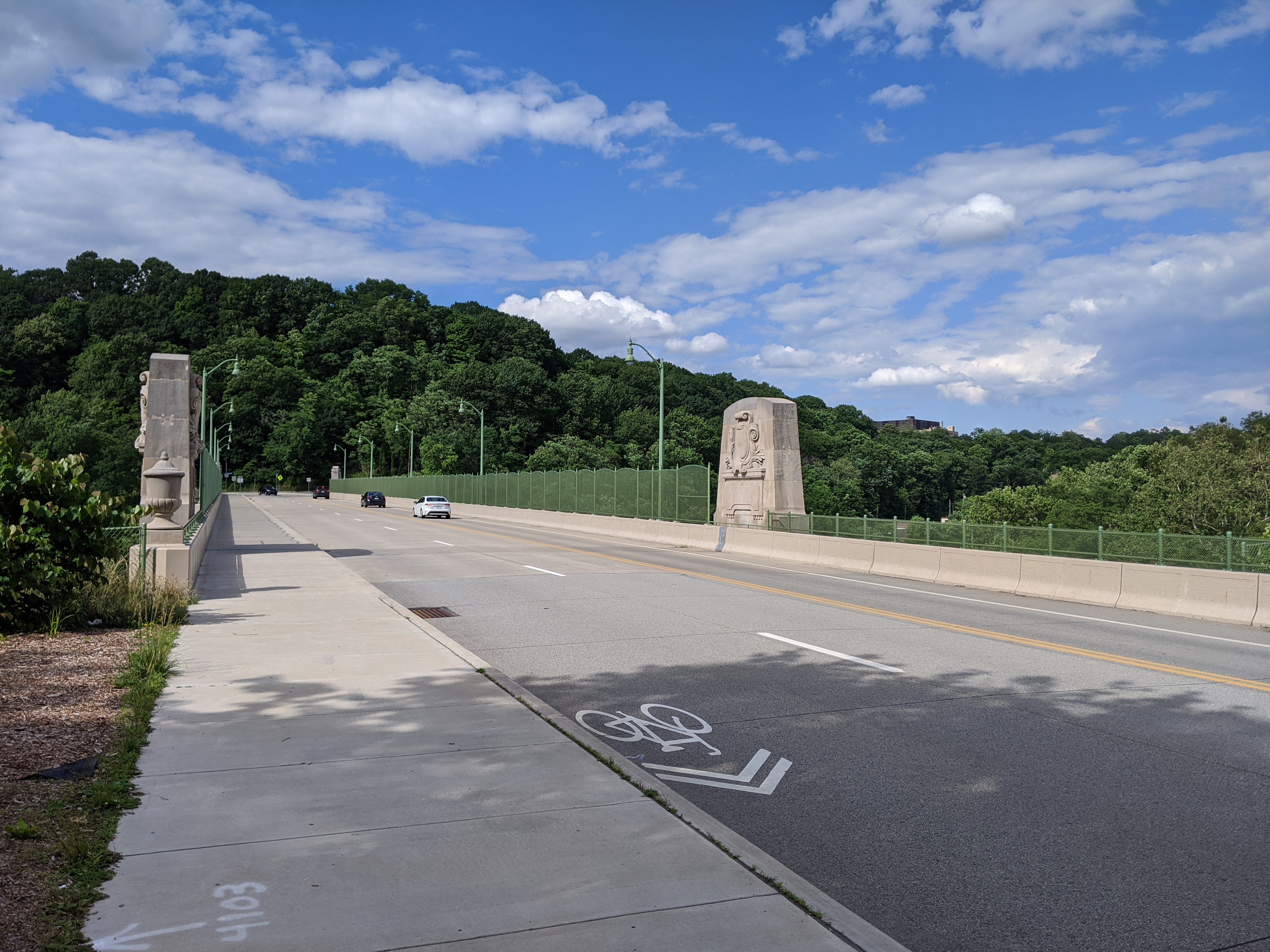
The pedestrian bridge was controversial when it was proposed and built. It connects the wealthy Shadyside neighborhood to the expensive Whole Foods, a high-end liquor store, and other luxury shops. It is also redundant as the South Highland Avenue bridge is only 0.1 miles away. A quarter mile away, is the neighborhood of Larimar whose residents are primarily living on low-incomes and do not have a walkable route to the lower cost Giant Eagle grocery store or Trader Joes that are just on the other side of the busway from their homes. For years, the residents have been asking for a pedestrian bridge over the busway to give them better access to these stores. Instead of a bridge serving those who need it, an ornamental bridge was built to provide access for those who already have abundant options.

Around the same time that this bridge was built, the Port Authority altered its bus service by eliminating the 94B bus that connected the low-income residents of Larimar with a shopping center featuring Walmart, Giant Eagle, TJ Maxx and similar clothing retailers, and other stores. In addition to providing shopping opportunities for necessities, these locations provided jobs. The 94B bus was never less than half-full (an unusual condition for Pittsburgh buses outside of rush hour). This bus was replaced by the 75 bus, which connected the higher-end shopping centers of South Side Works and Bakery Square through the wealthy residential neighborhood of Shadyside. For years, it was common to be the only person or one of a handful of people riding the 75. Eventually, the Port Authority acknowledged the value of the 94B route and tact it on to the end of the 75 route.

Presumably both the pedestrian bridge and bus route changes of 2012 were supported at least in part by the federal infrastructure funds of the time. With the current round of federal funding, it would be nice to see a greater focus of infrastructure investment for those who need it and not on additional luxury options.

“Poor Condition” Forbes Ave Bridge Collapsed Yesterday

Yesterday, after the Fern Hollow Bridge collapsed in Pittsburgh a photo circulated on social media of one of the steel support beams of the bridge completely rusted through. This photo was taken in 2018 and reported to the City’s 311 system. While the photo also showed cables that had been added to the bridge to presumably take over the job of the steel beam that then ended in mid-air, the person submitting the photo was concerned that this might not be sufficient. I have seen similar rusted conditions on other bridges that I have walked over or under in Pittsburgh. I cannot remember if it was the Negley Ave bridge over the busway, the Charles Anderson Bridge over Junction Hollow in Frick Park, both, neither, or a handful of other bridges. (Note: both of these bridges are rated in poor condition.)

A neighbor quoted in a Tribune Review article after the Fern Hollow Bridge collapse wondered why the bridge hadn’t been repaired or replaced before the accident since it was known to be in poor condition. According to BridgeReports.com, which pulled inspection data on the bridge from 1991-2017, the bridge has been rated as in poor condition since 2011. Based on my experiences and exposure to bridges, I am not surprised that a bridge was left in poor condition for over a decade. This morning, I pulled data from the National Bridge Inventory on the 449 inventoried bridges within a 6-mile radius of downtown Pittsburgh. I was surprised to find that only 10% of these bridges were rated in poor condition.

Below is a chart of the 48 bridges rated in poor condition within a 6-mile radius of downtown, which includes some that are outside the boundaries of the City of Pittsburgh. In those cases, the city owner would be the municipality they are within. The first four columns are the data I pulled from the National Bridge Inventory, the final column is from BridgeReports.com. Both sources were updated through 2018, which means that there have been some changes since then, including the possibility that more bridges have fallen into a poor state. I marked in italics the bridges that I am heard went through renovations in recent years and in bold the one that collapsed. The bridges with hyperlinks are the ones that I have walked and blogged.

OwnerBridge DescriptionYear BuiltYear RenovatedRated Poor Since
StateIsland Avenue Bridge1900
StateWetzel Rd over Pine Creek1936
StateBlvd of Allies over cliff19502018
StateBlvd of Allies over Forbes195219842017
StateRamp U over Old Brady St195419852013
StateRamp R over Brady195619852017
StateRamp H over Forbes, Diamond, 6th Ave196220121997
StatePeoples Rd over Girtys Run1963
StateWashington Ave over P&O RR1965
StateFt Duquesne to 10th St19681988
StateBlvd of Allies over another cliff198120012018
RailroadWest Ohio St over NS RR190319581991
RailroadN Ave & Brighton Rd over NS RR190519292009
County9th Street – Rachel Carson Bridge192619942013
CountyJacks Run Rd over Jacks Run19802019
CountyWible Run Rd over Wible Run1987
CitySecond Ave over Nine Mile Run1886at least 1991
CityShaler St over Saw Mill Run1900at least 1991
CityLowrie St over Rialto St190019722008
CityElizabeth St over Gloster St190019792014
CityRidge Ave over NS RR19031957at least 1991
CityTimberland Ave over Saw Mill Run1909at least 1992
CityFremont St over Girtys Run1911
CityLincoln Ave over Girtys Run19111950
CityLarimer Ave over Washington Blvd1912at least 1991
CityGrant Ave over Girtys Run19141986
CityKlopper St over Girtys Run1915
CityLincoln Ave over Girtys Run19151986
CityFrazier St over Saline St191519892007
CityS Negley Ave over E Busway19241973at least 1991
CityW Carson St over Chartiers Creek192519782009
CityAnsonia Pl over Saw Mill Run192519981995
CityMaple Ave over N Charles St19291953at least 1991
CitySwindell Br over East St193019902009
CityCalera St over Streets Run1931at least 1991
City28th St over Busway & RR19311974at least 1990
CityE Main St over Chartiers Creek19342002
CityCharles Anderson Bridge193819872012
CityMission St over S 21st St193919822010
CityRiver Ave over Bike Trail193919862008
CityGanges Way over Streets Run19512016
CityE Liberty Blvd SB over walkway19682009
CityForbes Ave over Fern Hollow19702011
CityHerron Ave over Busway & RR19802018
CityMcArdle over Sycamore St19832017
CityMilroy St over I-27919862011
Other Local AgencyCentre Ave over East Busway19792008
Other Local AgencyPenn Ave over East Busway19812018

Breaking News: Fern Hollow Bridge Collapse

A bridge collapsed in Pittsburgh this morning. While not an iconic bridge, the Forbes Avenue Bridge over Fern Hollow was significant as the sole road link over Frick Park. With this link missing, motorists and those using public transit will have to travel several miles out of their way through some very congested roads. Pedestrians and bicyclists have some shorter options using the park’s trails.

The bridge was built in the early 1970s and as far as I know has not had any significant maintenance work done since then. It is owned by the City of Pittsburgh. Based on the National Bridge Inventory by the Federal Highway Administration, the bridge was in “Poor” condition, had an inspection frequency of 18-24 (units were not included, hopefully this is months), the structural evaluation was “Minimally Tolerable,” the substructure was rated “Satisfactory” while the superstructure was rated “Poor,” average daily traffic was 10,000-15,000, and the detour route would add 2-5 miles. In addition, this site estimates the replacement cost at $6.5 million. I could not find the date of the last inspection on the NBI site. Based on a summary of inspections on BridgeReports.com, which sites the NBI as its source, the bridge was inspected every two years between 1991 and 2017, so presumably there were additional inspections in 2019 and 2021.

There was a bus and some other vehicles on the bridge when it collapsed. The two passengers on the bus were taken to a hospital with “minor injuries” as was a third person. Seven other people are reported to have “minor injuries” that did not require a hospital visit. The City’s first official press release on this disaster says that rescue efforts concluded at 8:30am, but that underneath the bridge was still being checked for potential victims – some of the park’s well-used trails pass underneath. WTAE has videos from the scene; the Tribune Review has quotes from nearby residents on what they heard and saw this morning. This story has also made national news with coverage by on the US News and World Report website.

The coincidences: President Biden is scheduled to speak in Pittsburgh today about infrastructure, including bridge maintenance, the overnight snow may have limited vehicular and foot traffic over and under the bridge, and I just happened to be somewhere where the news was on this morning in time to see the first news report on WTAE (I never watch or read the daily news).

Mayor Gainey is quoted as saying “we were fortunate.” The people using the bridge were unfortunate that the bridge collapsed when it did, but given that it did collapse, they were fortunate in that it appears there are no serious injuries and no deaths. It was also fortunate that the collapse happened before rush hour and on a bridge that was over land. If this was one of our river bridges or if it happened during rush hour, serious injury and death seem impossible to avoid.

Deferred maintenance of bridges is a real and serious thing. Bridges are a crucial part of our daily lives (especially in places like Pittsburgh). Every time I walk over the Negley Ave bridge over the busway, I warily eye the rusted structure. The old Highland Ave bridge over the busway used to spark the same reaction, but it was fortunately replaced several years ago. The Smithfield Street bridge has holes through the sidewalk. How far do we push our “poor” condition bridges before investing in maintenance and repair?

Then & Now: 16th Street Bridge

urbantraipsing turns 10 in May. To mark a decade of urban-traipsing and bridge-walking, I will be revisiting twelve of the Pittsburgh bridges I walked early on to see the changes 10 years brought to them and their surroundings.

I started walking and photographing bridges to get different angles and views of the city. In 2012, the 16th Street Bridge provided views of two major, controversial development sites: the Produce Terminal and the former St. Nicholas Croatian Catholic Church.

During the summer of 2012, the Produce Terminal seemed on the cusp of being redeveloped, and partly demolished. However, significant opposition to the demolition plans killed that proposal. For years there was no visible progress. Eventually, after extensive negotiations, a new development proposal was approved and implemented (see the first photo pair below). Simultaneously, several new developments popped up nearby, replacing much of the sea of parking I complained about in my original post on the bridge (see the second and third photo pairs below).

The former St Nicholas Croatian Catholic Church was visible from the 16th Street Bridge in 2012. Six months later, it was demolished to make way for the widening of Route 28 despite parishioners efforts to save their church (see a 2013 Tribune Review article for more). I followed the story of their fight for their building closely at the time, which is what I believe prompted me to take a photo of the church from the bridge (see the fourth photo pair below).

Oakland Bridges: Blvd of the Allies

The Blvd of the Allies was one of Pittsburgh’s grand public works projects from the 1920s. It rises from downtown, passing along the backside of Uptown and cutting through South Oakland before wrapping up in Schenley Park.

Four bridges enable the Blvd to make its mark on Oakland. Under normal conditions, only one of these bridges is pedestrian usable.

The road makes a flying leap into Oakland on the Boulevard of the Allies Bridge. On the South Oakland side, the Blvd enters a commercial corridor that begrudgingly gives pedestrians a place on a narrow sidewalk that abruptly begins (or ends) at the edge of the bridge. On the other side of the bridge, the Blvd is a mess of highway interchanges, so pedestrians are not welcome to utilize this bridge to go anywhere.

At the other end of the commercial corridor, pedestrians are invited to cross the Charles Anderson Bridge over Junction Hollow and into Schenley Park. (This bridge is also featured in Oakland Bridges – The Hollows.) However, once in the park, pedestrians are pushed away from the Blvd as it changes names and before it cruises through the Park.

The next two bridges are related as one is over the pedestrian route and one over the vehicular route to the recreational facilities of Schenley Park. These facilities include a pool, ice skating rink, disc golf course, tennis courts, and a track. The bridge over the pedestrian route is a small affair to cross over the pedestrian tunnel. The other is a slightly longer overpass over the two-lane segment connecting Panther Hollow Road and Overlook Drive. Neither the tunnel-bridge nor the overpass are open to pedestrians – except during the annual Pittsburgh Vintage Grand Prix, which I once took advantage of for some photographs.

Oakland Bridges: The Hollows

Oakland is a cluster of Pittsburgh neighborhoods east of downtown. It has the highest concentration of institutions and cultural amenities in the city. It is home to Carlow College, the University of Pittsburgh (Pitt), Carnegie Mellon University (CMU), multiple UPMC hospitals, the Phipps Conservatory (Phipps), Schenley Park (the second largest city park), and the Carnegie Institute complex (housing the Carnegie Museums of Art and Natural History, the main Carnegie Library, and the Carnegie Music Hall). Most of these as well as much of the commercial and residential parts of Oakland were built on a shelf. The hospitals, part of Pitt, and some houses climb the slope toward the Hill District. Some houses also spill over the edge of the shelf, down into the hollows.

Several bridges span the Junction and Panther hollows in Oakland. The Forbes Avenue bridge connects CMU to the Carnegie Institute complex and one of the commercial districts. The Schenley Bridge connects Pitt and the Carnegie Institute complex to the Phipps and Schenley Park. The Panther Hollow Bridge spans a second hollow to connect the Phipps with the rest of Schenley Park. The Charles Anderson Memorial Bridge carries the Blvd of the Allies over Junction Hollow. A fifth bridge without pedestrian access carries 376 over the hollow. This bridge can be partially glimpsed from the Anderson Bridge, but its presence can be clearly marked by the traffic’s rushing whoosh that carries up the hollow.

By the Forbes Ave and Schenley bridges, Junction Hollow has an industrial feel. The railroad is mostly exposed at these points (further down it is surrounded by trees, shrubs, and other overgrowth). There are also several parking lots and CMU houses some of its facilities functions along the hollow. By the Schenley Bridge, a massive electrical substation was recently constructed across from the historic (and active) steam factory.

The Panther Hollow Bridge provides a completely different feel as its hollow is 100% park. It is the only one of these bridges that does not cross over the railroad and is therefore the only one without a cage. A small lake with walking trail is visible on one side (with the railroad beyond a row of weeds). The other side overlooks a forested hillside and valley floor. Hawks and/or falcons can often be seen gliding over this hollow.

The Anderson Bridge overlooks Junction Hollow at its most parklike point, but it has a less peaceful feel than the Panther Bridge. A combination of the almost-highway Blvd of the Allies, the bridge’s height above the hollow, and its pedestrian fence make the bridge feel isolated from nature when walking across.

Beechview Bridges

Beechview is a neighborhood built on the crest of a hill and spilling down all the sides of the ravines and runs. It claims the steepest paved car “accessible” street in the US, if not the world. Traveling in almost any direction around or through the neighborhood includes an uphill portion. It is a place where anyone driving without chains ought to call in sick or request to work from home after a snow or ice storm to avoid sliding back down the hill when attempting to leave the neighborhood.

Bridges are used to create more level routes, spanning hillsides, runs, and dips. However, none of the two and a half bridges in the neighborhood are for cars. (The half bridge crosses the city boundary into the neighboring borough of Dormont.) The bridges are for the “T”, the local light rail system. Cars are left to manage the ups and downs as best they can. Pedestrians have access to one of the bridges, but otherwise, they are also left to manage the slopes as best they can.

The bridge with pedestrian access was constructed in the era of cages (see post). I am noticing a theme of completely enclosed pedestrian walkways found in association with major transit lines (ex. Beechview’s bridge, Graham Street Bridge, and the former pedestrian bridges over the East Liberty busway) while partially enclosed cages are found in association with roads and rivers (ex. Highland Park Bridge and the pedestrian bridge over Bigelow Blvd).

Greenfield Bridge

The Greenfield Bridge, formerly known as the Beechwood Boulevard Bridge, was originally built in 1922, demolished in 2015, rebuilt in 2017, and repaired in 2020. It was a classic case of waiting until the bridge was falling down before replacing it. To increase the lifespan of the original bridge, a second bridge was built underneath, and a net installed as early as the late 1980s to protect cars on the freeway below from the falling debris.

Yet it remained in that deteriorating condition for decades before being imploded in a grand ceremony between Christmas and New Year’s Eve 2015. The freeway was covered with tons of dirt, the bridge dropped onto this pile, and the debris cleared away before the highway was needed again for regular commuting. Many people (myself and my family included) stationed themselves on either hillside to watch. We picked a distant vantage point in Schenley Park where we had a great view of the dust cloud that resulted from the demolition.

Another grand ribbon cutting ceremony took place when the new bridge reopened in 2017. A part of the reason for celebration was that, similar to the rebuilding of Heth’s Run Bridge, the historical decorative elements of the bridge were restored or reinstated. The new fencing on the bridge also aimed for a more decorative feel compared to the previous cage-like fencing.

After all the ceremonies and splash around the new bridge, I was surprised to receive a press release three years later announcing that the bridge would be closed for a month to undergo repaving and other repairs. On the one hand, it was nice to see that a bridge was undergoing maintenance instead of being left to fall to pieces before being replaced, but three years seemed early to need this kind of maintenance. According to the Post-Gazette, the repairs were for issues identified in the final inspection before the 2017 reopening. These issues threatened to significantly shorten the projected 50-year life span if unaddressed. Now that those issues have been resolved, I assume it will be at least 50 years before the next press release about repair or renovation for this bridge.

London Bridge (and others) are Falling Down

As if there weren’t already enough crises, London’s bridges were “falling down” in 2020. Three were closed for vital repairs. Hammersmith Bridge remains suspended in limbo while the other two, London Bridge and Vauxhall Bridge, reopened after months of work. Yet, none are totally in the clear. London Bridge’s reopening included significant daytime traffic restrictions. Traffic restrictions may be implemented for Vauxhall Bridge, if money cannot be found for more repairs. Financial straits threaten Hammersmith Bridge as well. It was first closed to vehicular traffic in April 2019 and closed to all traffic, pedestrian and bicycles over and boat traffic under, in August 2020 due to widened cracks feared to portend imminent collapse. The estimate to repair this bridge is £140 million and nearly seven years of work.

London Bridge is falling down,

Falling down, falling down,

London Bridge is falling down,

My fair Lady.

In my experiences walking bridges, it seems common to wait until a bridge is almost falling down to invest in it. It appears politically unappealing to direct funds to maintaining bridges, so we live in a world with a dire refrain of our collapsing infrastructure.

Build it up with bricks and mortar,

Bricks and mortar, bricks and mortar,

Build it up with bricks and mortar,

My fair Lady.

Bricks and mortar will not stay,

Will not stay, will not stay,

Bricks and mortar will not stay,

My fair Lady.

In Pittsburgh, bridges are often left to run the course of their lives without regular maintenance, then are replaced with a new bridge. The resulting demolition ceremonies and ribbon cuttings  make splashy political news stories. The river bridges are an exception. Probably because of their character and contribution to the city’s photogenetic downtown, they are occasionally partially or completely closed for maintenance.

Build it up with iron and steel,

Iron and steel, iron and steel,

Build it up with iron and steel,

My fair Lady.

Iron and steel will bend and bow,

Bend and bow, bend and bow,

Iron and steel will bend and bow,

My fair Lady.

London’s river bridges have more history and, sometimes, more character than Pittsburgh’s bridges. Hammersmith Bridge is one of the city’s unique and historical bridges. The steep price tag to repair this bridge, perhaps the result of mounting deferred maintenance, begs the question of at what point in the decades of non-investment is the threshold crossed beyond which repair is no longer an option.

Build it up with silver and gold,

Silver and gold, silver and gold,

Build it up with silver and gold,

My fair Lady.

Silver and gold will be stolen away,

Stolen away, stolen away,

Silver and gold will be stolen away,

My fair Lady.

The decades of neglect in Pittsburgh and London overlooks bridges’ frequent role as practical infrastructure built to assist in crossing an obstacle. Even temporary closings can cause extreme headaches and delays to those who rely on the bridge. Hammersmith Bridge was left to deteriorate so long, it had to be closed before a plan was in place. As funds and a repair approach are sought, the residents and businesses of Hammersmith continue to be seriously inconvenienced by not being able to cross the river close to home.


Note: Lyrics to “London Bridge is Falling Down” were taken from https://allnurseryrhymes.com/london-bridge-is-falling-down/.

Heth’s Run Bridge – Post Reconstruction

My experiment of living without home internet in 2014 interfered with posting the images of Heth’s Run Bridge I took that fall as it reopened with an actual gap underneath:

I went back this year to get an updated view:

Previous posts in the Heth’s Run Bridge series: