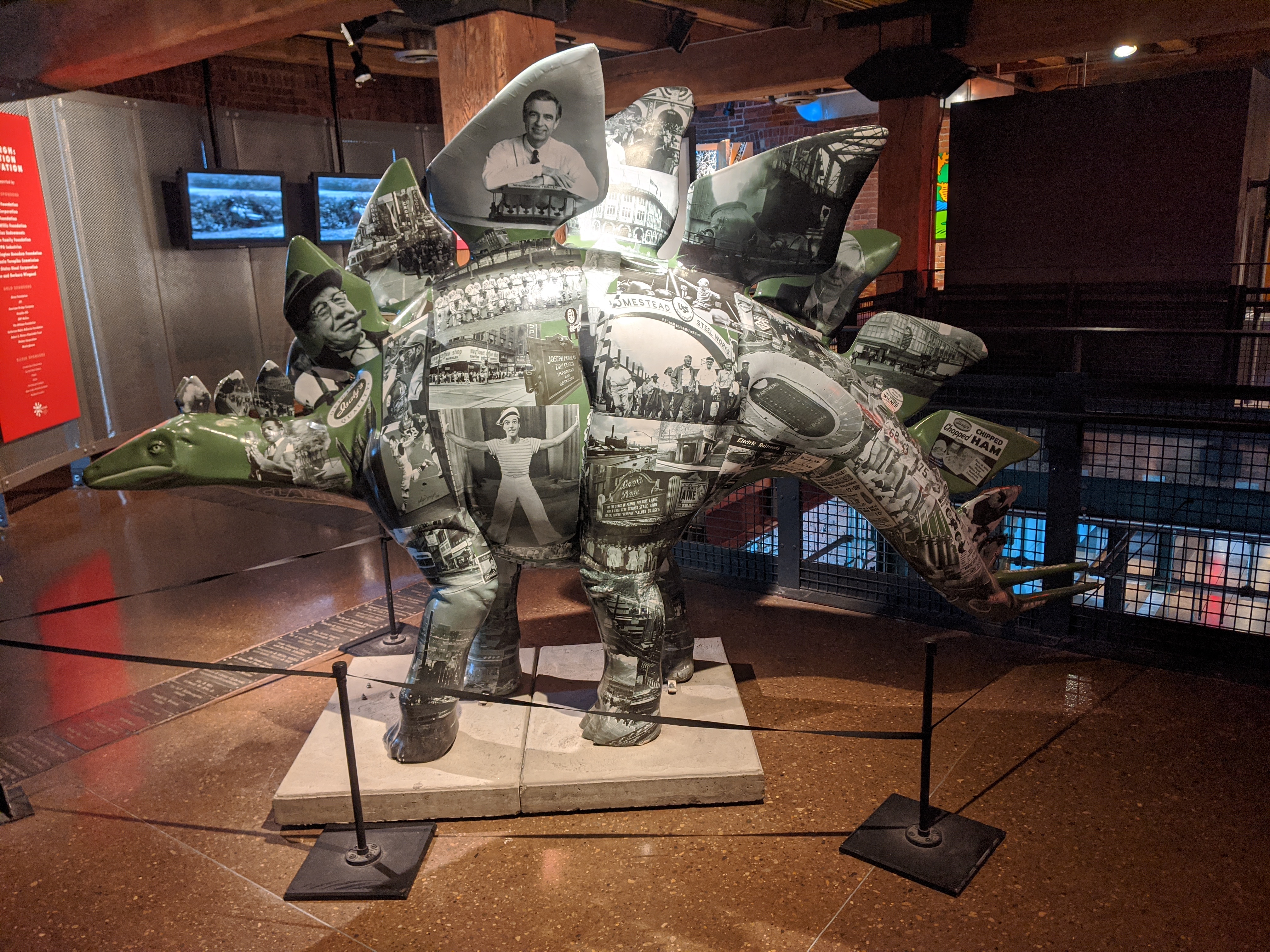
Pittsburgh DinoMite Parade 18

urbantraipsing turns 10 in May. To mark a decade of urban-traipsing and bridge-walking, I will be revisiting twelve of the Pittsburgh bridges I walked early on to see the changes 10 years brought to them and their surroundings.
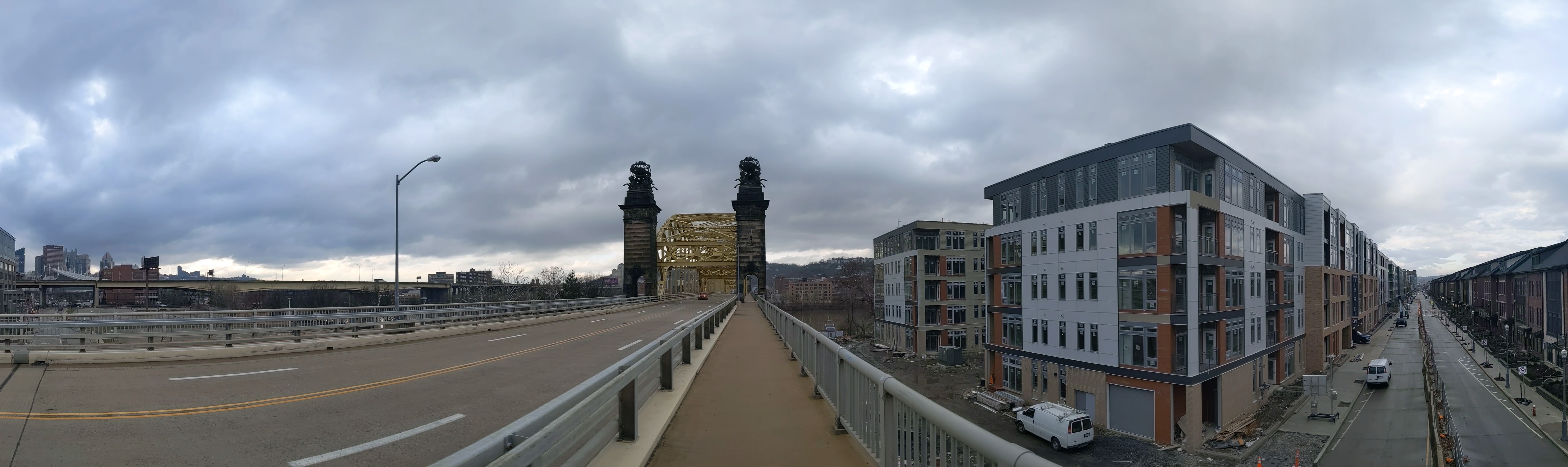
I started walking and photographing bridges to get different angles and views of the city. In 2012, the 16th Street Bridge provided views of two major, controversial development sites: the Produce Terminal and the former St. Nicholas Croatian Catholic Church.
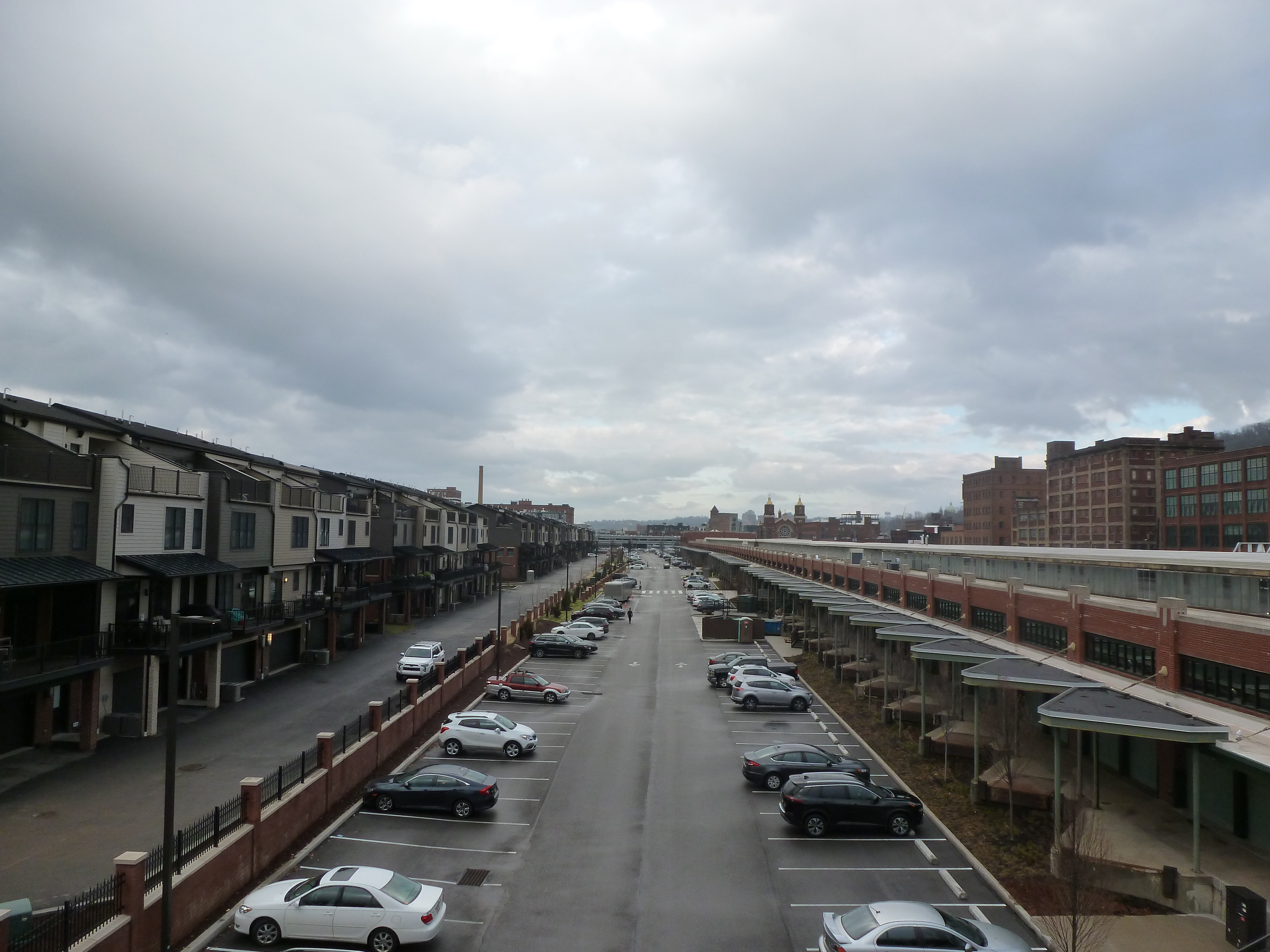
During the summer of 2012, the Produce Terminal seemed on the cusp of being redeveloped, and partly demolished. However, significant opposition to the demolition plans killed that proposal. For years there was no visible progress. Eventually, after extensive negotiations, a new development proposal was approved and implemented (see the first photo pair below). Simultaneously, several new developments popped up nearby, replacing much of the sea of parking I complained about in my original post on the bridge (see the second and third photo pairs below).
The former St Nicholas Croatian Catholic Church was visible from the 16th Street Bridge in 2012. Six months later, it was demolished to make way for the widening of Route 28 despite parishioners efforts to save their church (see a 2013 Tribune Review article for more). I followed the story of their fight for their building closely at the time, which is what I believe prompted me to take a photo of the church from the bridge (see the fourth photo pair below).


To date I have walked the 31st Street Bridge twice. The first time was a few years ago when I had over two hours to kill between an event downtown and a meeting in the Strip a few blocks from the bridge. So I naturally decided to spend it by walking from the first to second location along the Three Rivers Heritage Trail. It was winter and I saw the first flurries of the season as I crossed this bridge. For that reason, I remember the walk and the bridge fondly though I was disappointed and surprised when I arrived at the Strip District end of the bridge to realize how far away I was from the stores in the Strip. I had been planning on getting a snack at one of the nice little ethnic groceries or perhaps at the bakery. As I was in a car every other time I had been to the Strip, I never realized how little of the neighborhood the stores took up. Fortunately, there was hot chocolate and a good spread of fruit and pastries at my meeting.
As I sat down to write this post, I realized that I have already discussed most of the observations I had or at least something similar in other posts. So I went to PGHbridges.com to look for some inspiration of something new to write. It has a nice description of the decorations on the bridge (see link), which I completely missed as I walked it this summer either because they aren’t there or because I looked in the wrong places as I thought there might be some decoration. The other thing that intrigued me on the website was the name of the bridge which is 31st Street Bridge, Number Six Allegheny River. I thought perhaps this meant it was the sixth bridge at this location; however PGHbridges.com says that the 31st Street Bridge replaced a former bridge at 30th Street. While the streets aren’t that far apart, it seems more likely that “number six” refers to it being the sixth bridge up the Allegheny from the Point, yet this would have to be only counting road bridges (not railroad). The 1929 G.M. Hopkins map shows that the sixth bridge from the point is the 16th Street Bridge when you count the railroad bridge between the 9th and 16th Street bridges.


These are the pictures that go with the topics I’ve discussed in other posts. On the left is the cookie-cutter, perfectly manicured housing development on Herr’s Island. In my Converted Railroad Bridge post, I mention how I feel like a trespasser when I walk through this part of the island. Except for the little lighthouse/widow’s walk attachments on top of the houses (the circular, red peaked roof thing), the development looks identical to some of the newer developments (older being 1960s) in the California town I lived in for several years.
The view downriver, above on the right, shows again the two clusters of tall buildings downtown that I first observed on the 16th Street Bridge (see July 13 post).


Several well-known landmarks (which I have mentioned in other posts) are visible from the 31st Street Bridge. First on the downstream side (above left) is the Immaculate Heart of Mary Church. Perhaps because of the lighting and angle, I don’t think it appears as impressive in the picture as it does in real life. I mentioned this landmark previously in my post about the Fort Duquesne Bridge. On the other side of the bridge (above right), the most famous landmark is Children’s Hospital, which came up in the 9th Street Bridge post. Before doing this project, I don’t think I realized just how big Children’s Hospital is. I thought it was big, but I’ve learned from observing it from the 9th and 31st Street bridges that it is actually huge. Closer to the bridge a little lower on the hill from the hospital is the St. Augustine Church in Lawrenceville, one of the many large, old, and beautiful churches in the city. I’d also like to point out the little church on the right-hand side of the photo towering above its surroundings. I don’t want to go into much detail about it now, but it is one of Pittsburgh’s repurposed churches and I will be coming back to it in a future post.

 The Veterans Bridge is one of the bridges I will not be walking in Pittsburgh because it doesn’t have pedestrian access. It carries another one of the freeways over the Allegheny River. As discussed in the Fort Duquesne Bridge post, freeways and pedestrians usually don’t mix.
The reason that I am including a post on this bridge, as my focus is on the bridges that I walk, is that it adds to the discussion of how many bridges are there in Pittsburgh. As the Veterans Bridge, I consider it a single bridge entity. However, the image above shows that there are three separate entities that make up the bridge, at least as it crosses over the parking lots in The Strip (I believe at least two of these merge before the bridge crosses the river). So the question is, do these three elevated roadways get counted as three separate bridges in addition to the bridge over the river? If that is the case, then it is easy to see how Pittsburgh can outrank Venice in the number of bridges each city has. Though I have yet to go to Venice, I image its bridges are more like London’s bridges where there is only one roadway and few or no elevated ramps/roadways to approach the bridge.
