Then & Now: South Highland Ave Bridge

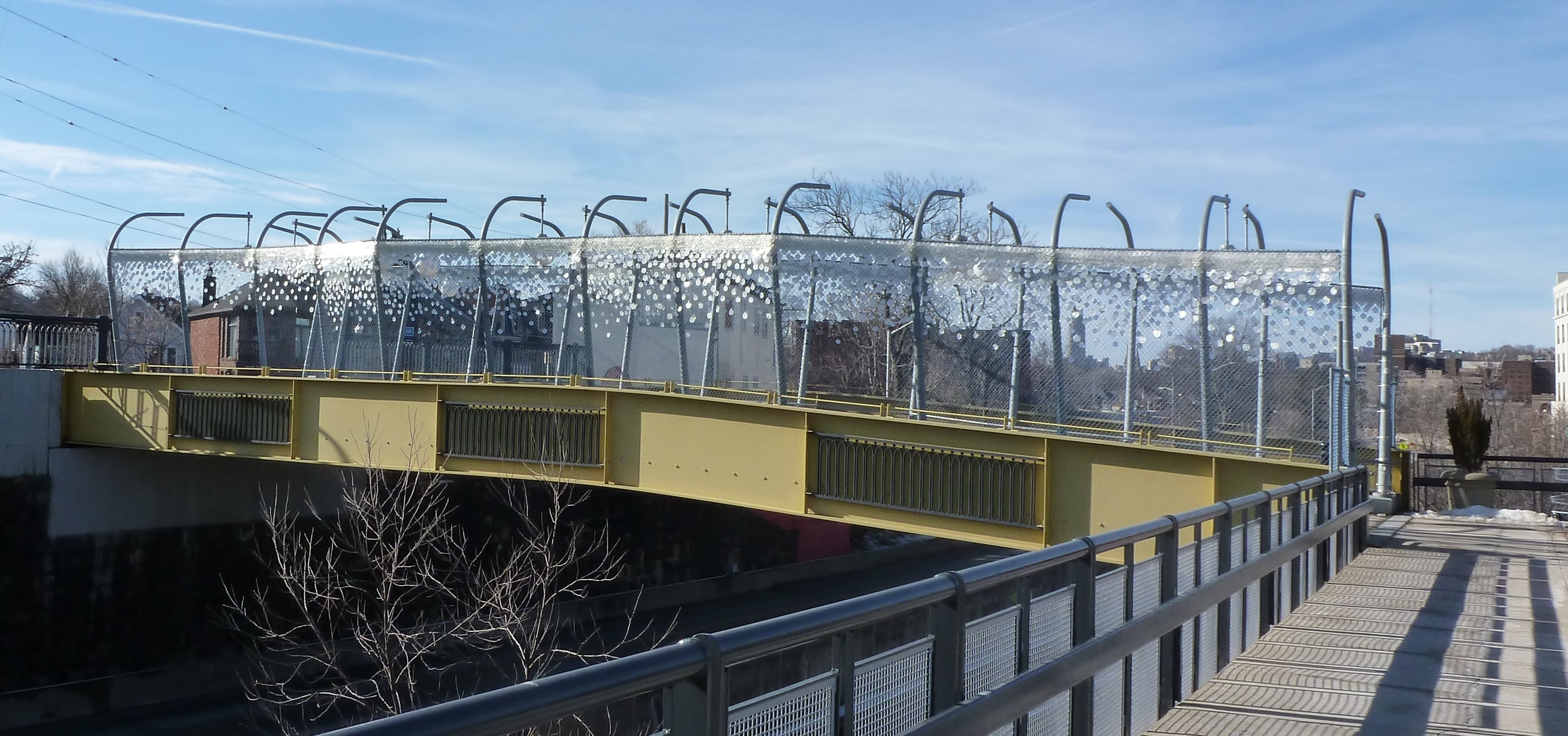
When I first started walking Pittsburgh’s bridges, the South Highland Avenue Bridge rated among those that were more than a little creepy. First, you were partially caged in. Second, the integrity of the wooden planks holding you up seemed more than questionable. I have no doubt that this bridge was rated in “poor condition” at that time. Now, the new bridge is considered in “good condition” per the National Bridge Inventory as of its November 2017 inspection. It has presumably been inspected twice more since then (November 2019 & November 2021), but those results have not been made publicly available yet.

The reconstruction of this bridge in 2013 made me hopeful that the similarly creepy bridge at South Negley Avenue would also shortly be reconstructed. This has yet to happen. My hope is renewed with the passage of the Infrastructure Investment and Jobs Act coupled with the greater attention “poor condition” bridges are receiving this year after the collapse of the Fern Hollow Bridge. However, according to a recent article on the redevelopment of the busway station adjacent to the South Negley Avenue bridge (Tribune Review, February 16, 2022), funding issues and coordination with Norfolk-Southern Railroad are causing continued delays to the proposed reconstruction of this bridge.

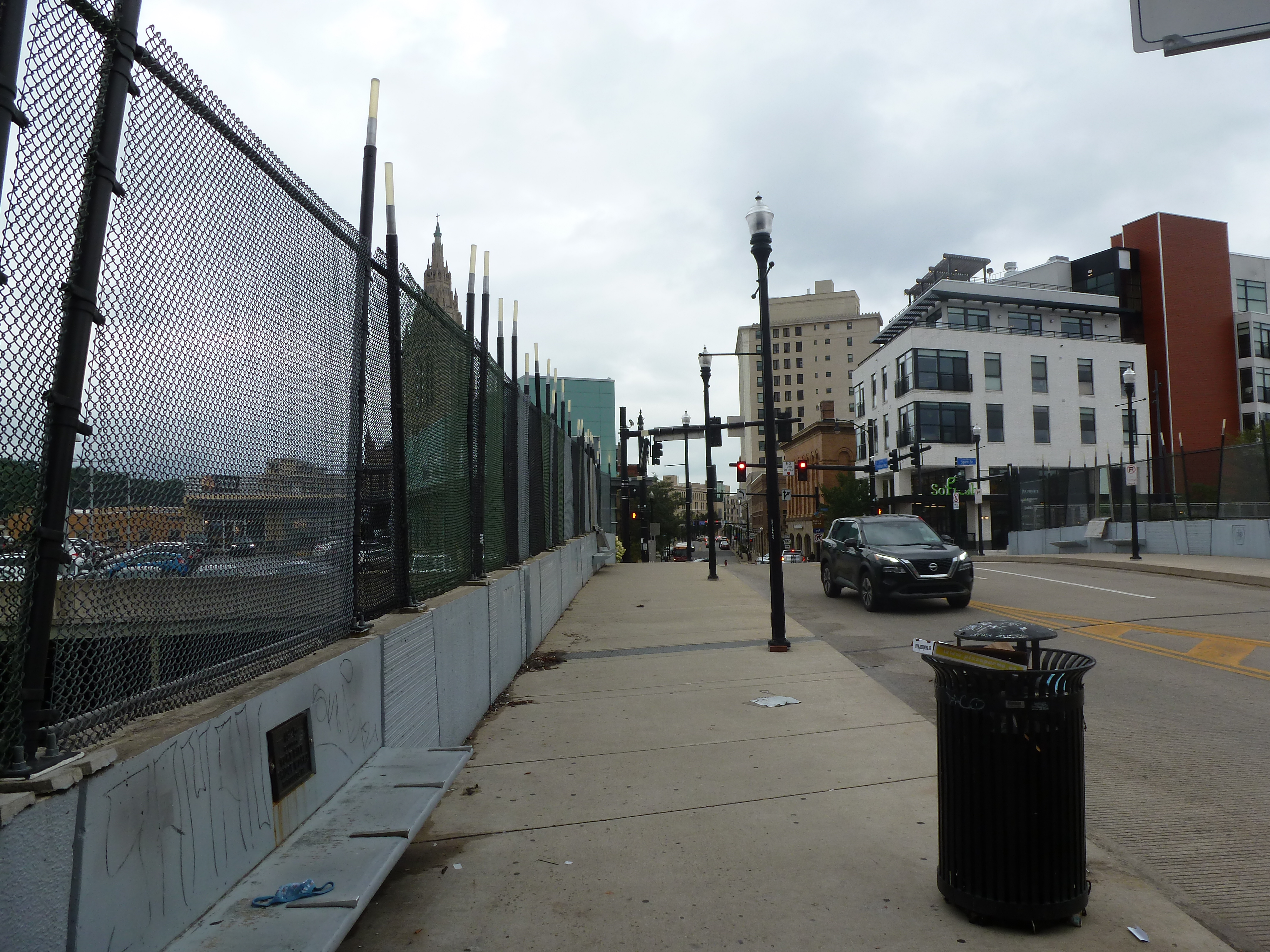
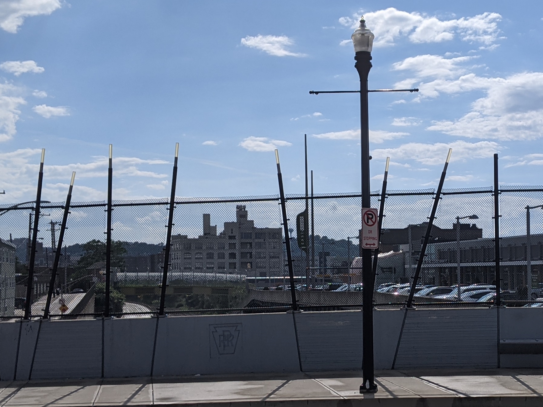
The new South Highland Avenue is a definite improvement over the last one. I no longer cringe at the thought of walking across it as being fenced in is better than being caged in (second photo set below). Yet, it is still not a pleasant experience to walk this bridge.  On the other hand, the Smithfield Street Bridge, for example, is a nice bridge to walk despite the many places where the sidewalk has rusted out providing direct views to the river below. The difference in these experiences is in part due to the bridges’ environments – nothing short of climate change will return the former river to what is now the busway and train tracks under the South Highland Bridge. However, design also plays a part in the experience. Many people in Pittsburgh’s architecture and design community are concerned that a poor bridge design will be rushed through on the Fern Hollow Bridge replacement with the excuse that it is an emergency (WESA, March 3, 2022). As the Fern Hollow Bridge has pleasant surroundings, it will be the bridge’s design that makes or breaks the experience of using the future bridge.

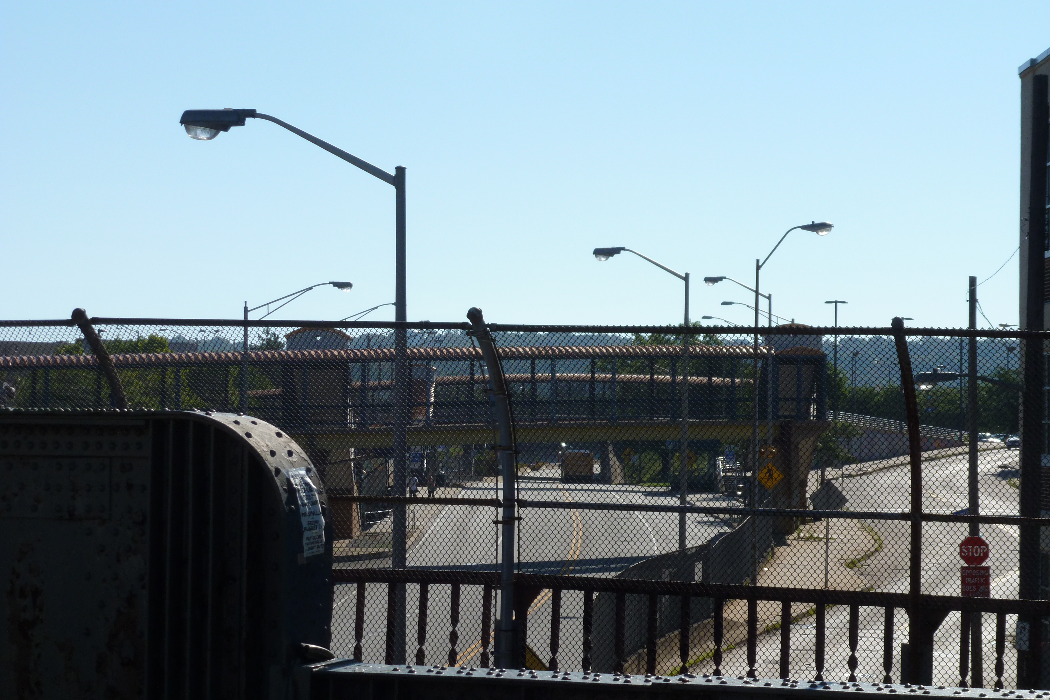
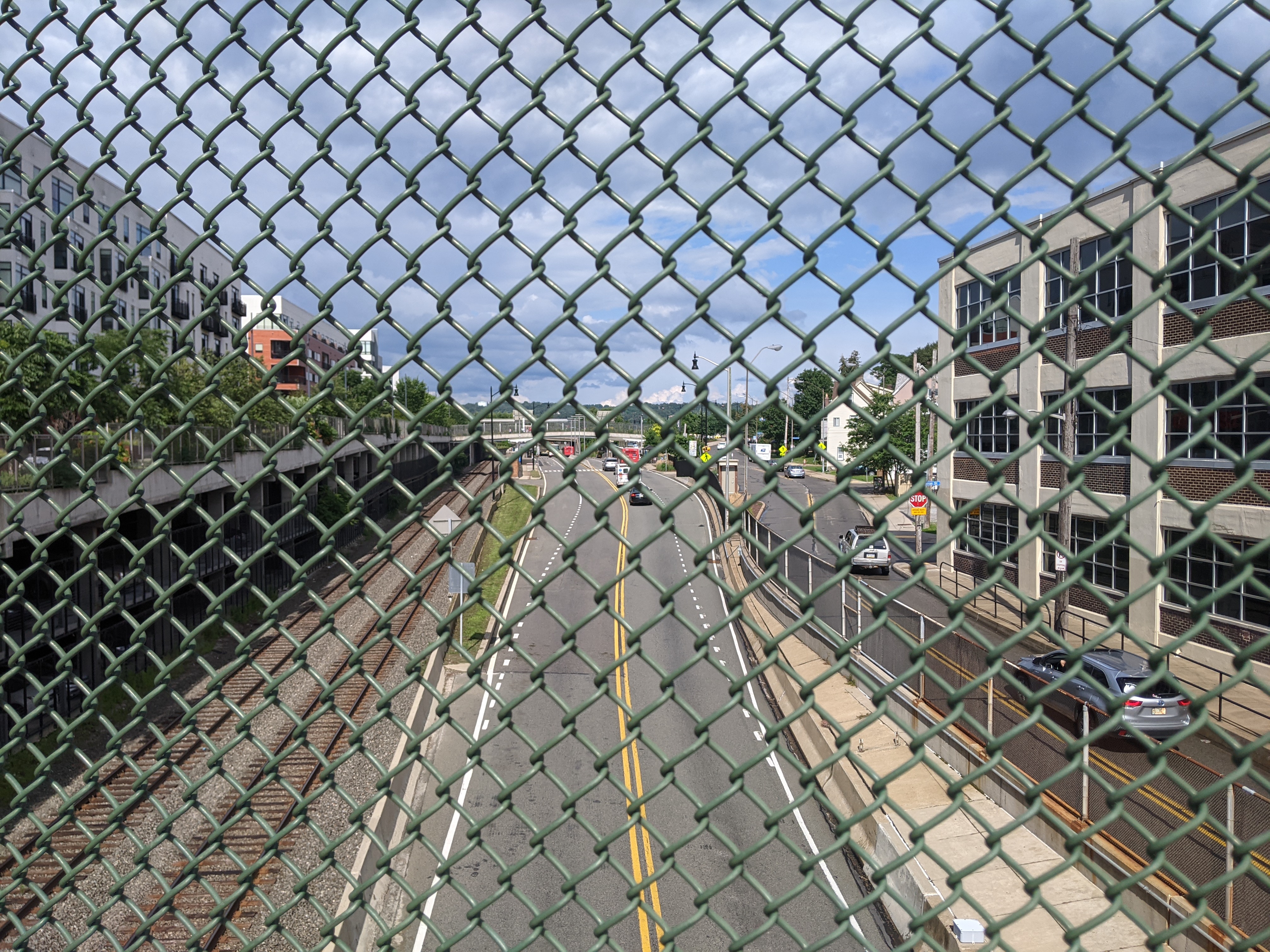
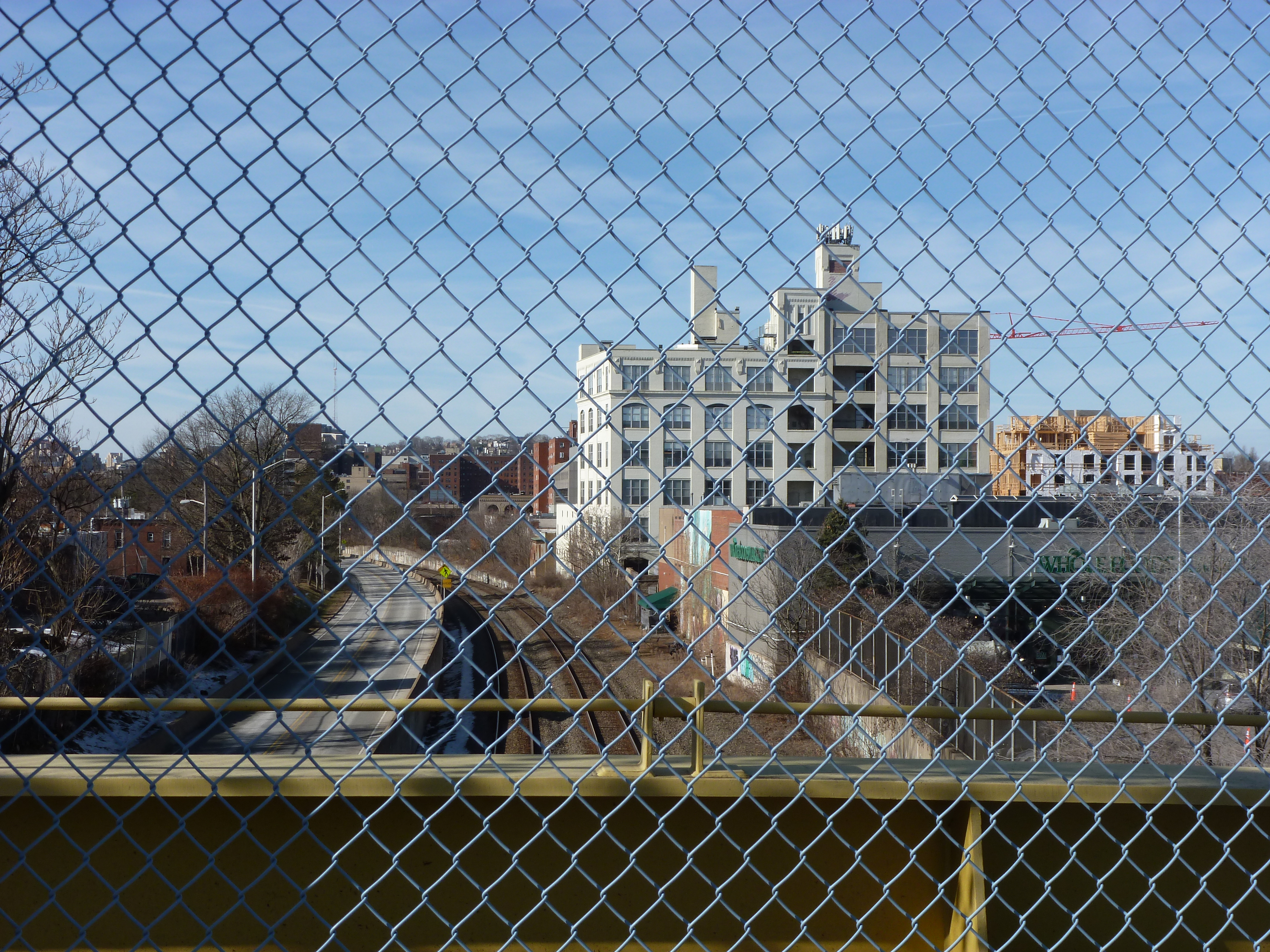
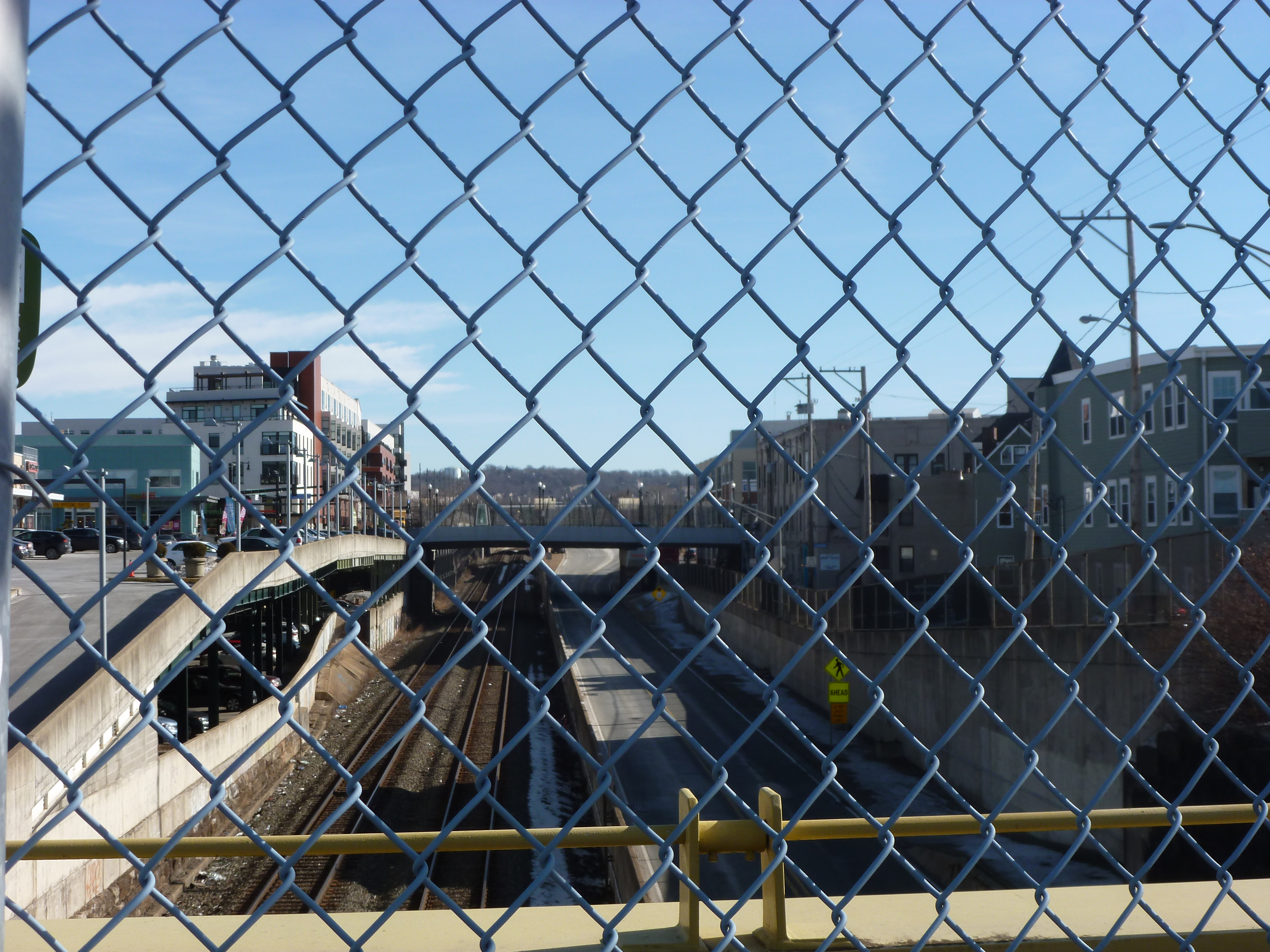
The South Highland Avenue bridge was replaced before it turned into an emergency. I assume the reason why it was replaced when it was while the South Negley Bridge continues to rust away is the massive amount of investment and redevelopment that was put into the East Liberty neighborhood in the last 10+ years. Looking west from the bridge, the early developments are visible, including the East Liberty Pedestrian bridge that was last month’s 10-year anniversary featured bridge and the Whole Foods location. These developments are old enough that the “Then” and “Now” views (third photo pairing) look substantially the same. The newer developments are clear in the east view (final photo pairing below), which looks like a completely different world between the “Then” and “Now” views. Next month’s feature will discuss this redevelopment in greater detail.

Then & Now: East Liberty Pedestrian Bridge

Just after I began my 10-year anniversary celebration of bridge walking, the Forbes Ave Bridge over Fern Hollow collapsed on January 28, 2022. This accident shone a light on a pattern of infrastructure funding in the time since I became a bridge person. Ten years ago, there were several bridges built, repaired, or replaced in Pittsburgh. Five years later, the flurry of long overdue investment in our infrastructure stopped – before all the bridges that needed help received it. An article on the aftermath of last month’s bridge collapse reminded me that federal funds were allocated toward infrastructure under the Obama administration. As a result, many bridges that were falling apart were fixed or replaced. It seems that when that funding stopped, so did the repairs. Now that new funding has been allocated under the Biden administration, we should see a similar spurt of investment in our infrastructure, starting with the now missing Fern Hollow Bridge.

One of the bridges presumably supported by the Obama infrastructure funding was the brand-new pedestrian bridge across the East Busway connecting the Shadyside and East Liberty neighborhoods. This bridge is 10-years old this month. The “road” surface of the bridge hasn’t held up very well: the paint was faded and the top surface was patchy when I returned this month. On the other hand, the over-the-top lamps and giant glitter looked like they have held up well. Though it’s hard to say in wintertime, the landscaping between the cage and the bridge walls also appeared to be well maintained.

From the bridge, some of the new developments in East Liberty are visible. Looking southwest toward the current location of Whole Foods (soon to relocate), one of the several new apartment buildings along the Baum-Centre corridor is visibly under construction in the far right of the second set of photos. In the third set, the northeast view shows the new South Highland Avenue Bridge and (to the left of the bridge) the final phase of the East Side Bond development that brought several buildings of first floor commercial with residences above.

I was surprised to find that the highly controversial and massive redevelopment of the former Penn Plaza affordable housing complex was not visible from this bridge. Despite being only a quarter mile apart, the first phase of redevelopment is blocked from the bridge’s view by the iconic Motor Square Gardens building. One of the controversies of this new development is that affordable housing units were demolished without replacement for a series of commercial buildings which include the feature anchor of the pricey Whole Foods grocery store.

The pedestrian bridge was controversial when it was proposed and built. It connects the wealthy Shadyside neighborhood to the expensive Whole Foods, a high-end liquor store, and other luxury shops. It is also redundant as the South Highland Avenue bridge is only 0.1 miles away. A quarter mile away, is the neighborhood of Larimar whose residents are primarily living on low-incomes and do not have a walkable route to the lower cost Giant Eagle grocery store or Trader Joes that are just on the other side of the busway from their homes. For years, the residents have been asking for a pedestrian bridge over the busway to give them better access to these stores. Instead of a bridge serving those who need it, an ornamental bridge was built to provide access for those who already have abundant options.

Around the same time that this bridge was built, the Port Authority altered its bus service by eliminating the 94B bus that connected the low-income residents of Larimar with a shopping center featuring Walmart, Giant Eagle, TJ Maxx and similar clothing retailers, and other stores. In addition to providing shopping opportunities for necessities, these locations provided jobs. The 94B bus was never less than half-full (an unusual condition for Pittsburgh buses outside of rush hour). This bus was replaced by the 75 bus, which connected the higher-end shopping centers of South Side Works and Bakery Square through the wealthy residential neighborhood of Shadyside. For years, it was common to be the only person or one of a handful of people riding the 75. Eventually, the Port Authority acknowledged the value of the 94B route and tact it on to the end of the 75 route.

Presumably both the pedestrian bridge and bus route changes of 2012 were supported at least in part by the federal infrastructure funds of the time. With the current round of federal funding, it would be nice to see a greater focus of infrastructure investment for those who need it and not on additional luxury options.

Busway Bridges: 28th Street

The 28th Street Bridge is one of Polish Hill’s two points of access to the lower regions between it and the Allegheny River, the second is the Herron Street Bridge (see post).  This bridge is also the last pedestrian accessible bridge across the busway before downtown.  Several of the views from this bridge are similar to, but better than, the ones from the Herron Street Bridge.

For instance, the images of downtown from the 28th Street Bridge have fewer non-downtown buildings blocking the view than those from the Herron Street Bridge.

Also, the Children’s Hospital and Choir Loft Condominiums are visible from both bridges, but on the Herron Street Bridge only the tops of the buildings were visible while from the 28th Street Bridge most of the buildings are visible.

Across the river in Troy Hill, another site of contention within the city is visible.  The former St. Nicholas Church pictured above is the sister to the St. Nicholas Church I saw from the 40th Street Bridge (see post), has been vacant since 2004, and has been locked in a battle between preservationists and the parish for over a year.  The parish wants to demolish the building that it cannot afford to maintain and many people have called an eyesore, while the preservationists want to preserve the building.  This summer a county judge ruled in favor of the parish (see article), but the city has threatened to appeal this decision (see article).  The building is certainly architecturally interesting, however it is in a horrible location, smack up against route 28, which I believe provides the only access to the building.

Earlier this summer, when I was talking with someone about my project to walk the bridges of Pittsburgh, he asked me which bridge was my favorite so far.  I hadn’t thought about it before, but when he asked, I decided that the Heth’s Run Bridge was my favorite because its design and its existence called up many questions (see May 31 and June 9 posts).  Now I would say that the 28th Street Bridge is my favorite, despite the fact that it is rusting, the sidewalk is crumbling, and it has the cage-like fence I generally dislike.  I think the bridge is rather cute (if a bridge can be called cute)….Or perhaps I like it so much because it has a stone-lined approach.  I love stone.

Busway Bridges: Herron Avenue

Polish Hill, the neighborhood which is home to the Immaculate Heart of Mary’s Church I’ve pointed out in some posts (see 31st Street Bridge and A Sidewalk to Nowhere), has only two points of access to the lower ground along the Allegheny River.  These are the Herron Avenue Bridge (above) and the 28th Street Bridge (see post) which cross over the busway and parallel railroad tracks to reach Lawrenceville and The Strip District, respectively.

There are a few sites of interest from the Herron Avenue Bridge.  The first of which is the former Iron City Brewery site, which up until a few years ago was the oldest (and only remaining) brewery within the city limits.  It closed and the site has been vacant ever since.  This summer, it became a site of contention.  The property was purchased earlier in the year by a development company, who this summer demolished some of the buildings on the site.  The site is a designated historic landmark, but the company received permission to demolish one building that was structurally unsound.  As I read it in articles in the Post-Gazette and elsewhere, the company said that when this building was demolished others became unstable requiring immediate demolition.  The Lawrenceville Stakeholders Historic Preservation Committee petitioned the city to site the company for unauthorized demolitions.  At the end of August, the development company was fined $20,000 for the demolitions (see article).  Despite the argument over the demolitions, the company and the neighborhood are supposedly working together to come up with a plan to (re)develop the site.

Also visible from the bridge are two of Pittsburgh’s repurposed churches.  The one in the first picture is the Church Brew Works, the city’s most infamous adaptive reuse of a church building.  The one in the second picture is the Choir Loft Condominiums which have been visible from other bridges as well (see Bloomfield Bridge and 31st Street Bridge posts).

Other views from this bridge show downtown and the busway.

Bloomfield Bridge

The Bloomfield Bridge towers over much of the surrounding areas thanks to the unique geography of Pittsburgh.  As I discussed in Pedestrian Bridges: Bigelow Boulevard, the Bloomfield Bridge is an a location that could lend itself to higher pedestrian traffic than some of the bridges I’ve walked because of its close proximity to a grocery store and a drug store on one side and residences on the other.  However, the accessibility for the residents is limited and not inviting.  Car traffic on the bridge and on Bigelow Blvd tend to have higher speeds, particularly as Bigelow Blvd is used like an expressway to get from one part of town to another.

Despite the issues of limited accessibility and the non-pedestrian friendliness of the bridge, it was worth the walk across for the various views of the city available from this bridge.  As I mention in my introductory post about my plan to walk Pittsburgh’s bridges, what I was already enjoying about the project was the various views of the city from the beautiful to the industrial and developing a greater awareness and appreciation for the varied geography of the city.  The Bloomfield Bridge covers both of these ideas.

I refer to the Bloomfield Bridge in the introductory post linked above because of the “underbelly”-like view it still provides of Pittsburgh.  While much of the city is being shined and cleaned up–such as downtown and East Liberty–there are still places of what I like to call the nitty-gritty of Pittsburgh.  The Bloomfield Bridge shows one of these areas along the busway.  I’m not sure how all the buildings lined up in the picture above are used, but I believe at least some are junk yards for cars.  I believe the smoke stack in the distance at the end of the line buildings is for the former Iron City Brewery site, which I will talk about more in the post on the Polish Hill bridges.

This view off of the other side of the bridge helps illustrate the extreme changes in geography around the Bloomfield Bridge from the rise on which West Penn Hospital sits (this photo) to the gully where the busway runs (photo above).  I think that the Bloomfield Bridge may offer one of the most open views in the city.  Like the view from the pedestrian bridge across Bigelow, the view east from the Bloomfield Bridge stretches past Bloomfield to East Liberty, Shadyside and beyond.

The view west of the bridge also reaches far: beyond the busway out over the rooftops of the warehouses and factories of The Strip District to the 31st Street Bridge (see post), the Herr’s Island development (see post) and the hills beyond.  There are not many places in Pittsburgh where the view stretches so far in multiple directions.

Part of the neighborhood of Bloomfield continues west of the Bloomfield Bridge.  Just a few blocks from the bridge is Woolslair Elementary School behind which is the Choir Loft Condominiums (formerly a German Evangelical Church).  I pointed out this church in my 31st Street Bridge post.  I explained in my first post about this blog that my current themes in walking are bridges and the adaptive reuse of churches.  This summer I focused mostly on the bridges as I set myself the goal of walking as many of Pittsburgh bridges as I could.  This fall I plan to shift the focus more toward the adaptive reuse of churches, though I will still continue to walk bridges as well.  Once I shift my emphasis, the Choir Loft Condominiums will be among the first adapted churches in Pittsburgh I will discuss.

Busway Bridges: Shadyside

The Negley Avenue and Aiken Avenue bridges connect the sections of Pittsburgh’s Shadyside neighborhood divided by the busway.  Both were originally built in the 1920s and renovated in the 1970s.  There were at least two previous bridges at Aiken (see 1909 and 1924 photos).  I did not find any images of an earlier bridge on Negley, but there are images of the bridge from 1924 (the year it was built) and from 1965.

Today, these bridges share the feature of the mesh fence protecting the pedestrians from the edge.  The width of the sidewalk on the Aiken Bridge is wide enough to reduce any feelings of being caged in, but on the Negley bridge, the metal girder on one side and the fence on the other enhance the caged feeling for pedestrians.

These bridges are two blocks apart, but because the busway curves they are not visible to each other.  Both do see the Graham Street pedestrian bridge (see post).

This space between the Negley and Aiken bridges is mostly residential.  Next to the Negley Bridge is a condo complex while single family homes line the busway near Aiken Avenue.  On the other sides of the bridges, the area turns more industrial.  The industrial area east of Negley is denser than that west of Aiken.

Busway Bridges: Millvale Avenue

When I crossed the Millvale Avenue Bridge over the busway, I was thinking a lot about the “caged” aspect of many of Pittsburgh’s bridges.  I wrote about this idea in my Highland Park Bridge, Taking the Long Way Round, and Busway Bridges: East Liberty posts.  While a lot of bridges in Pittsburgh have the mesh fencing, which often makes me as a pedestrian feel caged in, there are several that do not.  As I prepared to cross this bridge I wondered why that is.

I wondered if perhaps it was to prevent people from jumping off the bridges.  This theory did not make sense though.  First, if that is the case shouldn’t all the bridges have the fences?  One of the times I crossed the Birmingham Bridge, I witnessed a scene that I believe was a group of people working to dissuade a jumper.  The Birmingham Bridge is one of the bridges without a fence.  The second reason this theory doesn’t fit is that on the Millvale Bridge, the fencing is only along part of it.  There is a significant stretch not fenced with a big drop.  The part that is fenced is the stretch over the railroad tracks and the busway.

My next ideas were that perhaps the fences are meant to stop litter from blowing off the bridge and onto the tracks/road/river below or to stop people from throwing things over the bridge.  Again, these don’t make sense.  Litter can blow in from any direction and could blow over the fence.  There is also a parking lot under the Millvale Bridge, so if the concern is about people tossing things over the bridge, why isn’t the fence extended to protect the cars in the lot?

I mention in Busway Bridges: Baum-Centre Corridor that most of the bridges across the busway between Penn Avenue and the Bloomfield Bridge are ugly and unpleasant.  Millvale Avenue Bridge is mostly exempted from this.  The design of the bridge is more aesthetically pleasing than the concrete of the Baum and Centre bridges and the rusty metal of the Highland and Negley bridges.  The area surrounding this bridge is also more residential and less used than the commercial arteries of Baum and Centre.

I thought the aesthetic difference might be explained by the years in which the bridges were built, but that is not the case.  The Highland, Negley, Aiken, Baum, and Millvale bridges across the busway were built in the 1910s or 1920s.  They were all reconstructed while the Penn, Centre, and Bloomfield bridges were all built in the 1960s, ’70s, or ’80s.  The Negley and Aiken bridges also connect with residential areas, so the land use around the bridge cannot explain the slightly different and better design of the Millvale Bridge.

Busway Bridges: Baum-Centre Corridor

Baum Boulevard and Centre Ave run parallel along the border of Pittsburgh’s Shadyside and Bloomfield neighborhoods and are arteries that help people move from downtown and Oakland to East Liberty and other East End neighborhoods.  The Baum-Centre corridor is currently receiving a lot of attention from the perspective of the development of the city.  There is even a community group called the Baum-Centre Initiative made up of representatives from other groups along the corridor.  Their goal is to work together to promote development along the corridor that is beneficial and satisfactory to their respective groups and communities.

This area is attracting interest in part because of its arterial activity, but also because Baum used to be the car dealership district.  Most of the dealerships have closed their locations leaving behind many empty buildings.  Contrary to this disinvestment, Centre Ave hosts one of the UPMC hospitals and an urgent care center was recently added.  From what I’ve picked up, UPMC is working to expand in this area.

The large building between Centre and Baum last housed a party/costume supply store, but I image most of the building was sitting empty.  For about the last year, it has been under redevelopment.  The rumor I have heard is that something related to UPMC is going into the space.

I also heard that UPMC wants to build a parking lot for its employees in this area.  I couldn’t picture exactly where it was to be placed from the description I heard, but I wonder if it is this empty lot off of Baum Boulevard.

Outside of the developments going on near them, my impression of these two bridges is that they are quite ugly.  I am glad that except for when I walked them for my project, I’m in a bus when crossing Centre Avenue’s bridge and in a car when crossing Baum Boulevard’s bridge.  Now that I mention it, that’s how I felt about most of the bridges across the busway I’ve walked (except for the new pedestrian bridge, see July 26 post).  Though I haven’t written the posts for all of them yet, at this point I have walked all the bridges over the busway between Penn Avenue and the Bloomfield Bridge.

My favorite part about walking these two bridges was the view of Bloomfield/Lawrenceville from the Baum Boulevard Bridge.  This view captures two of Bloomfield’s churches (both currently active) with Lawrenceville’s Childrens Hospital sandwiched between them.

Pedestrian Bridges: Shadyside

When the pedestrian bridge I discuss in “Taking the Long Way Round” was in the process of being built, I was thinking it was the first pedestrian bridge in Pittsburgh.  When I started my project of walking the bridges in Pittsburgh, I realized what a ridiculous thought that was.  Pittsburgh has many pedestrian bridges, but until the new one was built, I never heard anyone talk about any pedestrian bridge in the city.  Many of these pedestrian bridges are not particularly attractive and are not in high traffic areas.

Shadyside has one of these hidden pedestrian bridges.  The bridge connects Graham Street across the busway and railroad tracks.  The only reason I know about this bridge is from riding buses on the busway.  Walking down Graham from Centre Ave (a busy corridor lined with businesses, churches and a hospital and used by several major bus routes and lots of cars), I was impressed how quiet and peaceful the residential area between Centre and the busway was.  That is until a train comes by.

As I walked across this bridge, I wondered why it was there.  There is a vehicular bridge with sidewalks on both sides across the busway a block in either direction.  There are eight other roads between this bridge and the Penn Ave Bridge that end at the busway and have neither a vehicular or pedestrian bridge connecting them to the other side of the busway.  In my walk, I speculated that perhaps it was put in to connect the residents on the north side of the busway to places of work on the southern.  This was based on the fact that there was a large building on the southern side that now houses the Shadyside Boys and Girls Club (photo below).

When I got home I went to PGHbridges.com, which I have used whenever I’ve had questions like this about the origin or design of Pittsburgh bridges.  However, for some reason this website ignores many of the bridges over the busway.  In looking up some of the bridges that PGHbridges.com misses, I found several other bridge websites that list and identify many of the bridges in the city, but none of them include the Graham Street Bridge, not even the National Bridge Inventory Database.

So I turned back to my favorite resource–the G.M. Hopkins maps.  I also went to the image collection on Historic Pittsburgh, the parent site for the Hopkins maps.  In the image collection I found one photo from 1908 of the bridge under construction.  The 1904 and 1911 maps show the area immediately adjacent to the bridge as all residential.  The building that is now the Boys and Girls Club does not exist.  All I’m left with is speculation at this point.  However, there is a school a few blocks from the southern end of the bridge and in between 1904 and 1911 another church was built a couple blocks north of the bridge.  There already was a large church a block from the site of the newer, smaller one.  Perhaps, the bridge was built to facilitate school students and church goers to get to their respective destinations.

Based on the way the bridge is depicted on the 1911 map and the 1939 map, I suspect the bridge may have been rebuilt since 1908.  At the very least the stairs were replaced.  The southern steps are drawn as coming straight out from the bridge to the road, but today the stairs are perpendicular to the line of the bridge and Graham Street.  The northern steps are drawn perpendicular to the bridge and facing the same direction the southern steps face today.  However, the steps I walked are switchback style, with the upper portion facing the opposite direction depicted on the 1939 map.

Busway Bridges: East Liberty

There are currently two pedestrian bridges across the busway in East Liberty to give bus riders access to and from the busway and surrounding neighborhoods.  I have used the larger of the two many times to get to and from the busway, but the smaller one (pictured above) always seemed out of the way, scary, and a bit useless.  It ended up not be as scary as I imagined, but it is not a path I would choose to use after dark.  It seemed useless, and out of the way, as it connects very low traffic areas to the busway and the Highland Ave Bridge (see July 26 post) or the other pedestrian bridge provide access between the busway and high traffic areas.

Both these bridges are scheduled to be demolished and replaced with one bridge.  In June, there was an announcement that a TIGER (Transportation Investment Generating Economic Recovery) Grant was awarded for a new transit center at this location (see June 20 and June 23 articles in the Post-Gazette).  In this new transit center, the busway station will be shifted closer to Penn Avenue, making the smaller pedestrian bridge truly obsolete.  The larger pedestrian bridge is planned to be rebuilt and the former bus ramp (see July 27 post) will be made into a pedestrian/bicycle connection to the busway (near the top of the ramp a bicycle garage is planned to be built).  The articles say that the developer hopes to start construction in the spring.  Perhaps in a year, or a little more, there will be a new bridge for me to walk.

Both the current pedestrian bridges take the caged feeling that several of the bridges I’ve crossed to a new level (see Highland Park Bridge, Taking the Long Way Round posts).  I have heard that the new bridge planned for this area will be more open and thereby more pleasant.  Whether this means it will be more open like the pedestrian bridge in Taking the Long Way Round or it will be truly open without any cage-like fencing, only time will tell.

When I first heard about the planned new transit center, I thought the whole idea was ridiculous–there already are bus stops on the busway and on Penn Avenue and there already are bridges connecting these areas, also public transit across the city has been in serious danger for the last couple years and there is no indication that its downward spiral with increasing route cuts and fare increases is going to stop anytime soon.  However after learning more about the new transit center, it seems like it might actually be helpful/useful by making the busway easier to access and more attractive to access.  Also after observing the behavior of a pedestrian in Taking the Long Way Round, I wonder if the new transit center might encourage more people to use alternative transit options.