East Liberty Station Pedestrian Bridge, August 2020, Carolyn RistauSpahr Street Pedestrian Bridge, February 2022, Carolyn Ristau
The winner of the 2024 Bridge Madness tournament, the East Liberty Station Pedestrian Bridge, faced stiff competition in the Final Four round from the Spahr Street Pedestrian Bridge. Both of these bridges are relatively new, constructed with funding sources from the Obama Administration. When I moved to Pittsburgh 15 years ago, neither of these bridges existed. There was no pedestrian connection at Spahr Street and the pedestrian bridges at East Liberty Station were boxed-in bridges with no greenery. (For a side-by-side comparison of the prior and current East Liberty Station bridges see their Then and Now post.) These are not the only changes to bridges in this area. In fact, I suggest that East Liberty has seen more bridge turn-over in the last 100 years than any other part of Pittsburgh.
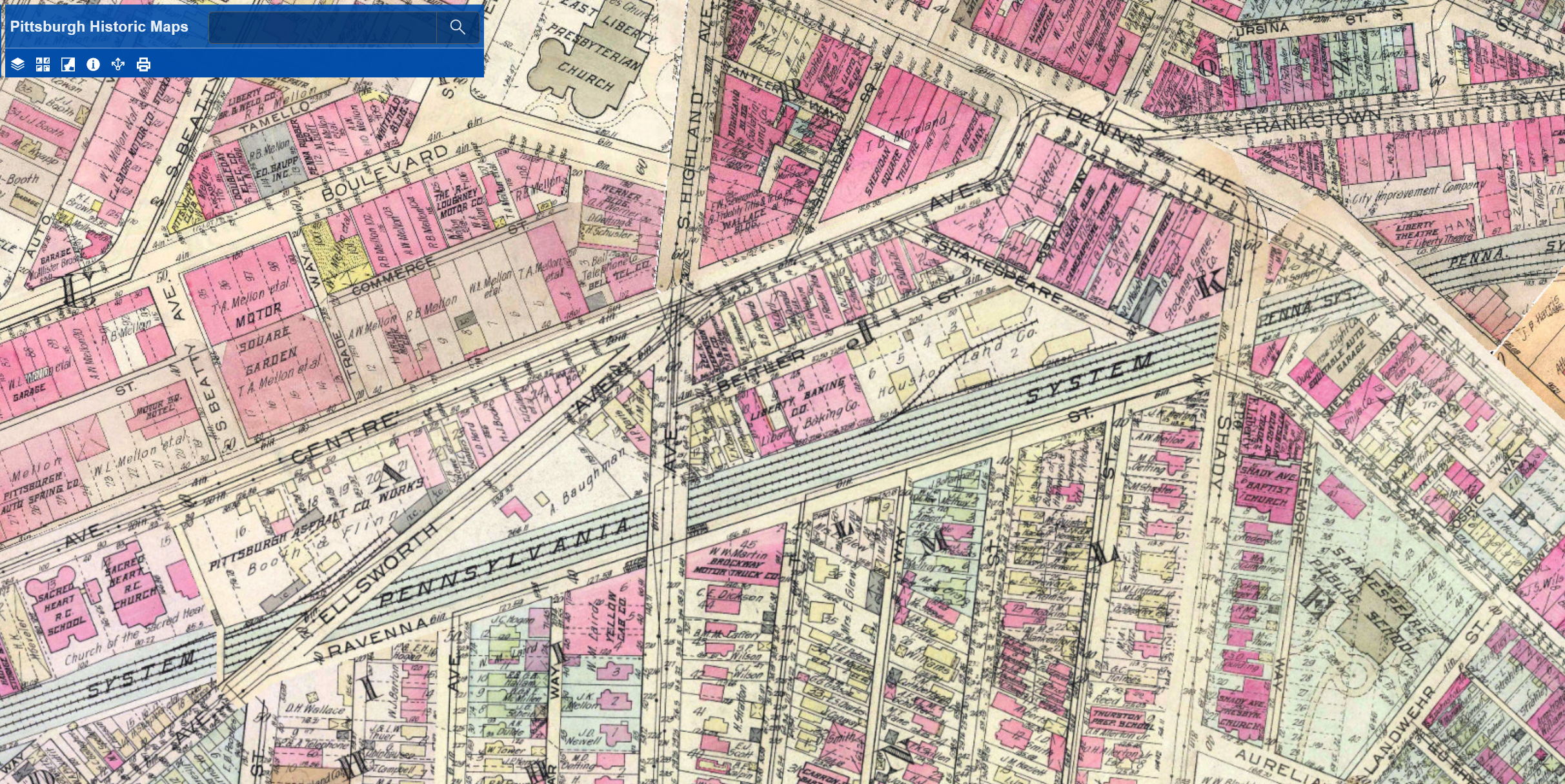
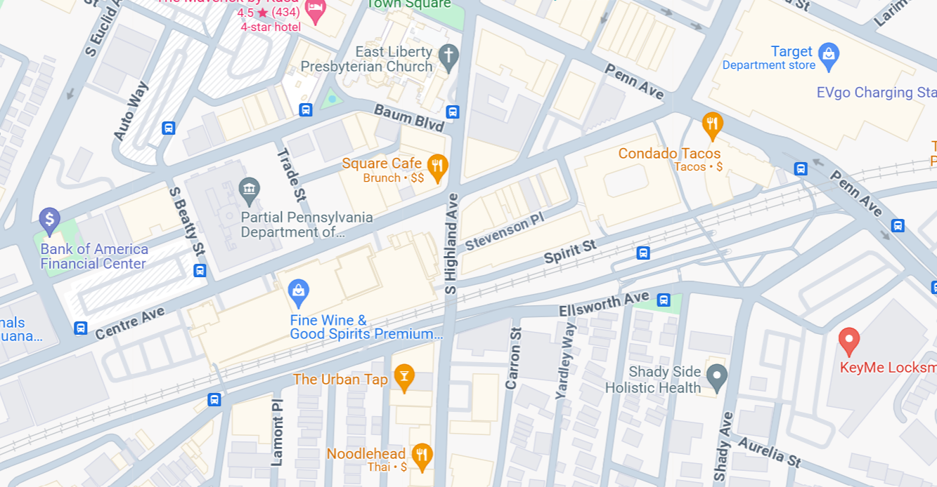
The Penn Avenue and South Highland Avenue Bridges have stayed fairly constant, at least as far as location is concerned. The South Highland Avenue Bridge was rebuilt and redesigned in the 15 years I’ve lived here. While the Spahr Street Pedestrian Bridge is new, the 1923 G. M. Hopkins map above shows that there used to be a pedestrian bridge at this same location. The historical precedent for a pedestrian bridge here may be another factor for why the bridge was located here and not further east where residents have been asking for a pedestrian bridge for years.
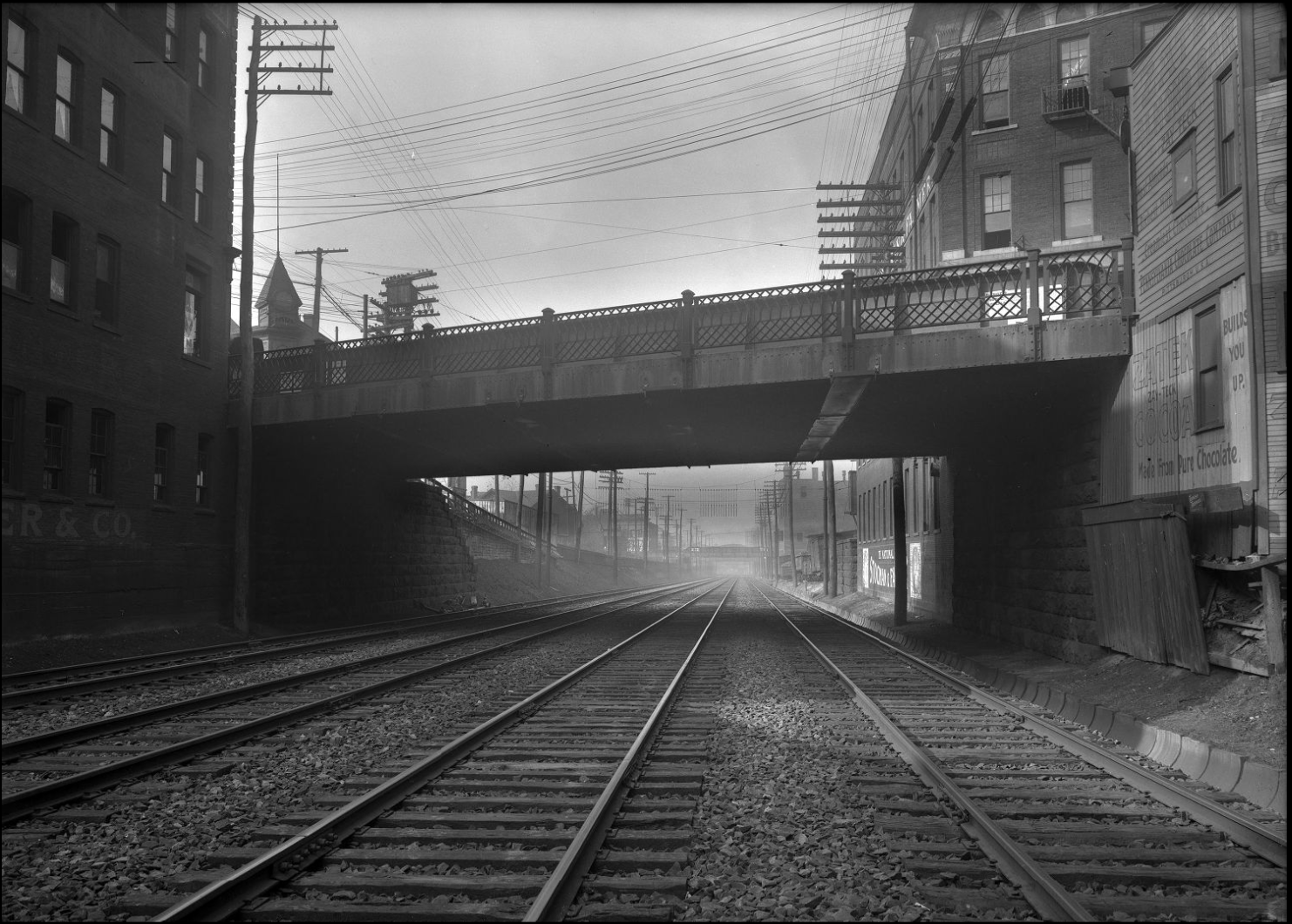
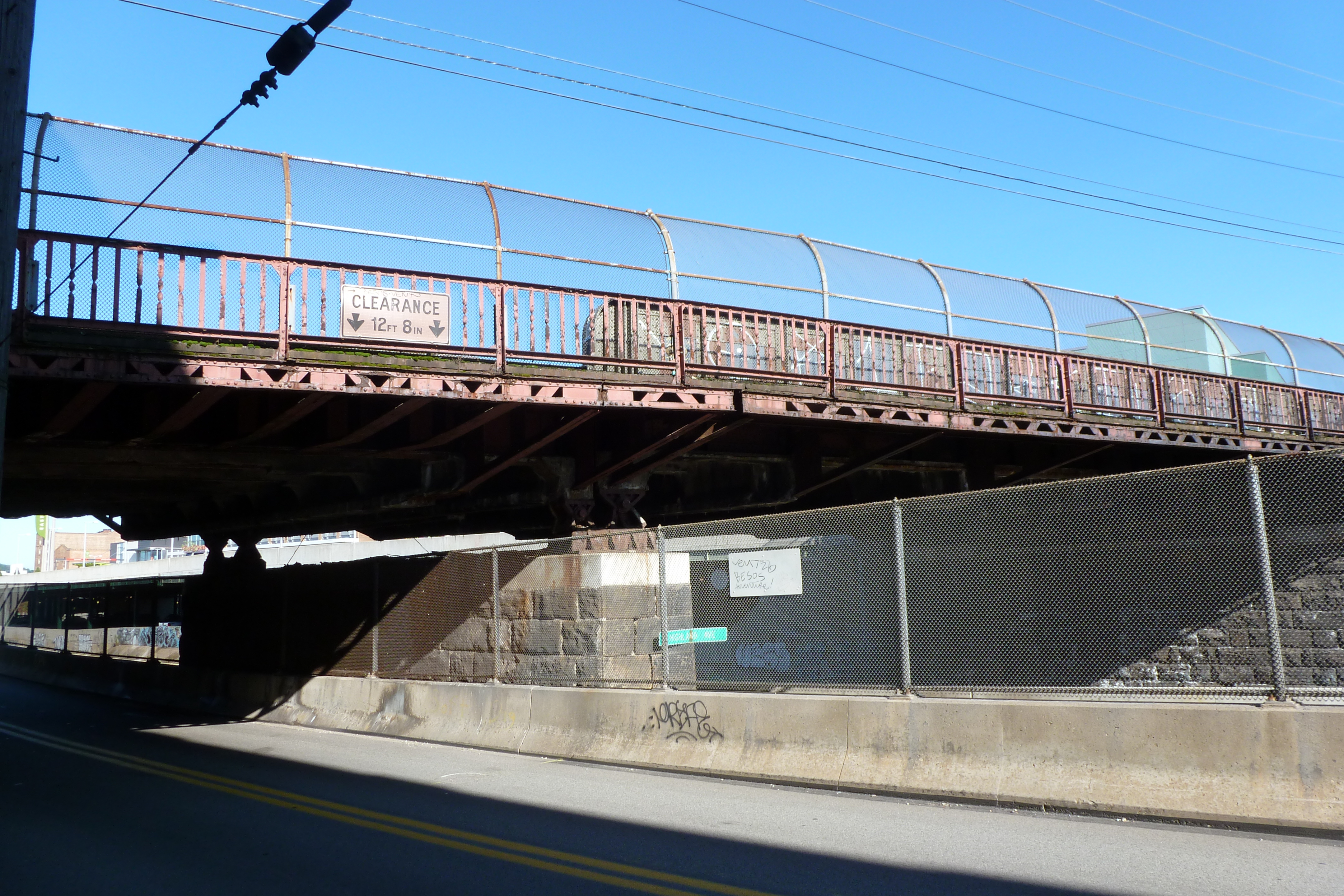
The other major bridge changes in this area are the former Ellsworth Avenue and Shady Avenue Bridges that show on the 1923 G. M. Hopkins map. Both of those are long gone. I assume they were casualties of the massive Urban Renewal of the neighborhood that significantly impacted the street grid of the area. The digital archives of Historic Pittsburgh include photos of these former bridges. The Shady Avenue Bridge seems to have been of a similar design to the former South Highland Avenue Bridge. The Ellsworth Avenue Bridge seems to have been of a similar design to the current South Negley Avenue Bridge that is just outside the map frame to the west. One key difference is that cages were added at some point to the South Highland and South Negley Bridges.
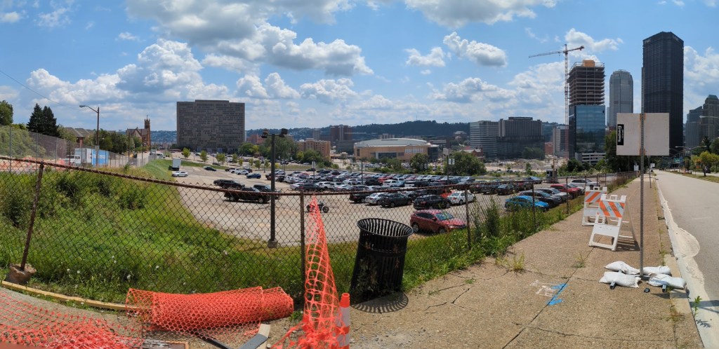
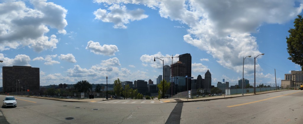
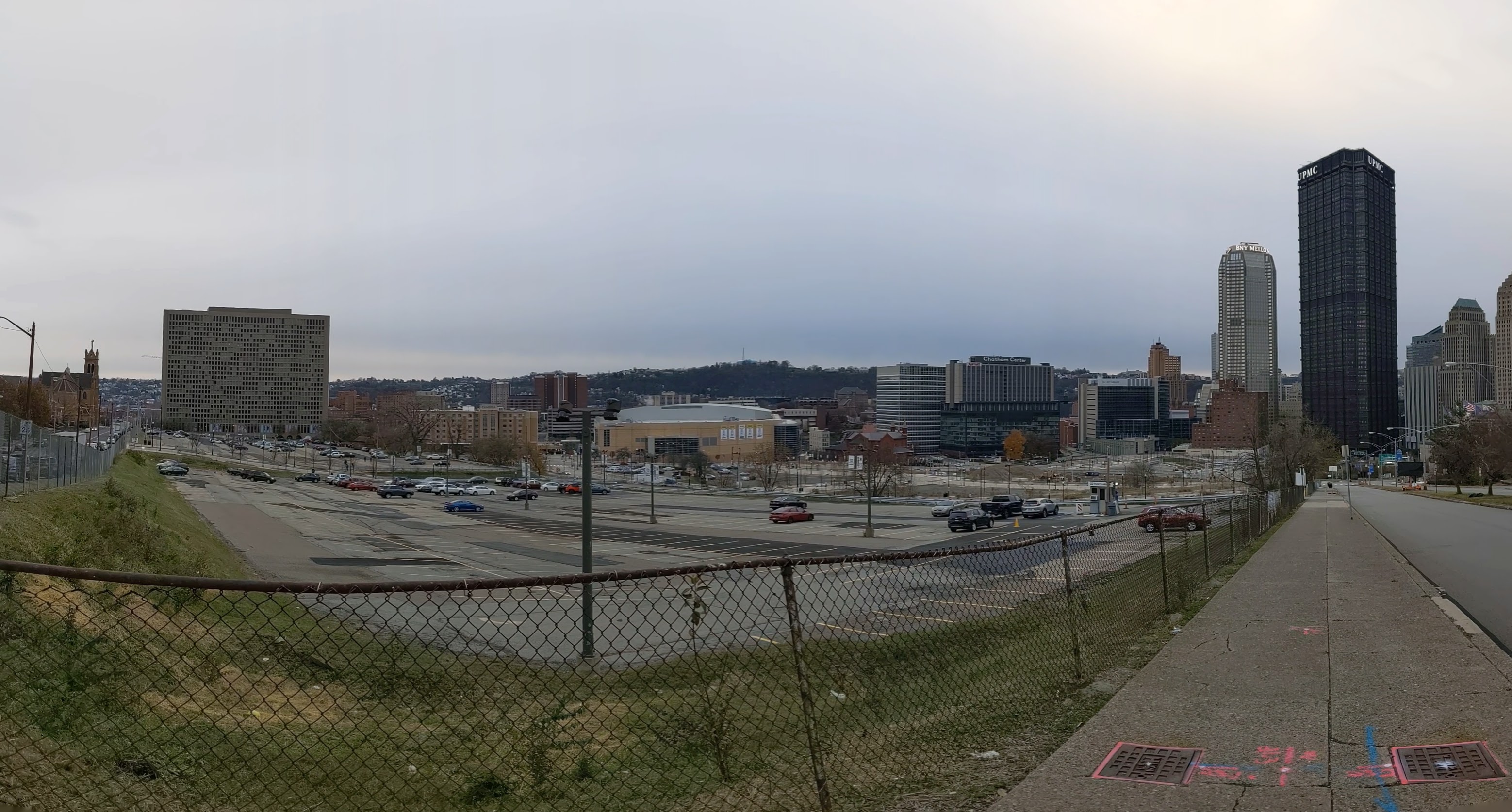
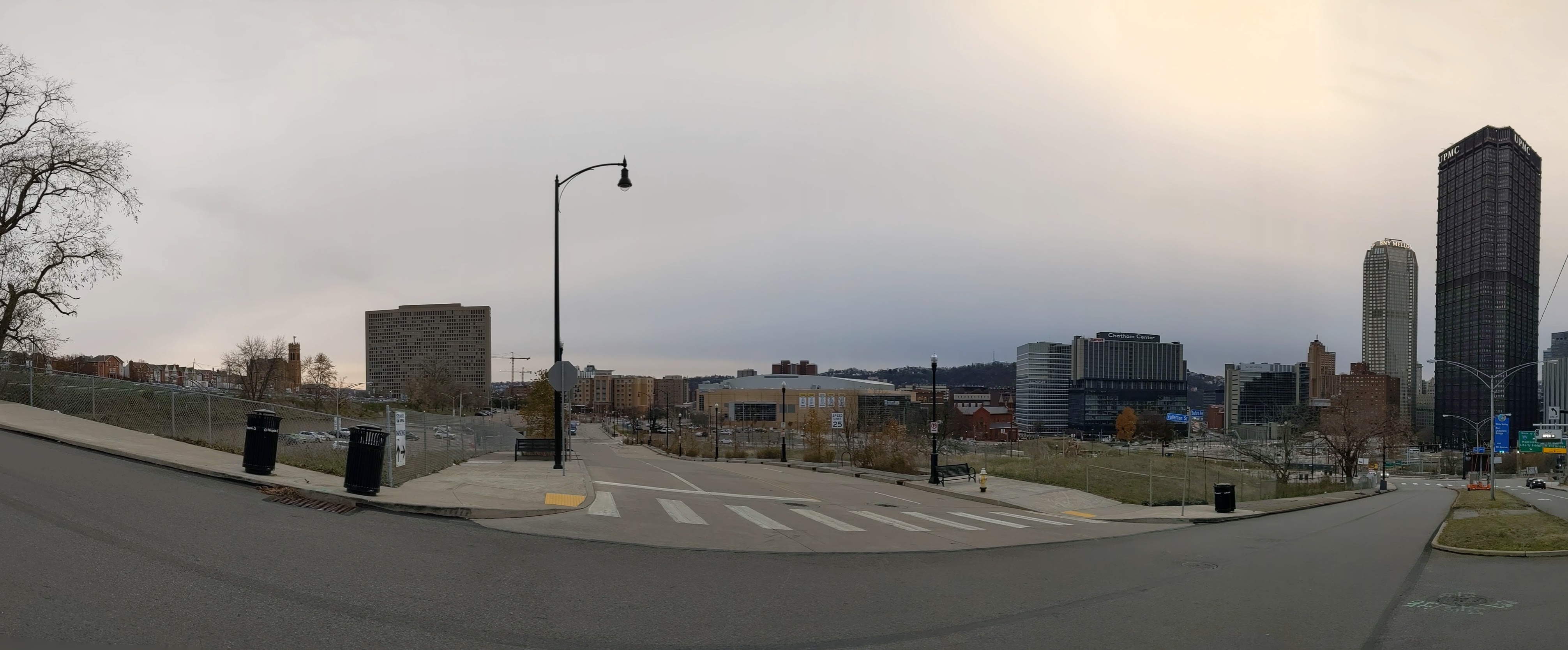
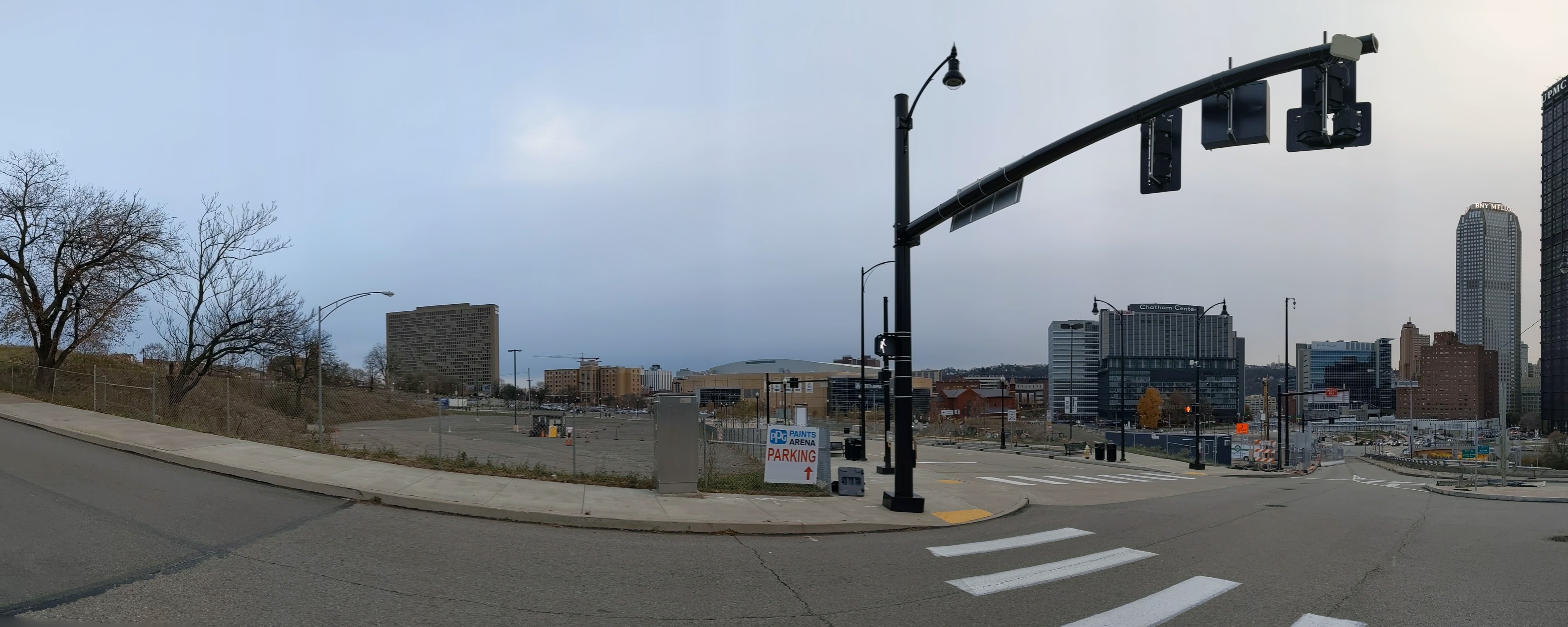
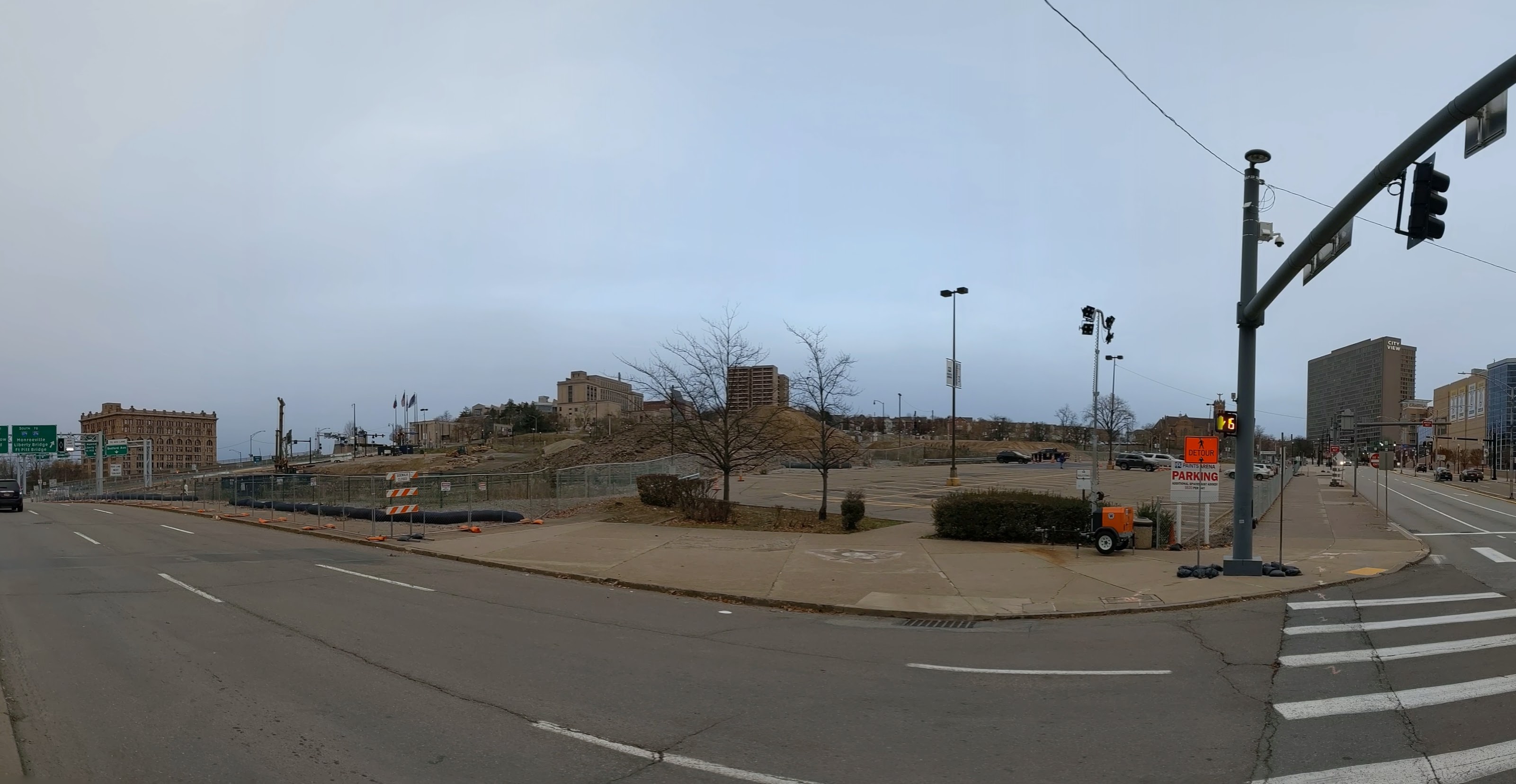
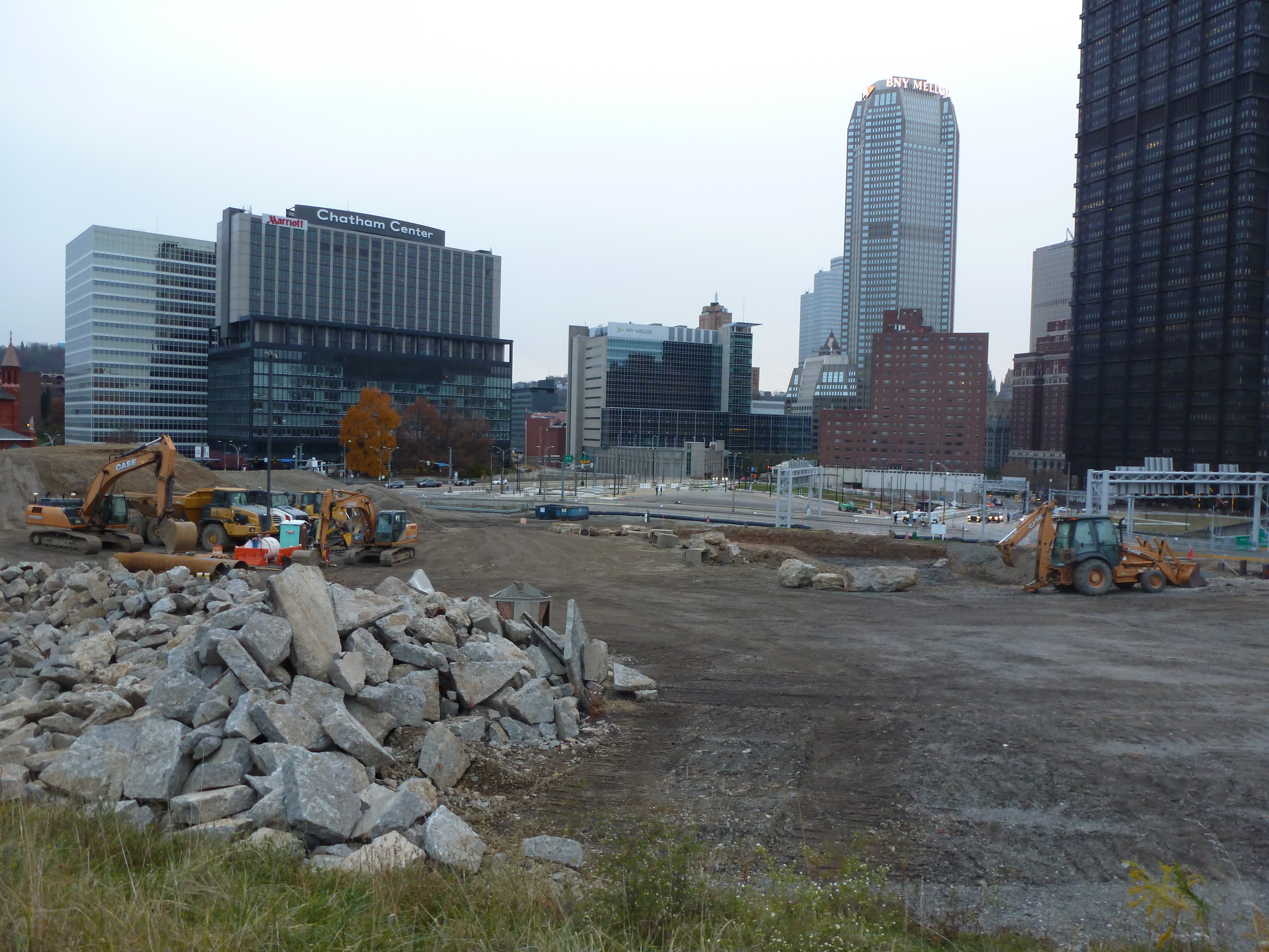
The Lower Hill is a notorious site in Pittsburgh, a scar on the city from the height of Urban Renewal. A vibrant (but poor and predominately Black) neighborhood was demolished in the 1950s so the City could build a cultural mecca centered on a Civic Arena, most of which ended up not being built and was left as parking lots.
Now that the arena has been demolished and replaced adjacent to the former location, the Penguins hockey team has the development rights to rebuild the Lower Hill, stitching back together the fabric of the city and reconnecting the remainder of the Hill District neighborhoods with downtown.
However, grand language describing the wonderful benefits to a city are part and parcel of any major development project, including the 1950’s Urban Renewal of the Lower Hill. Fifty years later, the Urban Renewal of the Lower Hill is rarely, if ever described as a good thing. In fact the current redevelopment is sometimes described as undoing the mistakes of that project. However, can the negative financial, social, and emotional repercussions of the original demolition and decades of disconnect be undone simply by reinstating (most of) the former street grid?
This blog post is part of an on-going photographic series to watch the redevelopment of the Lower Hill. Periodically, approximately once every six months, I return to the site to take new photographs. In addition, I include links to articles about the project that I’ve encountered since the previous post in the series. At the end of the post, there are links to all the previous posts in the series.
What’s New
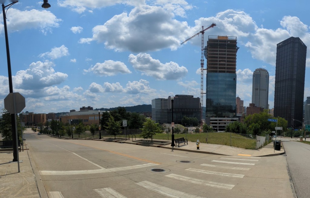
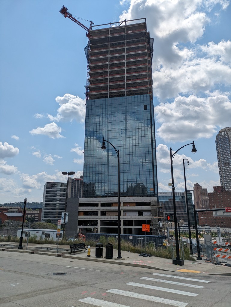
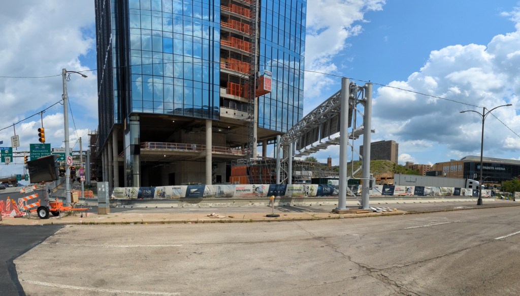
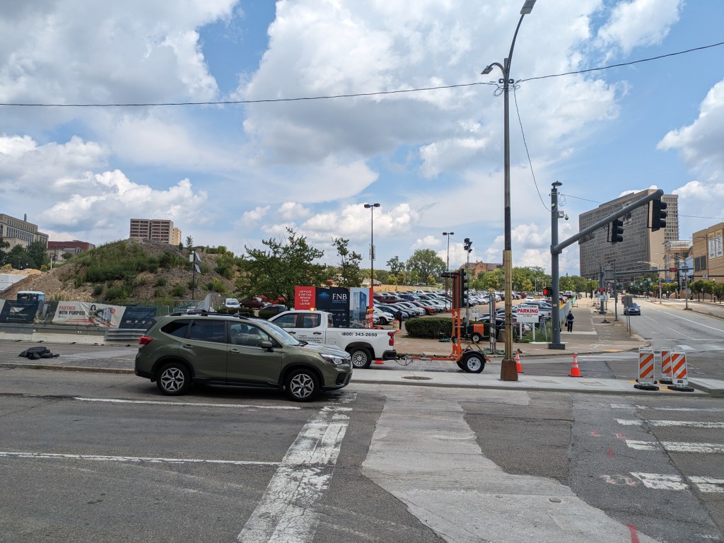
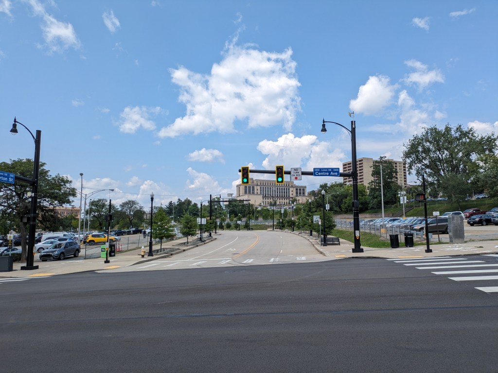
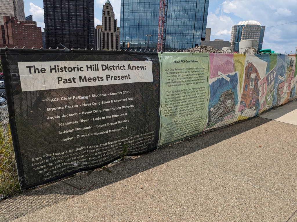
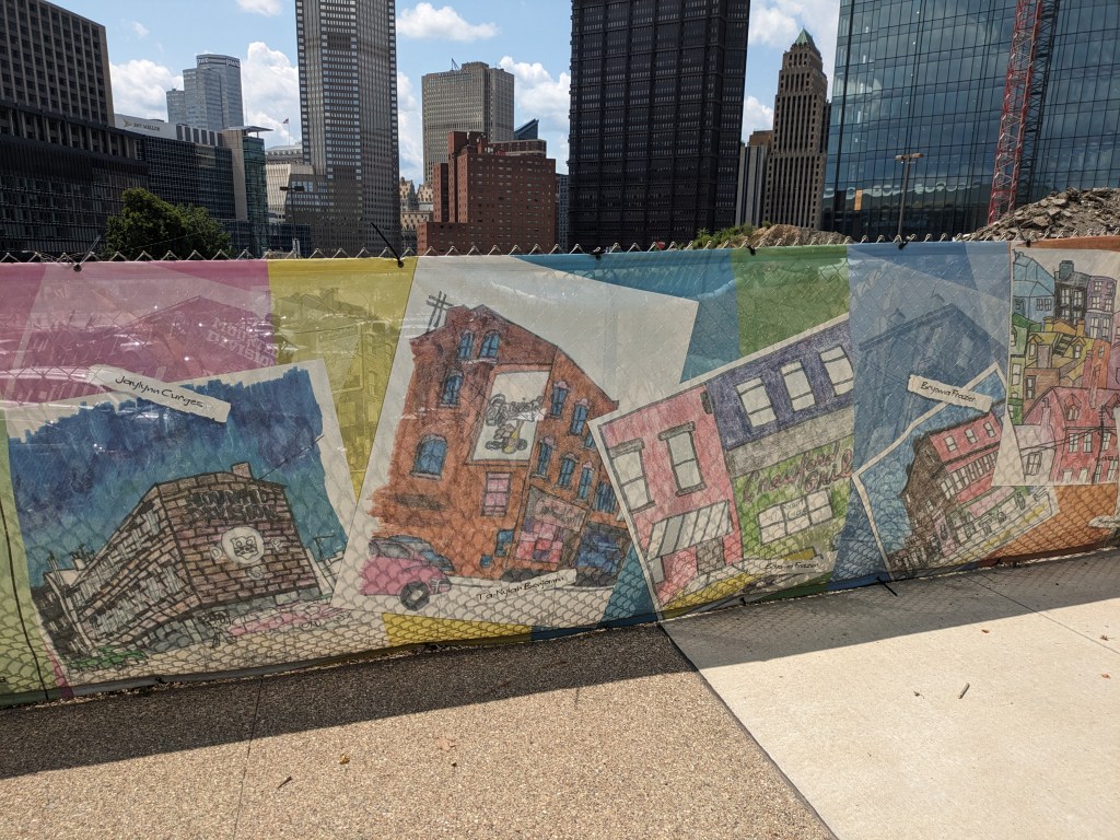
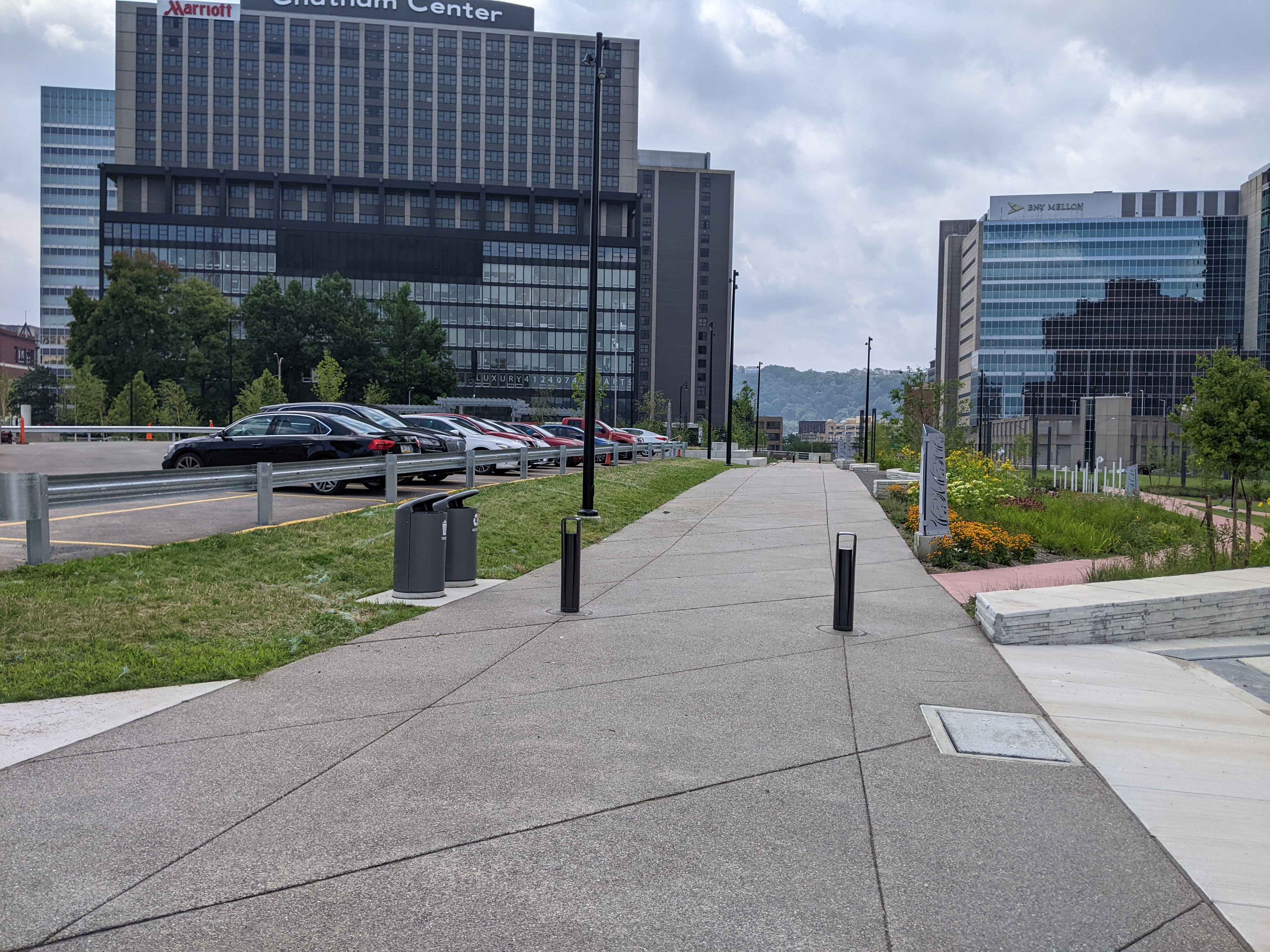
While still primarily a sea of parked cars, there have been a few changes on the site:
After months of the FNB Tower seemingly stuck at 5 or so stories despite activity on the site, the building shot up to what I assume is its full height.
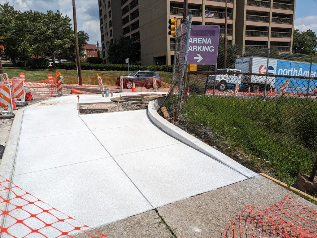
There was some sidewalk restructuring on the older sections – though as that’s happening around the city, it may not indicate anything special in regards to the redevelopment of the Lower Hill.
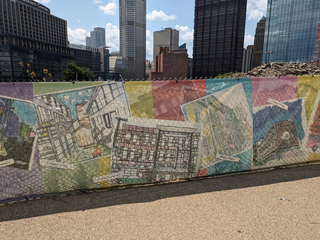
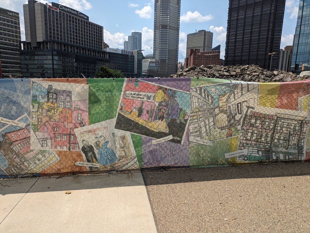
The construction fencing now has a temporary art installation by a non-profit that based in the Hill District and focused on connecting youth with arts.
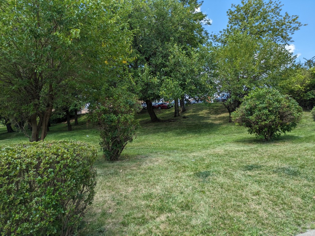
The hedges along Centre Ave were noticeably taller than the last time I photographed them.
Other than that, the site remains much the same. But there has been LOTS of news about it and other developments in the Hill District (see below).
Photos
Lower Hill in the News
Next Pittsburgh named the Lower Hill redevelopment as one of the top 8 developments to watch in Pittsburgh in 2023 (January 11, 2023). Throughout the year, there have been conversations on the development opportunities happening and projected in the Lower Hill and beyond (Pittsburgh Business Times, June 7, 2023; Pittsburgh Business Times, June 8, 2023; Pittsburgh Business Times, June 13, 2023).
The question of how to equitably develop the Lower Hill and other areas of the city that have long seen disinvestment is a hot topic this year (Public Source, January 23, 2023). The community continues to express concern about the deals and process in the redevelopment of the Lower Hill (Next Pittsburgh, January 25, 2023; Public Source, April 22, 2023; Pittsburgh Business Times, May 15, 2023; City Paper, May 16, 2023). The proposed concert venue that is one of the subprojects generating concern in the community moved forward (Pittsburgh Business Times, January 10, 2023; Public Source, January 10, 2023; Public Source, January 24, 2023; Pittsburgh Business Times, May 11, 2023; Public Source, May 11, 2023).
A project website dedicated to construction bidding opportunities shows the most recent bid opportunity was for the controversial concert venue.
Bethel AME is Pittsburgh’s oldest Black congregation. They were one of the organizations forced out of the Lower Hill neighborhood to make way for what became the Civic Arena and a sea of parking lots. They are now seeking reparations and the ability to return to the neighborhood (Public Source, April 14, 2023). An agreement between Bethel AME and the Penguins was reached (Public Source, April 14, 2023; Pittsburgh Business Times, April 14, 2023).
The funding announced last year for the redevelopment of the Housing Authority’s Bedford Dwelling apartments has been augmented by an additional $50 million grant (Pittsburgh Business Times, July 21, 2023; Public Source, July 21, 2023; Pittsburgh Business Times, July 28, 2023) and Planning Commission approval of the plans (Pittsburgh Business Times, July 11, 2023; Public Source, July 25, 2023). The Pittsburgh Business Times also ran a profile of Michele Beener (May 11, 2023), who helped with the grant application for Bedford Dwellings that received funding in 2022.
The New Granada Theater is a historic building with strong ties to the cultural wealth of the Hill District about 0.5 miles from the Lower Hill. The community has put in decades of advocacy, planning, fundraising, and more around redeveloping this building in a meaningful way. Fruits of their labors are starting to ripen with the groundbreaking for new life for the theater (Pittsburgh Business Times, May 25, 2023; Post-Gazette, May 26, 2023) and a ribbon cutting for a new affordable housing development adjacent to the theater (Post-Gazette, September 1, 2023).
The grocery store that the Hill District advocated for many years, was built, and closed after a few years in business is getting new life. A local multi-ethnic market purchased the site earlier this year (Pittsburgh Business Times, April 13, 2023; Public Source, April 13, 2023).
For more information on the community that lives and has lived in the Hill District, Ralph Proctor Jr. published a book describing his memories and experience living in the Hill District (Next Pittsburgh, June 20, 2023) and Next Pittsburgh published an article on the influence of the Burke family on the bar and entertainment scene in the Lower Hill from the 1920s to 1960s (January 19, 2023).
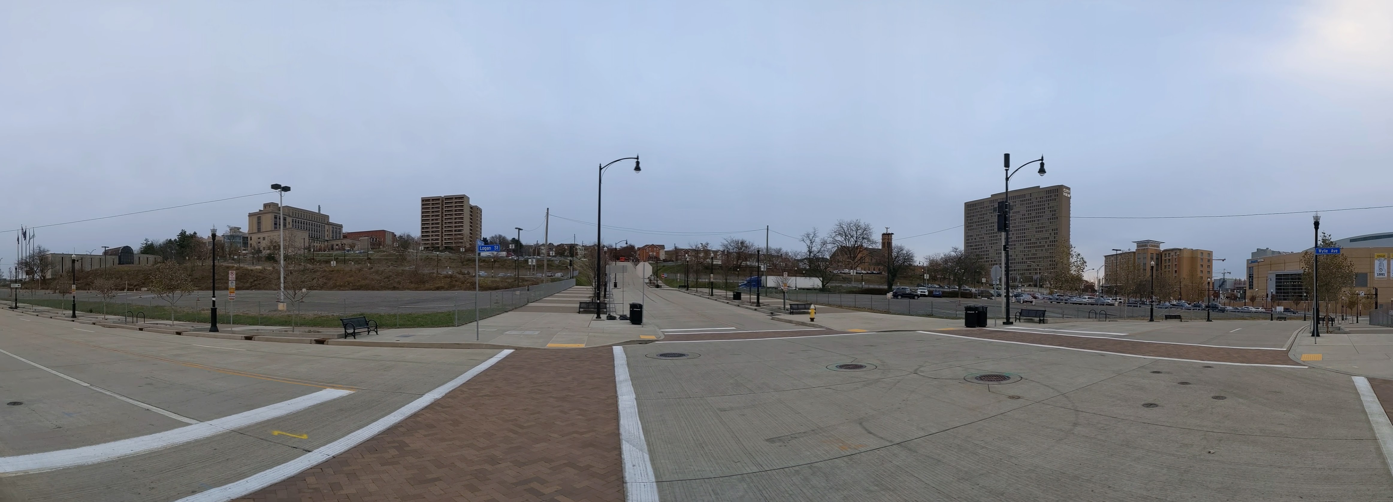
The Lower Hill is a notorious site in Pittsburgh, a scar on the city from the height of Urban Renewal. A vibrant (but poor and predominately Black) neighborhood was demolished in the 1950s so the City could build a cultural mecca centered on a Civic Arena, most of which ended up not being built and was left as parking lots.
Now that the arena has been demolished and replaced adjacent to the former location, the Penguins hockey team has the development rights to rebuild the Lower Hill, stitching back together the fabric of the city and reconnecting the remainder of the Hill District neighborhoods with downtown.
However, grand language describing the wonderful benefits to a city are part and parcel of any major development project, including the 1950’s Urban Renewal of the Lower Hill. Fifty years later, the Urban Renewal of the Lower Hill is rarely, if ever described as a good thing. In fact the current redevelopment is sometimes described as undoing the mistakes of that project. However, can the negative financial, social, and emotional repercussions of the original demolition and decades of disconnect be undone simply by reinstating (most of) the former street grid?
This blog post is part of an on-going photographic series to watch the redevelopment of the Lower Hill. Periodically, at least once a year, I return to the site to take new photographs. In addition, I include links to articles about the project that I’ve encountered since the previous post in the series. At the end of the post, there are links to all the previous posts in the series.
What’s New
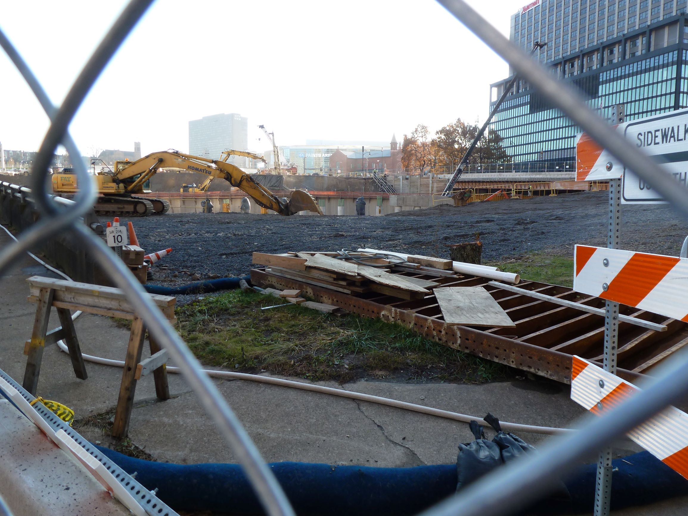
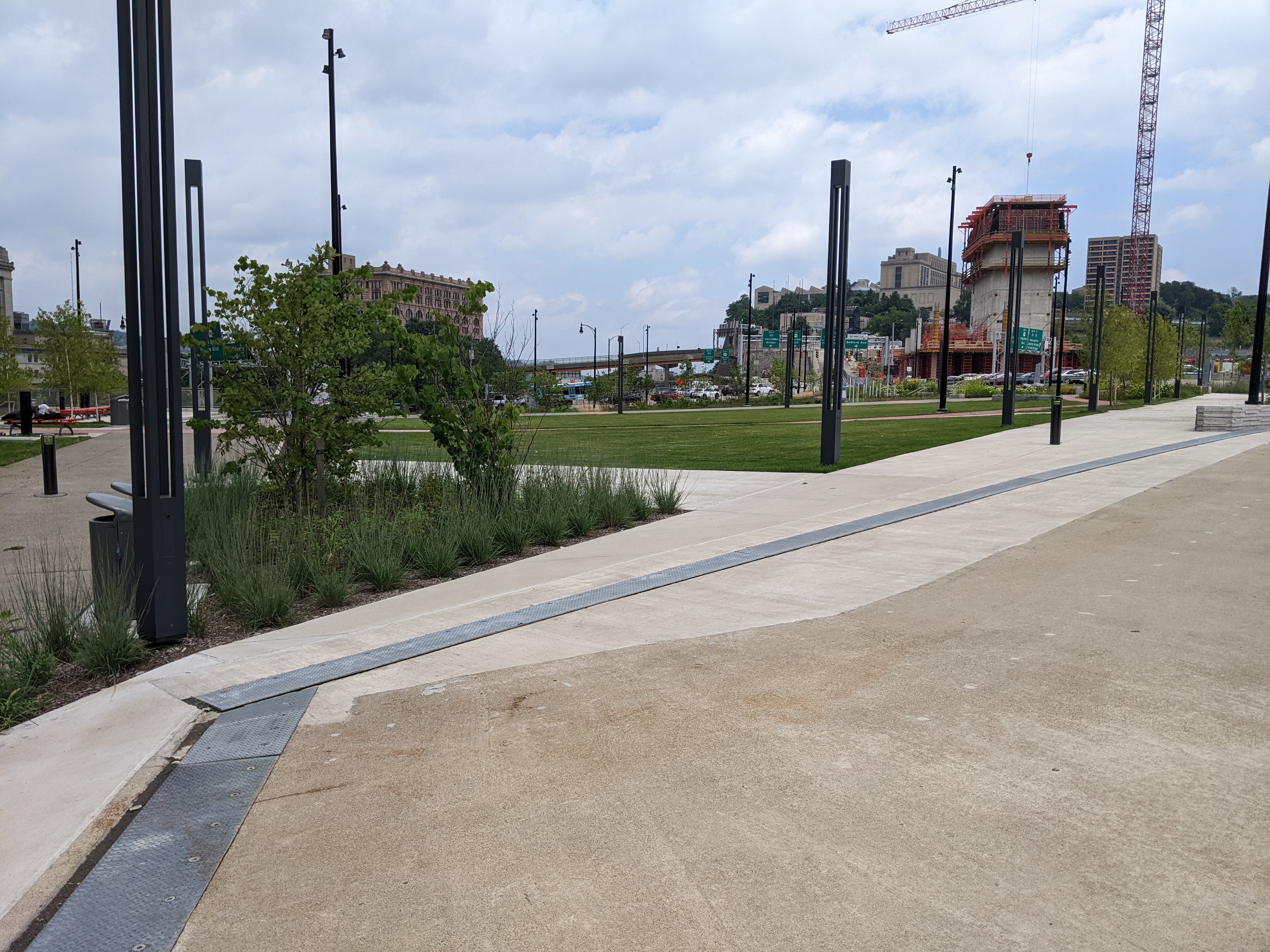
In 2022, construction of the FNB Tower progressed. Not much else changed on the ground, but the news shared some of the negotiations and deals being made to move the rest of the site forward.
Photos
Lower Hill in the News
Next Pittsburgh named the Lower Hill redevelopment as one of the top 10 developments to watch in Pittsburgh in 2022 (January 3, 2022).
Bethel AME, Pittsburgh’s Oldest Black Church (Public Source, January 31, 2022) who’s building was taken through eminent domain and demolished in the 1950s to build the Civic Arena, has been in talks with the Penguins about reparations as part of the redevelopment of the Lower Hill (Next Pittsburgh, October 3, 2022). In October 2022, it appeared a preliminary agreement had been reached (Public Source, October 17, 2022; Next Pittsburgh, October 17, 2022), but in November the talks stalled according to Bethel AME (City Paper, November 18, 2022).
The plans for “Block E” were presented to the Planning Commission in the first of two hearings (Planning Commission Agenda & Application; Public Source, December 13, 2022; Pittsburgh Business Times, December 13, 2022). In the months prior to this hearing, this plan, which is a revision from the original Preliminary Land Development Plan, was presented to the community amid concerns about process and the Community Collaborative Implementation Plan (Pittsburgh Business Times, October 14, 2022).
Funding announcements for the greater Hill District included infrastructure funding from a federal RAISE Grant (City Paper, August 11, 2022) and Housing Authority funds allocated toward the redevelopment of the Bedford Dwelling apartments along with the intention to apply for a Choice Neighborhoods grant (Public Source, December 15, 2022).
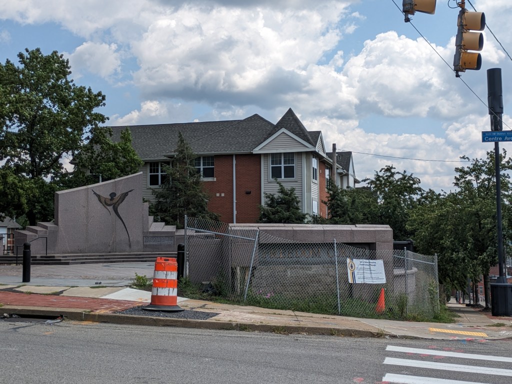
A car crashed into Freedom Corner damaging the monument on the site (City Paper, August 3, 2022). This is an important neighborhood location for many social justice actions including as a marker at the demarcation line of the redevelopment of the Lower Hill, which did not spread beyond that line due to community resistance.
In other Hill District development new, the redevelopment of the former Miller School into apartments was moving forward (Pittsburgh Business Times, November 30, 2022).
After WWII, while the federal government was building highways — sometimes through communities — and subsidizing and incentivizing the construction and purchase of detached single-family dwellings — that is, if you were of the “right” race, ethnicity, and economic level, — there was a growing sense that cities, and perhaps even towns, weren’t safe places to live. As people and jobs, or jobs and people, or some people and jobs starting leaving cities in large numbers, the cities started looking for ways to reinvent themselves to reattract people and jobs in order to survive. Pittsburgh was a leader at that time, inventing and defining the process of Urban Renewal. Other cities like Bethlehem looked up to Pittsburgh and tried to adopt the strategies and techniques of Urban Renewal used in Pittsburgh. Often these cities, as illustrated by Bethlehem, lacked the resources and power to pull off Urban Renewal on the same scale as Pittsburgh.
Revisiting the once familiar environs of Stroudsburg (pop. 5,950) and East Stroudsburg (pop. 9,669), I realized that even these small towns adopted practices and principals of Urban Renewal. And similar to the pairing of Allentown (pop. 125,944) and Bethlehem (pop.75,624), the larger of the two municipalities implemented more Urban Renewal projects while the smaller implemented more historic preservation practices.
Below is a very biased sample of the the Urban Renewal practices I believe I identified in the Stroudsburgs:
Urban Renewal Practice #1 – The Ring Road
Both boroughs contain a partial or complete loop of one-way streets around portions of their downtowns. This traffic pattern now appears to me as strongly reminiscent of the circles Pittsburgh built around important commercial neighborhoods – which subsequently nearly died, possibly because they were already dying, but probably aided by being choked off by these ring roads. In Stroudsburg and East Stroudsburg, it didn’t appear that the ring road has the same sort of death grip on the commercial enterprises they encircled. Several of the business I remembered were still operating and I didn’t notice significant numbers of vacant properties – though the couple vacant businesses I noticed were in East Stroudsburg. However, they weren’t areas that were tempting to explore more closely because they were sites developed along the second Urban Renewal practice.
Urban Renewal Practice #2 – Auto-oriented Uses
Both boroughs contained drive-through businesses in the center of their ring roads. In addition, strip malls are off to the right as you enter each borough on the ring road. In Stroudsburg, the auto-oriented uses felt like they were tightly centered on the ring road; nearby and spilling into the ring road was a dense, walkable downtown. On the other hand, in East Stroudsburg, it felt like the auto-oriented uses were spilling beyond the immediate environs of the ring road and into what was presumably once a much more extensive dense, walkable downtown.
Urban Renewal Practice #3 – Demolition for Underutilized Parking Lots
Part of what made the experience in East Stroudsburg feel more auto-oriented was the larger number of visible paved lots, presumably for parking, but largely empty. While I was most likely day-dreaming about the plot of my latest story featuring either princesses or cowboys when I previously spent time in downtown East Stroudsburg, there was a feeling of familiarity in the near empty parking lots suggesting that I would have felt uncomfortable if they were actually parked to capacity in the same way I felt uncomfortable passing locations where trees I used to know had been cut down.
Stroudsburg’s Ring Road Encompasses Auto-Oriented usesWalkable Downtown Spills into Stroudsburg’s Ring RoadEast Stroudsburg’s Ring Road (left two roads) with Auto-oriented Uses Spilling beyond the Ring (mid-frame parking lot)
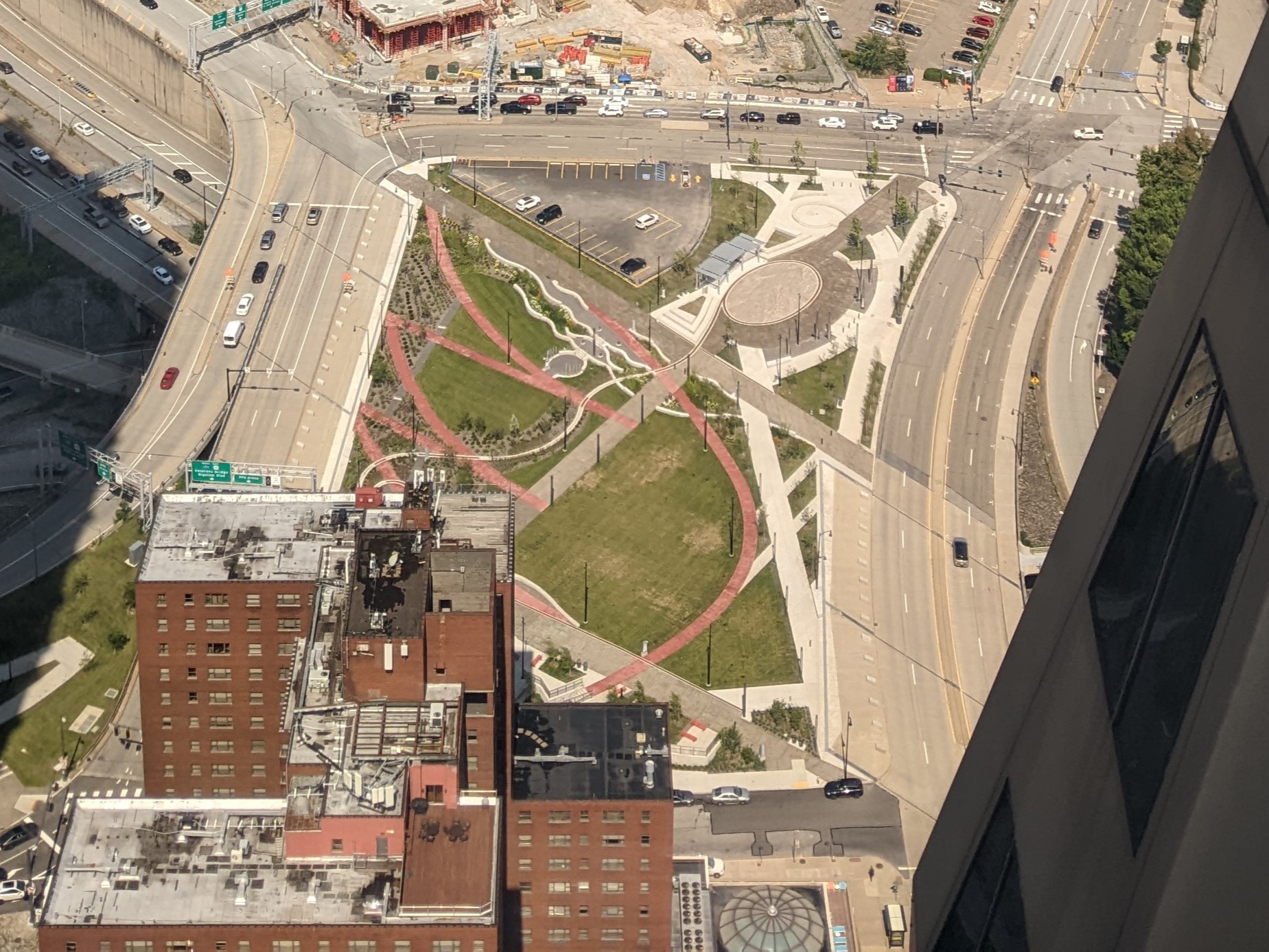
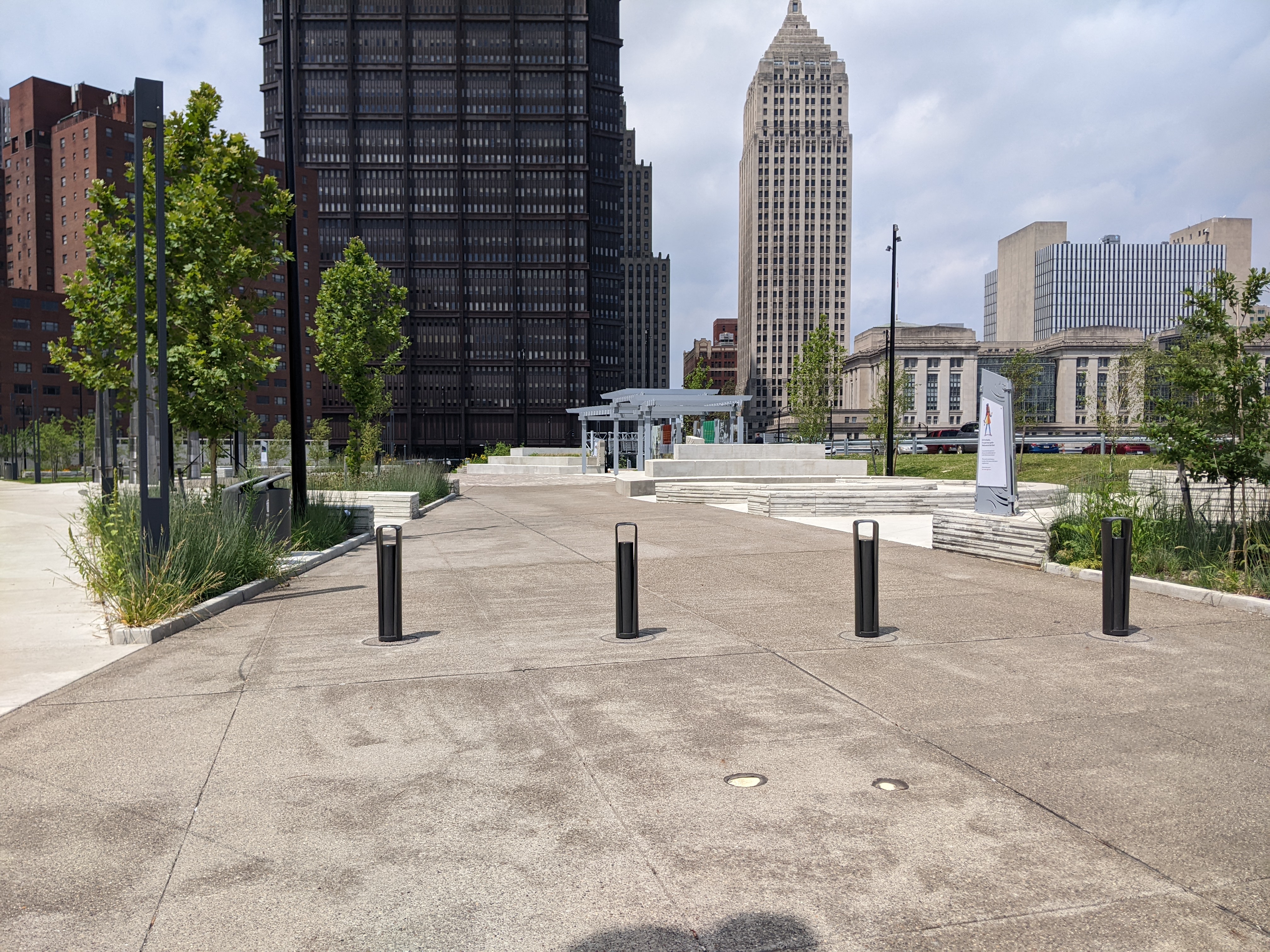
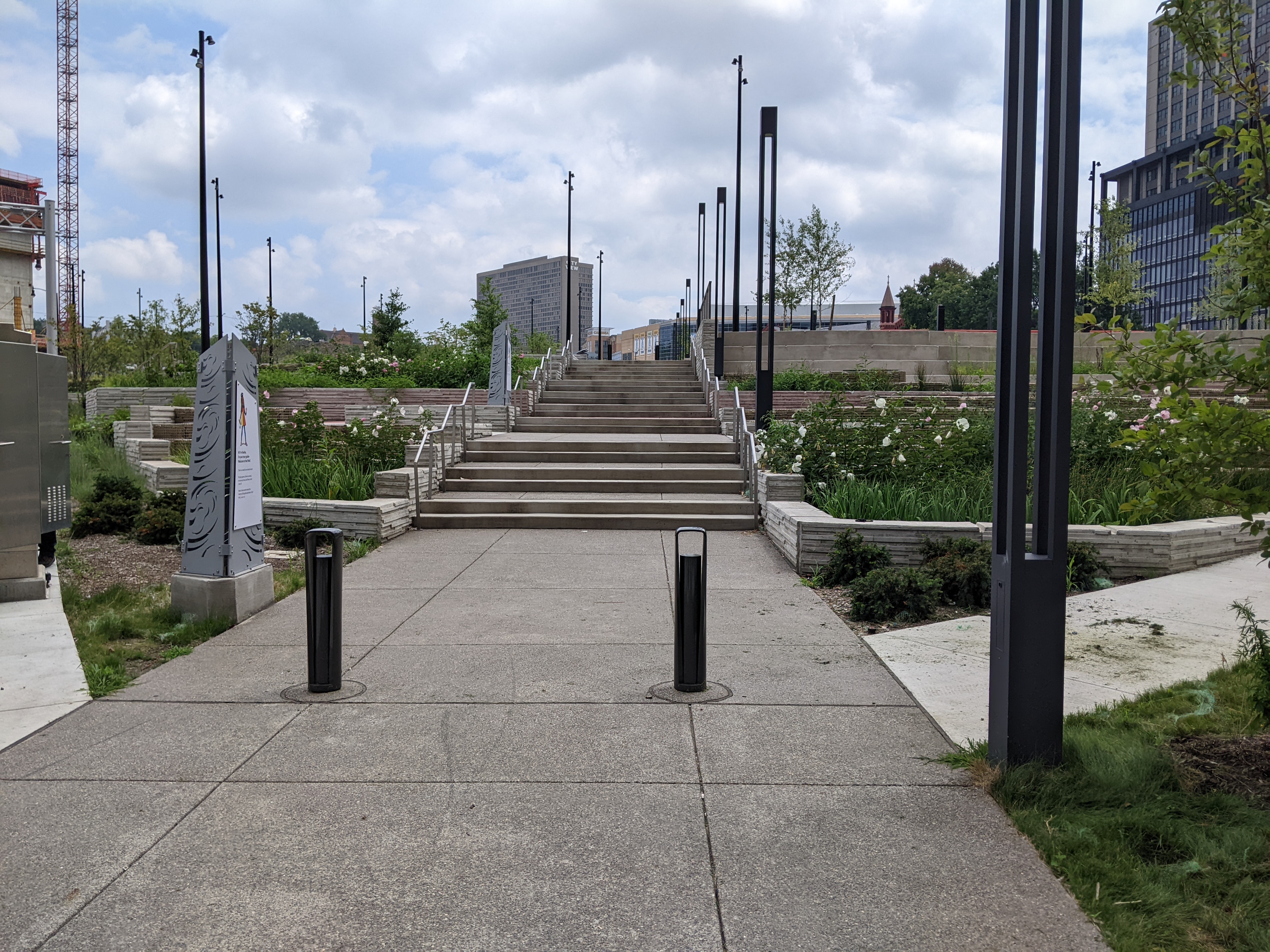
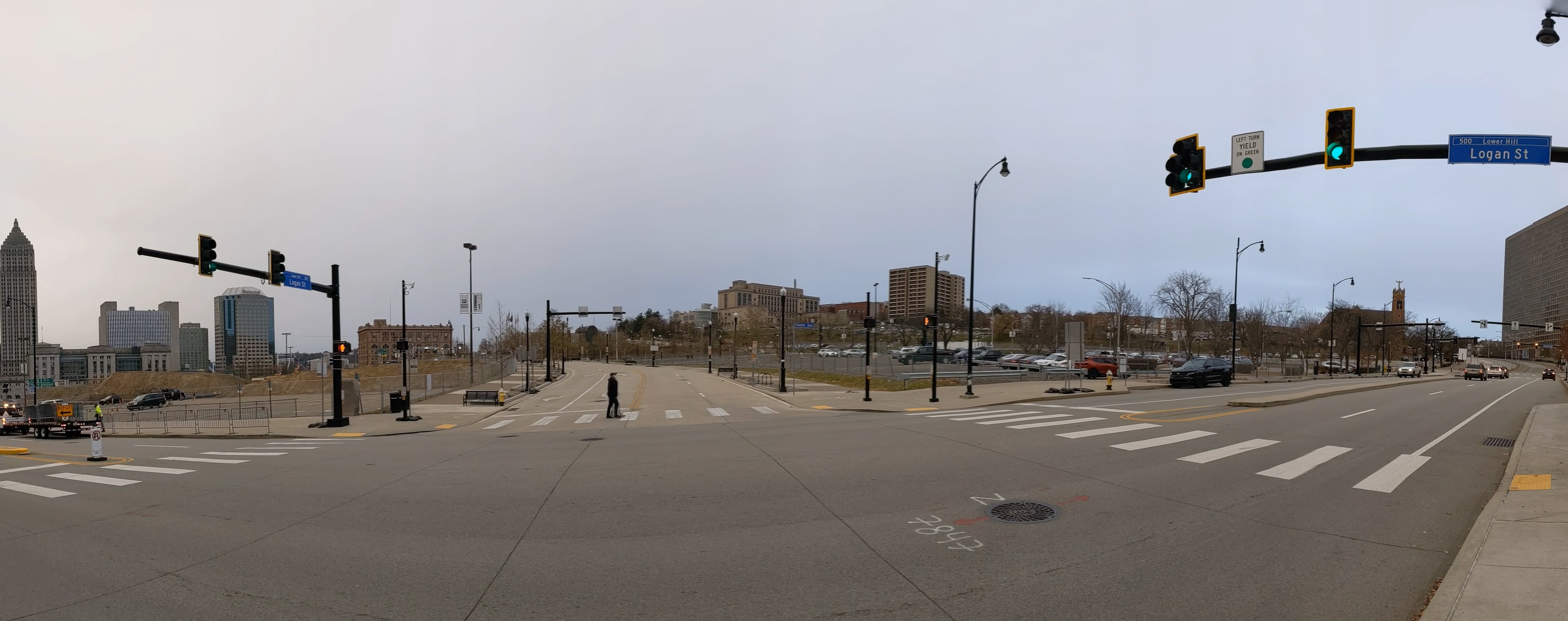
At the November 2021 ribbon cutting for the Frankie Pace Park on the CAP, Governor Wolf said, “A great injustice was done in the ’50s and this is finally a way to address that injustice.” He was referring to Pittsburgh’s poster child Urban Renewal project that demolished thousands of homes and businesses that once formed the physical infrastructure of a community whose members were predominantly Black, poor, or both. The buildings of the Lower Hill neighborhood were demolished, and the people dispersed to make way for the Civic Arena, a cultural amenity for the wealthy and White featuring opera performances. This erasure of community was followed in the early 1960s by the construction of a moat between the Lower Hill and downtown for the I-579 freeway, also known as the Crosstown Boulevard. The CAP now covers that moat and provides an educational park (and a pedestrian connection between downtown and the Penguins arena).
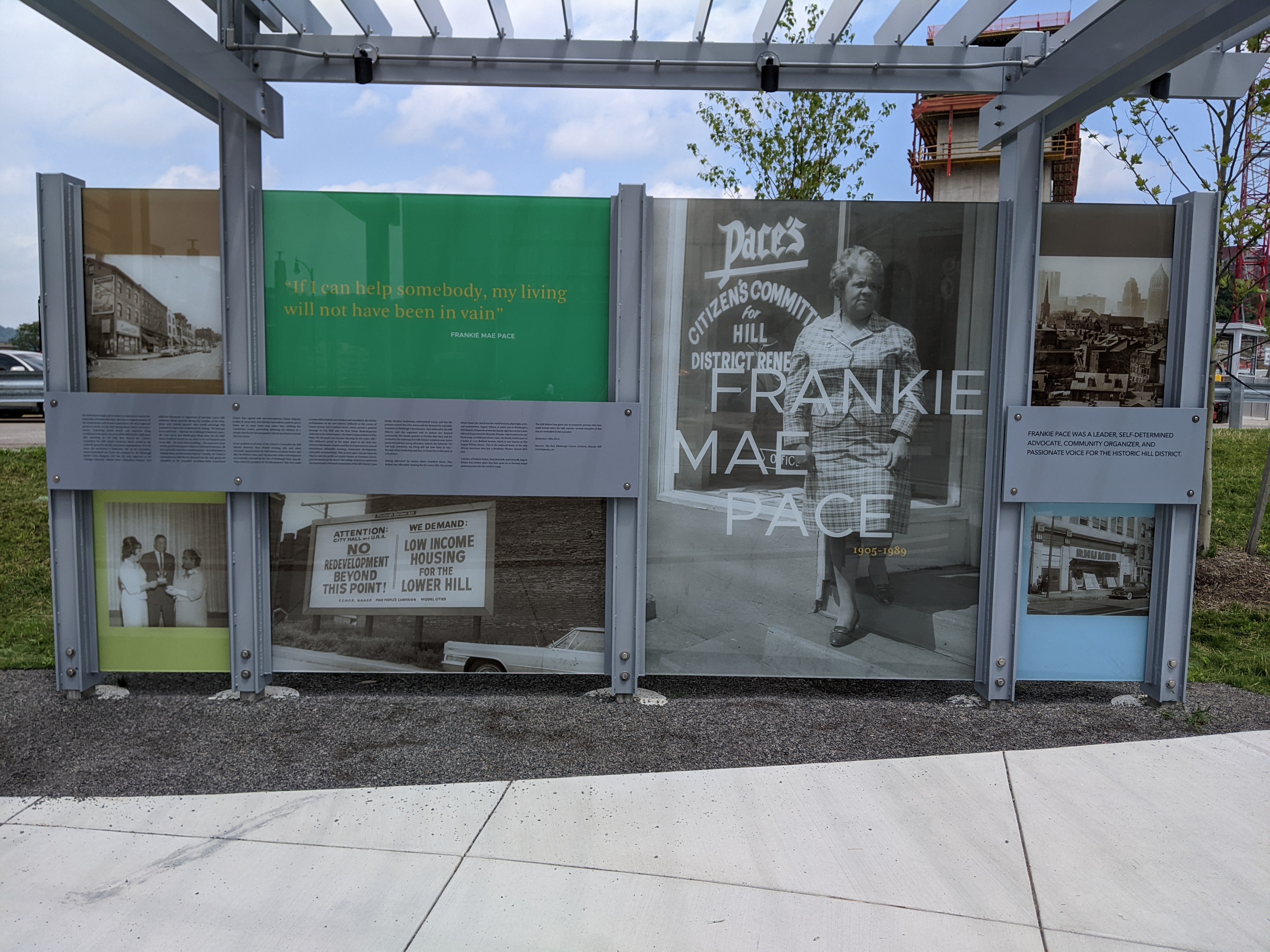
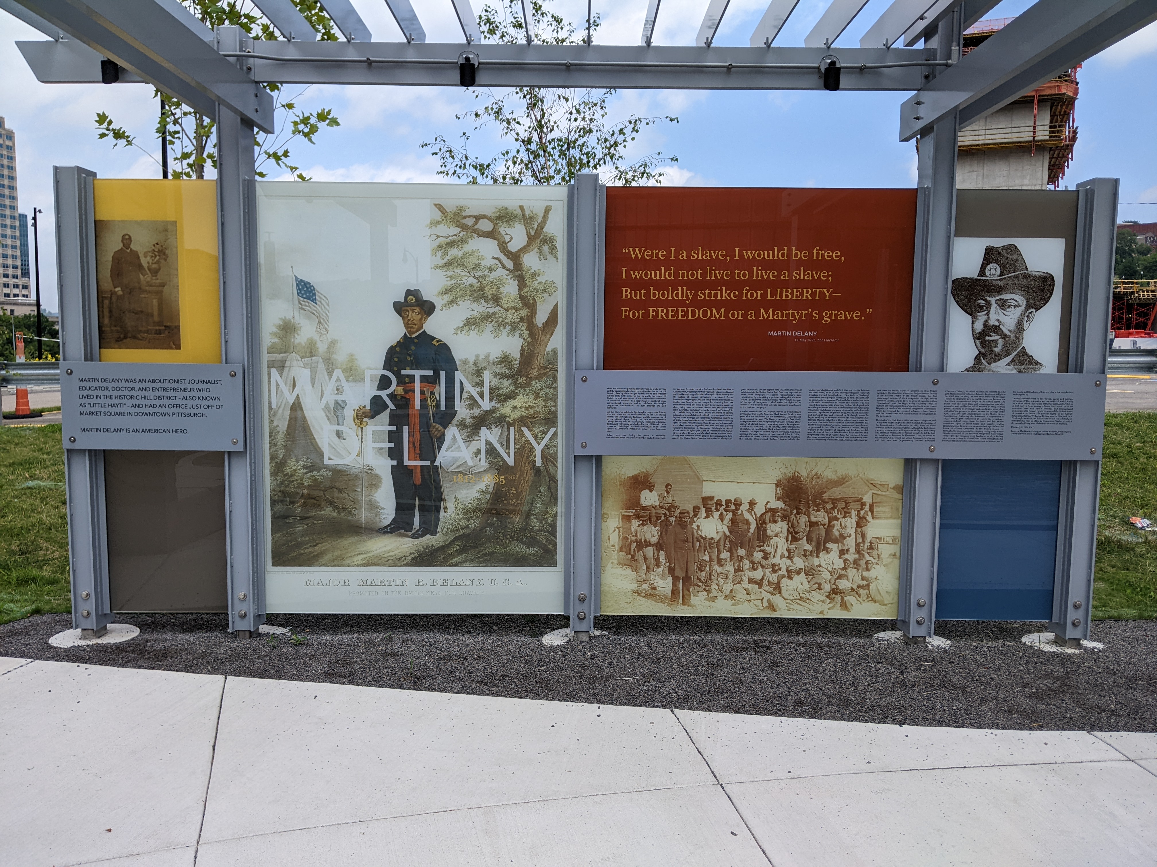
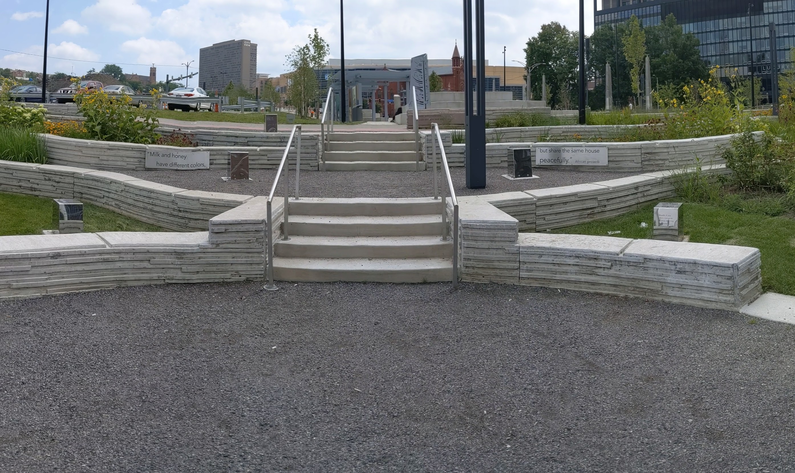
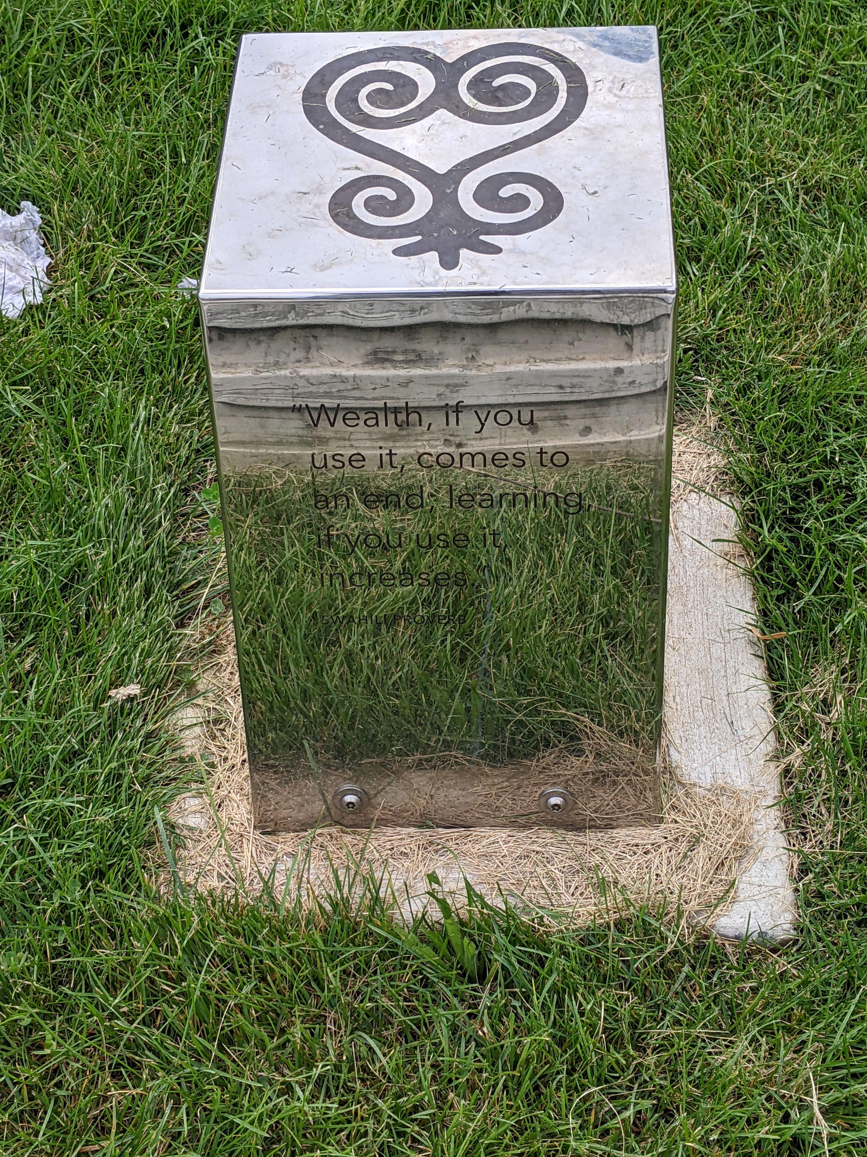
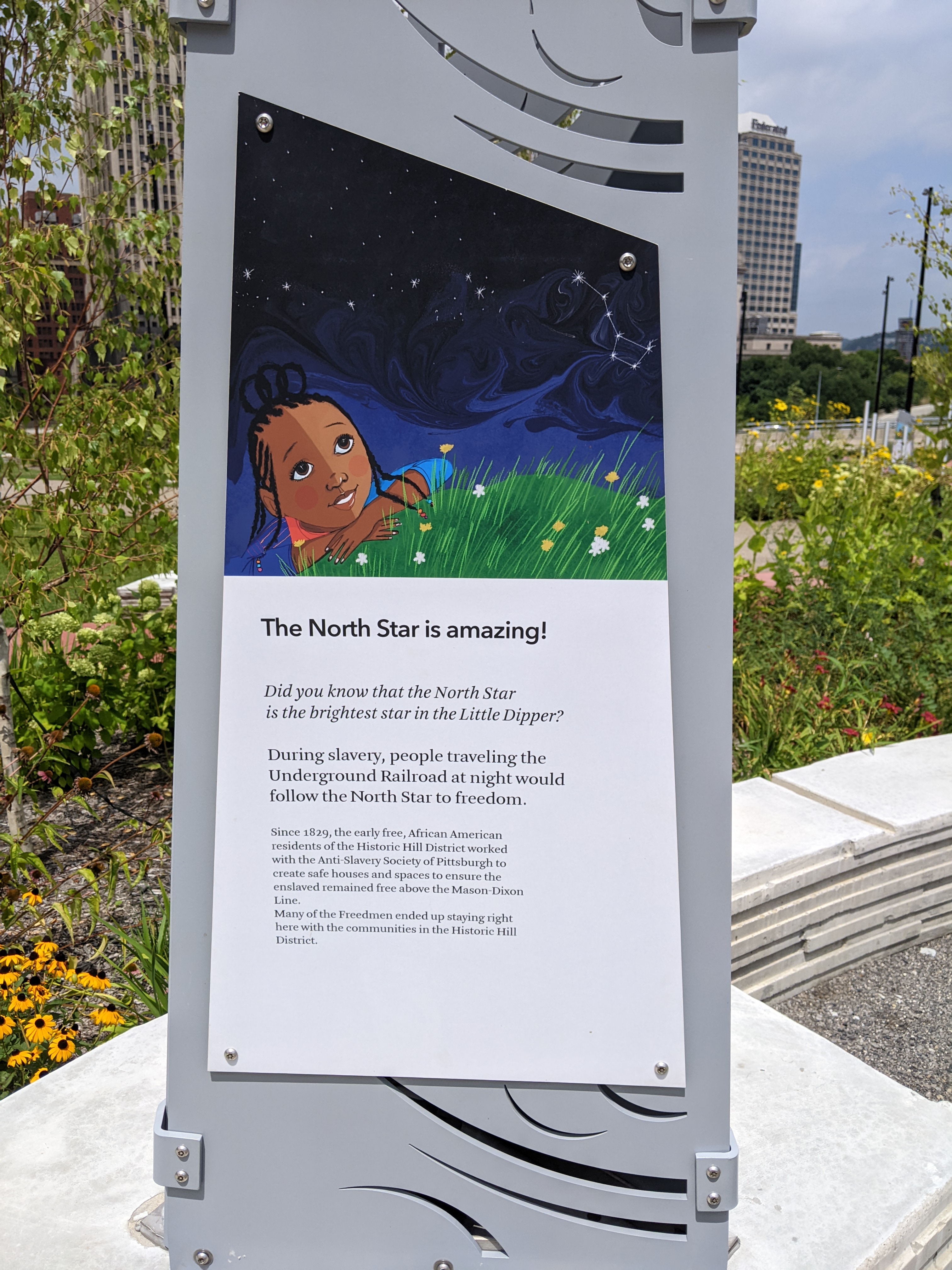
In addition to the infrastructure restitching the physical gap between downtown and the Lower Hill, the public art installed throughout the park aims to at least partially stitch the cultural gap that is one of the legacies of Urban Renewal and other segregationist policies. An educational display tells the stories of Frankie Pace, a 20th century activist for the Hill District neighborhoods of Pittsburgh, and Martin Delany, an abolitionist, journalist, and doctor in 19th century Pittsburgh. Throughout the park, proverbs of African heritage are etched on the walls and on metal blocks as reflective as Chicago’s Cloud Gate.
Below is a slideshow of some of the public art in the park. At the end of the post, there are links to all the previous posts in the series.
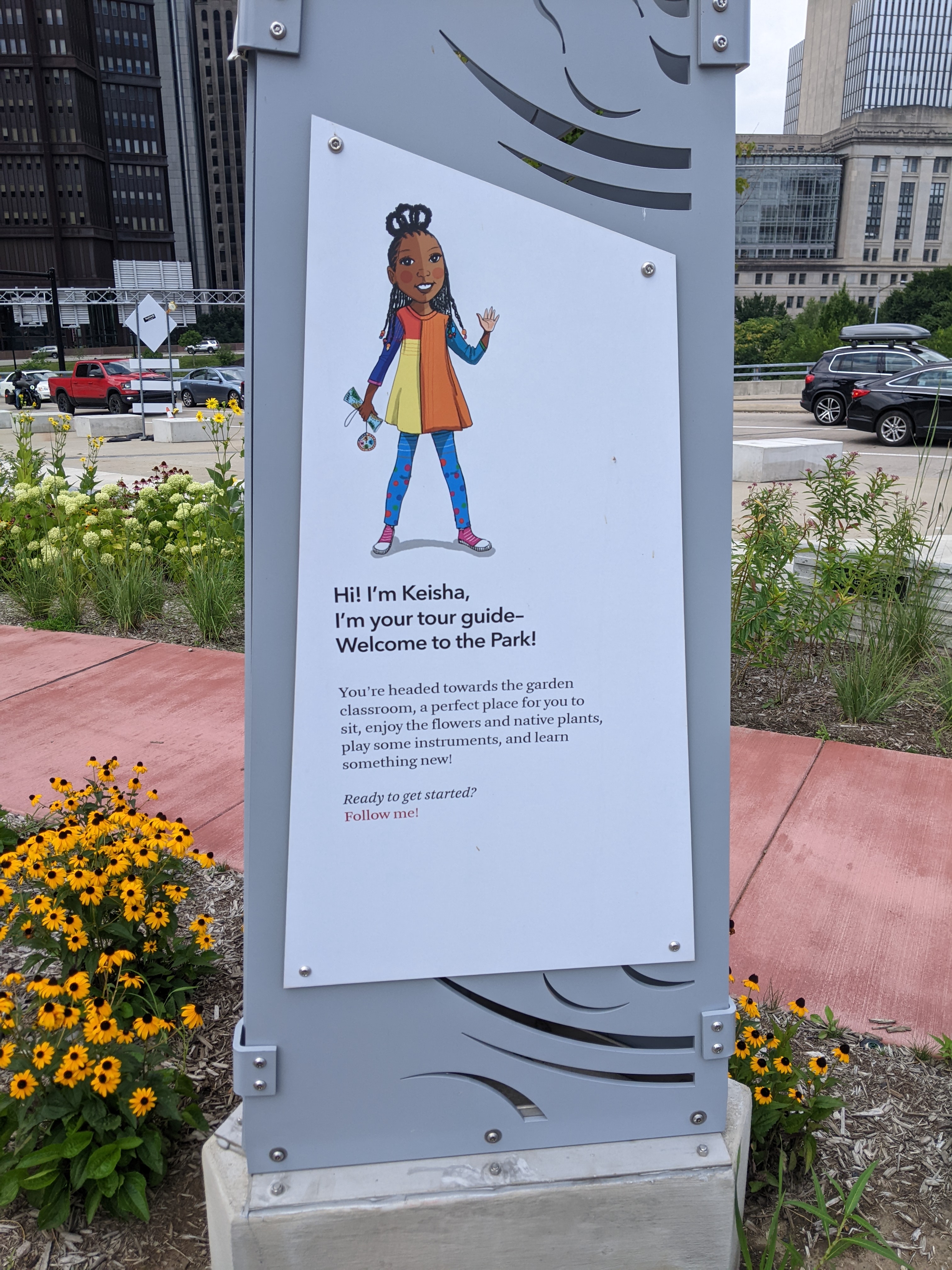
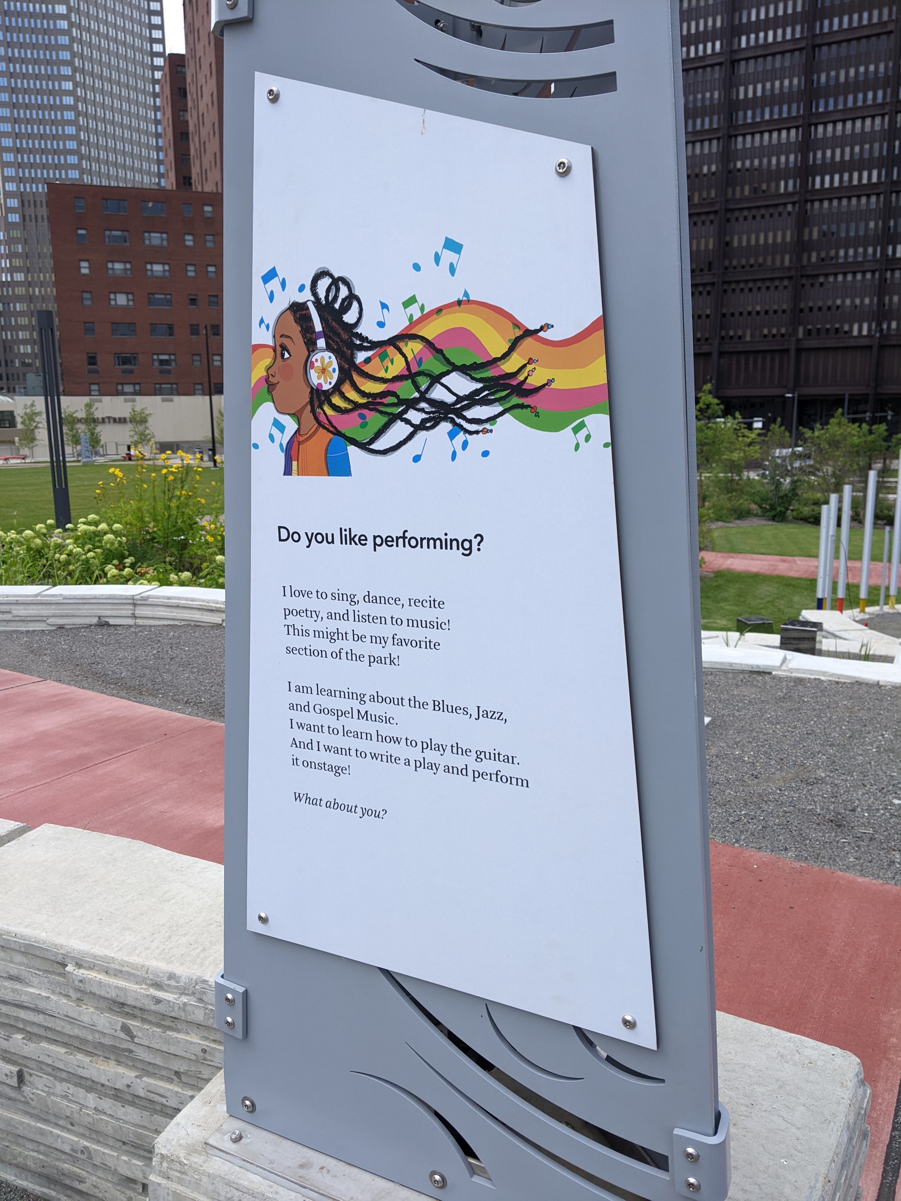
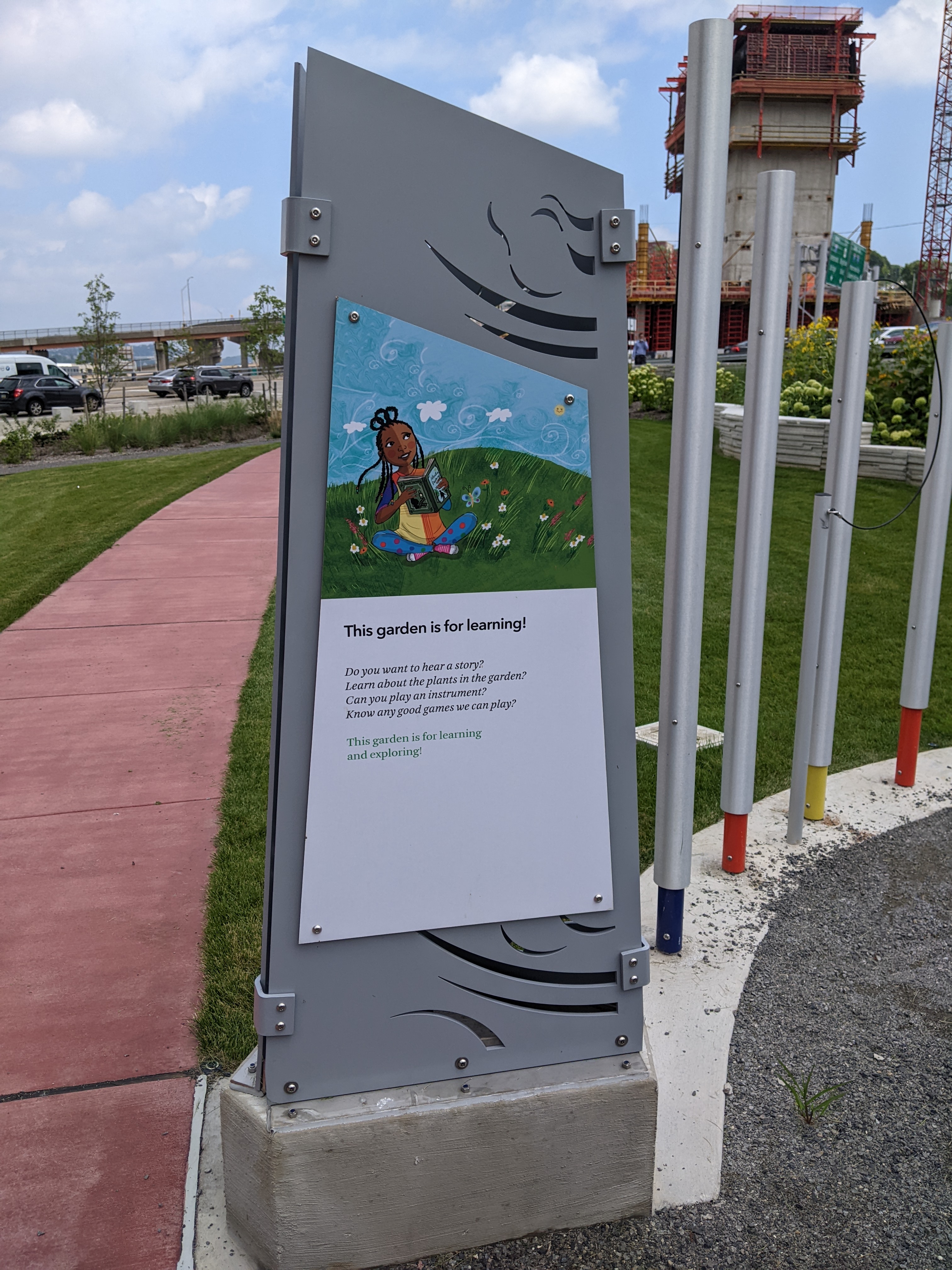
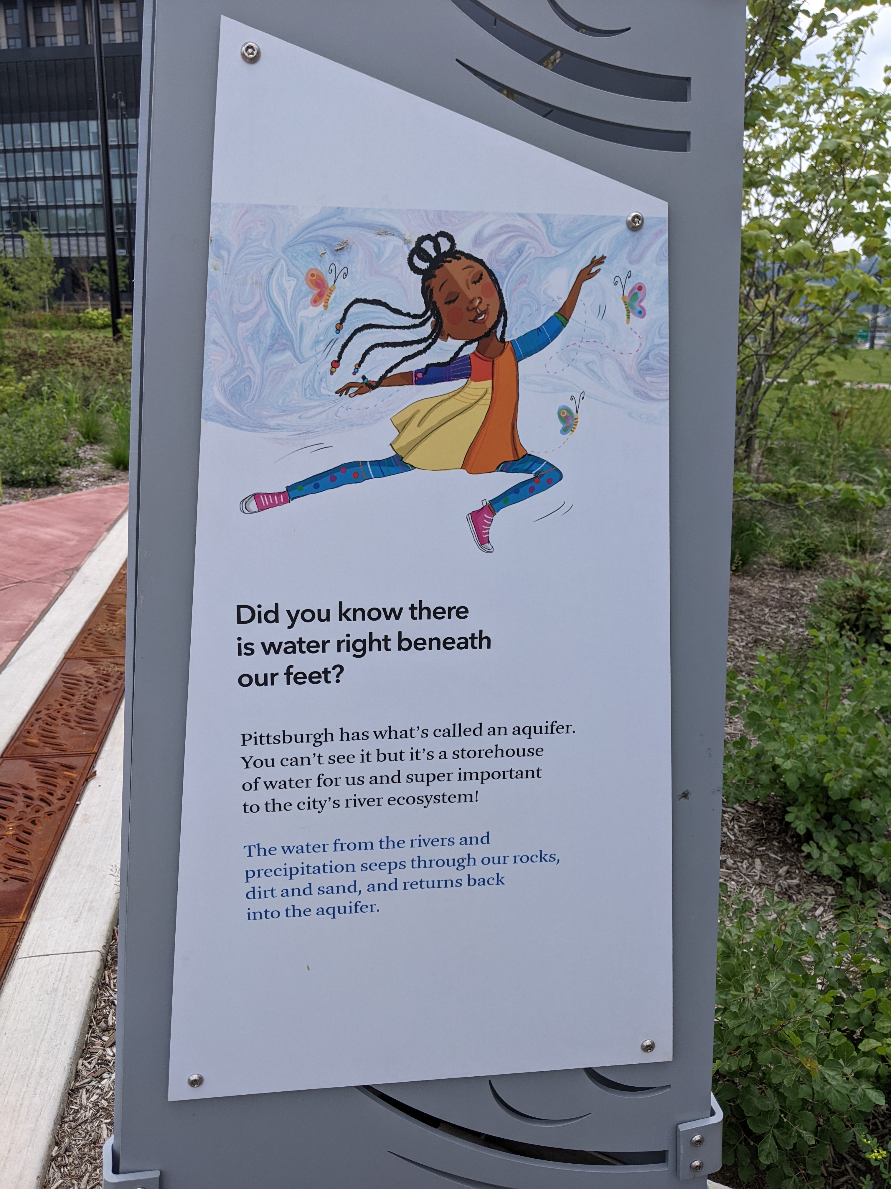
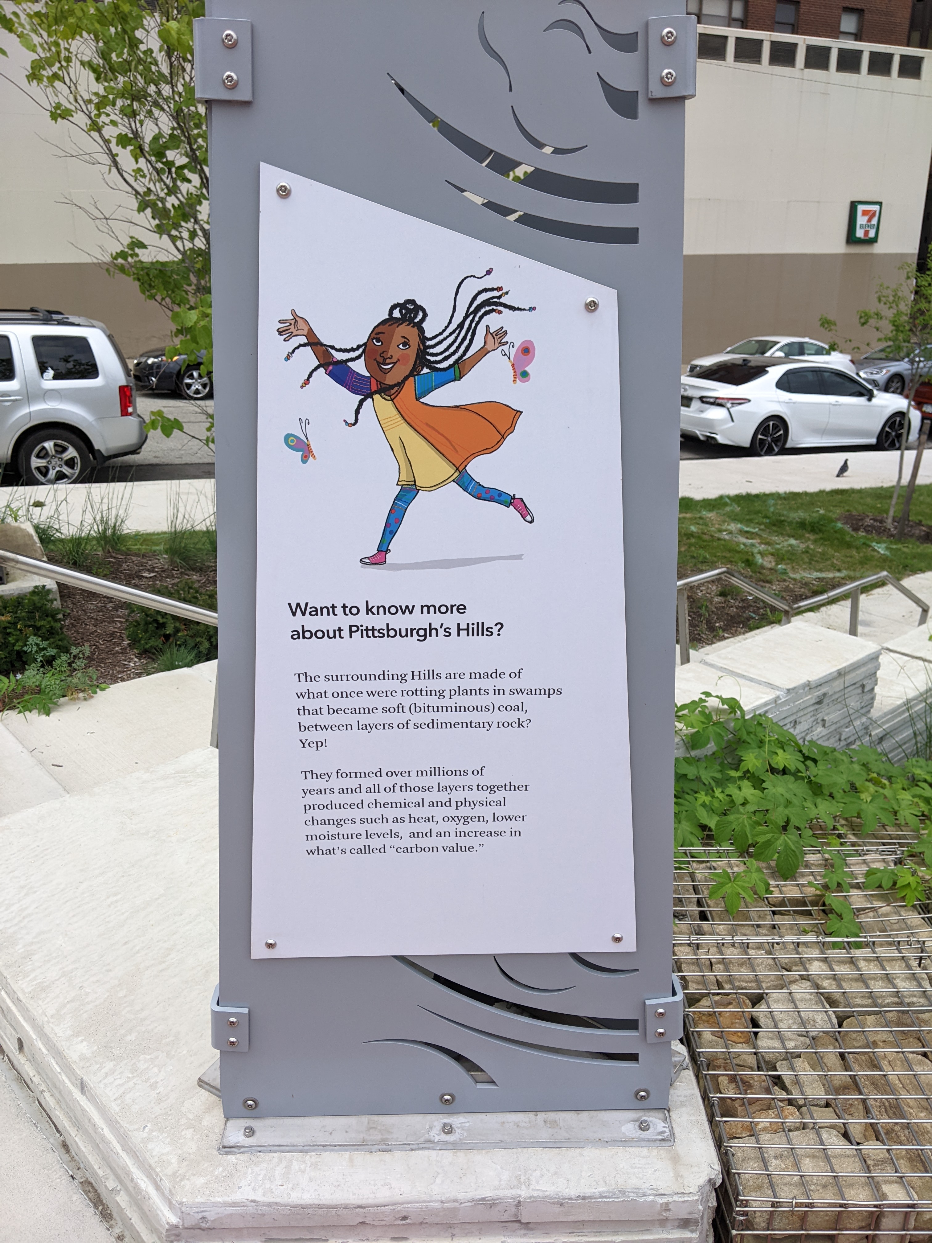
When I first explored the interior of the Frankie Pace Park, I was surprised by the wayfinding approach. A series of signs are posted throughout the site describing different features of the park, such as the rain garden. The surprising part was the choice of a Black girl narrator who wants you to join her as you journey through the park. It felt like the intended audience is elementary school-aged children. Given the park’s location adjacent to the tallest office skyscrapers downtown, adjacent to the first new building to be built on the Lower Hill – another office building, and kitty-corner-ish to the Penguins hockey arena, children seem to be a very small percentage of the prospective users of the park.
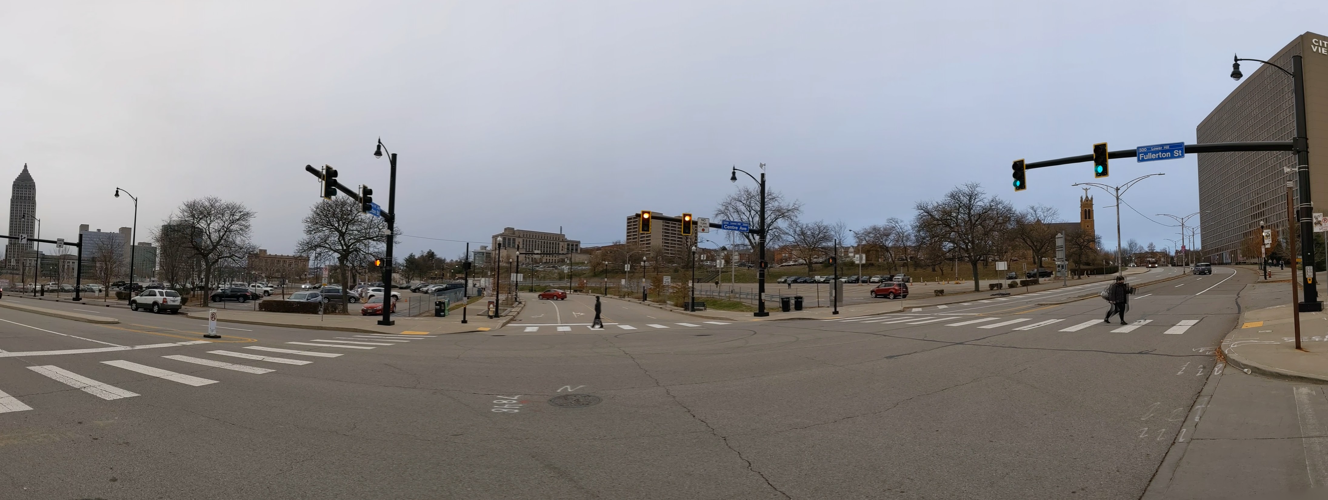
The CAP is a project in Pittsburgh “fixing the mistakes” of Urban Renewal. The Crosstown Blvd was built in the 1960s creating a freeway in a canyon dividing the Lower Hill neighborhood from downtown. The Lower Hill neighborhood, formerly predominantly poor and black, had already been demolished by this point to make way for the Civic Arena and other cultural amenities that were never built.
The CAP is a park on a bridge built over the Crosstown Blvd and is intended to reconnect downtown and the Lower Hill, while the Lower Hill is being rebuilt by the Penguins hockey team. Construction began in June 2019 and was completed in November 2021.
Below is a slideshow of these wayfinding signs. At the end of the post, there are links to all the previous posts in the series.
This week, I took a lunch-time walk through the new Frankie Pace Park to see what the completed CAP project looks like and how it is used. There were two men sleeping on benches in the park and a handful of other people walking the paths singly or in pairs. Prior to 2020, I would have interpreted this as a failure of the park to attract users because any green space downtown between 12 and 1 was always full of people. However, in the continuing fallout of the pandemic, a handful of people walking or using the seats is typical even of the parks that you used to need to arrive before 11:59 if you wanted to find a seat to eat your lunch.
The CAP is a project in Pittsburgh “fixing the mistakes” of Urban Renewal. The Crosstown Blvd was built in the 1960s creating a freeway in a canyon dividing the Lower Hill neighborhood from downtown. The Lower Hill neighborhood, formerly predominantly poor and black, had already been demolished by this point to make way for the Civic Arena and other cultural amenities that were never built.
The CAP is a park on a bridge built over the Crosstown Blvd and is intended to reconnect downtown and the Lower Hill, while the Lower Hill is being rebuilt by the Penguins hockey team. Construction began in June 2019 and was completed in November 2021.
Below is a side-by-side comparison of the four corners of the CAP from November 2019 when I first started this photographic series and from my August 2022 walk. At the end of the post, there are links to all the previous posts in the series.
The Photos
CAP Northwest view – November 2019CAP Northwest view – August 2022CAP Southwest view – November 2019CAP Southwest view – August 2022CAP Southeast view – November 2019CAP Southeast view – August 2022CAP Northeast view – November 2019CAP Northeast view – August 2022
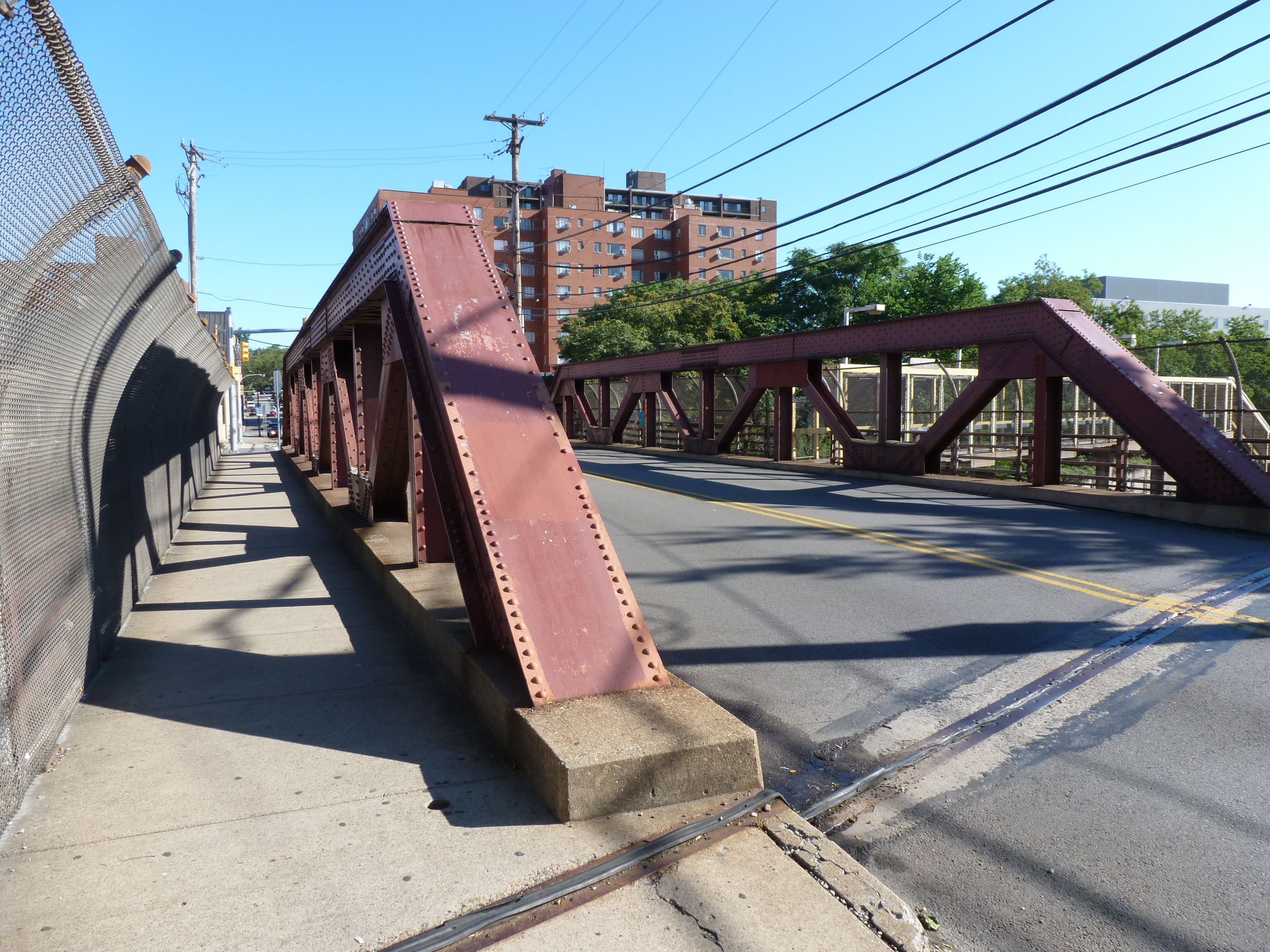
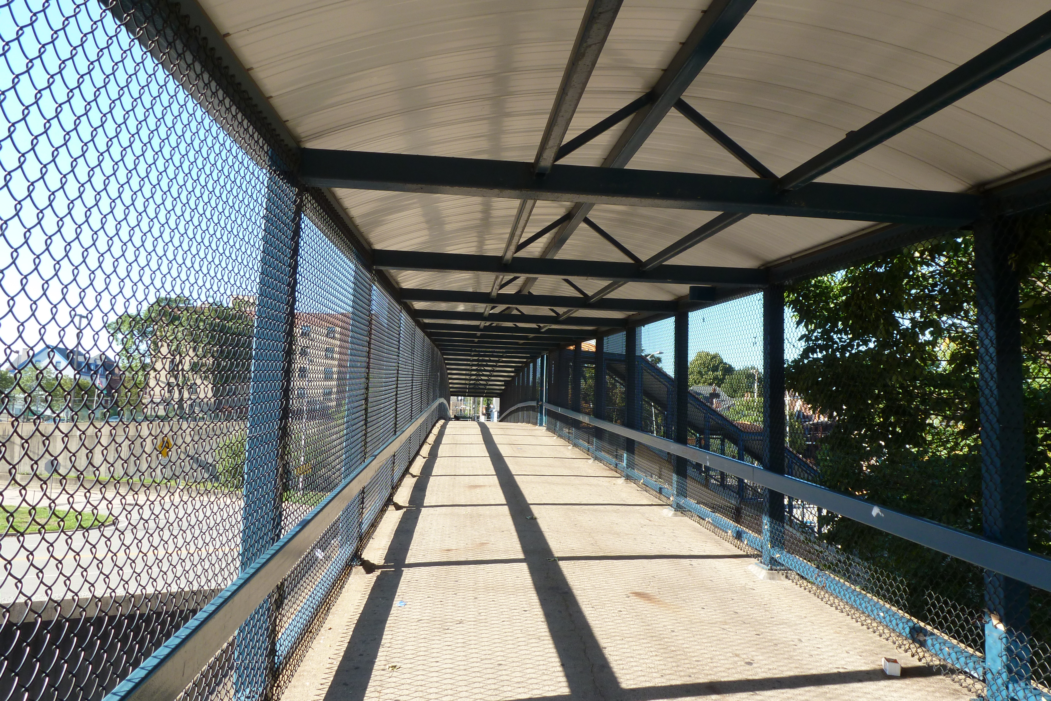
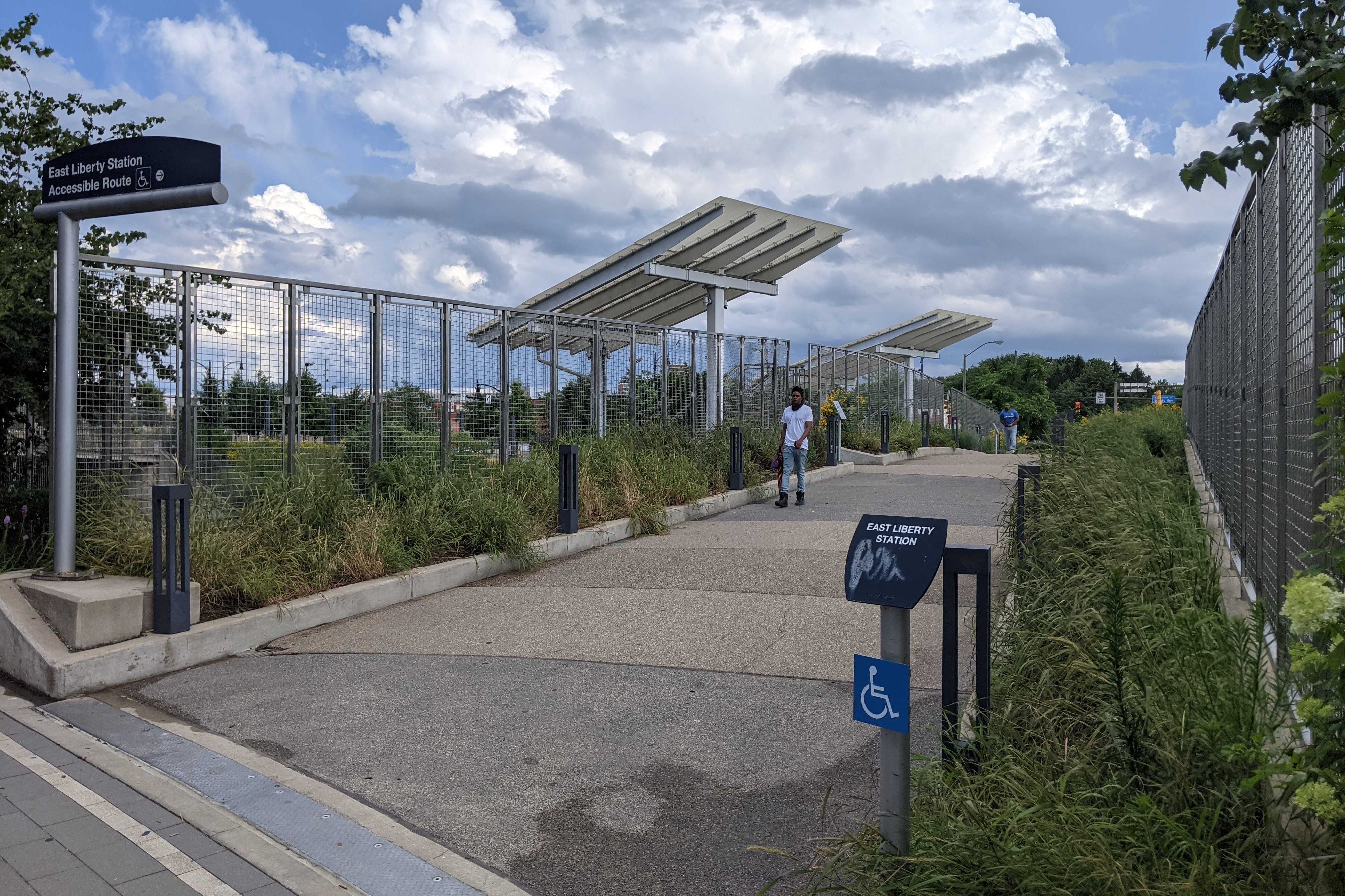
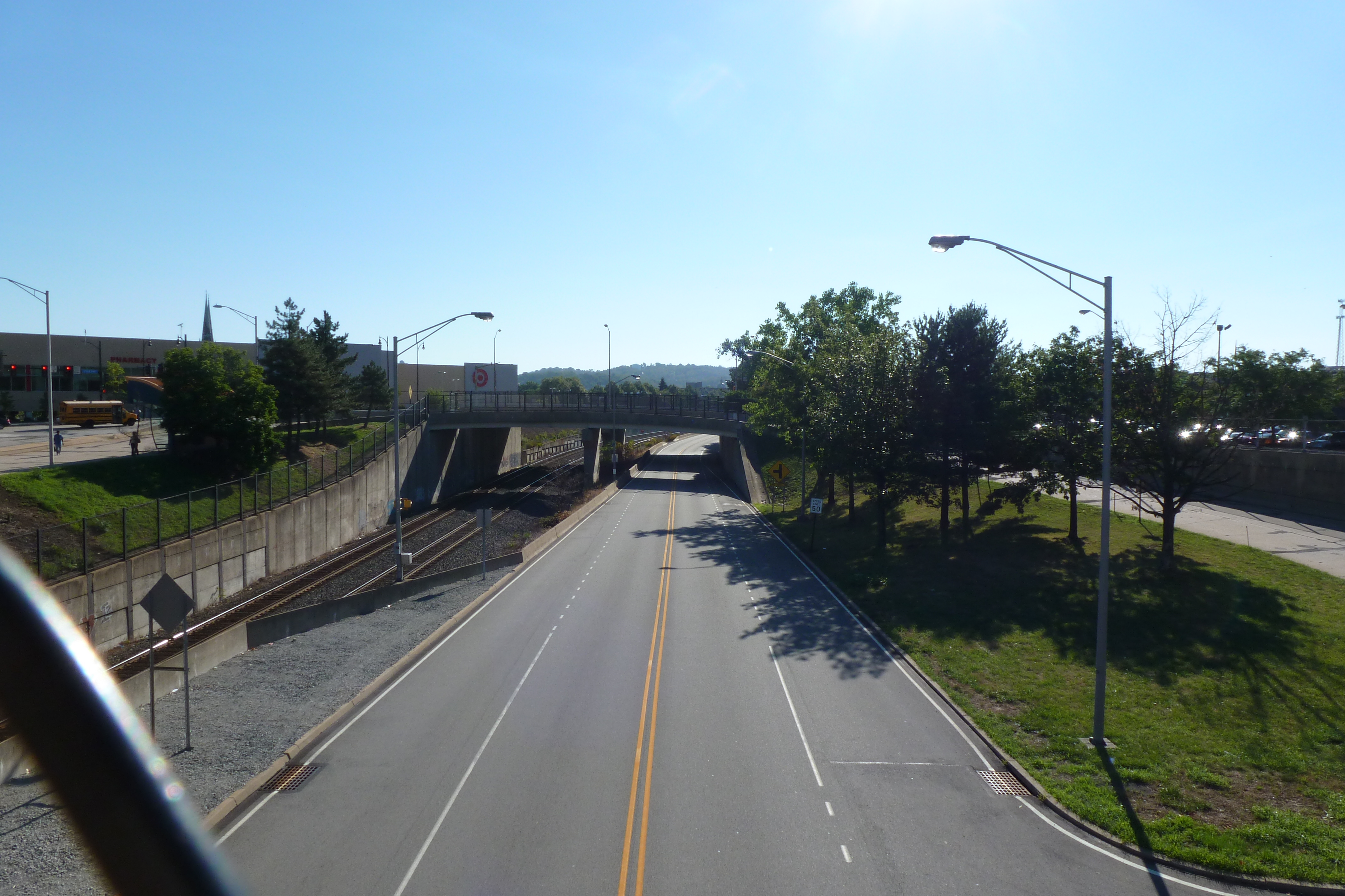
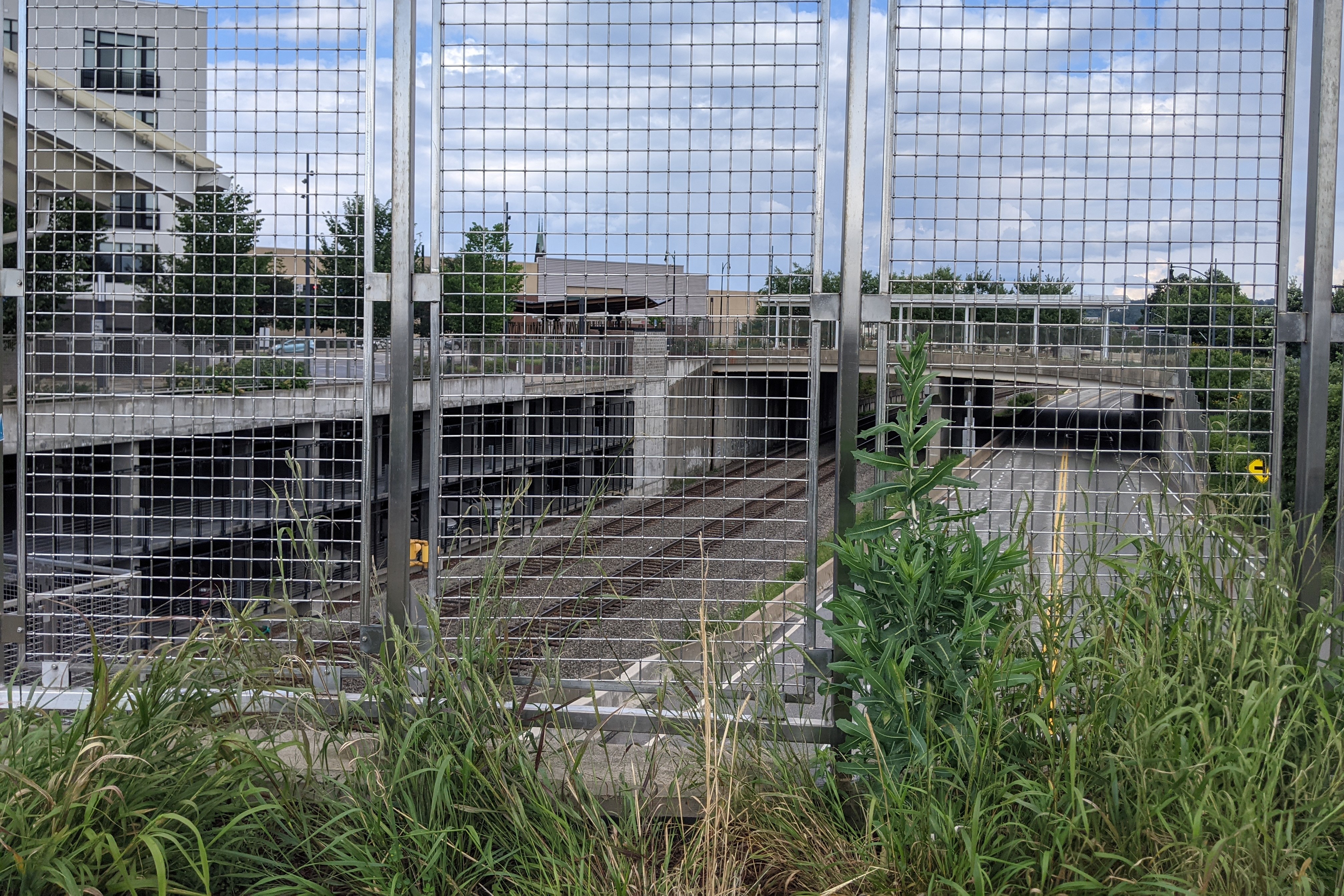
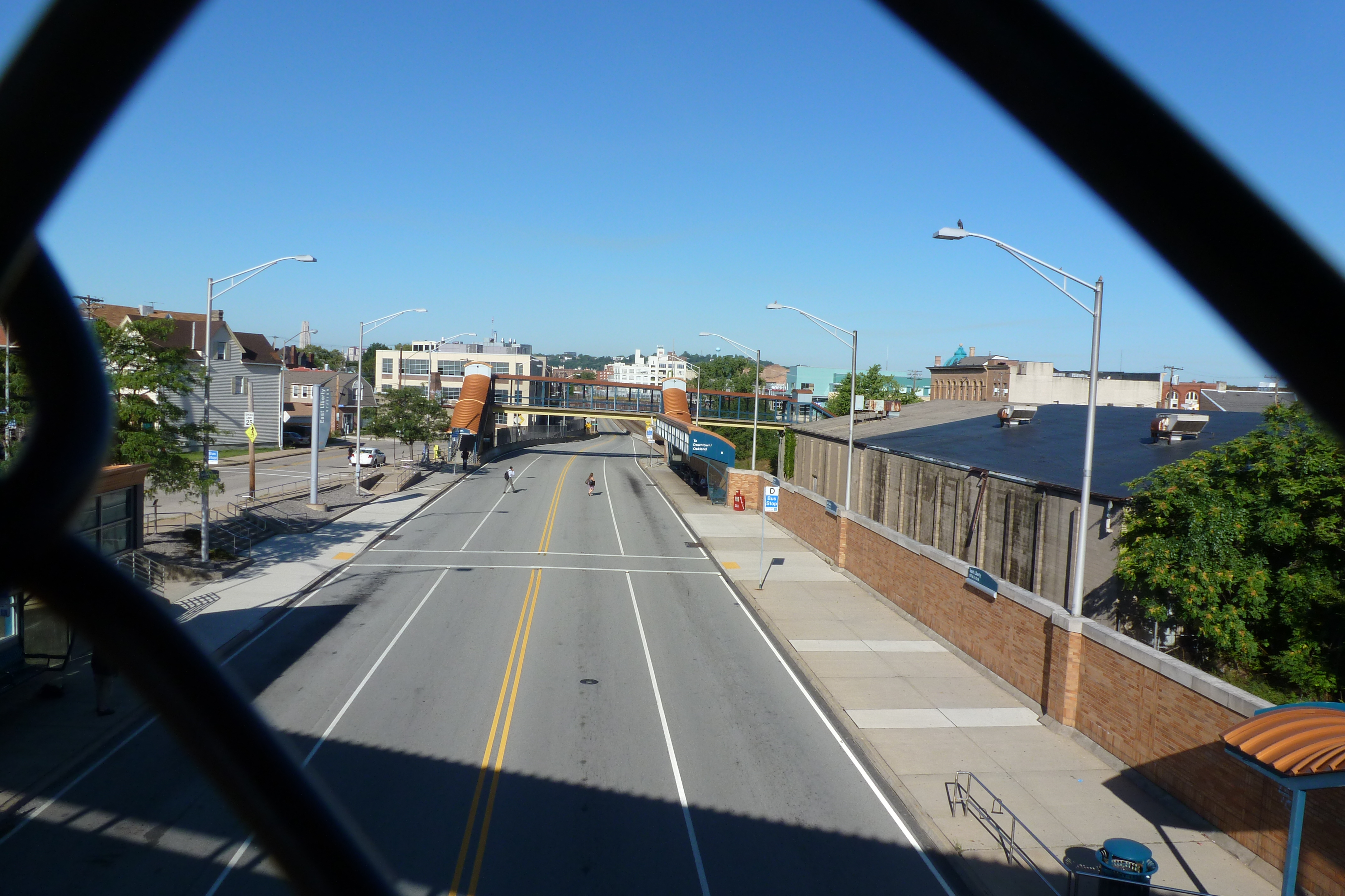
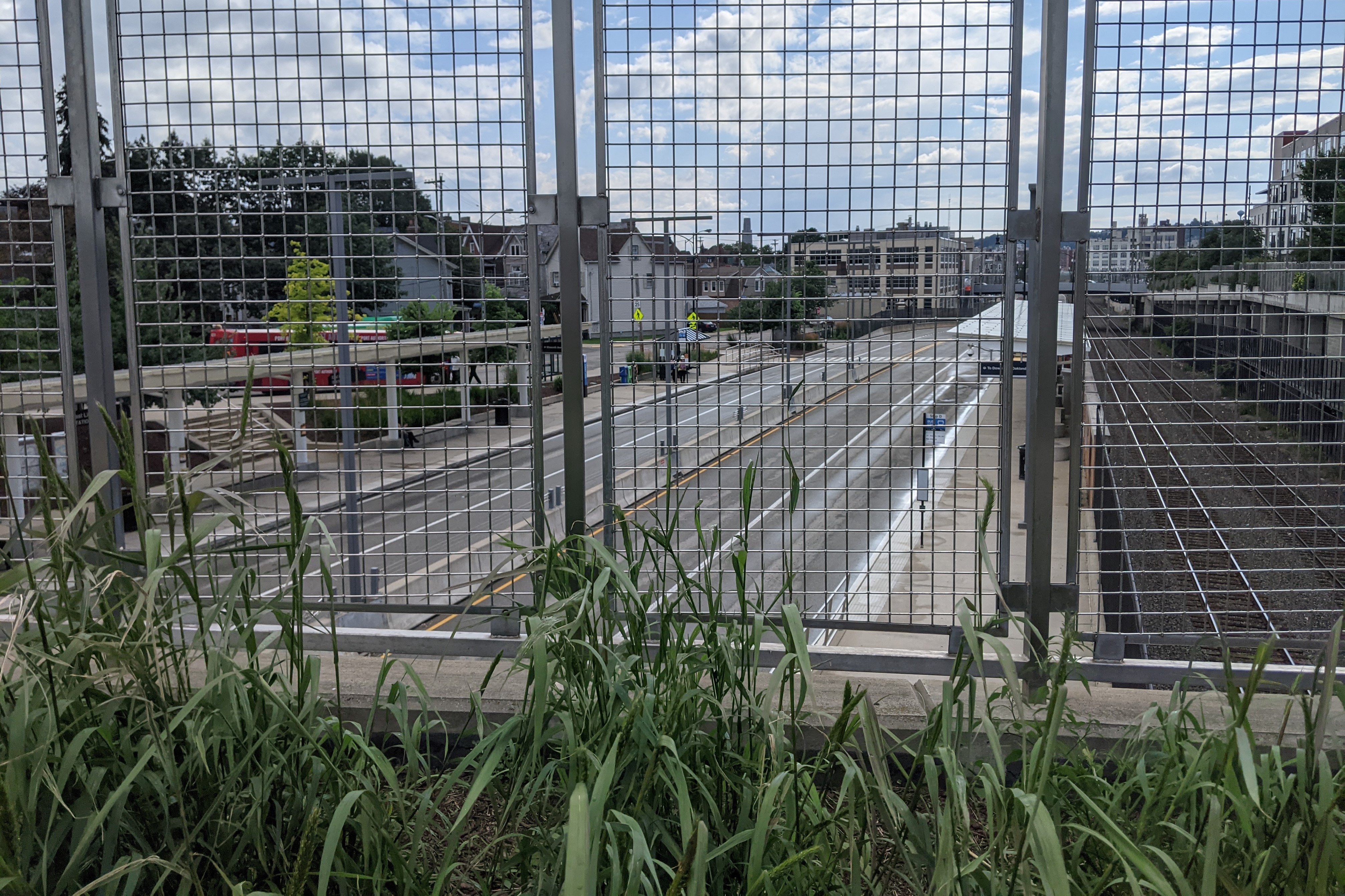
Just beyond the South Highland Bridge from the East Liberty Pedestrian bridge is the busway’s East Liberty Station. When I moved to Pittsburgh over a decade ago, there were two pedestrian bridges over the busway and train tracks – one at either end of the station – and a ramp providing buses on Penn Avenue access to the busway. Across the tracks from the busway was a one-story, graffiti-covered warehouse, a parking lot, and a drive-through bank. Along Penn Avenue and connected by the ramp to the busway was a major bus stop on its own governor’s drive.
All of this was replaced in 2014-2015 with a transit-oriented development. The two boxed-in (a step beyond caged) pedestrian bridges were demolished and replaced by a new open bridge (first photo pair below) and a crosswalk on the busway. The bus ramp was renovated into an accessible pedestrian ramp (seen in the east view, second photo pair). Plantings were introduced on both the bridge and the ramp, changing this portion of the vast paved, treeless area into a desert oasis. It is still a hot and uncomfortable place to be in the summer months, but at least now there are black-eyed Susans to bring cheer.
The warehouse, parking lot, drive-through bank, and Penn Avenue bus stop were replaced with a massive mixed-use complex called EastSide Bond (glimpsed on the right in the final pair of photos, also visible in the South Highland Avenue Bridge Then & Now post). The new development features 360 residential units, 43,000 sq ft of retail (most of which is occupied, except for the promised anchor tenant), 554 parking spaces in a garage under the buildings, and a 120-space bike parking garage (which I’ve only ever seen a handful of bikes in, probably because Penn Avenue is not a bike-friendly thoroughfare).
Similar to the older, new developments near the East Liberty Pedestrian Bridge, this site and its uses cater to a White and moneyed demographic. However, in 2010, East Liberty had a population that was 67% Black (down from 72.5% a decade prior) and the median income was $23,000. This means the site is catering to an audience that currently makes up a minority of the neighborhood. Perhaps that is why whenever I pass by or stop at one of the retail locations at EastSide Bond, I feel like it has a luke-warm success. In contrast, the Target across the street is heavily trafficked as is the busway station – both are used by the current population.
Once upon a time, Black residents were pushed to East Liberty through Urban Renewal and the demolition of their previous lives. Now, we may be witnessing the pushing out of Black residents through redevelopment and the demolition of their current lives. The current proposed redevelopment of the shopping center south of the East Liberty Station promises to bring the grocery store back and to include 35 affordable units out of 232. There is no mention of whether any of the other smaller retail stores that catered to the current population will be returning. I also wonder if the grocery store will still carry beauty products for darker skin tones when it reopens. Down the street, the redevelopment of the former affordable and predominantly Black Penn Plaza apartments is the latest project that is definitely catering to people who are not the majority residents of the neighborhood, after permitting affordable housing units to deteriorate through neglect before demolishing them.
East Liberty Busway Pedestrian Bridge – July 2012East Liberty Busway Pedestrian Bridge – July 2021East Liberty Busway Pedestrian Bridge – East View – July 2012 East Liberty Busway Pedestrian Bridge – East View – July 2021 East Liberty Busway Pedestrian Bridge – West View – July 2012 East Liberty Busway Pedestrian Bridge – West View – July 2021
The ribbon-cutting for the CAP, now called the Frankie Pace Park, happened on schedule on November 22, 2021. The Tribune-Review, Pittsburgh Post=Gazette, WTAE, KDKA/CBS, and SAI Consulting Engineers reported on the ceremony. The Tribune-Review and WTAE also have articles on the resolution earlier this month by City Council to name the park after Frankie Pace (1905-1989), a community activist and business owner in the Lower Hill.
The CAP is a project in Pittsburgh “fixing the mistakes” of Urban Renewal. The Crosstown Blvd was built in the 1960s creating a freeway in a canyon dividing the Lower Hill neighborhood from downtown. The Lower Hill neighborhood, formerly predominantly poor and black, had already been demolished by this point to make way for the Civic Arena and other cultural amenities that were never built.
The CAP is a park on a bridge built over the Crosstown Blvd and is intended to reconnect downtown and the Lower Hill, while the Lower Hill is being rebuilt by the Penguins hockey team. Construction began in June 2019 and was completed in November 2021.
This post is an update on the on-going photographic series to watch the development and usage patterns of the CAP. Periodically, once or twice a year, I return to the site to take new photographs. I plan to take the next series of photos next year in the warmer weather to see who uses the park and how. At the end of the post, there are links to the previous posts in this series.
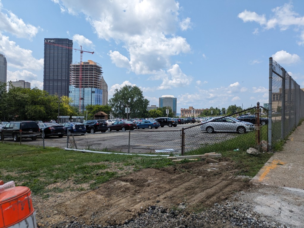
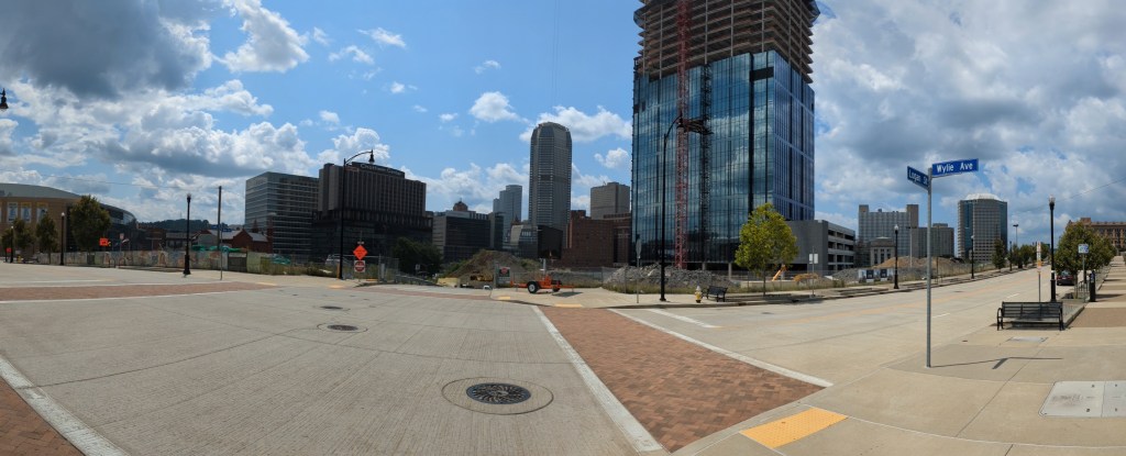
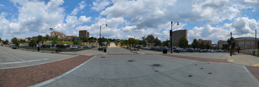
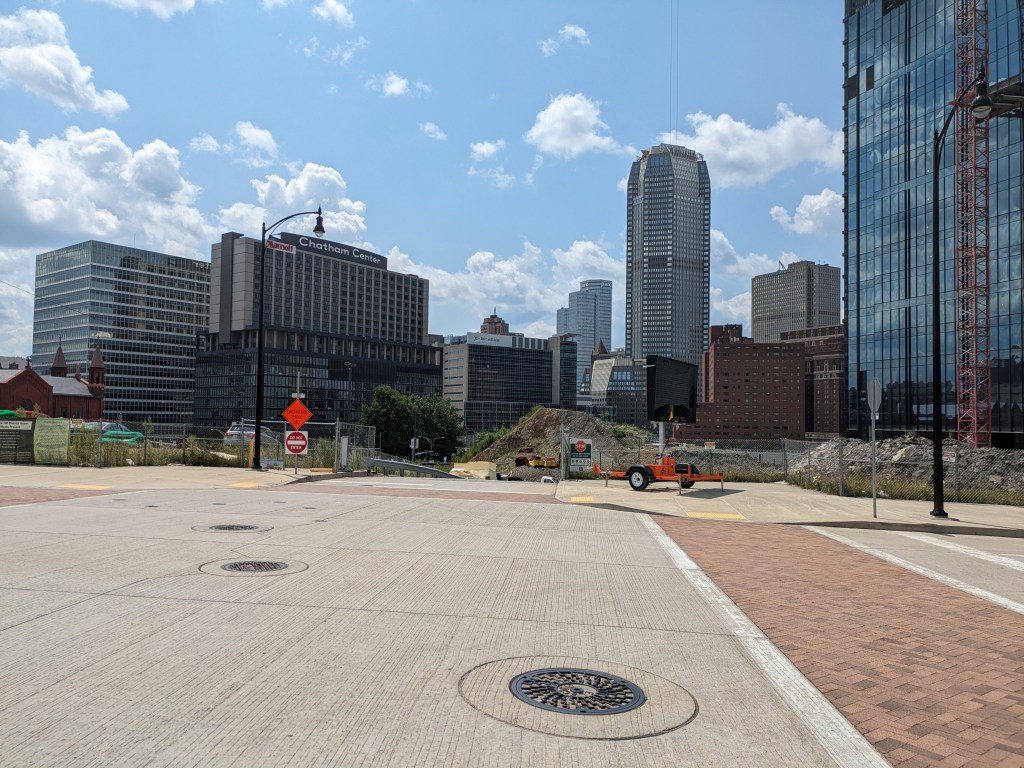
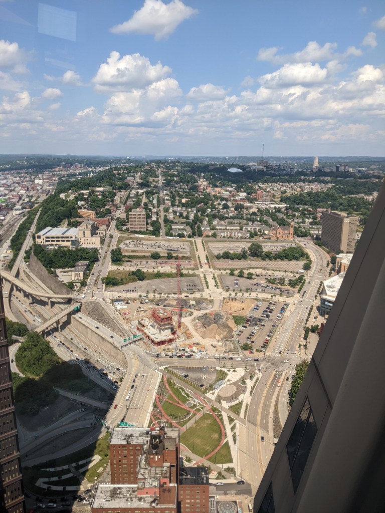
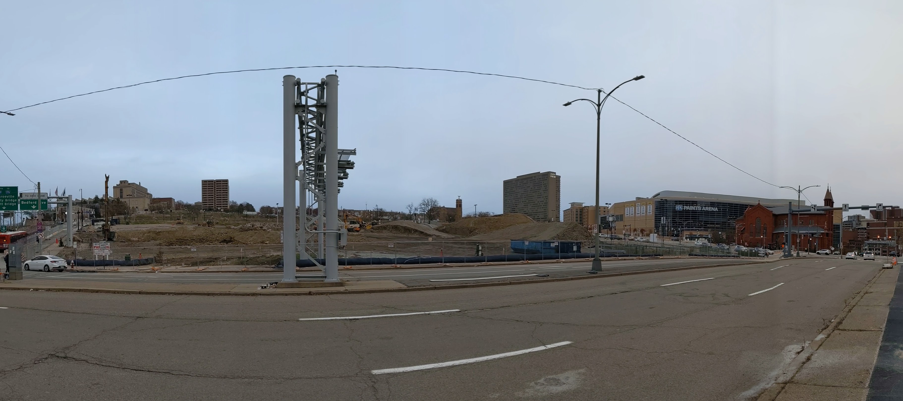
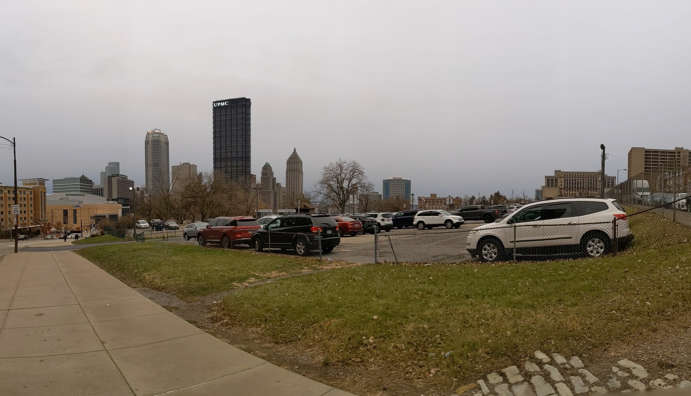
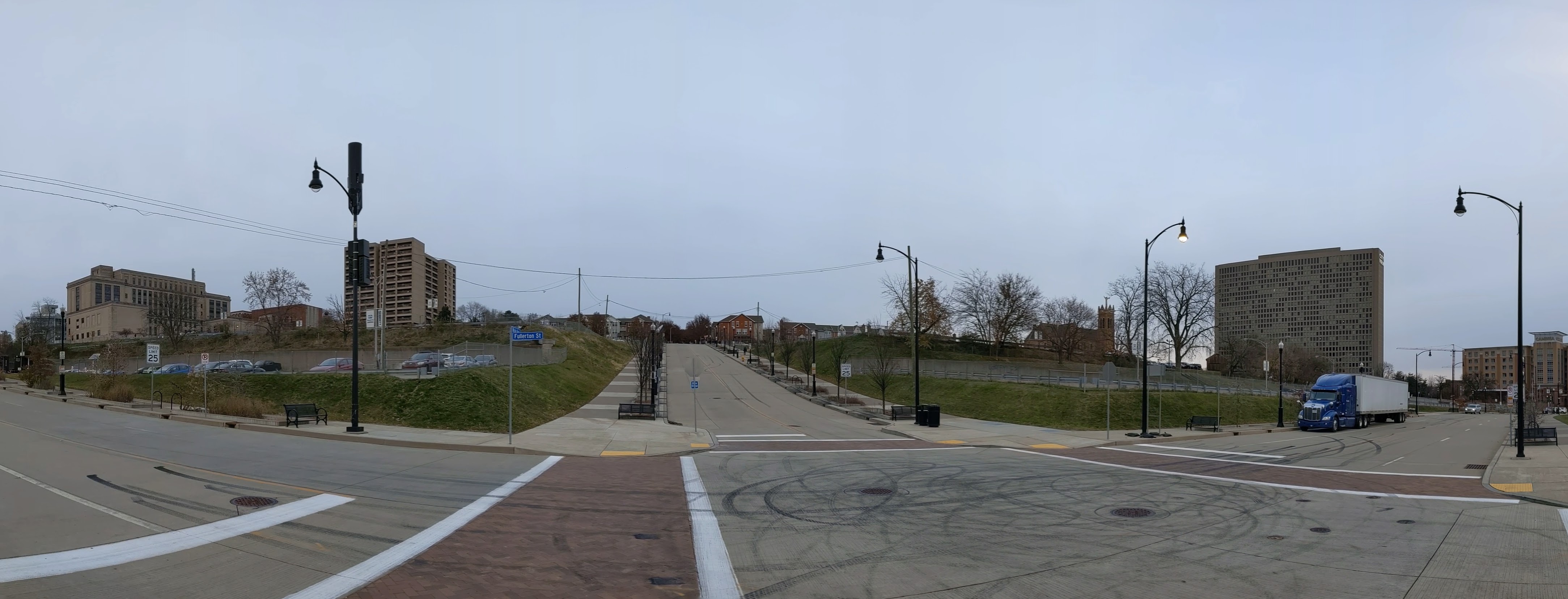
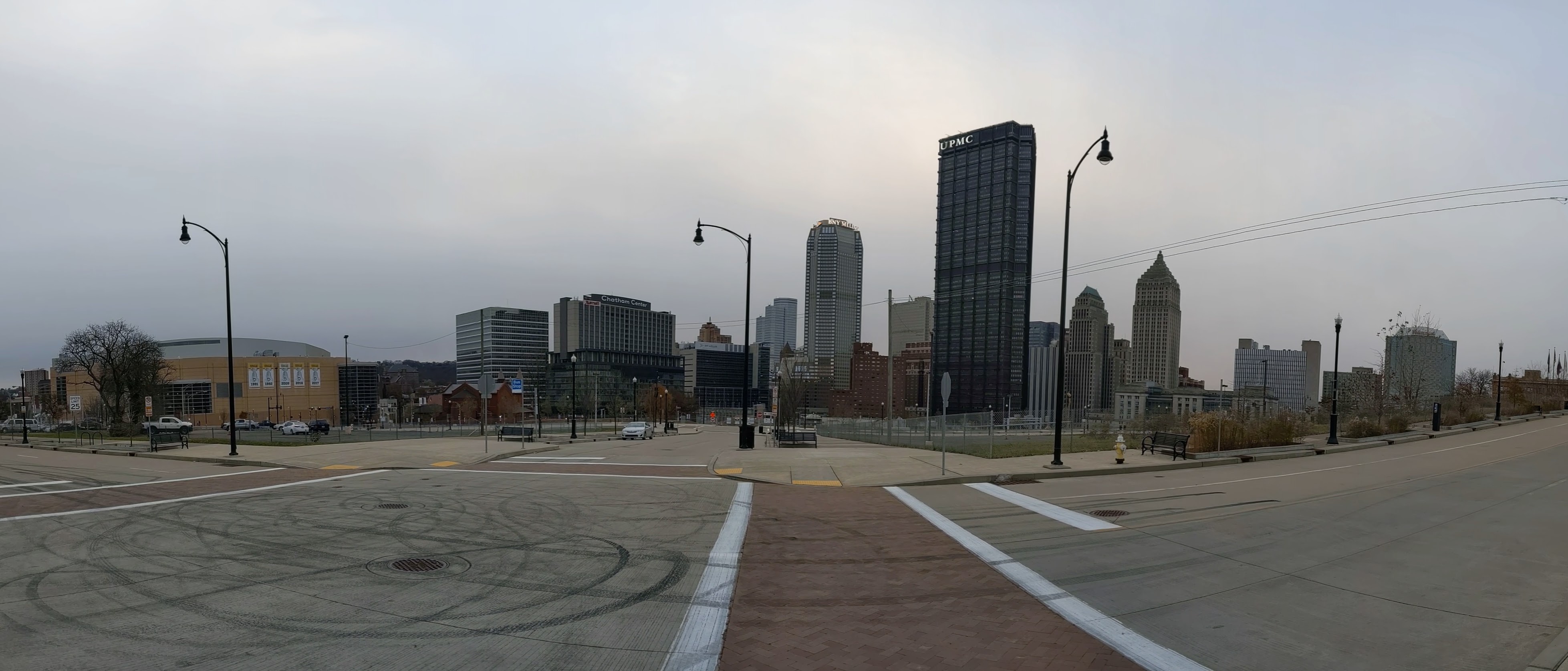
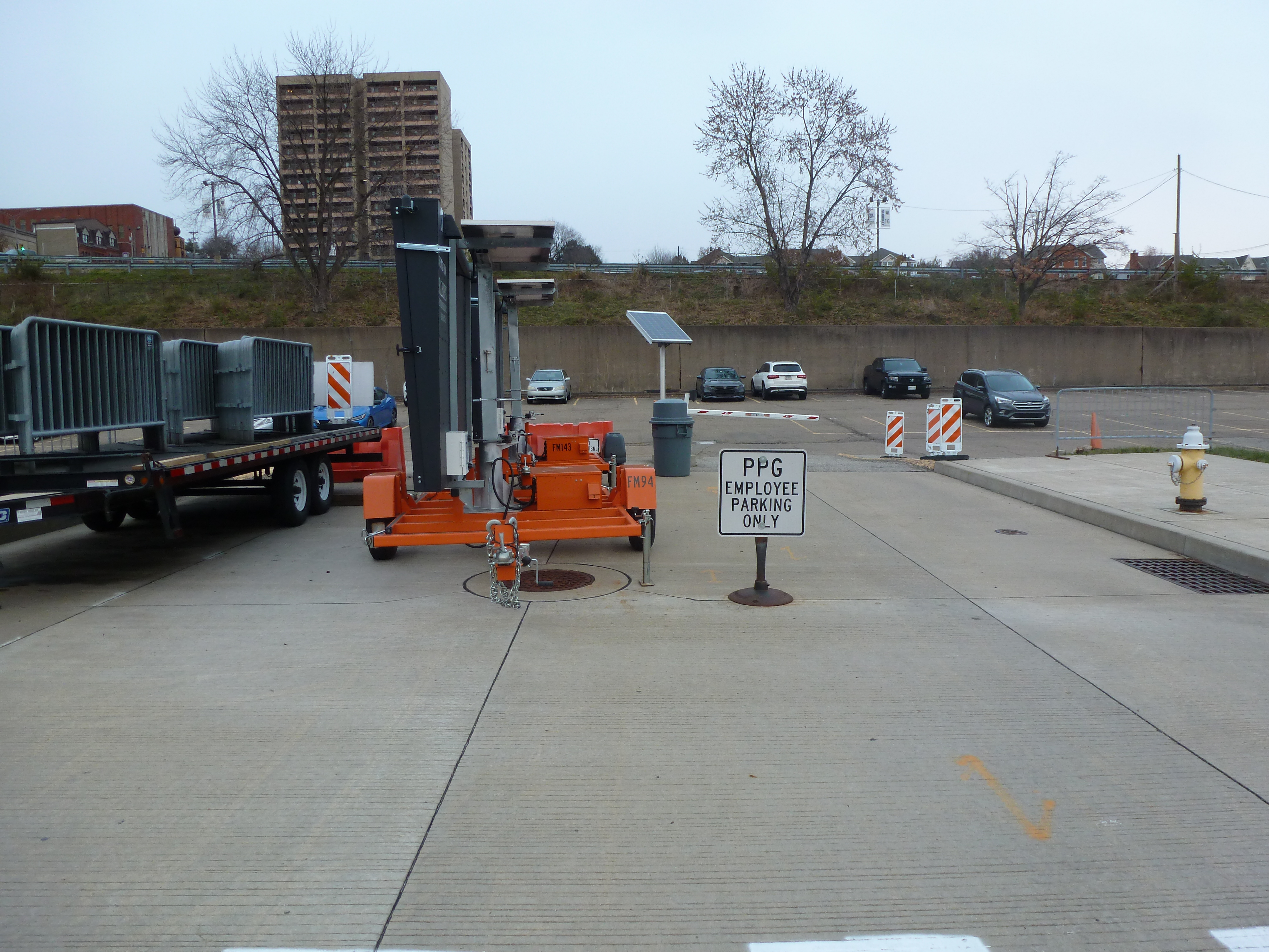
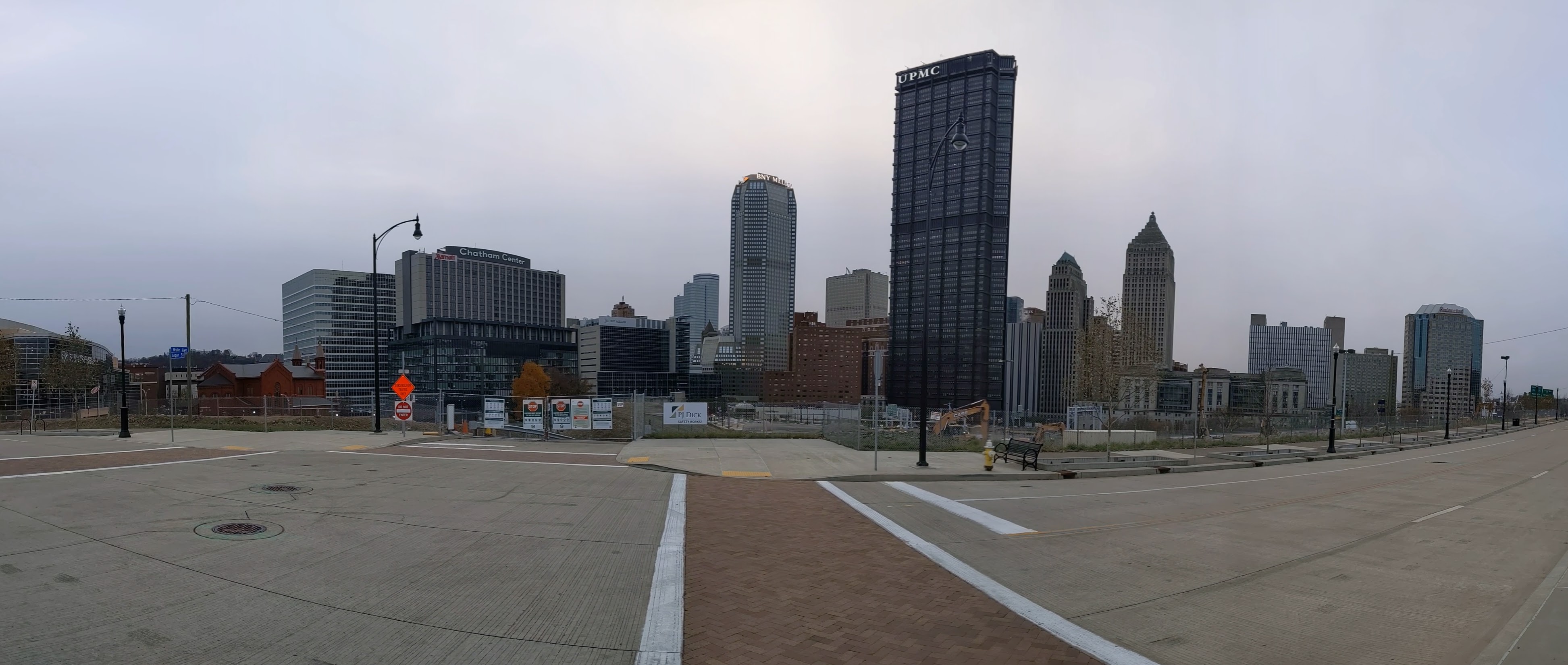
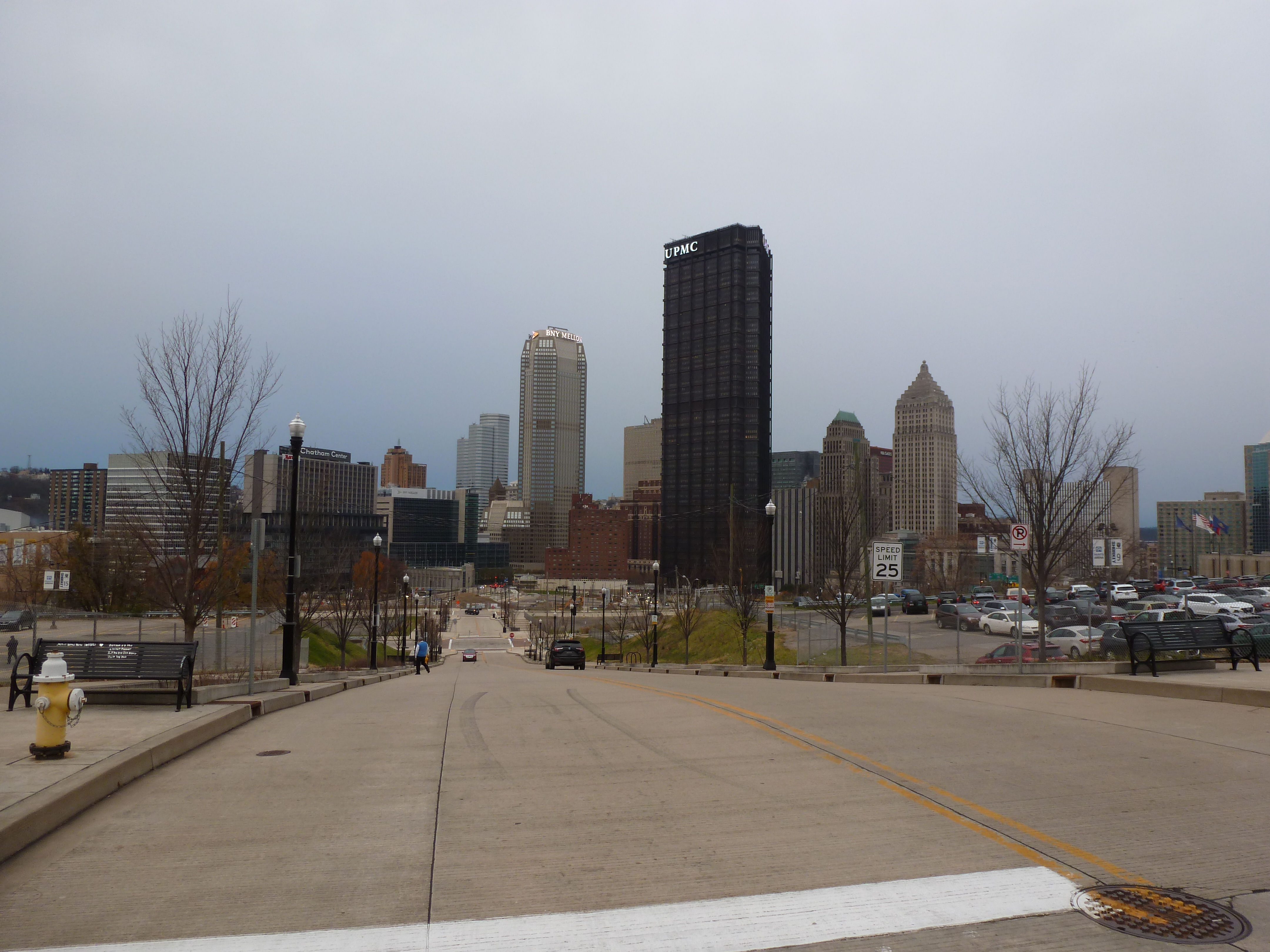
The Lower Hill is a notorious site in Pittsburgh, a scar on the city from the height of Urban Renewal. A vibrant (but poor and predominately Black) neighborhood was demolished in the 1950s so the City could build a cultural mecca centered on a Civic Arena, but most of the site ended up not being built and was left as parking lots.
Now that the arena has been demolished and replaced adjacent to the former location, the Penguins hockey team has the development rights to rebuild the Lower Hill, stitching back together the fabric of the city and reconnecting the remainder of the Hill District neighborhoods with downtown.
However, grand language describing the wonderful benefits to a city are part and parcel of any major development project, including the 1950’s Urban Renewal of the Lower Hill. Fifty years later, the Urban Renewal of the Lower Hill is rarely, if ever, described as a good thing. In fact, the current redevelopment is sometimes described as undoing the mistakes of that project. However, can the negative financial, social, and emotional repercussions of the original demolition and decades of disconnect be undone simply by reinstating (most of) the former street grid?
This blog post is part of an on-going photographic series to watch the redevelopment of the Lower Hill. Periodically, approximately once every six months, I return to the site to take new photographs. In addition, I include links to articles about the project that I’ve encountered since the previous post in the series. At the end of the post, there are links to all the previous posts in the series.
What’s New
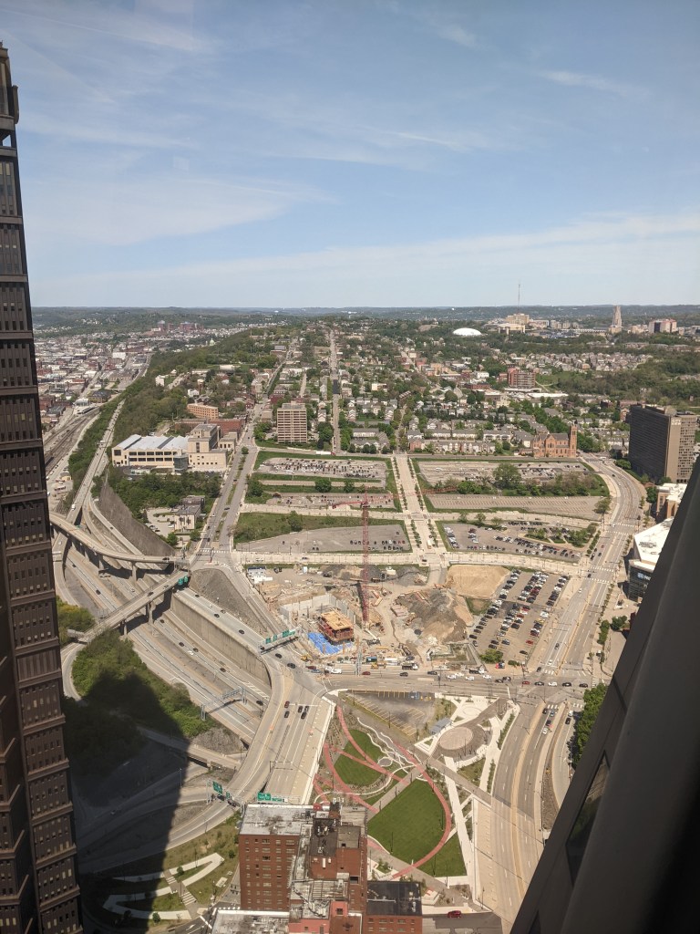
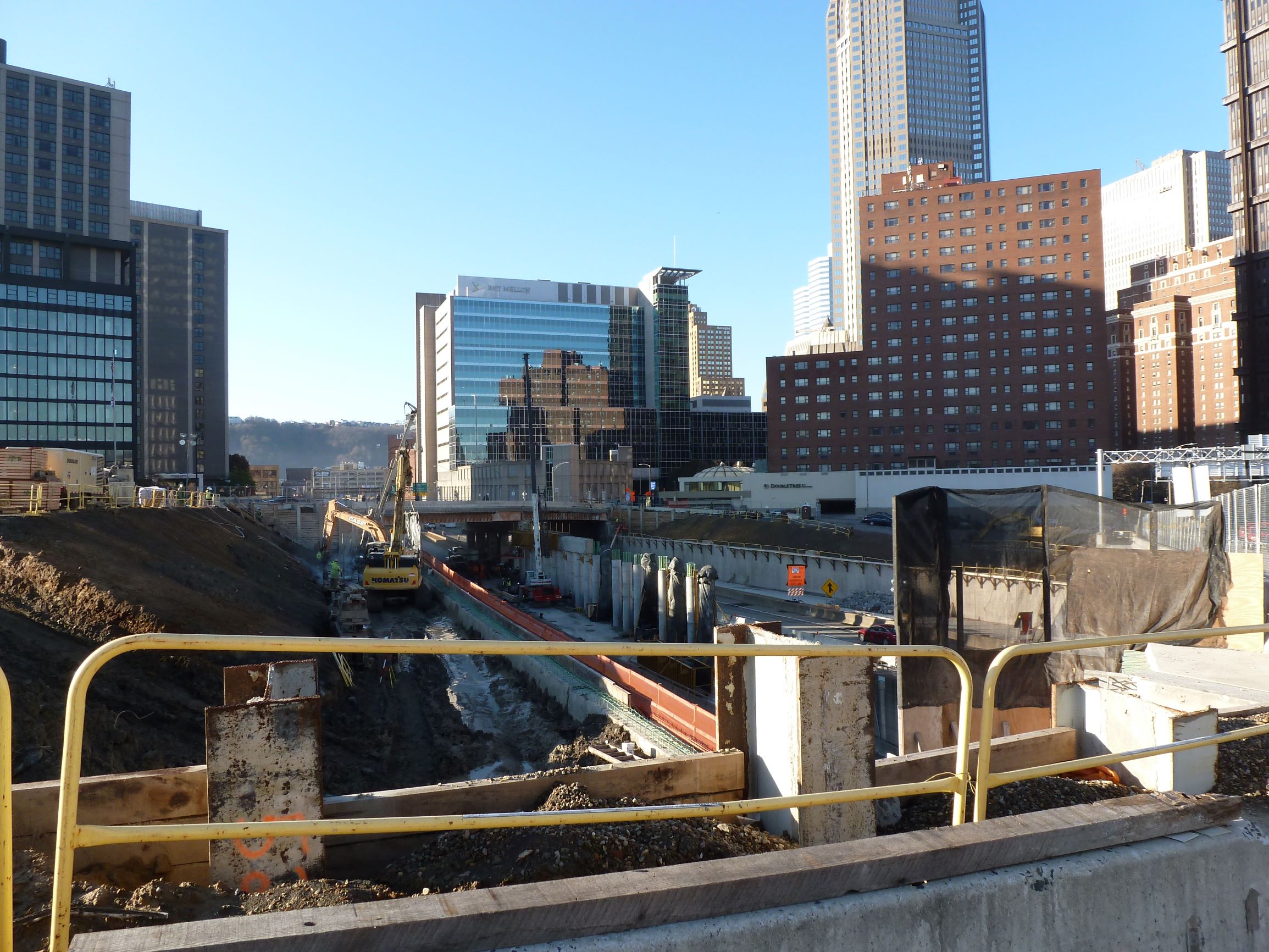
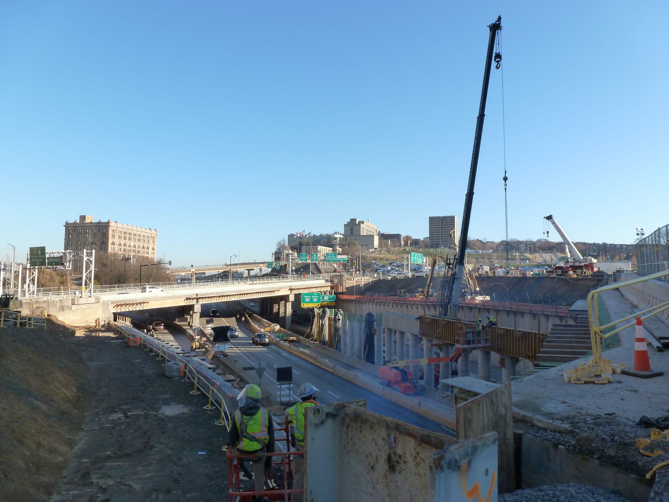
Ground has broken! There are a large hole, giant piles of dirt and debris, and closed sidewalks as construction begins for the new FNB Tower, the first building to be built on the site.
This was also the first time that I’ve visited the site on the day of a Penguins game, which was interesting to see how the sea of parking lots get used for events. At least one of the lots is reserved for employees only during events. There is also a slight price differential, the lot closet to the arena costs $30 to park for the event, while the one at the top of the hill is “only” $25.
Photos
Lower Hill in the News
Controversy and concerns continue over the redevelopment of the Lower Hill from the Executive Management Committee that was appointed to answer how the redevelopment would benefit the entire Hill District in private meetings (September 17, 2021, Public Source, & September 23, 2021, NextPittsburgh) to the impact of a pending change in owner of the Penguins (November 23, NextPittsburgh) and the pending registration of a second community organization in the Lower Hill, which would then also participate in the Lower Hill development activities meetings (November 19, 2021, Public Source). The potential new owner has previously been involved in real estate development around sports arenas (November 21, 2021, Post-Gazette).