Even in the midst of destruction, life finds a way…


Even in the midst of destruction, life finds a way…
Heth’s Run Bridge, the first bridge I posted about in my Pittsburgh bridges project, is scheduled to be replaced by the end of next year. The notice to proceed was expected to be issued last week with construction beginning on Sept. 24 with the installation of a temporary road around the bridge, through the zoo’s parking lot. According to the schedule that was passed out at a community meeting at the end of August, the bridge is expected to close with all car traffic being diverted to the temporary road on Nov. 1st. Due to the turning radius constraints with the temporary road, trucks will not be permitted and will instead be by way of the Highland Park Bridge, Route 28 and the 62nd Street Bridge. If all goes according to schedule the bridge should reopen to all traffic on October 1, 2014. Additional road work will continue through October. After final inspections, the project is expected to be officially completed by December 8, 2014.
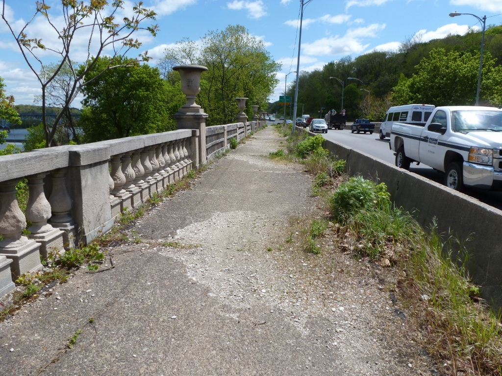
This is a PennDOT project expected to cost over $18.5 million and is definitely needed. As I discuss in my Heth’s Run Bridge Part II and Highland Park Bridge posts, the sidewalks here are in desperate need of repair and the proportion of sidewalk to road across the bridge is at least 50 years out of date. All this is going to be addressed in the reconstruction. The new bridge is going to have two lanes in each direction to match the roadway on either end. Additional features of the new bridge will be decorative railing, period lighting, entrance pylons, and “architectural features on the abutments with form liners” (which I believe refers to new urns). At the community meeting, it was mentioned that the current urns will be saved and kept in a warehouse until a new home is found for them.
In addition to the bridge, about 870 feet of Butler Street are going to be reconstructed including sidewalks. My understanding is that this is the part of Butler from the Heth’s Run Bridge to the ramps of the Highland Park Bridge, which should take care of my complaints about the condition of the sidewalk for those of us trying to cross the Highland Park Bridge without a car. This should also clear up the confusion for the outbound traffic of whether this part of the road is one lane or two as the plans include removing the “kink” from the existing alignment.
New signals and ADA ramps will be installed at the intersections of Butler with One Wild Place and with Baker Streets.
Another major part of the project is the excavation under the bridge to an elevation of 762. According to GoogleEarth, the bridge is at an elevation of 800 ft. I’m not sure if this will restore the bridge to its exact historic height, but it will be close (see the photo of the previous bridge from 1912). This will also pave the way for connecting this area to the proposed Allegheny Riverfront Green Boulevard project.
This project will no doubt cause some inconveniences during the construction process, but the construction of the temporary road will significantly cut down on this even though it adds over a month to the process. Imagine instead, everyone having to go on the truck detour or all the Zoo traffic coming down Morningside Ave and Baker Street instead of One Wild Place and Butler Street. That would be a true nightmare. Thank you, PennDOT and the Pittsburgh Zoo & PPG Aquarium for the temporary road. Thank you, PennDOT and any other funders, Sen. Jim Ferlo, Rep. Dom Costa, and anyone else who had a hand in helping bring about this long overdue project.
I can’t wait to walk over the new bridge when it’s finished!
More information about the project including the design of the temporary road can be found here: http://morningside-pa.org/wp-content/uploads/2013/08/hethsrunbridge.pdf
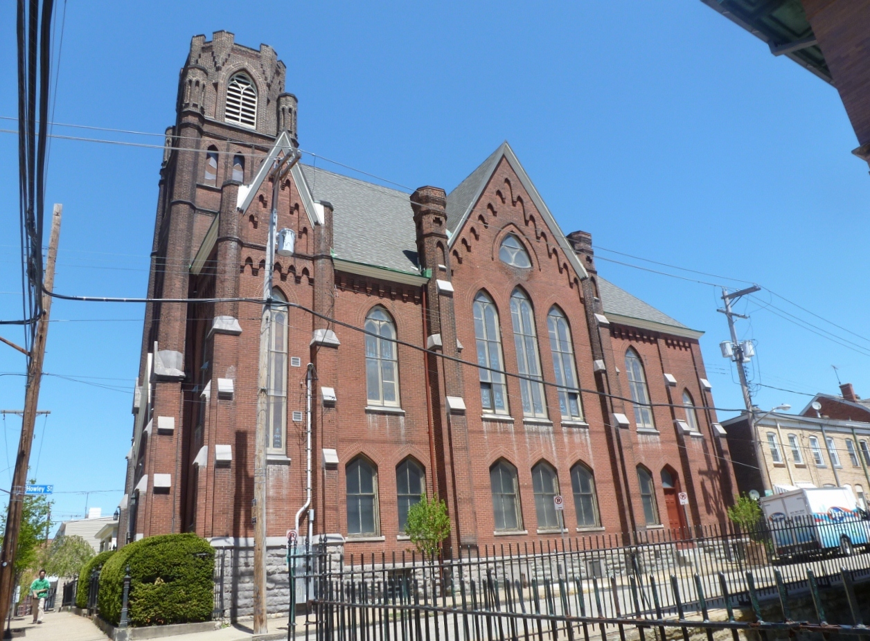
This little gem in Pittsburgh’s Lawrenceville neighborhood is full of surprises. In the 20-some years I’ve been passing through this area, I never noticed the building. It was brought to my attention a few years ago when I began researching adapted church buildings in Pittsburgh. If you are in the nearby vicinity, the building blends into its surroundings. But from other parts of the city it stands out (see 31st Street Bridge, Bloomfield Bridge, Busway Bridges: Herron Street, Busway Bridges: 28th Street). It is also visible standing out along the ridge in the second photo in my Washington’s Crossing Bridge post.

There are two characteristics that make it stand out from a distance. The first is its location at the highest point on 40th Street in Lawrenceville.
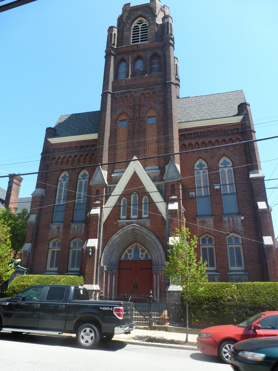
The second characteristic is one of the most intriguing parts of this building: the fellowship hall is at ground level and the sanctuary is above, reached by a flight of stairs. This is the only church building I have been in where the sanctuary is a full flight of stairs above ground level. I’m very curious to know if there are any others–please share, if you’ve come across one!

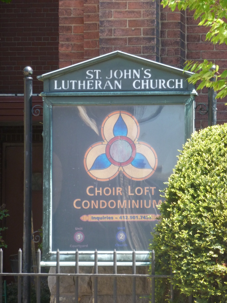
The building was built in 1896-97 for the German Evangelical Lutheran St. John’s Congregation, which later became St. John’s German Evangelical Lutheran Church. In 2002, the congregation merged with St. Andrew’s Lutheran Church and closed the doors on this location. A real estate agent purchased the property and prepped it for conversion into 3 condominiums–one unit each for the sanctuary, fellowship hall, and parish house–before the current owners purchased the property and completed most of the rehab work creating the Choir Loft Condominiums. (A side note that may be of interest is that the current owners considered purchasing the building that is now the Union Project but chose this one instead.)
The owner reported that the building was essentially empty for nearly 2 years before he acquired it. The floors were in bad condition–the pews had been ripped out, tearing the sanctuary’s floor, and the choir loft’s floor was completely missing. He said his goal in renovating the building was to “not destroy the architecture and the interior. We wanted it to feel like a church still because it is a church.”
Having gotten a tour of the interior of the sanctuary unit, I’d say they succeeded in this goal. The former sanctuary space is an open loft configuration with hardwood floors. The raised steps for the altar area were kept and made into the kitchen. The choir loft remained open and served as the bedroom. The gorgeous stained glass windows were also intact. While I was there on a winter evening after sunset, I loved the description of how the colored pattern from the stained glass gradually moves across the floor like a very colorful sundial. My other favorite part was that there was still a bell in the tower, which the owner rang for me. While inside the sound was muffled, it sounded like it could have woken sleeping neighbors.
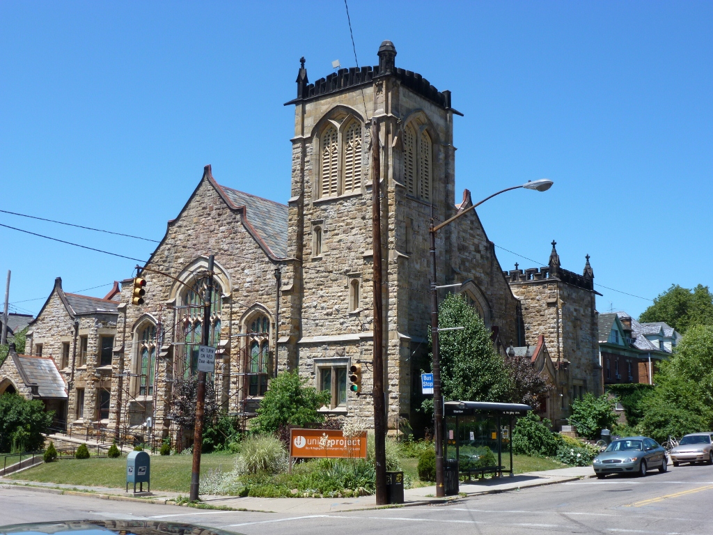
Every adapted church building I’ve come across has something that makes it unique. Of all the ones I’ve come across so far, the Union Project used the most creative method in restoring/adapting the building.
In the late 1990s, a small group of people came together and said that they wanted a “space for art and faith” in their neighborhood. (The quotes in this post are from one of the founding members, who I interviewed for a school project.) By 2001, this group and this sentiment had grown and they purchased the vacant, former Union Baptist Church at the intersection of Negley and Stanton Avenues, two major roads in the East End of Pittsburgh, to convert it into a community center.
When the community center acquired it, the church was still considered active, but it had not been used regularly for two to four years. The building was in very poor condition: the roof leaked, there were broken windows, and pigeons and rodents lived inside. It took four years to prepare the building for occupancy and an additional six years to completely restore the structure.
The part that I like the most about how this building was adapted, was the alternative method they came up with for restoring the stained glass windows of the structure. All the windows needed restoration, which I’m sure would have added up to a colossal expense. Instead of giving up or attempting to raise all the funds to pay for a professional restoration, they offered community classes in stained glass restoration using the church’s windows as the class materials. Some of the windows needed to be completely reconstructed in which case the instructor, a stained glass professional, created the new windows. Beside these, all the windows were restored by community members at the classes.


I took one of the classes a few summers ago. It was a lot of fun and quite interesting to learn how stained glass windows are put together. At least a couple of the people in my class were taking the course so they would be able to restore the stained glass windows in their homes. Much of the housing stock in the neighborhoods surrounding the building feature at least one stained glass window, so this was a useful skill for the local homeowners to learn. A 2012 article in the Post-Gazette announces the completion of this restoration project.
Over the years since the Union Project began, the building has slowly been restored one piece at a time. The former classrooms behind the sanctuary were restored first and converted into office space. Several of these offices are used for the administration of the Union Project, while the rest are rented out to other community groups including a church group. The basement was converted into an art space. This is where the stained glass restoration classes were held. There is also a pottery studio which offers classes. Hula-hooping classes are held in the atrium, or out on the lawn in nice weather. The sanctuary is used as a rental hall for receptions, community events and the like. The narthex is a little coffee shop.
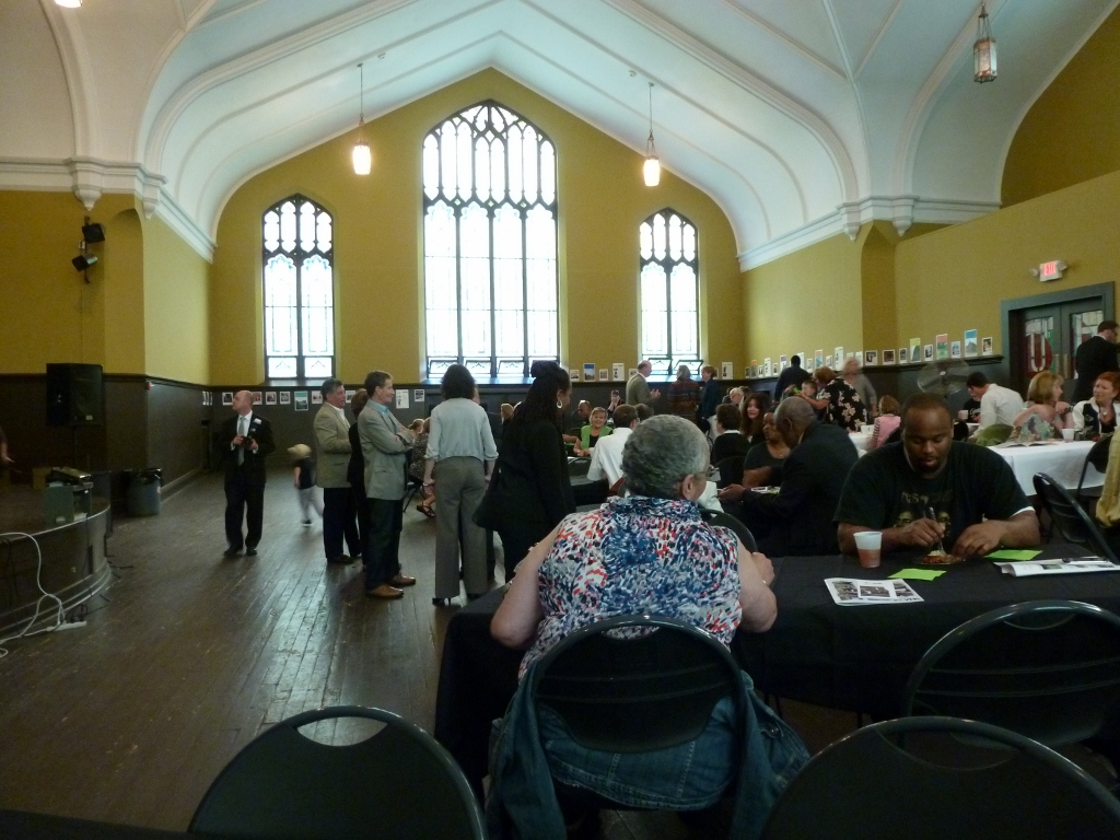
By the summer 2012, the building finally looked like a completed project: the stained glass windows were restored, the sanctuary was finally completely repainted, and the black soot was cleaned off the stone façade. Because of Pittsburgh’s past as a major industrial city, all stone façade buildings collected black soot–many of these buildings have been cleaned in the last ten to twenty years. In cleaning the soot off the Union Project, the crenellations on top of the towers were left black, leaving a respectful reminder of the past, while the change from a black building to white brightened up this corner of the neighborhood.
This is a project that showed me, and the group who completed it, that “anything is possible.”
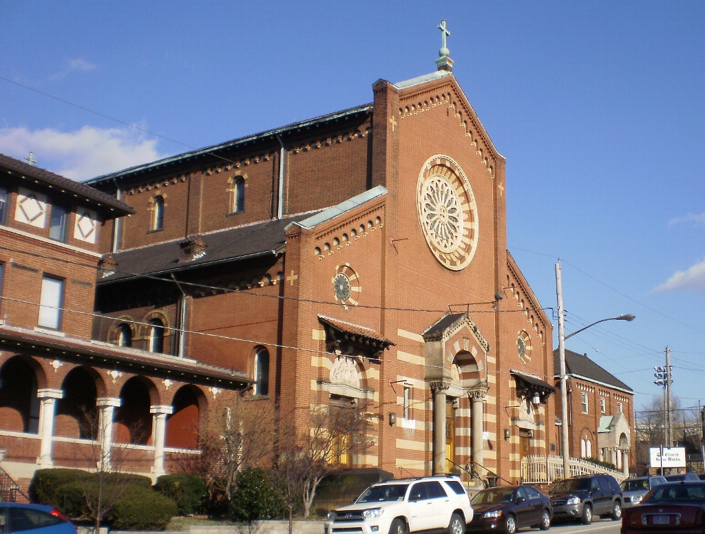
January 8, 2013, has been declared by City Council as Church Brew Works Day in the city of Pittsburgh to recognize the work of the restaurant’s founder/president, head brewer, and staff. Council’s proclamation highlights the success of this group in adapting a vacant church “into a premiere, nationally recognized craft brewery, neighborhood fixture, and regional asset.”
The Church Brew Works is probably the most infamous of Pittsburgh’s adaptively reused churches. Its notoriety stems from the fact that the brew house is located in the former altar. A friend of mine told me that this positioning bothers her and if she eats at the Church Brew Works, she has to sit with her back to the altar. I have heard that other people consider it sacrilegious to have the brew house on the former altar area and that these people refuse to patronize the restaurant.
This building was formerly an Eastern European Catholic Church and was purchased in 1996 to be converted into a restaurant and brewery. I interviewed the founder/president for a paper on adaptively reused church buildings in Pittsburgh. He explained that the idea for the restaurant started in 1994. The first building selected for the project was an old fire hall two blocks away from the church. The church was chosen in the end because of the availability of parking and the “great architecture.” It was also easily accessible by car, which he felt was important for the success of the restaurant as Pittsburgh “lacks good public transit.” Five months after the purchase was completed, the restaurant opened.
The church had been empty for two years by the time it was purchased in 1996. The school attached to the church had been closed for twenty-five years. The president felt that this added to the decrease in the congregation. The closing of the mills drove church members away to search for new jobs while the closing of the school drove them away to find a new school for their children. As a result of these pressures, the congregation dropped from 2000 to 200 parishioners. When acquired for the restaurant, the church was “worn out” from a lack of reinvestment over the years and there was additional damage as a result of being completely closed for two years. While the initial renovations of the building were completed in five months, paving the parking lot and completing the patio took longer. Fifteen years later, work is still being done because of the “age of the building.”

Much of the original building was reused or adapted in the conversion from a church to a restaurant. The history section of the restaurant’s website explains how the pews were reused as benches for the tables and the bricks from the confessional that was taken down were used to create the pillars for the restaurant’s sign outside. The original floor and lanterns were restored. The result is a beautiful and unique interior for this restaurant. To see what the interior looks like, check out the website or stop by for a meal. I’ve enjoyed the food the few times I’ve eaten here.

The Spire House is perhaps my favorite of all the adaptively reused churches I found in London. Originally built as Christ Church Lancaster Gate in the 1850s and 1860s, the building has since been adapted to housing. As I walked around the building, I thought it might have been one of the ones damaged during the war, but according to a website about the building most of the structure was demolished in the 1970s because of decay and fungus.


The reason why I liked this building was that despite the fact that most of it was demolished, part of it was saved and the rebuilt structure recalls the former design. I particularly liked the “flying buttresses.”
I agree that there are times when a building can no longer function well, in this case because of decay and fungus, but buildings tell a lot about a society and its history and when they are demolished something gets lost. The Spire House found a compromise between these two and it tells a lot about the city. From the way this building was designed, it is apparent that this society is moving forward and changing, but still respects its past and its religion. There other signs of this throughout the city, such as the church tower in the middle of a road.

When I started planning on going to London this year, my first idea was to go for a month or so to study the adaptive reuse of churches in that city. I thought London would be a good place to see a wide variety of adaptions as the UK has been working with the problem of redundant churches for about a hundred years. As I was pursuing this idea I found a book from 1977 which addresses this problem across Great Britain. (I have not come across any book publications on the adaptive reuse of church buildings in the US.) This book “Chapels and Churches: Who Cares?” includes a discussion of what had been done up until that point in time in the adaptive reuse of church buildings. I compiled a list of 76 different uses that these buildings have been adapted to from the book. In my observations in the Pittsburgh area, I have seen less than ten types of new use for church buildings with housing being the most common.
There was one factor about the church buildings in London that I found fascinating, perhaps in part because it is not a factor in Pittsburgh, or any US city for that matter. Many churches sustained damage during WWII and The Blitz. The churches damaged during the war were demolished, rebuilt, adaptively reused, or memorialized, resulting in some unique (at least to me) situations.
I ended up not going to London to complete a research project on the adaptive reuse of church buildings, but instead went to the city for a few days and explored as much of the city as I could in that time. This included looking for a few of the adaptively reused churches I had learned about in my preliminary research. In the process of looking for the ones I knew about and simply walking around the city, I found some other adaptively reused churches.

Baum Boulevard and Centre Ave run parallel along the border of Pittsburgh’s Shadyside and Bloomfield neighborhoods and are arteries that help people move from downtown and Oakland to East Liberty and other East End neighborhoods. The Baum-Centre corridor is currently receiving a lot of attention from the perspective of the development of the city. There is even a community group called the Baum-Centre Initiative made up of representatives from other groups along the corridor. Their goal is to work together to promote development along the corridor that is beneficial and satisfactory to their respective groups and communities.
This area is attracting interest in part because of its arterial activity, but also because Baum used to be the car dealership district. Most of the dealerships have closed their locations leaving behind many empty buildings. Contrary to this disinvestment, Centre Ave hosts one of the UPMC hospitals and an urgent care center was recently added. From what I’ve picked up, UPMC is working to expand in this area.
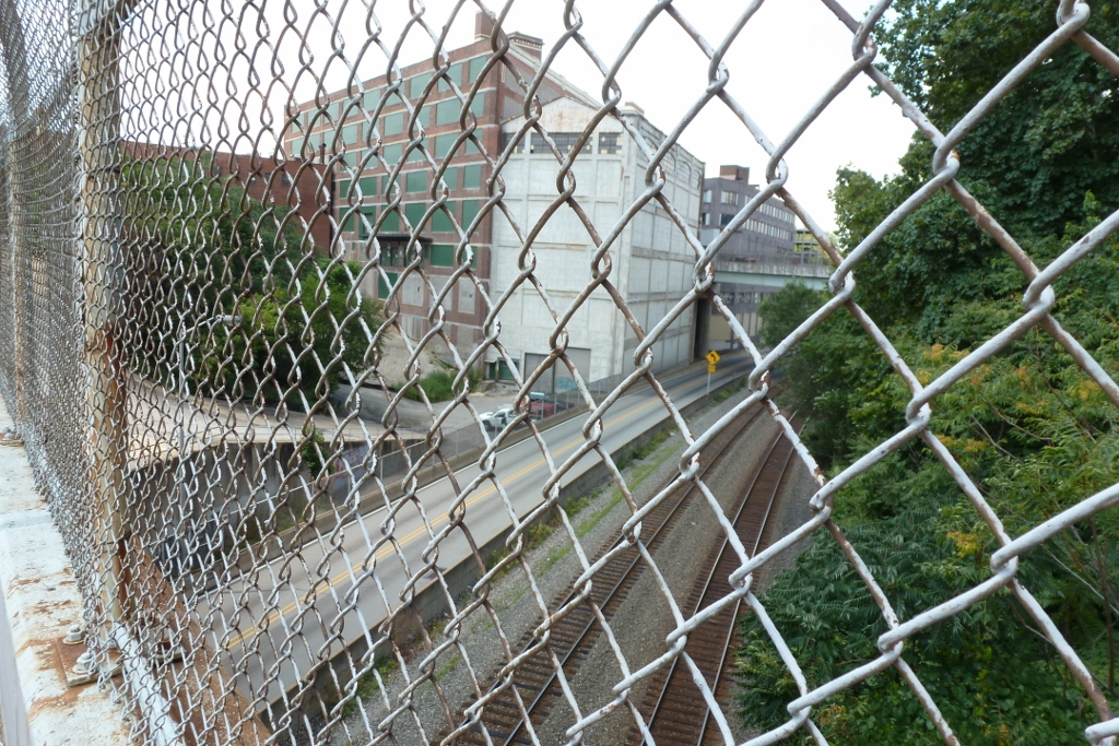
The large building between Centre and Baum last housed a party/costume supply store, but I image most of the building was sitting empty. For about the last year, it has been under redevelopment. The rumor I have heard is that something related to UPMC is going into the space.
I also heard that UPMC wants to build a parking lot for its employees in this area. I couldn’t picture exactly where it was to be placed from the description I heard, but I wonder if it is this empty lot off of Baum Boulevard.
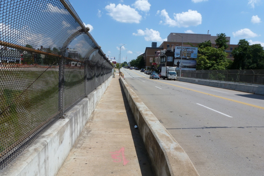
Outside of the developments going on near them, my impression of these two bridges is that they are quite ugly. I am glad that except for when I walked them for my project, I’m in a bus when crossing Centre Avenue’s bridge and in a car when crossing Baum Boulevard’s bridge. Now that I mention it, that’s how I felt about most of the bridges across the busway I’ve walked (except for the new pedestrian bridge, see July 26 post). Though I haven’t written the posts for all of them yet, at this point I have walked all the bridges over the busway between Penn Avenue and the Bloomfield Bridge.

My favorite part about walking these two bridges was the view of Bloomfield/Lawrenceville from the Baum Boulevard Bridge. This view captures two of Bloomfield’s churches (both currently active) with Lawrenceville’s Childrens Hospital sandwiched between them.

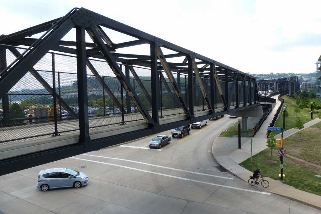
After walking the Hot Metal Bridge, I realized that it is really three separate bridges. One of the bridges is the bike/pedestrian bridge pictured above that crosses over Second Avenue. The other two are in the background of the image above–one carries all vehicular traffic while the other carries all pedestrians and bicycles. The bridge pictured above is not structurally connected with either of the other bridges. The two bridges that span the Monongahela River were built at different times. While at this end (north) the bridges are at the same level, they are at two different elevations on the other side of the river.


The Hot Metal Bridge is one of the more locally famous and popular bridges in the city. In my experience of participating in and overhearing people’s conversations locally about Pittsburgh bridges, the Hot Metal and Smithfield Street bridges are the two that come up the most as fun to use and interesting. In the case of the Hot Metal Bridge, this is perhaps because it used to be a set of railroad bridges which have now been converted. They were built and used by the Jones & Laughlin Company to connect its sites on opposites of the river. The name of the bridge (Hot Metal) came from the fact that the trains were carrying molten metal from one factory to another. There are, or at least there were, placards along Water Street along the South Side Works that describe the history of the J&L steel company on this site and on the bridge. I don’t know if they are still up as there is currently construction going on in this area.
According to the description attached to the oldest image of the bridge on Historic Pittsburgh, the bridge was built in 1887. This image, as well as PGHbridges.com’s page for the bridge, identifies the names of the two structures as the Monongahela Connecting Railroad Bridge (now the vehicular bridge) and the Hot Metal Bridge (now the pedestrian bridge). The G.M. Hopkins maps tell a slightly different story. As early as 1882, the maps show a bridge at this location. That map and the 1889 map identify the bridge as the East End Bridge. All the maps from 1890 through 1923 of this site call it the Jones & Laughlins Bridge. Up until 1904, the bridge is depicted as carrying a single track, which I assume would be the bridge that is now the pedestrian bridge. Starting in 1910, the bridge is depicted with three railroad tracks, meaning the current vehicular bridge was added in that time.
It is amazing to me that as late as 1998 this part of the city was still dominated by steel mill buildings as illustrated by this photo. I suppose this means that I did not come to this part of the city then. As the South Side Works mall did not exist yet, I guess there was no reason for me to come over here. According to PGHbridges.com, the conversion of the bridges began in 1998, but the larger of the two bridges didn’t open until 2000 while the pedestrian bridge opened in 2007.
My final comment on this bridge is that there is a nice view of downtown from here, although the buildings don’t form any interesting patterns and clusters like they did in the views from the Allegheny River bridges (see 16th Street Bridge post for an example of this).


Outside of the safety issues of the Birmingham Bridge (see July 30 post), the surroundings and view from the bridge were interesting. I was particularly interested in the uses along the waterfront around the bridge as there were three distinct types of use.
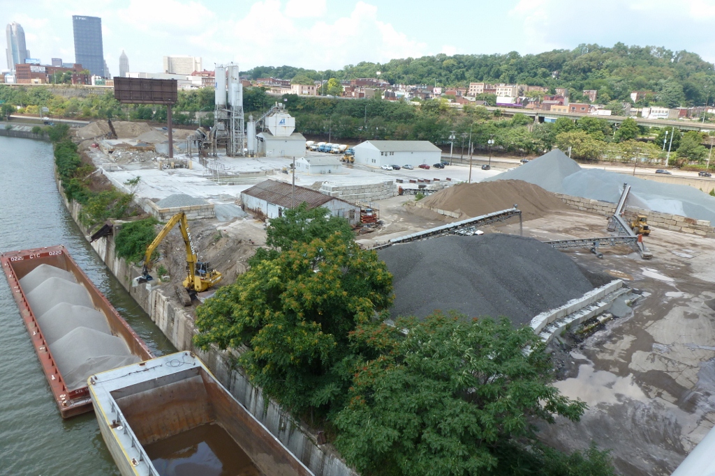
On the northern shore of the river and western side of the bridge is this gravel/cement? factory. I classify it as an industrial use, but I don’t really know what its purpose is. I watch for a little while as the excavator scooped gravel from the barge and dumped it on the conveyor belt which passed it along and piled with the rest. I think it is easy to forget at times that our rivers are still working rivers–some coal and other materials are still shipped by the rivers. The image above is a reminder of this as the gravel was obviously delivered by river.

On the same shore, but the other side of the bridge, is one of Pittsburgh’s redeveloped brownfields. This area used to be part of the Jones and Laughlin Steel Company, dominated by the Soho Iron Works (see 1923 map). Today it is home to several office buildings along Technology Drive, including Carnegie Mellon University’s Entertainment Technology Center. I believe the University of Pittsburgh may also have property on this site. This site is an illustration of Pittsburgh’s Second Renaissance, the “Eds and Meds,” which was implemented in the 1980s to counteract the job loss and deterioration caused by the decline of the steel industry. Here the former steel plant was replaced by buildings housing at least the education part of “Eds and Meds.”
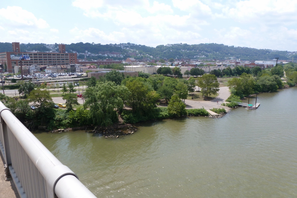
The third use of the waterfront at the Birmingham Bridge is recreation (and green space) on the southern shore. The Three Rivers Heritage Trail travels near the river among the trees and grass. The trail also passes under the Birmingham Bridge on the north shore, but the technology park and gravel site separate the trail from the river and it passes near the freeway, making it not a very pleasant place for recreation. The southern branch of the trail on the other hand is pleasant as it passes among greenery and near the river. The western side of the bridge provides additional opportunities for recreation on the southern shore as there is a boat launch and a parking lot that provides access to the boat launch and some picnic areas nearby.
The area around the Birmingham Bridge captures the various uses which riverfront property has been put in Pittsburgh. First it was an ideal spot for industry and mills. This has been replaced in some areas with new developments such as the offices at the technology center. Now there seems to be an increasing interest in making the river fronts accessible and available for recreational use.

