


I’ve walked numerous bridges and yet I didn’t try building a bridge until my fifth Architectural Dessert Masterpiece. After the near disaster of the skyscraper, this one succeeded beyond my best hopes. With a deck made of shortbread, piers of pretzels, and a non-structural suspension system of wafers and Twizzlers, this one was so structurally sound that it was a challenge to split it into serving pieces.
")
")
The first place to show me how a city can be stacked like a layer cake, Chicago provided ample opportunities to explore all levels of the city. The experience of noticing the expansion joints in roads that I assumed were on solid ground opened my eyes to the possibilities of stacking uses.
A vacant lot two stories below street level solved the mystery of the expansion joints, by exposing the inner guts. Two more roads sit below street level to segregate trash pick-up and deliveries from the flow of traffic. These lover levels also provide some opportunities for parking without monopolizing valuable real estate above. Retail shops connected by pedestrian passageways are also interspersed in these layers.
At the same elevation as the “underground life,” the Chicago River flows through the heart of the city. On and along the river are a variety of activities. Pedestrian paths, cafes, housing, parks, industrial uses, and homeless encampments line the shores. Meanwhile, the river abounds with ducks, boat tours, water taxis, construction staging, and marinas.
Back up on the street level, life buzzes. Vehicular and pedestrian traffic rush passed, occasionally pealing off to visit the numerous shops, offices, museums, restaurants, cafes, parks, and trails.
Yet, more life looms above. Several of the skyscrapers have penthouse, or nearly penthouse, restaurants. Others have rooftop observation platforms. Between these and the street are many other opportunities for enjoying life including a religious sanctuary, the “L”, gardens, art, pedestrian bridges, and of course, offices, apartments, hotel rooms, and shops.
Unlike Pittsburgh, in Chicago, the public is welcome in some form on every level to gain a full experience of the city.
I mentioned previously that I totally geek out over maps. I recently came across a fascinating “new” map called The “Z” Atlas & Map of Pittsburgh, PA, and Mount Oliver, PA. I am adding it to the Sanborn Maps and GM Hopkins Maps as a go-to for studying the changes Pittsburgh went through in the 20th Century. The “Z” Atlas was published in 1952. There are two things about this map that caught my eye as setting it apart from others during my initial perusal.
First, in the street index, it identifies which streets have unusual addressing. Pittsburgh is known for some unique addressing situations. For example, there is a block where houses built before WWII have 1300 numbers and the ones built after WWII have 1400 numbers, even though they are intermixed. This atlas shows that the post WWII houses were built after 1952 because the address numbers on that street weren’t wonky yet.
Second, this map claims that “Pittsburgh has more streets than any City in the World. You will find EVERY ONE of them in this ‘Z’ Atlas and Map!”
“Preposterous,” I said, when I first read that claim. Pittsburgh’s land area is small compared to other large metropoles. It does not make Wikipedia’s current list of the 150 largest US cities by land area. Without digging into census data, I assume that many of the old cities (ex. New York City, Chicago, Cleveland), if not most of the 150 listed, likely were of a similar size in the 1950s as today. How could it be possible for Pittsburgh to have more streets than these cities that are significantly larger?
Then it hit me. It is possible by the same token that makes it possible for Pittsburgh to have more bridges than any other city in the world, more steps than any other city, and the steepest paved street in the world: topography.
Pittsburgh’s many hills, ravines, cliffs, and rivers mean there are few long streets and many short streets. Maybe after all, Pittsburgh did have more streets than any other City in the World in 1952. Reading more of the “Z” Atlas, it elsewhere explains that Pittsburgh had over 6,000 streets at the time of the map’s publication. That number does include the numerous “paper” streets that were surveyed and mapped, “but never built or even marked in the dirt.”
Many of these paper streets still exist today causing headaches for the City and its citizens, but some have been vacated and turned over to private ownership. Between that and the rise of mega-cities since the 1950s, I won’t say that Pittsburgh can still claim more streets than any other city. A quick Google search showed that the question of what city has the most number of streets is not as well discussed as what city has the most bridges. Perhaps a more ambitious person than myself could run an analysis to see whether Pittsburgh still has more streets than any other City in the World. (Don’t forget to count the step streets!)

Last summer’s search for Roebling bridges (see Market St, Steubenville and Wheeling Suspension Bridge) came to a successful end as a golden sunset spread over Cincinnati. The reason we struck out earlier in the day is that the Cincinnati-Covington Bridge is one of the two remaining Roebling suspension bridges. The other is, of course, his most famous bridge: the Brooklyn Bridge. The first of Roebling’s five suspension bridges was built in Pittsburgh at the site of the current Smithfield Street Bridge, but lasted less than 40 years before the increased river and road traffic made it obsolete.

Between Roebling’s two remaining bridges, I found the Cincinnati bridge more appealing. Its character feels like it would fit right in on the Thames in London. I also appreciated the engaging green spaces at either end. The birds liked this bridge, too.


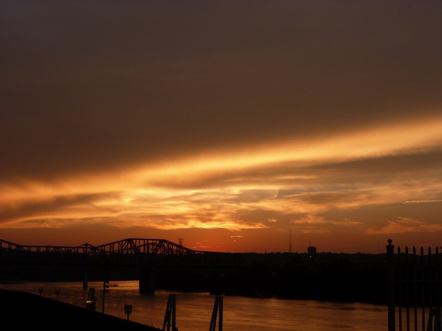
Sunset from the Roebling Bridge
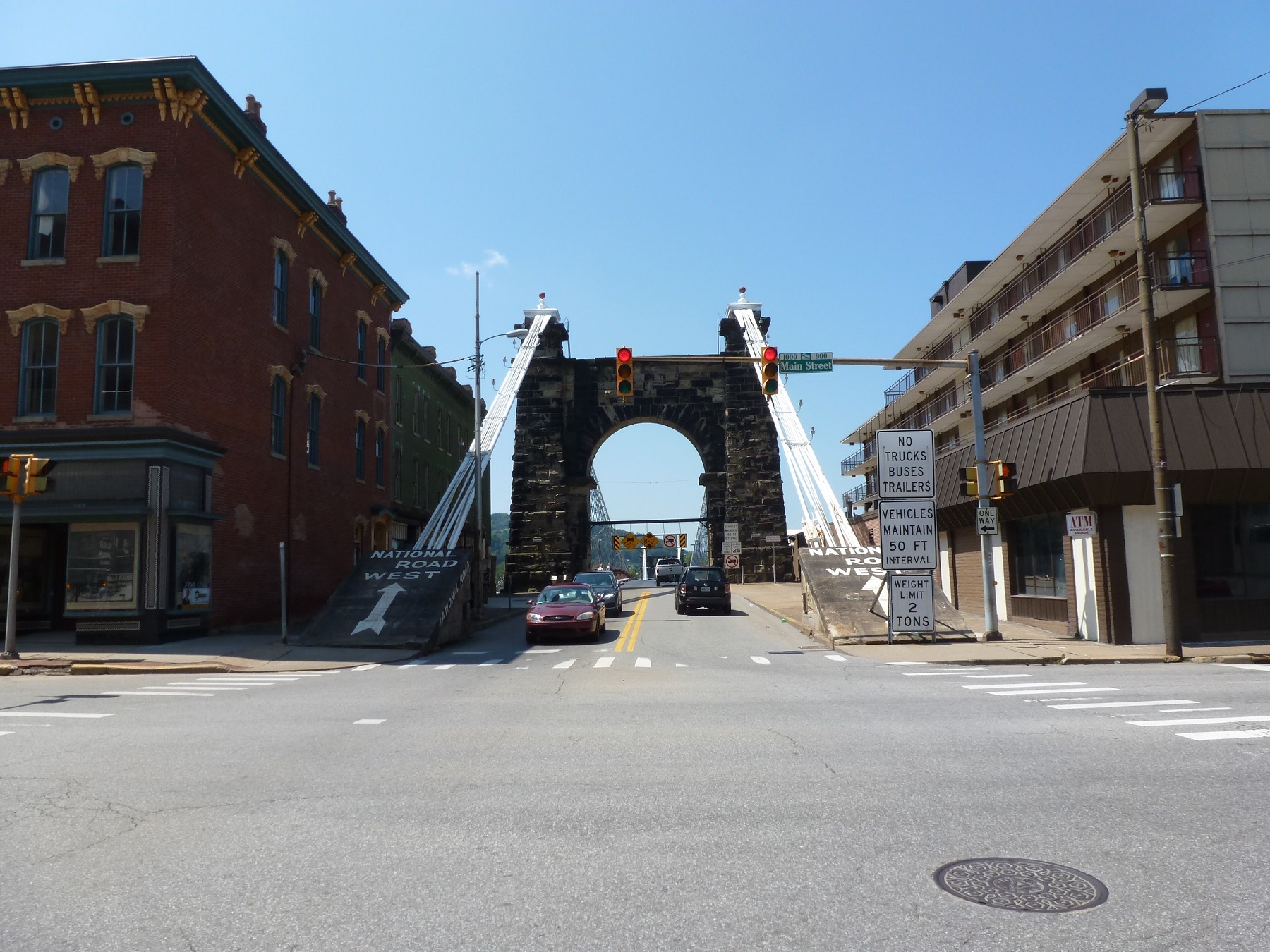
I had a blast with the Wheeling Suspension Bridge. First, I was fascinated by how it was squeezed between the buildings on the mainland side. Second, as an early suspension bridge, it has many parts to ensure that it would stay up, which provided more than the average opportunity to attempt to be artistic in photographing it.


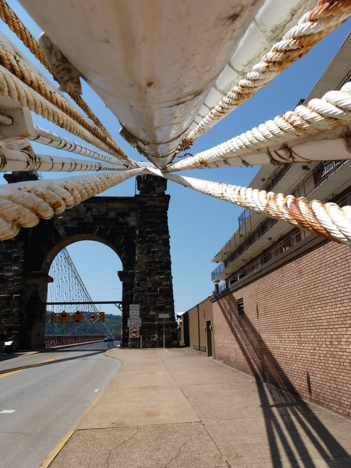
The Wheeling Suspension Bridge was the largest suspension bridge in the world when it was built. Charles Ellet won the competition to design the bridge over John Roebling. There are some similarities in style between this bridge and Roebling’s Brooklyn Bridge with the stone piers and suspension ropes. Before we walked across this one and read the plaque, we were under the impression that it was a Roebling bridge.

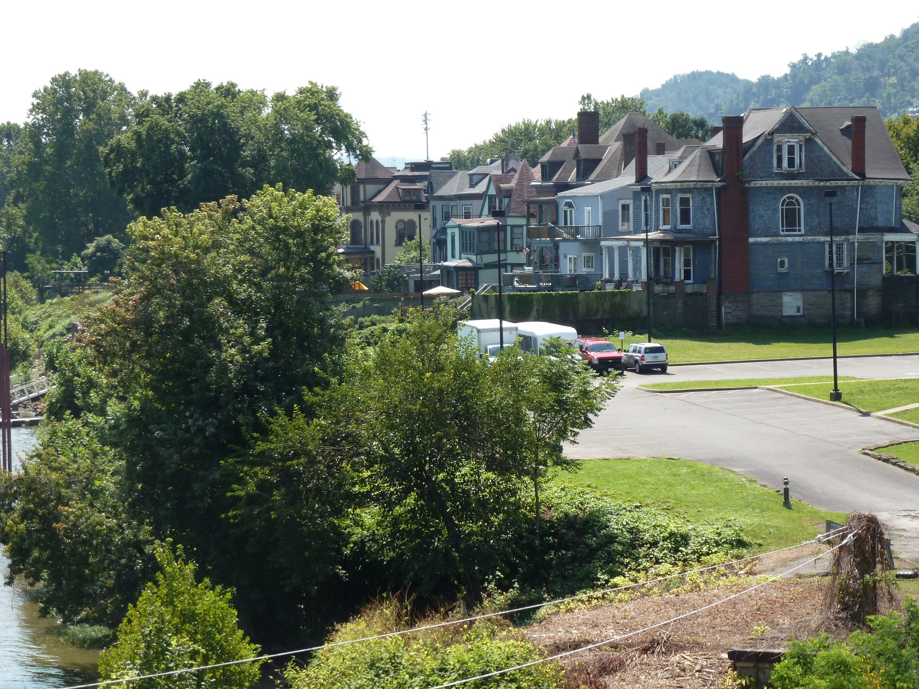
Wheeling has two different trends of riverfront uses than those found in Stuebenville. On one side of the river (island side), is riverfront housing of surprisingly old construction. On the other side (city side), is a modern riverfront park with bike trail.

 The name says it all. This bridge was built as the longest pedestrian- and bicycle-built bridge in the country spanning 4,226 feet across the Arkansas River, connecting Little Rock and North Little Rock. It is part of the Arkansas River Trail.
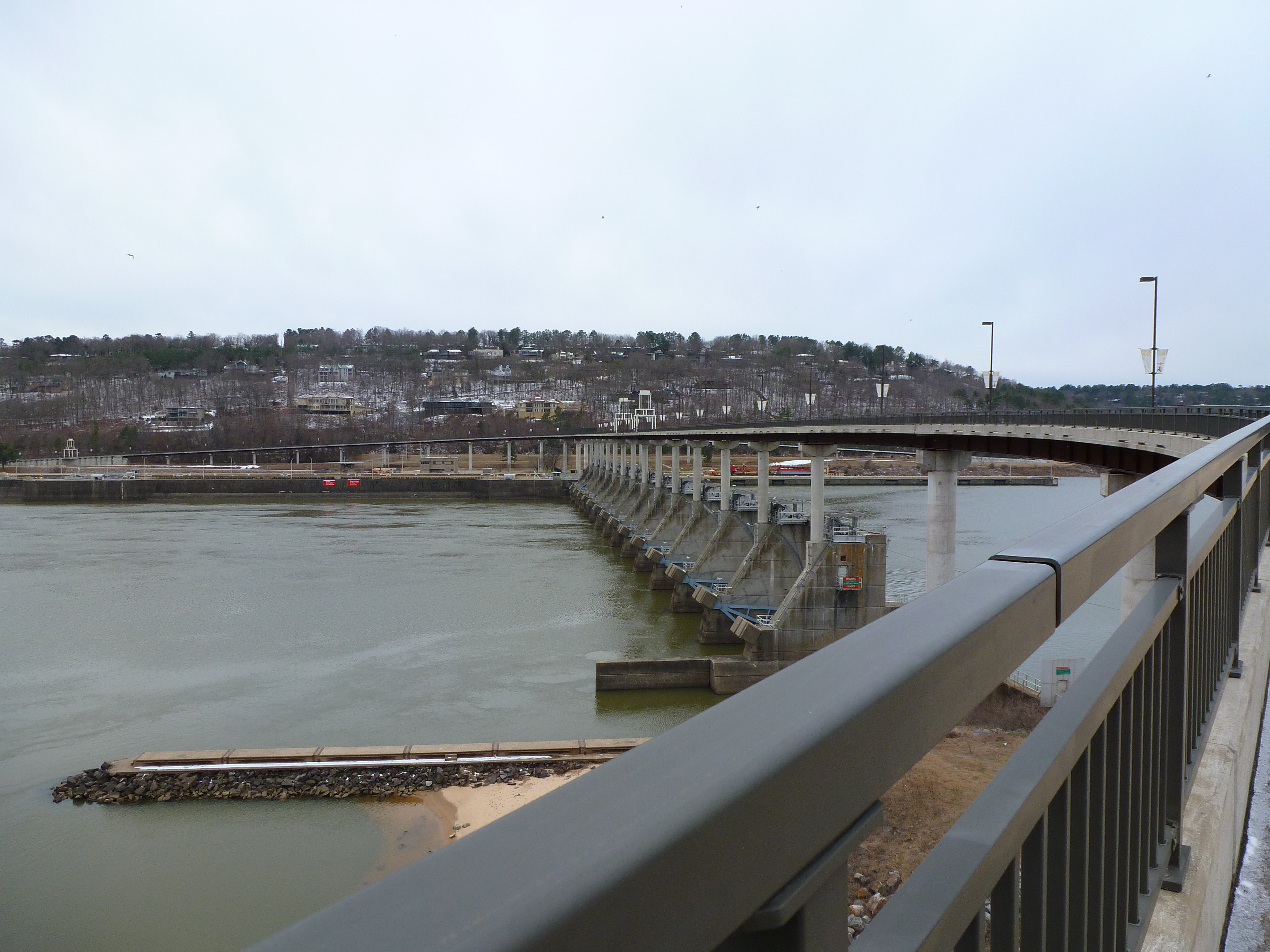
On a trip to Arkansas this winter, I discovered this bridge and naturally had to add it to my list of bridges I’ve walked across. The intention of my trip to Arkansas was to visit friends but also to get a break from the cold northern winter by heading south. When I bought my tickets in January, the Little Rock region was having 60 degree weather. A month later when I arrived, the high was 26.
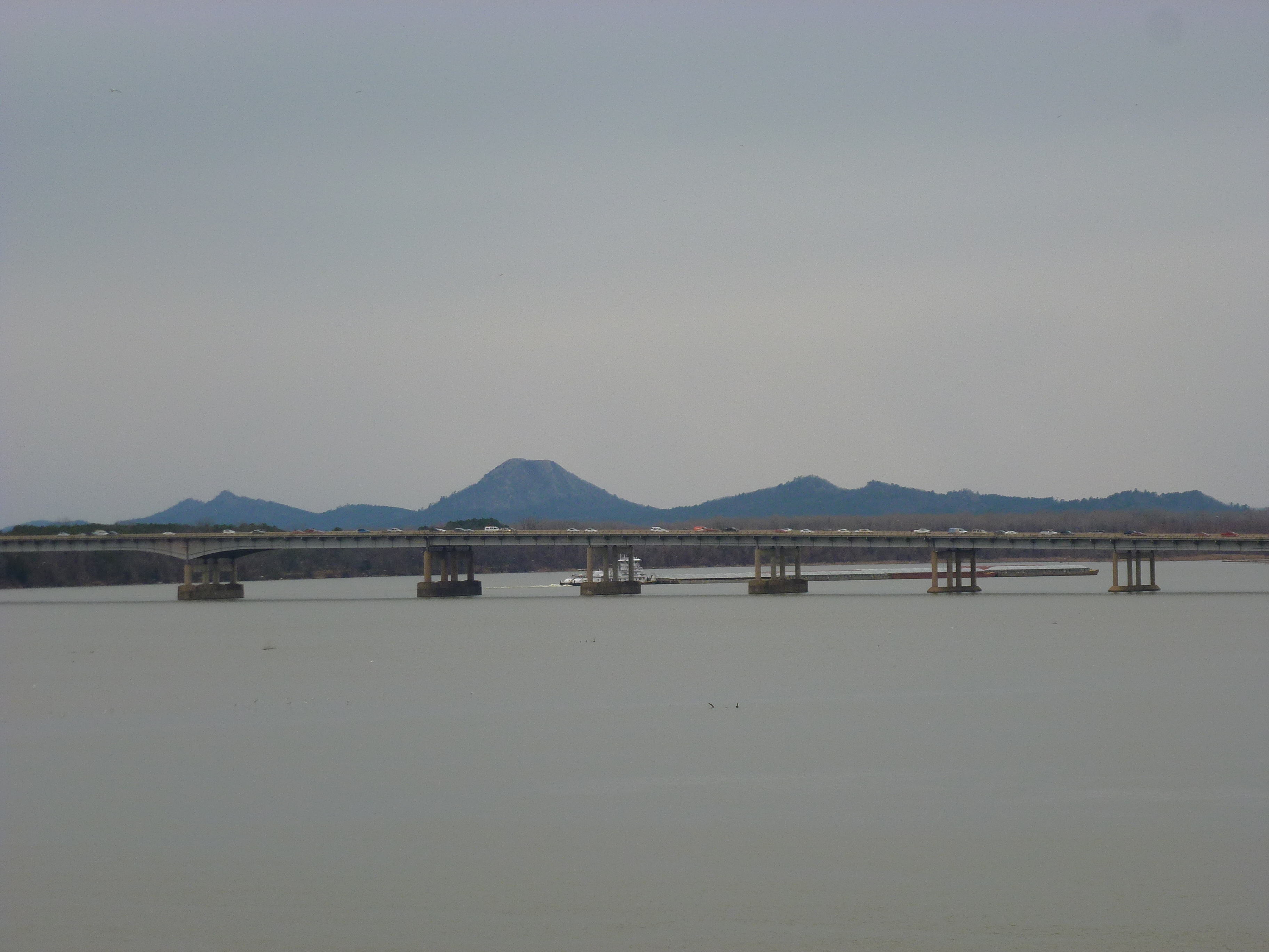
View of Pinnacle Mountain from the Big Dam Bridge

View toward downtown Little Rock showing Rebsaman Park
By the time we reached the half-way point of the bridge, we were frozen stiff. The farther we got on the bridge the stronger the wind got, probably creating a wind chill factor closer to 20 degrees or less. After admiring the views from the midpoint for a minute, the cold and wind forced us to turn back toward the car.
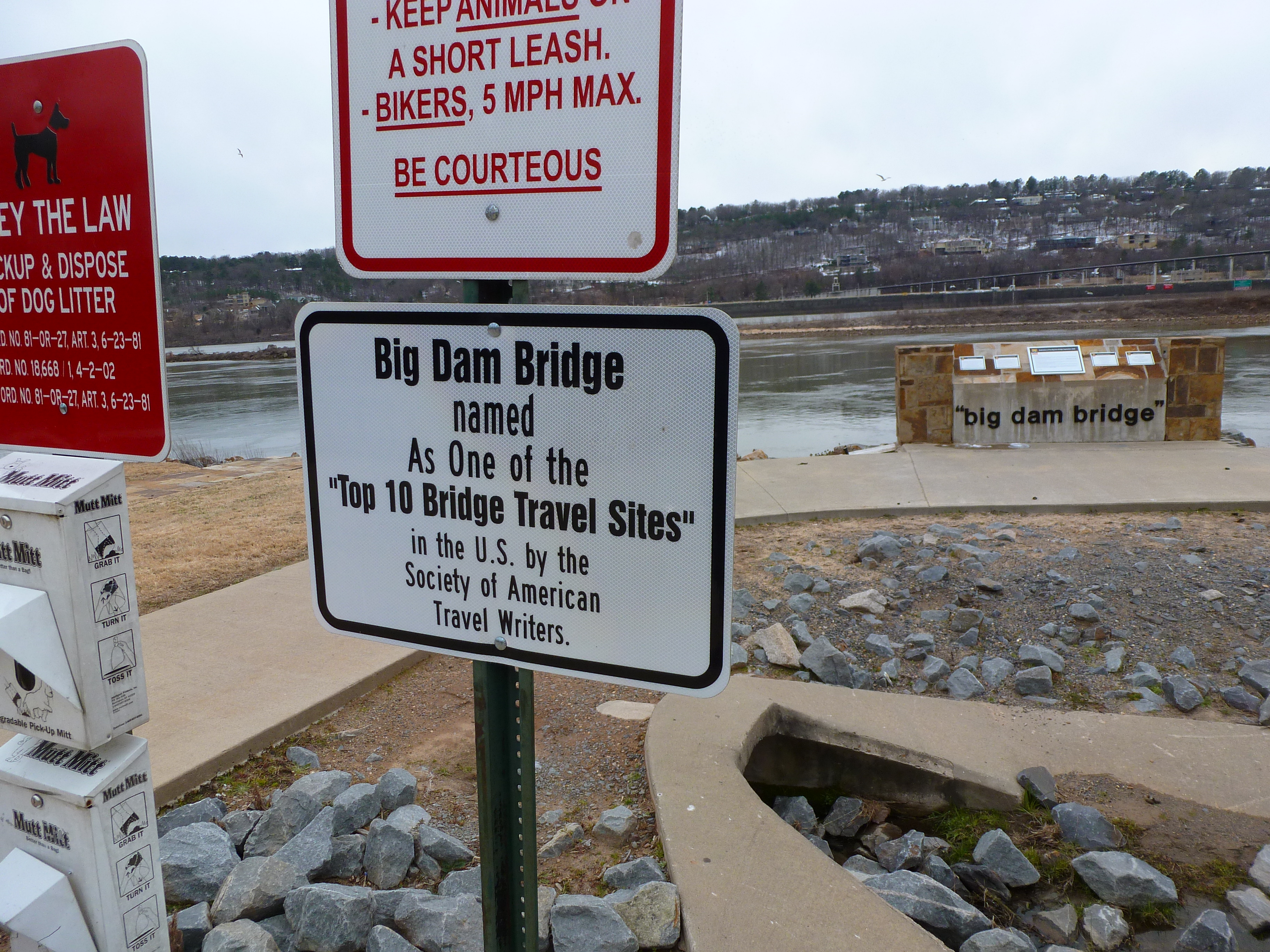 While I didn’t make it all the way across, I can still say I’ve been on one of the Top 10 Bridge Travel Sites in the US. Now I just have to find the other 9 sites.
