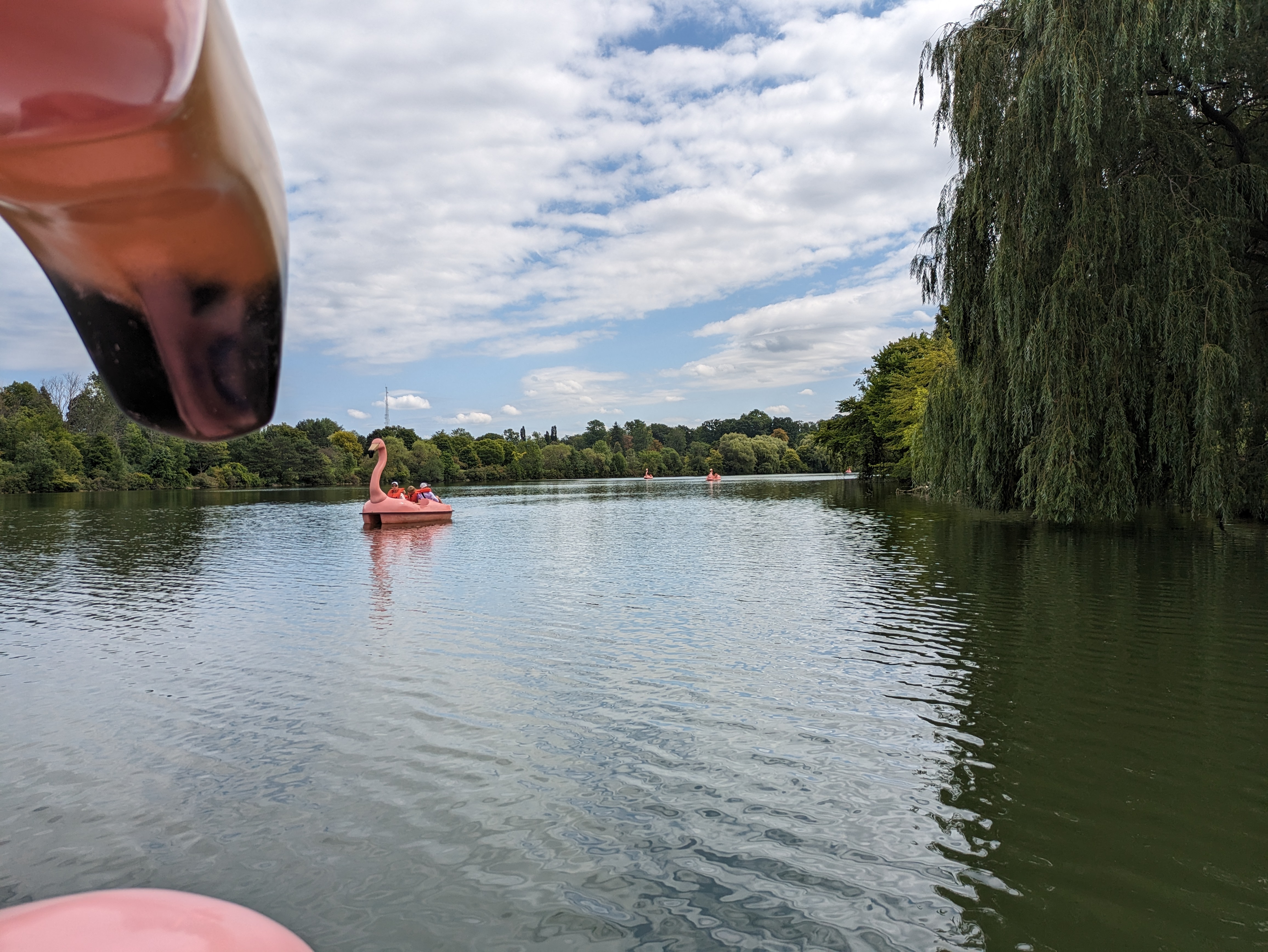
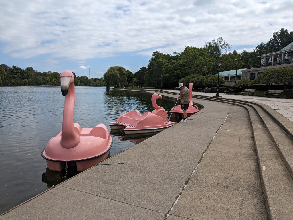
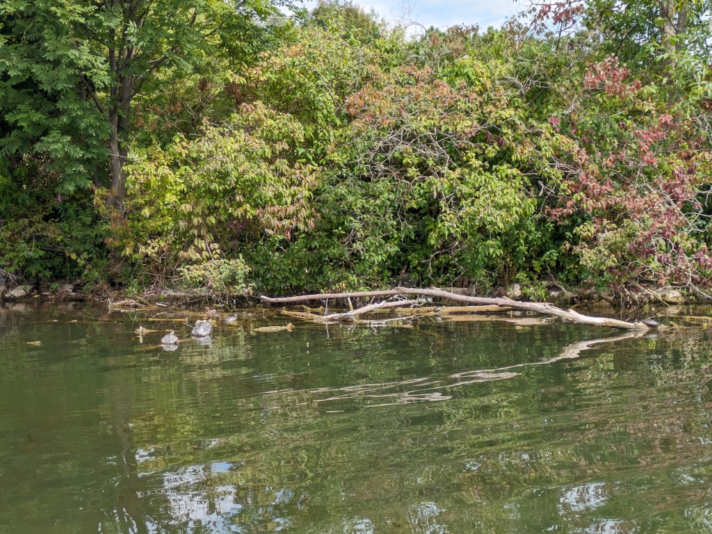
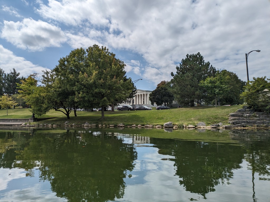
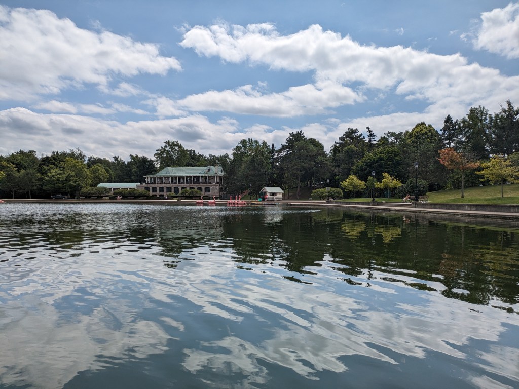
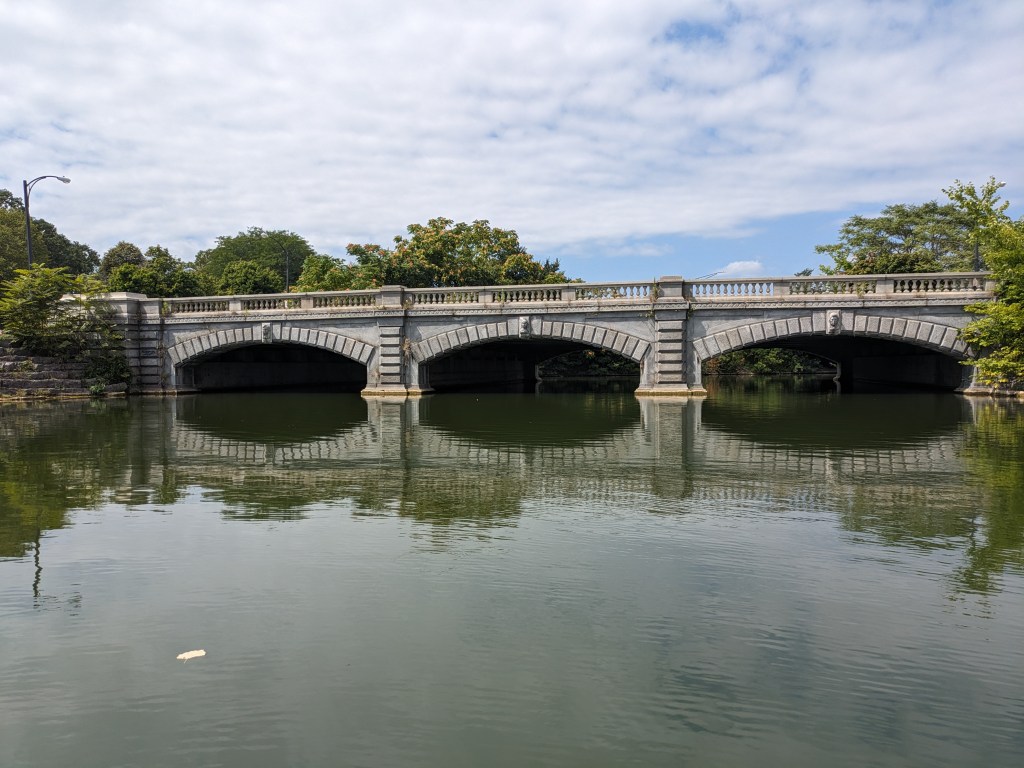
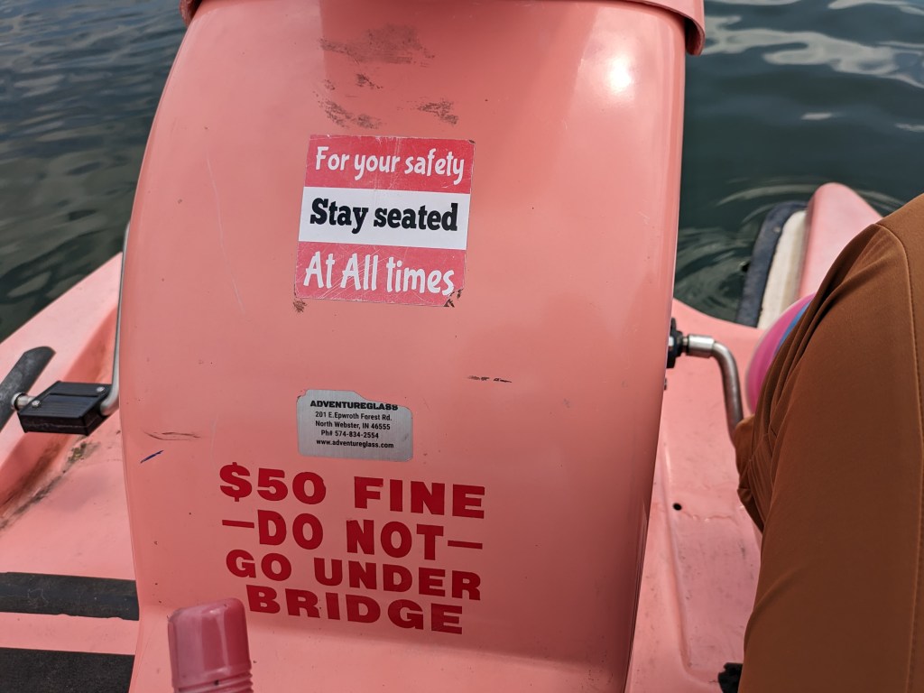
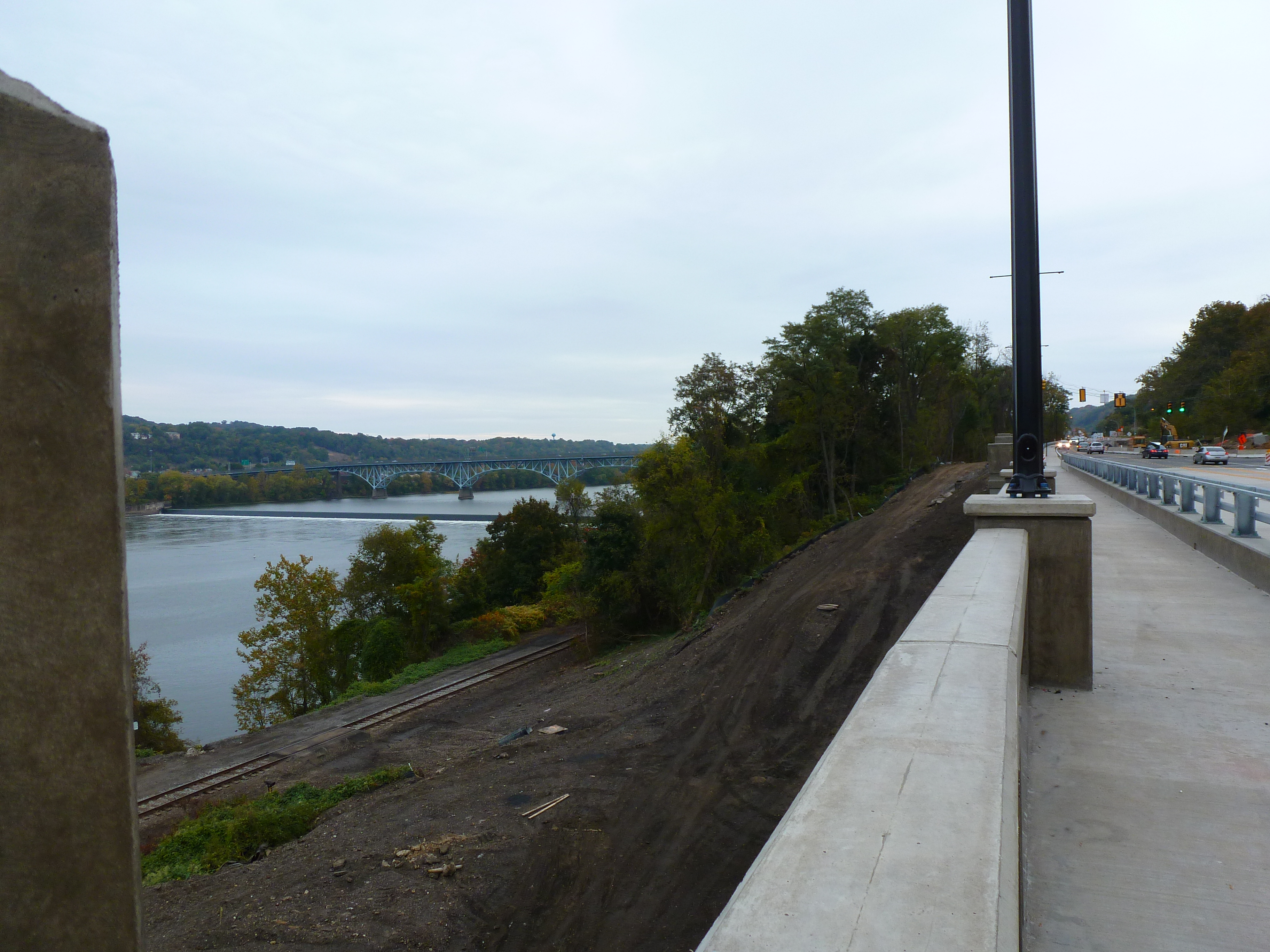
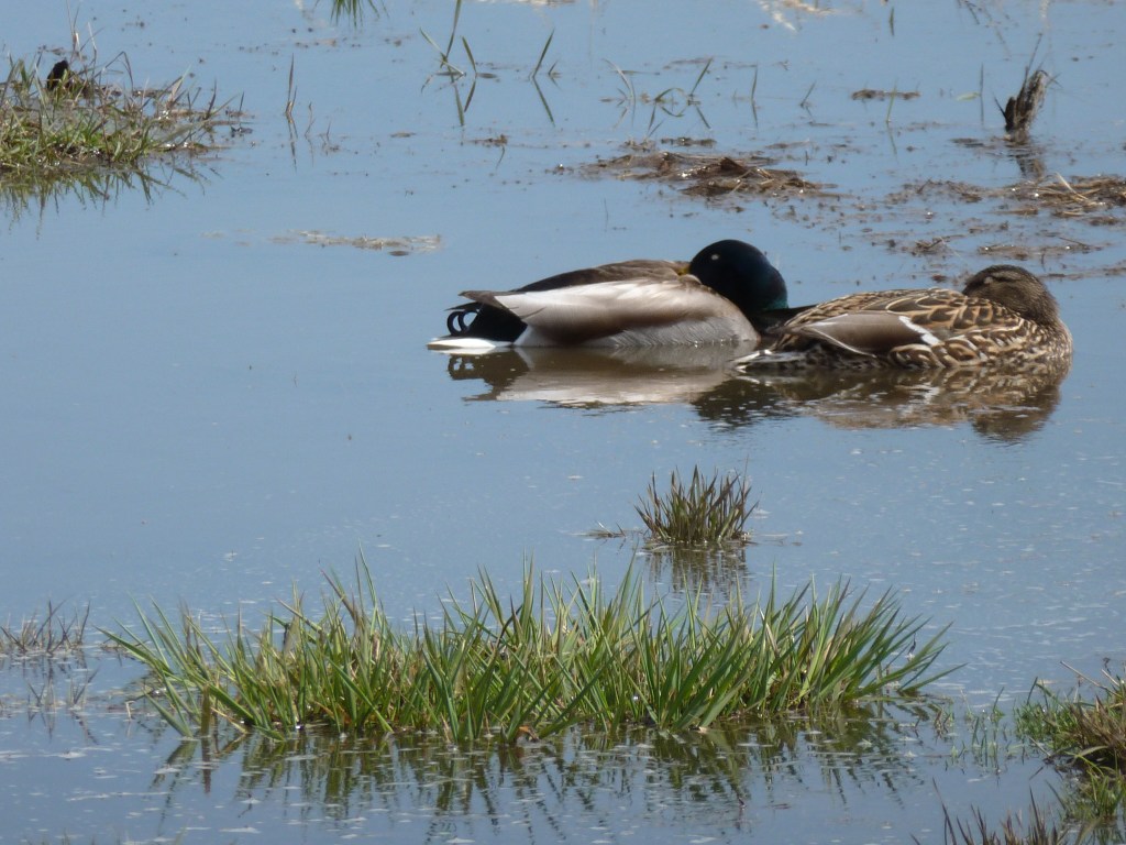
I took an enjoyable interlude in my wanderings in Buffalo’s Delaware Park that included getting the nice lake-eye views of the Lincoln Parkway Bridge I shared last month. I wonder if Frederick Law Olmsted ever imagined something like flamingo paddle boats as a potential use of the lake he designed. I don’t know if he would approve, but I had fun stepping out of the ordinary for a hour to view the lake and the park from the flamingo’s perspective. Below you can vicariously join me on the experience in a short video or in the sample of photos I took around the lake (including one with at least 4 turtles sunning themselves).
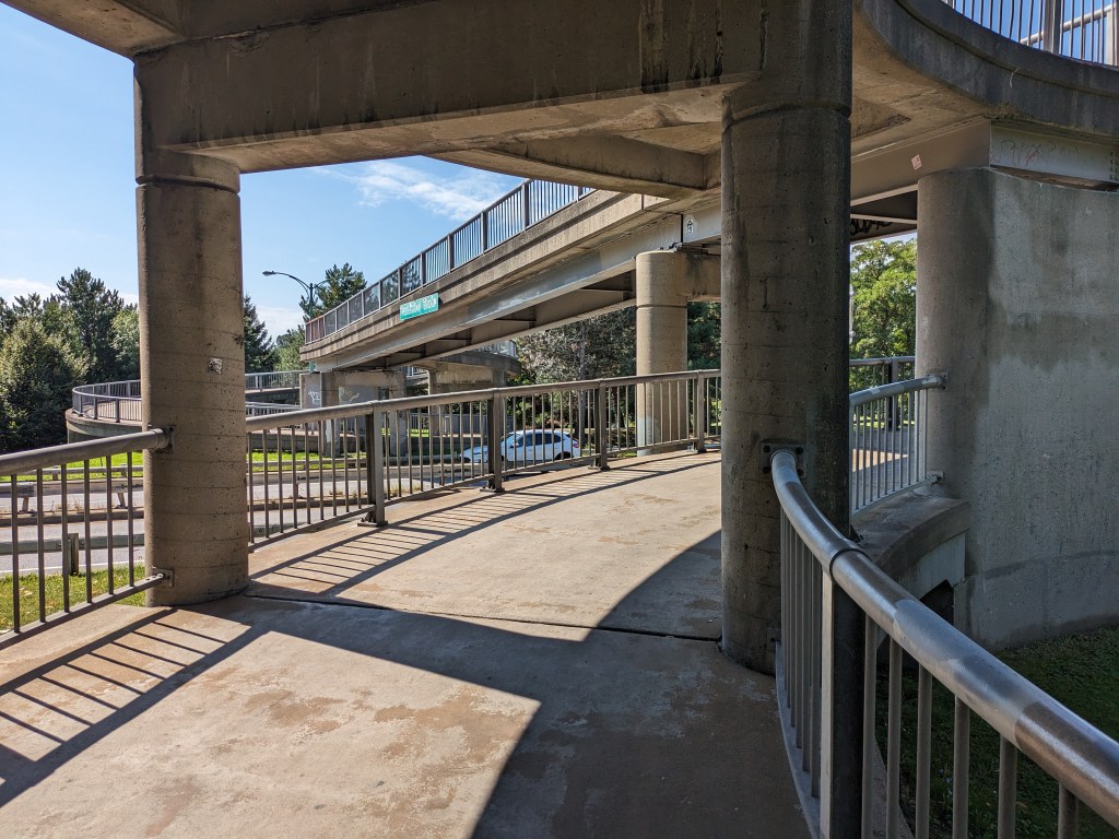
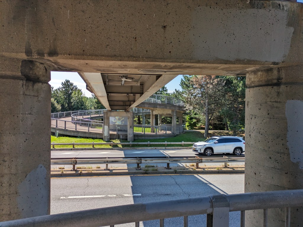
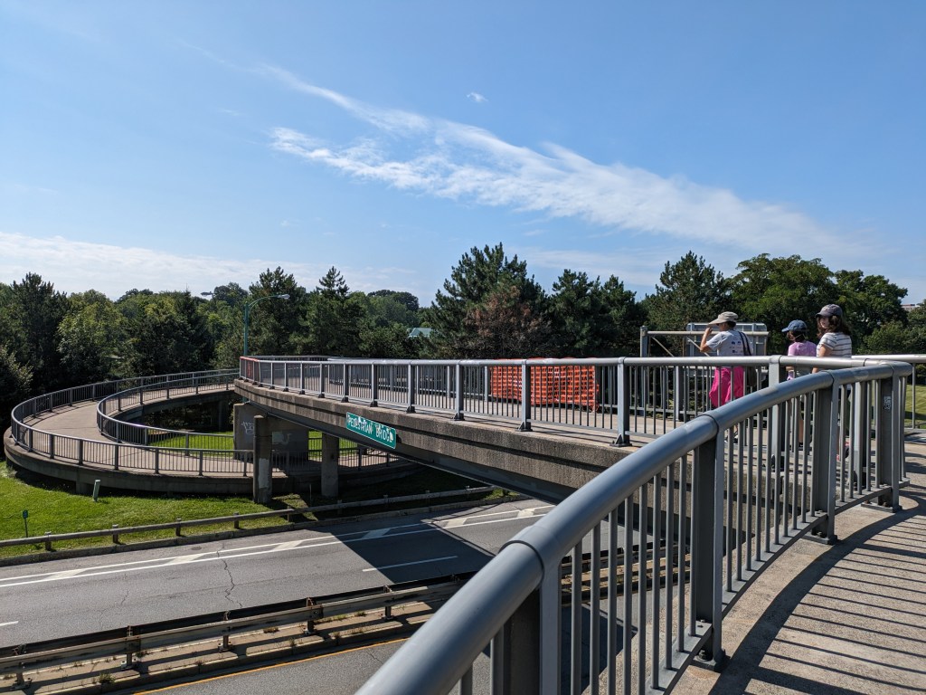
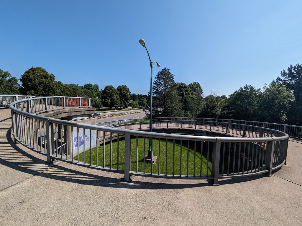
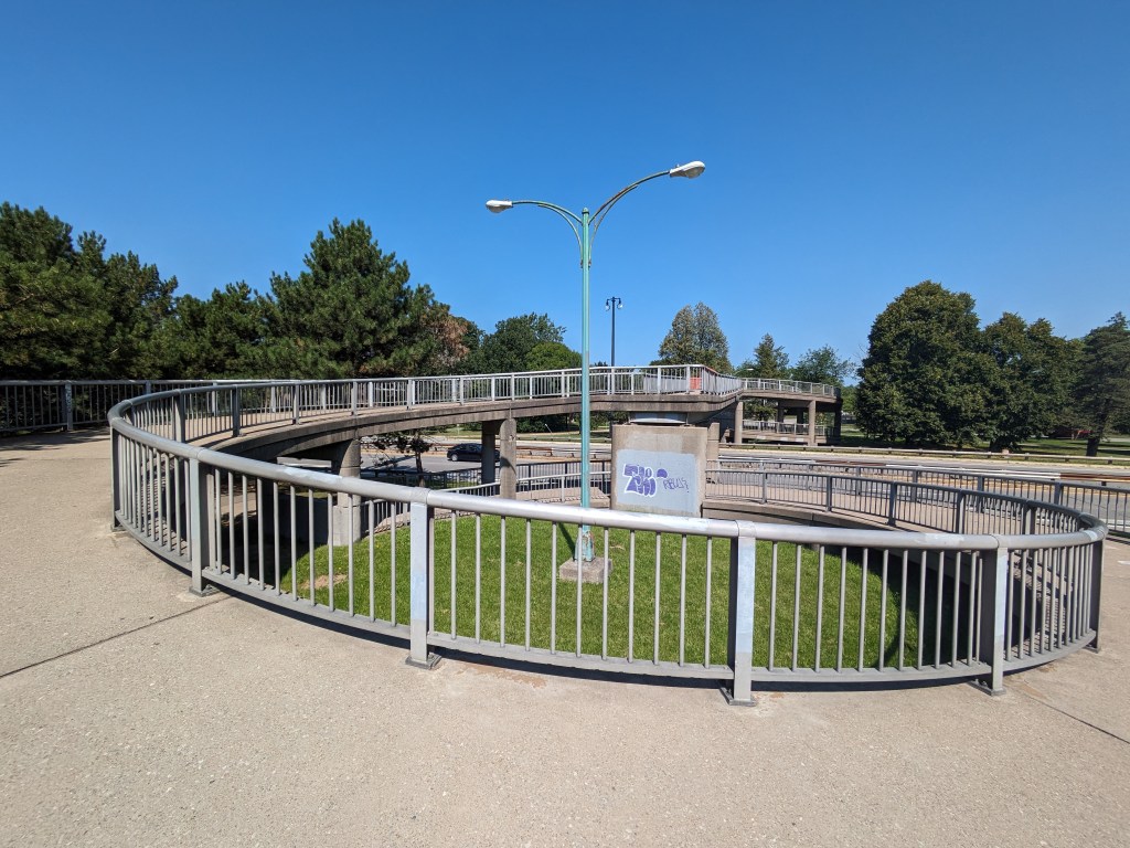
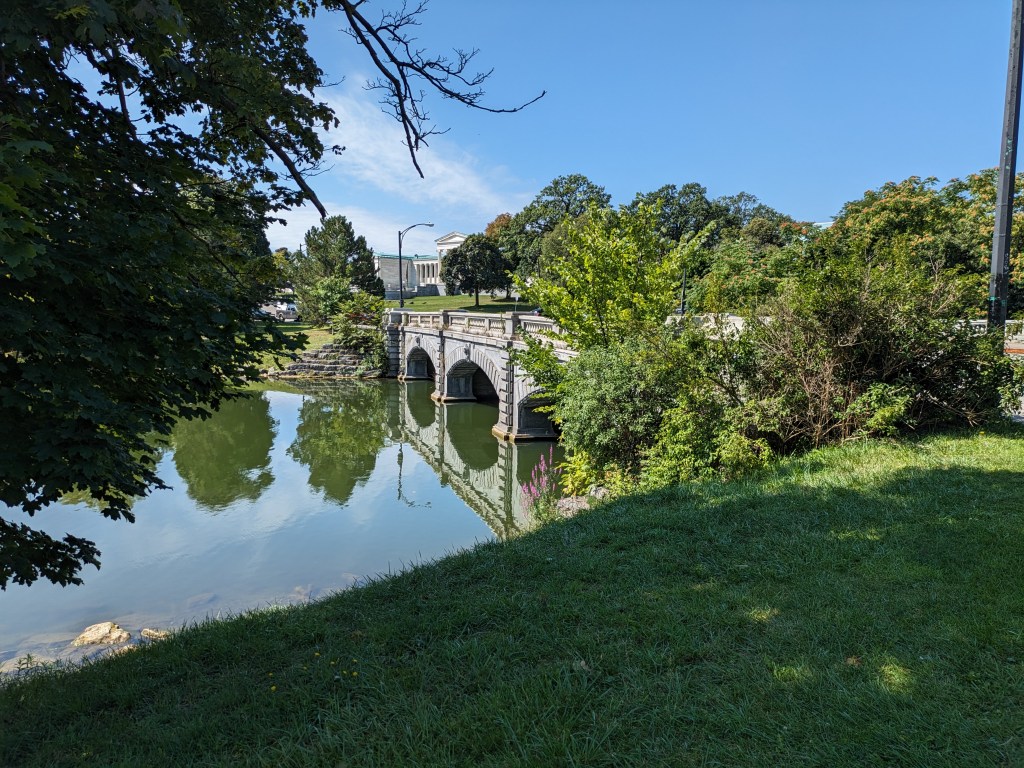
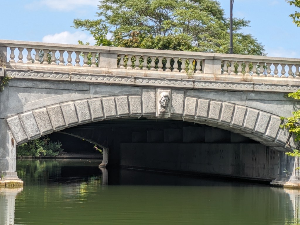
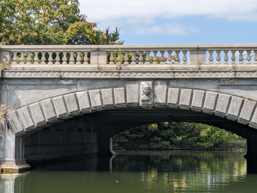
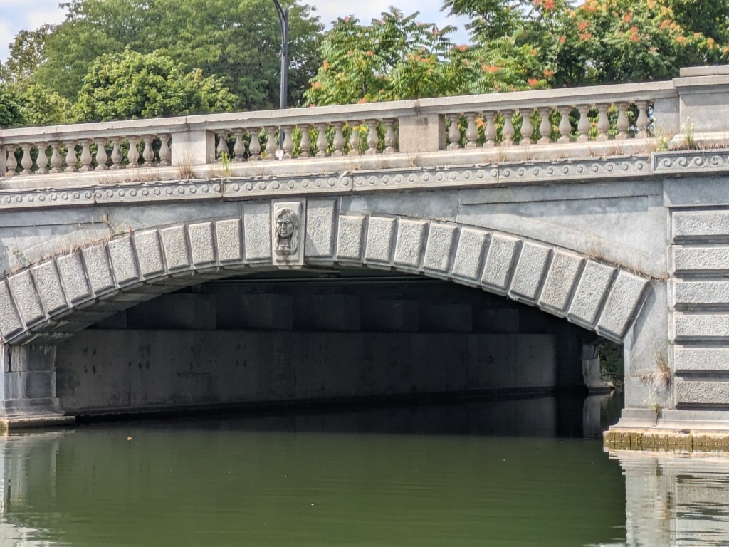
In my meanderings in Delaware Park as part of my exploration of World’s Fair sites, I walked over two interesting bridges: the Whirly-Twirly Bridge and the Lincoln Parkway Bridge. The Whirly-Twirly Bridge is the best named bridge of the 100+ bridges that I’ve encountered since I started walking bridges (even beating out the Big Dam Bridge). It also provides one of the few pedestrian links across the Scajaquada Expressway which divides Delaware Park. The Lincoln Parkway Bridge was built in 1900, perhaps as part of the 1901 Pan-American World’s Fair. If so, the story of this bridge gets drowned out in the attention paid to the temporary Triumphal Bridge with its massive pylons that lasted only as long as the fair. From my observation, the Lincoln Parkway Bridge is a nice, modest scale, stone arch bridge that acknowledges the indigenous people of the area in its sculpture. I was able to get a nice lake-eye view of these sculptures from a rented paddle boat that sadly included a prohibition on paddling underneath the bridge.
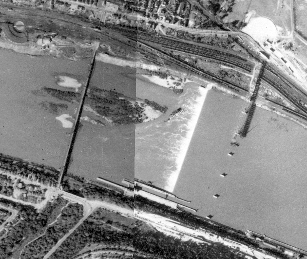
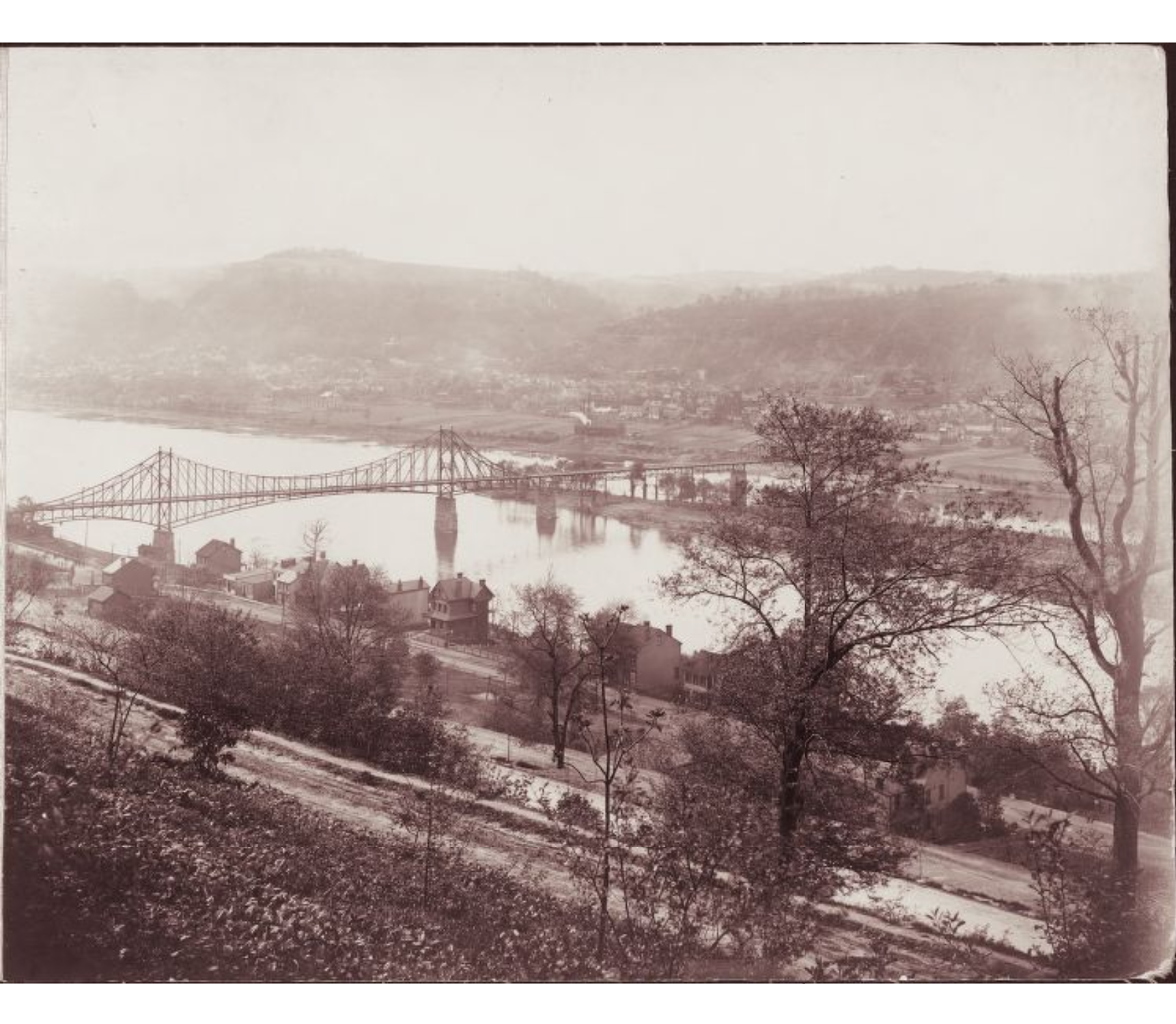
My primary day job this year involves spending lots of time with Pittsburgh archives, particularly maps. That was how I discovered that East Liberty used to have more bridges. Since then, I discovered that the Highland Park Bridge used to be in a completely different location, adjacent to the western end of Heth’s Run Bridge. The image above from the Pittsburgh Historic Maps, an online ArcGIS map viewer, shows the 1939 satellite images for the area with the former Highland Park Bridge to the left and the current Highland Park Bridge under construction on the right.
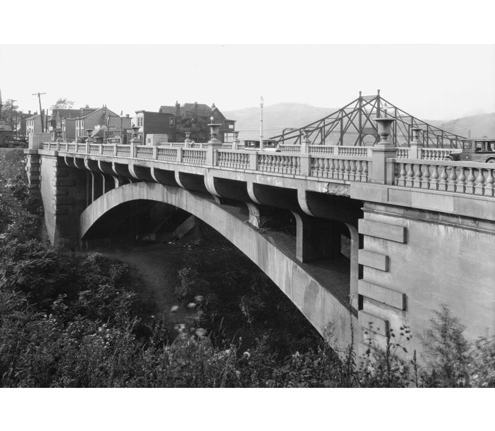
Once again, thanks to Historic Pittsburgh, I found photos of the former bridge. The first pair of photos below shows the Highland Park Bridge beyond the Heth’s Run Bridge, the older one looking west and the newer one looking east. The second pair of photos compares the Heth’s Run ravine in it’s original condition after being bridged to its restored condition after being filled in and then re-excavated. The third pair of photos compares the former and current Highland Park Bridges.
Having now been to two former World’s Fair sites, I felt compelled to round it out with a third. Weeks before COVID hit, I was in the planning phase for a trip to Buffalo when I discovered that they had held a World’s Fair in 1901. I had found my third site, though the visit was delayed several years from the fallout of COVID and life.
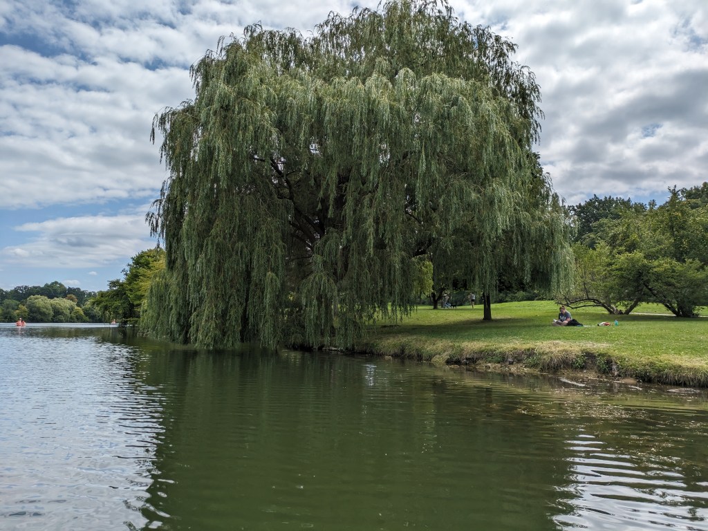
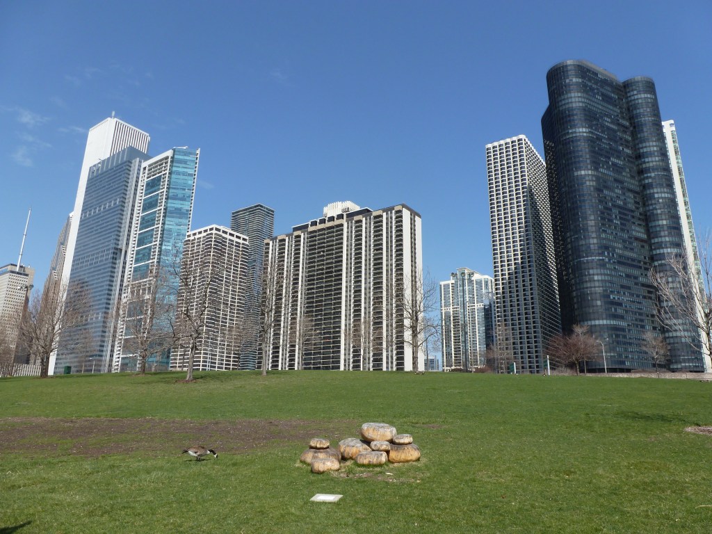
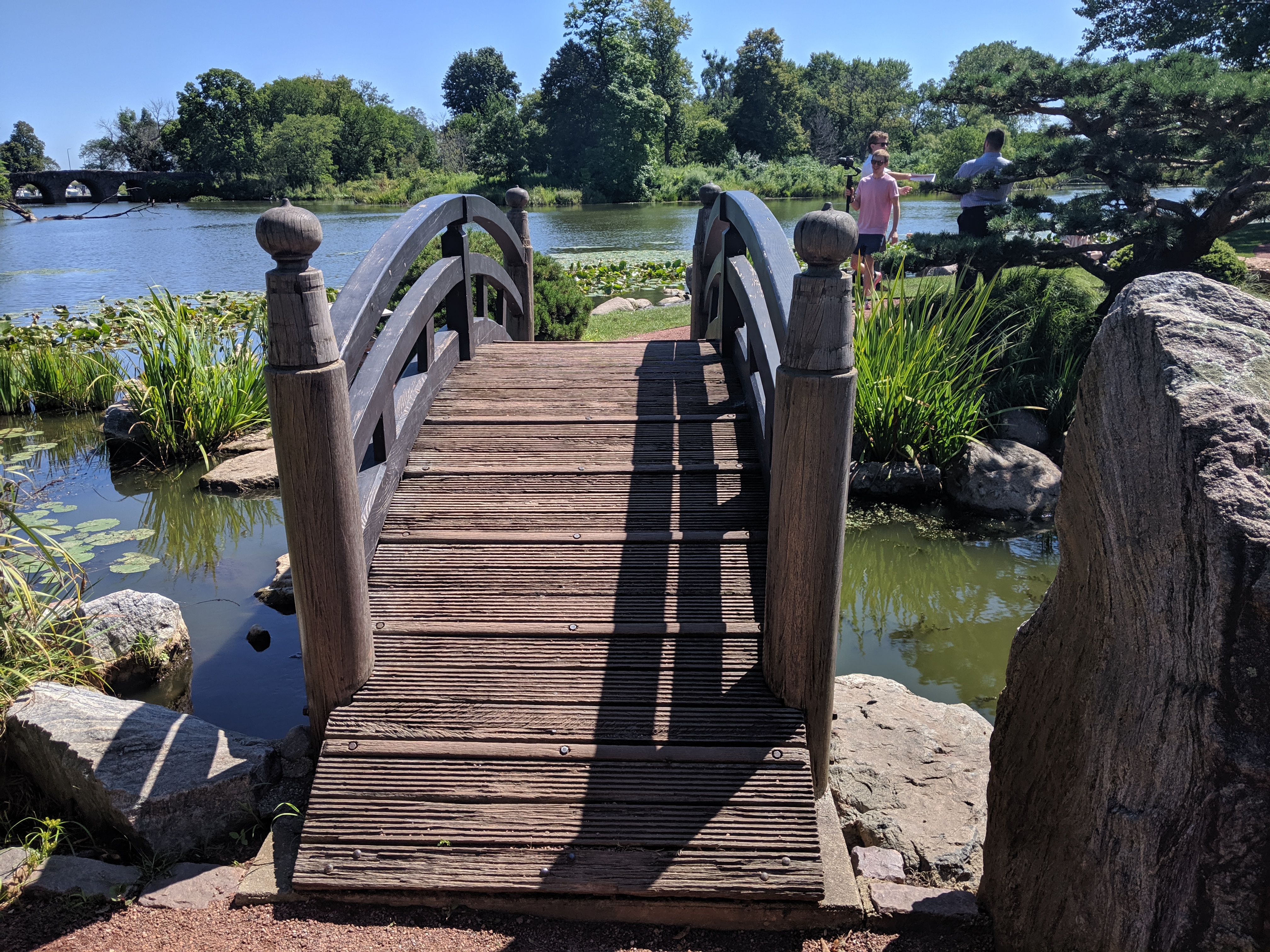
As I got off the bus at the end of a bridge over an expressway, I had moment of panic before seeing I was right next to the History Museum and a quiet residential neighborhood, just as I had intended. There were several parallels between this site and those I explored in San Francisco and Chicago, but the feel of the place was completely different. There was the characteristic lagoon, or in this case lake, surrounded by park, but the park and lake were designed by Frederick Law Olmsted long before the idea of the fair was born. Like Chicago, the remaining fair building(s) was used as a museum, and while the architecture is intended to inspire awe and perhaps intimidation, it is the normal awe and intimidation of the average temple to art or history seen in many cities and not the massive scale of San Francisco’s Palace. The park is also bisected by a road with dangerously fast traffic, but there are multiple safe pedestrian crossing points over and under (including the Whirly-Twirly Bridge). There was a Japanese Garden here as well, but it was installed decades after the fair and was illustrative of the fact that this site had a life before the fair and continues to have an on-going life after the fair.
The remainder of the fair site between the park and the railroad tracks where the fair had a station has been fully redeveloped. Over half of that area is now residential neighborhood(s) with a variety of housing types from modest single-family dwellings to large homes with security fencing and landscaping staff. (Passing these houses and taking photos, I again felt the potential for someone to approach and question my belonging and right to explore.) There were also two-family dwellings and apartments. I passed two schools, a former church, some industrial properties, a paddock, and a strip mall. One of the residential streets had a sign acknowledging the past as the site of the 1901 Pan American Exposition. Otherwise, I wouldn’t have know I was on the site of a former World’s Fair without having carefully studied the map of the fair beforehand. I felt as though I was in any other neighborhood of any other city that is flat and that has residents who have at least a little, though in many parts it was clear that the residents had a lot.
As I had unintentionally read about the World’s Fairs in San Francisco and Chicago before visiting those sites, I decided that I needed to intentionally read about Buffalo’s before going so that there would be some consistency in my approach. One of the points that Margaret Creighton reiterated in her book The Electrifying Fall of Rainbow City was that Buffalo was trying to outdo Chicago (they picked the Rainbow City theme and lighting scheme to be in direct contrast to Chicago’s White City). In the end, and certainly not helped by the fact that President McKinley was shot at the fair, Buffalo did not have the success they sought in receipts or in numbers of visitors.
Having now visited both Chicago and Buffalo’s fair sites, I would say that over 100 years later, Buffalo has had the greater long-term success on its fair site than Chicago. The entire area once covered by the fair is now, and has been for some time, an actively used location. From the park with a number of tourists and residents enjoying all the amenities (even in the middle of a Monday at the beginning of the school year) to the homes to the businesses, Buffalo’s fair site must by this point have long outstripped Chicago’s in number of visitors/residents/users and in tax revenue/receipts.
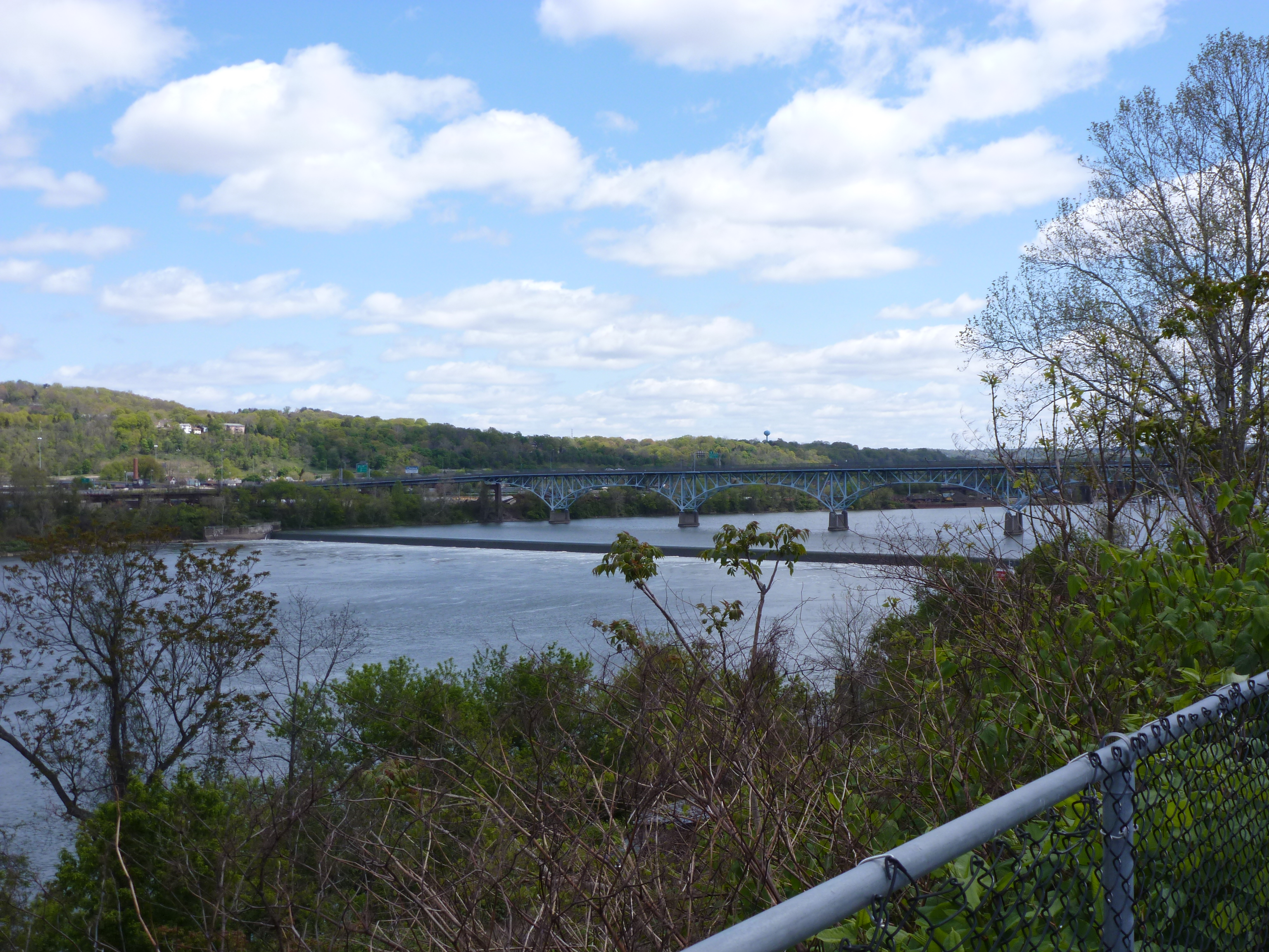
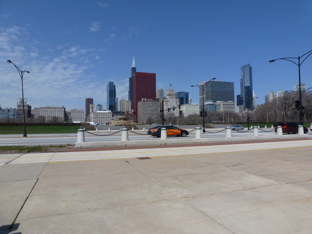
I’ve had multiple aborted experiences in Chicago. In 2013, I aborted an attempt to bike to the 1893 World’s Fair site. In 2019, I aborted an attempt to reach the waterfront. But during the eventually aborted bike ride, I experienced several miles of interesting waterfront. I don’t recall how I got to and from the waterfront for the bike ride as Chicago has the classic US urban problem of using highways to divide the waterfront from the rest of city. Once I was on the waterside, I enjoyed a variety of natural, architectural, and sculptural sights. I even unknowingly captured the remaining buildings from Chicago’s other World’s Fair (post pending).
My fascination with World’s Fairs was started when I was a child by Laura Ingalls Wilder and the San Francisco Panama-Pacific Exposition. It has continued as an adult. Chicago’s 1893 World’s Columbian Exposition is the World’s Fair for planners. The “White City” was the first major example of the City Beautiful Movement, an attempt to reduce or eliminate the unhealthy, overcrowded cities of the time.
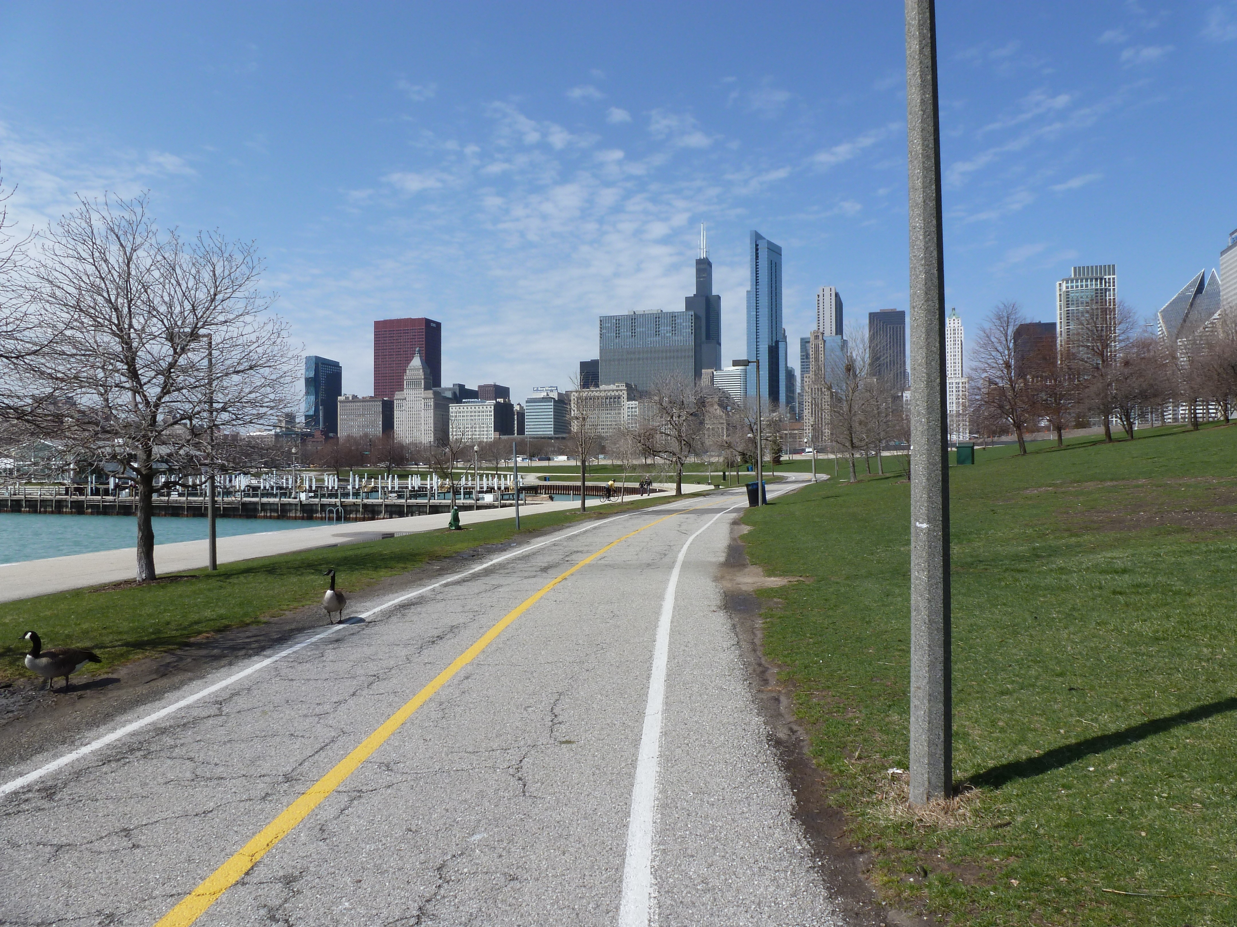
After years of hearing about the importance of the 1893 Chicago World’s Fair in planning and architecture and after reading Eric Larson’s The Devil in the White City, I made it a goal to visit the fair site. On one trip to Chicago when the weather was beautiful, I rented a bike and rode down the waterfront trail toward what was left of the White City. This was before I had a smart phone which meant I turned around and gave up because I feared that I had misjudged the distance by bike trail. Later, I realized I was probably pretty close and if I had only gone around one more curve, I would have seen my destination.
My next trip to Chicago was the same year I visited San Francisco. This time, I took a bus to the fair location. I picked the bus stop that on the map appeared to be the closest stop to the remaining places of interest from the fair. When I stepped off the bus onto a broken sidewalk, I found a desolate expanse of vacant land, scraggly trees, and pock-marked lawns. A weary walk presented itself every way I turned.
The bus didn’t run frequently out there. The roads that crossed the vacant expanse stretched far and wide, empty except for the random sudden appearance of a single speeding vehicle.
As soon as I had stepped off the bus and it drove off, I felt tired and scared. I wondered how to extricate myself from this horrible environment. I had some additional information that expanded the negative emotions stirred by the conditions around me. I had heard or read somewhere that the former Midway, which was where I got off the bus, was used as a sort of DMZ buffer to keep “those people” (in this case, primarily people with little income or people of color) away from the University of Chicago campus. I had clearly landed in the middle of a land of have-nots.
As I had come this far with a purpose and there seemed to be little else to do, I moved forward toward the lake. Migraine-inducing music was blaring from an unseen picnic far away and it followed me wherever I went. After feeling like I had taken my life in my hands by daring to cross the road where at any second a car could come speeding by, I reached a path among experimental plantings. Following random turns, I found the lagoon from the fair. The one white building that remained was on the opposite shore and was surrounded by scaffolding. The walk that once circumscribed the water was shut off by a menacing 6-foot high, chain link fence and a bridge that divided the lagoon seemed no longer safe to cross over, though passing under through the muck and mud was an option.
I eventually found a way forward and reached the Japanese Garden that was developed for the fair and remains a peaceful spot. Prior to that, at the moment of being confronted with a security fence and a broken bridge, the fear and doubt that often accompanies me on my explorations became overwhelming. What if I’m stopped? What if I’m questioned? Do I have a right to explore here and pass this way? Do I have a right to explore places and pass judgement?
East Liberty Station Pedestrian Bridge, August 2020, Carolyn RistauSpahr Street Pedestrian Bridge, February 2022, Carolyn Ristau
The winner of the 2024 Bridge Madness tournament, the East Liberty Station Pedestrian Bridge, faced stiff competition in the Final Four round from the Spahr Street Pedestrian Bridge. Both of these bridges are relatively new, constructed with funding sources from the Obama Administration. When I moved to Pittsburgh 15 years ago, neither of these bridges existed. There was no pedestrian connection at Spahr Street and the pedestrian bridges at East Liberty Station were boxed-in bridges with no greenery. (For a side-by-side comparison of the prior and current East Liberty Station bridges see their Then and Now post.) These are not the only changes to bridges in this area. In fact, I suggest that East Liberty has seen more bridge turn-over in the last 100 years than any other part of Pittsburgh.
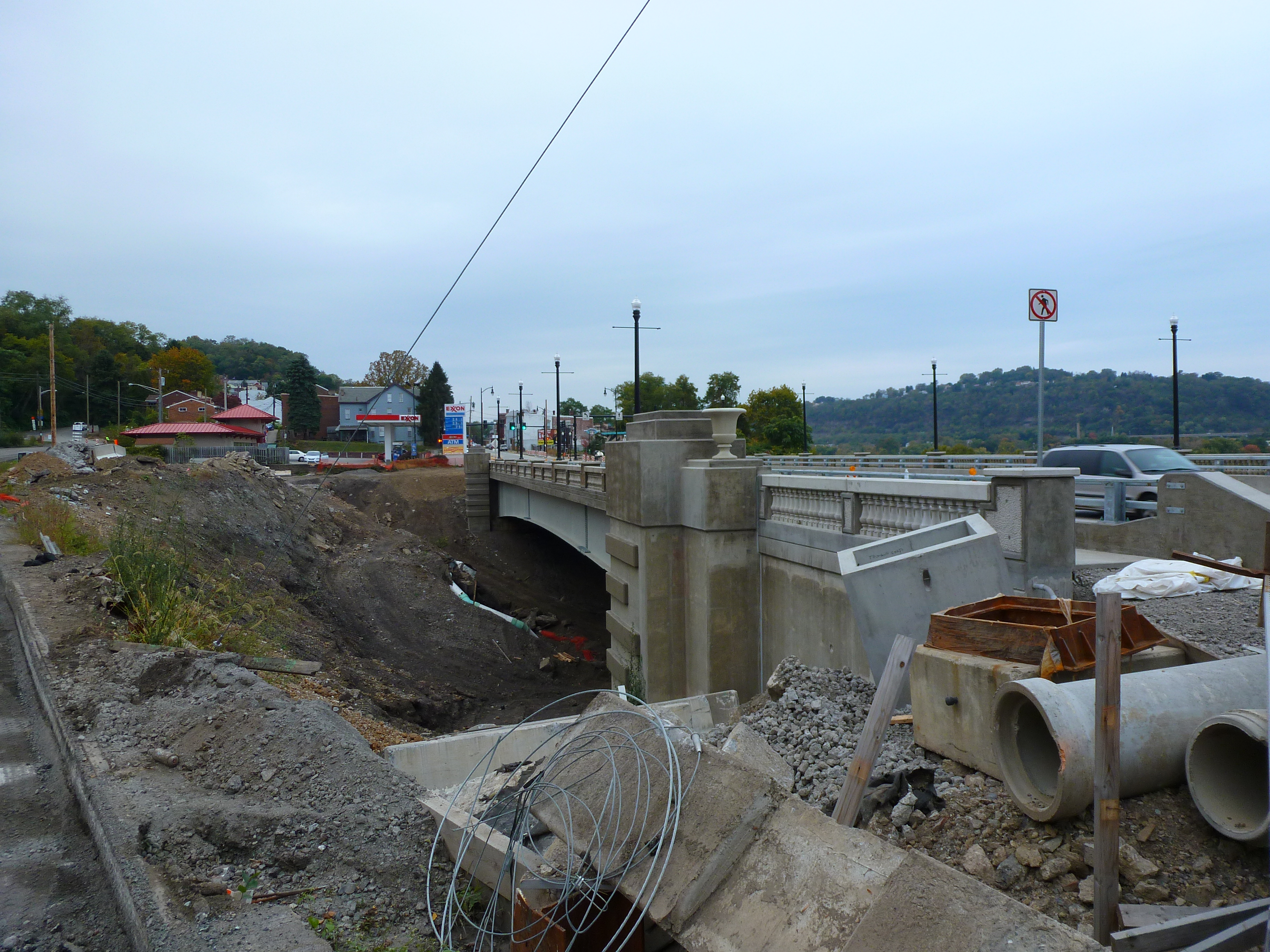
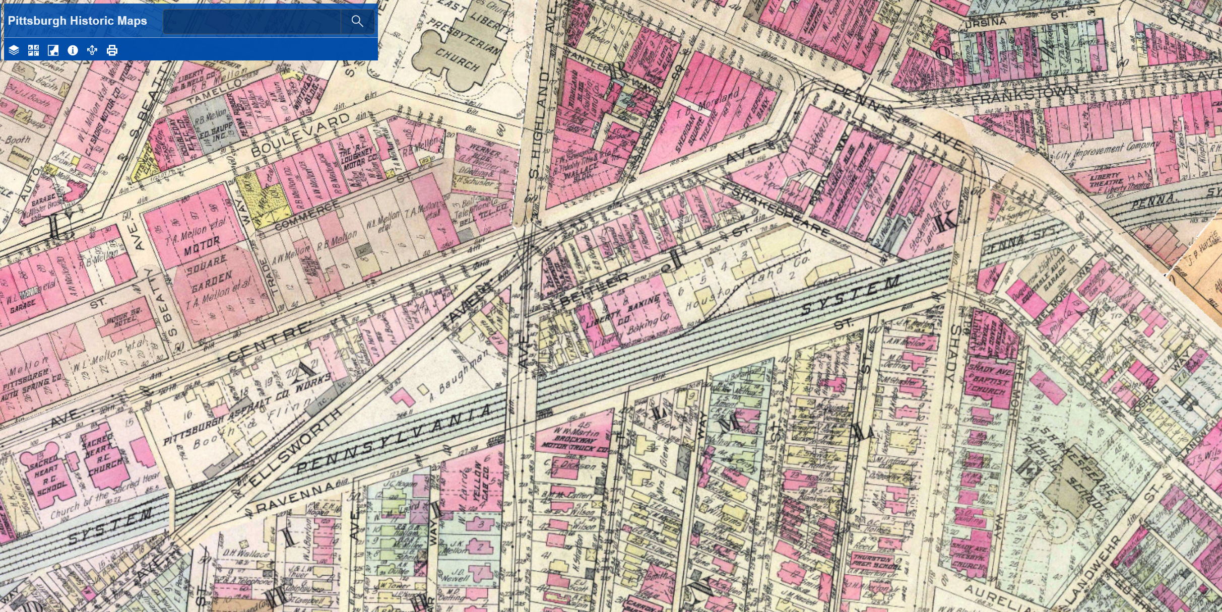
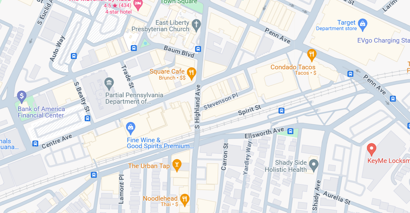
The Penn Avenue and South Highland Avenue Bridges have stayed fairly constant, at least as far as location is concerned. The South Highland Avenue Bridge was rebuilt and redesigned in the 15 years I’ve lived here. While the Spahr Street Pedestrian Bridge is new, the 1923 G. M. Hopkins map above shows that there used to be a pedestrian bridge at this same location. The historical precedent for a pedestrian bridge here may be another factor for why the bridge was located here and not further east where residents have been asking for a pedestrian bridge for years.
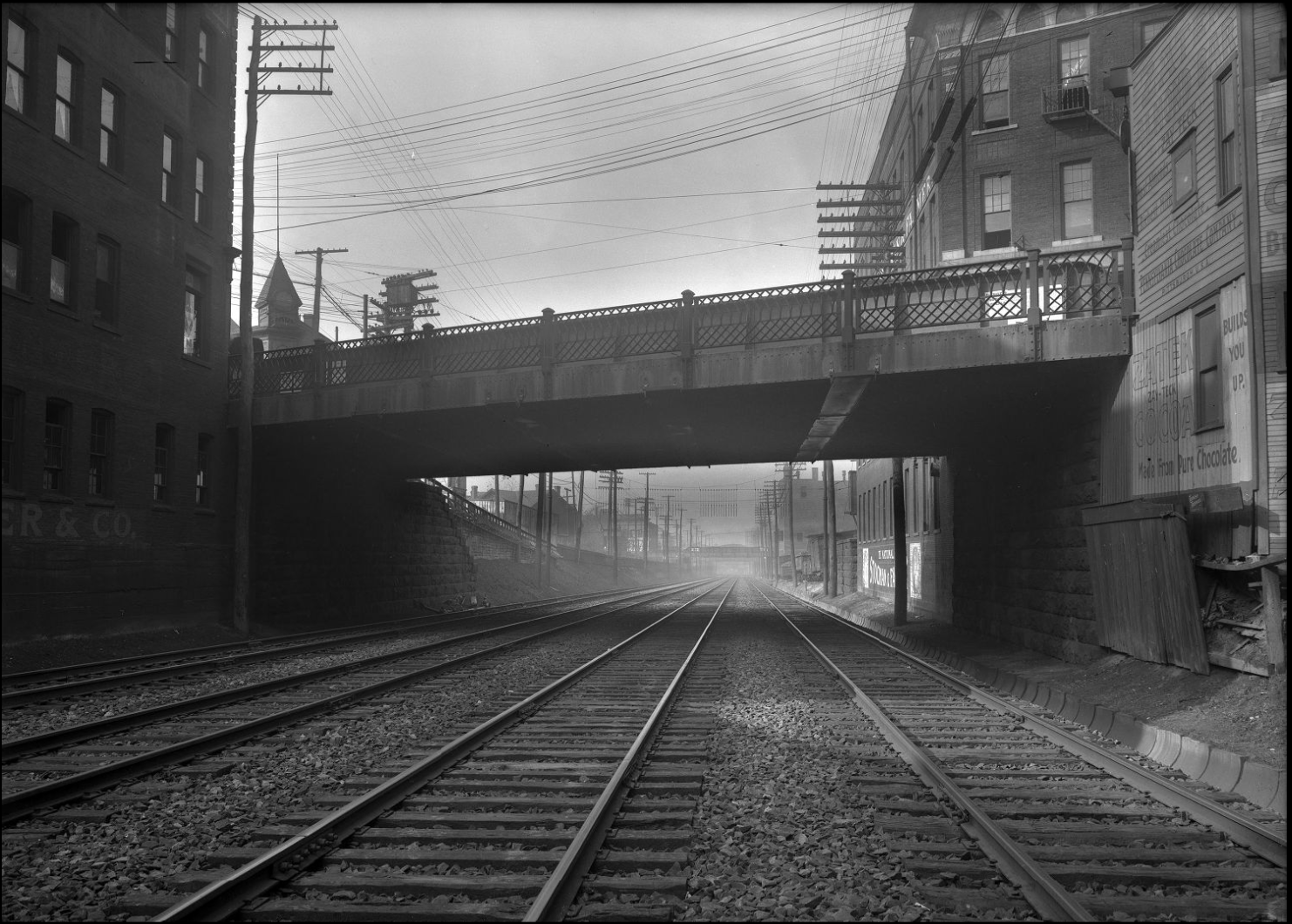
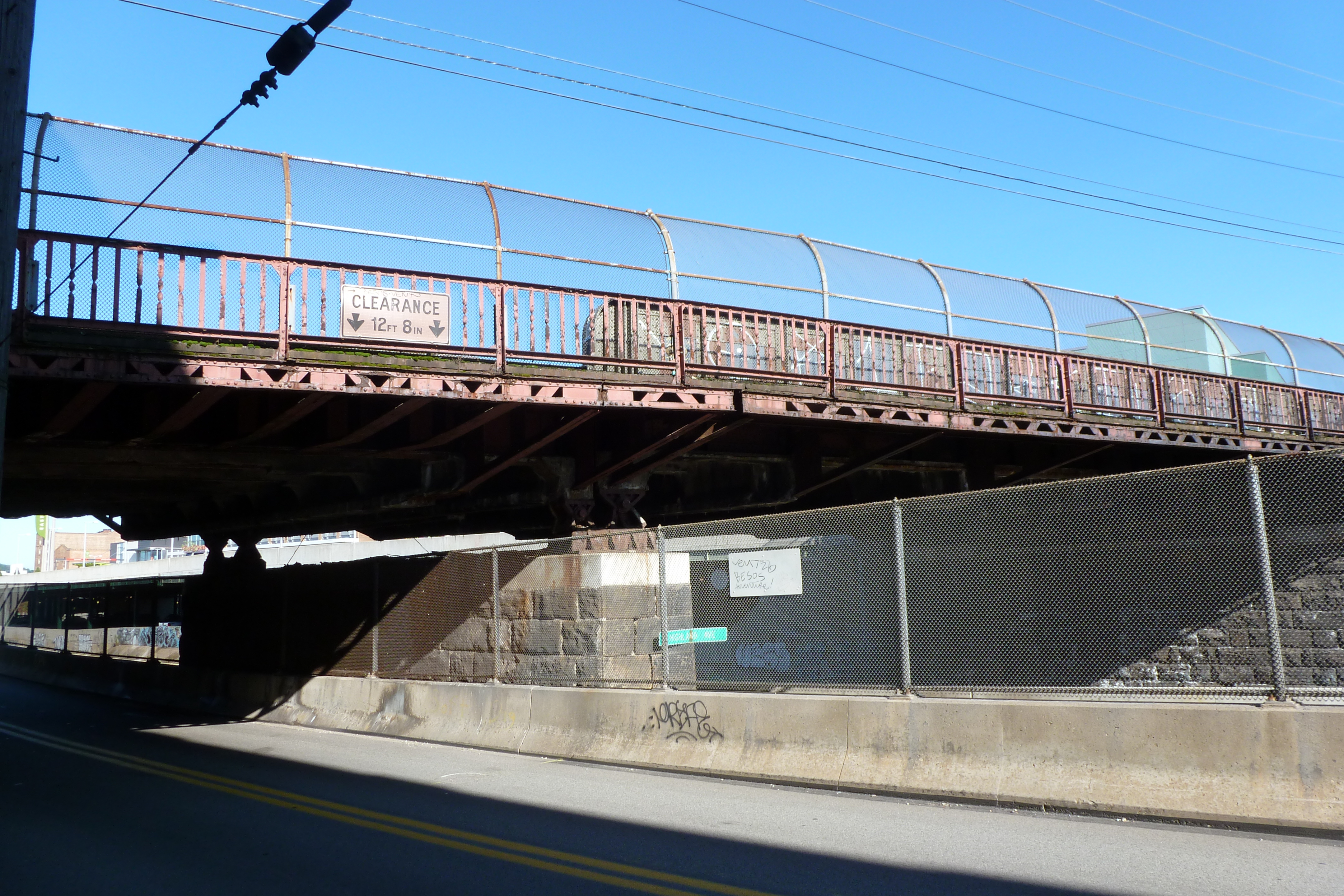
The other major bridge changes in this area are the former Ellsworth Avenue and Shady Avenue Bridges that show on the 1923 G. M. Hopkins map. Both of those are long gone. I assume they were casualties of the massive Urban Renewal of the neighborhood that significantly impacted the street grid of the area. The digital archives of Historic Pittsburgh include photos of these former bridges. The Shady Avenue Bridge seems to have been of a similar design to the former South Highland Avenue Bridge. The Ellsworth Avenue Bridge seems to have been of a similar design to the current South Negley Avenue Bridge that is just outside the map frame to the west. One key difference is that cages were added at some point to the South Highland and South Negley Bridges.
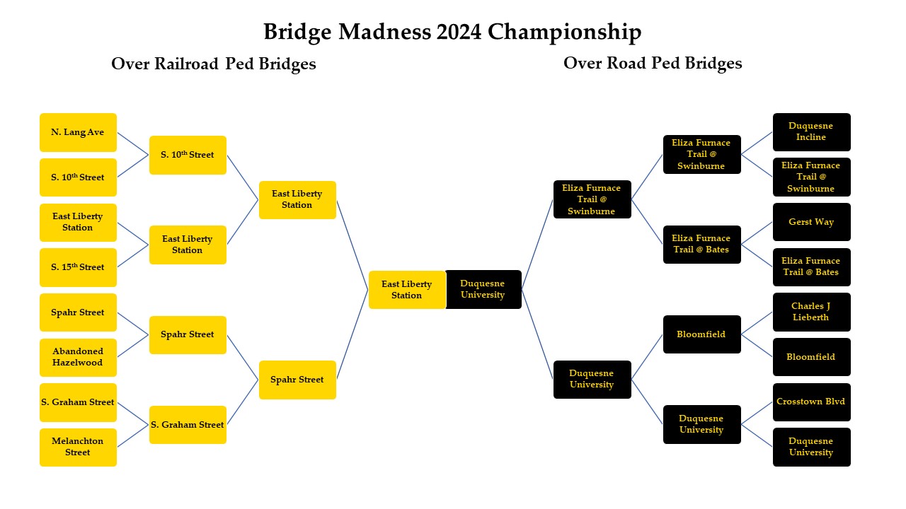
The East Liberty Station Pedestrian Bridge wins the 2024 Bridge Madness tournament with 56% of the votes.
Thank you for participating in the 2024 Bridge Madness Tournament. There were several tight contests in this year’s tournament. The tournament featured 16 pedestrian bridges in Pittsburgh. Half passed over railroads and half passed over roads.
From east to west, the bridges that pass over railroads were:
the North Lang Avenue Pedestrian Bridge
the East Liberty Station Pedestrian Bridge
the Spahr Street Pedestrian Bridge
the South Graham Street Pedestrian Bridge
the Melanchton Street Pedestrian Bridge
an abandoned pedestrian bridge in Hazelwood
the South 15th Street Pedestrian Bridge
the South 10th Street Pedestrian Bridge
From east to west, the bridges that pass over roads were:
the Eliza Furnace Trail Bridges over Swinburne Street
the Eliza Furnace Trail Bridge over Bates Street
the Bloomfield Pedestrian Bridge
the Duquesne University Pedestrian Bridge
the Crosstown Blvd Pedestrian Bridge
the Charles J Lieberth Pedestrian Bridge
the Gerst Way Pedestrian Bridge
the Duquesne Incline Pedestrian Bridge
They matched up as follows:
If you’re interested in exploring these bridges yourself, they are located:
One of my readers alerted me to last night’s collapse of the Francis Scott Key Bridge in Baltimore. While I’ve never walked that bridge, since the collapse of Pittsburgh’s Fern Hollow Bridge, which I have walked, the scope of my blog has expanded to highlight the fragile nature of the infrastructure we rely on daily in the United States (and across the pond). According to the reports coming in and the video of the accident, a loaded cargo liner crashed into a pier of the Francis Scott Key Bridge causing the structure to collapse. The Baltimore Sun (March 26, 2024) and Washington Post (March 26, 2024) articles are my primary sources for learning of the accident.
Unlike Pittsburgh’s disaster which was due to a deteriorated portion of the bridge finally giving way after years of deferred maintenance, no blame has yet been placed on any structural unsoundness of the Francis Scott Key Bridge.
The ship that ran into it is another story. Apparently, it recently was flagged as having questionable issues in its navigation system. The current understanding is that the ship lost power and control of steering, issued a mayday alert, and crashed into the bridge pier. In the early analysis of what happened, there are questions as to why various things were not handled differently to have prevented the collision. For example:
Why were there not more structures in the water to deflect any ships away from the bridge pier?
Why didn’t the tugboats continue with the ship until it cleared not just the harbor, but the bridge as well?
Why wasn’t the bridge built with redundancies so that even if one of the piers were knocked out, the bridge could still stand?
Much like deferred maintenance (of bridges and ships), I suspect that money is at the root of the reason why not for items one and three above. It may also be a factor in why the tugboats don’t travel farther down the river with the ships.
The City of Baltimore and State of Maryland have declared a state of emergency. Pledges are being made to rebuild the bridge quickly, including President Biden promising the money to rebuild. It may be interesting to compare the rebuilding of the Francis Scott Key Bridge against Pittsburgh’s Fern Hollow Bridge. While of significantly different scales, both bridges are considered major transportation arteries that the local region cannot afford to be without any longer than absolutely necessary. Will the Francis Scott Key Bridge rebuild include similar time saving measures of purely utilitarian design and of concurrent design/build phases?
Pittsburgh’s Charles Anderson Bridge closed to vehicles indefinitely pending restorationPittsburgh’s Swindell Bridge closed to vehicles indefinitely pending restoration
Pittsburgh isn’t alone in being home to bridges on the verge of collapsing. This year marks the 200th anniversary of London’s Hammersmith Bridge, which has been closed to vehicular traffic for five years after cracks threatening the stability of the bridge were discovered. The bridge was temporarily closed to pedestrians and cyclists crossing over and river traffic crossing under, but those restrictions have been lifted. Except cyclists are required to dismount and walk across. (Transport for London: Hammersmith Bridge) Work is slowly being done on the bridge, but there is no estimate for when it will be fully functional again. Part of the delay appears due to the decentralization of bridge ownership in London that puts the burden of costly bridge maintenance and repairs on local councils that don’t have sufficient funds (The Standard, July 5, 2023). Much as I enjoy walking across bridges, I would have second thoughts about walking one where the vibrations caused by a cyclist might increase the damage to the bridge.