
Category Archives: US Cities
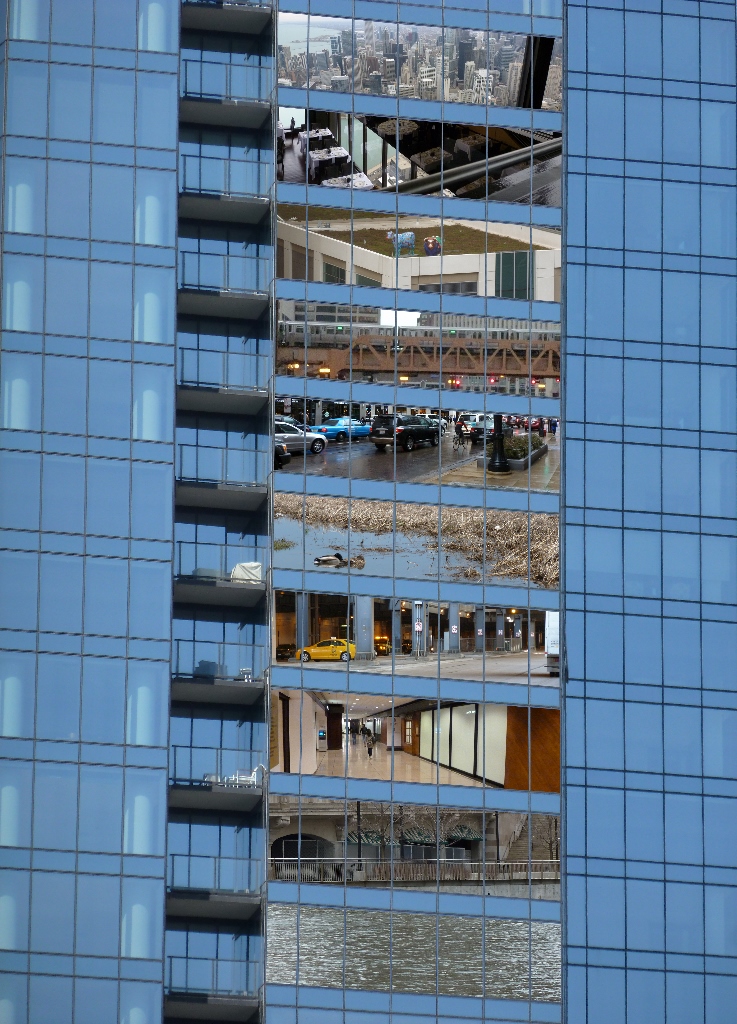
Layers of the City: Chicago Edition
The first place to show me how a city can be stacked like a layer cake, Chicago provided ample opportunities to explore all levels of the city. The experience of noticing the expansion joints in roads that I assumed were on solid ground opened my eyes to the possibilities of stacking uses.
Underground Life
A vacant lot two stories below street level solved the mystery of the expansion joints, by exposing the inner guts. Two more roads sit below street level to segregate trash pick-up and deliveries from the flow of traffic. These lover levels also provide some opportunities for parking without monopolizing valuable real estate above. Retail shops connected by pedestrian passageways are also interspersed in these layers.
River Life
At the same elevation as the “underground life,” the Chicago River flows through the heart of the city. On and along the river are a variety of activities. Pedestrian paths, cafes, housing, parks, industrial uses, and homeless encampments line the shores. Meanwhile, the river abounds with ducks, boat tours, water taxis, construction staging, and marinas.
Street Level
Back up on the street level, life buzzes. Vehicular and pedestrian traffic rush passed, occasionally pealing off to visit the numerous shops, offices, museums, restaurants, cafes, parks, and trails.
Pie in the Sky
Yet, more life looms above. Several of the skyscrapers have penthouse, or nearly penthouse, restaurants. Others have rooftop observation platforms. Between these and the street are many other opportunities for enjoying life including a religious sanctuary, the “L”, gardens, art, pedestrian bridges, and of course, offices, apartments, hotel rooms, and shops.
Unlike Pittsburgh, in Chicago, the public is welcome in some form on every level to gain a full experience of the city.
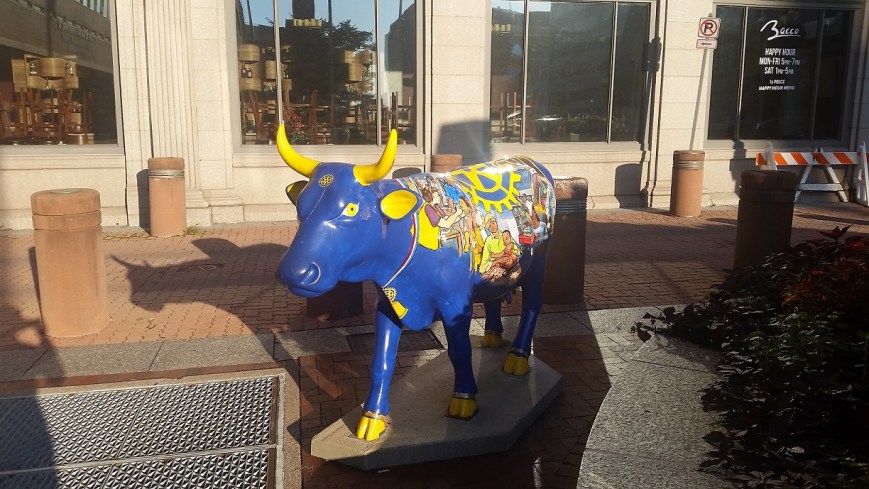
Harrisburg Cow Parade 3

Layers of the City: Pittsburgh Edition
I clench my teeth every time the “T”, Pittsburgh’s light rail system, slowly makes the first 90 degree bend leaving Gateway Station, squeaking like fingernails on a chalkboard. After traveling a few hundred yards, it turns back 90 degrees–squeak, scratch, squeak–before pulling into the Wood Street Station. As everyone knows that the shortest distance between two points is a straight line, I struggled to understand why the T was built with turns so sharp it is impossible for the trains not to screech, until my friend pointed out that there might be building foundations or basements that the underground tracks need to maneuver around.
Like many metropolises, the density of downtown Pittsburgh creates various physical layers of activity. Yet compared to other some other cities (see Layers of the City: Chicago Edition), Pittsburgh’s layers can be hard to notice. The T is perhaps the most obvious example. For most of it’s length through the southern neighborhoods and suburbs, the T travels at grade. Once it crosses the Monongahela River into Downtown, it becomes an elevated train for a few blocks before submerging underground until it passes under the Allegheny River to the North Shore, where it reemerges to end as an elevated train.
Underground Life
If you get off the T at Gateway Station and walk down a block to the start of 5th Ave, which actually feels like an alley, you might notice that the Highmark Building is built over an underground garage. I assume that this garage has multiple levels below grade and is at least part of the reason for the T’s sharp turns.
The new PNC Tower also has a garage below grade. Yet the most recent new construction project downtown, on the former site of Sax Fifth Avenue, places the garage between the first floor retail and proposed upper level residences.
The building I work in, the former Jones & Laughlin Steel Mill Headquarters, has at least 3 1/2 levels of basement. The building is long past its days of glory with peeling paint, cracked foundation, and elevators that you may never make it out of again. The mezzanine level of the basement is a maze of building supplies, file cabinets, discarded furniture and boxes upon boxes of documents. It is damp and dusty. Five minutes down there could lead to a severe allergy attack. Yet the stairs keep going down and down, plunging further into the dark depths. I’ve heard rumors of more documents being stored in the lower levels.
Street Level
Coming back above ground, most activity in downtown Pittsburgh takes place at street level. Pedestrians, bicyclists, buses, cars, delivery trucks, dumpsters, and more compete for space on the narrow streets and sidewalks. Most shopping and restaurants are located at street level. The Highmark Building and the Oxford Building still have some retail above the first floor.
Pie in the Sky
As you walk around downtown, if you look up, you might catch a rare sight of pedestrian sky bridges. The most famous of which is the Bridge of Sighs connecting the Allegheny County Courthouse with the former Jail. The second most famous (speaking with pure bias) is the bridge connecting the parking garage with what used to be the shoe section of the former Kaufmann’s Department Store (always a necessary stop when shopping for back to school). A handful of others are sprinkled throughout downtown. Indianapolis has got us beat though. That city has a network of pedestrian connections that enables you to walk for miles between the stadiums, office buildings, and other structures downtown without ever getting a taste of fresh air.
Higher up, there is a sprinkling of rooftop or penthouse restaurants. This is one of our complaints at work: while many new, good restaurants have opened downtown in recent years, there is still a dearth of restaurants and bars with views. Sienna Mercado’s Il Tetto, Harris Grill, and the Biergarten at Hotel Monaco all have rooftop decks, but they are surrounded by taller buildings limiting views. Ollie’s Gastropub on the top floor of the Oliver Building has some good views, but no fresh air.
There isn’t much connection or relationship between the different parts of these layers in Pittsburgh. It is like they are experiments, like the city is only dabbling. As if to say, it can’t make up its mind whether or not to let the public leave street level and participate in or explore all levels of the city.
Harrisburg Cow Parade 2
Seven Generations
One sculpture in Harrisburg’s riverfront park grabbed my mind like no other. Seven silhouettes each cut out of the other lined up in a row. Looking at it head on, it appeared to be one silhouette. The effect of their joining together and breaking apart as I passed mesmerized me.
I didn’t want to spoil the effect by learning hard facts about it from any plaque that may have been with it, so I continued on my way. Yet, the sculpture stayed with me, begging questions I barely knew how to form. I began to wonder what the artist intended. My curiosity was unexpected rewarded while I waited for my train home. The walls of the station had some posters which I read to pass the time. Turns out they were a guide to the sculptures in the park. The piece that had engaged me was a reference to the Iroquois stewardship policy to consider the effect any decision would have on the next seven generations before making a choice.
Seven generations.
That would be my great, great, great, great, great grandchildren.
None of the trees my great, great, great, great grandfather and his father-in-law encountered while establishing their homesteads in Western Pennsylvania still stand. Though it has been sold outside the family, the house my Cross ancestor built is still occupied. How many of the new buildings I have approved for Zoning in the last four years will still stand seven generations from now? Will they even survive for two generations?
How many of the next seven generations will be outlived by the plastic bag I brought home from the grocery store because I forgot my reusable bags?
What will happen to the latest gadget that will become obsolete in a year or so? What will happen to all the energy and waste that went into creating it and then destroying it?
I’ve sometimes heard people question what kind of world they are leaving their children and grandchildren, perhaps even their great grandchildren, but no further than that. What would happen if we set our sights a little bit further–a few more generations out?
Harrisburg Cow Parade 1

Harrisburg: Coal or Gem
I didn’t understand the pitying looks I received when I announced my fall vacation to Harrisburg. Now that it is over, I still don’t understand.
As a capital city, the downtown is quiet on the weekends, but the neighborhoods are still full of people. Even on a chilly, sleepy Sunday morning, joggers, bikers, and walkers enjoy the fresh air along the riverfront park that is part of the 20-mile Harrisburg Capital Area Greenbelt Trail. Sculptures dot the public spaces and art coats the fire hydrants and signal control boxes. Beautiful and intriguing architecture abounds. A former theater houses the largest used bookstore I’ve ever visited. Across the street, the Broad Street Market is filled with vendors of such mouthwatering temptations as Amish baked goods, hot Indian food, exotically flavored ice cream, fresh baked pretzels, and more.
A relatively compact and walkable city, I find surprising gems each time I visit Harrisburg.
Flood Measures

There is an enormous floodwall on the Covington, KY, side of the Roebling bridge, which spans the Ohio River. It shocked me to see such a huge wall when I was there last year. I wondered if there couldn’t have been some other means of flood control that would not have produced such a large barrier. It reminded me of the significant physical barriers to the waterfront that I observed in Erie, Pittsburgh, Homestead, PA, and Cleveland. Unlike Erie, Homestead, and Cleveland, Covington did not have any significant economic drivers separated from the town by the barrier wall. The river side only had a small park and parking lot.


In addition to acting as a barrier, the sheer massiveness of the flat concrete wall bothered me. I wanted to see it broken up into staggered segments, even though I knew that would not be useful in a structure intended to block the path of water. However, Covington handled the flat wall with style by turning it into a canvas for a giant mural. Almost as long as the wall itself, this mural depicts the history of the crossing at this location from 8000 BCE to the present day. While the mural did not help with the scale of the wall, it broke the monotony while turning it into a destination for its own sake.
In the back of my mind, this wall continued to bother me until observing the effects of the significant flooding experienced in Pittsburgh this year at the forks of the Ohio River (see Checking on the Rivers and The Aftermath). A google search showed me that the flooding Pittsburgh experienced in February this year also affected the Covington-Cincinnati region in the worst flood in that area since 1997. The concept of a wall still bothers me, but this one probably prevents a lot of property damage and Covington has taken steps to soften its negative effects.
Engaging Riverfronts
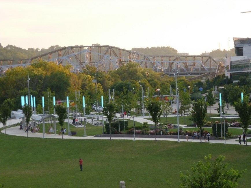
Cincinnati’s riverfront park with swings
There is a proposal in Pittsburgh to introduce a new feature to its riverfronts: swings. I am excited about this possibility as a swing lover and as someone who wants to see more welcoming and engaging spaces along Pittsburgh’s rivers. One of the inspirations for this idea are swings found in Cincinnati’s riverfront park. Last summer, I happened upon that park in a search for bridges by Roebling. On an ordinary summer evening, this enormous riverfront park was filled with people of all ages enjoying the various activities from walking paths to playgrounds to interactive art installations.

Istanbul exercise equipment

Istanbul exercise equipment

Istanbul exercise equipment
Previously, when walking around Istanbul, I experienced jealousy at seeing the number of parks with adult exercise equipment installed. This sort of acknowledgement that adults enjoy playing outdoors as much as children seemed lacking in parks across the United States. Cincinnati’s park showed me that inviting adults to play outside is embraced in some parts of our country.


More images from Cincinnati’s riverfront park
Pittsburgh has kayak and bike rentals for adults to play outside. The walking trails, Fountain at the Point, and Watersteps attract people to enjoy the outdoors and the rivers. However, if this swing proposal pans out, Pittsburgh may move up into the next tier of engaging outdoor spaces with the introduction of free play equipment for adults on par with Cincinnati and Istanbul.
