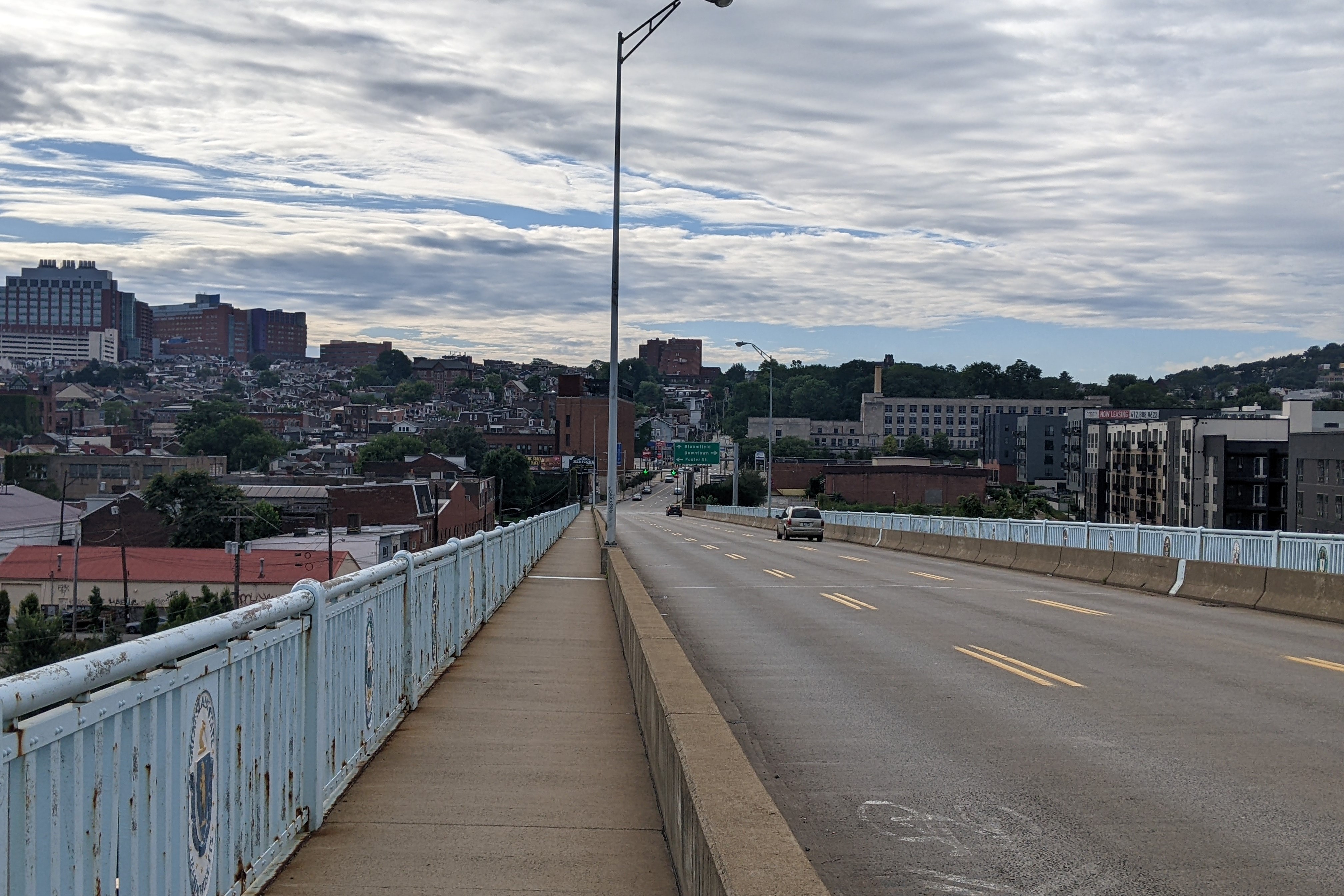
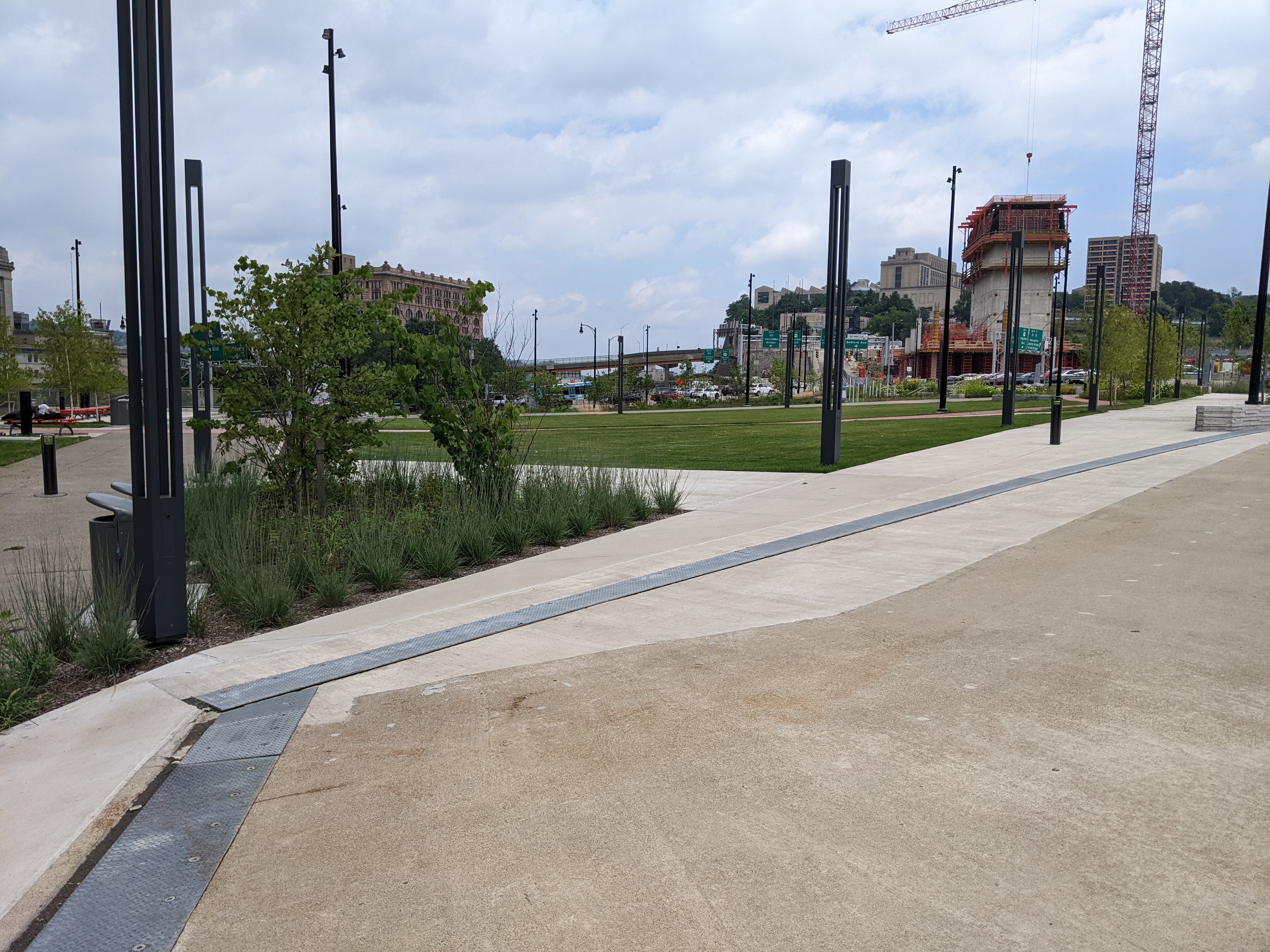
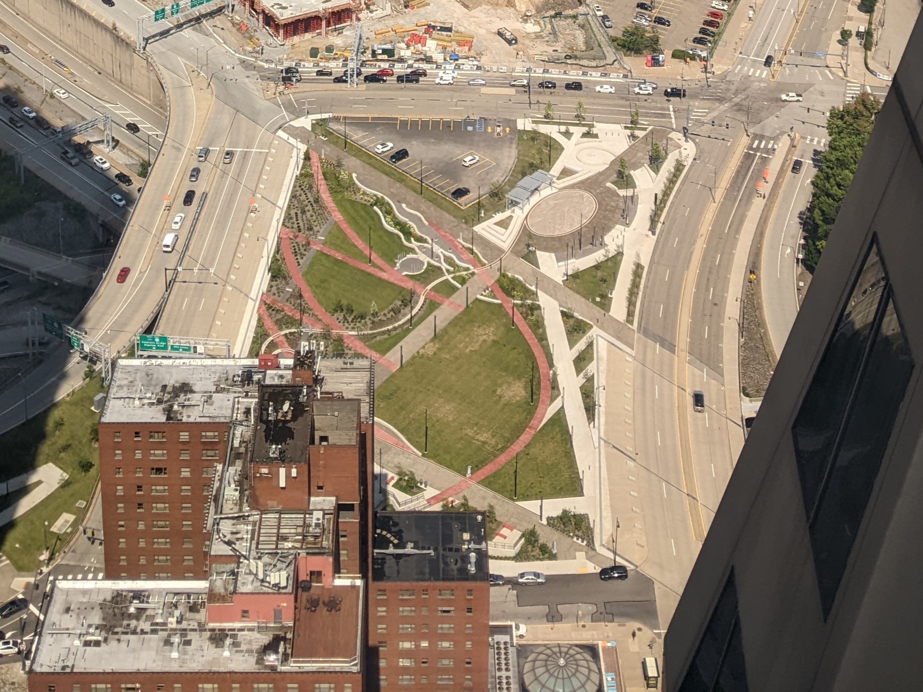
Keeping an Eye on the CAP: Public Art

Introduction

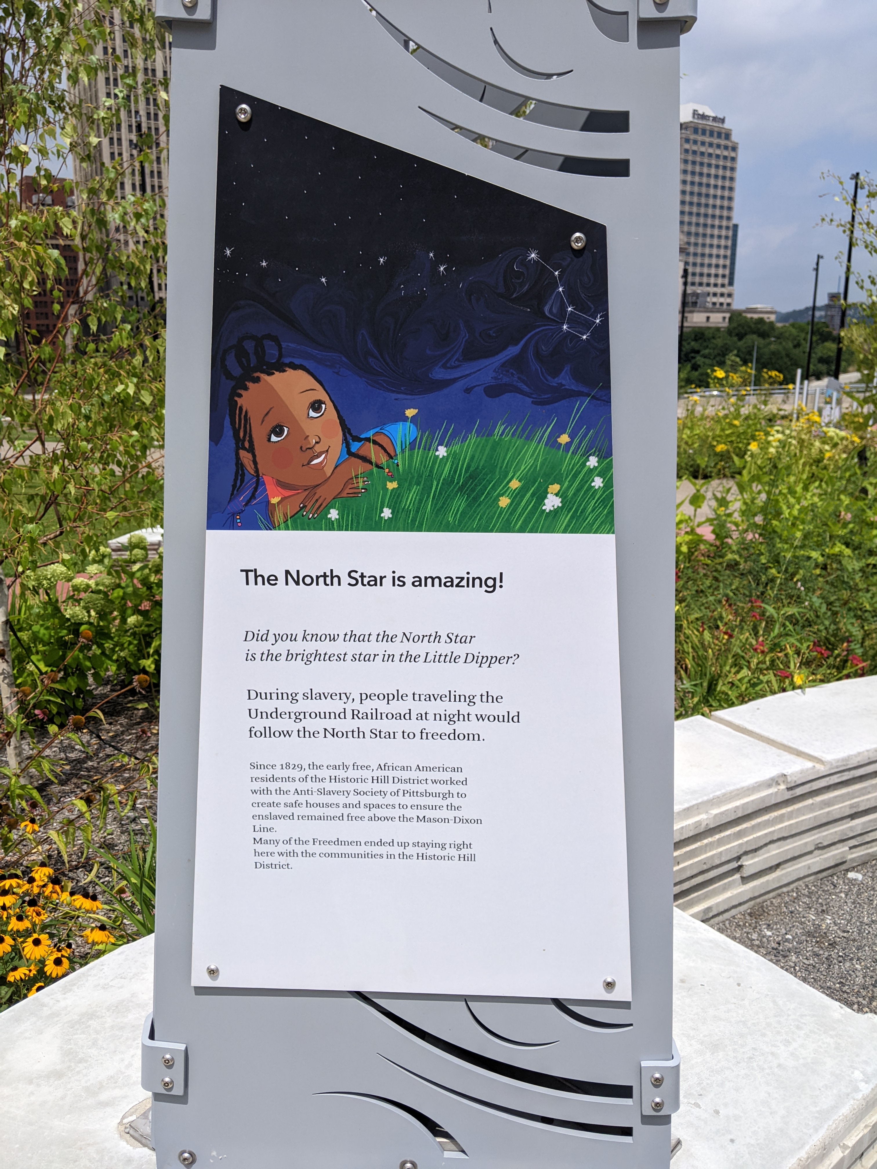
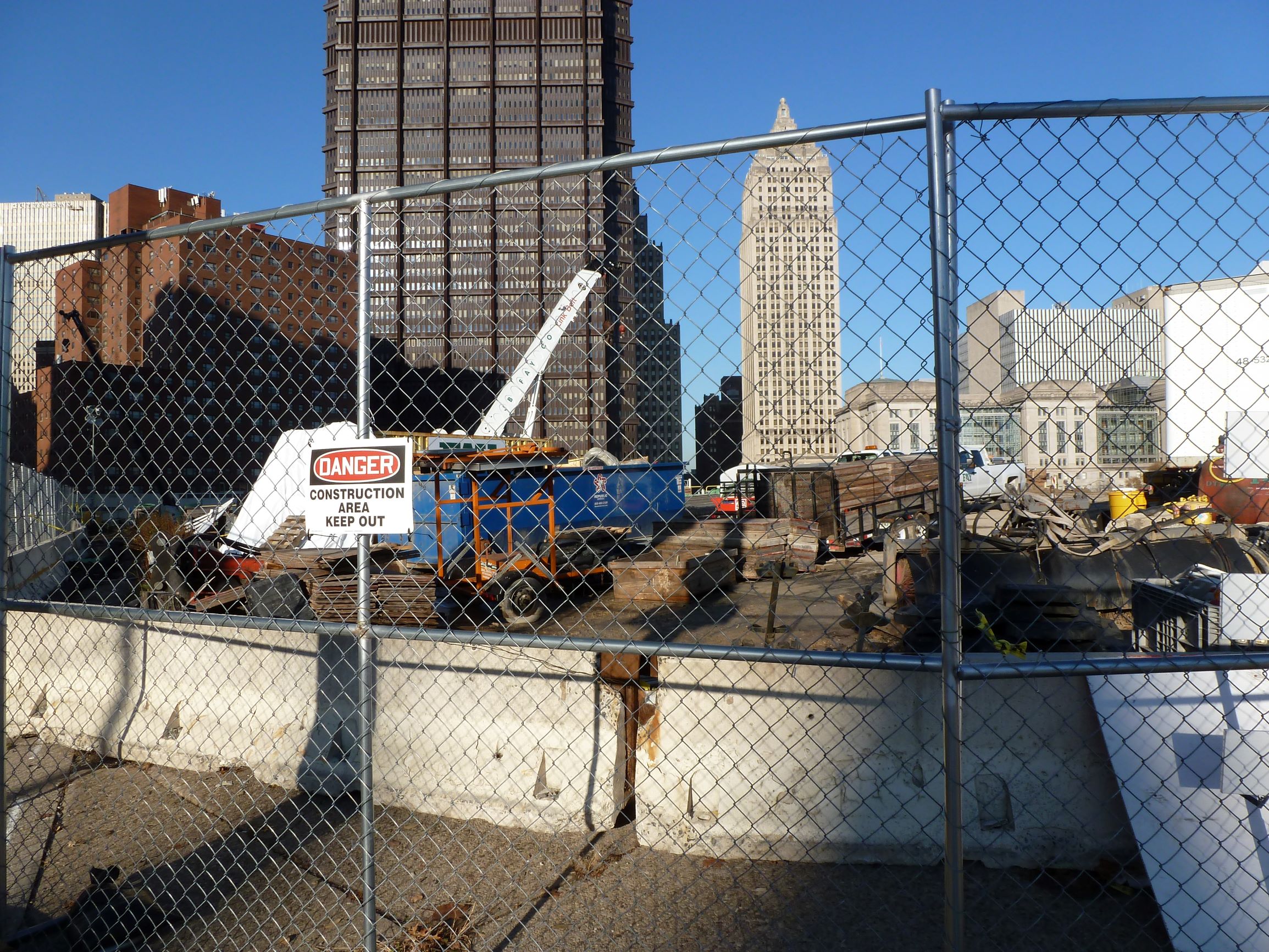
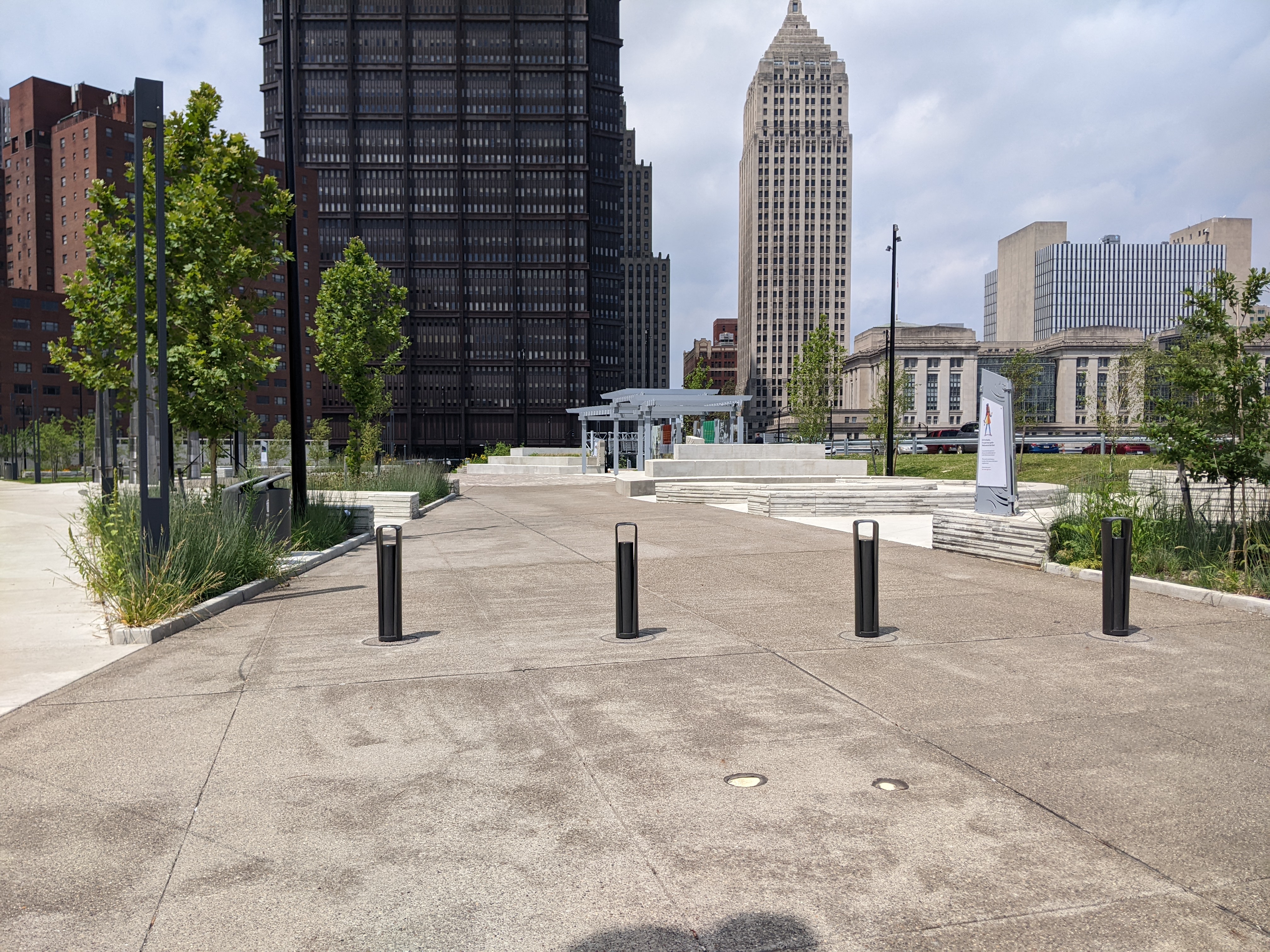
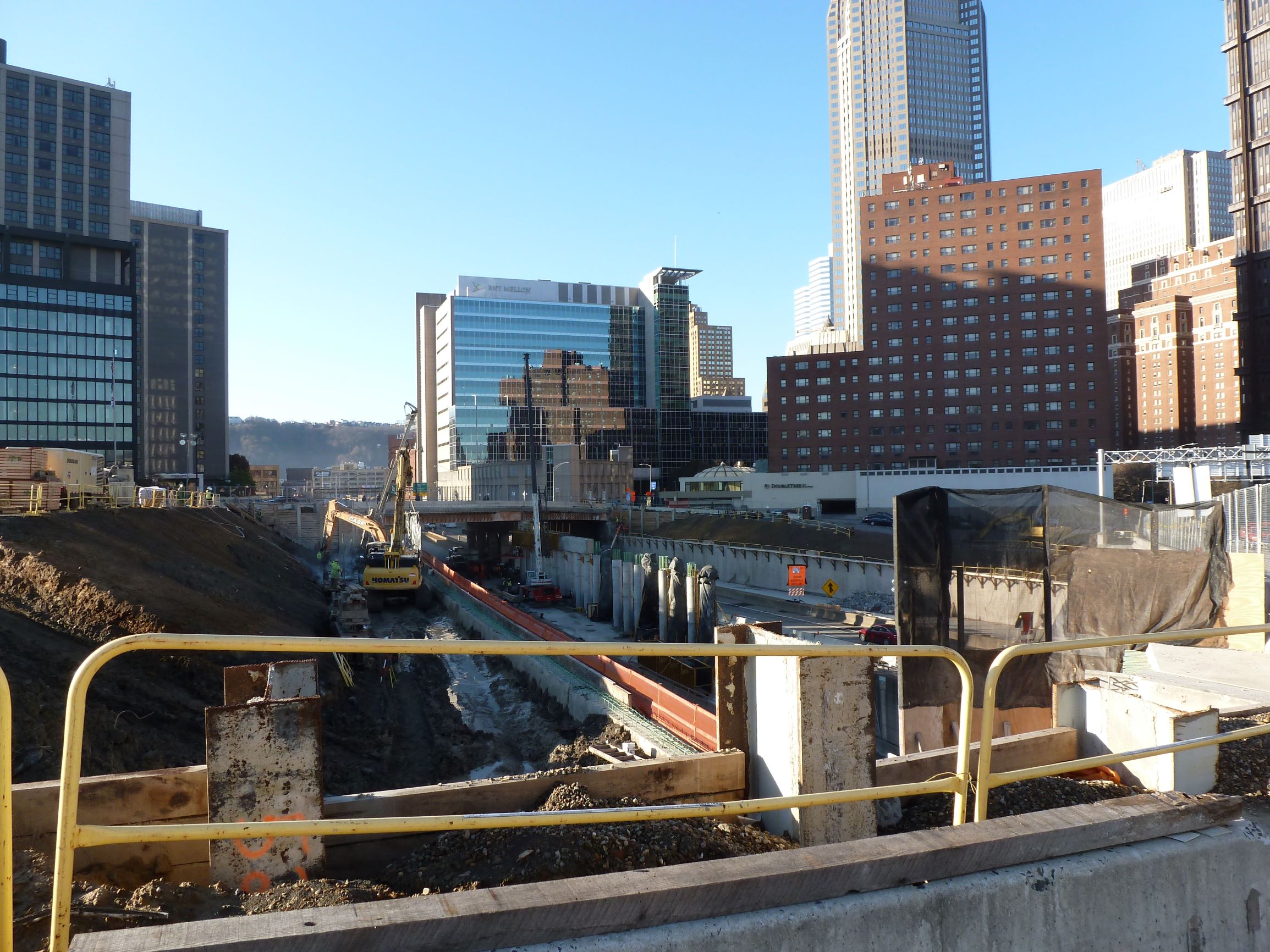
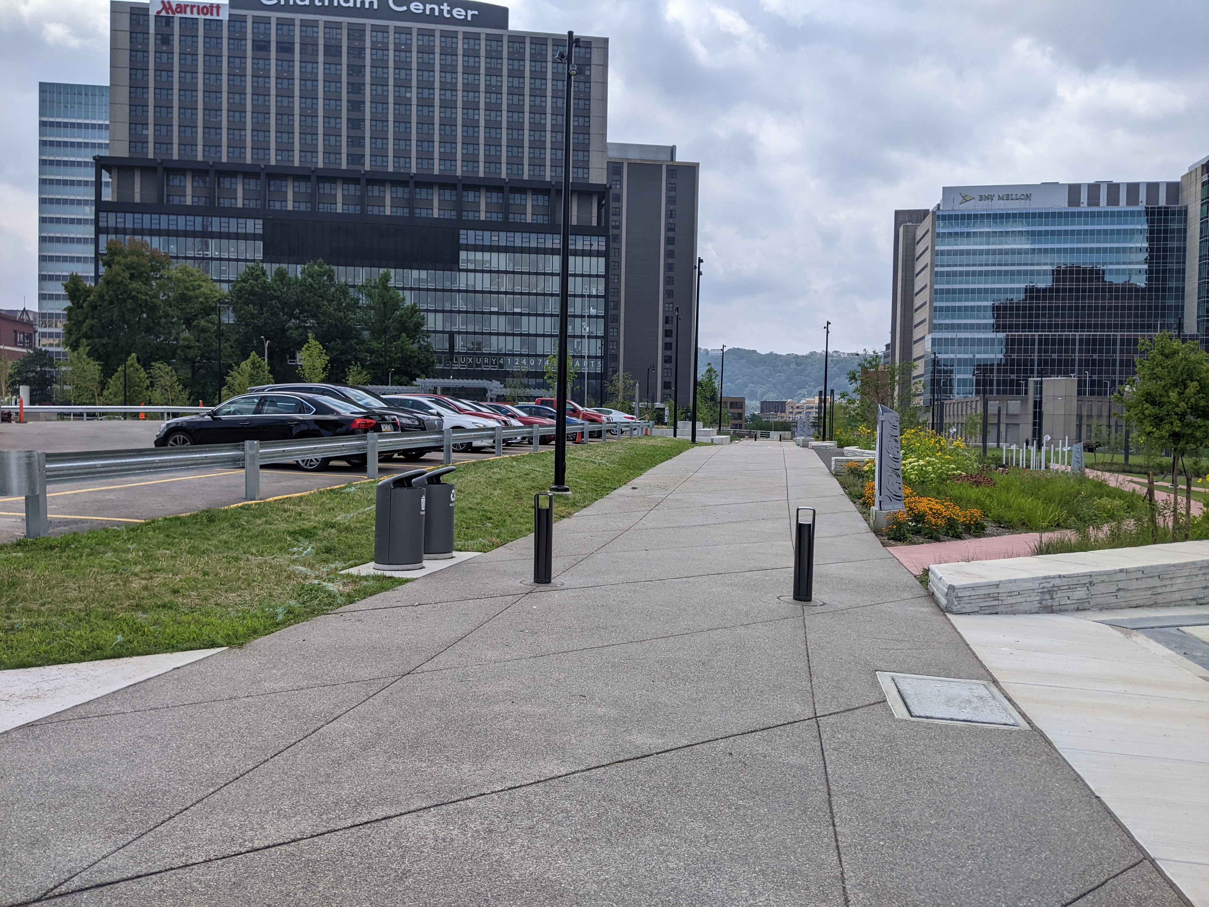
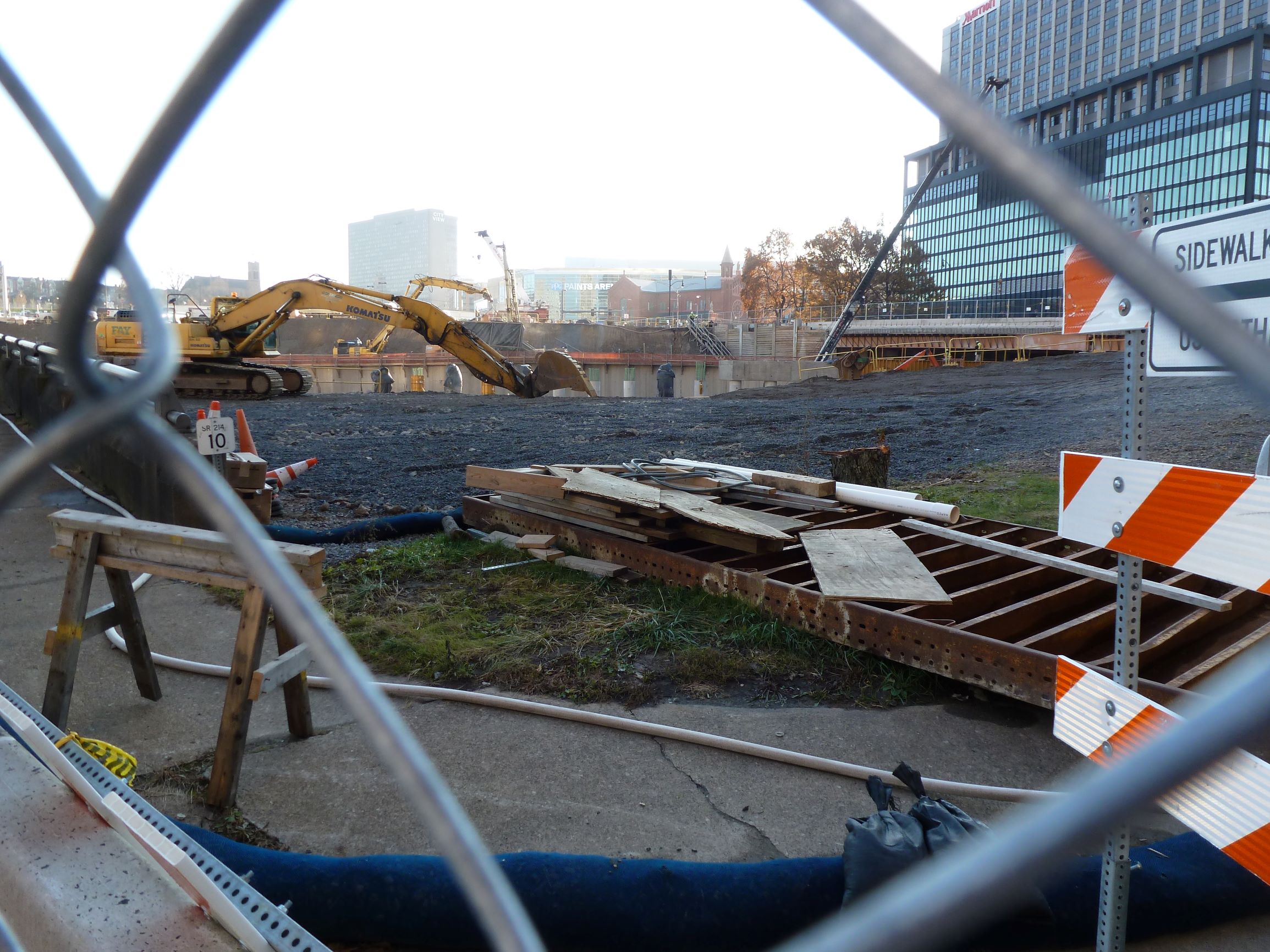
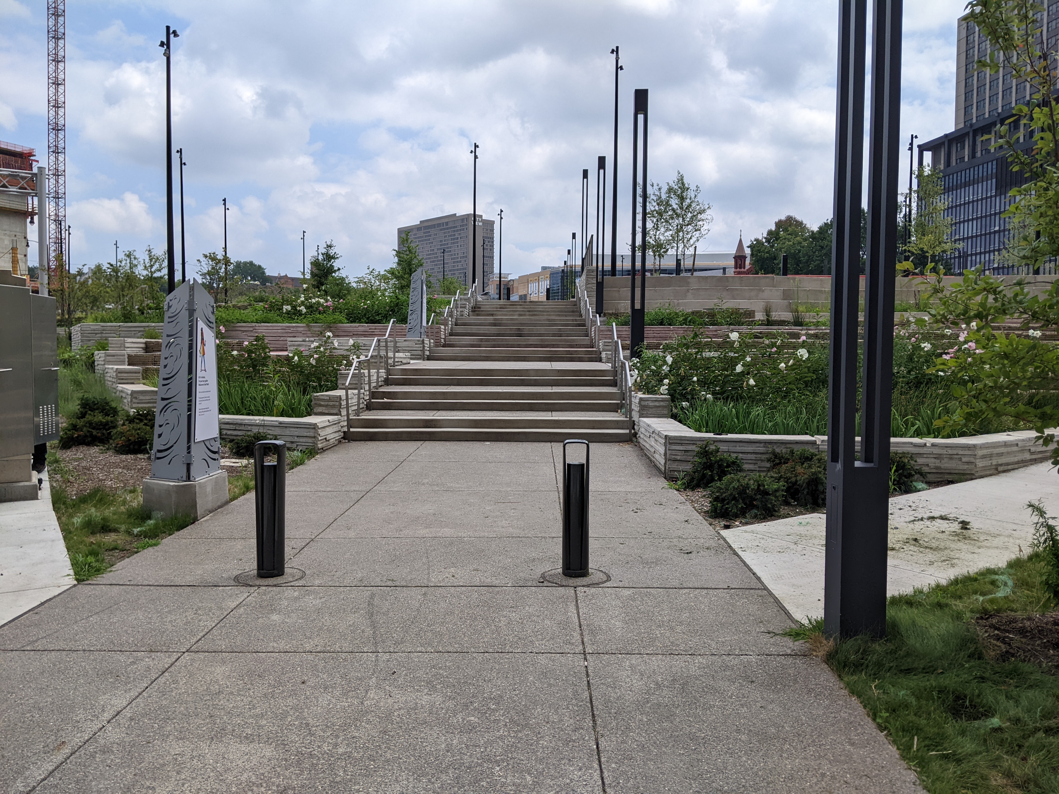
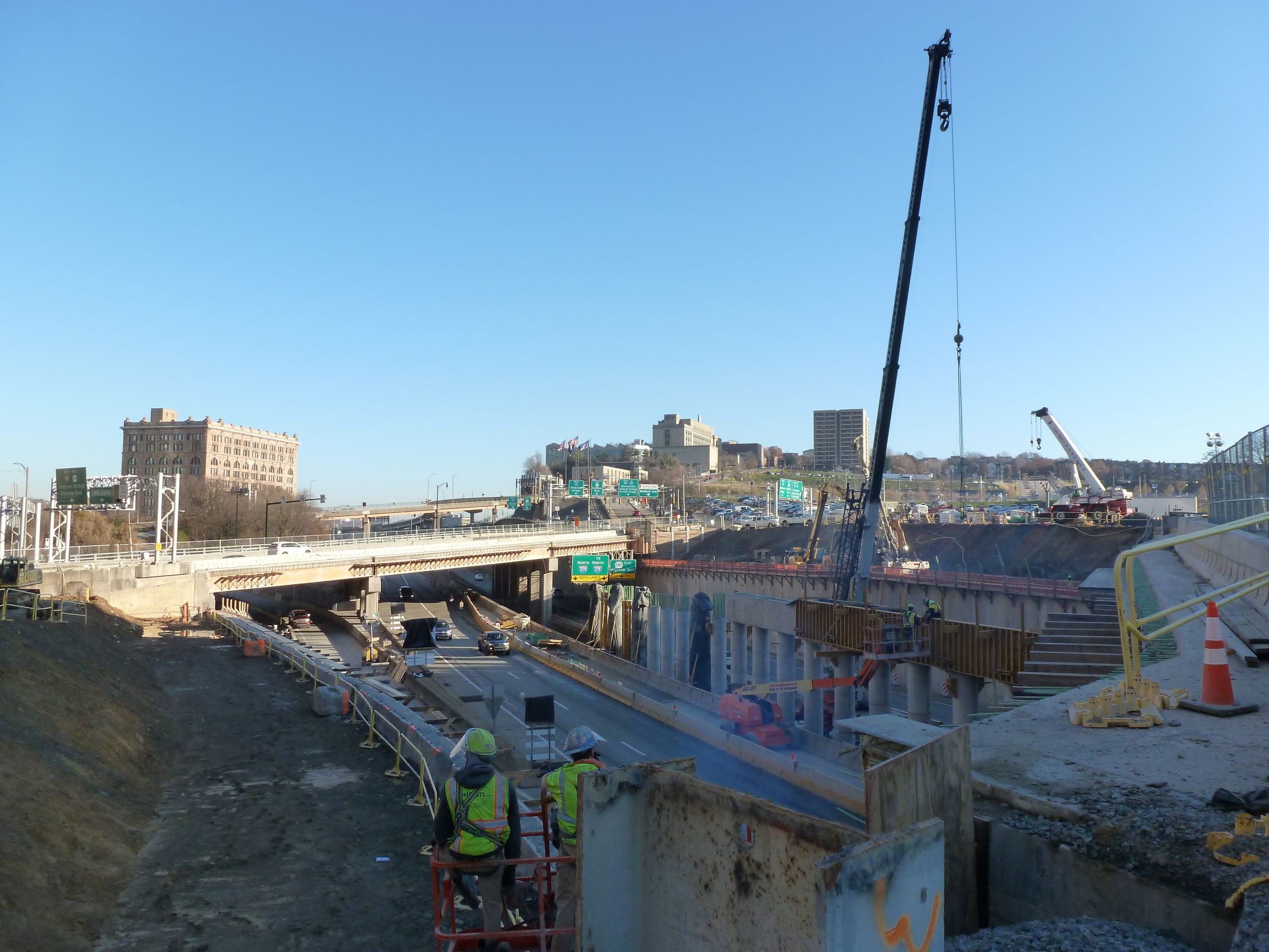
At the November 2021 ribbon cutting for the Frankie Pace Park on the CAP, Governor Wolf said, “A great injustice was done in the ’50s and this is finally a way to address that injustice.” He was referring to Pittsburgh’s poster child Urban Renewal project that demolished thousands of homes and businesses that once formed the physical infrastructure of a community whose members were predominantly Black, poor, or both. The buildings of the Lower Hill neighborhood were demolished, and the people dispersed to make way for the Civic Arena, a cultural amenity for the wealthy and White featuring opera performances. This erasure of community was followed in the early 1960s by the construction of a moat between the Lower Hill and downtown for the I-579 freeway, also known as the Crosstown Boulevard. The CAP now covers that moat and provides an educational park (and a pedestrian connection between downtown and the Penguins arena).

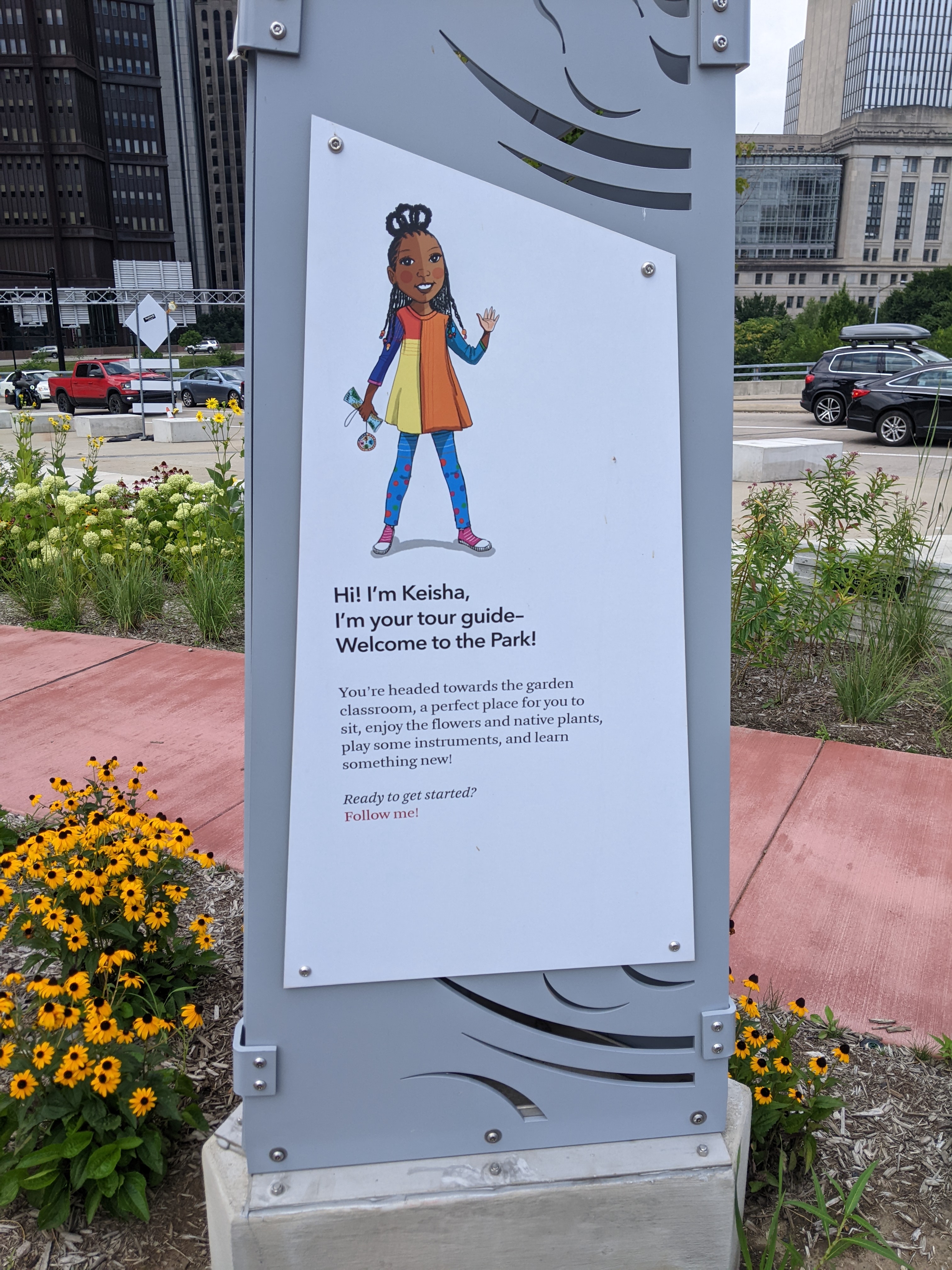
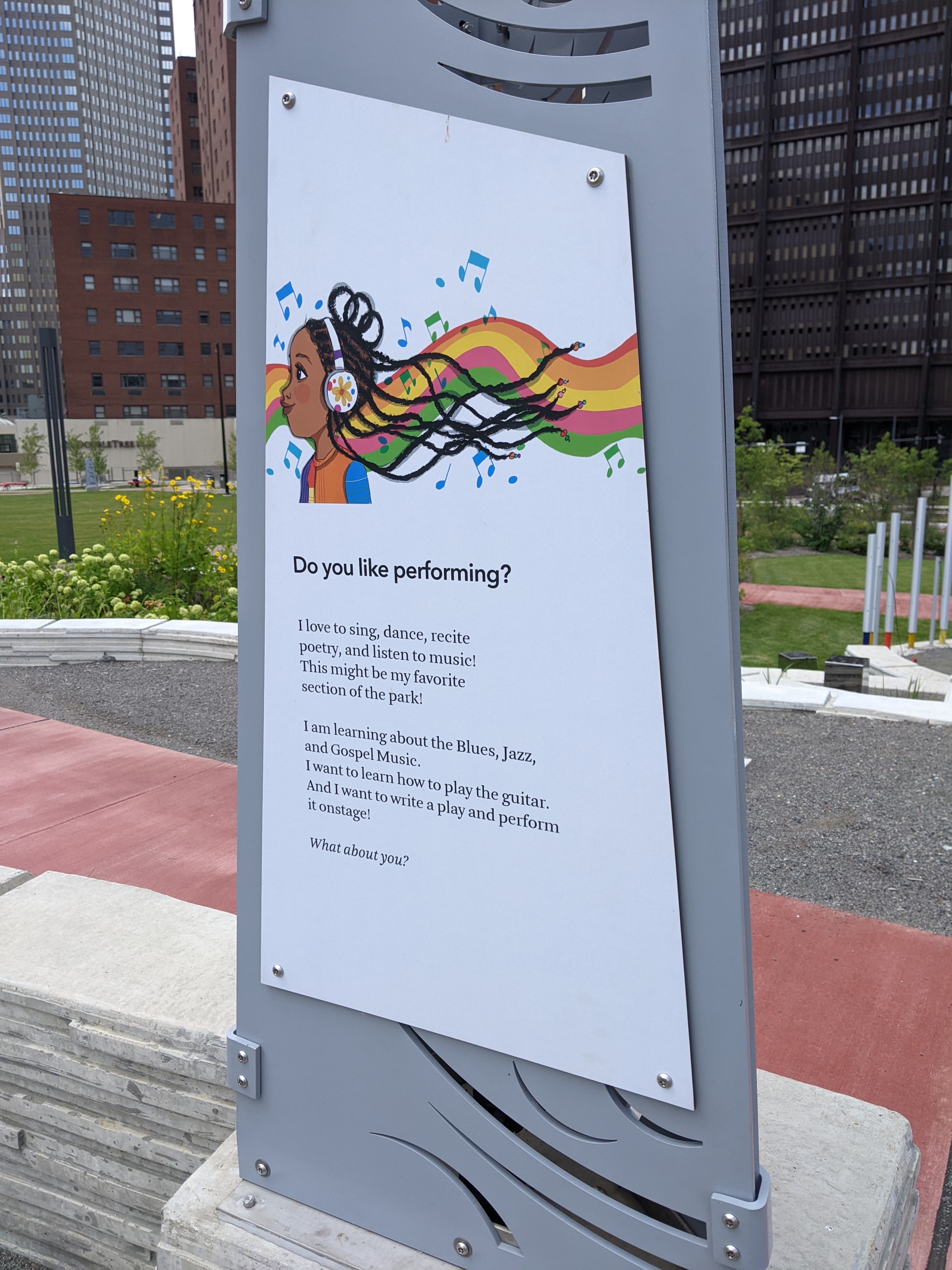
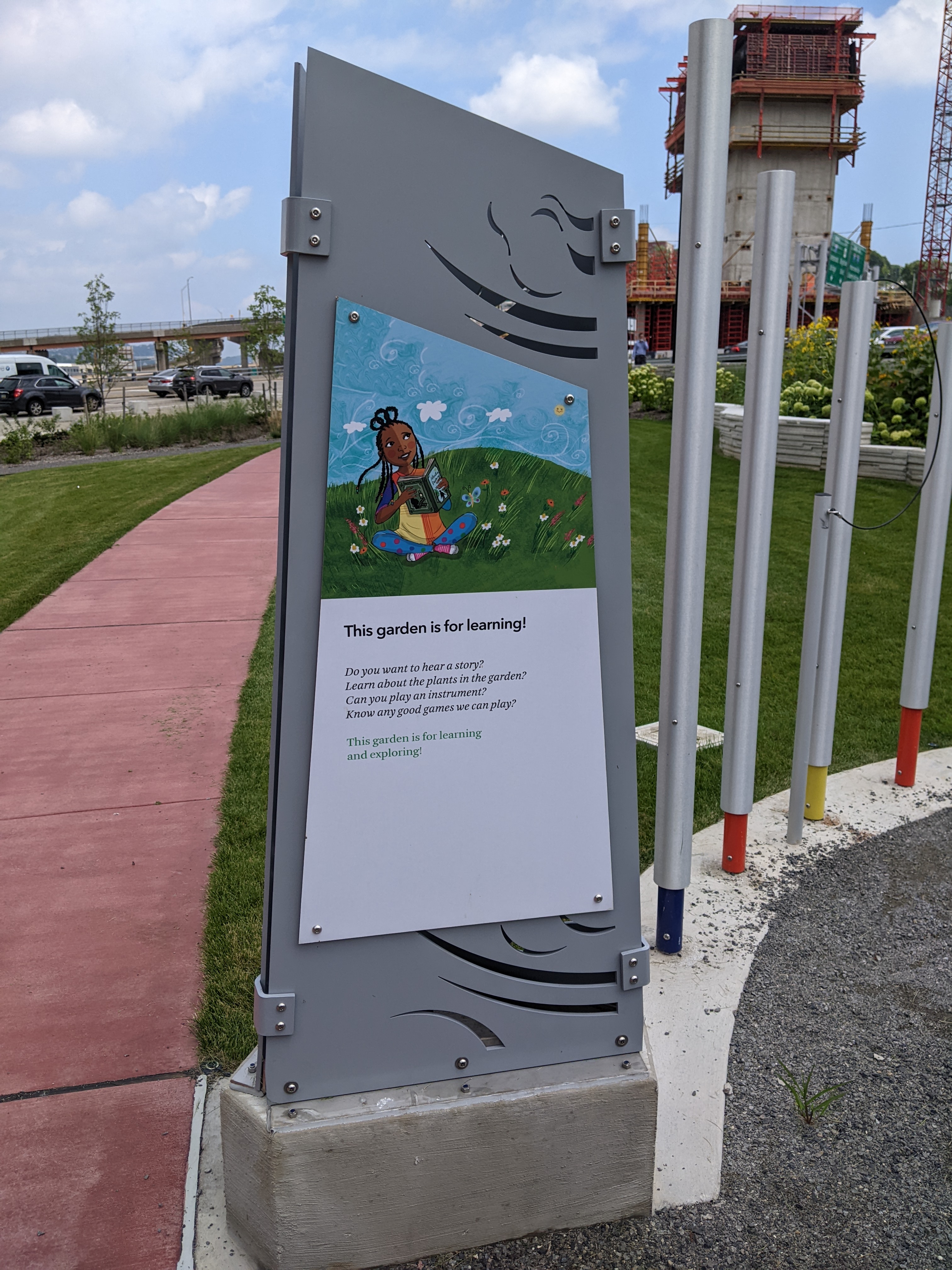
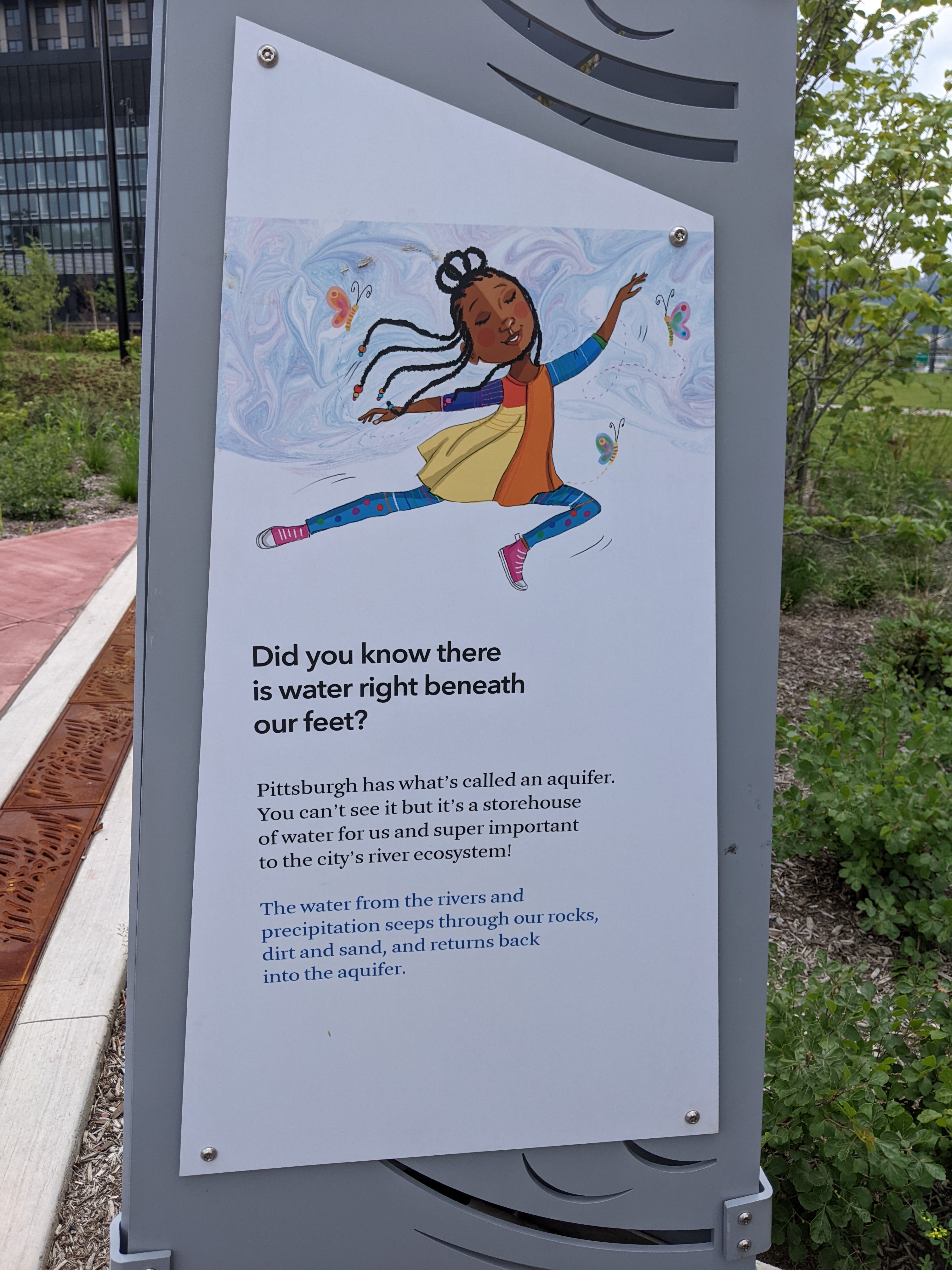
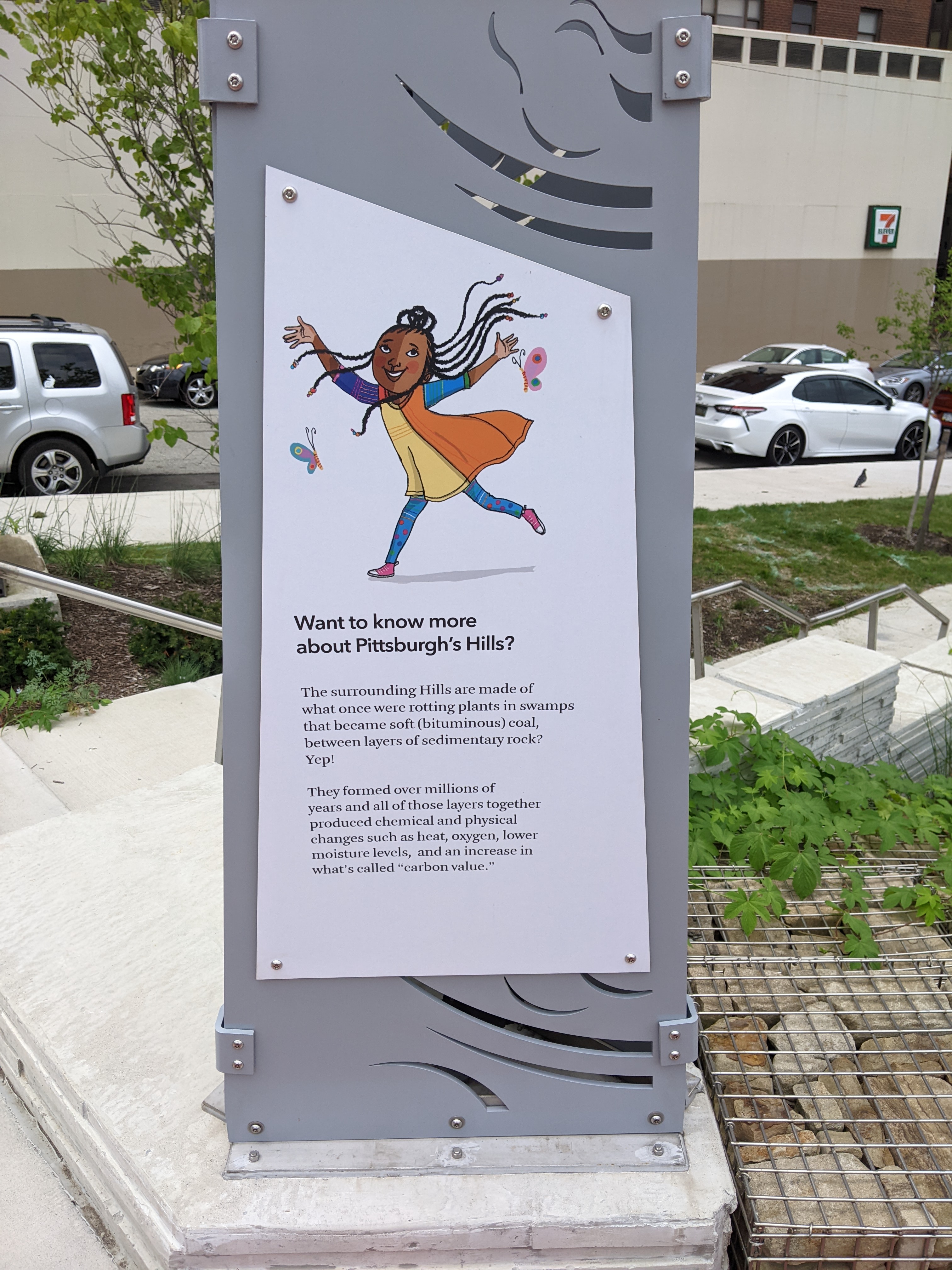
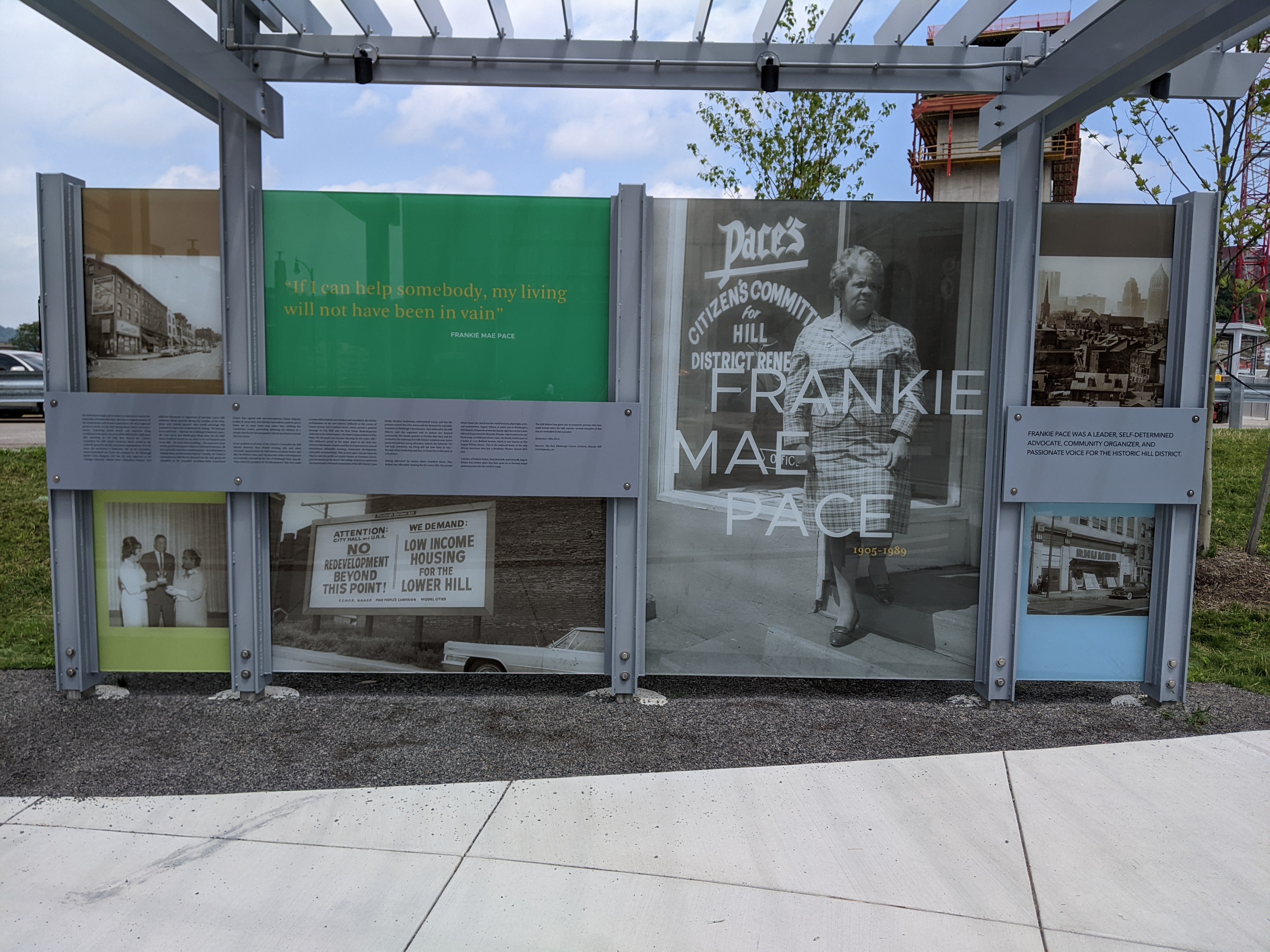
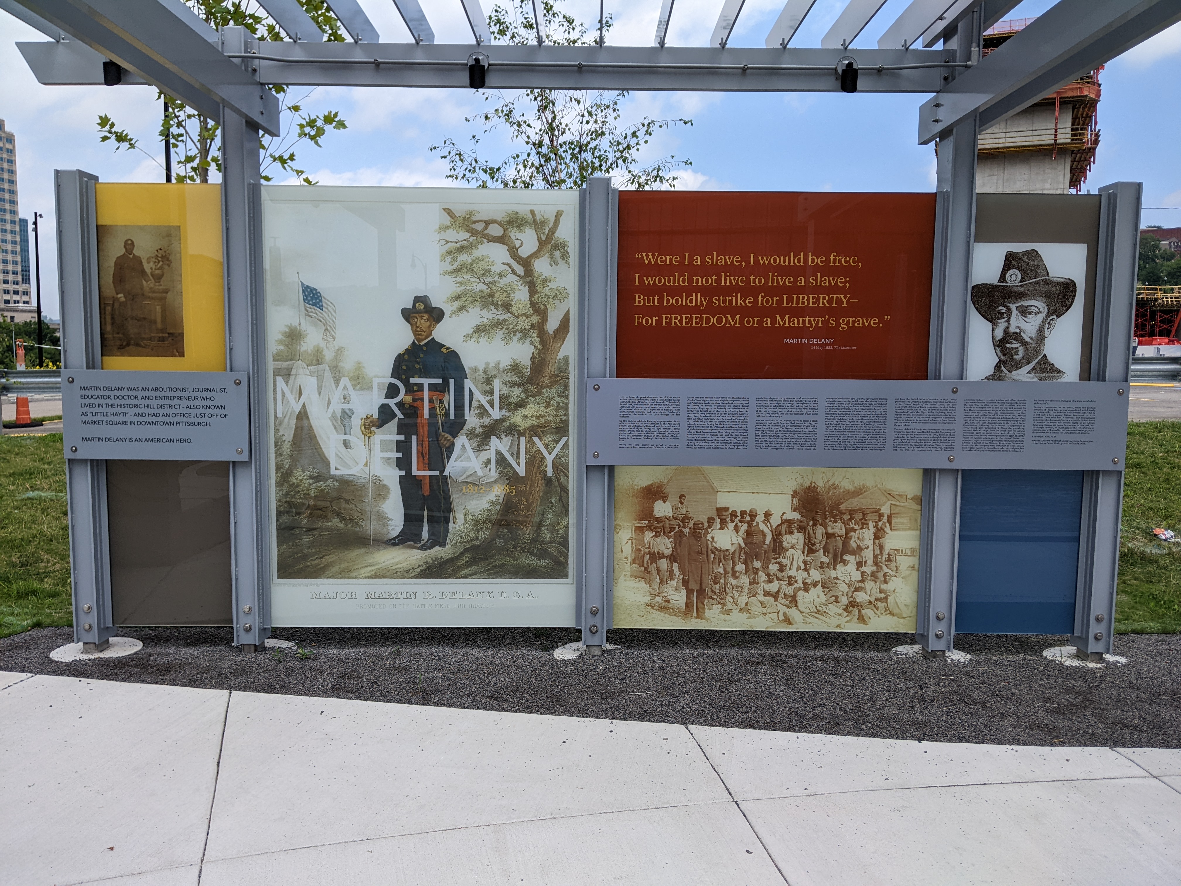
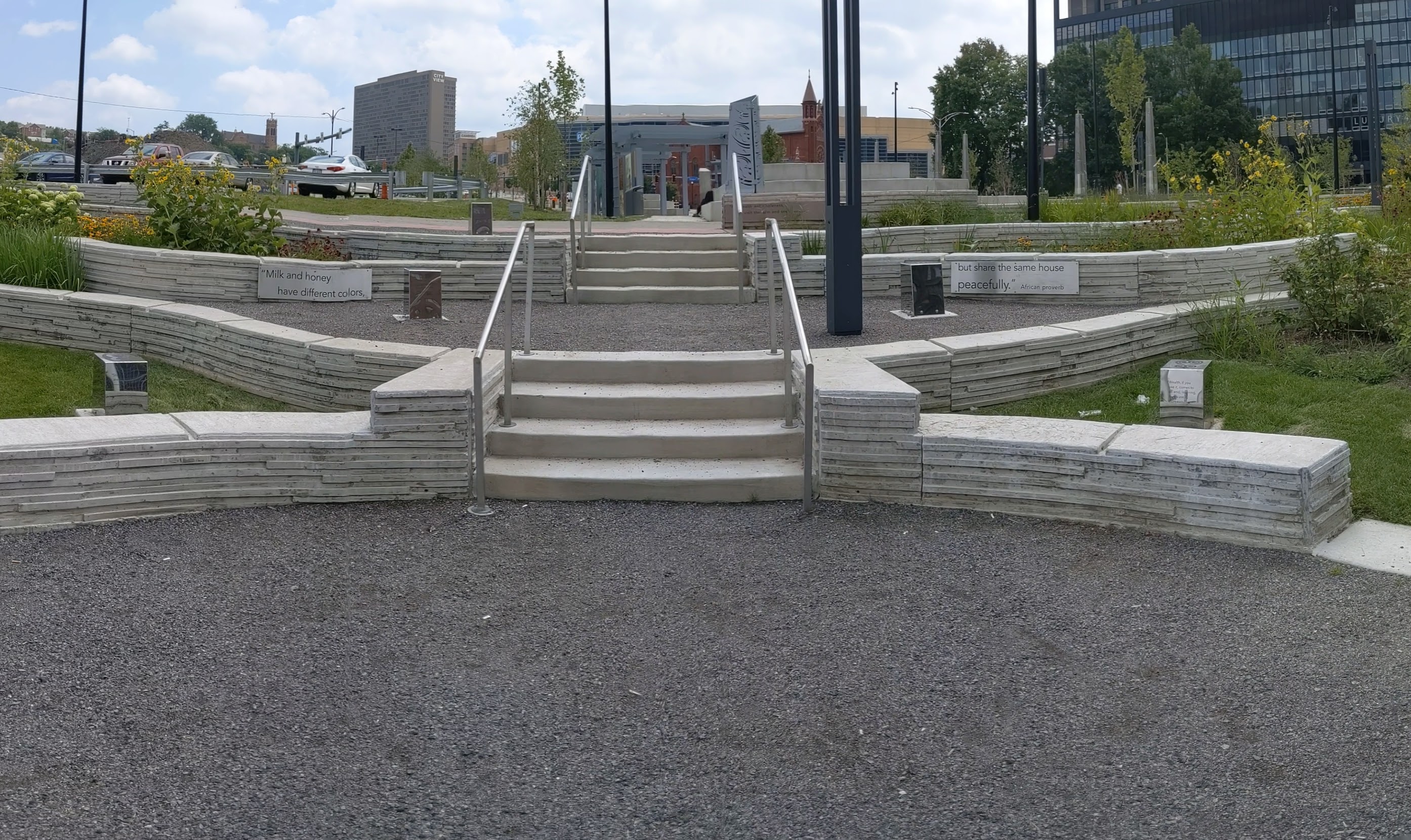
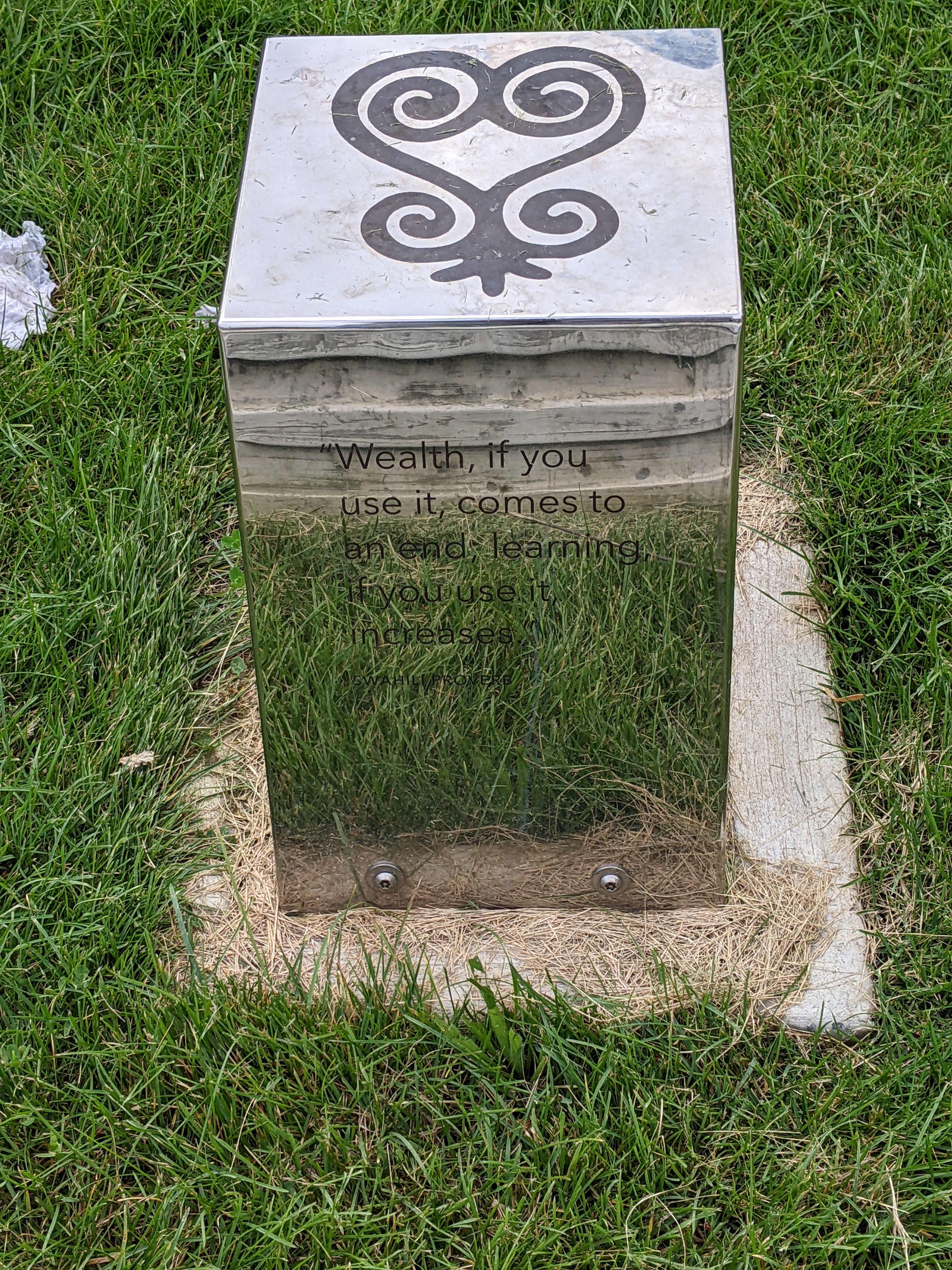
In addition to the infrastructure restitching the physical gap between downtown and the Lower Hill, the public art installed throughout the park aims to at least partially stitch the cultural gap that is one of the legacies of Urban Renewal and other segregationist policies. An educational display tells the stories of Frankie Pace, a 20th century activist for the Hill District neighborhoods of Pittsburgh, and Martin Delany, an abolitionist, journalist, and doctor in 19th century Pittsburgh. Throughout the park, proverbs of African heritage are etched on the walls and on metal blocks as reflective as Chicago’s Cloud Gate.

Below is a slideshow of some of the public art in the park. At the end of the post, there are links to all the previous posts in the series.


The Photos


The Map


The Series

Keeping an Eye on the CAP: Wayfinding

Keeping an Eye on the CAP: Aug. 2022

Keeping an Eye on the CAP: Ribbon Cutting

Keeping an Eye on the CAP: Nov. 2021

Keeping an Eye on the CAP: May 2021

Keeping an Eye on the CAP: Dec. 2020

Keeping an Eye on the CAP: Jun. 2020

Keeping an Eye on the CAP: Dec. 2019

Keeping an Eye on Uptown: Introduction

Keeping an Eye on the CAP: Wayfinding

Introduction

When I first explored the interior of the Frankie Pace Park, I was surprised by the wayfinding approach. A series of signs are posted throughout the site describing different features of the park, such as the rain garden. The surprising part was the choice of a Black girl narrator who wants you to join her as you journey through the park. It felt like the intended audience is elementary school-aged children. Given the park’s location adjacent to the tallest office skyscrapers downtown, adjacent to the first new building to be built on the Lower Hill – another office building, and kitty-corner-ish to the Penguins hockey arena, children seem to be a very small percentage of the prospective users of the park.


The CAP is a project in Pittsburgh “fixing the mistakes” of Urban Renewal. The Crosstown Blvd was built in the 1960s creating a freeway in a canyon dividing the Lower Hill neighborhood from downtown. The Lower Hill neighborhood, formerly predominantly poor and black, had already been demolished by this point to make way for the Civic Arena and other cultural amenities that were never built.

The CAP is a park on a bridge built over the Crosstown Blvd and is intended to reconnect downtown and the Lower Hill, while the Lower Hill is being rebuilt by the Penguins hockey team. Construction began in June 2019 and was completed in November 2021.


Below is a slideshow of these wayfinding signs. At the end of the post, there are links to all the previous posts in the series.


The Photos


The Map


The Series

Keeping an Eye on the CAP: Aug. 2022

Keeping an Eye on the CAP: Ribbon Cutting

Keeping an Eye on the CAP: Nov. 2021

Keeping an Eye on the CAP: May 2021

Keeping an Eye on the CAP: Dec. 2020

Keeping an Eye on the CAP: Jun. 2020

Keeping an Eye on the CAP: Dec. 2019

Keeping an Eye on Uptown: Introduction

Then & Now: 40th Street Bridge

The next bridge in the 10-year look back at urbantraipsing bridge walking is the 40th Street Bridge, which is about a mile from last month’s featured bridge: Herron Ave Bridge. The 40th Street Bridge, aka Washington’s Crossing Bridge, crosses the Allegheny River connecting Pittsburgh’s Lawrenceville neighborhood with the Borough of Millvale.

I first walked the 40th Street Bridge before I had the idea to blog about bridge walking, but as I had my camera with me, I took views from the bridge. Since then, the quality of my cameras has grown exponentially and several developments have arisen on the Lawrenceville side of the river. On the upriver side of the bridge, there is a new apartment complex, The Foundry at 41st, and a new office building, TechMill 41 (see the first pair of photos below).

On the downriver side, phase 1 of the large Arsenal 201 mixed-use development was completed on the former site of the Allegheny Arsenal famous for supplying munitions to the Union Army during the Civil War (see the second pair of photos below). The arsenal is perhaps even more famous for the accidental explosion that is identified as the worst civilian casualty of the war killing 78 people, mostly women and girls. Phase 2 of this development is well under way.

Also, on that side of the bridge, some of the new developments on Butler Avenue near Our Lady of the Angels Parish St. Augustine Church are visible including the new Capuchin Friars home (third pair of photos) and one of the new mixed-use buildings that have popped up in the neighborhood over the last 10 years.

Keeping an Eye on the CAP: Aug. 2022

Introduction

This week, I took a lunch-time walk through the new Frankie Pace Park to see what the completed CAP project looks like and how it is used. There were two men sleeping on benches in the park and a handful of other people walking the paths singly or in pairs. Prior to 2020, I would have interpreted this as a failure of the park to attract users because any green space downtown between 12 and 1 was always full of people. However, in the continuing fallout of the pandemic, a handful of people walking or using the seats is typical even of the parks that you used to need to arrive before 11:59 if you wanted to find a seat to eat your lunch.

The CAP is a project in Pittsburgh “fixing the mistakes” of Urban Renewal. The Crosstown Blvd was built in the 1960s creating a freeway in a canyon dividing the Lower Hill neighborhood from downtown. The Lower Hill neighborhood, formerly predominantly poor and black, had already been demolished by this point to make way for the Civic Arena and other cultural amenities that were never built.

The CAP is a park on a bridge built over the Crosstown Blvd and is intended to reconnect downtown and the Lower Hill, while the Lower Hill is being rebuilt by the Penguins hockey team. Construction began in June 2019 and was completed in November 2021.

Below is a side-by-side comparison of the four corners of the CAP from November 2019 when I first started this photographic series and from my August 2022 walk. At the end of the post, there are links to all the previous posts in the series.

The Photos


The Map


The Series

Keeping an Eye on the CAP: Ribbon Cutting

Keeping an Eye on the CAP: Nov. 2021

Keeping an Eye on the CAP: May 2021

Keeping an Eye on the CAP: Dec. 2020

Keeping an Eye on the CAP: Jun. 2020

Keeping an Eye on the CAP: Dec. 2019

Keeping an Eye on Uptown: Introduction