Closing out the East Liberty portion of the Then & Now 10-year anniversary series is the Penn Ave Bridge Ramp. This ramp inspired the second Pittsburgh edition of What is a Bridge?. As best as I can make out from the data on the National Bridge Inventory, the Federal Highway Commission does not consider the ramp a bridge. It is not marked as one of the bridges inventoried by the Commission. And the data for the Penn Avenue Bridge does not include any approach spans. This leaves me wondering who, if anyone, inspects the ramp.
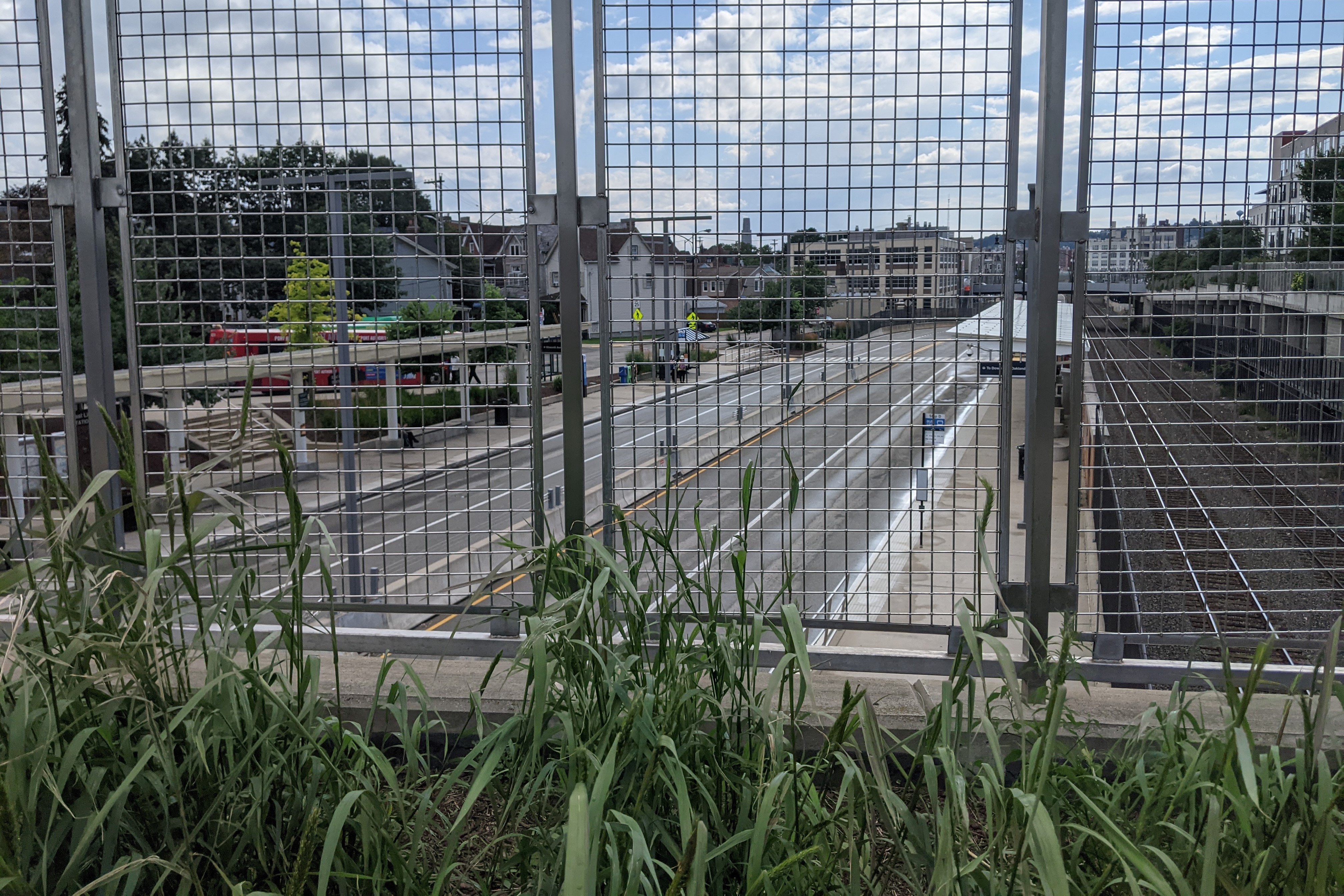
As I cannot find a public source that shares inspection data of the ramp (if it is inspected), its condition rating is anyone’s guess. However, this lack of data may be attributable to the change the ramp underwent in the last ten years. It was originally a ramp for buses to travel from a major bus stop off Penn Avenue onto the East Busway. With the redevelopment of the East Busway Station, this bus stop was redesigned as a regular on-street stop and the ramp was converted to pedestrian access only (second photo set below). The National Bridge Inventory seems to skip over pedestrian bridges as the East Liberty Pedestrian Bridge featured in February is also not listed.
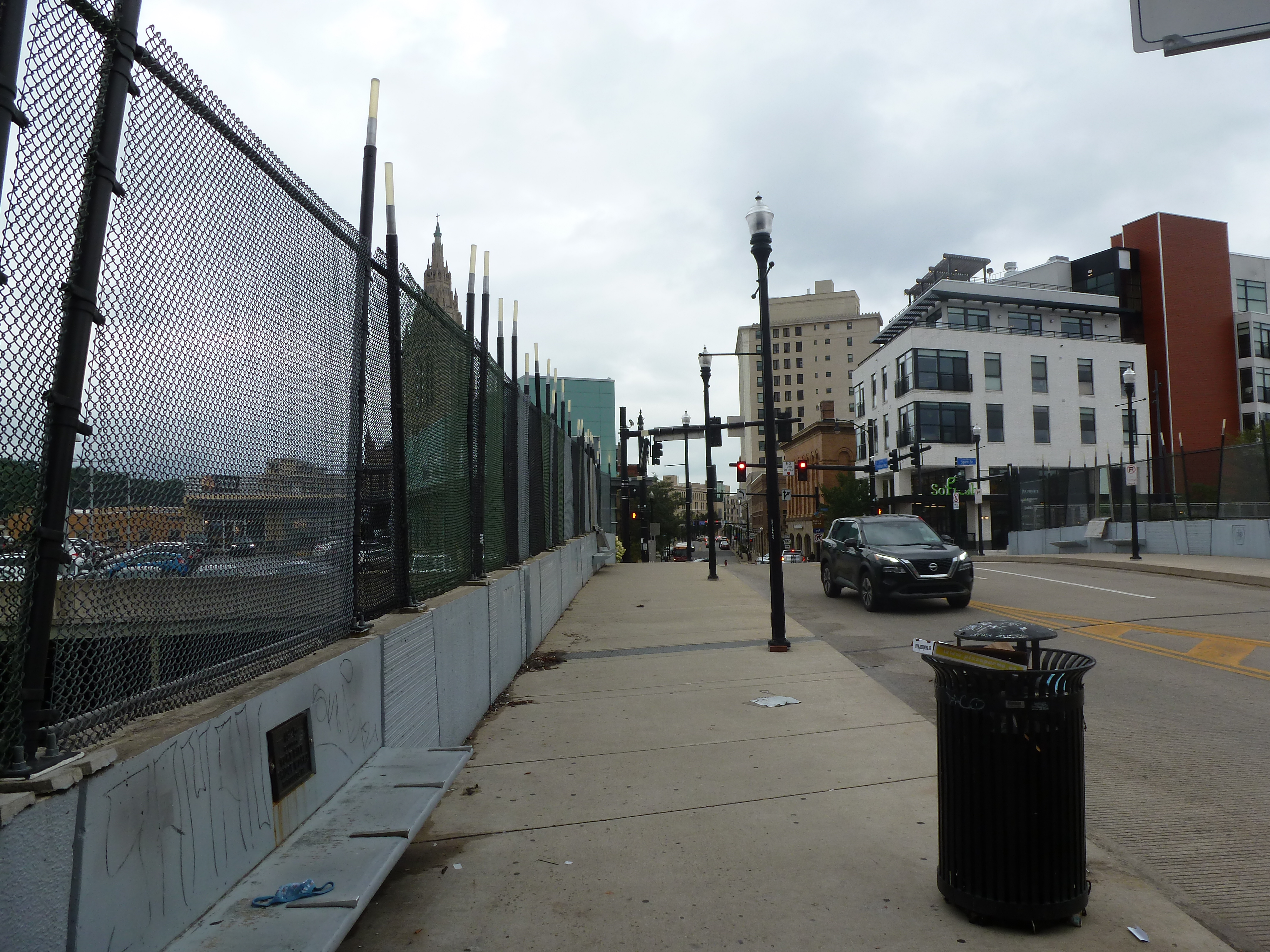
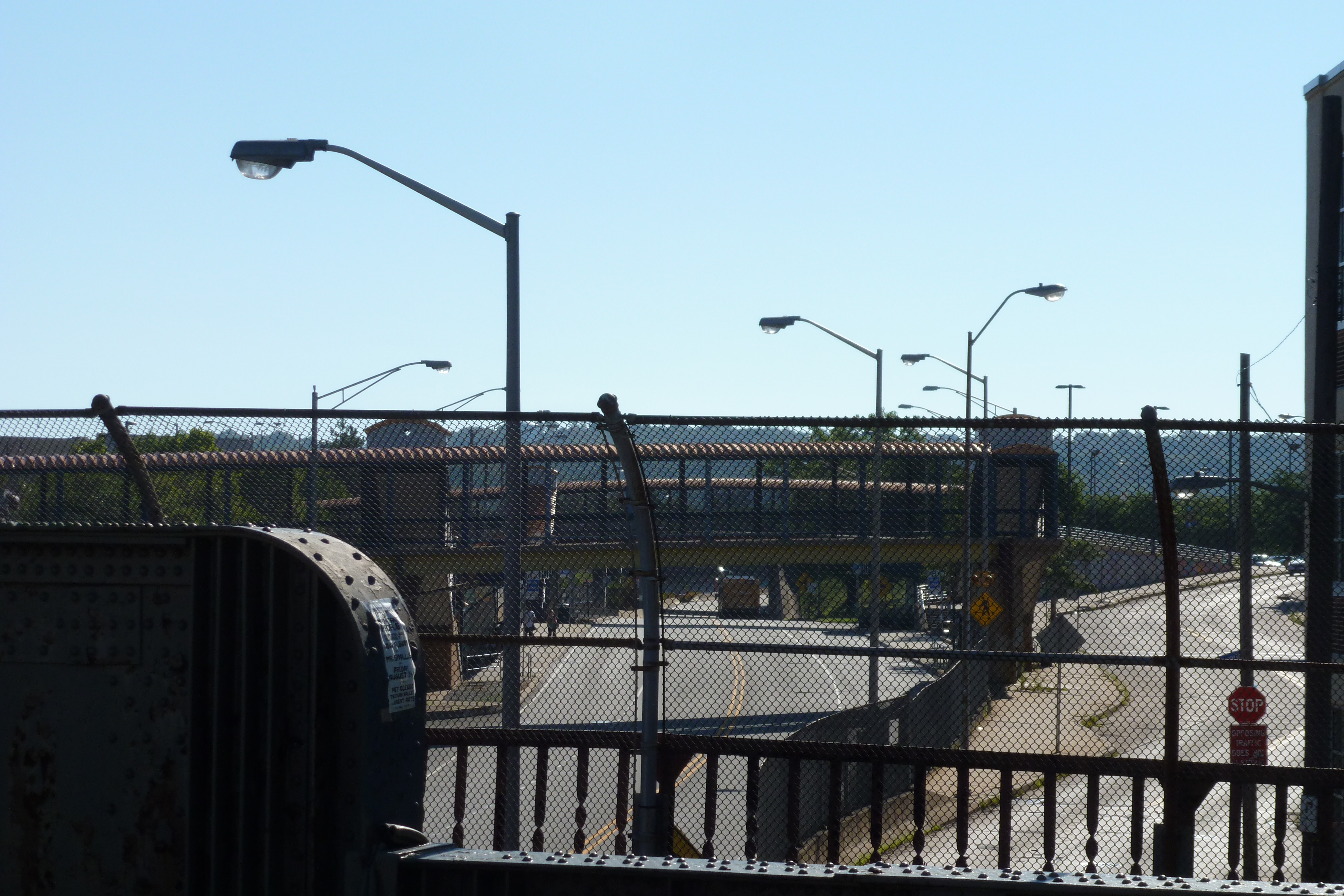
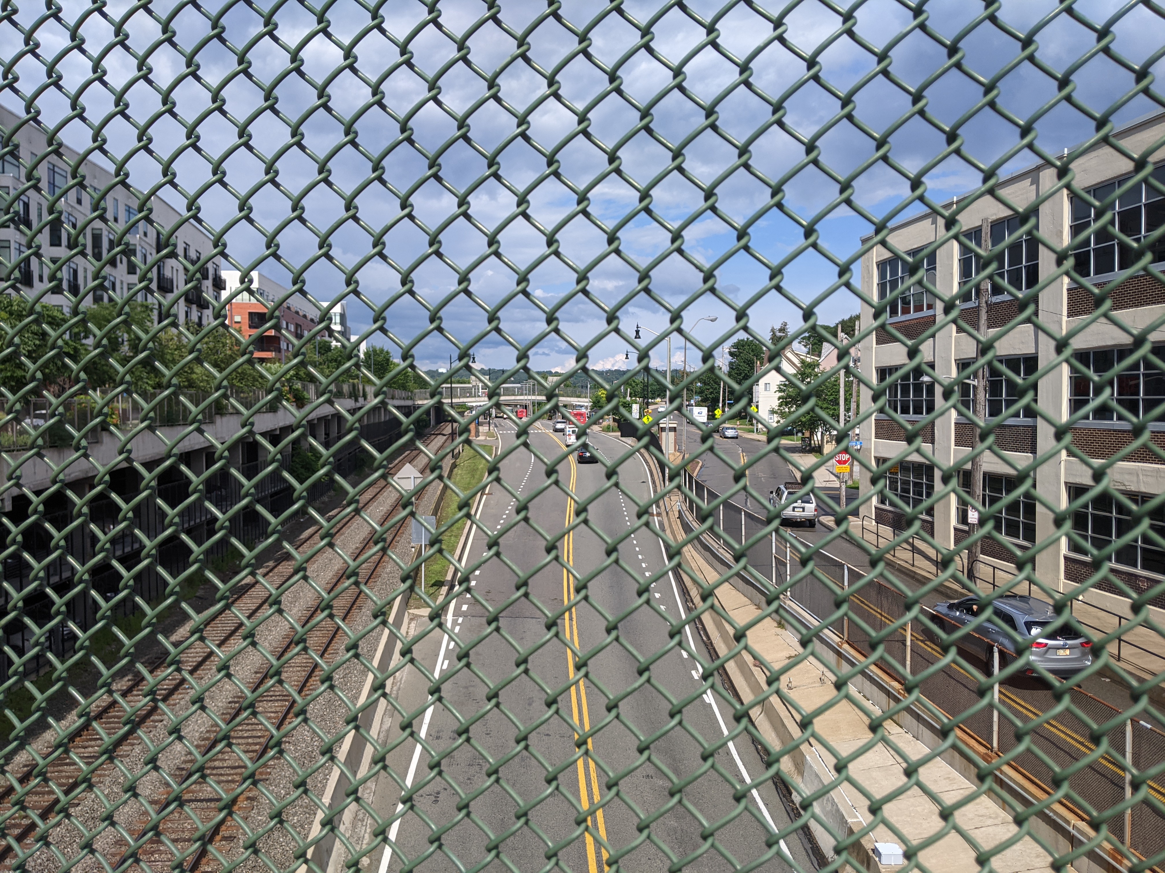
Regardless of the ramp’s condition, its fate now seems tied to the fate of the Penn Avenue Bridge as the gap between the two been filled in with much needed greenspace (first photo set below). The Penn Avenue Bridge was last inspected in May 2020 (which means it probably has been or will be inspected again this month). It received a “poor” condition rating in that inspection – a rating that is worrying for Pittsburghers since the collapse of the “poor” condition Fern Hollow Bridge, despite reassurances from the bridge engineering community that “poor” condition does not necessarily equate to imminent danger.
Penn Ave Bridge with ramp on left – July 2012 Penn Ave Bridge with ramp on left – August 2020Penn Ave Bridge & Ramp from Busway Ped Bridge – July 2012 Penn Ave Bridge & Ramp from Busway Ped Bridge – August 2020
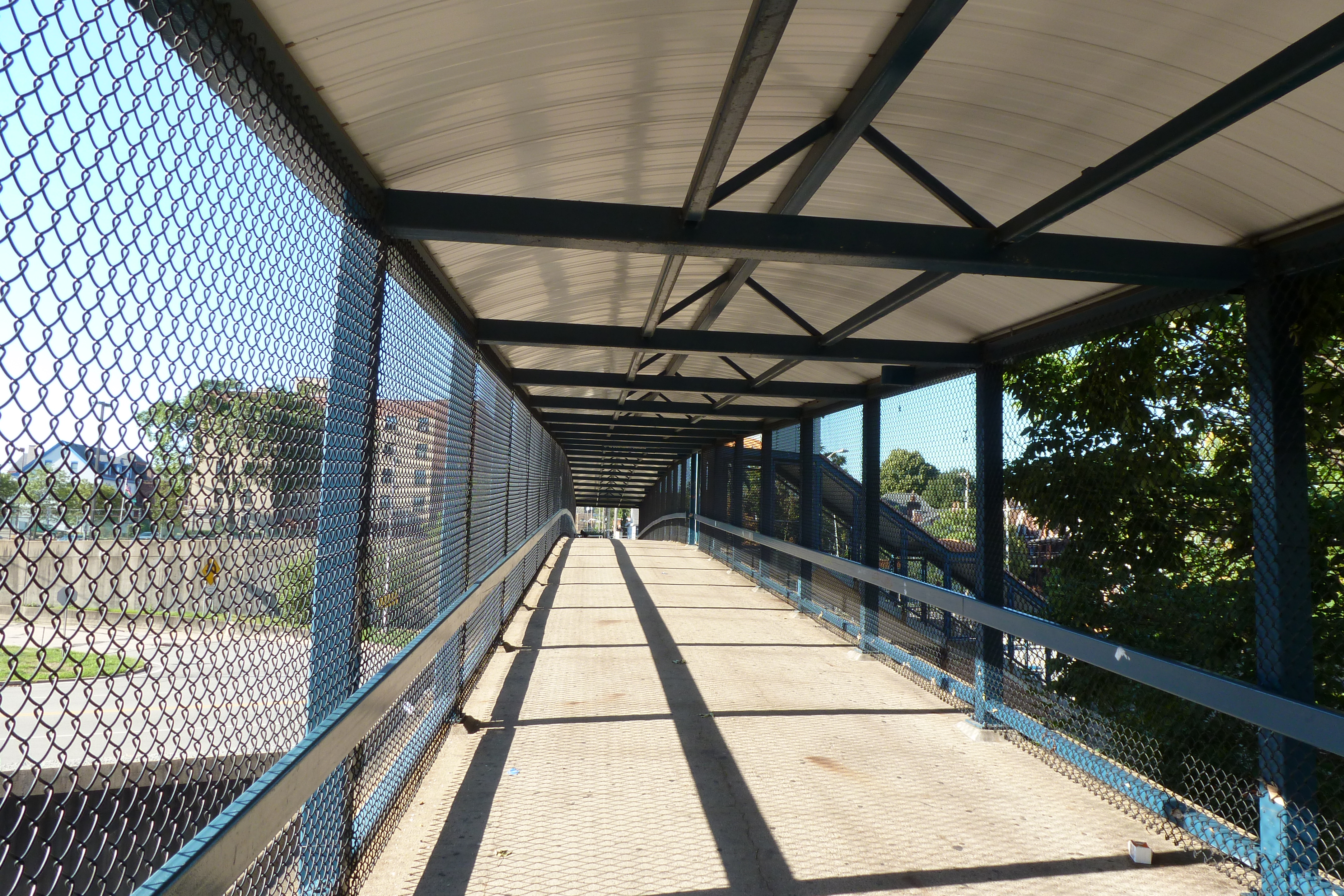
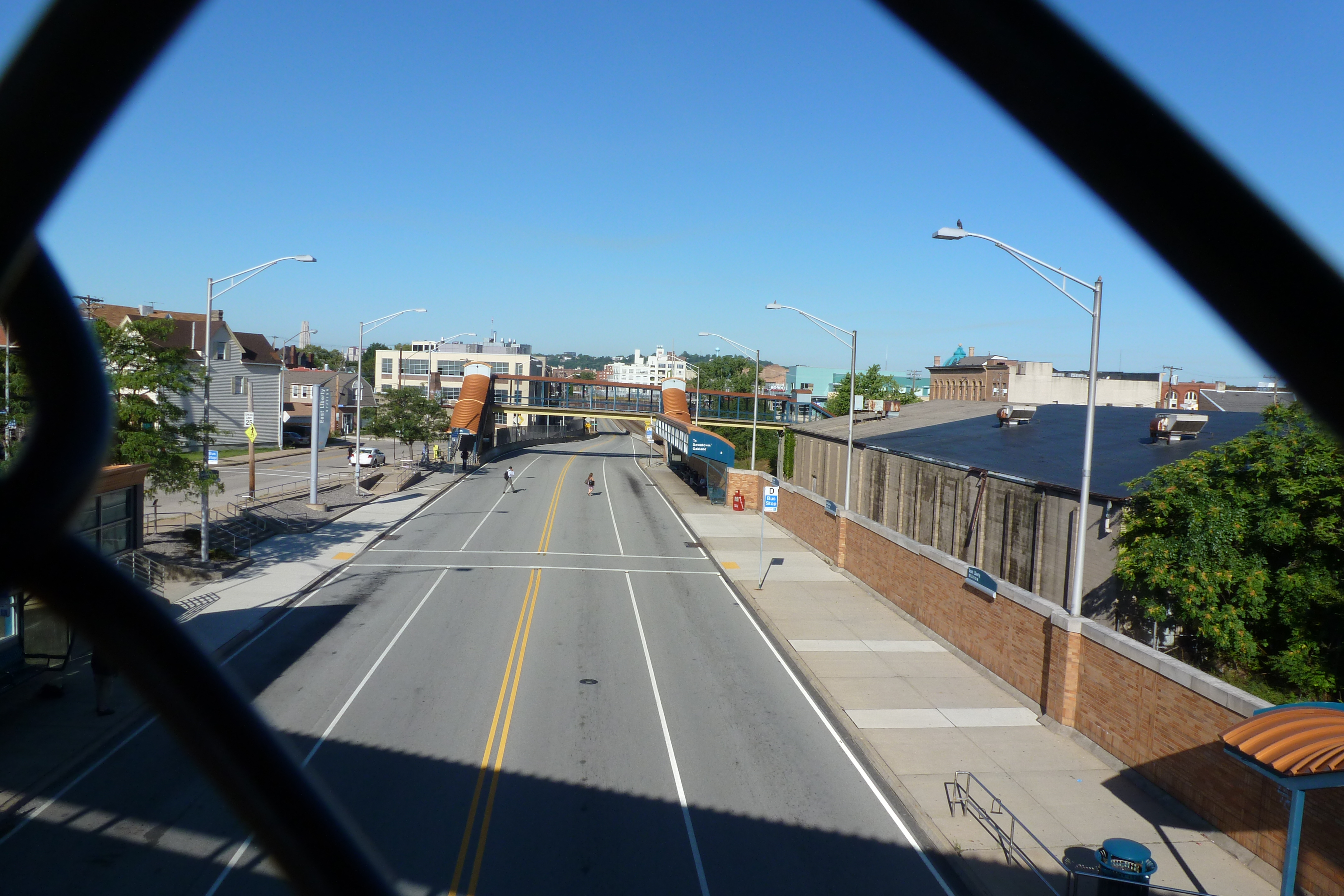
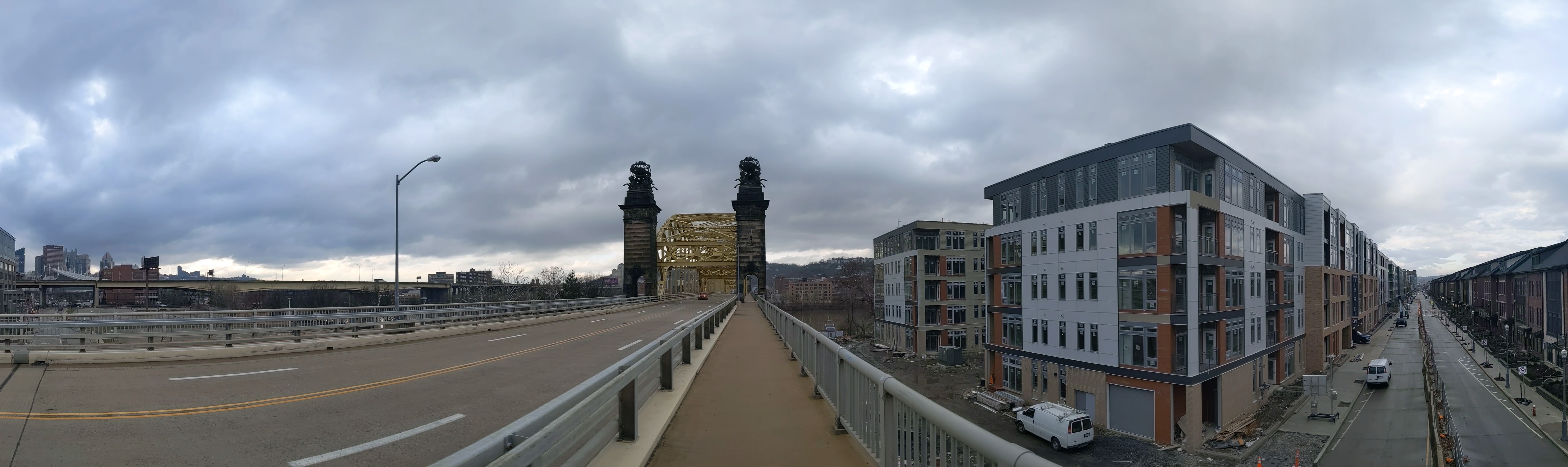
Just beyond the South Highland Bridge from the East Liberty Pedestrian bridge is the busway’s East Liberty Station. When I moved to Pittsburgh over a decade ago, there were two pedestrian bridges over the busway and train tracks – one at either end of the station – and a ramp providing buses on Penn Avenue access to the busway. Across the tracks from the busway was a one-story, graffiti-covered warehouse, a parking lot, and a drive-through bank. Along Penn Avenue and connected by the ramp to the busway was a major bus stop on its own governor’s drive.
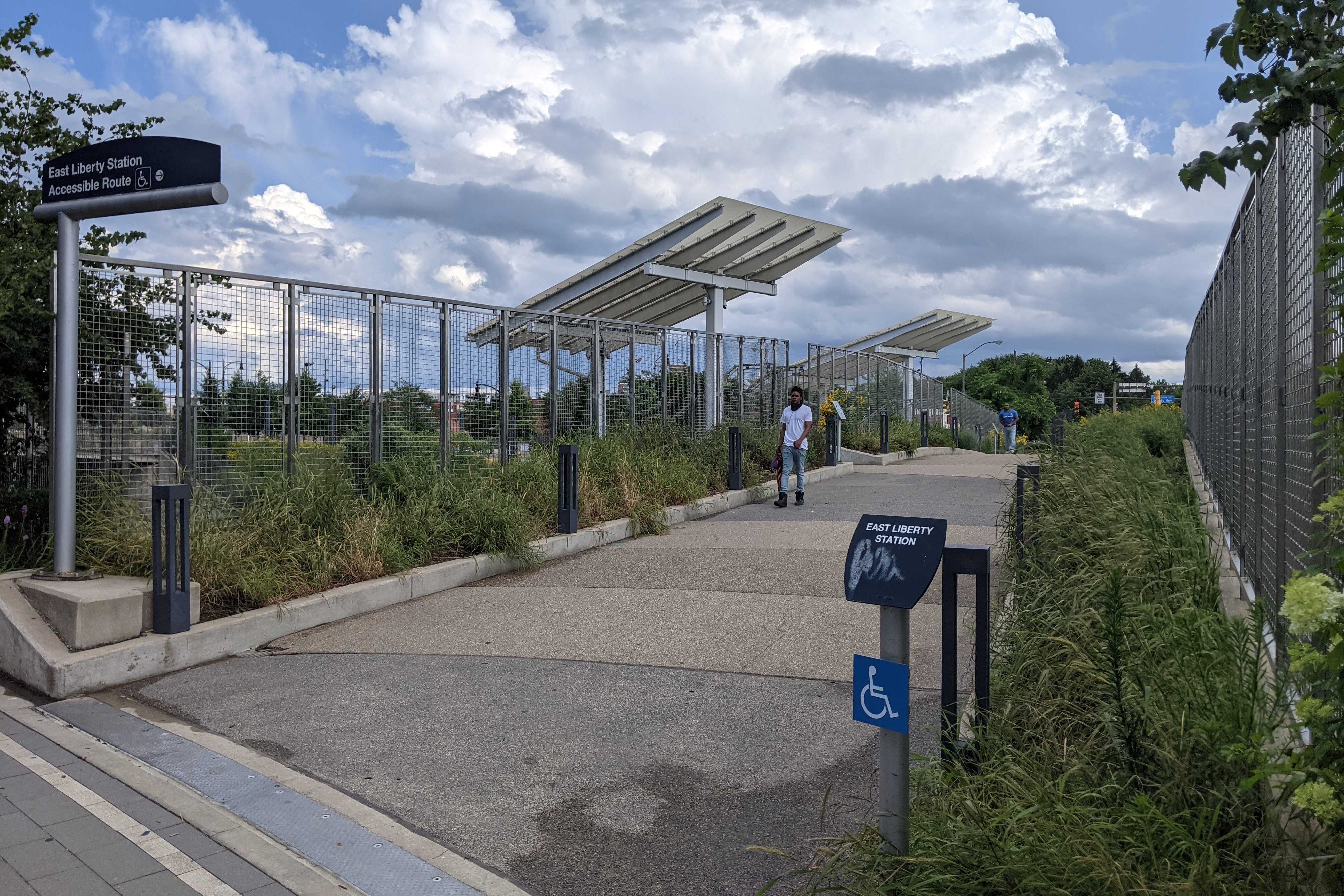
All of this was replaced in 2014-2015 with a transit-oriented development. The two boxed-in (a step beyond caged) pedestrian bridges were demolished and replaced by a new open bridge (first photo pair below) and a crosswalk on the busway. The bus ramp was renovated into an accessible pedestrian ramp (seen in the east view, second photo pair). Plantings were introduced on both the bridge and the ramp, changing this portion of the vast paved, treeless area into a desert oasis. It is still a hot and uncomfortable place to be in the summer months, but at least now there are black-eyed Susans to bring cheer.
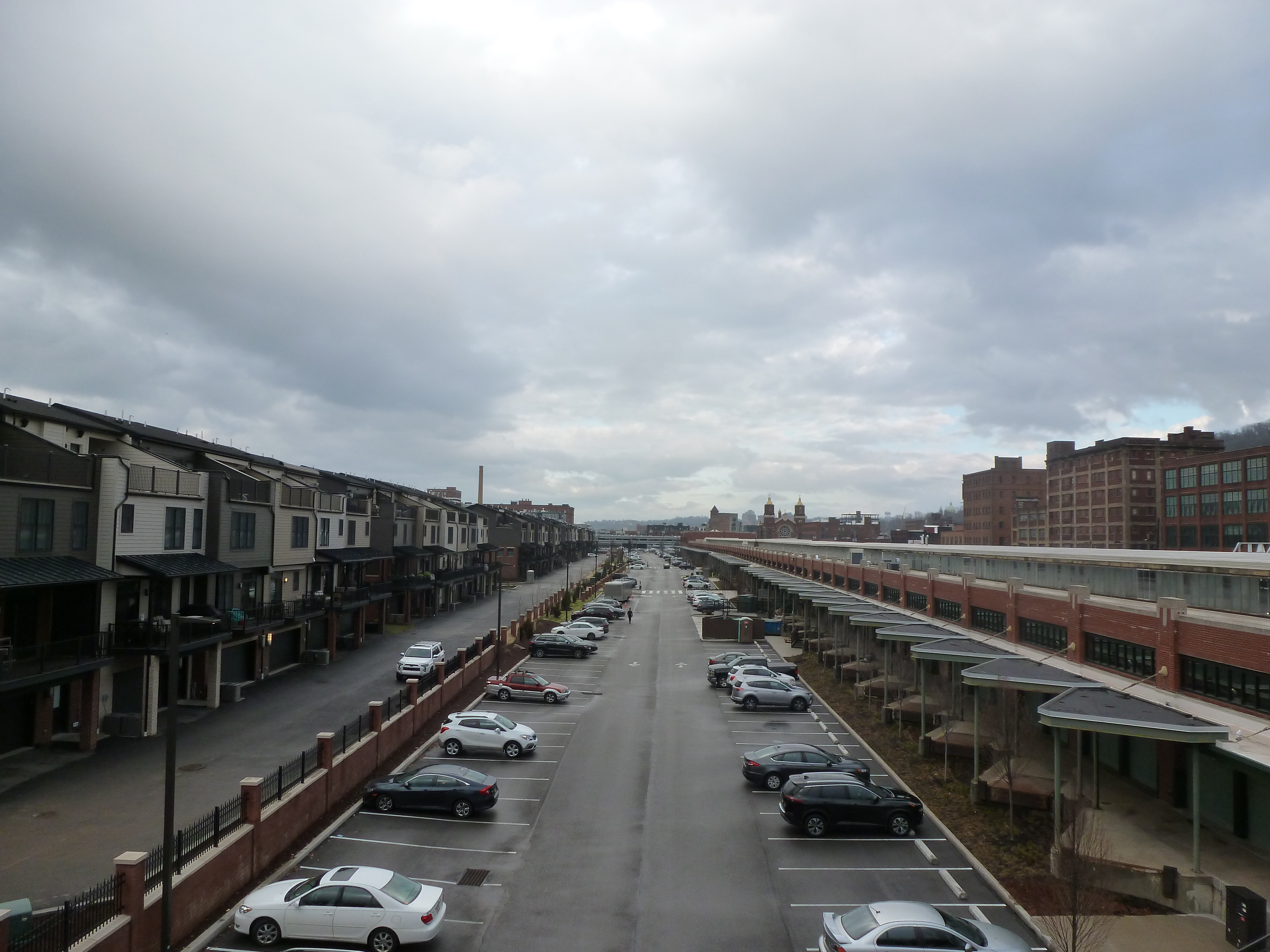
The warehouse, parking lot, drive-through bank, and Penn Avenue bus stop were replaced with a massive mixed-use complex called EastSide Bond (glimpsed on the right in the final pair of photos, also visible in the South Highland Avenue Bridge Then & Now post). The new development features 360 residential units, 43,000 sq ft of retail (most of which is occupied, except for the promised anchor tenant), 554 parking spaces in a garage under the buildings, and a 120-space bike parking garage (which I’ve only ever seen a handful of bikes in, probably because Penn Avenue is not a bike-friendly thoroughfare).
Similar to the older, new developments near the East Liberty Pedestrian Bridge, this site and its uses cater to a White and moneyed demographic. However, in 2010, East Liberty had a population that was 67% Black (down from 72.5% a decade prior) and the median income was $23,000. This means the site is catering to an audience that currently makes up a minority of the neighborhood. Perhaps that is why whenever I pass by or stop at one of the retail locations at EastSide Bond, I feel like it has a luke-warm success. In contrast, the Target across the street is heavily trafficked as is the busway station – both are used by the current population.
Once upon a time, Black residents were pushed to East Liberty through Urban Renewal and the demolition of their previous lives. Now, we may be witnessing the pushing out of Black residents through redevelopment and the demolition of their current lives. The current proposed redevelopment of the shopping center south of the East Liberty Station promises to bring the grocery store back and to include 35 affordable units out of 232. There is no mention of whether any of the other smaller retail stores that catered to the current population will be returning. I also wonder if the grocery store will still carry beauty products for darker skin tones when it reopens. Down the street, the redevelopment of the former affordable and predominantly Black Penn Plaza apartments is the latest project that is definitely catering to people who are not the majority residents of the neighborhood, after permitting affordable housing units to deteriorate through neglect before demolishing them.
East Liberty Busway Pedestrian Bridge – July 2012East Liberty Busway Pedestrian Bridge – July 2021East Liberty Busway Pedestrian Bridge – East View – July 2012 East Liberty Busway Pedestrian Bridge – East View – July 2021 East Liberty Busway Pedestrian Bridge – West View – July 2012 East Liberty Busway Pedestrian Bridge – West View – July 2021
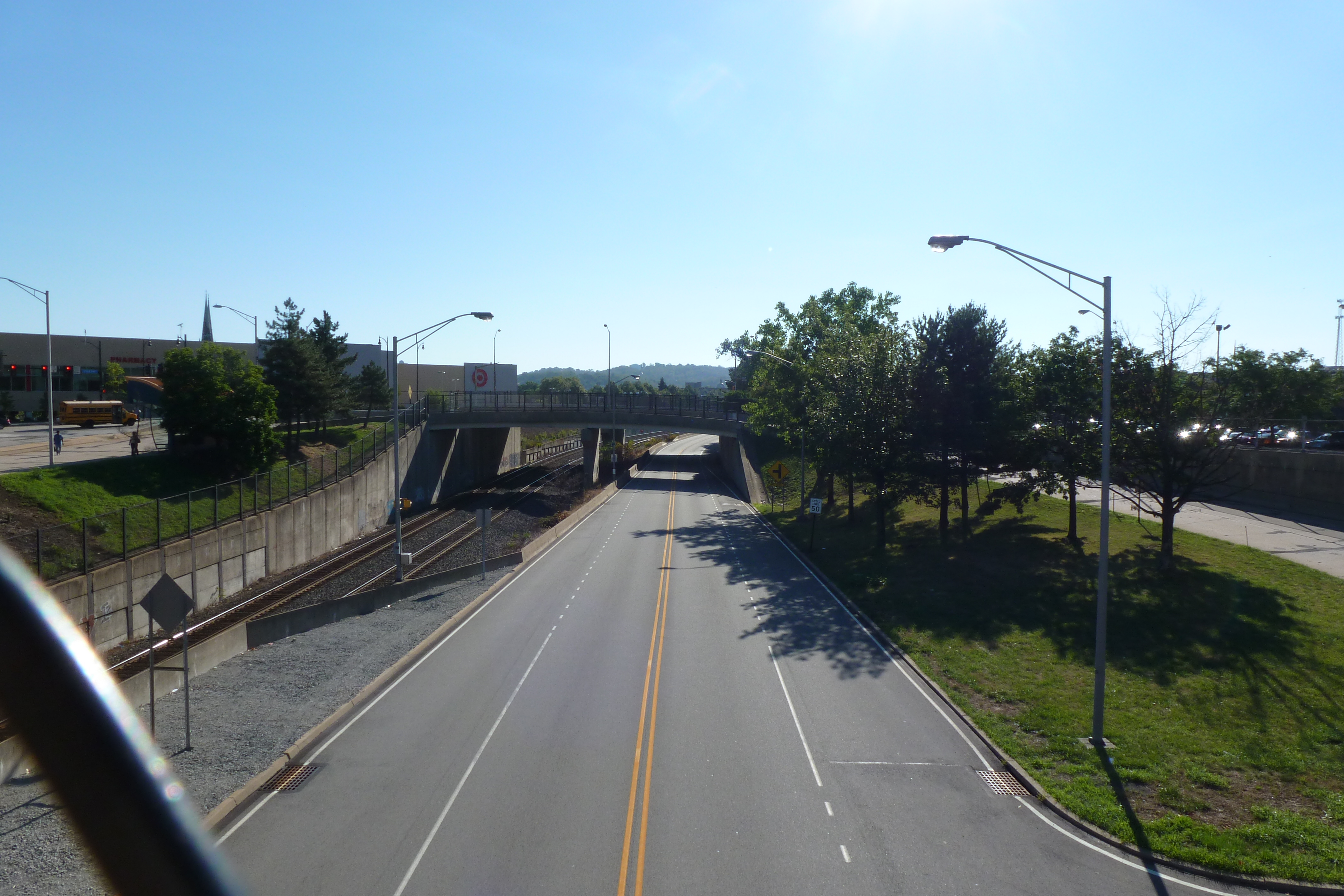
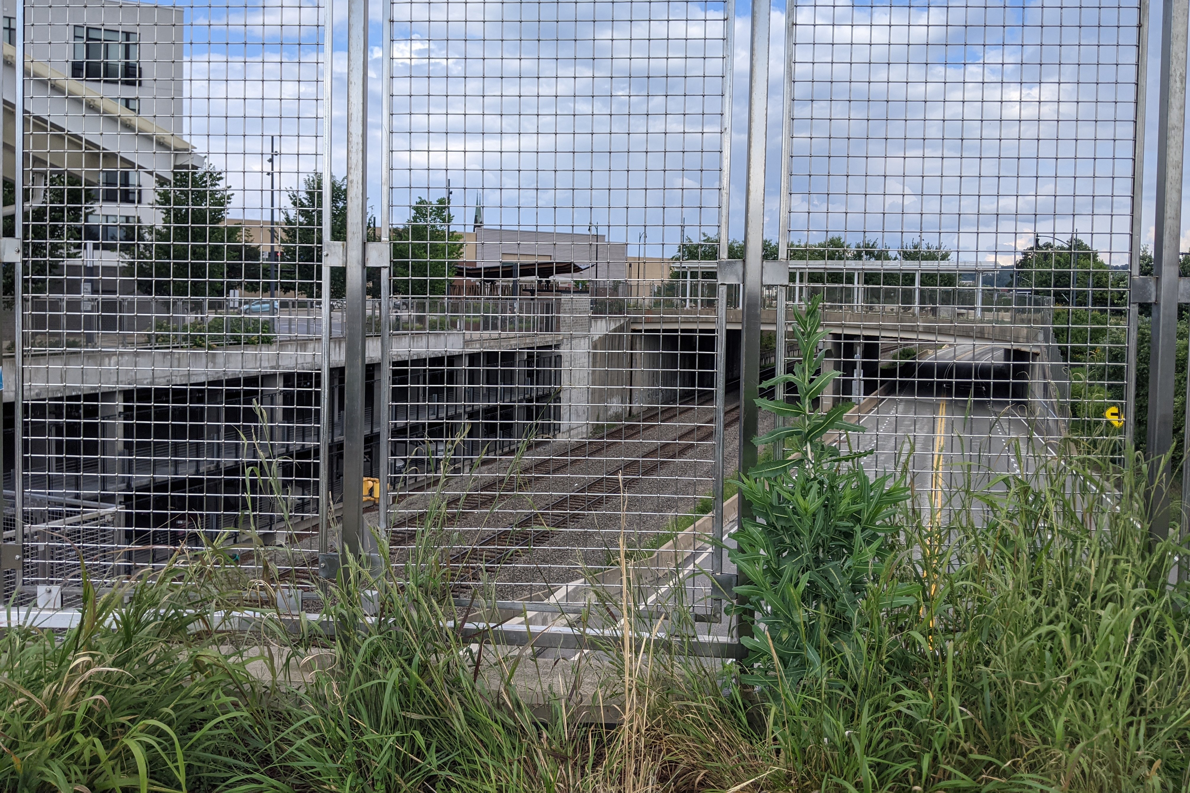
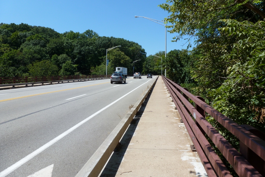
When I first started walking Pittsburgh’s bridges, the South Highland Avenue Bridge rated among those that were more than a little creepy. First, you were partially caged in. Second, the integrity of the wooden planks holding you up seemed more than questionable. I have no doubt that this bridge was rated in “poor condition” at that time. Now, the new bridge is considered in “good condition” per the National Bridge Inventory as of its November 2017 inspection. It has presumably been inspected twice more since then (November 2019 & November 2021), but those results have not been made publicly available yet.
The reconstruction of this bridge in 2013 made me hopeful that the similarly creepy bridge at South Negley Avenue would also shortly be reconstructed. This has yet to happen. My hope is renewed with the passage of the Infrastructure Investment and Jobs Act coupled with the greater attention “poor condition” bridges are receiving this year after the collapse of the Fern Hollow Bridge. However, according to a recent article on the redevelopment of the busway station adjacent to the South Negley Avenue bridge (Tribune Review, February 16, 2022), funding issues and coordination with Norfolk-Southern Railroad are causing continued delays to the proposed reconstruction of this bridge.
The new South Highland Avenue is a definite improvement over the last one. I no longer cringe at the thought of walking across it as being fenced in is better than being caged in (second photo set below). Yet, it is still not a pleasant experience to walk this bridge. On the other hand, the Smithfield Street Bridge, for example, is a nice bridge to walk despite the many places where the sidewalk has rusted out providing direct views to the river below. The difference in these experiences is in part due to the bridges’ environments – nothing short of climate change will return the former river to what is now the busway and train tracks under the South Highland Bridge. However, design also plays a part in the experience. Many people in Pittsburgh’s architecture and design community are concerned that a poor bridge design will be rushed through on the Fern Hollow Bridge replacement with the excuse that it is an emergency (WESA, March 3, 2022). As the Fern Hollow Bridge has pleasant surroundings, it will be the bridge’s design that makes or breaks the experience of using the future bridge.
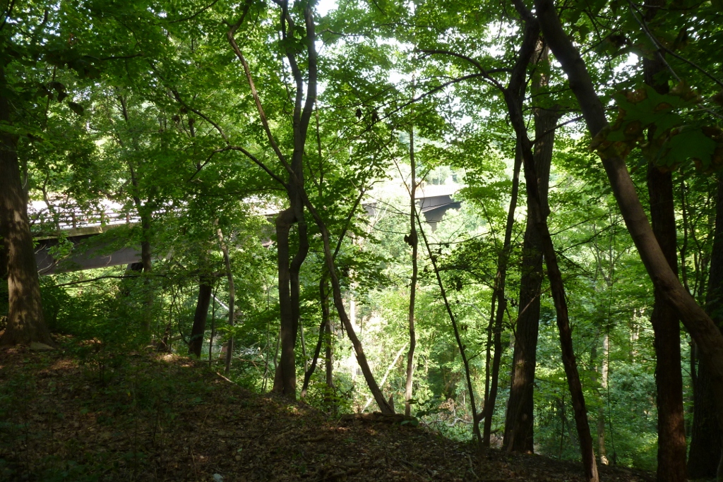
The South Highland Avenue bridge was replaced before it turned into an emergency. I assume the reason why it was replaced when it was while the South Negley Bridge continues to rust away is the massive amount of investment and redevelopment that was put into the East Liberty neighborhood in the last 10+ years. Looking west from the bridge, the early developments are visible, including the East Liberty Pedestrian bridge that was last month’s 10-year anniversary featured bridge and the Whole Foods location. These developments are old enough that the “Then” and “Now” views (third photo pairing) look substantially the same. The newer developments are clear in the east view (final photo pairing below), which looks like a completely different world between the “Then” and “Now” views. Next month’s feature will discuss this redevelopment in greater detail.
South Highland Ave Bridge – July 2012South Highland Ave Bridge – July 2021South Highland Ave Bridge north view – July 2012South Highland Ave Bridge north view – July 2021South Highland Ave Bridge west view – July 2012South Highland Ave Bridge west view – July 2021South Highland Ave Bridge east view – July 2012South Highland Ave Bridge east view – July 2021
Yesterday, after the Fern Hollow Bridge collapsed in Pittsburgh a photo circulated on social media of one of the steel support beams of the bridge completely rusted through. This photo was taken in 2018 and reported to the City’s 311 system. While the photo also showed cables that had been added to the bridge to presumably take over the job of the steel beam that then ended in mid-air, the person submitting the photo was concerned that this might not be sufficient. I have seen similar rusted conditions on other bridges that I have walked over or under in Pittsburgh. I cannot remember if it was the Negley Ave bridge over the busway, the Charles Anderson Bridge over Junction Hollow in Frick Park, both, neither, or a handful of other bridges. (Note: both of these bridges are rated in poor condition.)
A neighbor quoted in a Tribune Review article after the Fern Hollow Bridge collapse wondered why the bridge hadn’t been repaired or replaced before the accident since it was known to be in poor condition. According to BridgeReports.com, which pulled inspection data on the bridge from 1991-2017, the bridge has been rated as in poor condition since 2011. Based on my experiences and exposure to bridges, I am not surprised that a bridge was left in poor condition for over a decade. This morning, I pulled data from the National Bridge Inventory on the 449 inventoried bridges within a 6-mile radius of downtown Pittsburgh. I was surprised to find that only 10% of these bridges were rated in poor condition.
Below is a chart of the 48 bridges rated in poor condition within a 6-mile radius of downtown, which includes some that are outside the boundaries of the City of Pittsburgh. In those cases, the city owner would be the municipality they are within. The first four columns are the data I pulled from the National Bridge Inventory, the final column is from BridgeReports.com. Both sources were updated through 2018, which means that there have been some changes since then, including the possibility that more bridges have fallen into a poor state. I marked in italics the bridges that I am heard went through renovations in recent years and in bold the one that collapsed. The bridges with hyperlinks are the ones that I have walked and blogged.
A bridge collapsed in Pittsburgh this morning. While not an iconic bridge, the Forbes Avenue Bridge over Fern Hollow was significant as the sole road link over Frick Park. With this link missing, motorists and those using public transit will have to travel several miles out of their way through some very congested roads. Pedestrians and bicyclists have some shorter options using the park’s trails.
The bridge was built in the early 1970s and as far as I know has not had any significant maintenance work done since then. It is owned by the City of Pittsburgh. Based on the National Bridge Inventory by the Federal Highway Administration, the bridge was in “Poor” condition, had an inspection frequency of 18-24 (units were not included, hopefully this is months), the structural evaluation was “Minimally Tolerable,” the substructure was rated “Satisfactory” while the superstructure was rated “Poor,” average daily traffic was 10,000-15,000, and the detour route would add 2-5 miles. In addition, this site estimates the replacement cost at $6.5 million. I could not find the date of the last inspection on the NBI site. Based on a summary of inspections on BridgeReports.com, which sites the NBI as its source, the bridge was inspected every two years between 1991 and 2017, so presumably there were additional inspections in 2019 and 2021.
There was a bus and some other vehicles on the bridge when it collapsed. The two passengers on the bus were taken to a hospital with “minor injuries” as was a third person. Seven other people are reported to have “minor injuries” that did not require a hospital visit. The City’s first official press release on this disaster says that rescue efforts concluded at 8:30am, but that underneath the bridge was still being checked for potential victims – some of the park’s well-used trails pass underneath. WTAE has videos from the scene; the Tribune Review has quotes from nearby residents on what they heard and saw this morning. This story has also made national news with coverage by on the US News and World Report website.
The coincidences: President Biden is scheduled to speak in Pittsburgh today about infrastructure, including bridge maintenance, the overnight snow may have limited vehicular and foot traffic over and under the bridge, and I just happened to be somewhere where the news was on this morning in time to see the first news report on WTAE (I never watch or read the daily news).
Mayor Gainey is quoted as saying “we were fortunate.” The people using the bridge were unfortunate that the bridge collapsed when it did, but given that it did collapse, they were fortunate in that it appears there are no serious injuries and no deaths. It was also fortunate that the collapse happened before rush hour and on a bridge that was over land. If this was one of our river bridges or if it happened during rush hour, serious injury and death seem impossible to avoid.
Deferred maintenance of bridges is a real and serious thing. Bridges are a crucial part of our daily lives (especially in places like Pittsburgh). Every time I walk over the Negley Ave bridge over the busway, I warily eye the rusted structure. The old Highland Ave bridge over the busway used to spark the same reaction, but it was fortunately replaced several years ago. The Smithfield Street bridge has holes through the sidewalk. How far do we push our “poor” condition bridges before investing in maintenance and repair?
urbantraipsing turns 10 in May. To mark a decade of urban-traipsing and bridge-walking, I will be revisiting twelve of the Pittsburgh bridges I walked early on to see the changes 10 years brought to them and their surroundings.
I started walking and photographing bridges to get different angles and views of the city. In 2012, the 16th Street Bridge provided views of two major, controversial development sites: the Produce Terminal and the former St. Nicholas Croatian Catholic Church.
During the summer of 2012, the Produce Terminal seemed on the cusp of being redeveloped, and partly demolished. However, significant opposition to the demolition plans killed that proposal. For years there was no visible progress. Eventually, after extensive negotiations, a new development proposal was approved and implemented (see the first photo pair below). Simultaneously, several new developments popped up nearby, replacing much of the sea of parking I complained about in my original post on the bridge (see the second and third photo pairs below).
The former St Nicholas Croatian Catholic Church was visible from the 16th Street Bridge in 2012. Six months later, it was demolished to make way for the widening of Route 28 despite parishioners efforts to save their church (see a 2013 Tribune Review article for more). I followed the story of their fight for their building closely at the time, which is what I believe prompted me to take a photo of the church from the bridge (see the fourth photo pair below).
View of inland side of Produce Terminal (Smallman St) June 2012View of inland side of Produce Terminal (Smallman St) January 2022View of the riverside of Produce Terminal – June 2012View of riverside of Produce Terminal – January 2022Southwest view from 16th Street Bridge – June 2012Southwest view from 16th Street Bridge – January 2022View of the former St Nicholas site – June 2012View of the former St Nicholas site – January 2022
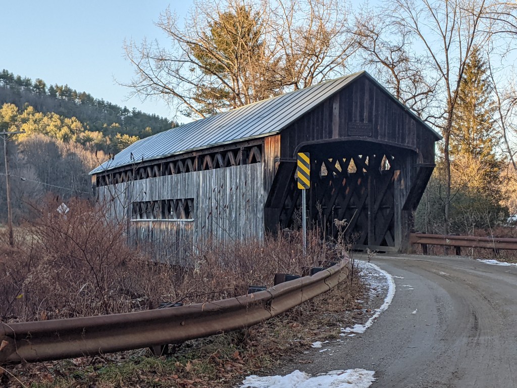
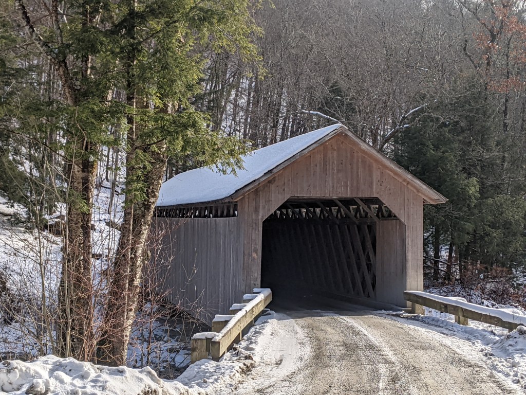
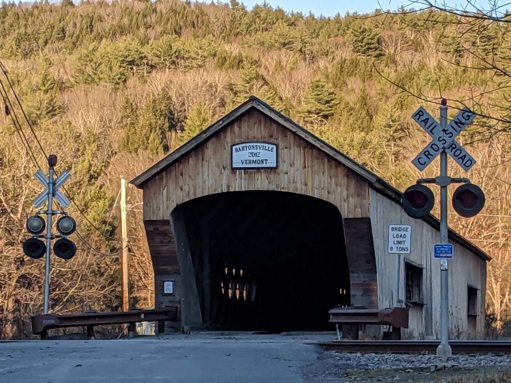
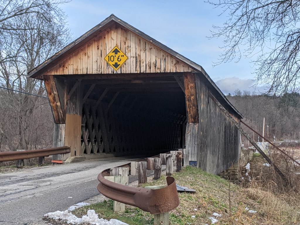
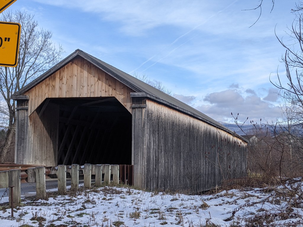
This year’s Architectural Dessert Masterpiece was inspired by a trip to Vermont where I explored 14 covered bridges within an hour’s drive of Rutland. I was surprised by the amount of variety in these bridges. Most were only wide enough for one car lane, but one was definitely made for two-way traffic and a couple had sidewalks incorporated. The colors and shapes varied from bridge to bridge. Some appeared to be based on a truss-type structure while at least one looked like it had an arch infrastructure. Ages also ranged from the 1830s (Taftsville Bridge) to 1970s (Quechee Bridge). You can view all 14 bridges in the slideshow below.
Sadly, shortly after construction, my covered bridge experienced a collapse. While the incident is still under investigation, an anonymous authority stated that the collapse is believed to have been trigged by a motorist exceeding the posted 5 mph speed limit.
I’m surprised that this is my first total collapse over the eight Architectural Dessert Masterpieces that I’ve created. My first, the Parthenon, experienced a partial collapse that actually made it look even more like the original. The next closest to disaster was the Marina Tower that merged into the Leaning Tower of Pisa.
The collapse highlighted several tips for future constructions. First, I confirmed that pretzels really do make excellent piers as I originally demonstrated in my Pittsburgh suspension bridge. Second, I learned that wheatless gingerbread still has the same (or similar) strength as traditional gingerbread as the roadbed remained secure throughout the disaster. Third, I found that wheatless gingerbread is more pliable than traditional gingerbread, which resulted in more warping when transferring the pieces to the baking sheet and during baking. However, the other side of the pliability is that it is easier to trim after baking than traditional gingerbread. If I use this recipe again, I will plan to make adjustments to the dimensions of the pieces post baking. I believe that will resolve the structural issues by creating straight edges that can support each other.
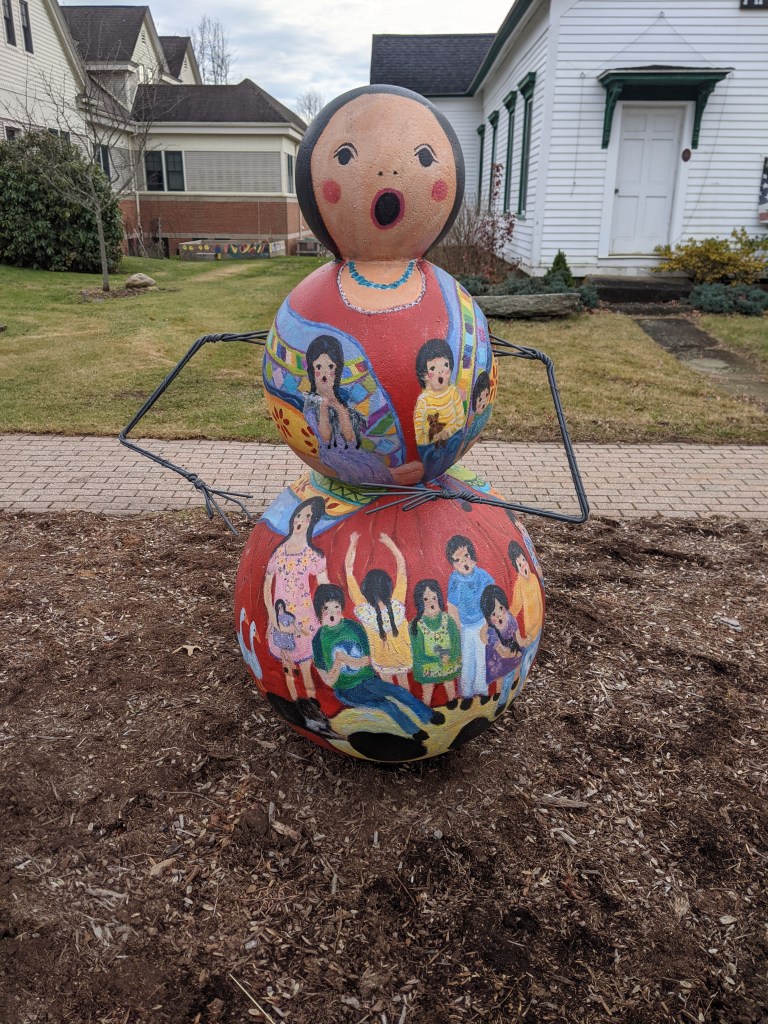
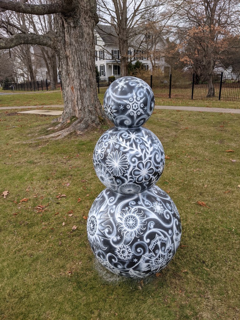
Pittsburgh dinosaur hunting is on pause this month. Instead, the public art feature of this month is from Hebron, CT. Hebron is a typical small Connecticut town built up at a crossroads. It was incorporated in 1708 and its current population is just under 10,000. In passing through on a recent trip around New England, my eye was caught by a public art display of snow people on the town green. I originally assumed that this was one of the fiberglass fundraisers like the Pittsburgh DinoMite Days dinosaurs, however these snow people are made of Styrofoam. However, like the fiberglass statues, each one is decorated by a different artist. They seem to be a new annual tradition of the town, having first appeared in the winter of 2020 then hibernating over the summer before returning this winter. Scroll through the slideshow below to see all eight of the snow folks (my favorite is the hula dancer).
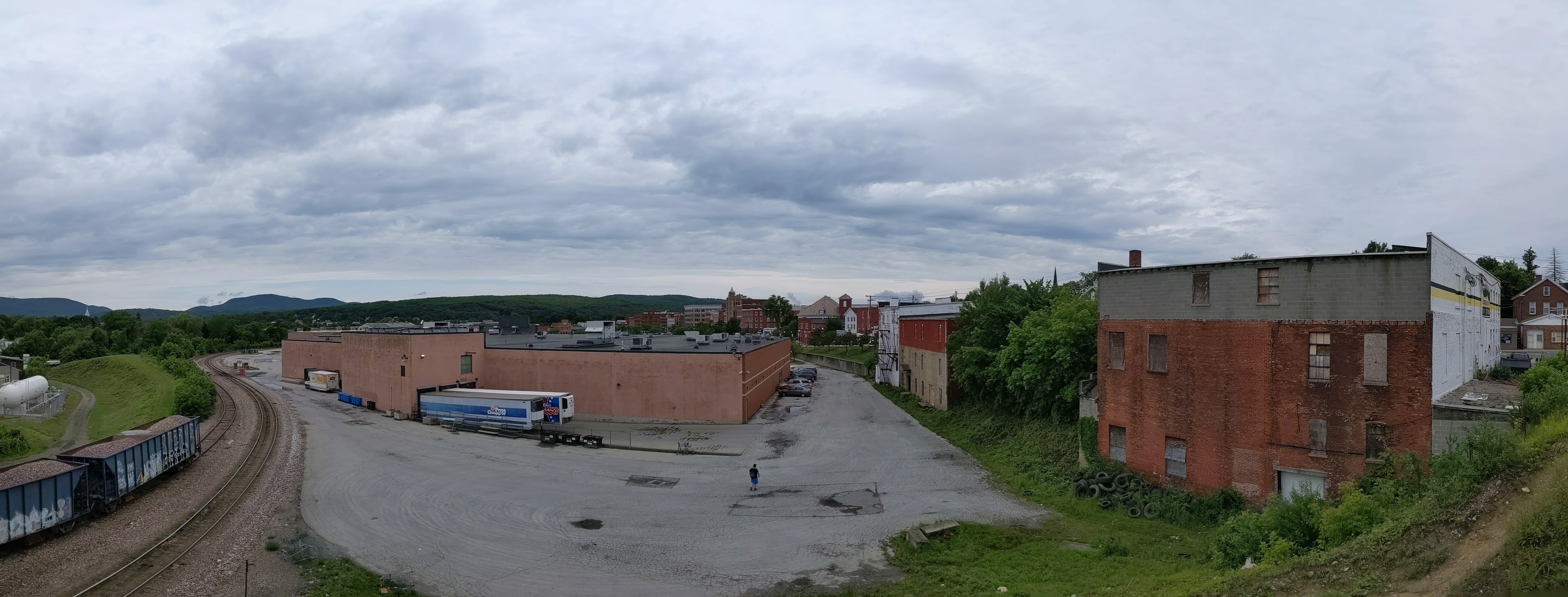
While wandering around Rutland, Vermont’s third largest city coming in at around 16,000 residents, I found a bridge. Naturally, I walked across it. The bridge connects the worker housing on the flats to the cultural/civic center on the slope beyond which are the wealthier residences. In addition to overcoming the obstacle of the elevation change, the bridge spans the remnants of the formerly extensive rail yard much of which has been converted to a shopping center.
There was also a railroad bridge near the other end of the shopping center. By the time I found this bridge I was hungry, overcome by the humidity, and over a mile from where I was staying. A little farther on were some creeks that probably have bridges over them. I’ll have to look for those the next time I’m in town.
Rutland is a small town in Vermont of just over 15,000 residents incorporated in 1892. At one point, it was a major railroad hub for local marble quarries. Its past and present is clearly reflected in its public art.
Instead of the fiberglass sculptures I stumble upon in many cities, in Rutland, I discovered a series of marble sculptures featuring important people from Rutland. The people honored in the sculptures I found are Paul Harris, founder of the first Rotary club; Andrea Mead Lawrence, an Olympic skier; William G. Wilson, co-founder of Alcoholics Anonymous; the immigrants who worked in the quarries; and Martin Henry Freeman, an African American educator and abolitionist.
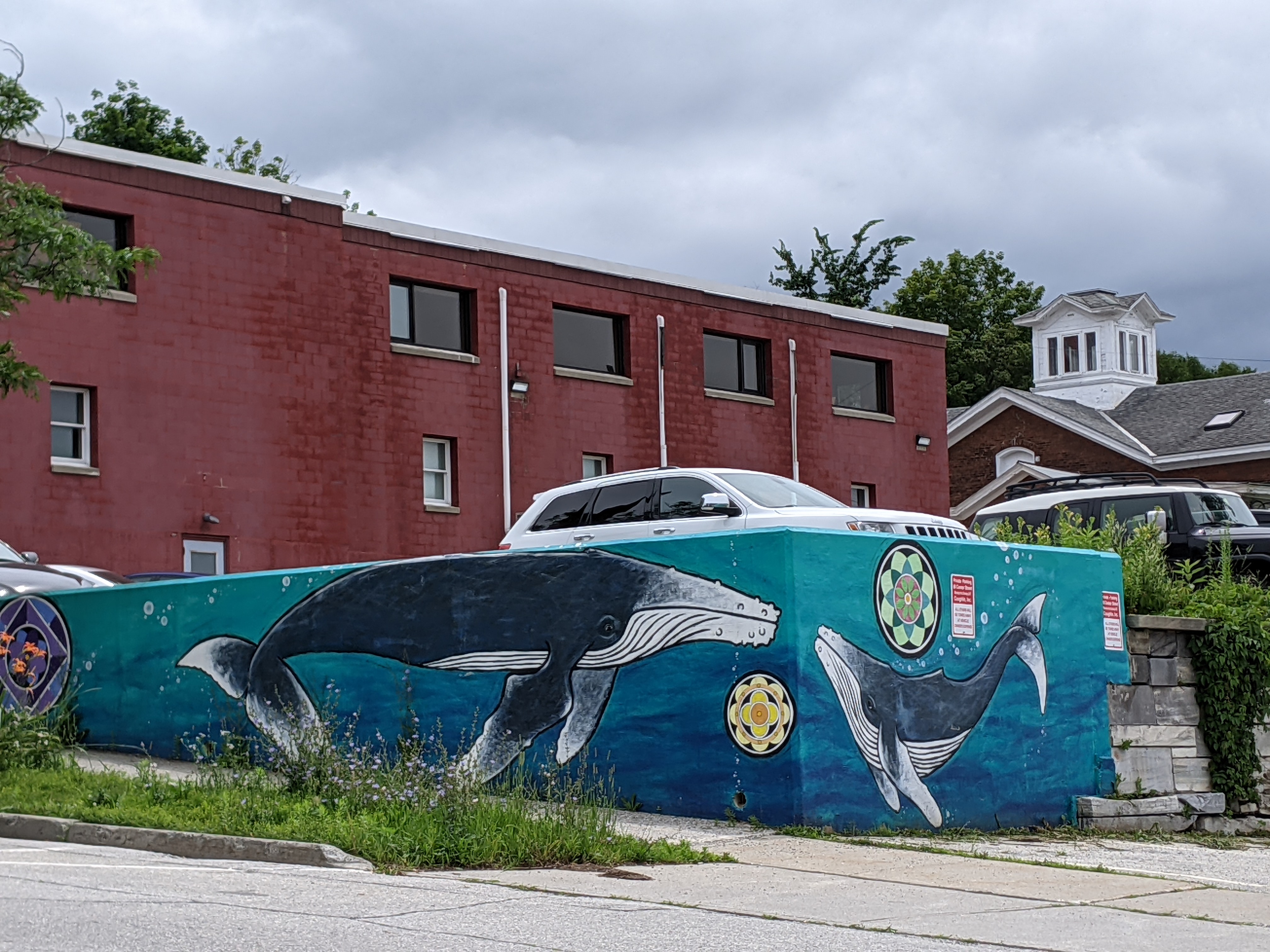
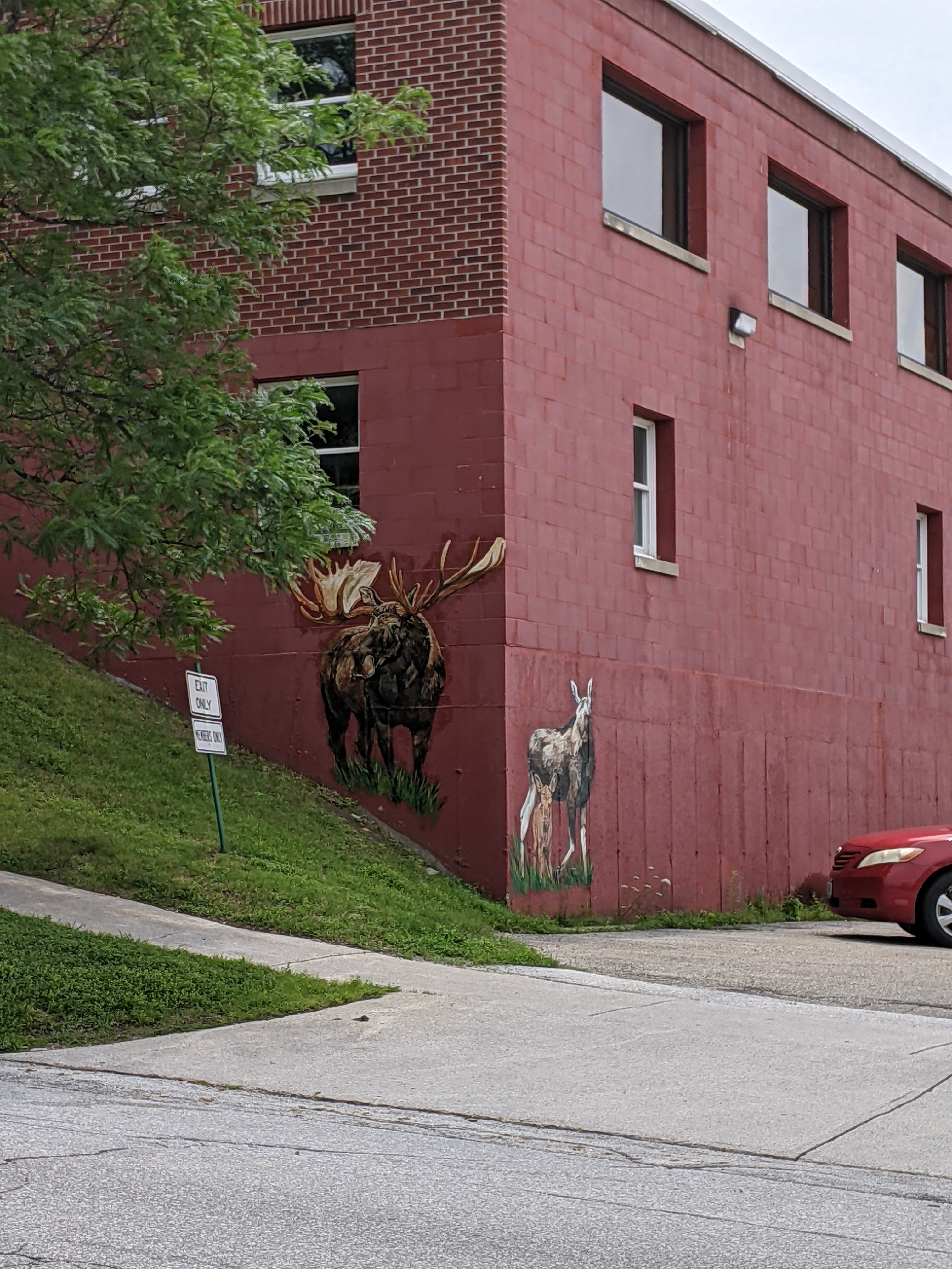
Today, Rutland has a strong environmental and arts focus. In my wanderings, I discovered two sculptures from the Trash2Art series, one from the HeART of Rutland series, and several murals. The mural of whales was particularly eye-catching given that the ocean is hours away. I wondered about the choice of subject until I saw the closest cross street was called Wales Street. The moose just up the street were almost as elusive as real moose – despite multiple trips to Vermont and one to Alaska, I have yet to see a live moose.