Layers of the City: Pittsburgh Edition

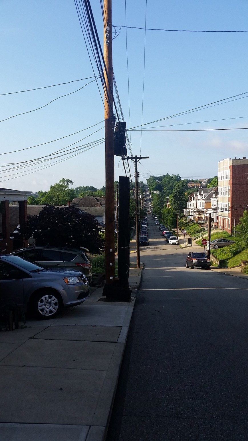
I clench my teeth every time the “T”, Pittsburgh’s light rail system, slowly makes the first 90 degree bend leaving Gateway Station, squeaking like fingernails on a chalkboard.  After traveling a few hundred yards, it turns back 90 degrees–squeak, scratch, squeak–before pulling into the Wood Street Station.  As everyone knows that the shortest distance between two points is a straight line, I struggled to understand why the T was built with turns so sharp it is impossible for the trains not to screech, until my friend pointed out that there might be building foundations or basements that the underground tracks need to maneuver around.

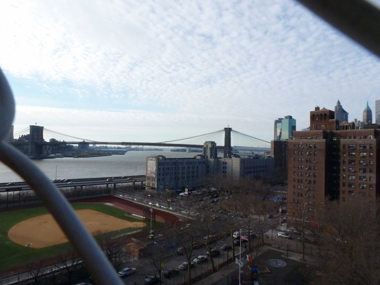
Like many metropolises, the density of downtown Pittsburgh creates various physical layers of activity.  Yet compared to other some other cities (see Layers of the City: Chicago Edition), Pittsburgh’s layers can be hard to notice.  The T is perhaps the most obvious example.  For most of it’s length through the southern neighborhoods and suburbs, the T travels at grade.  Once it crosses the Monongahela River into Downtown, it becomes an elevated train for a few blocks before submerging underground until it passes under the Allegheny River to the North Shore, where it reemerges to end as an elevated train.

Underground Life

If you get off the T at Gateway Station and walk down a block to the start of 5th Ave, which actually feels like an alley, you might notice that the Highmark Building is built over an underground garage.  I assume that this garage has multiple levels below grade and is at least part of the reason for the T’s sharp turns.

The new PNC Tower also has a garage below grade.  Yet the most recent new construction project downtown, on the former site of Sax Fifth Avenue, places the garage between the first floor retail and proposed upper level residences.

The building I work in, the former Jones & Laughlin Steel Mill Headquarters, has at least 3 1/2 levels of basement.  The building is long past its days of glory with peeling paint, cracked foundation, and elevators that you may never make it out of again.  The mezzanine level of the basement is a maze of building supplies, file cabinets, discarded furniture and boxes upon boxes of documents.  It is damp and dusty.  Five minutes down there could lead to a severe allergy attack.  Yet the stairs keep going down and down, plunging further into the dark depths.  I’ve heard rumors of more documents being stored in the lower levels.

Street Level

Coming back above ground, most activity in downtown Pittsburgh takes place at street level.  Pedestrians, bicyclists, buses, cars, delivery trucks, dumpsters, and more compete for space on the narrow streets and sidewalks.  Most shopping and restaurants are located at street level.  The Highmark Building and the Oxford Building still have some retail above the first floor.

Pie in the Sky

As you walk around downtown, if you look up, you might catch a rare sight of pedestrian sky bridges.  The most famous of which is the Bridge of Sighs connecting the Allegheny County Courthouse with the former Jail.  The second most famous (speaking with pure bias) is the bridge connecting the parking garage with what used to be the shoe section of the former Kaufmann’s Department Store (always a necessary stop when shopping for back to school).  A handful of others are sprinkled throughout downtown.  Indianapolis has got us beat though.  That city has a network of pedestrian connections that enables you to walk for miles between the stadiums, office buildings, and other structures downtown without ever getting a taste of fresh air.

Higher up, there is a sprinkling of rooftop or penthouse restaurants.  This is one of our complaints at work: while many new, good restaurants have opened downtown in recent years, there is still a dearth of restaurants and bars with views.  Sienna Mercado’s Il Tetto, Harris Grill, and the Biergarten at Hotel Monaco all have rooftop decks, but they are surrounded by taller buildings limiting views.  Ollie’s Gastropub on the top floor of the Oliver Building has some good views, but no fresh air.

There isn’t much connection or relationship between the different parts of these layers in Pittsburgh.  It is like they are experiments, like the city is only dabbling.  As if to say, it can’t make up its mind whether or not to let the public leave street level and participate in or explore all levels of the city.

Pittsburgh’s Bragging Rights

I mentioned previously that I totally geek out over maps.  I recently came across a fascinating “new” map called The “Z” Atlas & Map of Pittsburgh, PA, and Mount Oliver, PA.  I am adding it to the Sanborn Maps and GM Hopkins Maps as a go-to for studying the changes Pittsburgh went through in the 20th Century.  The “Z” Atlas was published in 1952.  There are two things about this map that caught my eye as setting it apart from others during my initial perusal.

First, in the street index, it identifies which streets have unusual addressing.  Pittsburgh is known for some unique addressing situations.  For example, there is a block where houses built before WWII have 1300 numbers and the ones built after WWII have 1400 numbers, even though they are intermixed.  This atlas shows that the post WWII houses were built after 1952 because the address numbers on that street weren’t wonky yet.

Second, this map claims that “Pittsburgh has more streets than any City in the World. You will find EVERY ONE of them in this ‘Z’ Atlas and Map!”

“Preposterous,” I said, when I first read that claim.  Pittsburgh’s land area is small compared to other large metropoles.  It does not make Wikipedia’s current list of the 150 largest US cities by land area.  Without digging into census data, I assume that many of the old cities (ex. New York City, Chicago, Cleveland), if not most of the 150 listed, likely were of a similar size in the 1950s as today.  How could it be possible for Pittsburgh to have more streets than these cities that are significantly larger?

Then it hit me.  It is possible by the same token that makes it possible for Pittsburgh to have more bridges than any other city in the world, more steps than any other city, and the steepest paved street in the world: topography.

Pittsburgh’s many hills, ravines, cliffs, and rivers mean there are few long streets and many short streets.  Maybe after all, Pittsburgh did have more streets than any other City in the World in 1952.  Reading more of the “Z” Atlas, it elsewhere explains that Pittsburgh had over 6,000 streets at the time of the map’s publication.  That number does include the numerous “paper” streets that were surveyed and mapped, “but never built or even marked in the dirt.”

Many of these paper streets still exist today causing headaches for the City and its citizens, but some have been vacated and turned over to private ownership.  Between that and the rise of mega-cities since the 1950s, I won’t say that Pittsburgh can still claim more streets than any other city.  A quick Google search showed that the question of what city has the most number of streets is not as well discussed as what city has the most bridges.  Perhaps a more ambitious person than myself could run an analysis to see whether Pittsburgh still has more streets than any other City in the World.  (Don’t forget to count the step streets!)

Utility Siloes Part 2


20180624_080041 (2)

Dismantling in progress (6/24/2018)


After continued observations, I need to modify some of my assumptions in the post Utility Siloes.  It turns out that the existence of the other utility wires attached to the poles does not prevent the old poles from being removed.  Instead, weeks after a new utility pole is installed, the remainder of the deteriorated pole is removed except for the chunk where the other wires are attached.


20180624_080058 (2)

Close-up of the dismantling (6/24/2018)

Perhaps the crew that removes poles is different than the crew that installs them.  Although, the installation team is able to lob off the top of the old pole after they transfer the wires to the new one.  Why then can’t they dismantle the rest of the pole at the same time?  And in the case of constricted locations, such as the feature of these posts, why can’t they located the new pole in the same location as the old one?


20180630_093623 (2)

Dismantling Complete (6/30/2018)


20180630_095652 (2)

View of another dismantled pole, the remaining chunk is secured to the new pole by a rope.


Utility Silos

20180421_133652 - Copy

The obstruction from utility silos

This spring, the electric company went around my neighborhood installing replacement utility poles where the existing ones were on their last leg.  Watching them do this for a pole just down the street from me, I drew some conclusions about the interaction between the various companies that supply the different technologies available at our fingertips.  The electrical company owns the poles and the electric wire, but other companies own the other fiber optics and cables that use the poles.  The electric company installs new poles when the existing ones are deteriorated.  Once installed, they transfer the electric lines to the new pole.  The old pole is left with all the other lines in place, until the companies that own the rest of the lines transfer them to the new pole.

This arrangement seemed relatively harmless as I watched it in action near my house, but then I found the example above.  In this case, the rigidity of the silos and jurisdictions of the various companies created a physical barrier in the neighborhood that will likely be in place for the next 35 years or so, until the pole is ready to be replaced.  This is in direct contradiction to the City’s initiatives for greater accessibility illustrated by the sidewalk curb ramps installed within the last year at the intersections on either side of this pole.

20180421_133736 - Copy

Close-up showing the curb, the old pole, the new pole, the foot of sidewalk left, and the combined driveways

The choices were limited for siting this new utility pole.  There are driveway curb cuts immediately adjacent on either side.  Therefore, to place the new pole in line with the existing poles would have partially blocked someone’s driveway.  Apparently, the silos are so entrenched that even under unusual circumstances such as these the various companies cannot work together so that a new pole can be placed in the exact same spot as the old pole.  The sidewalk that was already narrow and could not accommodate the recommended 5-foot clearance around obstructions is now nearly impassible and requires pedestrians to cross partially on the driveways.

I do not know if anyone paused before installing this new utility pole to ask if there was a different or better way to approach the situation.  From my experiences at my office in trying to work with others to design an approach that looks at the organization as a whole while still respecting and acknowledging each area of expertise and specialization, it is difficult to get all parties at the table to apply creative thinking and openness to how we can approach our work.  No doubt, even if someone was able to get all relevant parties involved in this utility pole to the table, they would have encountered similar challenges.

20180421_133844 - Copy

Evidence that the old poles eventually get removed and an example of where a new pole was placed next to the old along side the curb

Brooklyn Bridge

119 (1024x768)

Yesterday, as I was writing my post about the Wheeling Suspension Bridge by Roebling’s competitor, I was fascinated to discover that I never wrote a post about my walk across the Brooklyn Bridge. I decided to rectify the situation. The more I worked on it; the more fascinated I became. At this point, nearly 5 years after having walked it, all I can surmise is that I must have been very tired and/or hungry while crossing it.

In my post on the Manhattan Bridge, I mention how much more I liked that bridge than the Brooklyn Bridge. I can remember how much more thought provoking I found the Manhattan Bridge, but in looking back at my photos, I am shocked at how uninspiring I found the Brooklyn Bridge. I think it may hold the record for the fewest number of photos I’ve taken of any of the bridges I have walked. Especially, if we look at number of photos versus the length of the bridge. I suppose there may have been some other factors such as the construction zone on parts of the bridge.

144 (1024x768)

Another factor may have been the fact that the walkway is in the center of the bridge and above level of the traffic. While I remember this as a highlight and an intriguing part of the bridge, I also seem to recall that it may have caused interference with framing any potential photos.

156 (768x1024)

I will take back some of my comments on the Wheeling Suspension Bridge. While both bridges do have a lot of structural parts holding them up, those of the Wheeling bridge were much more fascinating. This may in part have been because you were able to get up close with them.

Below are the views of the surroundings. On one side you have the Manhattan Bridge and on the other the Statue of Liberty. That is just about the extent of the photos I took from the Brooklyn Bridge.

154 (1024x768)

166 (1024x768)

I feel that I ought to give this bridge a second chance. If/when I ever make it back to New York City, I think I will have to walk it again (maybe after a good meal). The problem here is that my last trip there in 2012 when I first walked the bridge confirmed for me that New York is really not the city for me and I have no plans to make a trip back anytime soon.


Heth’s Run Bridge: Redux

Heth’s Run Bridge, the first bridge I posted about in my Pittsburgh bridges project, is scheduled to be replaced by the end of next year.  The notice to proceed was expected to be issued last week with construction beginning on Sept. 24 with the installation of a temporary road around the bridge, through the zoo’s parking lot.  According to the schedule that was passed out at a community meeting at the end of August, the bridge is expected to close with all car traffic being diverted to the temporary road on Nov. 1st.  Due to the turning radius constraints with the temporary road, trucks will not be permitted and will instead be by way of the Highland Park Bridge, Route 28 and the 62nd Street Bridge.  If all goes according to schedule the bridge should reopen to all traffic on October 1, 2014.  Additional road work will continue through October.  After final inspections, the project is expected to be officially completed by December 8, 2014.

Heth's Run Bridge's hazardous sidewalk

This is a PennDOT project expected to cost over $18.5 million and is definitely needed.  As I discuss in my Heth’s Run Bridge Part II and Highland Park Bridge posts, the sidewalks here are in desperate need of repair and the proportion of sidewalk to road across the bridge is at least 50 years out of date.  All this is going to be addressed in the reconstruction.  The new bridge is going to have two lanes in each direction to match the roadway on either end.  Additional features of the new bridge will be decorative railing, period lighting, entrance pylons, and “architectural features on the abutments with form liners” (which I believe refers to new urns).  At the community meeting, it was mentioned that the current urns will be saved and kept in a warehouse until a new home is found for them.

In addition to the bridge, about 870 feet of Butler Street are going to be reconstructed including sidewalks.  My understanding is that this is the part of Butler from the Heth’s Run Bridge to the ramps of the Highland Park Bridge, which should take care of my complaints about the condition of the sidewalk for those of us trying to cross the Highland Park Bridge without a car.  This should also clear up the confusion for the outbound traffic of whether this part of the road is one lane or two as the plans include removing the “kink” from the existing alignment.

New signals and ADA ramps will be installed at the intersections of Butler with One Wild Place and with Baker Streets.

Another major part of the project is the excavation under the bridge to an elevation of 762.  According to GoogleEarth, the bridge is at an elevation of 800 ft. I’m not sure if this will restore the bridge to its exact historic height, but it will be close (see the photo of the previous bridge from 1912).  This will also pave the way for connecting this area to the proposed Allegheny Riverfront Green Boulevard project.

This project will no doubt cause some inconveniences during the construction process, but the construction of the temporary road will significantly cut down on this even though it adds over a month to the process.  Imagine instead, everyone having to go on the truck detour or all the Zoo traffic coming down Morningside Ave and Baker Street instead of One Wild Place and Butler Street.  That would be a true nightmare.  Thank you, PennDOT and the Pittsburgh Zoo & PPG Aquarium for the temporary road.  Thank you, PennDOT and any other funders, Sen. Jim Ferlo, Rep. Dom Costa, and anyone else who had a hand in helping bring about this long overdue project.

I can’t wait to walk over the new bridge when it’s finished!

More information about the project including the design of the temporary road can be found here: http://morningside-pa.org/wp-content/uploads/2013/08/hethsrunbridge.pdf

Safety while Traipsing

The Bloomfield-Garfield Corporation, a non-profit community development organization in Pittsburgh, is raising funds to buy back guns.  The goal is to get unwanted guns out of the community where they may be stolen and used in a crime or found by a child and played with, causing injury and death.

In the process of raising funds and talking with different people, it’s become clear that not all guns are bad.  Some guns are very useful such as soldering guns, caulking guns, staple guns, salad shooters, glue guns, nail guns, heat guns, cookie guns, water guns, and cameras (which shoot).  Check out the links for each of these guns to see how they can improve communities (more links will be added over the next few weeks).

As an urban traisper, it is important to feel safe as I walk around exploring the city.  I have chosen not to walk the bridges in certain neighborhoods of Pittsburgh, because of safety concerns.  I was excited when I joined the staff of the BGC to hear that they were working on planning a gun buyback to reduce the chances of gun violence in their neighborhoods.  Maybe our work will make a small difference and help lead to broader changes that will improve the safety of the currently troubled areas or those perceived as troubled.

For more about the Gun Buyback Initiative, check out our Razoo page.  While you’re there, please consider giving a donation.  We hope to reach at least $15,000 by August 31.  Thank you!

Pedestrian Bridges: Chicago

BP Bridge

There are two pedestrian bridges connecting to Millennium Park in Chicago.  The first I encountered was the BP Bridge.  I admired the undulating silver sculpture above as I walked past and was thrilled to discover it was a pedestrian bridge.  My excited was quickly crushed as the bridge was closed to traffic due to construction at the other end.  I realized that I have become quite addicted to bridge-walking.  I was on my way to see The Bean before renting a bike to ride along the lake, when seeing this bridge completely sidetracked me.  I had a desperate urge to walk a bridge.  Fortunately, there was another pedestrian bridge nearby and while it was not nearly as enticing, it had some interesting parts.

BP Bridge The Nichols Bridgeway

The Nichols Bridgeway connects Millennium Park with the Art Institute of Chicago.  Both ends had space-age-like toughs, which I assumed were supposed to be a fancy drainage system.  If their purpose is a drainage system, the upper end by the Institute has failed and been turned into a wishing well.

Lower Trough Upper Trough/Wishing Well

The part I liked best about this bridge was that while it looked like the surface was level, there were ridges or “speed-bumps” every few feet.  I wondered if these were merely artistic or if they had a functional value like reducing the slipperiness of the bridge during icy conditions.

Bumpy Walkway The Nichols Bridgeway

Manhattan Bridge: A Multimodal Link

The Manhattan Bridge

When I was planning my walk across the Brooklyn Bridge while in New York City last December, I noticed there was a bridge nearby called the Manhattan Bridge.  I decided to cross to Brooklyn by the Manhattan Bridge and return to Manhattan by the Brooklyn Bridge.  The Manhattan Bridge ended up being the more interesting of the two bridges.

Gateway to the Manhattan Bridge

I found my way from the subway stop to the Manhattan Bridge by following the way-finding signs for the bike lanes in the Lower East End.   This brought me to the left side of the bridge, where I was temporarily upset to see that pedestrians were not permitted to use the sidewalk on that side of the bridge–it was dedicated to two-way bicycle traffic.  I was concerned that I was not going to be able to walk across this bridge and instead would have to cross the Brooklyn Bridge twice (I try to avoid walking across a bridge just to walk back across it; doing so gives me a sense of pointlessness).  Luckily, there are sidewalks on both sides of this bridge (from walking Pittsburgh bridges I know not to assume that bridges have sidewalks on two sides) and the sidewalk on the right side is dedicated to pedestrians.

I suggest that NYC puts up a sign on the bicycle side to direct pedestrians to the other side, which might help encourage pedestrians to follow the traffic directions set up on this bridge–I watched a pedestrian ignore the bicycle-only signs to cross the bridge on the bike lanes.

The Pedestrian Side

This bridge is the most multimodal bridge I have walked with the bike lanes on one side, pedestrian way on the other, and the subway and roadway in between.  While I approve of this welcoming of alternative transportation methods, I am not sure about placing the pedestrians next to the subway tracks.  This does give a barrier between the pedestrians and the noise of the cars, but instead, the pedestrians have to deal with the noise of the subway, which while it is less constant than the cars, it is a little more startling/disturbing.

The Manhattan Side The Brooklyn Bridge

The neighborhoods the Manhattan Bridge links had some similar physical elements, but are clearly used by different populations.  The populations on both the Manhattan and Brooklyn sides use their rooftops, but for different purposes.  On the Manhattan side, the rooftops were covered in graffiti, while the Brooklyn rooftops had new additions and places to sit.  There were also parks on both sides of the East River.  However, the Manhattan side only had a baseball diamond while the Brooklyn side had a carousel and a pirate-ship playground.

Manhattan side park

Carosel Pirate Ship Playground

What intrigues me most about the Manhattan Bridge is that I had never seen or heard of it before and yet it is the bridge shown in the background (multiple times) in the Doctor Who episode “The Angels Take Manhattan.”  Based on my walk on the Brooklyn and Manhattan Bridges, it looks like these shots were taken on the Brooklyn side of the river, in which case it seems like it possible to get the Brooklyn Bridge in the background instead as these two are close together on that side.  To me the images of the Brooklyn Bridge say New York, while (at least before I walked it) images of the Manhattan Bridge just say a place with a bridge and hence water.  I wonder if the Manhattan Bridge is better known in the UK than in my circle?

View like that used in Doctor Who

Isolated Waterfronts

In October 2012, I spent a few days in Erie, PA, to attend a conference.  Before arriving, I had looked at the map to figure out how to get from the bus station to my accommodations to the convention center.  On the map it looked pretty straight forward and simple.  All the places I had to get were within a mile of each other—piece of cake.  I often walk that far just to get to a bus in Pittsburgh.  Shortly after arriving in Erie, I realized that purely considering distance does not capture the true picture.  The seemingly short mile-long paths that I had to take included significant geographical and man-made barriers.

The main drag ran up through the town and straight out to the waterfront ending at the convention center hotel.  From the town square (6th Street), most of the buildings are flush with the sidewalk, except for the parking-lot-centric McDonald’s in the middle of these older buildings.  At 3rd Street, this changes.  The next two blocks are dominated by the campus of a UPMC hospital.  Then the barriers come.

First there is a small hill down toward the waterfront, then a wide parkway, followed by a barren strip of land on one side of the road and a marina on the other.  Finally, there is the convention center hotel.  Of course you have to pass the long parking garage, the lobby and rooms of the hotel, go up an elevator across a pedestrian bridge over the entrance to the marina, and down another elevator before you get to the convention center.

I was staying in a Bed and Breakfast near the town square, so several times a day I walked back and forth along this route to attend the conference events.  Even though the walk was only about a mile long, it seemed to take forever because of the barriers of the hill, road, vacant land, and water.  After going back and forth a few times, I realized that the set up was not much different from what I had seen in Cleveland this summer.  That city also has a major roadway cutting off the town from the shores of Lake Erie.  This road of course was much bigger than the one in Erie as the city is correspondingly bigger.

Despite the fact that there is a major freeway dividing the waterfront from downtown Cleveland, I still felt welcome to cross this barrier to reach the waterfront park or the Rock ‘n’ Roll Hall of Fame.  In Erie, I got a very clear impression that the downtown residents were not welcome to cross the barriers to get to the convention center/hotel or the little public jetty next to it and that the visitors at the hotel/conference center were not encouraged to explore into downtown Erie.  This situation seems to defeat part of the purpose of convention centers to bring economic benefits to the surrounding area, by bringing in more people to use local services.