As I continue to explore the question “What is a Bridge?” I find that there is a structural, or form, perspective and a more philosophical, or function, perspective. In asking if the building in Chambersburg pictured above is a bridge, I earlier came to the conclusion that it is. That answer required searching beyond two standard dictionary definitions both of which required that the structure carry a path or roadway to qualify as a bridge. The Encyclopedia Britannica did not have that qualification and so I embraced their definition as I felt that this Chambersburg building and the backyards and buildings I discuss in Millvale should be called bridges. Structurally, these may be bridges, but philosophically are they bridges? Does a bridge need to allow movement across it to fulfill the purpose of a bridge?
Up to this point, I’ve been primarily focused on Merriam-Webster’s definition of bridge as a structure found in the built environment. There are many other definitions and types of bridges under their entry for “bridge,” starting with a time, place, or means of connection or transition. Other examples of “bridges” include the bridge of a nose, the bridge of a violin and other string instruments, the passage of music called a bridge that links two sections of the piece, a dental bridge, and a ship’s bridge. For each of these examples, the function of connection or transition seems to be the crucial part that makes them bridges.
In Buffalo, I also questioned the different between a structural bridge and a philosophical bridge. I proposed then that an overpass may be structurally a bridge, but philosophically if the primary purpose of the structure is to pass over instead of to connect then it is not a bridge.
Putting these ideas together, there is a difference between a structural bridge and the concept of a bridge. The Chambersburg and Millvale examples are structurally bridges, I believe, but their main purpose is to expand the buildable area. They are not intended to create connection and therefore they are not bridges.
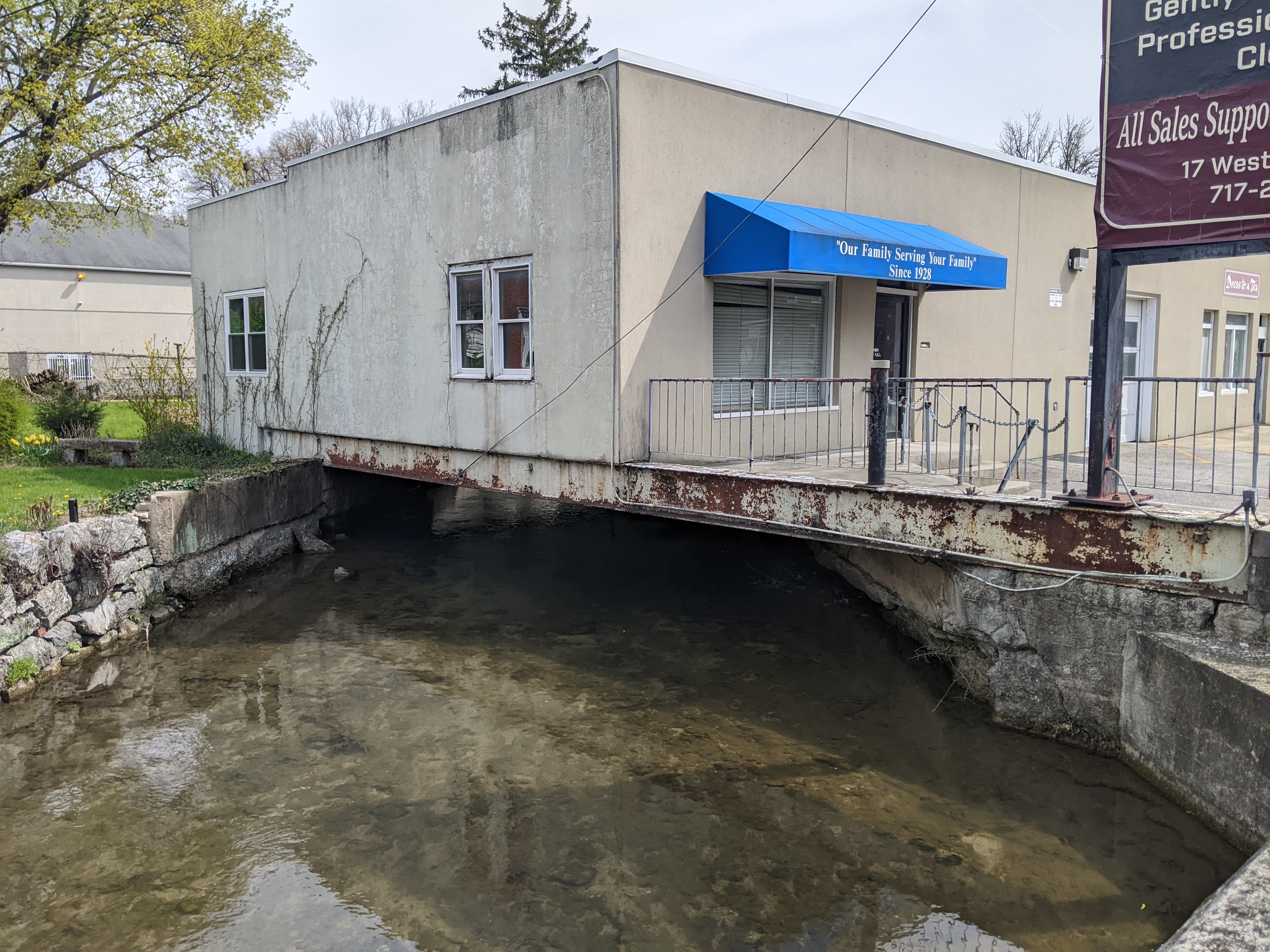
In Chambersburg, PA, a historic town along the Lincoln Highway, the question of what is a bridge comes up again. This time, the specific iteration is: “Is a building a bridge?”
This question is a continuation of the one inspired by Millvale. When I shared my thoughts on the building/bridge and backyard/bridge in that town, I focused on the fact that those bridges were hidden from sight and are likely an important factor contributing to the town’s flooding issues.
The structure in Chambersburg, on the other hand, sits in plain view. To tackle this question, I think it is time to return to the formal definition of a bridge. I looked up a definition of a bridge for the first Pittsburgh edition of this series and seemed to accept that definition at face value. I returned to a definition of a bridge in the second Chicago definition to help define what a viaduct is. I again did not question the definition of bridge. Perhaps it is time to change that?
Merriam-Webster defines bridge as a structure carrying a pathway or roadway over a depression or obstacle.
The Oxford English Dictionary defines bridge as a structure forming or carrying a road, path, or (in later use) a railroad, etc., which spans a body of water, a roadway, a valley, or some other obstacle or gap, and allows a person or vehicle to pass unimpeded over or across it.
Both of these definitions avoid the interaction of buildings and bridges.
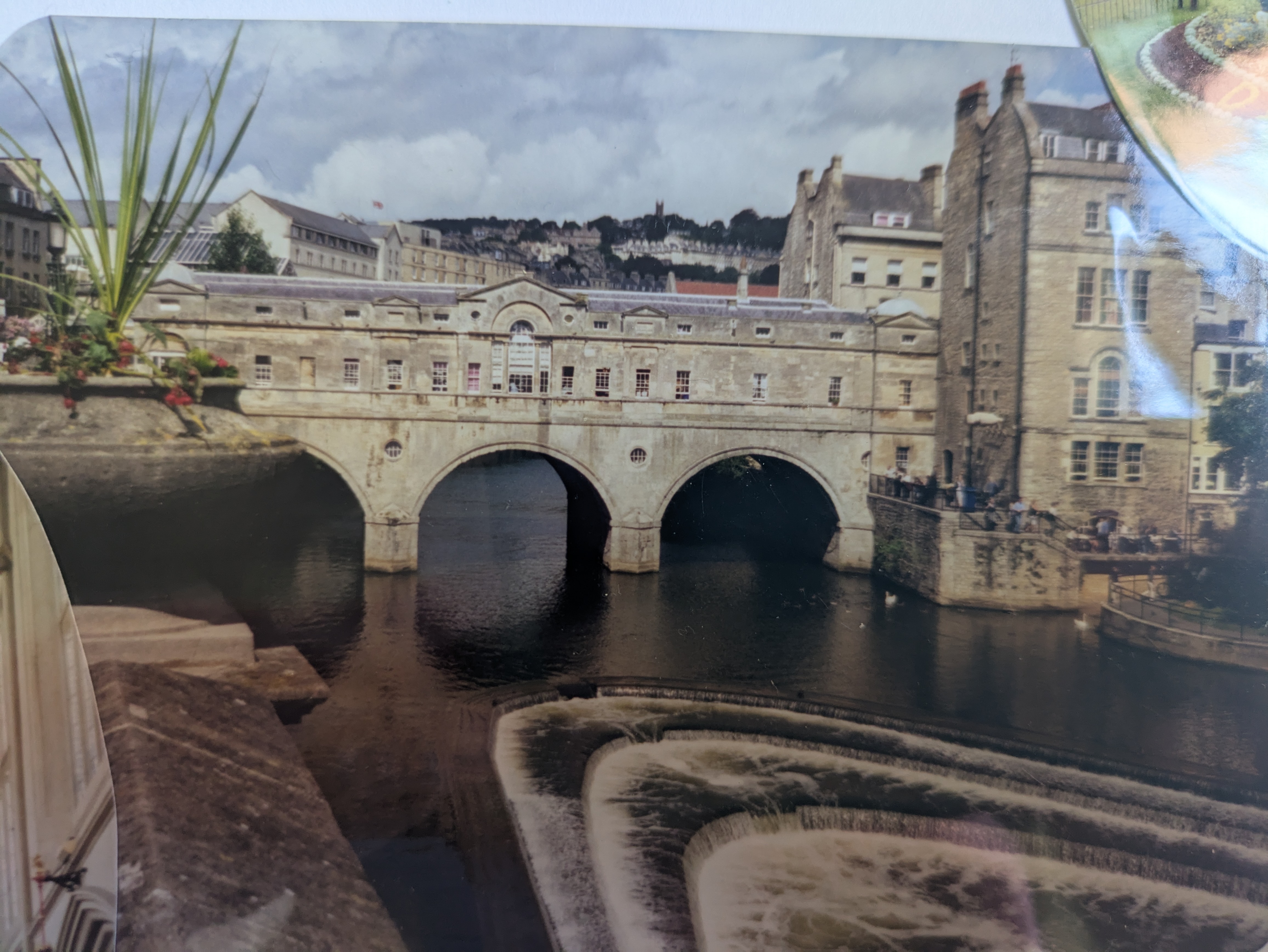
My first encounter with buildings on bridges was Pulteney Bridge in Bath, UK (photo of photo below). I was 13. It would be over a decade before I would start intentionally walking bridges. At that time, I declared, “That is one of the coolest bridges I’ve ever been on. There are shops on both sides of the road. You can’t tell you’re on a bridge.” (Notice the echoes of my later musings on the “bridges” of Chicago.)
The next most memorable building/bridge encounter was in Istanbul. The Galata Bridge is a 2-decker bridge with the lower deck full of restaurants with open seating facing the Bosphorus.
While both of these bridges also carry multi-modal roadways and therefore meet the two dictionary definitions of a bridge, they suggest the possibility of a broader definition of bridge.
As I did with viaducts, I next turned to “How to Read Bridges” by Edward Denison and Ian Stewart. Interestingly, they do not provide a definition for a bridge. They discuss bridge types – if the Chambersburg building is a bridge, it would be a beam bridge. They also discuss bridge uses. “Bridges are designed to satisfy a wide range of different uses from the obvious, such as vehicle, railroad, cycles, and pedestrian traffic, to the more obscure, such as carrying water. Many are even designed to cater to multiple uses.” (68) While they hint at “more obscure” uses, their chapter on uses goes on to talk specifically about pedestrian, water, vehicular, rail, and military uses. Buildings are missing from that list. However, their case studies do include Bath’s Pulteney Bridge and Florence’s Ponte Vecchio, which also includes buildings featuring shops and apartments on the bridge.
The Encyclopedia Britannica (Britannica.com) has the broadest definition of a bridge that I’ve encountered so far: Bridge, structure that spans horizontally between supports, whose function is to carry vertical loads. The prototypical bridge is quite simple – two supports holding up a beam – yet the engineering problems that must be overcome even in this simple form are inherent in every bridge: the supports must be strong enough to hold the structure up, and the span between supports must be strong enough to carry the loads.
By that criteria, the building/bridge in Chambersburg meets the definition of a bridge as it is a horizontal structure “whose function is to carry vertical loads.”
Moreover, this criteria suggests a broader interpretation of my framing question than I intended. “Is a building a bridge?” was intended to ask if a building built over a stream is considered a bridge. However, I wasn’t that specific in my wording and reading Britannica’s description of a bridge, it sounds like any building floor that is not the equivalent of concrete poured on the ground would count as a bridge. . . .Supports, beams, arches, piers, and cantilevers are all elements used in both bridges and buildings. . . .And so, the answer to the unintended broader question of “is a building a bridge?” may in fact be “yes.”
While there absolutely are structural similarities between buildings and bridges, I am not comfortable with a definition of bridge so broad that it includes all multi-story buildings and perhaps even some single-story ones. Perhaps a common distinguishing element between a building and a bridge is that bridges are designed to allow the free passage of air underneath the horizontal structure. That would make my working definition of a bridge: a structure that spans horizontally between supports, whose function is to carry vertical loads and that allows unobstructed passage of elements, objects, or animals, etc., underneath.
By this version of a definition of bridge, the building in Chambersburg is a bridge, the backyards and buildings in Millvale are likely bridges (assuming the stream has unobstructed passage below them all), but Heth’s Run Bridge while it was buried was not a bridge.
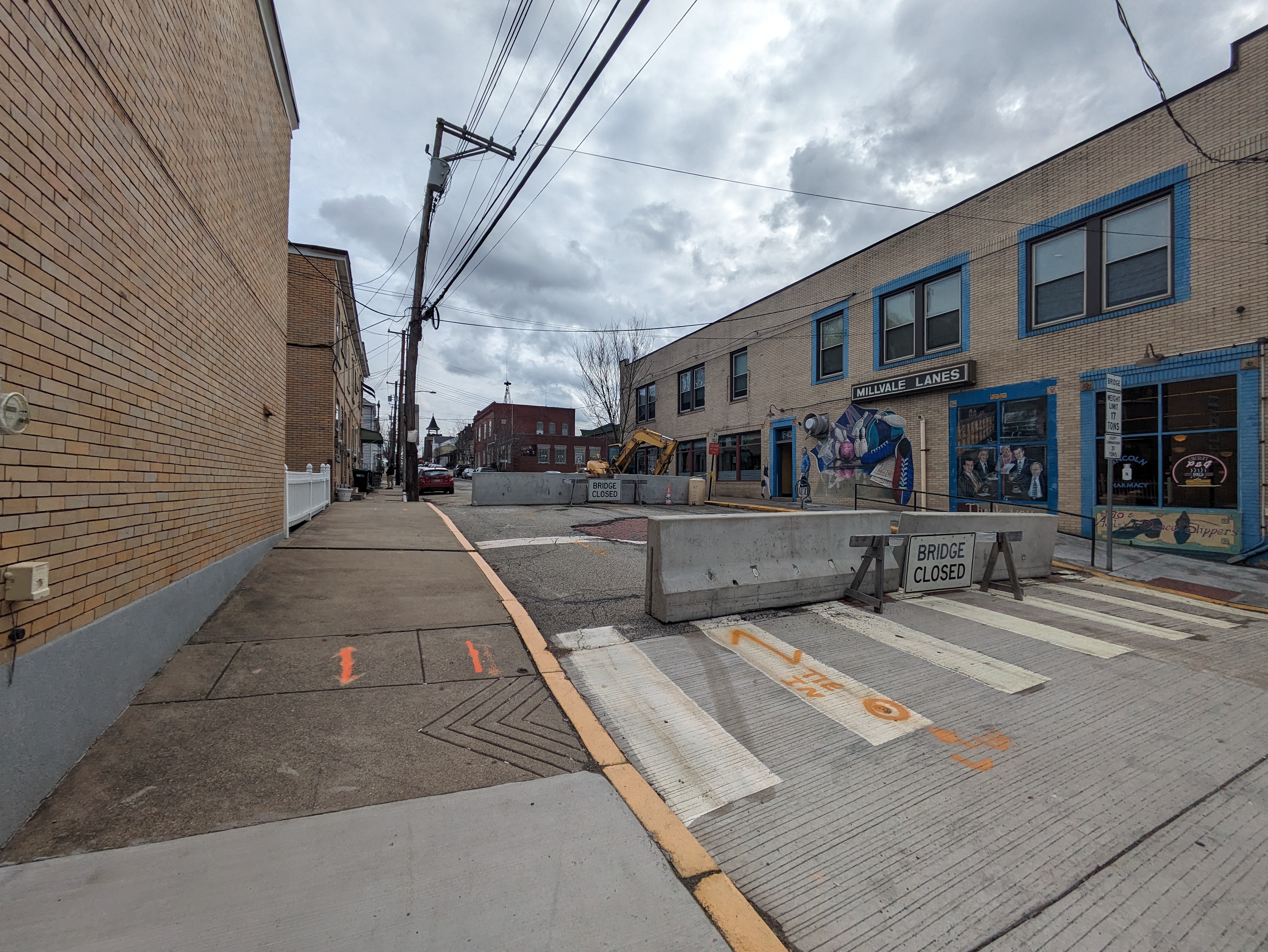
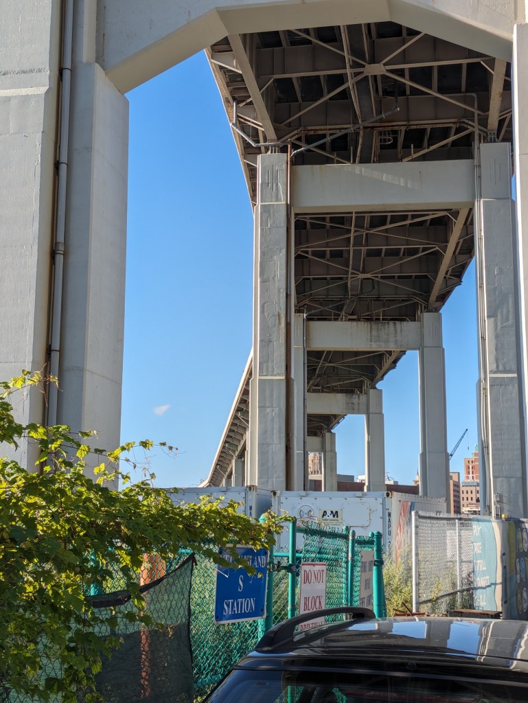
Millvale, PA, sits tucked in a valley that spills out into the Allegheny River at the far end of Pittsburgh’s 40th Street Bridge. Like all the valleys in this region, it formed over time by a stream cutting into the bed of the Allegheny Plateau. But when PennDOT announced the indefinite closure of two of Millvale’s bridges, I struggled to pinpoint their location. One of the two streets appeared to be nowhere near the streambed.
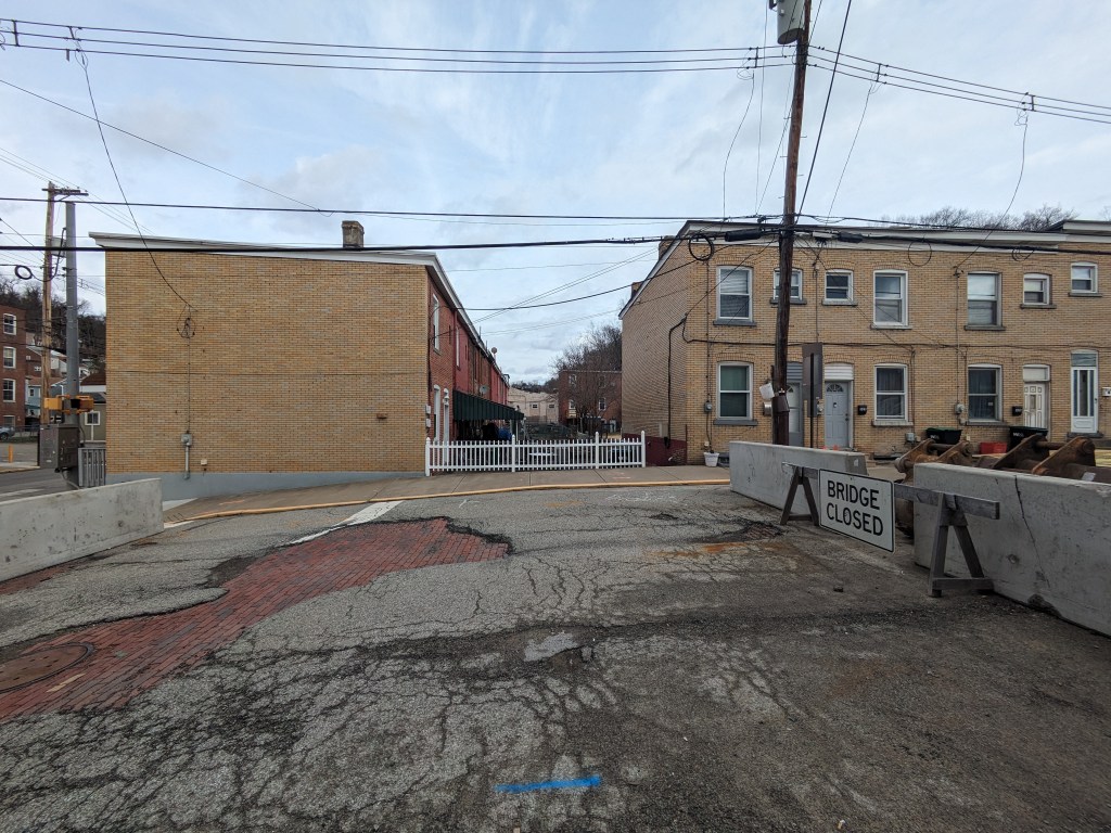
Then, in 2024, while I was primarily home-bound due to Long COVID and my mom sometimes took me along on her errands to help me get out of the house, she wanted to stop at a shop in Millvale. I thought I would sit in the car and wait for her, but as she was looking for a parking space, I noticed a barrier across one of the roads we passed with a sign that appeared to say “Bridge Closed.”
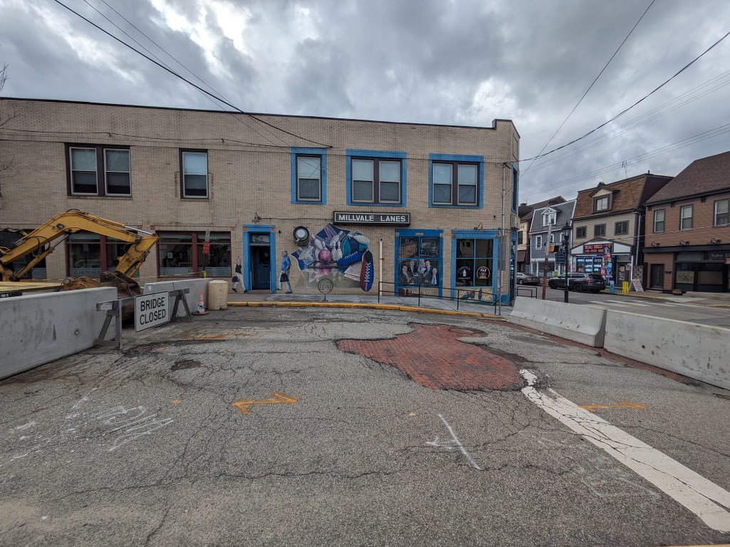
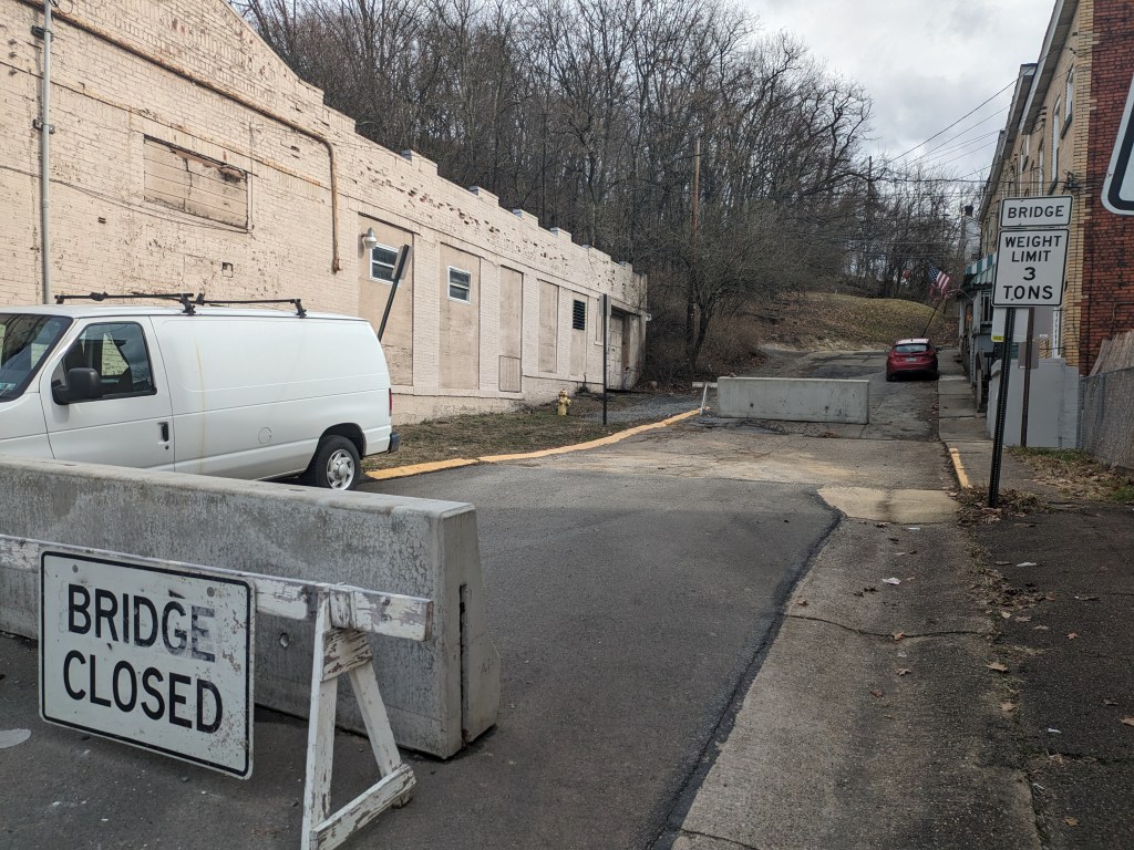
I investigated the closure while my mom went on her errand. Sure enough, on what looked like a street, just like all the other streets around, were jersey barriers marked with “Bridge Closed” signs (photo above). This street/bridge was the Lincoln Avenue Bridge that PennDOT had closed a year before. The only indication that this was a bridge was the “Bridge Closed” sign and the bridge weight limit sign on the right side of the bridge. A block over, Fremont Street had a similar barrier with “Bridge Closed” next to a bridge weight limit sign. Again, looking around from this bridge, it made perfect sense to me why I was unable to pinpoint its location on the map. (photos below)
While standing on the Liberty Avenue Bridge, it struck me if this road was a bridge, then what are the buildings and back yards on either side of the bridge in the direction of the pathway of Girty’s Run? Is the bowling alley a bridge? Is the back lawn of the adjacent houses a bridge? Do the people who live and play in these spaces know that they are on bridges?
I asked similar questions in Chicago as the ground shook beneath my feet with the passing of trucks and buses and as I walked over expansion joints. However, there wasn’t a river running underneath the Chicago ground-bridges. Those “bridges” enabled a variety of activities to happen while stacked one above the other as a solution to work with the density of the city.
In Millvale, the presence of bridges hidden in plain sight bothered me. I’ve heard over the years that Millvale has lots of trouble with flooding, in a region where flooding is common. That hearsay has left the impression that Millvale’s flooding is worse than average for the area. The municipal website includes directions for what to do when you hear the town siren give off flood warnings, which seems to support my impression. When I saw how much of the stream was buried under “bridges” made of roads, buildings, and backyards, it instantly made sense that flooding would be a major problem here.
Over my years of bridge-walking, I have come to see that intent is a part of the definition of what a bridge is. Most bridges seem to have the intent of connecting two (or more) points. However, in Buffalo, I encountered a bridge that the number one intent seems to be passing over an area. Millvale illustrates a third, vital component. The intent seems to go beyond just connecting two points (and passing over something, in this case, a stream). The intent here seems to include a demonstration that humans best nature . . . a demonstration that doesn’t appear to be working in this particular town.
I have dealt with the question of what is a bridge multiple times in the last decade. Buffalo adds to this philosophical conversation by combining the questions “what is a bridge?” and “what is the purpose of a bridge?” I’ve previous walked through what is the difference between a bridge and a ramp (Pittsburgh Edition I and Edition II), this time the nuance is “what is the difference between a bridge and an overpass?”
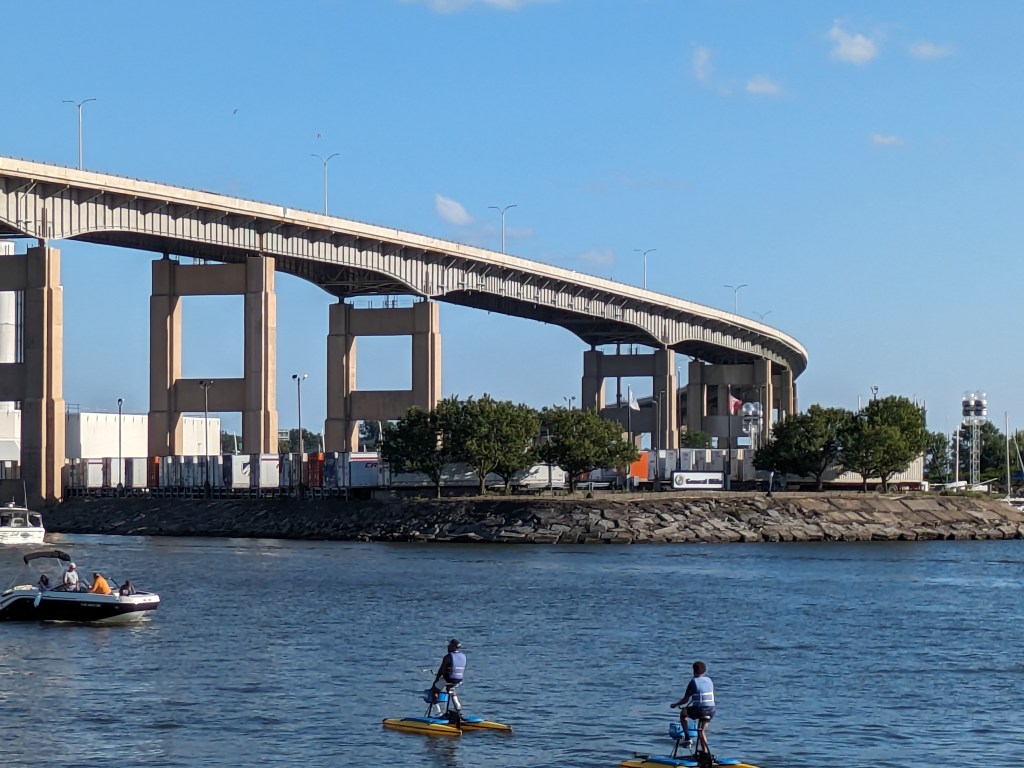
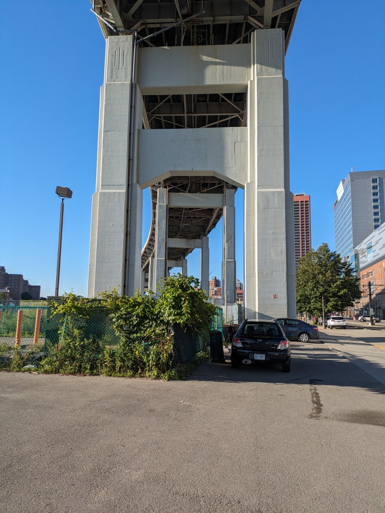
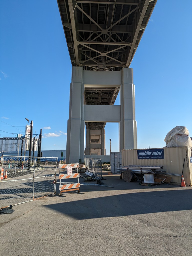
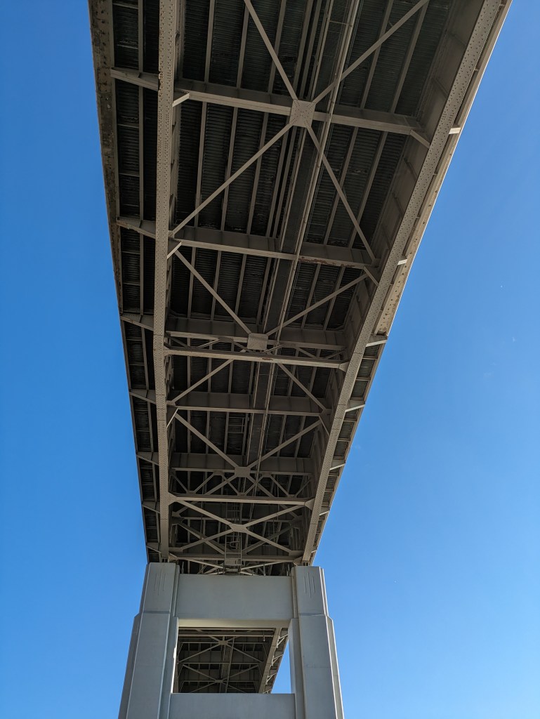
In Buffalo, the structure that carries Route 5 over what used to be largely industrial areas with some residential parts reads to me like an overpass. But sitting down to think it through, I realized that I may have to call it a bridge as well. It has all the structural components that are found in bridges: roadbed, spans, support. Yet, its purpose does not feel like a bridge.
While in Pittsburgh bridges divide the residents of the city, more typically bridges are about making connections. We use the term “bridge” metaphorically for building a connection. I see physical bridges as a structure that connects two (or more) points.
But Route 5 is not about connection, it is all about passing over. So can I call it a bridge?
I think an engineer would say yes. Since I started this philosophical debate of what is a bridge, the Fern Hollow Bridge in Pittsburgh collapsed, which led me to discover the Federal Highway Administration’s bridge database. It took a minute to figure out which dot on their map referred to Route 5’s structure, but I’m pretty sure it’s the one that is 1.38 miles long with 112 spans. The FHA, therefore, considers it a bridge.
From a structural viewpoint then, an overpass is a bridge; but from a philosophical one, an overpass may not be a bridge unless it is also a path of connection.
Looking back at the original intent of the Hill-to-Hill Bridge and comparing it to its use today, I find myself asking a new question: what is the purpose of a bridge? The word bridge is often used metaphorically to describe something that brings two things together. At the same time, there is a running joke in Pittsburgh (the City of Bridges) that if it involves crossing a bridge, people would rather stay home. This conflict of ideas between a bridge as a connector and a bridge as a divider is illustrated by the Hill-to-Hill Bridge.
The Hill-to-Hill Bridge started out as a connector. A Y at the north end linked West Bethlehem and Bethlehem to the main span which connected to South Bethlehem. The ramps in-between connected the neighborhoods to the businesses on the flats by the water.* Over time, the priority on connection disappeared as the bridge was modified. Of the seven original approaches, three were demolished, one was permanently closed to through traffic, and one was changed to one-way traffic.
The explanations I came across for alterations to the bridge seem reasonable, but they do not tell the whole story.
Reason #1: Industry changed and shut down in Bethlehem as with other Rust Belt cities. Some of the business destinations connected to the bridge were among those that closed, removing the need for the connection.
Reason #2: Cars became bigger, faster, and more numerous, making it harder to navigate the tight turns on some of the approaches.
The story that is overlooked by these explanations is that in the 1960s a new highway was built from the north directly tying into the bridge. The introduction of high-speed traffic to the bridge, or to any roadway, certainly makes it less safe for local traffic.
As a result of the addition of the highway, instead of connecting the neighborhoods of West Bethlehem, Bethlehem, and South Bethlehem, the bridge funnels traffic directly toward the former steel mill, Lehigh University, and other points south. In fact, the residents of West Bethlehem are practically excluded from using the bridge to get anywhere, as the western ramp is closed to through traffic (though open to parking). To use the Hill-to-Hill Bridge to reach South Bethlehem, a resident of West Bethlehem would have to drive north several blocks to get on the highway going south. Alternately, a resident could go south by taking Spring Street, a road parallel to the western and eastern wings of the bridge, (by)passing under the main span, then skirting around the hill of historic downtown, and taking the Fahy Bridge instead.
People living and working in the historic downtown area (the Bethlehem neighborhood) are also now limited in their use of the bridge. If coming across the bridge from the south, they can take the eastern viaduct to enter the historic downtown, but to leave the area by way of the Hill-to-Hill Bridge, they would have to drive north to the same highway access point as the residents of West Bethlehem. They could alternately take the Fahy Bridge for a more direct route south.
Use of the bridge is a little easier as a pedestrian, though it is still the most challenging for residents of West Bethlehem. For pedestrians to access the bridge from the west, they would have to use the sidewalks on Spring Street, walk under the main span, and climb a towering staircase up to the sidewalks on the bridge. If they are not able to use the stairs, they could keep going on Spring Street up the hill to the eastern end of the viaduct. Once on the bridge, both the historic downtown and south side are accessible. Given the history of the bridge, I imagine that there once was a time when there were crosswalks at the intersection of the main span and the east and west spurs so that pedestrians had full use of the structure just as drivers would have had.
The shift in the bridge’s focus from local to regional traffic seems like a classic case of the Urban Renewal efforts of the 1950s and 1960s. The discussion among planners and officials in recent years is how do they undo or erase the mistakes of Urban Renewal. Pittsburgh is trying to reconnect the local by returning some one-way roads to two-way traffic and by building a cap over the highway that divided downtown and the Hill District. As I watch these developments in Pittsburgh, I wonder if there are ways to return the Hill-to-Hill Bridge to a focus on the local.
For example: The highway has to end at some point, which is currently at the southern end of the bridge. What if it were moved to the north end of the bridge? If a traffic light were introduced there, the western branch could be reopened to through traffic and the eastern branch could be restored to two-way traffic. Pedestrians would also be able to then use all the remaining approaches. Thus, West Bethlehem, Bethlehem, and South Bethlehem would be reconnected for the enjoyment of pedestrians and drivers.
This suggestion is based upon the assumption that the local community would want to be better connected by way of this bridge. Perhaps the question that should come before “what is the purpose of a bridge?” is “who gets to decide the purpose of a bridge?”
*By prioritizing connections, Clarence W Hudson, the bridge’s designer, was forced to develop a one-of-a-kind truss design to accommodate the railroad tracks beneath the bridge and the connections coming into the bridge. There is no record of this truss design being used on any other bridge.
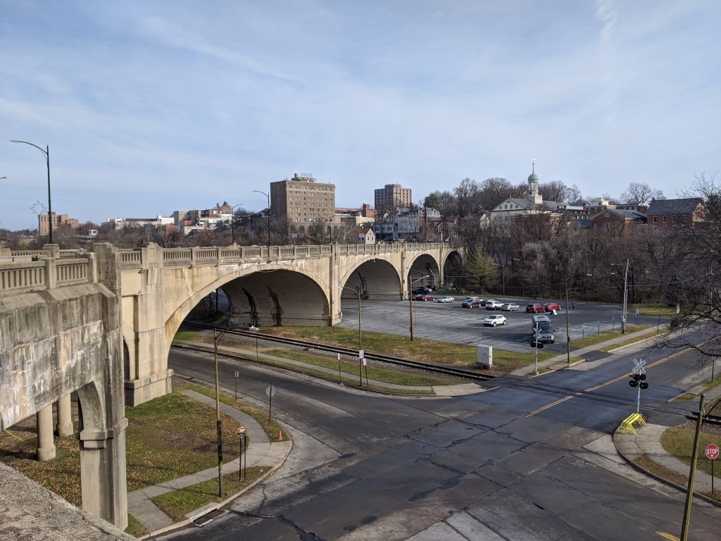
I was in the midst of trying to understand what is a viaduct when I traveled to Bethlehem, PA, with my family. One of our activities was to explore the bridges (see also Cage-free Bridges). As we walked the Hill-to-Hill Bridge, my initial reaction was “now here is a viaduct.” I hadn’t reached the point of developing a semi-clear definition for viaduct but looking at the flat roadbed supported by multiple arches over the floodplain, viaduct seemed the most appropriate word for the structure.
As we kept walking, it turned out that the viaduct was only a portion of the Hill-to-Hill Bridge. In fact, it would be more appropriately called the Hill-to-Hill-to-Hill-to-Hill Bridge. There are two approaches to the main span on the south end and three on the north end, including the viaduct and one approach permanently closed to through traffic. When the bridge was built in 1924, there were a total of seven approaches at various points along the main span. With so many components, this structure brings me back to the question of how many is one bridge?
Unlike when I asked this question of the 30th and 31st Street bridges in Pittsburgh, here the main bridge, the intersecting viaduct, and the numerous connections seem to be considered one bridge. They are together called the Hill-to-Hill Bridge while the structure in Pittsburgh has three distinct names (including River Avenue Ramp). Perhaps the deciding factor in whether it is one or more bridges is the original intent. The Hill-to-Hill Bridge was designed as a multifaceted structure whereas the 30th and 31st Street bridges were developed independently.
The best indication of the original intent seems to be the name. The Hill-to-Hill Bridge has a single name whereas the 30th and 31st Street bridges have separate names. The other examples I looked at in 2012 were the Veterans Bridge (Pittsburgh), the Fort Duquesne Bridge (Pittsburgh), and what I called the Jubilee Bridge (London).
The Veterans Bridge joins three approaches into one bridge, all under a single name. Therefore, it is one bridge, not three.
The pedestrian walkway of the Fort Duquesne Bridge was built decades after the vehicular portion but does not have a separate name. Therefore, it is one bridge, not two.
What I called the Jubilee Bridge (despite the photo I took at the time of the dedication plaque stating otherwise) is actually called the Golden Jubilee Bridges. While these bridges share the support structure of the underground’s Hungerford Bridge due to concerns about unexploded WWII bombs in the area, they have separate names. Therefore, it is three bridges, not one nor two.
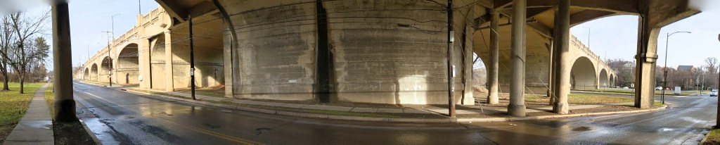
While poking around the map collection at Chicago’s Public Library, I discovered that the structures carrying roads over the railroad tracks in Grant Park are considered viaducts. The word viaduct brings to my mind a Roman structure soaring over a valley floor and conveying a flat road on top of towering stone arches. The Chicago “viaducts” do not fit that image. To me, they look like bridges with no striking difference between them and Chicago’s river bridges other than color and style of ornamentation. Both groups of structures have fairly flat roadbeds supported by piers. I am puzzled why one set of structures is called bridges and the other viaducts.
The main difference seems to be that the bridges are crossing a body of water while the viaducts are crossing an obstacle on land. This doesn’t feel like the answer, though. I’ve walked over 50 bridges in Pittsburgh, the majority of which are over land. Not one of these structures is called a viaduct. To help find clues to solve this puzzle, I looked up the definitions of bridge and viaduct.
Merriam-Webster’s definitions are not much help:
Viaduct: a long elevated roadway usually consisting of a series of short spans supported by arches, piers, or columns
Bridge: a structure carrying a pathway or roadway over a depression or obstacle
The Oxford English Dictionary has similar definitions:
Viaduct: an elevated structure consisting of a series of arches or spans, by means of which a railroad or road is carried over a valley, road, river, or marshy low-lying ground
Bridge: a structure forming or carrying a road, path, or (in later use) a railroad, etc., which spans a body of water, a roadway, a valley, or some other obstacle or gap, and allows a person or vehicle to pass unimpeded over or across it
Based on these definitions, the features that seem to distinguish a viaduct from a bridge are elevation and short spans. This still doesn’t help solve the question of why the Grant Park structures are viaducts and the Chicago River structures are bridges.
Next, I turned to “How to Read Bridges” by Edward Denison and Ian Stewart. The glossary defines viaduct as “a type of bridge over land formed by a series of small (usually arched) spans.” This definition seems to work best for the viaducts in Chicago. They are over land and have a series of spans, though the spans are not arched.
To further develop my understanding, I paged through the nine examples of viaducts in “How to Read Bridges.” All nine examples are elevated (such as the 330-foot high Goltzsch Viaduct and the 407-foot high Garabit Viaduct) and have multiple arches or piers (such as the 21-arch Glenfinnan Viaduct, the 8-arch Wharncliffe Viaduct, and the 5-pier Busseau Sur Grusse Viaduct). All, but one, have no support system above the road deck. The exception is the Millau Viaduct, which uses a cable-stayed deck on top of seven piers that range from 253 feet to 800 feet tall. All, but one, are over land. The Garabit Viaduct spans the Truyère Valley and one-third of its length crosses the Truyère River. In another example, the approaches to the Cubzac-les-Ponts over the River Dordogne are considered viaducts, but it is a bridge that crosses the river.
I find myself again at a loss. While the definition in this book seems to work for the Chicago viaducts, the examples do not look like the Chicago structures. To help the Chicago viaducts fit in, I propose a new definition built from the three definitions and nine examples above:
Viaduct: an elevated roadway, supported by many arches or piers over land.
Yet, there are exceptions to every rule. The nine examples in “How to Read Bridges” include exceptions to the support system of the viaduct and to the obstacle spanned by a viaduct. Expanding upon this, the Chicago viaducts, which are supported by multiple piers over land, become the exception to the elevated part of the rule or definition.
My biggest take away is that it is no easier to define a viaduct than it is to define a bridge. In most cases, as with bridges, a viaduct is something you know when you see it, even if you cannot define it. However, sometimes it takes a label or a sign, such as the maps of Chicago’s viaducts and, prior to its restoration, the maps of Heth’s Run Bridge, to know what you are seeing.
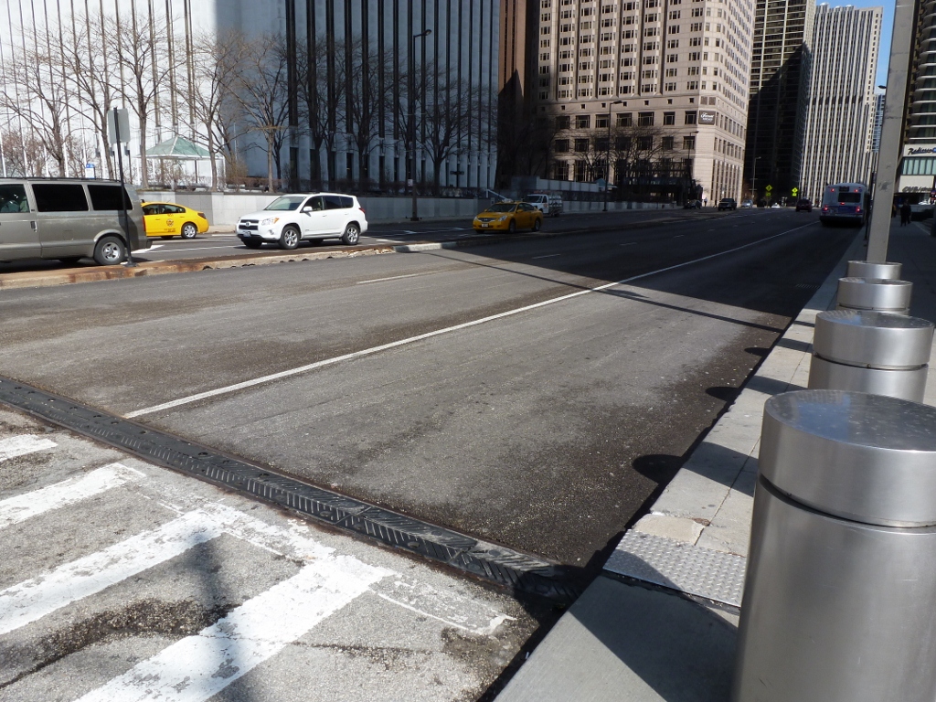
In July 2012, a few months into the height of my Pittsburgh bridge-walking, I pondered the definition of a bridge in What is a Bridge? Pittsburgh Edition I and What is a Bridge? Pittsburgh Edition II. Asking what a bridge is may seem a little odd. After all, it’s one of those things that you know it when you see it, right? Yet, in walking bridges, I’ve discovered it really isn’t that simple. In everyday life, the actual semantics of what a bridge is, is not important–you either cross it or you don’t and move on with your life. But if you’re trying to walk as many Pittsburgh bridges as you can (as I am) or to count the number of bridges a city has to see which has the most of any city in the world (as others have), spelling out a clear definition of a bridge becomes important. By the end of my previous posts on the definition of a bridge, it seemed like I had covered almost all the difficulties: is a bridge still a bridge if it no longer bridges anything? what’s the difference between a bridge and a ramp? how many is one bridge?….but then I went to Chicago and faced a new facet to this problem.
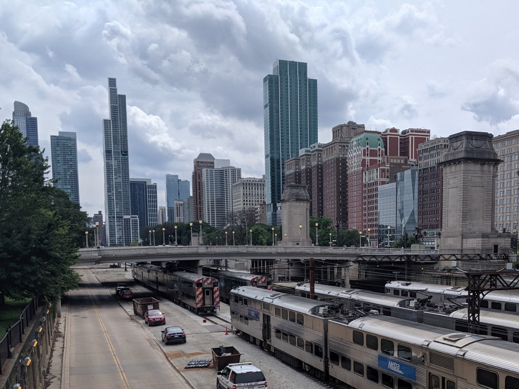
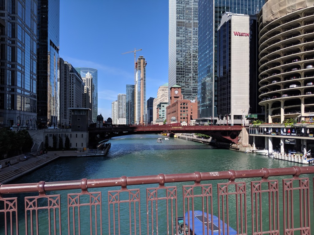
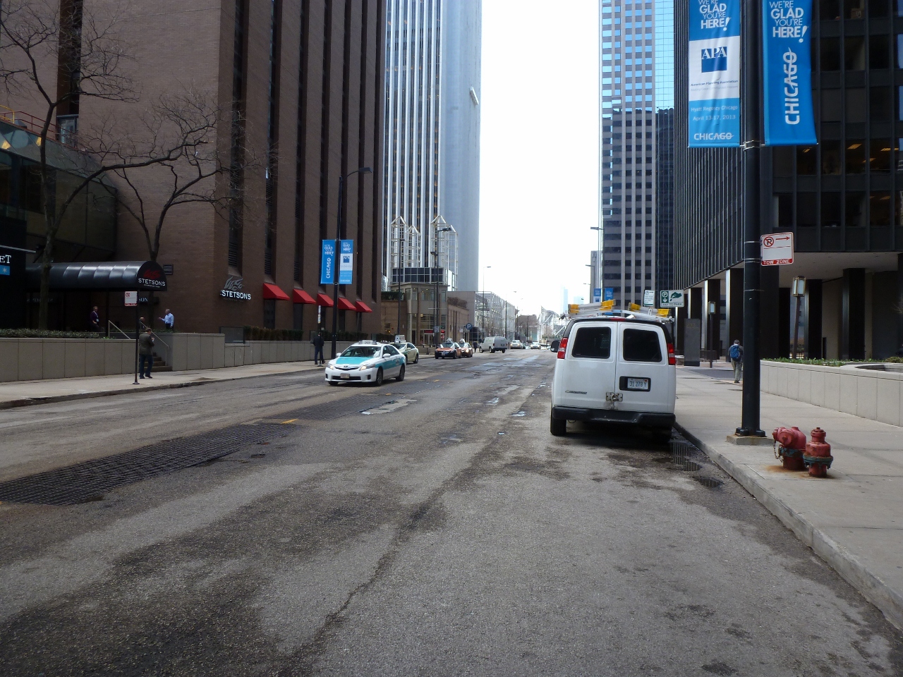
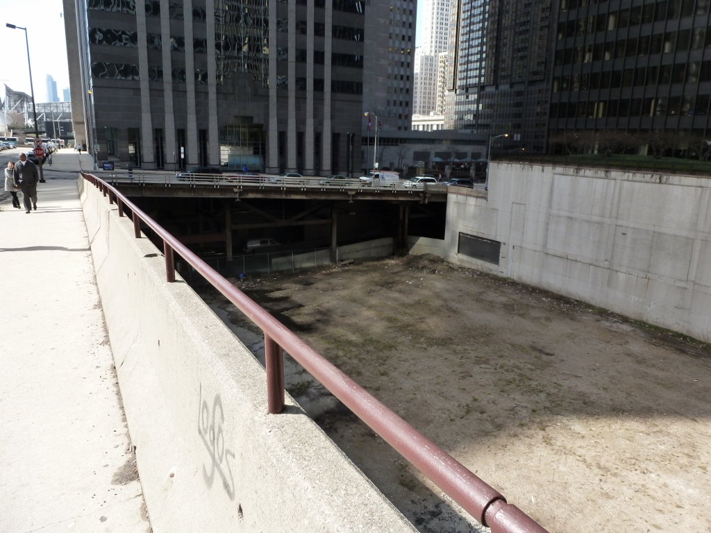
The issue Chicago brings up is best illustrated by the image above. Is there a bridge in that picture?….No, right?….Try again. If you walk past the buildings on the right, you get a new perspective on the seemingly solid ground you stand on (pictured below).
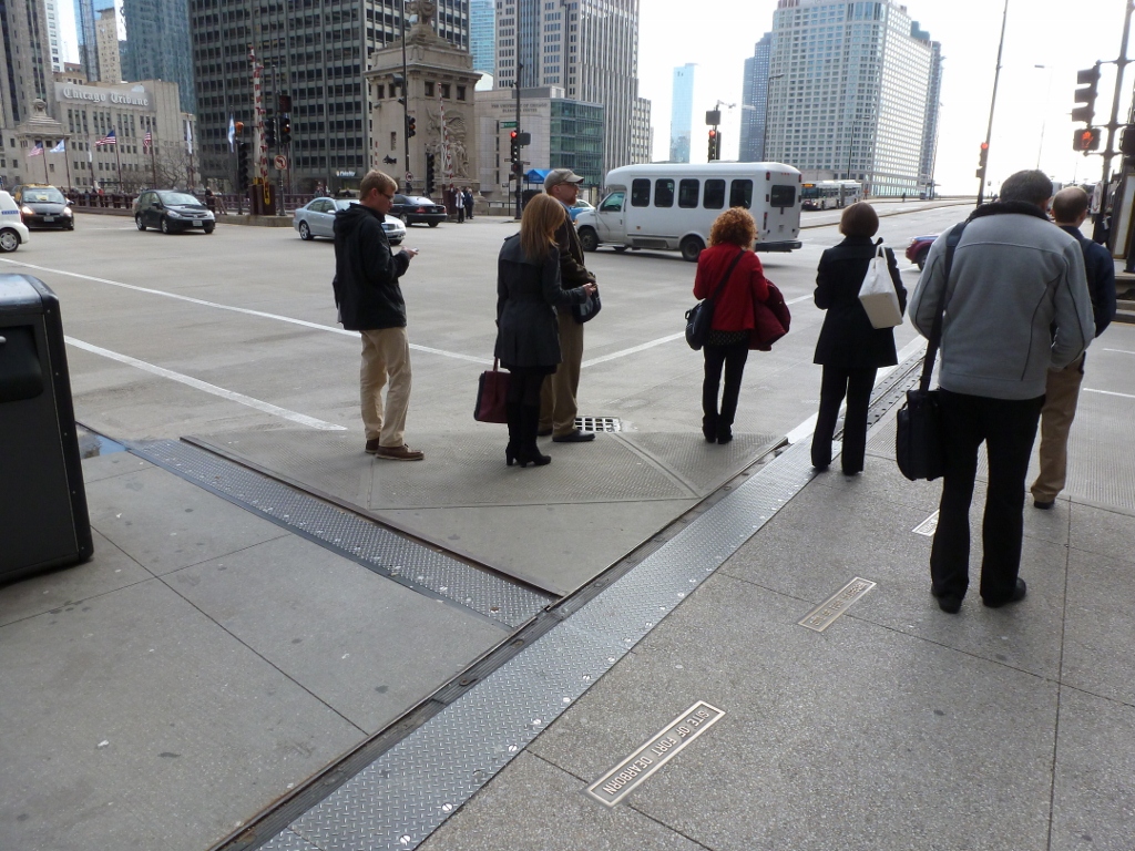
Walking around on this street and the blocks around it, you may notice metal joints like those normally found only in bridges running across the roads and sidewalks. You may also feel the ground bounce like a bridge as a large truck drives by.
Are these roads, then, really bridges? If no, what are they? If yes, where does one bridge end and the other begin? For example, is the Michigan Avenue Bridge across the Chicago River, visible in the back left of the image above-left, just a continuation of the Michigan Avenue road-bridge or is it a separate bridge?
When I wrote the first “What is a Bridge?” post, I felt confident that Merriam-Webster’s definition of a bridge, “a structure carrying a pathway or roadway over a depression or obstacle,” was sufficiently explicit to exclude ramps. However, while crossing the Penn Avenue Bridge in East Liberty I found a new structure to challenge the definition of a bridge.
The former bus ramp from the former Penn Avenue (Bus) Station to the (not former) East Liberty Busway Station meets the above definition of a bridge as it carries a roadway over the obstacle presented by the railroad bordering the busway. On the other hand, it also meets the definition of a ramp, “a slope or inclined plane for joining two different levels,” as the busway is significantly lower than most of the surrounding area. So, is it a bridge or a ramp? It almost feels like asking is a tomato a fruit or vegetable? or perhaps even which came first, the chicken or the egg? Are these equally impossible questions to answer or is it rather the case that there are exceptions to every rule? There aren’t always easy or straight-forward answers. I suppose in this case the structure is both a bridge and a ramp.
Perhaps a way to answer the question a little more specifically is to look at the way it is used. In its previous use, the point of the structure was to get buses down onto or up out of the lower busway level. While it was used in this fashion, I’d say it was more a ramp than a bridge. There is a future plan for it to be turned into a pedestrian bridge to transport pedestrians safely across the railroad and busway to the busway station (see Busway Bridges: East Liberty). At that point, in function the structure will be more of a bridge, though I suppose the ramp end will still function as a ramp to provide an accessible route to the station. Whether it is a ramp or a bridge, I did not walk it yet as it is not currently designed for pedestrian access. After its conversion is complete in the next couple years, I will come back to walk it.
When I reached the next pedestrian accessible bridge to get off of Herr’s Island/Washington’s Landing (after having got on it by the converted railroad bridge), the question of what is a bridge stared me in the face. I’ve skirted that question since starting this blog, sometimes alluding to it in passing, but never really dealing with it head on. It came up first with Heth’s Run Bridge. While in the posts on this bridge (see Part I and Part II) I mention that the deep ravine that the bridge once spanned has been filled in, I don’t discuss what this means for the structure’s status as a bridge. The question there is: Is a bridge still a bridge if what it bridged has been filled in and the bridge isn’t actually bridging anything anymore?
Then, when I wrote about the Bridge Under a Bridge, I couldn’t help wondering if it was cheating to include this bridge as it was purely an aesthetic bridge built so that a man-made pond could go underneath. A different aesthetic choice could have led instead to a path bordered by two man-made ponds. Yet I still refused to address the question of what is a bridge?
At this point, I feel it is necessary to face the question, this point being where the 30th Street Bridge connects to the River Avenue ramp which connects to the 31st Street Bridge. From the view pictured above of the 30th Street Bridge, it looks like a bridge. However, from where I got on it (the lower end on the left side in the image above) it looked to me like a ramp taking traffic from a low point to merge onto another road at a higher elevation. Besides, it connects to the River Avenue ramp and in the junction of these two structures (pictured below), it felt like one continuous ramp system. Yet, a portion of this system is called a bridge. So I ask myself, “what is a bridge?”
First, I thought, “a bridge is a structure that connects two points which would otherwise not be accessible to each other.” Then I realized this definition includes ramps. In my current example, there is no other way that River Avenue, which for most of its course runs at the same level as the bike path in the picture above, would be able to access the 31st Street Bridge without a ramp. Therefore, according to my definition above the ramp is a bridge.
Another thought I had was “a bridge is a structure that spans a geological obstacle.” Well then, that means that the bridges that only exist to cross over a road or railroad aren’t really bridges. I discuss these types of bridges some in my post on Cleveland Bridges. In that post, I don’t question whether or not they are bridges, but whether they are significant enough to be counted in comparing the number of bridges cities have. Though I didn’t state it, I also wondered if they were significant enough for me to include these types of bridges in my bridge walking. Regardless of their significance, I consider them bridges.
Merriam-Webster defines a bridge as “a structure carrying a pathway or roadway over a depression or obstacle.” This definition seems pretty good as it excludes ramps but includes the bridges over man-made obstacles. I’d say this definition also would include the Bridge Under a Bridge. However, it doesn’t address the situation of Heth’s Run Bridge prior to its renovation. What if the structure “carrying a pathway or roadway” at one time crossed over “a depression or obstacle,” but does so no longer though the structure is still there? Is it still a bridge?
There is one other dilemma suggested by the 30th Street Bridge/River Avenue Ramp/31st Street Bridge structures, the Fort Duquesne Bridge, the Veterans Bridge, and London’s Jubilee Bridge. This dilemma is perhaps best expressed by “what makes one bridge?”
In the Veterans Bridge example, three separate structures cross over the obstacle of the lower elevation of the parking lots in the Strip before joining to become one structure across the obstacle of the Allegheny River. So, is this one bridge or three?
When I walked the Fort Duquesne Bridge, I was walking a pedestrian bridge built approximately 40 years after the Fort Duquesne Bridge. The pedestrian bridge is attached to the Fort Duquesne Bridge over the Allegheny River, but on either end it is separate with its own supports. Is this one bridge or two?
London’s Jubilee Bridge has two separate pathways, but one name and dedication date. They are separated by a bridge for the underground, which, as far as I can tell, they are attached to for structural support. So is this one, two or three bridges?
The 30th Street Bridge/River Avenue Ramp/31st Street Bridge structures appear to me to be one conglomeration, similar to the three structures that merge in the Veterans Bridge. Yet while the elements in the Veterans Bridge appear to be considered one structure, the 30th Street Bridge is considered a separate structure from the 31st Street Bridge, at least in so far as it has its own name and its own page on PGHbridges.com. What makes the 30th Street and 31st Street bridges different from the other examples I’ve listed above?