Pittsburgh’s Bragging Rights

I mentioned previously that I totally geek out over maps.  I recently came across a fascinating “new” map called The “Z” Atlas & Map of Pittsburgh, PA, and Mount Oliver, PA.  I am adding it to the Sanborn Maps and GM Hopkins Maps as a go-to for studying the changes Pittsburgh went through in the 20th Century.  The “Z” Atlas was published in 1952.  There are two things about this map that caught my eye as setting it apart from others during my initial perusal.

First, in the street index, it identifies which streets have unusual addressing.  Pittsburgh is known for some unique addressing situations.  For example, there is a block where houses built before WWII have 1300 numbers and the ones built after WWII have 1400 numbers, even though they are intermixed.  This atlas shows that the post WWII houses were built after 1952 because the address numbers on that street weren’t wonky yet.

Second, this map claims that “Pittsburgh has more streets than any City in the World. You will find EVERY ONE of them in this ‘Z’ Atlas and Map!”

“Preposterous,” I said, when I first read that claim.  Pittsburgh’s land area is small compared to other large metropoles.  It does not make Wikipedia’s current list of the 150 largest US cities by land area.  Without digging into census data, I assume that many of the old cities (ex. New York City, Chicago, Cleveland), if not most of the 150 listed, likely were of a similar size in the 1950s as today.  How could it be possible for Pittsburgh to have more streets than these cities that are significantly larger?

Then it hit me.  It is possible by the same token that makes it possible for Pittsburgh to have more bridges than any other city in the world, more steps than any other city, and the steepest paved street in the world: topography.

Pittsburgh’s many hills, ravines, cliffs, and rivers mean there are few long streets and many short streets.  Maybe after all, Pittsburgh did have more streets than any other City in the World in 1952.  Reading more of the “Z” Atlas, it elsewhere explains that Pittsburgh had over 6,000 streets at the time of the map’s publication.  That number does include the numerous “paper” streets that were surveyed and mapped, “but never built or even marked in the dirt.”

Many of these paper streets still exist today causing headaches for the City and its citizens, but some have been vacated and turned over to private ownership.  Between that and the rise of mega-cities since the 1950s, I won’t say that Pittsburgh can still claim more streets than any other city.  A quick Google search showed that the question of what city has the most number of streets is not as well discussed as what city has the most bridges.  Perhaps a more ambitious person than myself could run an analysis to see whether Pittsburgh still has more streets than any other City in the World.  (Don’t forget to count the step streets!)

Flood Measures

P1060955

There is an enormous floodwall on the Covington, KY, side of the Roebling bridge, which spans the Ohio River.  It shocked me to see such a huge wall when I was there last year.  I wondered if there couldn’t have been some other means of flood control that would not have produced such a large barrier.  It reminded me of the significant physical barriers to the waterfront that I observed in Erie, Pittsburgh, Homestead, PA, and Cleveland.  Unlike Erie, Homestead, and Cleveland, Covington did not have any significant economic drivers separated from the town by the barrier wall.  The river side only had a small park and parking lot.

In addition to acting as a barrier, the sheer massiveness of the flat concrete wall bothered me.  I wanted to see it broken up into staggered segments, even though I knew that would not be useful in a structure intended to block the path of water.  However, Covington handled the flat wall with style by turning it into a canvas for a giant mural.  Almost as long as the wall itself, this mural depicts the history of the crossing at this location from 8000 BCE to the present day.  While the mural did not help with the scale of the wall, it broke the monotony while turning it into a destination for its own sake.

In the back of my mind, this wall continued to bother me until observing the effects of the significant flooding experienced in Pittsburgh this year at the forks of the Ohio River (see Checking on the Rivers and The Aftermath).  A google search showed me that the flooding Pittsburgh experienced in February this year also affected the Covington-Cincinnati region in the worst flood in that area since 1997.  The concept of a wall still bothers me, but this one probably prevents a lot of property damage and Covington has taken steps to soften its negative effects.

Engaging Riverfronts

P1060986

Cincinnati’s riverfront park with swings

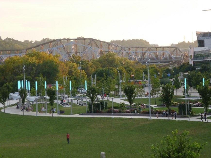
There is a proposal in Pittsburgh to introduce a new feature to its riverfronts: swings.  I am excited about this possibility as a swing lover and as someone who wants to see more welcoming and engaging spaces along Pittsburgh’s rivers.  One of the inspirations for this idea are swings found in Cincinnati’s riverfront park.  Last summer, I happened upon that park in a search for bridges by Roebling.  On an ordinary summer evening, this enormous riverfront park was filled with people of all ages enjoying the various activities from walking paths to playgrounds to interactive art installations.

Previously, when walking around Istanbul, I experienced jealousy at seeing the number of parks with adult exercise equipment installed.  This sort of acknowledgement that adults enjoy playing outdoors as much as children seemed lacking in parks across the United States.  Cincinnati’s park showed me that inviting adults to play outside is embraced in some parts of our country.

Pittsburgh has kayak and bike rentals for adults to play outside.  The walking trails, Fountain at the Point, and Watersteps attract people to enjoy the outdoors and the rivers.  However, if this swing proposal pans out, Pittsburgh may move up into the next tier of engaging outdoor spaces with the introduction of free play equipment for adults on par with Cincinnati and Istanbul.

In Search of Roebling

P1070036

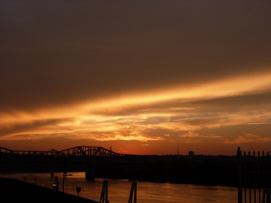
Last summer’s search for Roebling bridges (see Market St, Steubenville and Wheeling Suspension Bridge) came to a successful end as a golden sunset spread over Cincinnati.  The reason we struck out earlier in the day is that the Cincinnati-Covington Bridge is one of the two remaining Roebling suspension bridges.  The other is, of course, his most famous bridge: the Brooklyn Bridge.  The first of Roebling’s five suspension bridges was built in Pittsburgh at the site of the current Smithfield Street Bridge, but lasted less than 40 years before the increased river and road traffic made it obsolete.

P1060937

Between Roebling’s two remaining bridges, I found the Cincinnati bridge more appealing.  Its character feels like it would fit right in on the Thames in London.  I also appreciated the engaging green spaces at either end.  The birds liked this bridge, too.

P1070038

Sunset from the Roebling Bridge


Signs of the Times

20180709_124401 - Copy

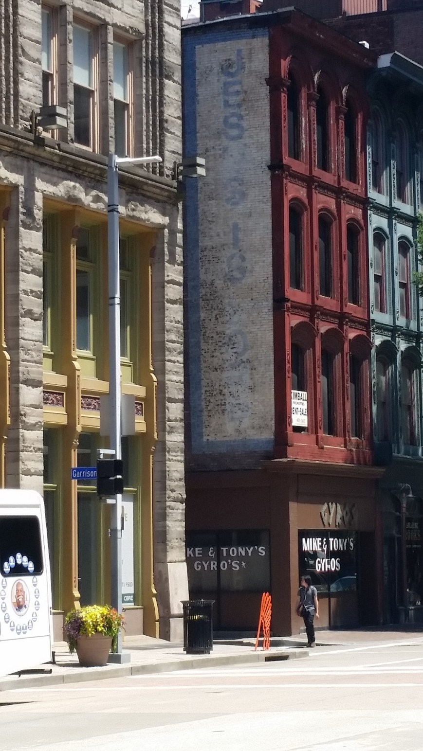
Once upon a time, signs painted on the side of buildings proliferated in Pittsburgh.  Over the decades as these types of signs went out of fashion, many were left to fade with time.  Remnants of these signs still cling to several buildings.  Some signs are faded but legible while others only show faint traces of having been there.

20180709_124148 - Copy

20180709_123654 - Copy

20180709_122215 - Copy

These signs tell a story of the history of the city.  Is it a story worth preserving?  If so, what is the appropriate way to preserve it?  Should these signs be refreshed so that they continue to live on?  Or should they be left alone to continue to fad to show their decline from favor?  Yet, there appears to be renewed interest in the hand painted sign.  (This article is one of several about a niche of successful hand painted sign artists.)  Maybe as these buildings are renovated, some of these signs will be refreshed with a modern take.

20180709_083128 - Copy

Utility Siloes Part 2


20180624_080041 (2)

Dismantling in progress (6/24/2018)


After continued observations, I need to modify some of my assumptions in the post Utility Siloes.  It turns out that the existence of the other utility wires attached to the poles does not prevent the old poles from being removed.  Instead, weeks after a new utility pole is installed, the remainder of the deteriorated pole is removed except for the chunk where the other wires are attached.


20180624_080058 (2)

Close-up of the dismantling (6/24/2018)

Perhaps the crew that removes poles is different than the crew that installs them.  Although, the installation team is able to lob off the top of the old pole after they transfer the wires to the new one.  Why then can’t they dismantle the rest of the pole at the same time?  And in the case of constricted locations, such as the feature of these posts, why can’t they located the new pole in the same location as the old one?


20180630_093623 (2)

Dismantling Complete (6/30/2018)


20180630_095652 (2)

View of another dismantled pole, the remaining chunk is secured to the new pole by a rope.


Out of Sight…

20180614_155542 (2)

Trash Train Passing through Pittsburgh

Once a week, I put a bag of trash out at the curb before going to bed.  When I leave for work in the morning, it’s gone.  Poof!

Yesterday, while enjoying the beautiful summer day, the stench of garbage made me look up.  Crossing the railroad bridge, chugged a train full of trash.  I couldn’t see either engine or caboose, only car upon car upon car full of trash.  As I passed under it, smelling the breadth of the aura of stink surrounding the train, my mind imagined all the homes, parks, farms, mountains, forests, and prairies that would be polluted by this rotting mass before it reached its final destination.  A destination that is forever polluted.

I don’t litter.  I recycle when possible (or easy).  I don’t have a newspaper delivered as most of it ends up going straight to my recycle bin, wasting energy and resources.  I try to buy yogurt by the quart instead of single serve to reduce the amount of plastic used.  I plan to compost, one day.  Yet, I had no qualms setting out a bag of garbage every week.

In a corner of my mind, I knew that a truck comes and takes the garbage away to something called a landfill.  And that the garbage will sit there…forever.

OLYMPUS DIGITAL CAMERA

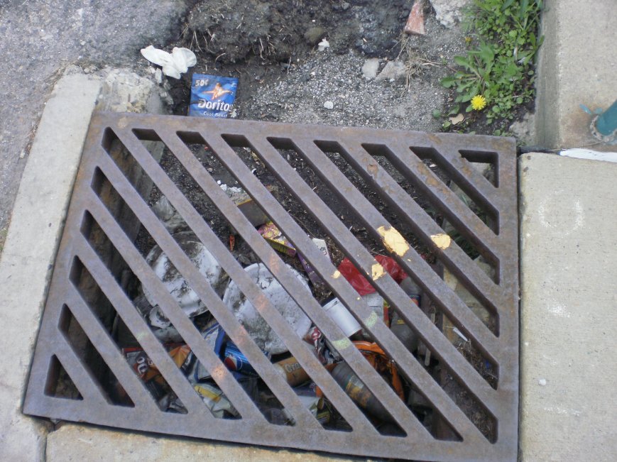
A Storm Drain Treated as a Trash Can

Today, that image of the trash train is causing me to question my behavior.  Is my habit of collecting all my “garbage” in a plastic bag and setting it at my curb for it to find its way to this train and then to a landfill really any better than the person whose habit is to drop their trash on the ground or down a storm drain?  Is a landfill really any better than the Great Pacific Garbage Patch?

Social media is filled with indignation over the trash vortex floating in our ocean, but maybe there should be more discussion and awareness about the rest of our trash: where it goes and what alternatives we have.

Utility Silos

20180421_133652 - Copy

The obstruction from utility silos

This spring, the electric company went around my neighborhood installing replacement utility poles where the existing ones were on their last leg.  Watching them do this for a pole just down the street from me, I drew some conclusions about the interaction between the various companies that supply the different technologies available at our fingertips.  The electrical company owns the poles and the electric wire, but other companies own the other fiber optics and cables that use the poles.  The electric company installs new poles when the existing ones are deteriorated.  Once installed, they transfer the electric lines to the new pole.  The old pole is left with all the other lines in place, until the companies that own the rest of the lines transfer them to the new pole.

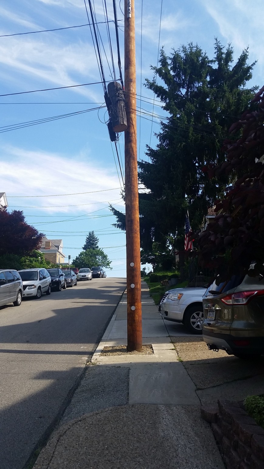
This arrangement seemed relatively harmless as I watched it in action near my house, but then I found the example above.  In this case, the rigidity of the silos and jurisdictions of the various companies created a physical barrier in the neighborhood that will likely be in place for the next 35 years or so, until the pole is ready to be replaced.  This is in direct contradiction to the City’s initiatives for greater accessibility illustrated by the sidewalk curb ramps installed within the last year at the intersections on either side of this pole.

20180421_133736 - Copy

Close-up showing the curb, the old pole, the new pole, the foot of sidewalk left, and the combined driveways

The choices were limited for siting this new utility pole.  There are driveway curb cuts immediately adjacent on either side.  Therefore, to place the new pole in line with the existing poles would have partially blocked someone’s driveway.  Apparently, the silos are so entrenched that even under unusual circumstances such as these the various companies cannot work together so that a new pole can be placed in the exact same spot as the old pole.  The sidewalk that was already narrow and could not accommodate the recommended 5-foot clearance around obstructions is now nearly impassible and requires pedestrians to cross partially on the driveways.

I do not know if anyone paused before installing this new utility pole to ask if there was a different or better way to approach the situation.  From my experiences at my office in trying to work with others to design an approach that looks at the organization as a whole while still respecting and acknowledging each area of expertise and specialization, it is difficult to get all parties at the table to apply creative thinking and openness to how we can approach our work.  No doubt, even if someone was able to get all relevant parties involved in this utility pole to the table, they would have encountered similar challenges.

20180421_133844 - Copy

Evidence that the old poles eventually get removed and an example of where a new pole was placed next to the old along side the curb