
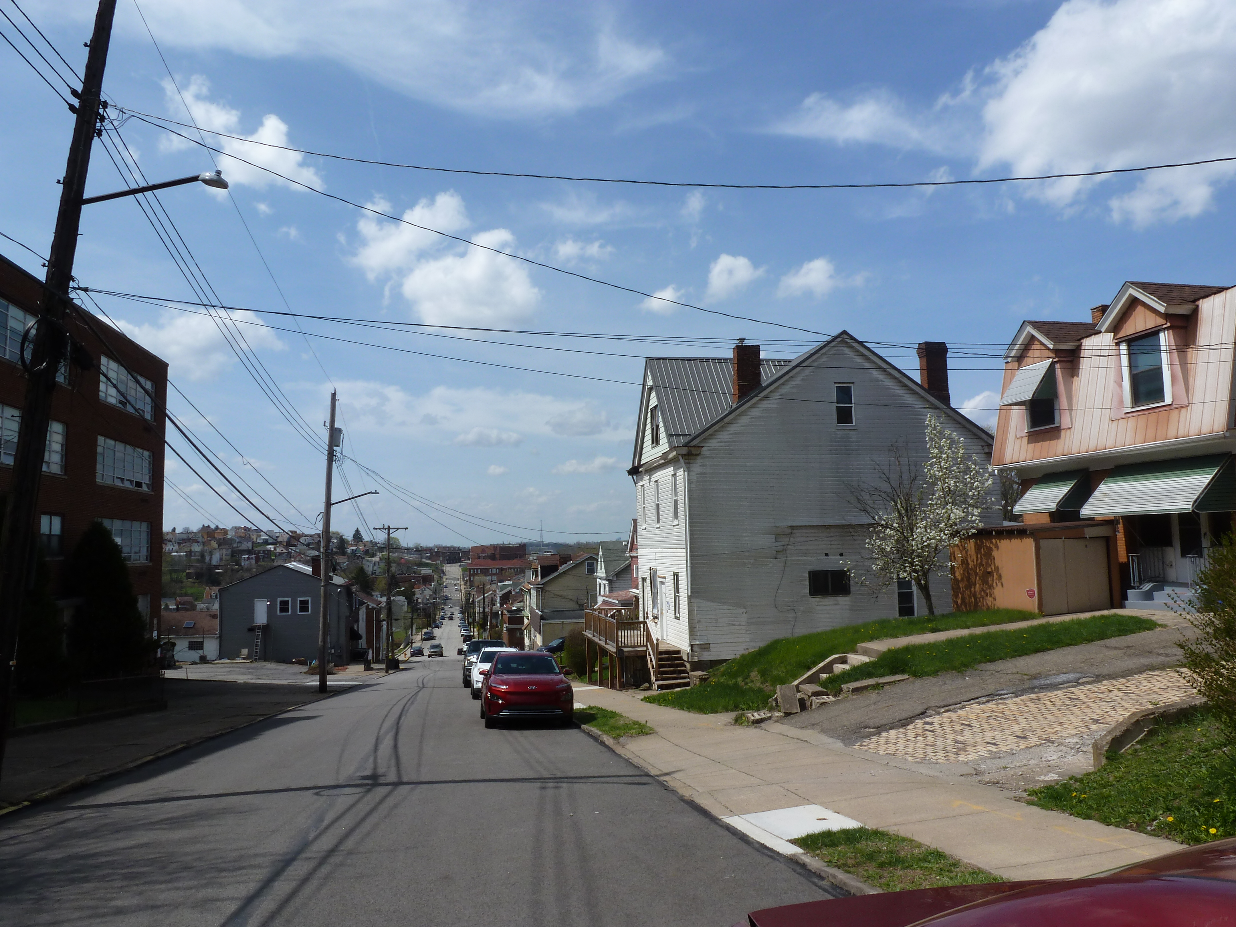
Mt. Oliver Neighborhood
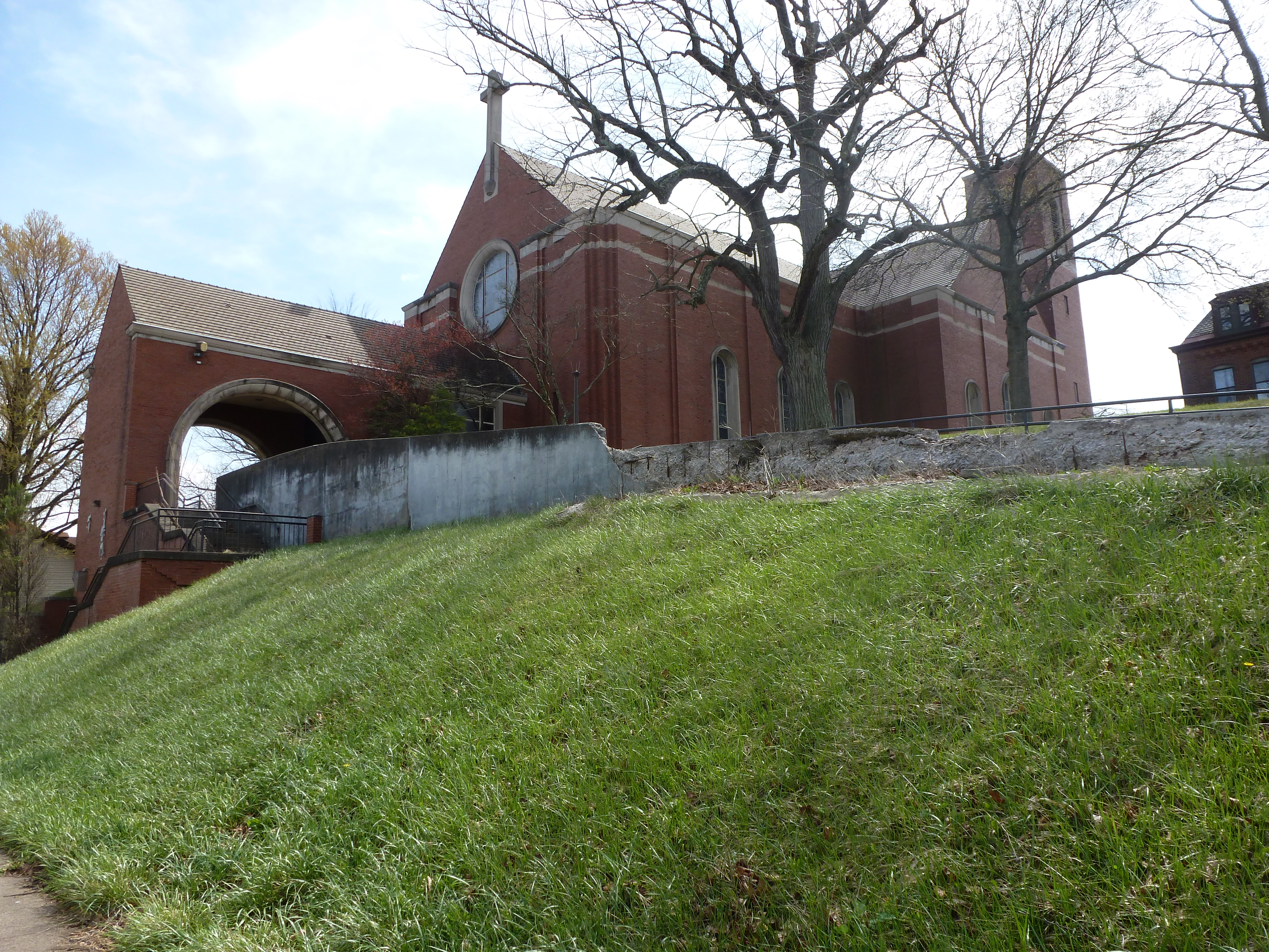
On the highest point in Mt. Oliver, the former St. Joseph Catholic Church towers above its surroundings. Its silhouette catches the eye from the surrounding neighborhoods. A woman who lives across the street stopped to chat as I was taking photographs. She mentioned that her parents were married at St. James and pointed out the plinth where the statue of St. Joseph stood until the Catholic Church removed it when they suppressed the church. She also shared stopping by an event recently held in the parish house that sounded suspiciously like an unauthorized rave and that was not her cup of tea.
Mt. Oliver neighborhood has always intrigued me. It is immediately east of Mt. Oliver Borough, the only municipality left that is completely surrounded by the City of Pittsburgh. The Borough residents soundly defeated the ballet measure to be annexed in 1928. However, the built environment is seamlessly connected between the Borough and the City. The Borough’s main commercial street runs along the boundary, the east side being the Borough and the west side the City.
I had always assumed that Pittsburgh’s Mt. Oliver neighborhood was a portion of the Borough that had agreed to be annexed. That appears to not be the case.
Mt. Oliver neighborhood was annexed to the City in 1923 as part of St. Clair Borough, which comprised the present day neighborhoods of Mt. Oliver, St. Clair, Arlington, and Arlington Heights. Today’s St. Clair neighborhood was largely undeveloped in 1916 and still comprised large land holdings. At that time, today’s Mt. Oliver neighborhood was largely platted with the lots we see today and some houses had been built. Based on the 1916 map and the diversity of style of house, it seems there was no coordinated development of housing in the Mt. Oliver neighborhood. Next door, in St. Clair neighborhood, was a different story. In 1953, the St. Clair Village housing project opened and the boundaries of the St. Clair neighborhood were drawn to encompass just that housing project. Perhaps, the Mt. Oliver neighborhood was named at that time to distinguish it from the St. Clair Village/neighborhood. Perhaps, the Mt. Oliver neighborhood was so named to put pressure on Mt. Oliver Borough to agree to annexation.
However it got its name, Mt. Oliver neighborhood probably remained influenced by its long ties to St. Clair, whether the Borough or the neighborhood. The common story of a mid-century housing project falling into disrepair due to lack of maintenance over the years and the residents abandoning the deteriorating site is the story of St. Clair Village. St. Joseph’s Catholic Church was rebuilt in 1953 after a fire destroyed the prior building, but then was closed in 1994, maybe in part due to the loss of population at the nearby St. Clair Village.
Neighborhood Statistics (Out of 70 in this Series)
- 70th largest by acreage
- 63rd highest number of religious sites (multi-way tie)
- 36th most sites/acre
Locations
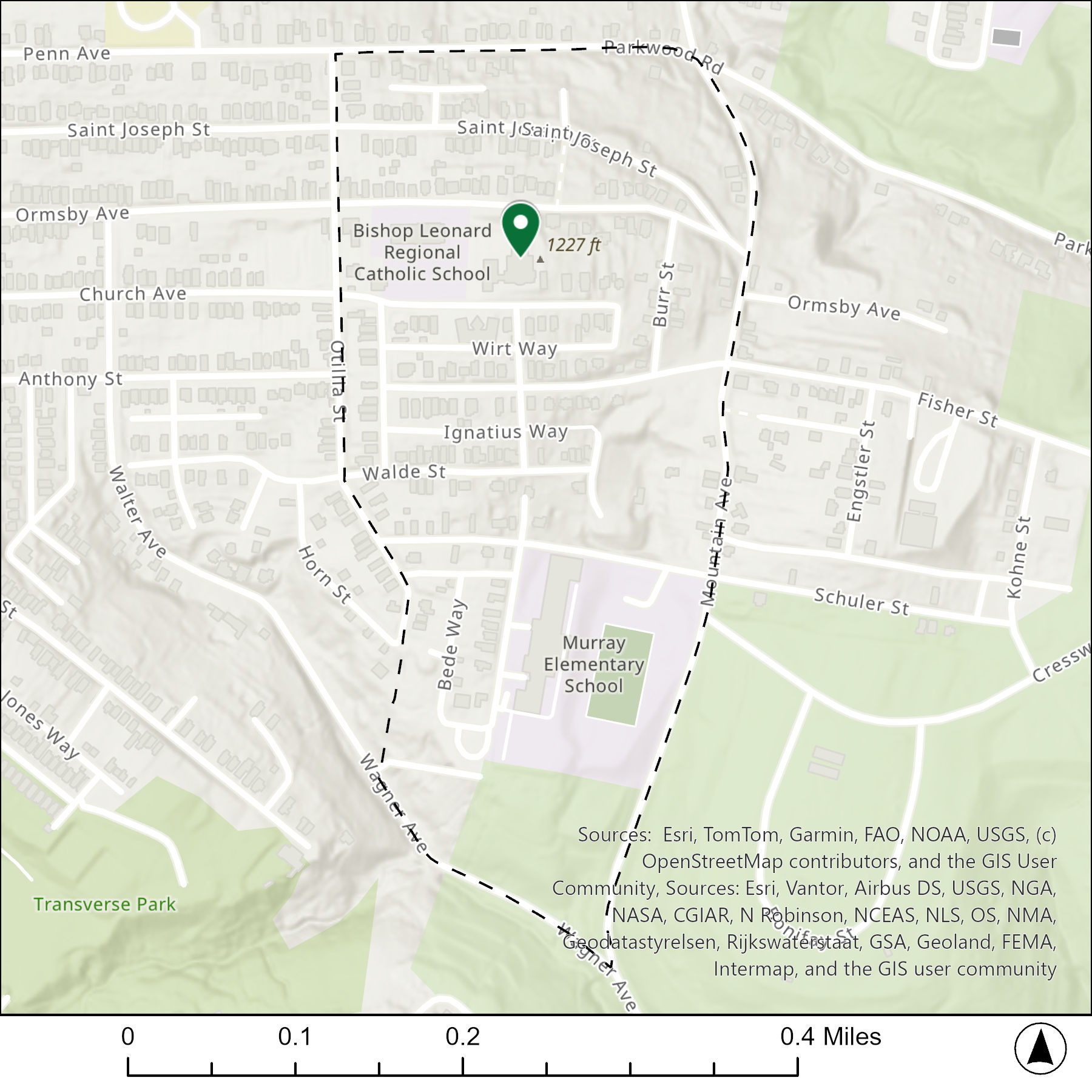
The map below shows the locations of the 1 congregations listed in the 1926 directory for Mt. Oliver (the dotted line marks the neighborhood boundary).
What are they now?
The table below matches the 1 congregations listed in the 1926 directory with the current use of the site.
| 1926 Congregation Name | By 2026 the Congregation’s Building is: |
| St. Joseph Catholic Church | replaced with a new building, now vacant |
Photos
For more on this series, visit our introductory post.
Sources:
Brookline Connection. St. Clair Village Housing Project (1951-2010). https://www.brooklineconnection.com/history/Locations/StClairVillage.html
Catholic Diocese of Pittsburgh. Saint Joseph, Mount Oliver. https://diopitt.org/saint-joseph-mount-oliver
G. M. Hopkins. Plate 32: Baldwin, Carrick, Hays, Arlington. 1916. https://historicpittsburgh.org/islandora/object/pitt:16v06p32
Pittsburgh City Council. Municipal Record, 1923. Page 32. https://archive.org/details/Pghmunicipalrecord1923/page/n153/mode/2up?q=annexation
Pittsburgh City Council. Municipal Record, 1928. Pages 1116-1117. https://archive.org/details/Pghmunicipalrecord1928/page/1115/mode/2up?q=oliver
Pittsburgh Department of City Planning. Census: Pittsburgh. January 2006.
Pittsburgh Neighborhood Alliance. An Atlas of the St. Clair Village and Mt. Oliver Neighborhoods of Pittsburgh, 1977. https://historicpittsburgh.org/islandora/object/pitt%3A31735070288059/viewer#page/1/mode/1up
Polk’s Pittsburgh City Directory, 1926. Pittsburgh: R. L. Polk & Co. https://digital.library.pitt.edu/islandora/object/pitt%3A31735056286846/viewer#page/4/mode/1up
Discover more from urbantraipsing
Subscribe to get the latest posts sent to your email.
 urbantraipsing