The World’s Tallest Church Building

Chicago Temple

Everything in Chicago is stretched–even churches.  My eye was caught by this building as I looked to cross a street in Chicago and saw the steeple on top of this skyscraper a couple blocks down.  I was very confused at first, trying to figure out why an office building had a steeple on top of it.  Then I saw the name of the church, First United Methodist Church, carved into the side of the building.  The only other indication on the exterior visible from a distance that suggested the religious use of the interior was the doorway.

Chicago Temple Doorway

This building is also known as the Chicago Temple.  The congregation was founded in 1831 and has been worshiping at this site since 1838.  The current building was built in 1924 and has 23 floors.

One of my souvenirs from Chicago was the book “City of the Century” by Donald L. Miller, which describes the history of Chicago up to the 1893 World’s Fair.  So it doesn’t talk about the building of this church building, but it does describe the building of the Auditorium–Chicago’s multipurpose Opera House.  The book notes “there was no government support of the arts in the United States, so the Auditorium would have to pay for itself” (361).  As a result the theater was enclosed in a office/hotel complex.

It seemed like there might have been similar thinking in the design of this church building–as real estate was expensive downtown, covering the church with office space could help it afford its location.  However, if that is why the building is mixed-use, it was not inspired by the Auditorium, which was built in the late 1880s.  According the history page of the church’s website, there has been a multipurpose church building on this site since 1858.  The first one was a 4-story structure with stores and businesses on the first two floors and the church above.

First Methodist Church

The new building has a two-story sanctuary on the first floor.  Accounts differ as to how many this can hold (500, 1000, 1200 people).  The second floor has another smaller sanctuary.  Floors three and four hold the accessory rooms–classrooms, meeting rooms, etc.  The parson’s house is also located in the building.  The remaining floors are office space.  The crowning jewel, is a small chapel underneath the steeple.

I regret that I did not take the time to stop and investigate whether I could explore the inside of the building.  As I was focused on a specific task when I came upon the building, I did not even think about trying to see inside.  If you are interested, I found a YouTube video that shows what I take to be the first floor sanctuary and the small chapel under the steeple.

Pedestrian Bridges: Chicago

BP Bridge

There are two pedestrian bridges connecting to Millennium Park in Chicago.  The first I encountered was the BP Bridge.  I admired the undulating silver sculpture above as I walked past and was thrilled to discover it was a pedestrian bridge.  My excited was quickly crushed as the bridge was closed to traffic due to construction at the other end.  I realized that I have become quite addicted to bridge-walking.  I was on my way to see The Bean before renting a bike to ride along the lake, when seeing this bridge completely sidetracked me.  I had a desperate urge to walk a bridge.  Fortunately, there was another pedestrian bridge nearby and while it was not nearly as enticing, it had some interesting parts.

BP Bridge The Nichols Bridgeway

The Nichols Bridgeway connects Millennium Park with the Art Institute of Chicago.  Both ends had space-age-like toughs, which I assumed were supposed to be a fancy drainage system.  If their purpose is a drainage system, the upper end by the Institute has failed and been turned into a wishing well.

Lower Trough Upper Trough/Wishing Well

The part I liked best about this bridge was that while it looked like the surface was level, there were ridges or “speed-bumps” every few feet.  I wondered if these were merely artistic or if they had a functional value like reducing the slipperiness of the bridge during icy conditions.

Bumpy Walkway The Nichols Bridgeway

What is a Bridge? Chicago Edition I

Stetson Ave, Chicago, from the Hyatt

In July 2012, a few months into the height of my Pittsburgh bridge-walking, I pondered the definition of a bridge in What is a Bridge? Pittsburgh Edition I and What is a Bridge? Pittsburgh Edition II.  Asking what a bridge is may seem a little odd.  After all, it’s one of those things that you know it when you see it, right?  Yet, in walking bridges, I’ve discovered it really isn’t that simple.  In everyday life, the actual semantics of what a bridge is, is not important–you either cross it or you don’t and move on with your life.  But if you’re trying to walk as many Pittsburgh bridges as you can (as I am) or to count the number of bridges a city has to see which has the most of any city in the world (as others have), spelling out a clear definition of a bridge becomes important.  By the end of my previous posts on the definition of a bridge, it seemed like I had covered almost all the difficulties: is a bridge still a bridge if it no longer bridges anything? what’s the difference between a bridge and a ramp? how many is one bridge?….but then I went to Chicago and faced a new facet to this problem.

The issue Chicago brings up is best illustrated by the image above.  Is there a bridge in that picture?….No, right?….Try again.  If you walk past the buildings on the right, you get a new perspective on the seemingly solid ground you stand on (pictured below).

Discovering Ground Level on Stetson Ave
Looking Back Toward Hyatt on Stetson

Walking around on this street and the blocks around it, you may notice metal joints like those normally found only in bridges running across the roads and sidewalks.  You may also feel the ground bounce like a bridge as a large truck drives by.

Metal Joints across road and sidewalk on Michigan Ave
Metal joint across road on Columbus Drive

Are these roads, then, really bridges?  If no, what are they?  If yes, where does one bridge end and the other begin?  For example, is the Michigan Avenue Bridge across the Chicago River, visible in the back left of the image above-left, just a continuation of the Michigan Avenue road-bridge or is it a separate bridge?


Additional Posts in Series:

Manhattan Bridge: A Multimodal Link

The Manhattan Bridge

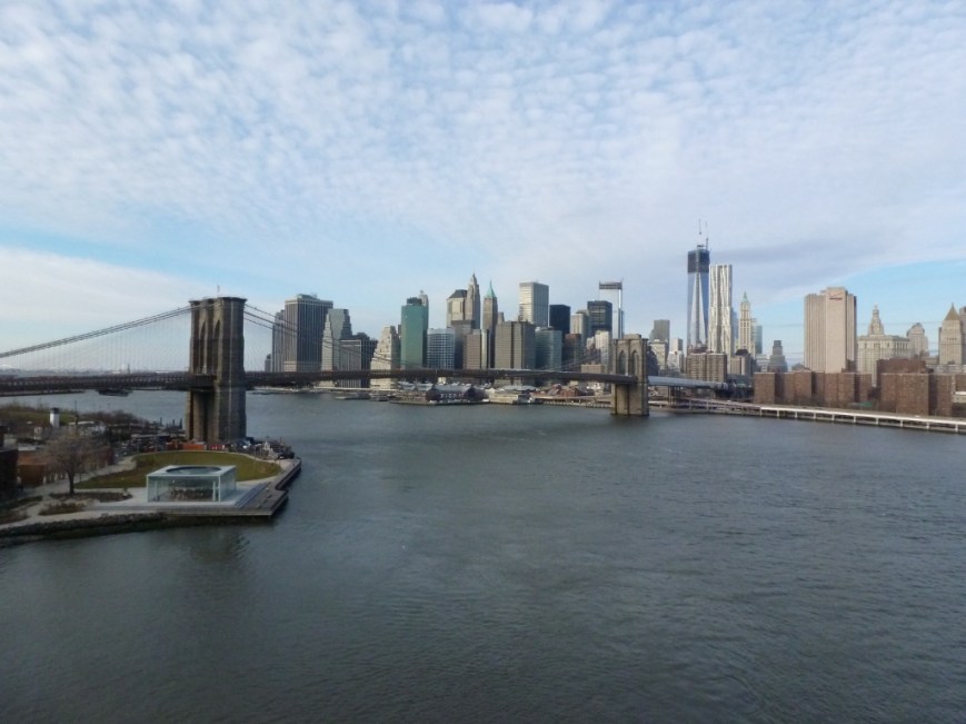
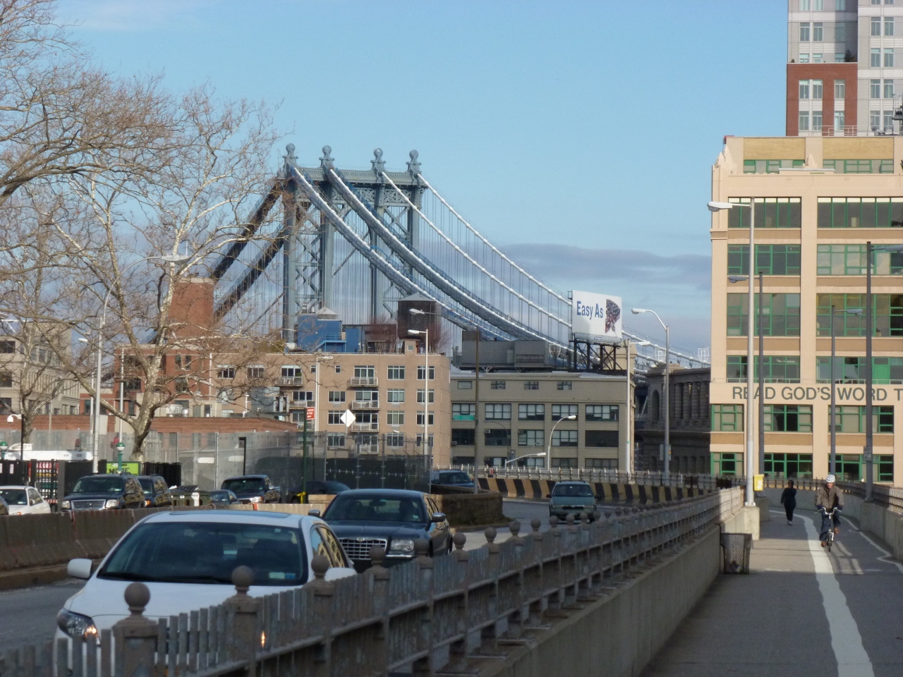
When I was planning my walk across the Brooklyn Bridge while in New York City last December, I noticed there was a bridge nearby called the Manhattan Bridge.  I decided to cross to Brooklyn by the Manhattan Bridge and return to Manhattan by the Brooklyn Bridge.  The Manhattan Bridge ended up being the more interesting of the two bridges.

Gateway to the Manhattan Bridge

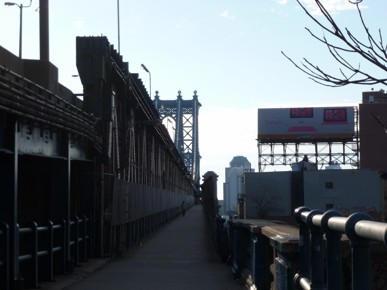
I found my way from the subway stop to the Manhattan Bridge by following the way-finding signs for the bike lanes in the Lower East End.   This brought me to the left side of the bridge, where I was temporarily upset to see that pedestrians were not permitted to use the sidewalk on that side of the bridge–it was dedicated to two-way bicycle traffic.  I was concerned that I was not going to be able to walk across this bridge and instead would have to cross the Brooklyn Bridge twice (I try to avoid walking across a bridge just to walk back across it; doing so gives me a sense of pointlessness).  Luckily, there are sidewalks on both sides of this bridge (from walking Pittsburgh bridges I know not to assume that bridges have sidewalks on two sides) and the sidewalk on the right side is dedicated to pedestrians.

I suggest that NYC puts up a sign on the bicycle side to direct pedestrians to the other side, which might help encourage pedestrians to follow the traffic directions set up on this bridge–I watched a pedestrian ignore the bicycle-only signs to cross the bridge on the bike lanes.

The Pedestrian Side

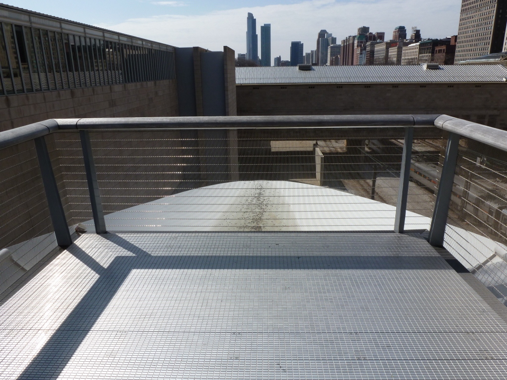
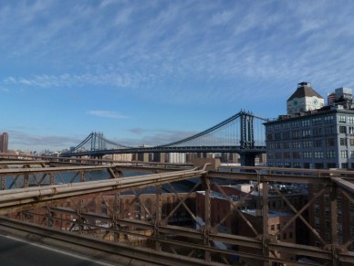
This bridge is the most multimodal bridge I have walked with the bike lanes on one side, pedestrian way on the other, and the subway and roadway in between.  While I approve of this welcoming of alternative transportation methods, I am not sure about placing the pedestrians next to the subway tracks.  This does give a barrier between the pedestrians and the noise of the cars, but instead, the pedestrians have to deal with the noise of the subway, which while it is less constant than the cars, it is a little more startling/disturbing.

The Manhattan Side The Brooklyn Bridge

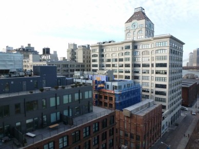
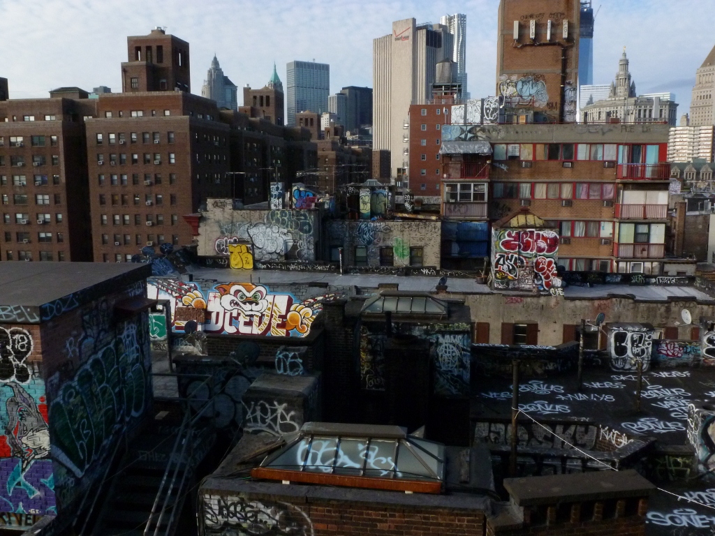
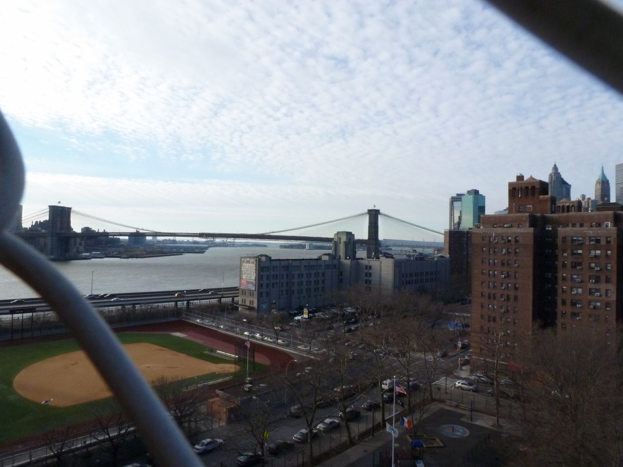
The neighborhoods the Manhattan Bridge links had some similar physical elements, but are clearly used by different populations.  The populations on both the Manhattan and Brooklyn sides use their rooftops, but for different purposes.  On the Manhattan side, the rooftops were covered in graffiti, while the Brooklyn rooftops had new additions and places to sit.  There were also parks on both sides of the East River.  However, the Manhattan side only had a baseball diamond while the Brooklyn side had a carousel and a pirate-ship playground.

Manhattan side park

Carosel Pirate Ship Playground

What intrigues me most about the Manhattan Bridge is that I had never seen or heard of it before and yet it is the bridge shown in the background (multiple times) in the Doctor Who episode “The Angels Take Manhattan.”  Based on my walk on the Brooklyn and Manhattan Bridges, it looks like these shots were taken on the Brooklyn side of the river, in which case it seems like it possible to get the Brooklyn Bridge in the background instead as these two are close together on that side.  To me the images of the Brooklyn Bridge say New York, while (at least before I walked it) images of the Manhattan Bridge just say a place with a bridge and hence water.  I wonder if the Manhattan Bridge is better known in the UK than in my circle?

View like that used in Doctor Who

Caerphilly, Castles and Cheese

Caerphilly Castle

When I arrived in the UK last spring, I realized I had one major flaw in my trip: I hadn’t planned to visit any castles.  Cardiff has a castle in the center of town and my hotel was right across the street from it.  However, I visited this castle on my last trip and remembered much of it: the Roman wall in the basement, the ornate room in the clock tower, the nursery painted with scenes from fairy tales, and the view from the keep.  Looking for a new castle to visit, my guidebook recommended Caerphilly.

Caerphilly is a twenty minute train ride north of the center of Cardiff.  It is a small town and features a castle begun in 1268.  In addition, the guidebook noted that the town is noted for Caerphilly Cheese, a mild relative of cheddar cheese.  As I love cheese, especially cheddar, Caerphilly was an appealing destination to satiate my interest in castles and cheese.

So one morning, I went down to the Central Cardiff station, purchased an open, round-trip ticket to Caerphilly for just a few pounds and enjoyed the short train ride through the Welsh country-side.  Cardiff is very flat, but Caerphilly and the surrounding area are quite hilly.  The castle wasn’t visible from the train station, so I started walking in what seemed the most promising direction: downhill on the main commercial street.  After a short walk, the road made a bend and the shops stopped on one side, leaving a wide view over a green park to the castle and the valley and hills beyond.

Views from the Castle's Keep Views from the Castle's Keep

Views from the Castle's Keep

A Welshman once told me that the only real castles are those in ruins.  Ones like Cardiff Castle that have been fixed-up, renovated, or refurbished in any way are not real.  I thought that he would have approved of Caerphilly Castle.

When I finished exploring every corner of the castle, I returned to the town looking for cheese and lunch.  There were no signs of Caerphilly Cheese anywhere.  There were lots of tourist-y areas and signs directing the way to tourist-like attractions, but none mentioned cheese.  Wikipedia claims that there is a cheese sculpture somewhere in town, but I didn’t see it.  I ended up choosing a quaint little diner (of the early 20th century style, not the 1950s/60s style we think of in the US) as the place to eat my lunch in the hopes that perhaps they used Caerphilly Cheese on their sandwiches, but they did not.

Feeling let down in my hunt for cheese, I returned to Cardiff shortly after my lunch.  Caerphilly’s castle was well worth the trip, but I was beginning to believe that Caerphilly Cheese was a myth.

….

Seven months later, my family and I were visiting New York City for Christmas.  On our last day, we made the requisite visit to Zabar’s.  I had been particularly looking forward to this stop on our trip as the last time I was in Zabar’s I was a kid who knew that there was something special about the shop, but didn’t understand why as I thought the height of culinary perfection was Kraft Mac’N’Cheese.

The first thing that caught my eye on entering Zabar’s was the cheese display.  I quickly went over and scanned the names of all the various cheeses, looking for the exotic one that I was going to take home to try.  Most had names that sounded familiar.  On my second look through, my heart stopped.  There on the shelf right in front of me was Caerphilly Cheese!!

I was shocked.  I had gone to Caerphilly to get their cheese and been disappointed.  Now, months later on the other side of the ocean, in a small store in NYC, I’d found it.  Needless to say, I purchased a brick.  It was a nice cheese, almost like a cross between a mozzarella and a mild cheddar: smooth, almost creamy, with a slight hint of the cheddar kick.

Erie Churches

Erie has a variety of attractive church buildings.  As I walked around admiring them, I was surprised to see that they were all still used as churches.  I did not find a single adaptively reused church building.  Given Erie’s location, relatively close to Cleveland, Buffalo, and Pittsburgh, I assumed it had similar significant population loss creating a need to either abandon, demolish or adapt some church buildings.  It turns out, that at least on the county level, this assumption was false.  Since 1900, the population of Erie County has grown every decade, except from 1980 to 1990 when there was a slight (1.5%) population loss, from 98,509 to 280,843 (2000’s population).  Allegheny County (Pittsburgh’s county), on the other hand saw growth from 775,058 in 1900 to 1,628,587 in 1960 after which the population has declined steadily to 1,223,348 in 2010.

I could not find statistics for the population change of the city of Erie; it is possible that there was a different trend within the city.  There were signs of abandonment and decay in other buildings and aspects of the town.  Yet the churches are still intact and appear to be thriving.  In fact, one of the larger churches was undergoing a major renovation while I was there.

Whatever the reason for the churches’ continued use, I enjoyed my treasure hunt chasing down as many steeples as I could in two hours:

Unknown

St. Patrick's Church 1903

Russian Old Believers Church of the Holy Trinity 1984

Russian Orthodox Church of the Nativity of Christ (Old Rite) 1987

Unknown

St. Peter Cathedral 1872

Cathedral School

St. Paul's United Church of Christ

Unknown

Methodist Church

First United Presbyterian Church of the Covenant 1929

Sandwich Shops

While in London last spring, I discovered a sandwich shop chain that I fell absolutely in love with: Pret a Manger.  I ended up eating lunch most days at one of their many locations around the city.  The food was great.  They had sandwiches on small baguettes, in wraps, and between two “normal” square slices of bread (which have been cut into triangles, as everyone knows triangle sandwiches taste better).  The flavors of sandwiches included ham and cheese, egg salad, and brie, tomato and basil.  The ingredients were fresh and real–meaning ham of the bone, not sliced deli ham, and arugula instead of shredded, nondescript “lettuce.”  And then the sides to go with the sandwich were interesting, exciting, and tasty.  The chip flavors I remember were “cheddar and red onion” and “sea salt and apple cider vinegar.”  Both delicious!  I was also attracted to the Pret sodas (I normally skip the soda options at restaurants).  I enjoyed the Grape & Elderflower, Apple, and Ginger Beer sodas.

Pret was the first place I had lunch in London and from the first bite, I couldn’t wait to come back and try another flavor of their sandwiches, chips, and drinks.  On my third day in London, I was ready for lunch, but could not find a Pret anywhere near where I was, so I went to another sandwich chain that I had been seeing around.  The style of this other place, the name of which I forget, was similar to Pret, but the taste was no comparison.  After trying this other place, I made sure that I was near a Pret at lunchtime for the remainder of my trip.

Besides the taste, I also enjoyed the convenience of the chain.  All the sandwiches are premade, so all you have to do is grab-and-go.  You don’t have a clerk staring you down while you decide what flavor you want today and you don’t have to wait for it to be made once you’ve made the decision.  All of which suits my personality better.

I cannot think of a sandwich shop in the US that has premade sandwiches.  It seems to me that one of the things the Subways, Quiznos, and the others are after with the don’t make it until it’s order deal is to prove that their food is fresh.  Blimpie’s for example doesn’t even slice the meat and cheese until you’ve put your order in.  Despite being premade, the sandwiches at Pret always tasted fresh and satisfying because they were made with solid food such as dense, but small bread, and chunks of chicken meat.  The chain’s website explains the secret: “Pret opened in London in 1986. College friends, Sinclair and Julian, made proper sandwiches avoiding the obscure chemicals, additives and preservatives common to so much of the ‘prepared’ and ‘fast’ food on the market today….They created the sort of food they craved but couldn’t find anywhere else.”  “Our partners drop off the very best ingredients to our shops everyday. We don’t mind that good, natural food goes off quickly. We don’t keep our sandwiches, baguettes and wraps overnight.”

One of my biggest disappointments on returning home was that I might never get another Pret sandwich (unless they’re still there the next time I’m in London) and instead the only options for buying sandwiches out would be places like Subway and Quiznos.  It was quite devastating.  Like the partners who started the Pret chain, I was going to be craving fresh, “proper” food, but unable to find it anywhere….

But then, I went to New York City for Christmas.  Walking around the first night there, I was thrilled to spot not one, but two Prets.  Needless to say, I went there every opportunity I got.  The options were somewhat different, particularly the chips–there were only boring, regular American flavors and styles to choose from (though they still weren’t national brands like Lays)–but the food was still good.  The egg salad wrap was melt-in-your-mouth delicious.  The roast beef, arugula, mustard-mayo and chicken, bacon, mayo baguettes were also yummy.  They also had the Pret Ginger Beer Soda, which tasted as yummy as the Ginger Beer I had in London, both Pret and non-Pret.  I’ve found Ginger Beer in Pittsburgh, but it’s just not the same.

It turns out that Pret a Manger has set up locations in New York, Boston, Chicago, and Washington, D.C.  As Chicago is one of the next US Cities I hope to visit, I know I will be getting another Pret sandwich soon.  I wonder though, if the large, diverse populations of these cities are necessary for a place like Pret a Manger to be successful.  Is it possible for a truly fresh sandwich shop to succeed (and set up multiple branches) in a smaller, less diverse city like Pittsburgh?

Isolated Waterfronts

In October 2012, I spent a few days in Erie, PA, to attend a conference.  Before arriving, I had looked at the map to figure out how to get from the bus station to my accommodations to the convention center.  On the map it looked pretty straight forward and simple.  All the places I had to get were within a mile of each other—piece of cake.  I often walk that far just to get to a bus in Pittsburgh.  Shortly after arriving in Erie, I realized that purely considering distance does not capture the true picture.  The seemingly short mile-long paths that I had to take included significant geographical and man-made barriers.

The main drag ran up through the town and straight out to the waterfront ending at the convention center hotel.  From the town square (6th Street), most of the buildings are flush with the sidewalk, except for the parking-lot-centric McDonald’s in the middle of these older buildings.  At 3rd Street, this changes.  The next two blocks are dominated by the campus of a UPMC hospital.  Then the barriers come.

First there is a small hill down toward the waterfront, then a wide parkway, followed by a barren strip of land on one side of the road and a marina on the other.  Finally, there is the convention center hotel.  Of course you have to pass the long parking garage, the lobby and rooms of the hotel, go up an elevator across a pedestrian bridge over the entrance to the marina, and down another elevator before you get to the convention center.

I was staying in a Bed and Breakfast near the town square, so several times a day I walked back and forth along this route to attend the conference events.  Even though the walk was only about a mile long, it seemed to take forever because of the barriers of the hill, road, vacant land, and water.  After going back and forth a few times, I realized that the set up was not much different from what I had seen in Cleveland this summer.  That city also has a major roadway cutting off the town from the shores of Lake Erie.  This road of course was much bigger than the one in Erie as the city is correspondingly bigger.

Despite the fact that there is a major freeway dividing the waterfront from downtown Cleveland, I still felt welcome to cross this barrier to reach the waterfront park or the Rock ‘n’ Roll Hall of Fame.  In Erie, I got a very clear impression that the downtown residents were not welcome to cross the barriers to get to the convention center/hotel or the little public jetty next to it and that the visitors at the hotel/conference center were not encouraged to explore into downtown Erie.  This situation seems to defeat part of the purpose of convention centers to bring economic benefits to the surrounding area, by bringing in more people to use local services.

Cleveland Guitars

As I mentioned in my Maps Are Awesome! post, I intended to walk over some of Cleveland’s bridges, but got distracted.  First I got distracted with some of the artwork on the street, such as the sculpture and fire hydrant below.


Then I got distracted by the gardens and the way the vacant property was dressed up as discussed in my Oh, Cleveland! post.  I also became fascinated by the map kiosk scattered throughout downtown (see Maps Are Awesome!).  Finally, and probably what clinched the deal, was the Guitar Mania.  Guitar Mania is one of the latest of fiberglass art fundraisers put together by a city.  In these fundraisers, a figure that is iconic to the city is chosen and artists decorate each uniquely and they are displayed all over the city.  After a certain time period of being on public display, these sculptures are auctioned off and the money goes to support charities and such.  An article I found online about Cleveland’s Guitar Mania mentions a few of the other cities that have done this, though they left out Pittsburgh.  Pittsburgh has actually done this twice now.  First was Penguins on Parade in 2002.  This was followed by DinoMite Days in 2003.  Though I haven’t seen a penguin since they were publicly on display in 2002, some of the dinosaurs can still be spotted around the city, mostly on corporate or institutional properties, but at least one is in someone’s private yard.  Other cities were I have personally experienced these kinds of events are Willimatic, CT, which had frogs sitting on spools (the city symbol due to a pre-Revolutionary War legend about frogs and the city and the city’s past as the headquarters of the largest thread company in the world) and Mystic, CT, which did whales.

However, getting back to Cleveland, this was the first time I was in a city while the statues were on public display and when I had the freedom to hunt for them.  I intended to still get to a bridge; however, I kept getting sidetracked as I spotted a guitar down one street or another.  In the end, I found 19 of the 100 guitars and photographed 18 and I decided it was a much better use of my time as the bridges will still be there the next time I’m in Cleveland, but the guitars will not be.  Later, I noticed a couple of decorated fiberglass Chinese dragon sculptures, but as I was passing in the car I was not able to take photos of them.  It turns out that Cleveland is doing a separate display of the Chinese dragons (see website, with link to locations) in addition to the guitar event.


Cleveland’s Bridges

I was surprised how many bridges there are in Cleveland, as I’ve always considered it a flat city.  There are several bridges across the Cuyahoga River which flows through the city, but there are also many bridges elsewhere in the city.  These other bridges cross over railroad tracks or the highways or are railroads and highways crossing over regular roads.  This realization (that even flat cities have can have lots of bridges) is causing me to reconsider what bridges are significant.  For instance in the claim that Pittsburgh has more bridges than Venice, if Pittsburgh has more bridges because highway overpass bridges are included in the count then is that kind of cheating as there was no geological reason for those bridges?  In other words, when cities compete for who has the most bridges, it seems like it would only be fair to count the ones that exist because of geological formations.  On the other hand, this almost sounds like I am calling some bridges more natural than others, but as they are all man-made how can any be natural?  Anyway, this is something to ponder.

In the meantime, I’ll return to Cleveland’s Bridges.  I did not cross over any of the river bridges while I was visiting recently.  Instead, I went under them on the Goodtime III boat tour of the Cuyahoga River and Lake Erie.  As seen on the map above, the boat entered the river in the upper left-hand corner, traveled downriver for over three miles (though as the bird flies it was only about 1.75 miles), and turned around in the last “corner” of the river seen in the lower right-hand corner.  In the process, we passed under 13 bridges, while a 14th bridge swung out of our way.

While I call Cleveland a flat city, there are at least two significant changes in elevation.  One is located out by University Circle and though it continues farther out, I am most familiar with it because it separates the frats and some dorms of Case Western Reserve University’s southern campus from the rest of the campus.  This is a moraine formed by glaciers during the last ice age (or so I’ve been told).  The second elevation change is next to downtown.  The Flats district along the river is significantly lower than the surrounding areas, including downtown and whatever the neighborhood on the western side of the river is.


All the bridges we traveled under on the Cuyahoga River were interesting and unique, at least compared to the bridges in Pittsburgh.  About half the bridges were railroad bridges.  The railroads tended to travel along the flats and so crossed the river with very low clearance.  To allow the passage of larger vessels, such as the one we were on, these bridges raised and lowered like elevators.  On the other hand, the bridges carrying roads were very tall as they traveled at the height of downtown and the western neighborhoods.  This also meant that most of them were very long as they not only crossed the river, but also crossed the flats which were sometimes very broad.

This bridge was the only one of its kind on the river.  Instead of raising and lowering like all the other low clearance bridges, this one rotates in either direction to swing out of the way of boats.

Here was a railroad bridge higher than the others.  Though it still had the mechanisms for rising up, if it needed to, it appeared that our boat was short enough to pass under without this.  A car bridge passes over this bridge before passing over the river as well, however this one will be demolished in the near future, after the one under construction is finished.

These bridges were interesting as they were two railroad bridges right next to each other, which seemed rather odd.  My theories for this are that either the tracks belong to different railroad companies or one was built first and then the railroad grew, expanding to two tracks, and instead of replacing the bridge with one for two tracks just built a second one right next to the first.  Either way, it’s a sight you don’t see every day.

Though Pittsburgh’s Fort Duquesne Bridge is nicknamed “The Bridge to Nowhere” (see June 19th post), this Cleveland bridge deserves the title more as the road or railroad it used to connect across the river no longer exists.  I wonder why they keep the bridge in place, when its purpose is gone.  It seems to me that this could easily become a hazard as the bridge weathers and there is no reason to maintain it.  In the meantime, before it comes crashing down, it does make an entertaining sight.


And of course, since I was passing underneath the bridges, I had to take a shot at the undersides!