As I continue to explore the question “What is a Bridge?” I find that there is a structural, or form, perspective and a more philosophical, or function, perspective. In asking if the building in Chambersburg pictured above is a bridge, I earlier came to the conclusion that it is. That answer required searching beyond two standard dictionary definitions both of which required that the structure carry a path or roadway to qualify as a bridge. The Encyclopedia Britannica did not have that qualification and so I embraced their definition as I felt that this Chambersburg building and the backyards and buildings I discuss in Millvale should be called bridges. Structurally, these may be bridges, but philosophically are they bridges? Does a bridge need to allow movement across it to fulfill the purpose of a bridge?
Up to this point, I’ve been primarily focused on Merriam-Webster’s definition of bridge as a structure found in the built environment. There are many other definitions and types of bridges under their entry for “bridge,” starting with a time, place, or means of connection or transition. Other examples of “bridges” include the bridge of a nose, the bridge of a violin and other string instruments, the passage of music called a bridge that links two sections of the piece, a dental bridge, and a ship’s bridge. For each of these examples, the function of connection or transition seems to be the crucial part that makes them bridges.
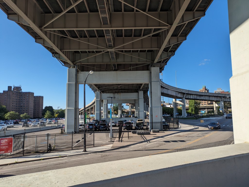
In Buffalo, I also questioned the different between a structural bridge and a philosophical bridge. I proposed then that an overpass may be structurally a bridge, but philosophically if the primary purpose of the structure is to pass over instead of to connect then it is not a bridge.
Putting these ideas together, there is a difference between a structural bridge and the concept of a bridge. The Chambersburg and Millvale examples are structurally bridges, I believe, but their main purpose is to expand the buildable area. They are not intended to create connection and therefore they are not bridges.
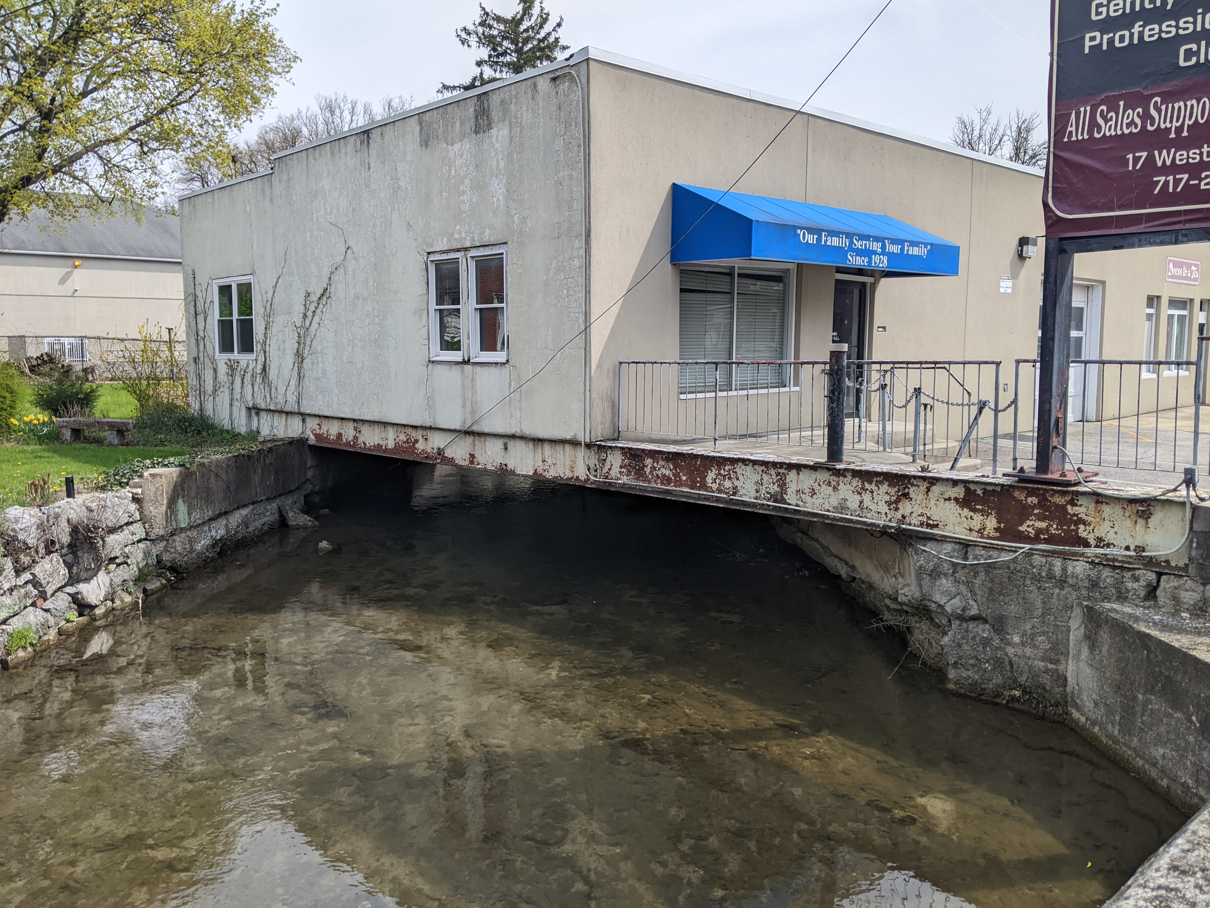
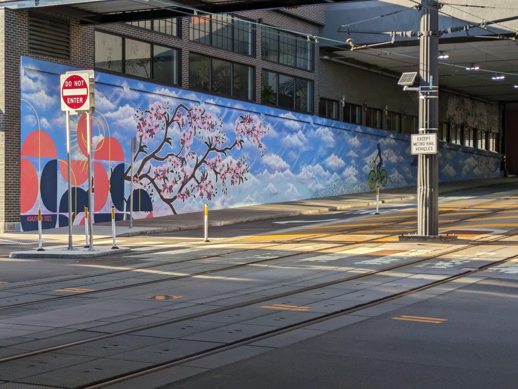
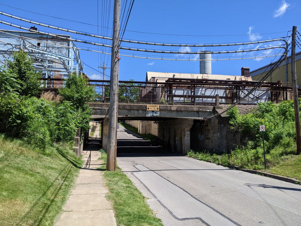
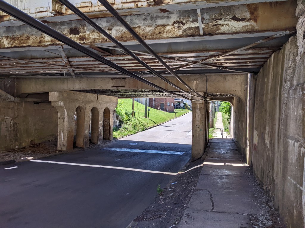
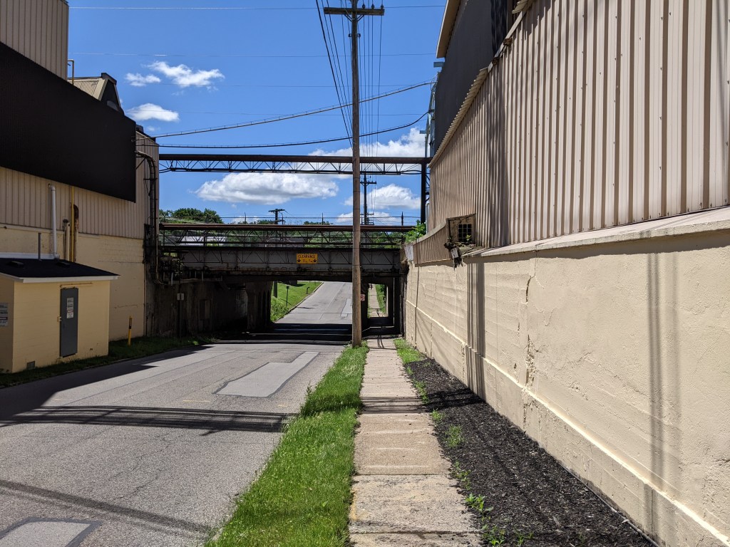
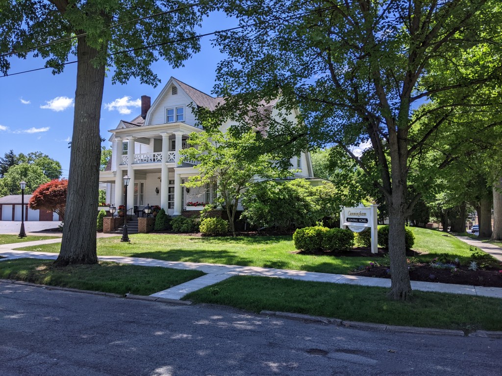
In Chambersburg, PA, a historic town along the Lincoln Highway, the question of what is a bridge comes up again. This time, the specific iteration is: “Is a building a bridge?”
This question is a continuation of the one inspired by Millvale. When I shared my thoughts on the building/bridge and backyard/bridge in that town, I focused on the fact that those bridges were hidden from sight and are likely an important factor contributing to the town’s flooding issues.
The structure in Chambersburg, on the other hand, sits in plain view. To tackle this question, I think it is time to return to the formal definition of a bridge. I looked up a definition of a bridge for the first Pittsburgh edition of this series and seemed to accept that definition at face value. I returned to a definition of a bridge in the second Chicago definition to help define what a viaduct is. I again did not question the definition of bridge. Perhaps it is time to change that?
Merriam-Webster defines bridge as a structure carrying a pathway or roadway over a depression or obstacle.
The Oxford English Dictionary defines bridge as a structure forming or carrying a road, path, or (in later use) a railroad, etc., which spans a body of water, a roadway, a valley, or some other obstacle or gap, and allows a person or vehicle to pass unimpeded over or across it.
Both of these definitions avoid the interaction of buildings and bridges.
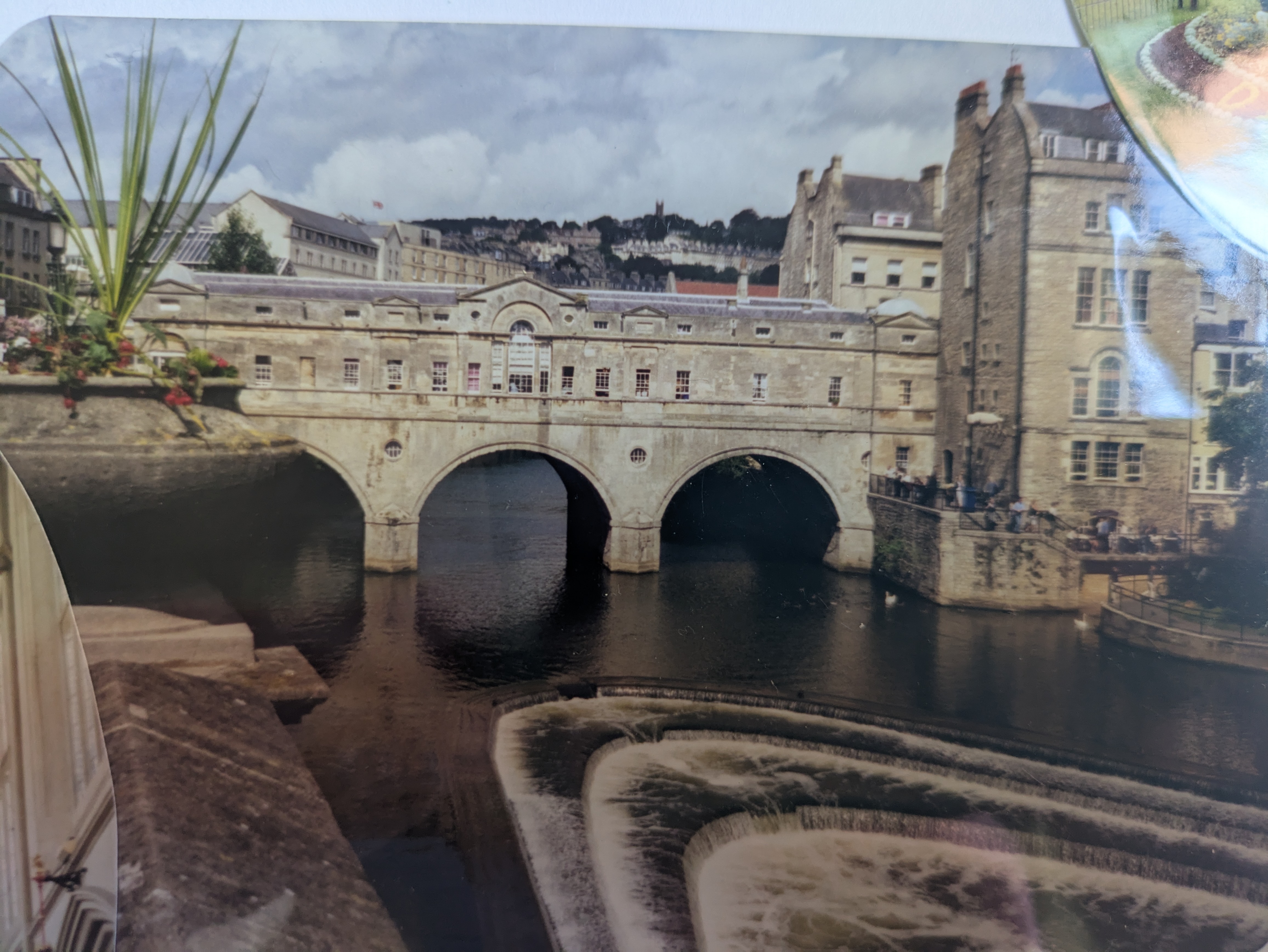
My first encounter with buildings on bridges was Pulteney Bridge in Bath, UK (photo of photo below). I was 13. It would be over a decade before I would start intentionally walking bridges. At that time, I declared, “That is one of the coolest bridges I’ve ever been on. There are shops on both sides of the road. You can’t tell you’re on a bridge.” (Notice the echoes of my later musings on the “bridges” of Chicago.)
The next most memorable building/bridge encounter was in Istanbul. The Galata Bridge is a 2-decker bridge with the lower deck full of restaurants with open seating facing the Bosphorus.
While both of these bridges also carry multi-modal roadways and therefore meet the two dictionary definitions of a bridge, they suggest the possibility of a broader definition of bridge.
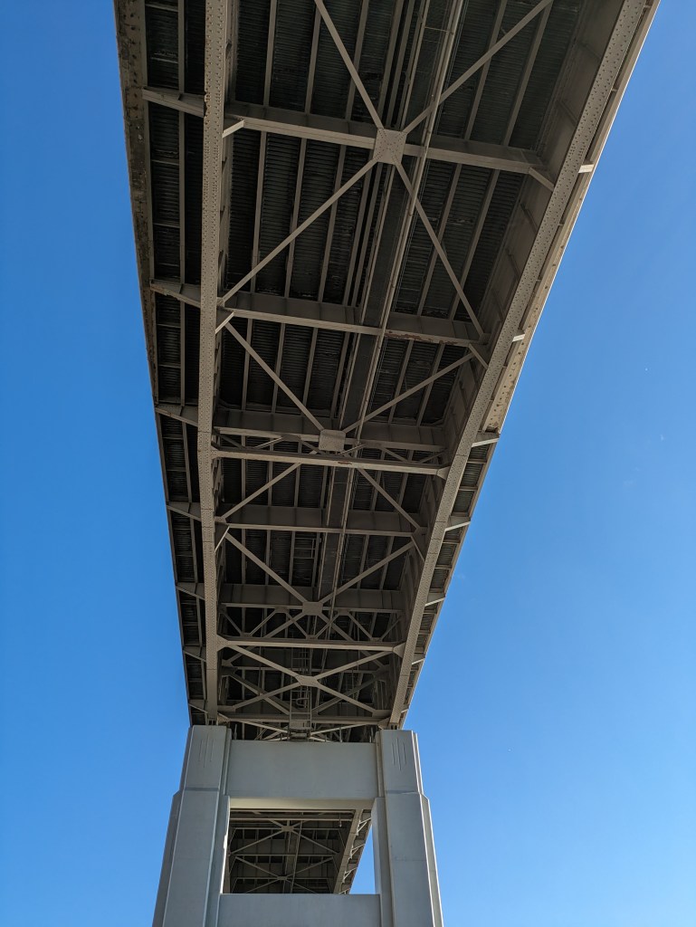
As I did with viaducts, I next turned to “How to Read Bridges” by Edward Denison and Ian Stewart. Interestingly, they do not provide a definition for a bridge. They discuss bridge types – if the Chambersburg building is a bridge, it would be a beam bridge. They also discuss bridge uses. “Bridges are designed to satisfy a wide range of different uses from the obvious, such as vehicle, railroad, cycles, and pedestrian traffic, to the more obscure, such as carrying water. Many are even designed to cater to multiple uses.” (68) While they hint at “more obscure” uses, their chapter on uses goes on to talk specifically about pedestrian, water, vehicular, rail, and military uses. Buildings are missing from that list. However, their case studies do include Bath’s Pulteney Bridge and Florence’s Ponte Vecchio, which also includes buildings featuring shops and apartments on the bridge.
The Encyclopedia Britannica (Britannica.com) has the broadest definition of a bridge that I’ve encountered so far: Bridge, structure that spans horizontally between supports, whose function is to carry vertical loads. The prototypical bridge is quite simple – two supports holding up a beam – yet the engineering problems that must be overcome even in this simple form are inherent in every bridge: the supports must be strong enough to hold the structure up, and the span between supports must be strong enough to carry the loads.
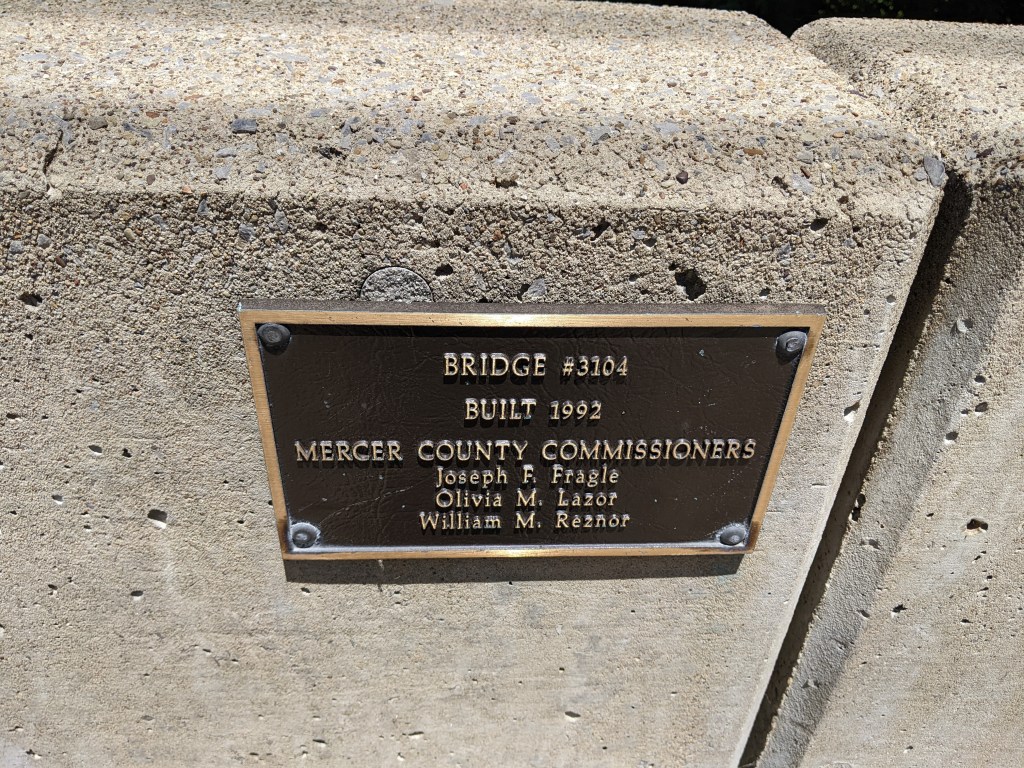
By that criteria, the building/bridge in Chambersburg meets the definition of a bridge as it is a horizontal structure “whose function is to carry vertical loads.”
Moreover, this criteria suggests a broader interpretation of my framing question than I intended. “Is a building a bridge?” was intended to ask if a building built over a stream is considered a bridge. However, I wasn’t that specific in my wording and reading Britannica’s description of a bridge, it sounds like any building floor that is not the equivalent of concrete poured on the ground would count as a bridge. . . .Supports, beams, arches, piers, and cantilevers are all elements used in both bridges and buildings. . . .And so, the answer to the unintended broader question of “is a building a bridge?” may in fact be “yes.”
While there absolutely are structural similarities between buildings and bridges, I am not comfortable with a definition of bridge so broad that it includes all multi-story buildings and perhaps even some single-story ones. Perhaps a common distinguishing element between a building and a bridge is that bridges are designed to allow the free passage of air underneath the horizontal structure. That would make my working definition of a bridge: a structure that spans horizontally between supports, whose function is to carry vertical loads and that allows unobstructed passage of elements, objects, or animals, etc., underneath.
By this version of a definition of bridge, the building in Chambersburg is a bridge, the backyards and buildings in Millvale are likely bridges (assuming the stream has unobstructed passage below them all), but Heth’s Run Bridge while it was buried was not a bridge.
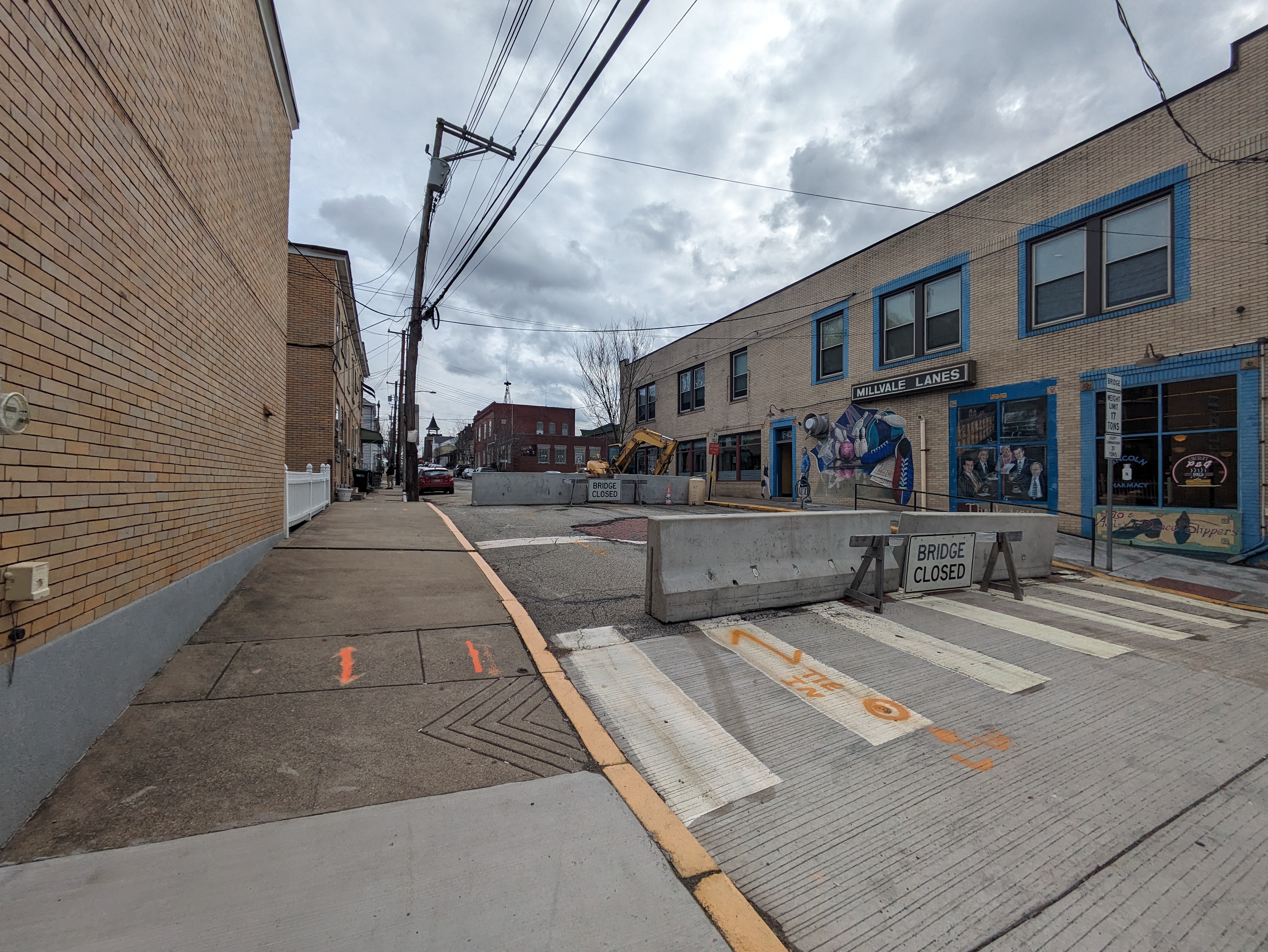
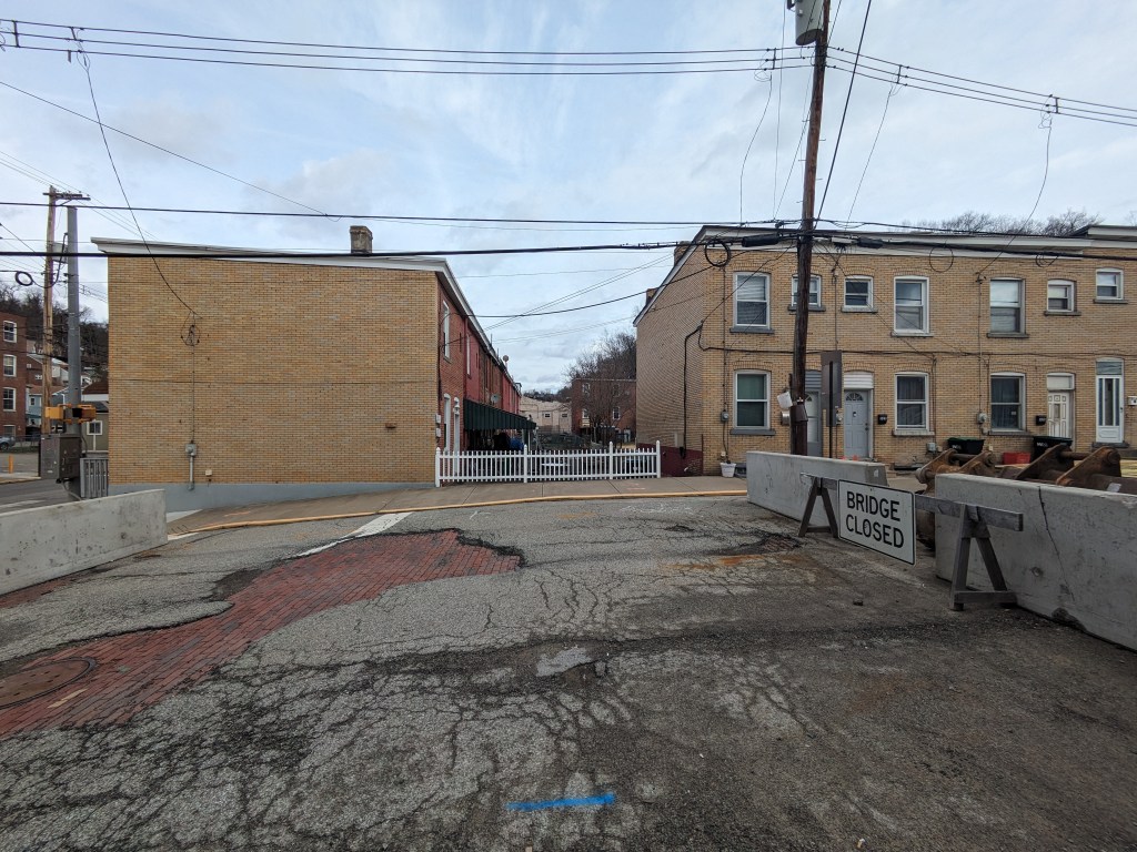
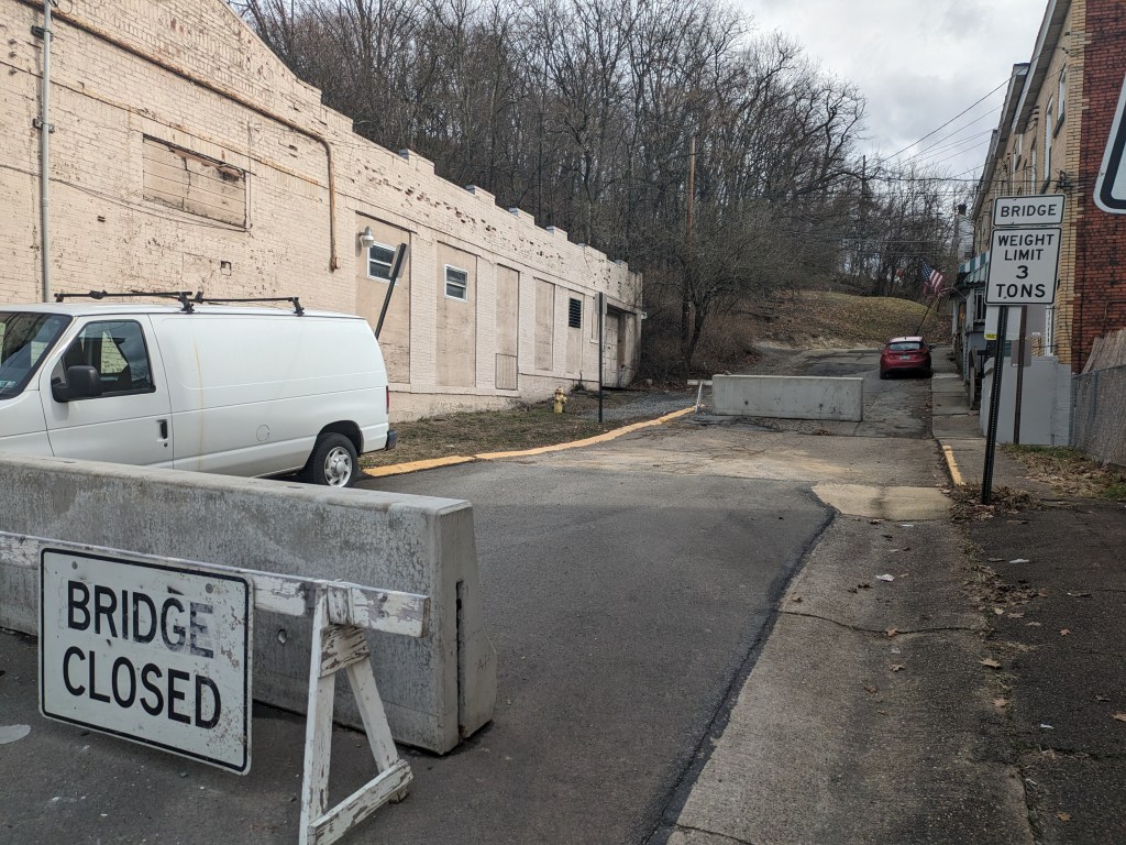
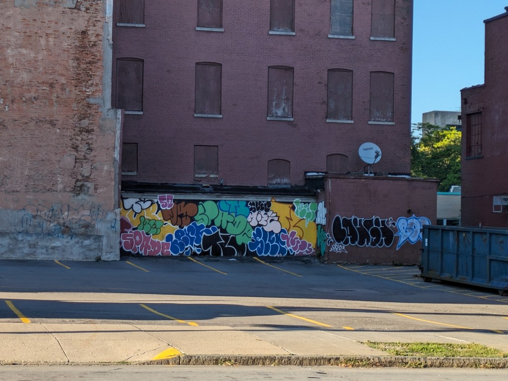
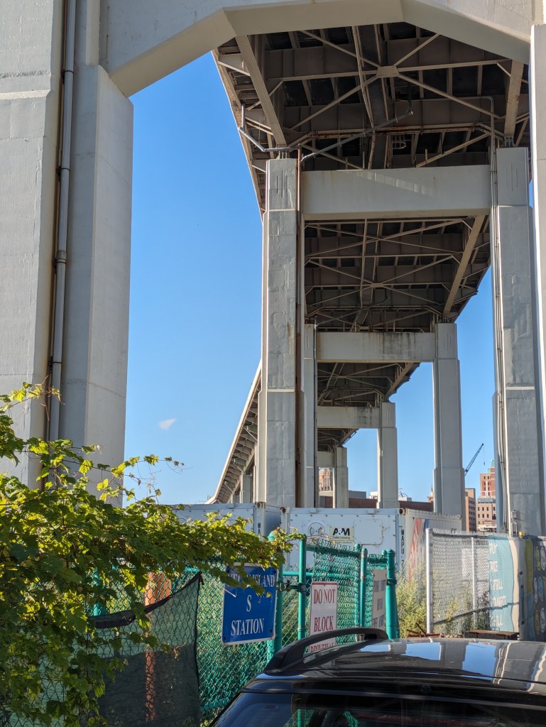
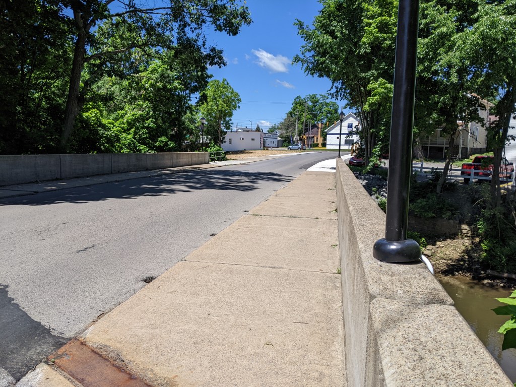
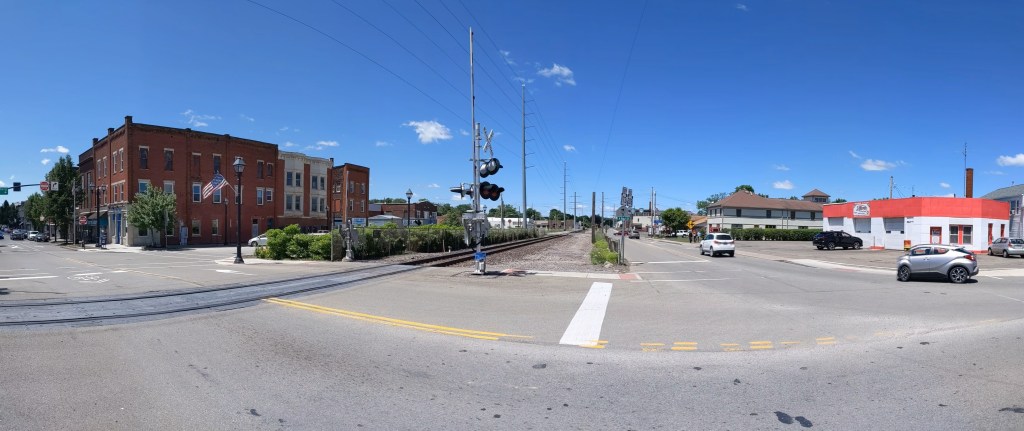
Millvale, PA, sits tucked in a valley that spills out into the Allegheny River at the far end of Pittsburgh’s 40th Street Bridge. Like all the valleys in this region, it formed over time by a stream cutting into the bed of the Allegheny Plateau. But when PennDOT announced the indefinite closure of two of Millvale’s bridges, I struggled to pinpoint their location. One of the two streets appeared to be nowhere near the streambed.
Then, in 2024, while I was primarily home-bound due to Long COVID and my mom sometimes took me along on her errands to help me get out of the house, she wanted to stop at a shop in Millvale. I thought I would sit in the car and wait for her, but as she was looking for a parking space, I noticed a barrier across one of the roads we passed with a sign that appeared to say “Bridge Closed.”
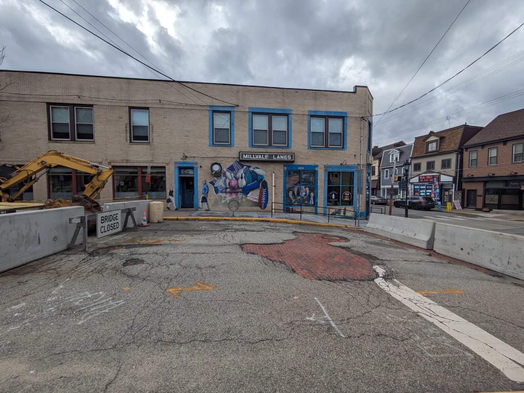
I investigated the closure while my mom went on her errand. Sure enough, on what looked like a street, just like all the other streets around, were jersey barriers marked with “Bridge Closed” signs (photo above). This street/bridge was the Lincoln Avenue Bridge that PennDOT had closed a year before. The only indication that this was a bridge was the “Bridge Closed” sign and the bridge weight limit sign on the right side of the bridge. A block over, Fremont Street had a similar barrier with “Bridge Closed” next to a bridge weight limit sign. Again, looking around from this bridge, it made perfect sense to me why I was unable to pinpoint its location on the map. (photos below)
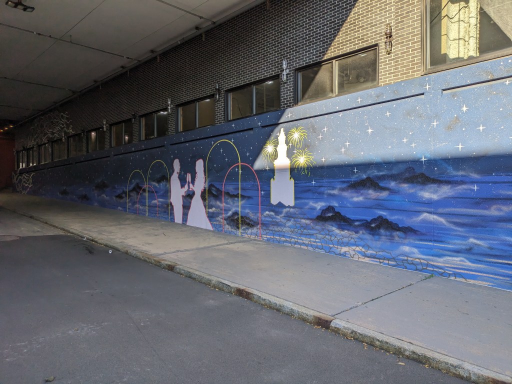
While standing on the Liberty Avenue Bridge, it struck me if this road was a bridge, then what are the buildings and back yards on either side of the bridge in the direction of the pathway of Girty’s Run? Is the bowling alley a bridge? Is the back lawn of the adjacent houses a bridge? Do the people who live and play in these spaces know that they are on bridges?
I asked similar questions in Chicago as the ground shook beneath my feet with the passing of trucks and buses and as I walked over expansion joints. However, there wasn’t a river running underneath the Chicago ground-bridges. Those “bridges” enabled a variety of activities to happen while stacked one above the other as a solution to work with the density of the city.
In Millvale, the presence of bridges hidden in plain sight bothered me. I’ve heard over the years that Millvale has lots of trouble with flooding, in a region where flooding is common. That hearsay has left the impression that Millvale’s flooding is worse than average for the area. The municipal website includes directions for what to do when you hear the town siren give off flood warnings, which seems to support my impression. When I saw how much of the stream was buried under “bridges” made of roads, buildings, and backyards, it instantly made sense that flooding would be a major problem here.
Over my years of bridge-walking, I have come to see that intent is a part of the definition of what a bridge is. Most bridges seem to have the intent of connecting two (or more) points. However, in Buffalo, I encountered a bridge that the number one intent seems to be passing over an area. Millvale illustrates a third, vital component. The intent seems to go beyond just connecting two points (and passing over something, in this case, a stream). The intent here seems to include a demonstration that humans best nature . . . a demonstration that doesn’t appear to be working in this particular town.
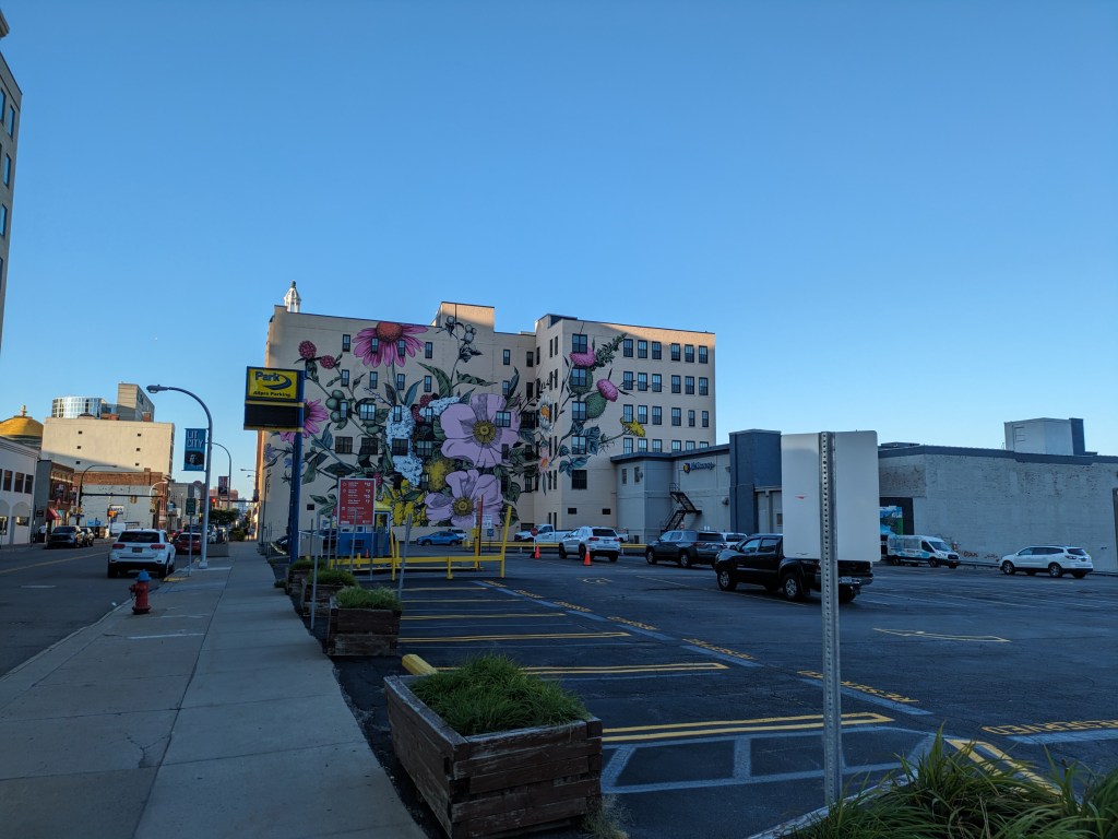
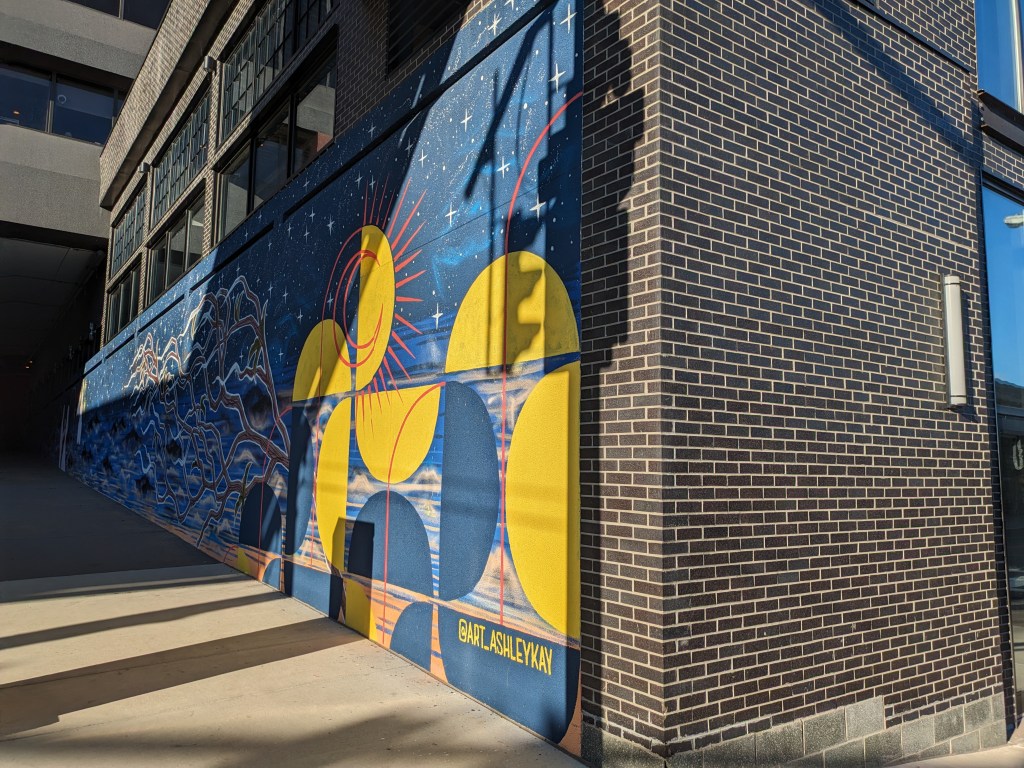
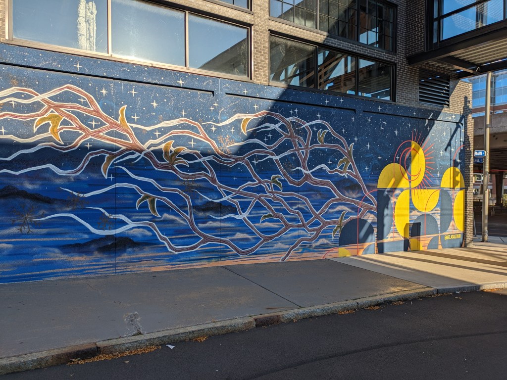
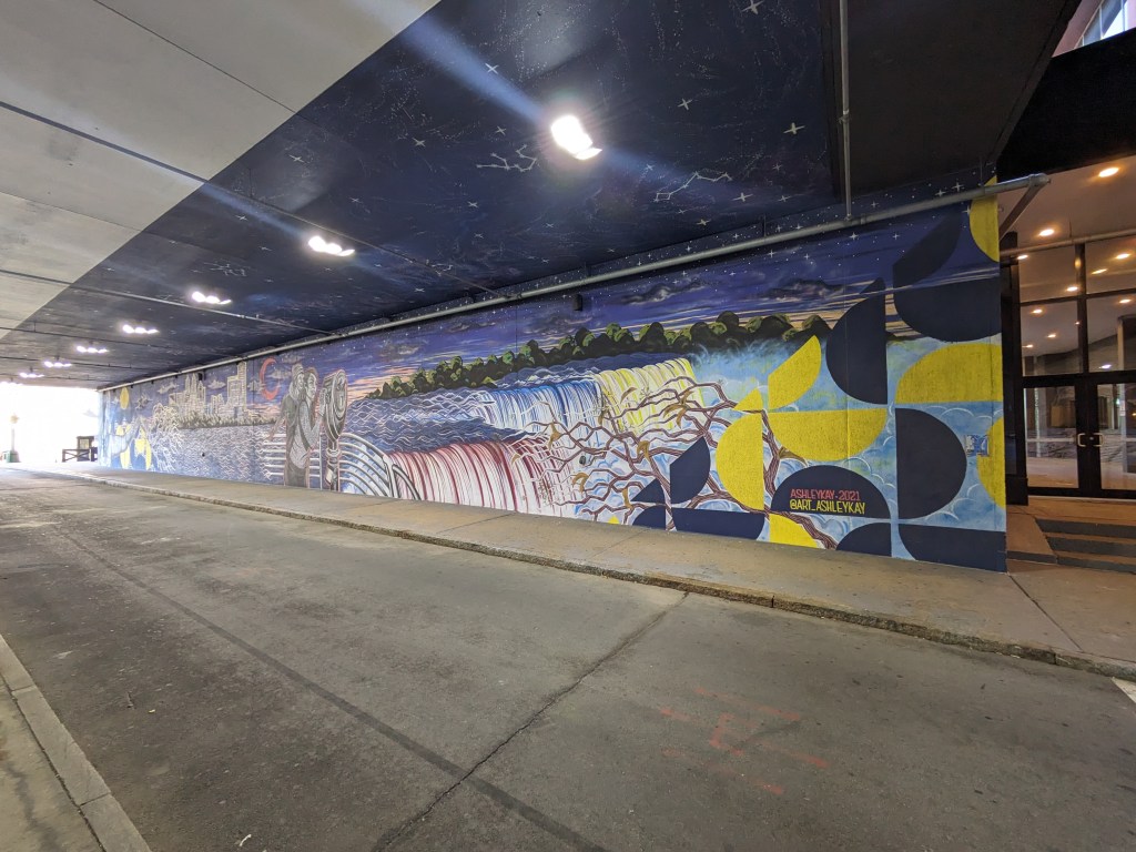
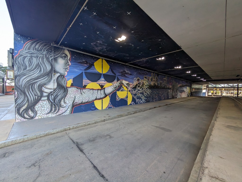
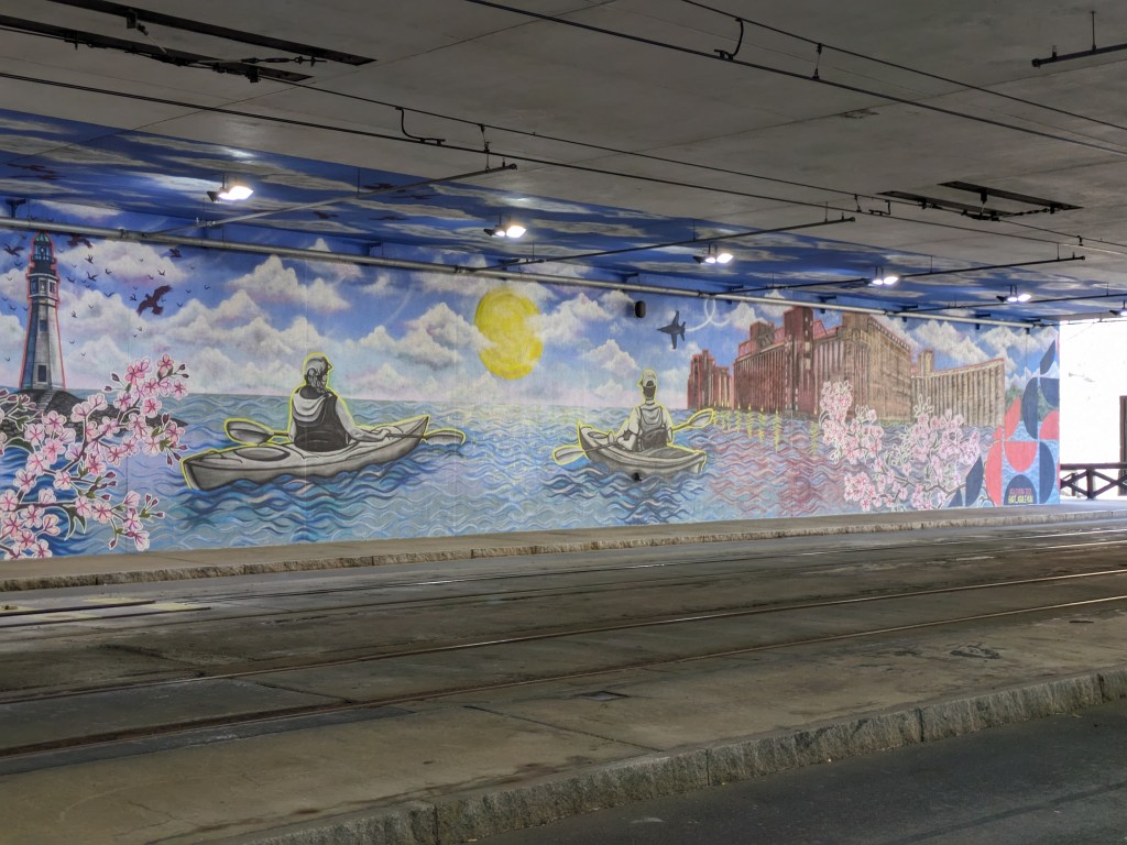
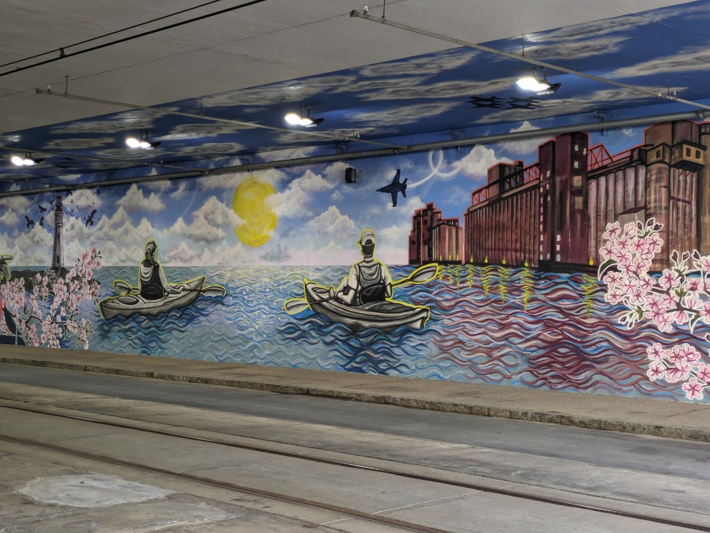
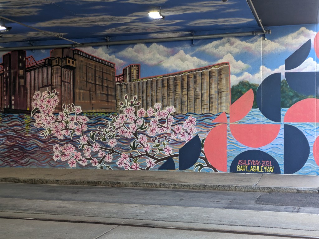
Walking around downtown Buffalo, I encountered several murals. They were all placed where the built environment would have otherwise created a drab or unpleasant experience. Three were on the sides of buildings bordered by parking lots. One was along both sides of the tunnel created by Seneca One, a 1970s tower built over Main Street. The mural along Main Street was particularly appealing. Usually walking along a road that passes underneath a building is a dark and dingy experience. This mural brightened up the space and created a distraction for the whole block. As Main Street is one of the possible pedestrian connections to the Canalside waterfront area, placing a mural here was a great decision to help make the approach more palatable. There are plenty more unpleasant places to pass before reaching the water.
I have dealt with the question of what is a bridge multiple times in the last decade. Buffalo adds to this philosophical conversation by combining the questions “what is a bridge?” and “what is the purpose of a bridge?” I’ve previous walked through what is the difference between a bridge and a ramp (Pittsburgh Edition I and Edition II), this time the nuance is “what is the difference between a bridge and an overpass?”
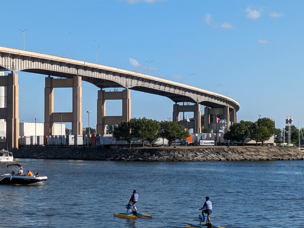
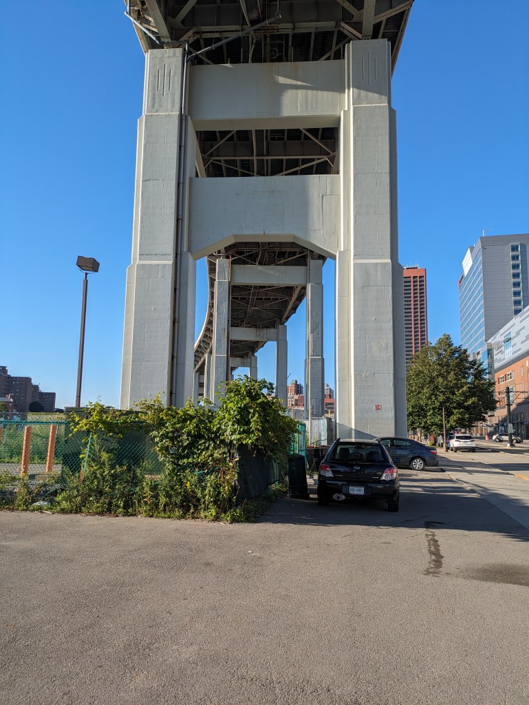
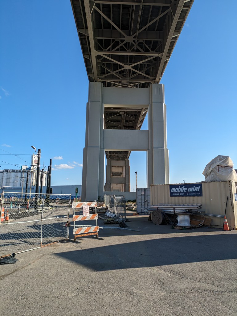
In Buffalo, the structure that carries Route 5 over what used to be largely industrial areas with some residential parts reads to me like an overpass. But sitting down to think it through, I realized that I may have to call it a bridge as well. It has all the structural components that are found in bridges: roadbed, spans, support. Yet, its purpose does not feel like a bridge.
While in Pittsburgh bridges divide the residents of the city, more typically bridges are about making connections. We use the term “bridge” metaphorically for building a connection. I see physical bridges as a structure that connects two (or more) points.
But Route 5 is not about connection, it is all about passing over. So can I call it a bridge?
I think an engineer would say yes. Since I started this philosophical debate of what is a bridge, the Fern Hollow Bridge in Pittsburgh collapsed, which led me to discover the Federal Highway Administration’s bridge database. It took a minute to figure out which dot on their map referred to Route 5’s structure, but I’m pretty sure it’s the one that is 1.38 miles long with 112 spans. The FHA, therefore, considers it a bridge.
From a structural viewpoint then, an overpass is a bridge; but from a philosophical one, an overpass may not be a bridge unless it is also a path of connection.
The week before Bridge Madness 2025, my aunt asked why I’m interested in bridges. The answer actually has nothing to do with the bridges themselves.
In 2009-2010, I volunteered in AmeriCorps in Pittsburgh, a city I thought I knew until AmeriCorps exposed me to a different side of the city. After 11 months of eye-opening experiences teaching me that Pittsburgh is far more than its downtown, museums, universities, and middle- and upper-income neighborhoods, I found myself attending a fundraiser at a house on Grandview Avenue.
Grandview Avenue is well named. It sits on top of a ridge directly across the river from downtown Pittsburgh, providing great views of the skyline and neighborhoods along the rivers. It is a popular spot to bring out-of-town visitors to show off the city and ride one of the two remaining inclines. I had been there countless times first as an out-of-town visitor and later as a resident bringing out-of-towners. The view from the street and lookout platforms is very familiar to me (and still fun).
But on that day in 2010, I suddenly found myself up 4 stories on a rooftop deck, looking at the same buildings, rivers, and neighborhoods I thought I knew and feeling like I was looking at a completely different scene.
It fascinated me that moving 40 feet made something familiar look brand new. As I stood at the railing pondering this, instead of mingling with the strangers who could afford a ticket to this fundraiser (unlike me who had been gifted a ticket), Pittsburgh’s iconic bridges were part of the view. I realized that the city would look completely differently from each of those bridges. And so I decided to start walking the bridges to continue increasing my perspectives and awareness of Pittsburgh.
The rest, as they say, is history. I thought it would be just a summer project. However, it has been so interesting….and there are still so many bridges to walk….that it has become a life habit. In the meantime, I have started getting interested in the structures themselves, not just the views from them.
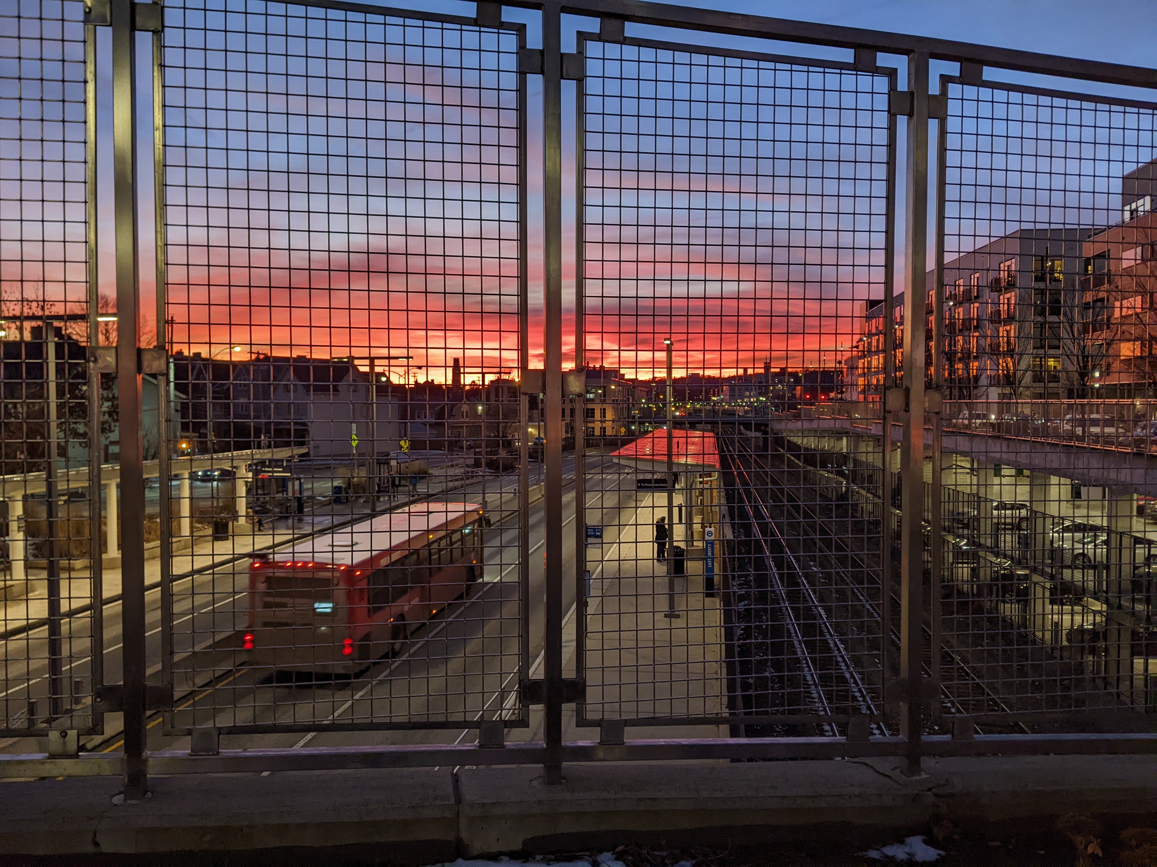
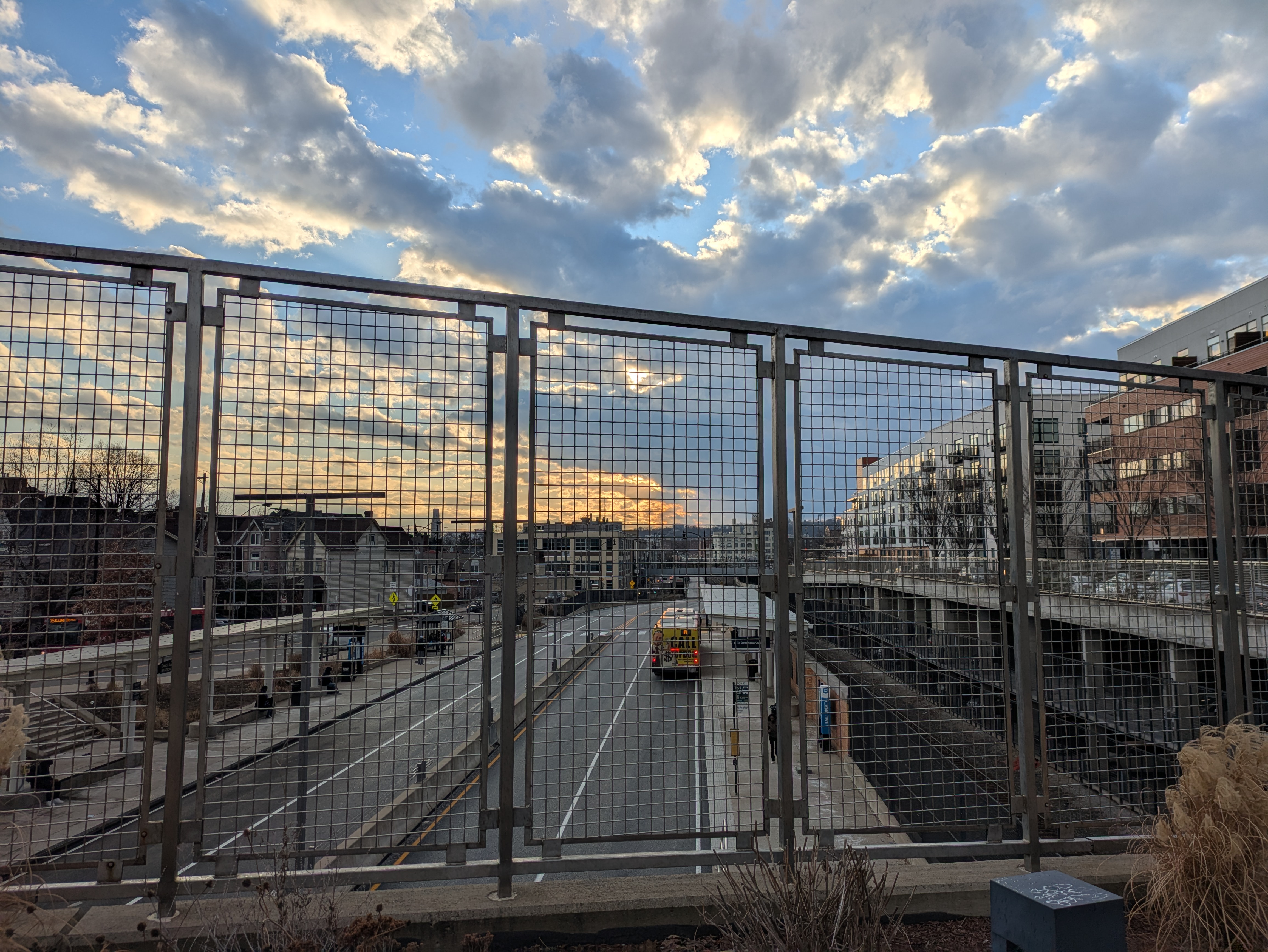
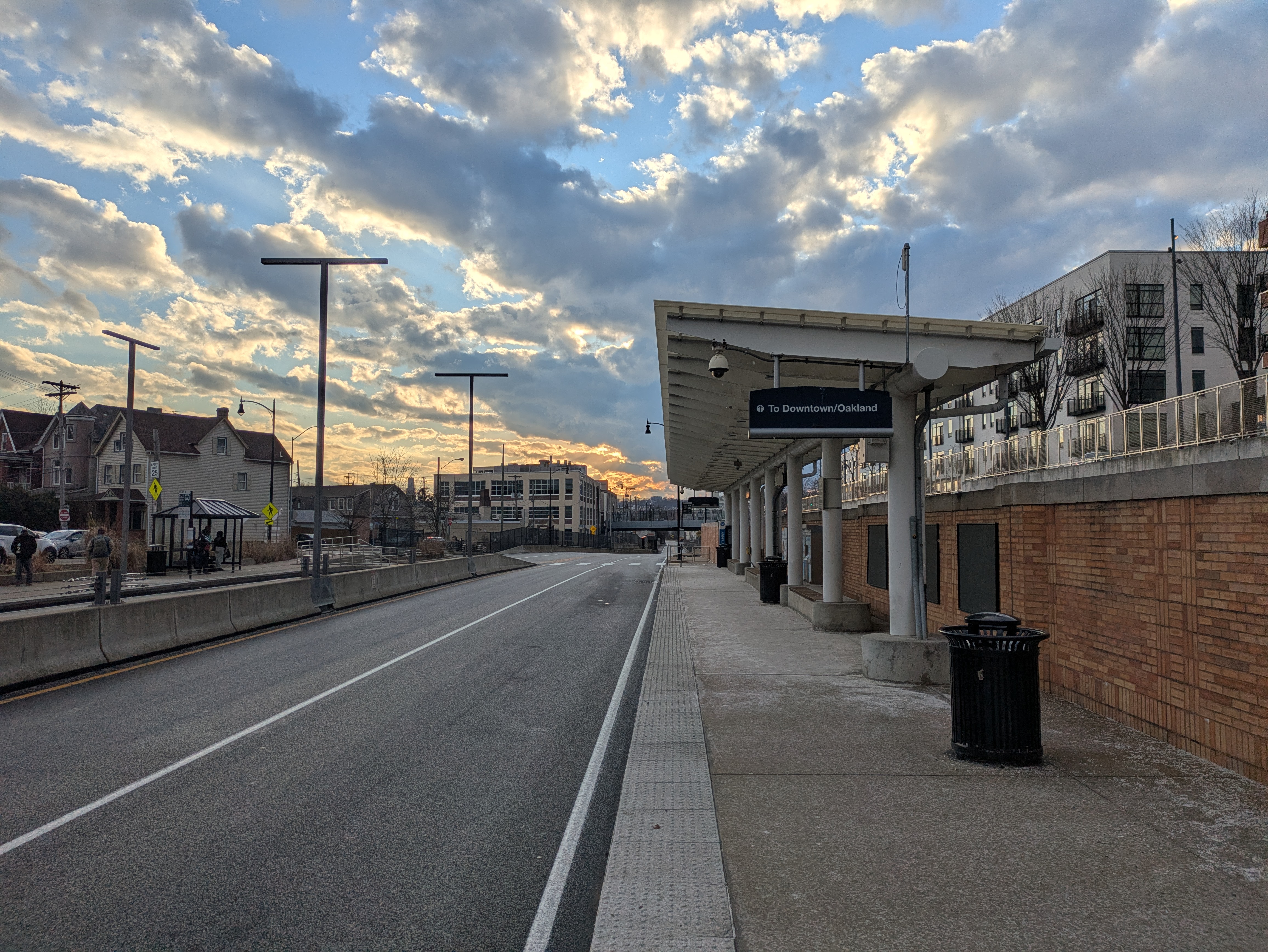
Two days after I told this story to my aunt, I walked across part of the East Liberty Station Pedestrian Bridge (Bridge Madness Champion 2024) at sunset. This is not the first time I’ve been on this bridge going about my daily business when I needed to stop to take photos of the view of sunset. In this instance, I then immediately walked down the steps to the busway station below. My experience of the sunset changed completely with the change in perspective. From the bridge, it seemed spectacular, but at the sidewalk below I no longer recognized it as something worthy of notice.
Have you ever noticed a time when a slight shift in perspective changed how you viewed your surroundings?
Sunset from the bridge 2025Sunset from the sidewalk below the bridge 2025
Three years ago, Pittsburgh’s Fern Hollow Bridge collapsed on a cold and icy morning. Since then, I have periodically checked in on the status of the new bridge, the fallout from the collapse including the Mayor’s new Commission on Infrastructure Asset Reporting and Investment, and the condition of other bridges, particularly those closed for safety reasons since the Fern Hollow Bridge collapsed.
At my last check-in one year ago, the National Transportation Safety Board’s investigation was still on-going with the latest update on their website a year old. The investigation wrapped up shortly after and the NTSB’s final report was issued in March 2024 (WTAE, March 22, 2024). Unsurprisingly, the report found that the City’s failure to act on the maintenance and repair recommendations from years of inspections led to the structural failure of the bridge. Specifically:
On Friday, January 28, 2022, about 6:37 a.m. eastern standard time, the Fern Hollow Bridge, which carried Forbes Avenue over the north side of Frick Park in Pittsburgh, Allegheny County, Pennsylvania, experienced a structural failure. As a result, the 447-foot-long bridge fell about 100 feet into the park below. The collapse began when the transverse tie plate on the southwest bridge leg failed due to extensive corrosion and section loss. The corrosion and section loss resulted from clogged drains that caused water to run down bridge legs and accumulate along with debris at the bottom of the legs, which prevented the development of a protective rust layer or patina. Although repeated maintenance and repair recommendations were documented in many inspection reports, the City of Pittsburgh failed to act on them, leading to the deterioration of the fracture-critical transverse tie plate and the structural failure of the bridge.
Immediately after the Fern Hollow Bridge collapsed, the City created a Commission on Infrastructure Asset Reporting and Investment. However, it took Mayor Gainey about 18 months to nominate any commissioners and another 5 months for the commission to have its first meeting on December 5, 2023. Despite finally existing, it still hasn’t been added yet to the city’s website listing all Boards and Commissions. It does have an official city website though. The first report from the Commission to City Council was issued on June 5, 2024. In the cover letter, the Commissioners acknowledge that they are charged with reporting to council at least twice a year.
The Charles Anderson Bridge was immediately closed to vehicular traffic on February 1, 2023. On November 4, 2024, the bridge was closed to bicycle and pedestrian traffic as construction was finally underway for rehabilitation of the bridge (the process started in 2019). The Panther Hollow Overpass is also being improved while the traffic is detoured. (Pittsburgh Engage project page)
Pittsburgh’s Swindell Bridge, which closed initially from July to September 2022 due to falling debris. The expectation was that repairs that summer would enable the bridge to fully reopen to traffic. Instead the latest repairs seem to have uncovered more issues. The bridge will eventually undergo a full rehabilitation, which will require another closure during construction. However, that will not be for some time as the bridge is still in the preliminary design phase. (Pittsburgh Engage page)
The “complete overhaul” of the South Negley Avenue Bridge announced in 2022 (CBS, February 25, 2022). The city still does not have a project page for this bridge, though both sidewalks have been closed for safety (Mayor’s Press Release, June 6, 2024; Mayor’s Press Release, June 17, 2024). The obvious deterioration on this bridge and lack of movement on repairs leaves the way open for speculation on whether we will have another bridge disaster in our city sooner rather than later.
Rehabilitation on the Swinburne Bridge remains on pause until after the Charles Anderson Bridge is reopened as the Swinburne Bridge is part of the detour route. (Pittsburgh Engage page)
Preliminary engineering remains ongoing for the rehabilitation of the 28th Street Bridge. (Pittsburgh Engage page)
Preliminary engineering has started for the California Avenue Bridge rehabilitation. (Pittsburgh Engage page)
While the number of “Engage pages” about Pittsburgh bridges has grown in the last year (full list below the map), it still does not align with all the bridges closed fully or partially. In addition to the bridges mentioned above, the most recent addition to the list of bridges with issues, but no Engage page is the Panther Hollow Bridge that closed to vehicles October 2024 due to the results of its most recent inspection (see 2024 Bridge Disasters Actual and Pending for more).
In national bridge news, Congress fully funded the reconstruction of the collapsed Francis Scott Key Bridge before the end of December (Governor Moore’s statement, December 21, 2024), contrary to my prediction on Funding Bridges (December 15, 2024).
Photos: Other Bridges
Historic Pittsburgh Bridge Disasters
According to Bob Regan’s 2006 book “The Bridges of Pittsburgh,” Pittsburgh is no stranger to bridge disasters:
1845 – The original Smithfield Street Bridge burned down
1851 – The 16th Street Bridge burned down
1865 – Two spans of the 16th Street Bridge was washed away in a flood
late 1880s – The 6th Street/St. Clair Street Bridge burned down
1903 – The Wabash Bridge collapsed during construction
1918 – The 16th Street Bridge burned down (again)
1921 – The 30th Street Bridge burned down
1927 – The Mount Washington Roadway Bridge collapsed during construction
Map of bridges discussed in the Bridge Collapse series:
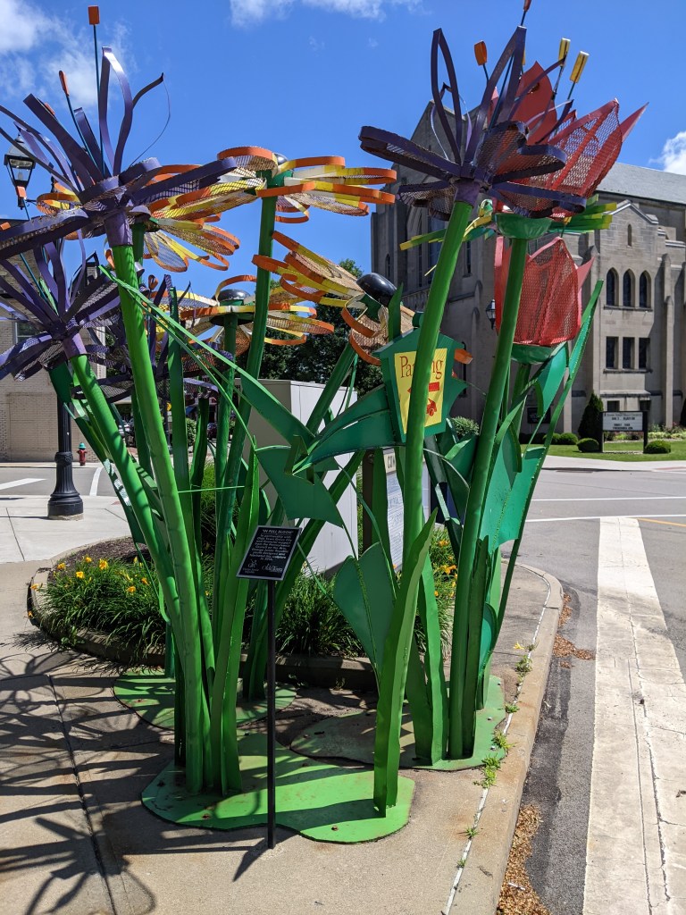
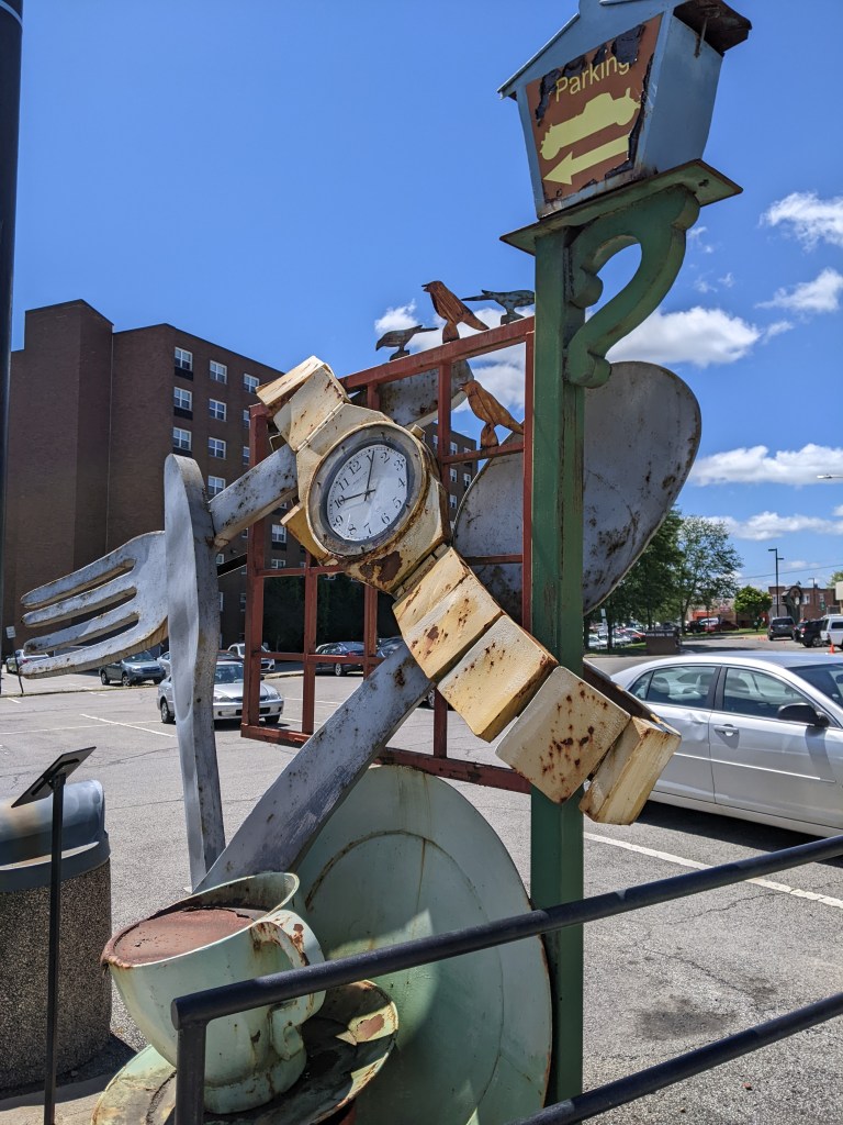
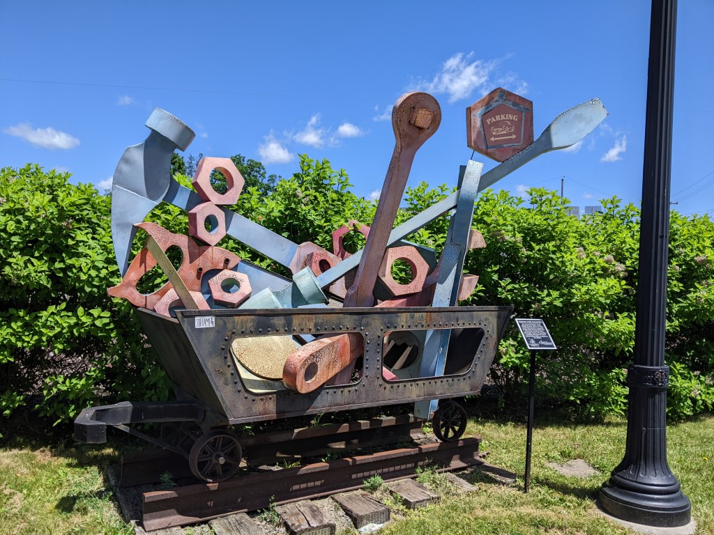
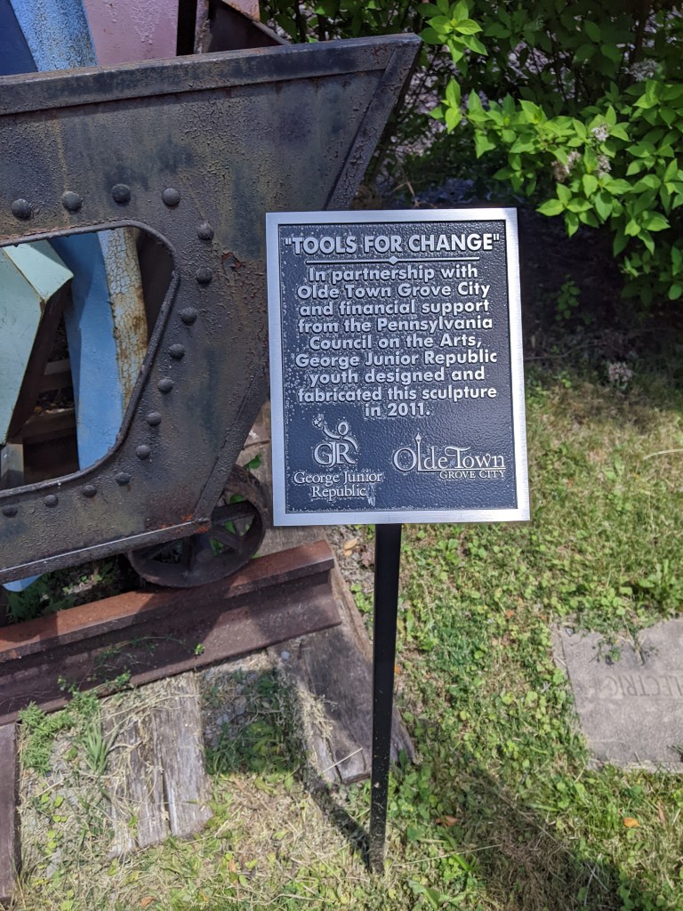
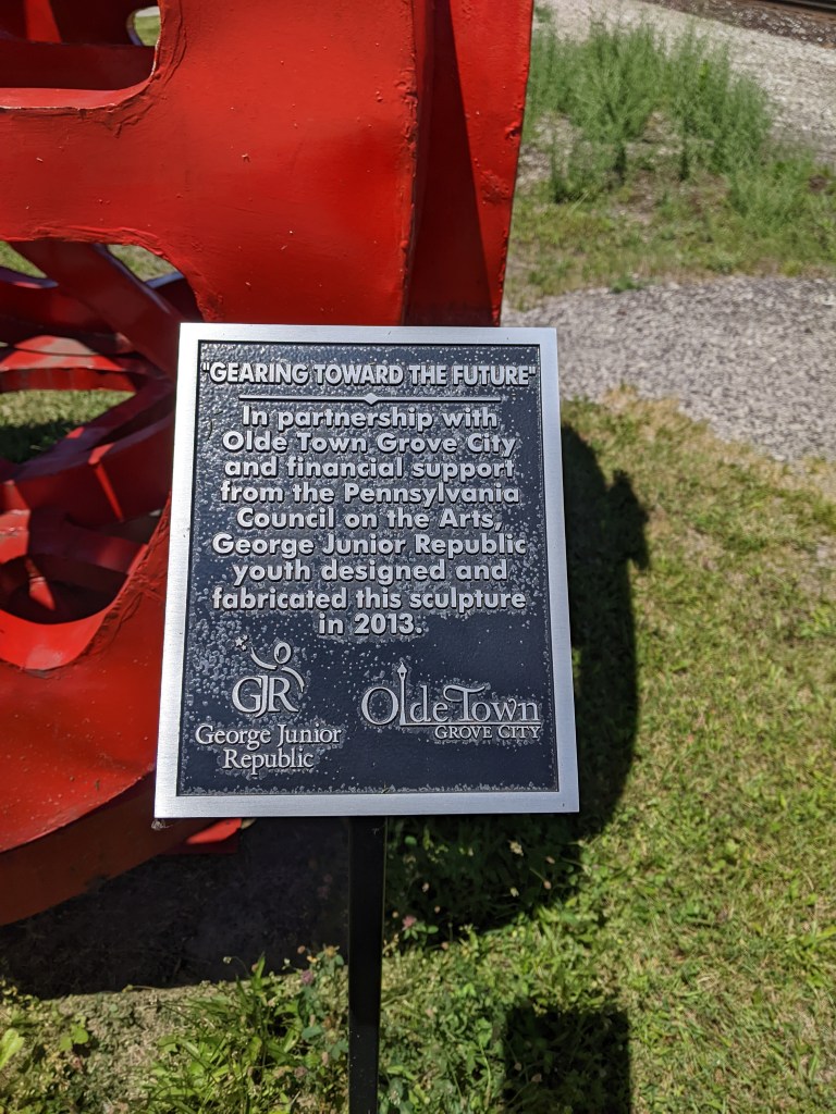
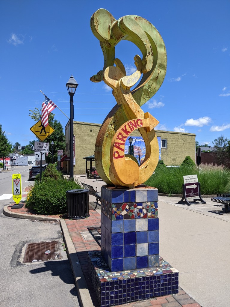
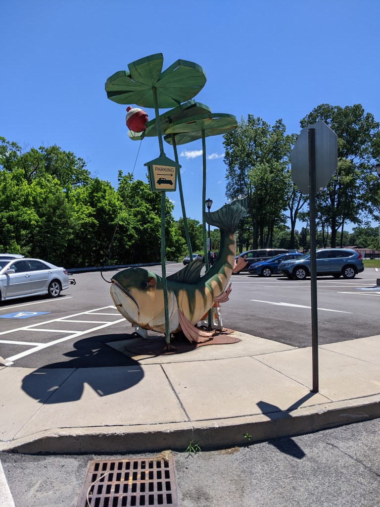
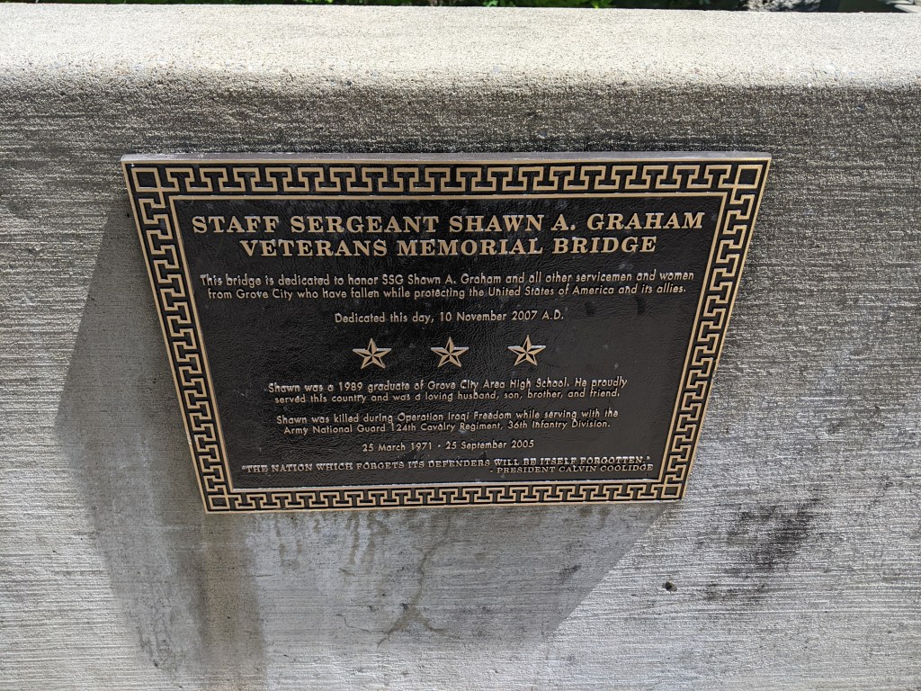
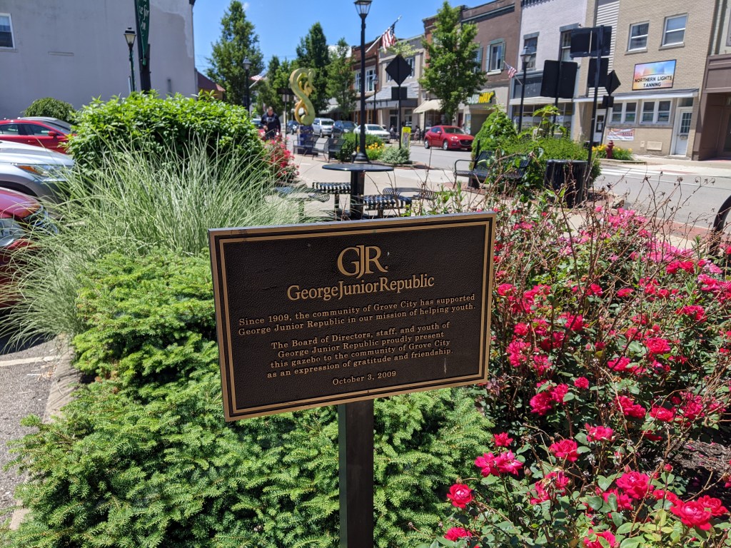
My day job for the last decade is working with zoning ordinances. *Yawn,* right? Except I find it surprisingly intriguing. For example, when I visited Grove City in 2022, I was in the middle of writing new model sign regulations for zoning. The puzzle pieces for this effort included incorporating Supreme Court rulings on the constitutionality of sign regulations and making the regulations easier to understand and follow.1 So signs were already on my mind when I encountered Grove City’s parking sculptures and my brain exploded.
Besides the century-old battle between planners and billboard companies, the most difficult thing about sign regulations is the definition of sign. Art cannot be regulated by zoning, but signs can. However, there is a lot of grey between art and sign. Grove City exemplifies that grey area.
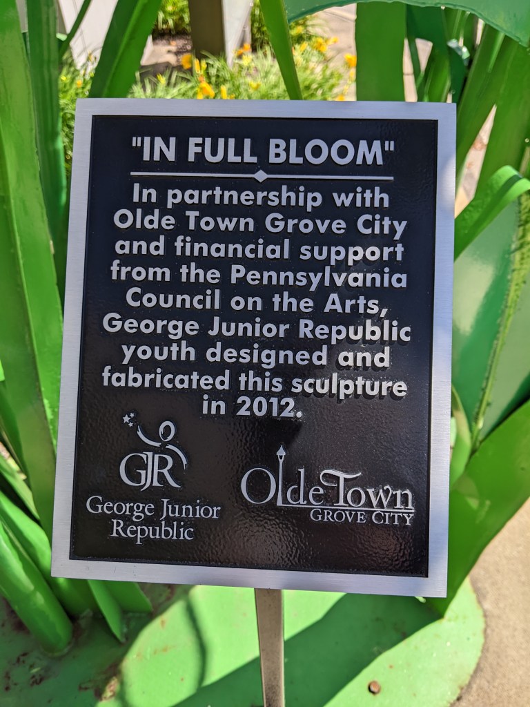
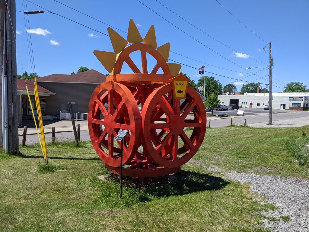
Grove City has a series of outdoor sculptures that incorporate directional signage for public parking areas. Based on a strict interpretation of Pittsburgh’s definition of sign (which interpretation frequently got me into arguments with my boss when I was zoning staff for Pittsburgh), the minute any component of a piece of artwork contains a sign, the whole piece of art becomes a sign (see Pittsburgh’s Zoning Ordinance Section 919.01.C.1). The phrase “or any structure designed to carry the above visual information” supports my interpretation that Grove City’s parking sculptures would not be permitted in Pittsburgh because they would not comply with the sign regulations.
Fortunately, Grove City’s zoning ordinance measures a sign only on the “separate individual letters, words, or graphic elements on the background” (see Grove City Zoning Ordinance Section 702, page 72 of 84 in the PDF). As the structure doesn’t count in the calculation of sign area in Grove City, I can now understand how parking sign sculptures could be created without violating their own ordinance.
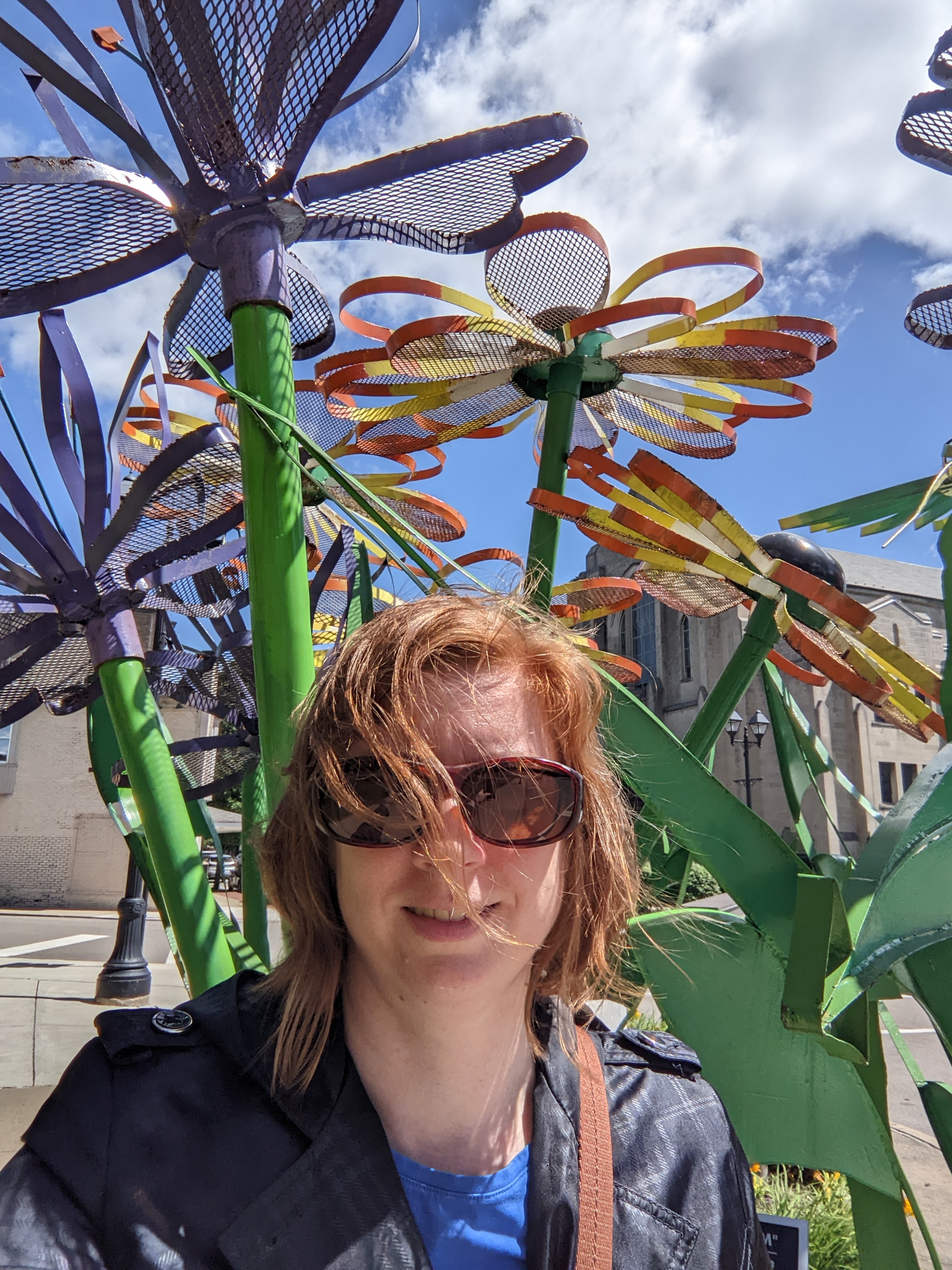
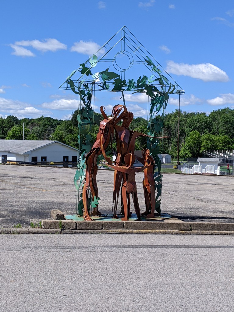
If you are a frequent visitor to urbantraipsing, you know I don’t typically take selfies. However, I did with the first parking sculpture I encountered in Grove City to provide a sense of scale. These are substantial structures. I am standing in the selfie…and, for those who don’t know me in person, I am 6 feet tall.
I succeeded in creating a model ordinance that balanced brevity with thoroughness and usability with constitutionality. Economy, PA, (Chapter 180, Article XIV) and McCandless, PA, (Article 1305) are two of the municipalities that have adopted this ordinance to their specific needs. ↩︎
I bought my first car in 2021. It ended up having a lot of problems. The first time I tried to drive to Erie, it started shaking like it was going to spontaneously break apart into a million pieces, just like a cartoon. Instead, it went into limp home mode and I turned around at the next exit, which was the middle of nowhere. After several repairs and a period of no further incidents, the following year I was ready to try again. But first, I tested the car to see if it could handle Rt. 79.
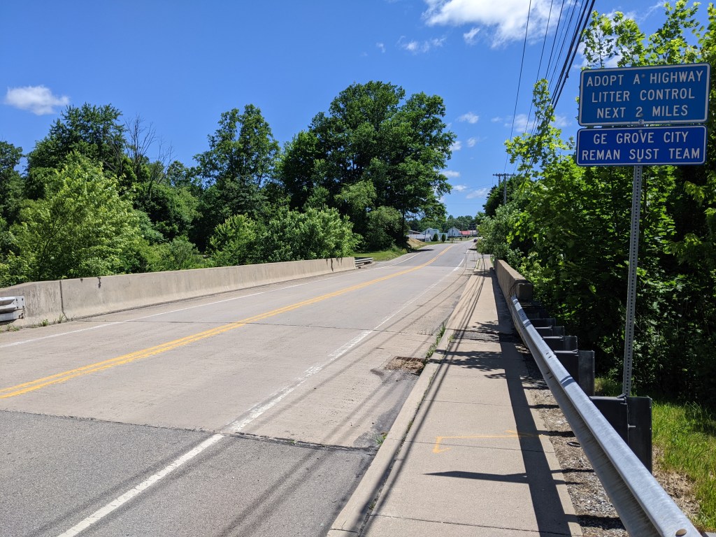
I knew of Grove City as an exit about halfway to Erie and as the closest outlet mall to Pittsburgh. I decided to aim for the actual Borough of Grove City1 as a destination to explore while testing my car’s ability to handle the speed limit and hills of Rt. 79. Naturally, since I arrived safely and knew nothing about the town, I set out to walk the bridges.
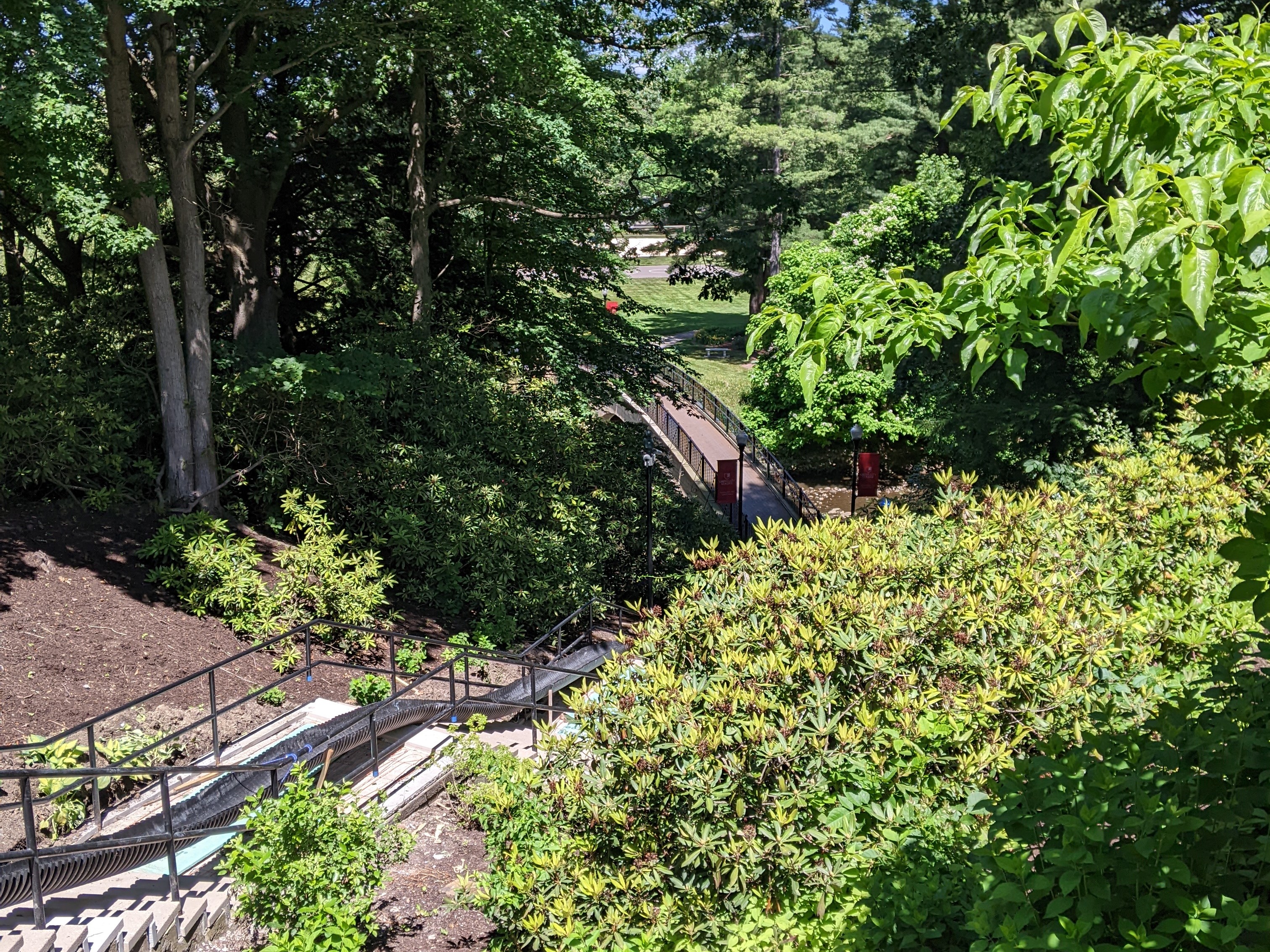
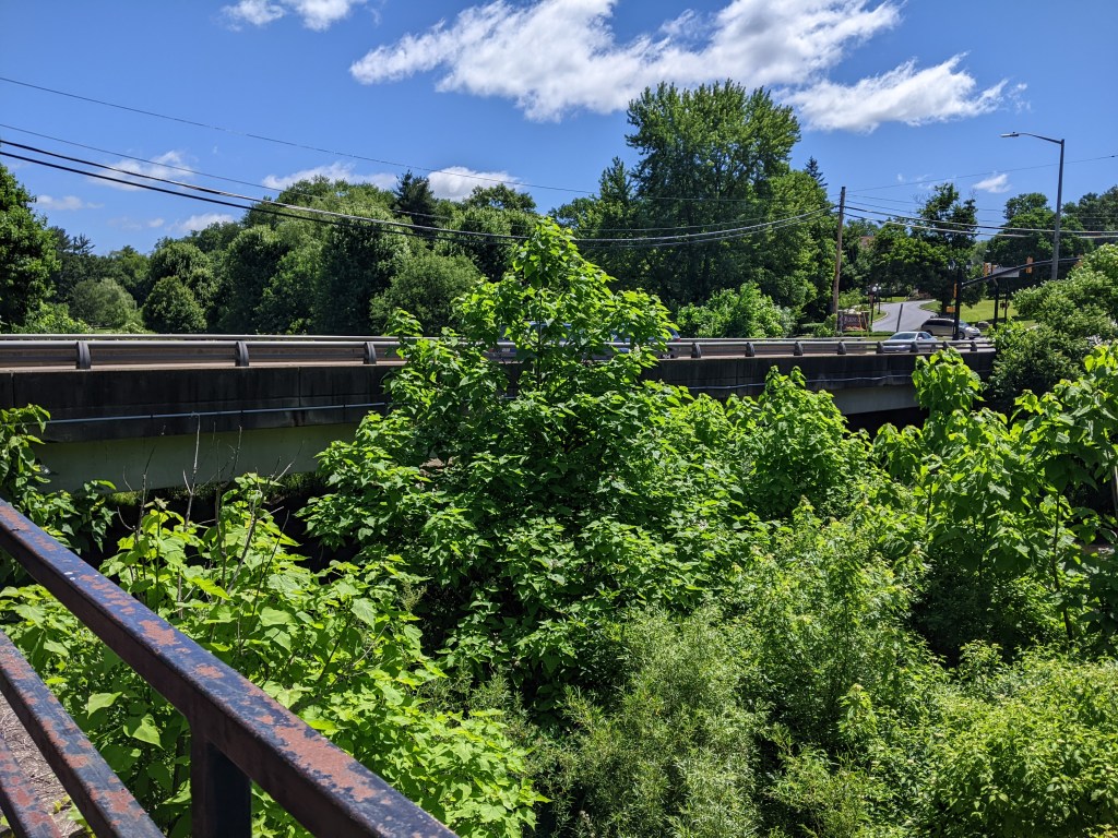
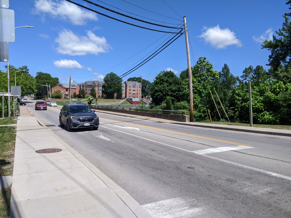
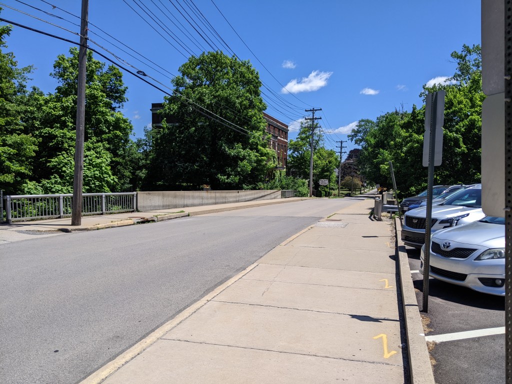
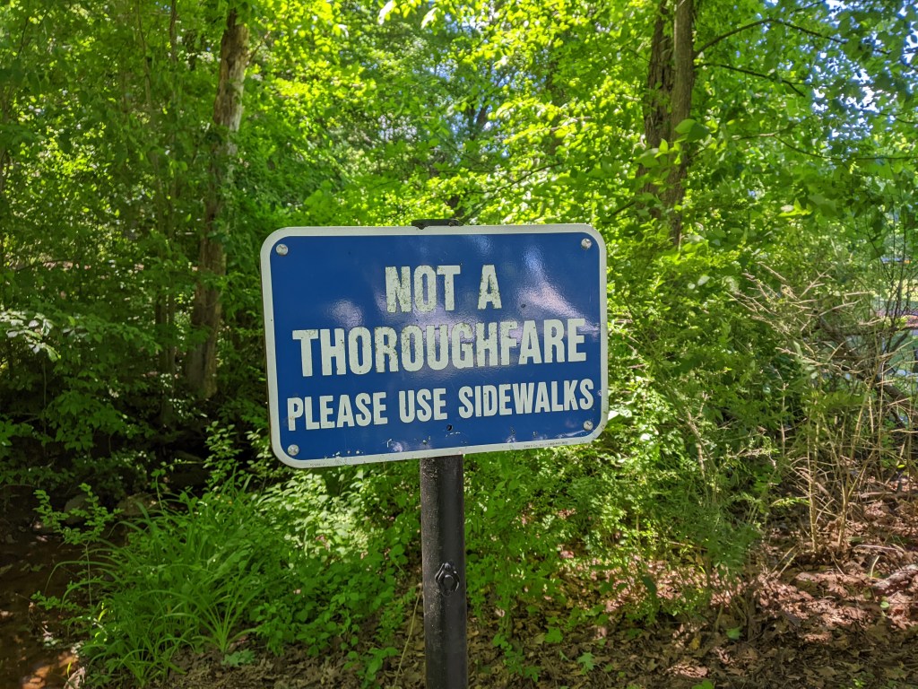
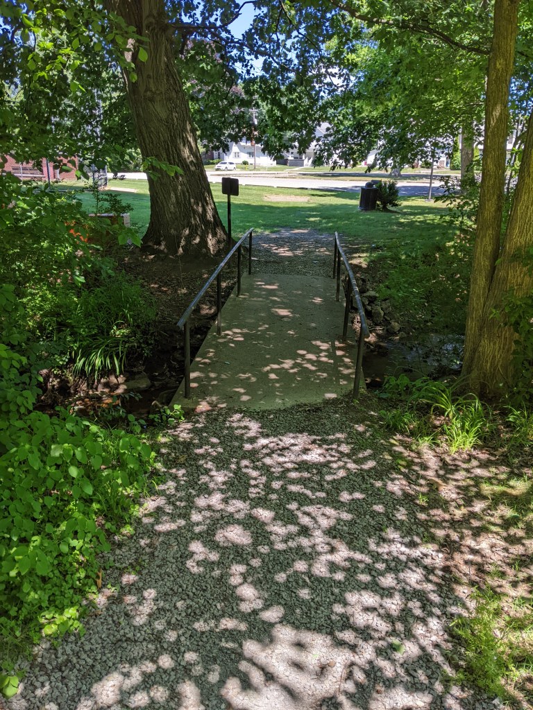
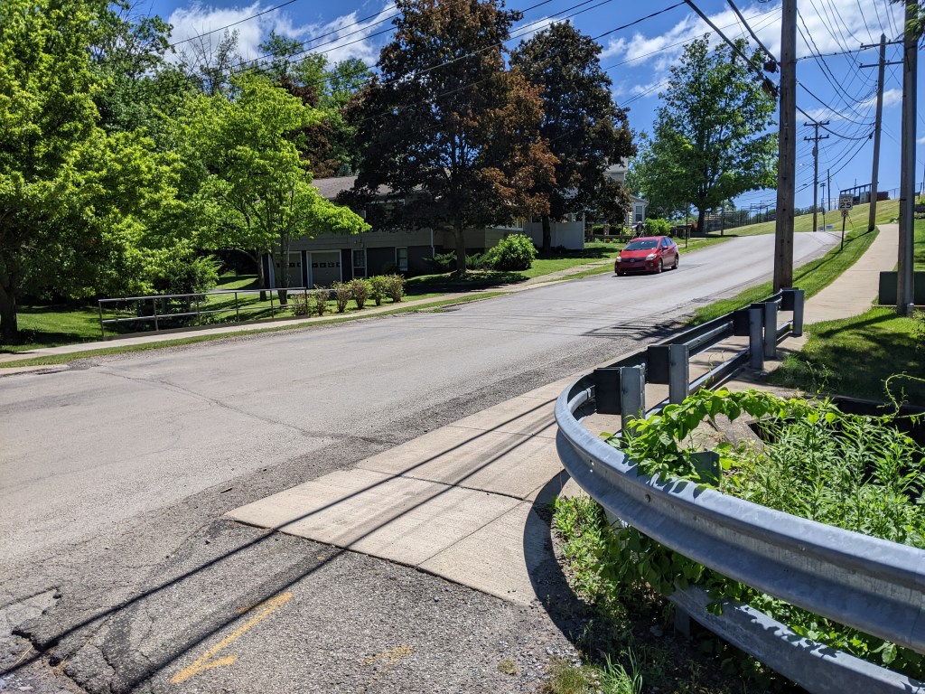
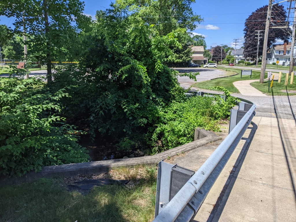
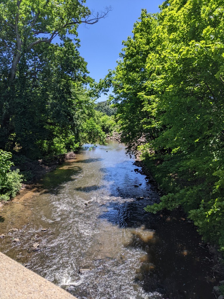
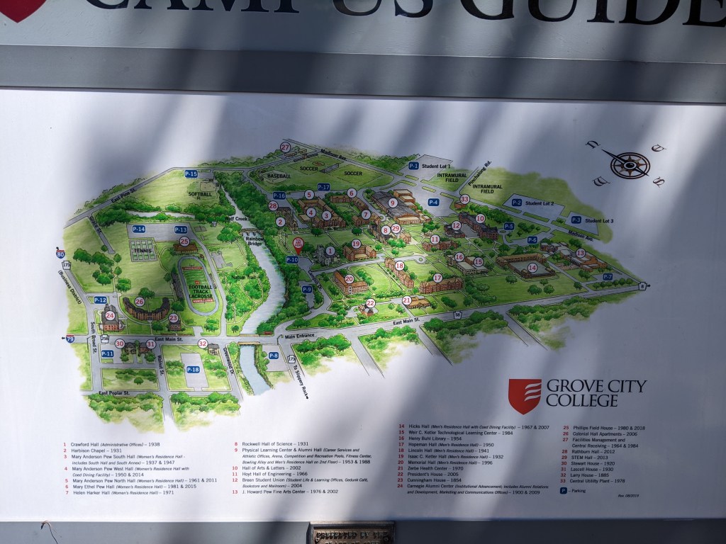
A town of 2.7 square miles and less than 8,000 residents, Grove City has several bridges over Wolf Creek and elsewhere. Unfortunately, the town’s premier pedestrian bridge, Rainbow Bridge (pictured above), was closed due to construction activities in the area. I discovered a second, unmapped pedestrian bridge over a small tributary to Wolf Creek, which I crossed only to see a sign on the other side claiming the bridge was not a throughway and directing people to use the sidewalks on the street to reach Grove City College’s main campus.
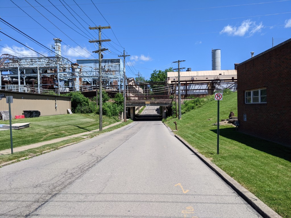
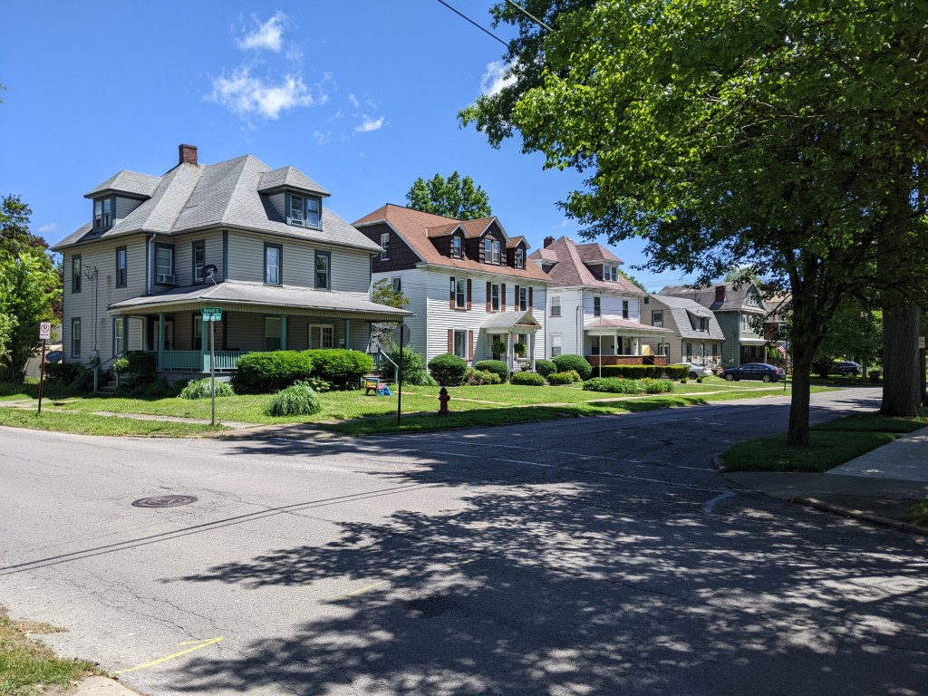
While the bridges themselves were structurally uninteresting, except for the Rainbow Bridge, I visited a throughout cross-section of town in walking them….which is the point of my bridge walking habit. My path took me through the college campus, the now less prominent industrial area, the large homes built for the boss class of the industries, the small homes built for the industrial workers, and the business district, both the car oriented portion and the historic portion. There are several bridgeless neighborhoods that I did not visit, but even without them, I learned a lot about the town in a short space of time.
Grove City Bridges
Grove City Cross-Section
I don’t know if this is true in other states, but Pennsylvania lets municipalities of any size call themselves cities. ↩︎
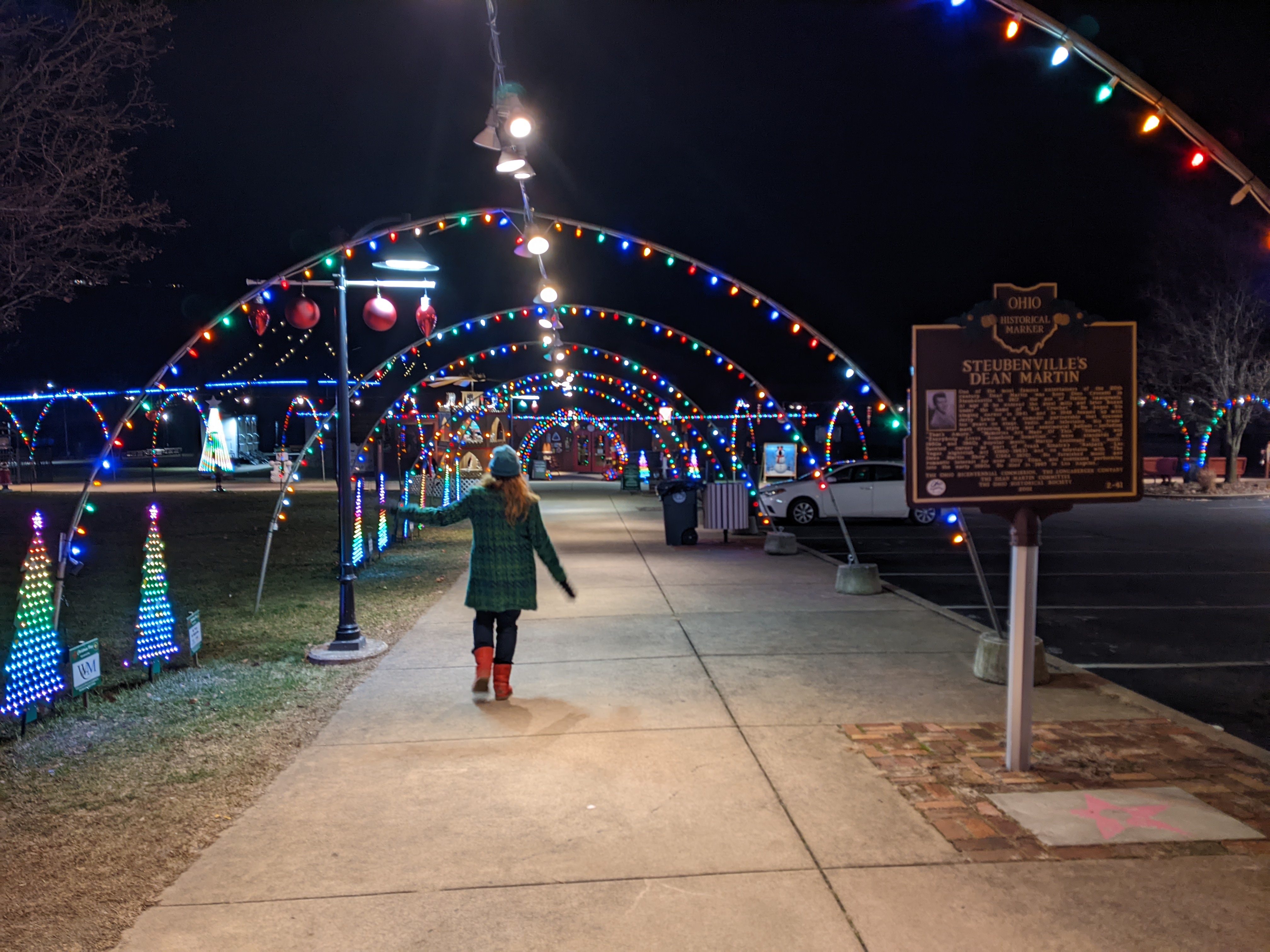
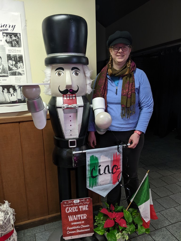
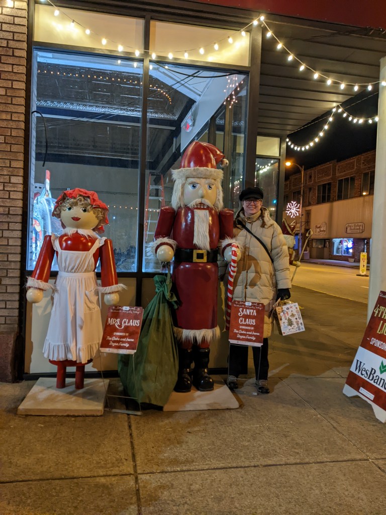
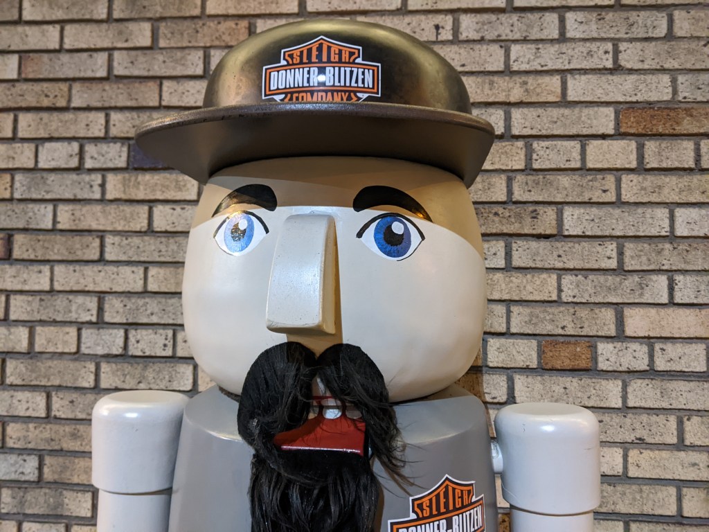
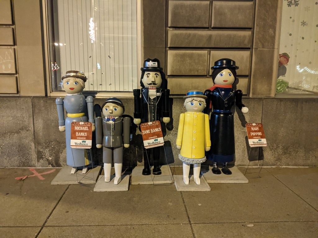
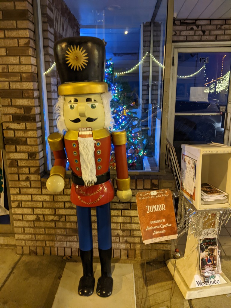
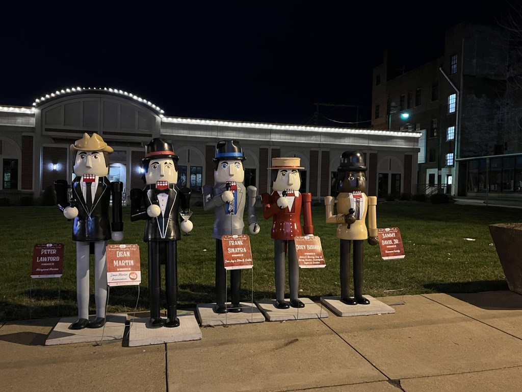
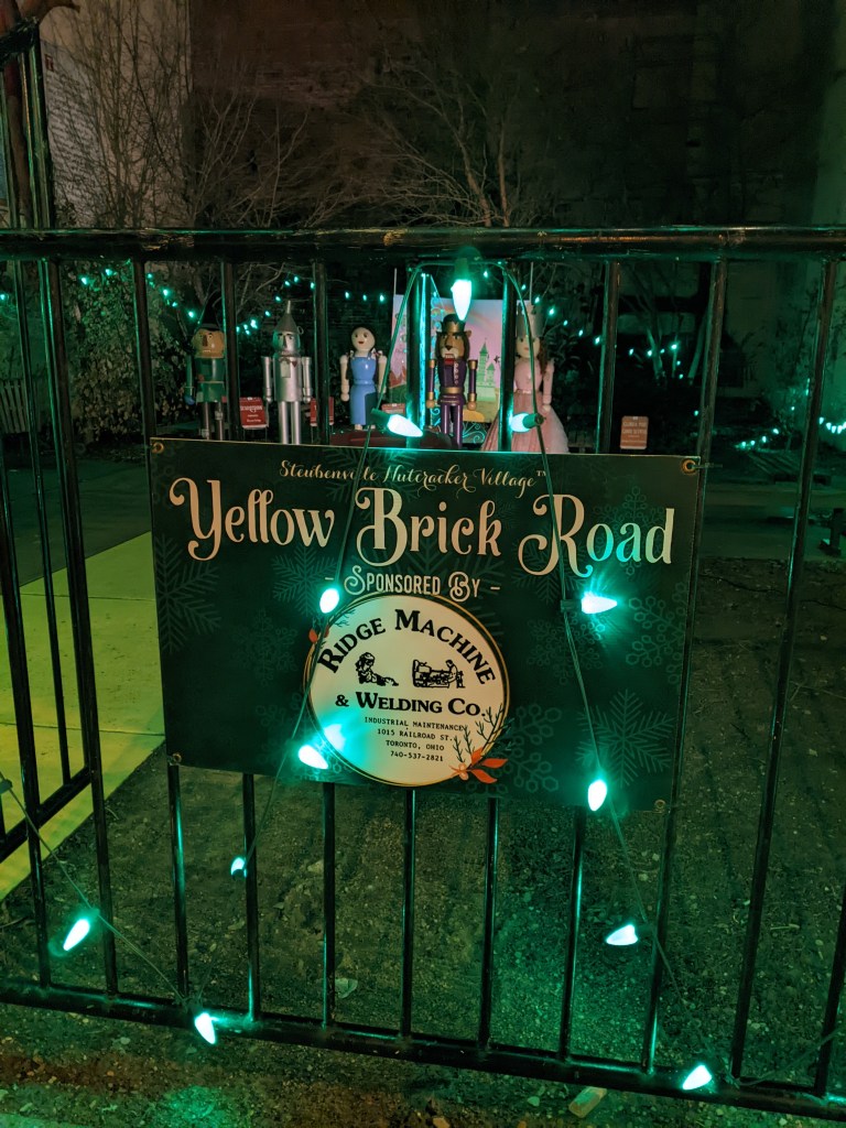
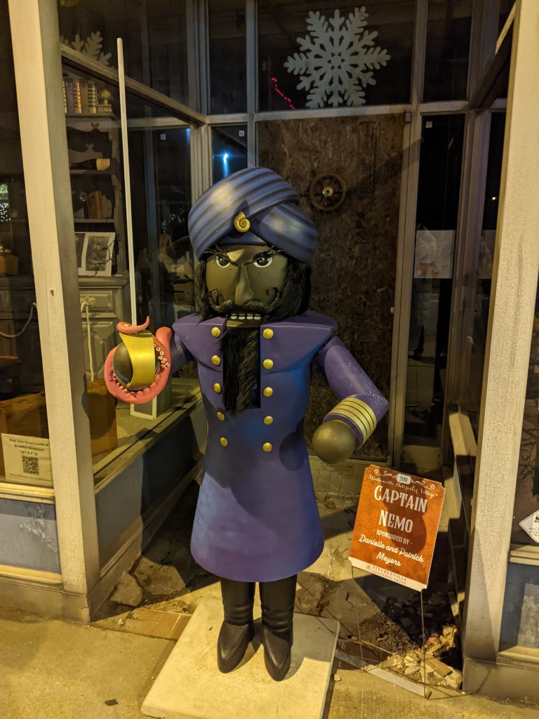
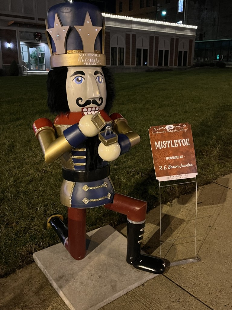
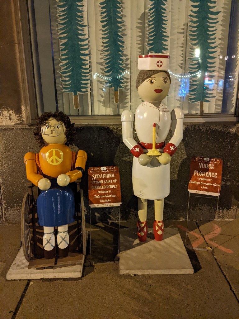
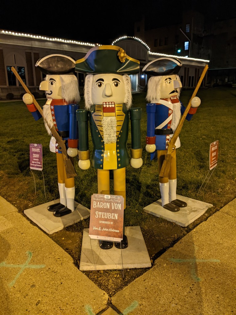
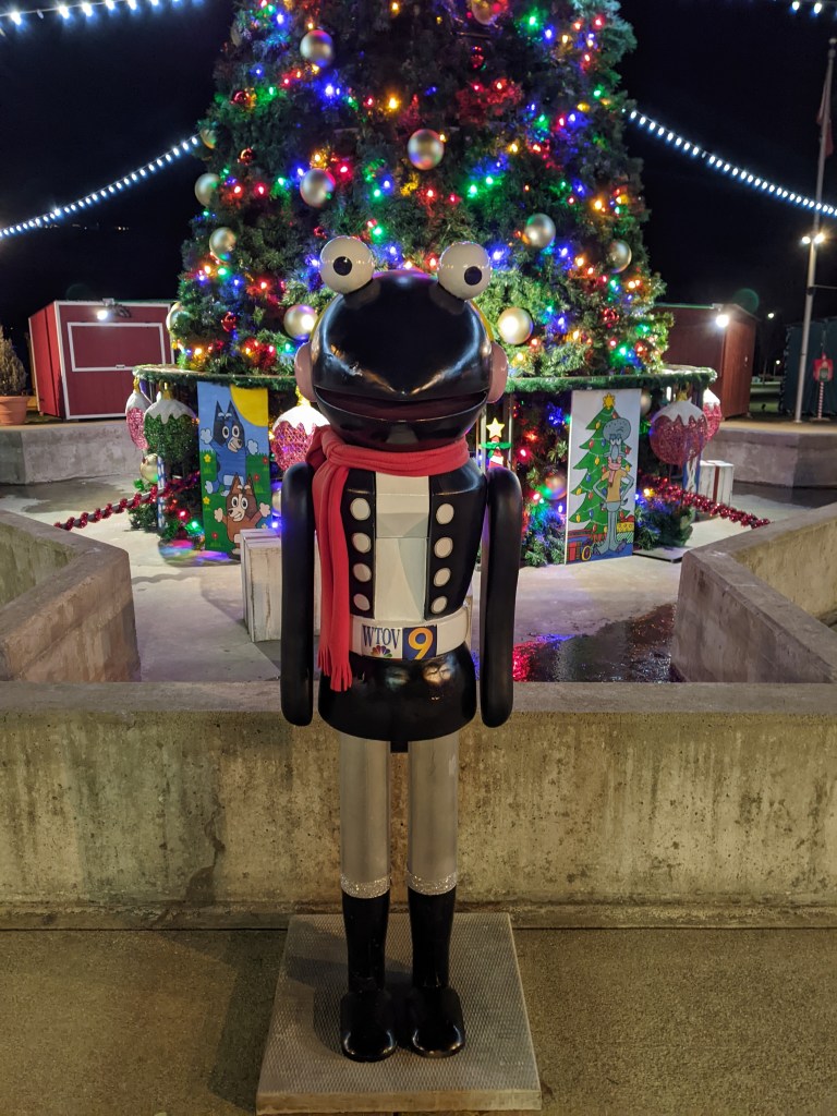
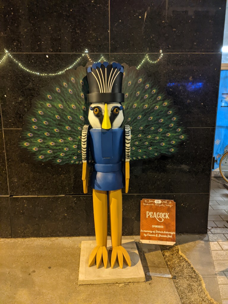
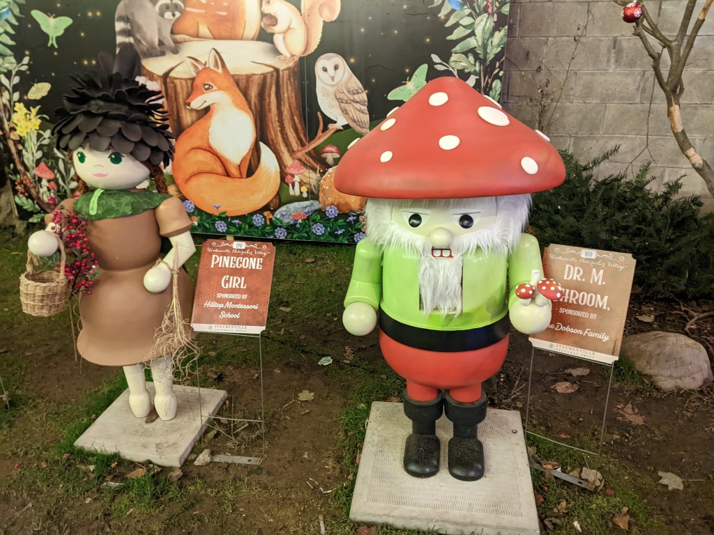
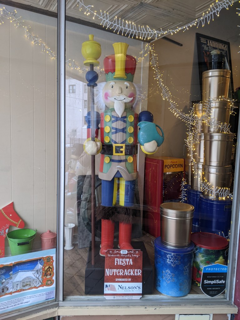
This season is the 10th anniversary of the Steubenville1 Nutcracker Village. Each year, the town of Steubenville, OH, sets out a growing number of human-sized nutcrackers each individually decorated. While they are advertised as 6-feet tall, there is some variation in their heights. A few, including “Santa Claus” and “Henry Harley Hank,” tower over the others. A few, including “Jane Banks” and “Michael Banks,” who I’m pretty sure are standing outside a bank, are eye-to-eye for children.
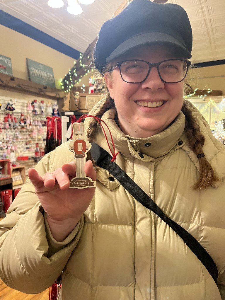
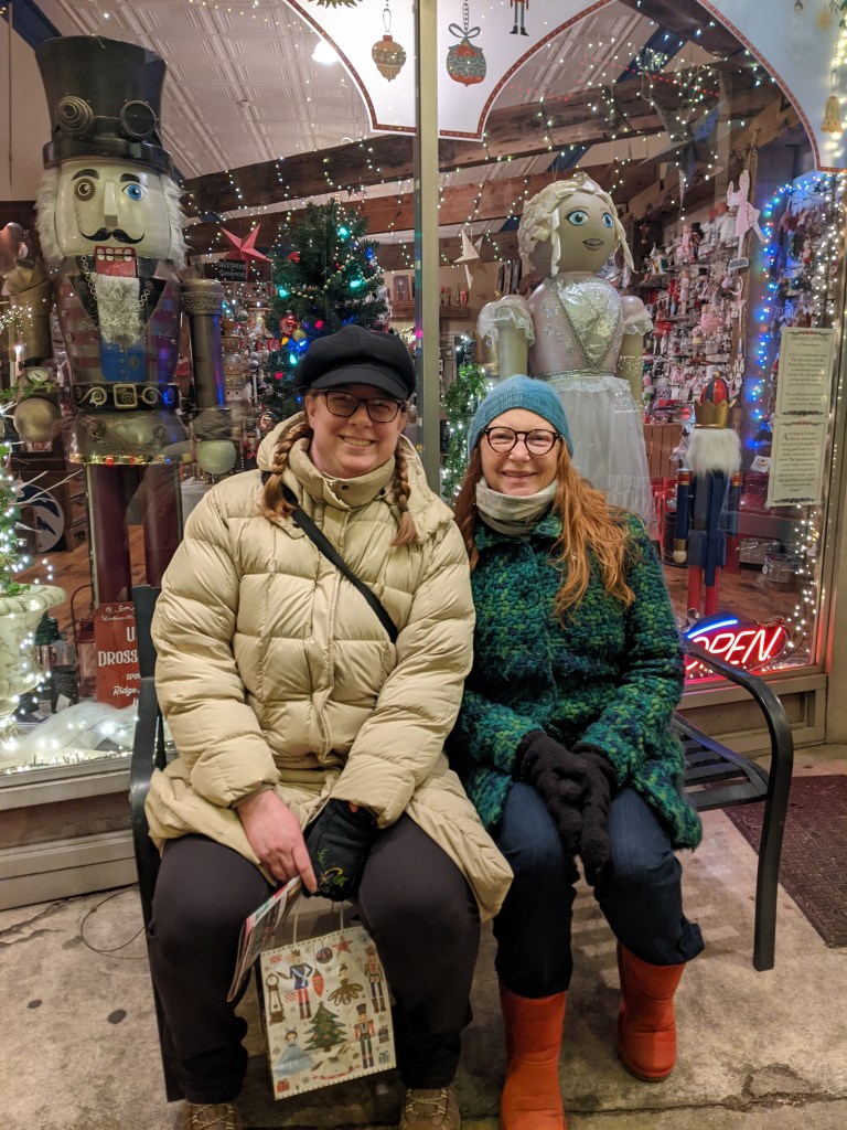
Over the course of the first three years of the Nutcracker Village 150 Nutcrackers were made. Today, there are over 200. (Learn more at the official website.) Shelly2 and I went on a mini-adventure after New Year’s to see these Nutcrackers and test how strong I am for traveling and for urbantraipsing after over a year with Long COVID. While I am tired and sore, it is a manageable level of fatigue, giving me hope that in 2025 I will be able to resume a moderate level of urbantraipsing and travel while continuing to share posts from previous trips.
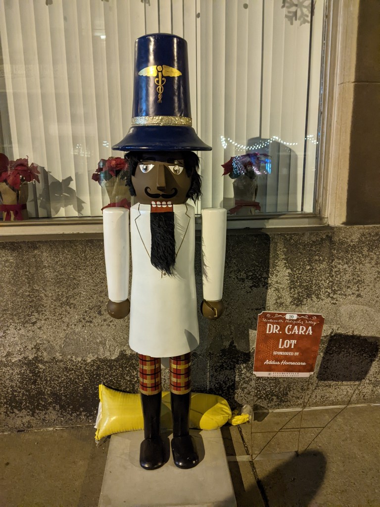
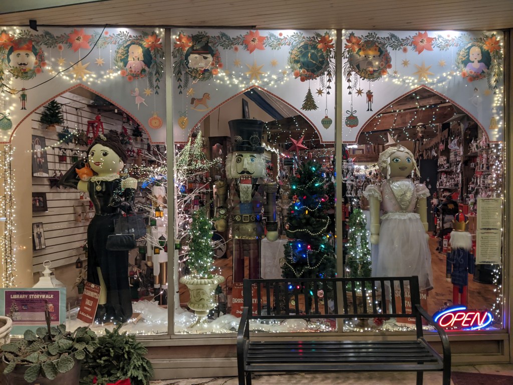
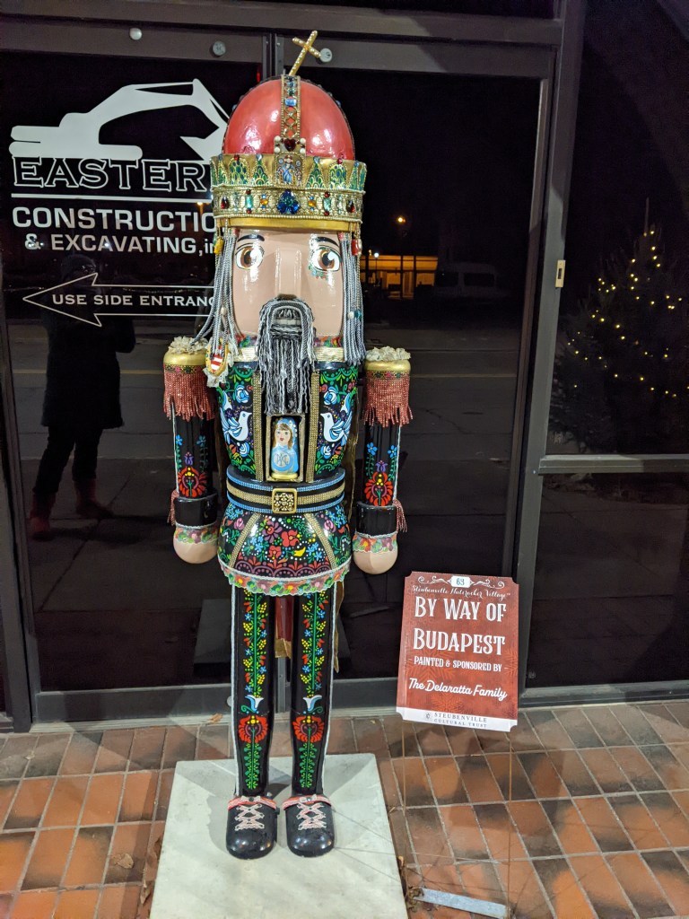
Between the two of us, Shelly and I photographed 145 of the nutcrackers and saw at least 40 more (we were cold and tired toward the end of our walk and passed by many without stopping to photograph them). Below I share a sampling of our favorite nutcrackers. There is quite a range of nutcrackers from the standard looking “Junior” to the punny “Dr. Cara Lot” and “Fashionutsa Holly,” the far left nutcracker in the window display, to the ornate “By Way of Budapest.” A wind storm that passed through the region a couple weeks ago damaged the Ohio State nutcracker, our waitress’s favorite, so we stopped at Drosselmeyer’s Nutcracker Shoppe where I posed with the ornament version of it.
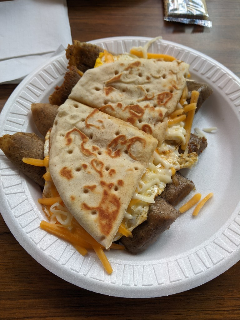
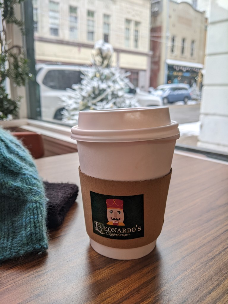
While Steubenville is only 45 miles from Pittsburgh, making this a very easy day trip adventure, we chose to spend the night. This enabled us to better manage my energy level and to explore more of the town. We enjoyed gyro, egg, and cheese pitas for breakfast from Yorgo’s Gyros & Potatoes and I got a mint chai pick-me-up from Leonardo’s Coffeehouse, the headquarters for the Nutcracker Village. I never would have thought that mint would go with chai, but it was a delicious combination.
This is my second urbantraipsing visit to Steubenville. In 2017, while Dad and I were exploring bridges along the Ohio River on our way to see the full eclipse in Tennessee, we stopped in Steubenville to walk the Market Street Bridge. ↩︎
Shelly is the host and executive producer of the podcast With Bowl and Spoon. We started traveling together the summer of 2023 when we went to Erie. She’s a fun travel companion and great at posing with the Steubenville nutcrackers and Erie frogs and fish. ↩︎