Then & Now 1926-2026: Point Breeze North Religious Buildings

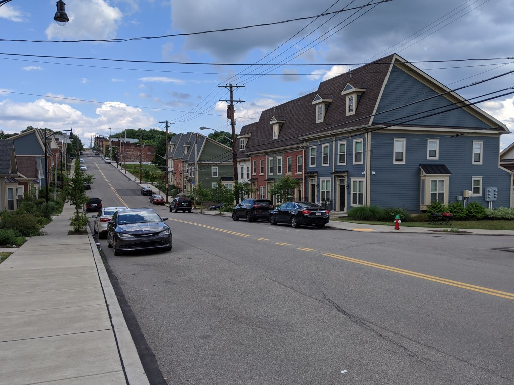
Sample of diverse housing on Thomas Blvd, taken from the boulevard’s green median

Point Breeze North Neighborhood

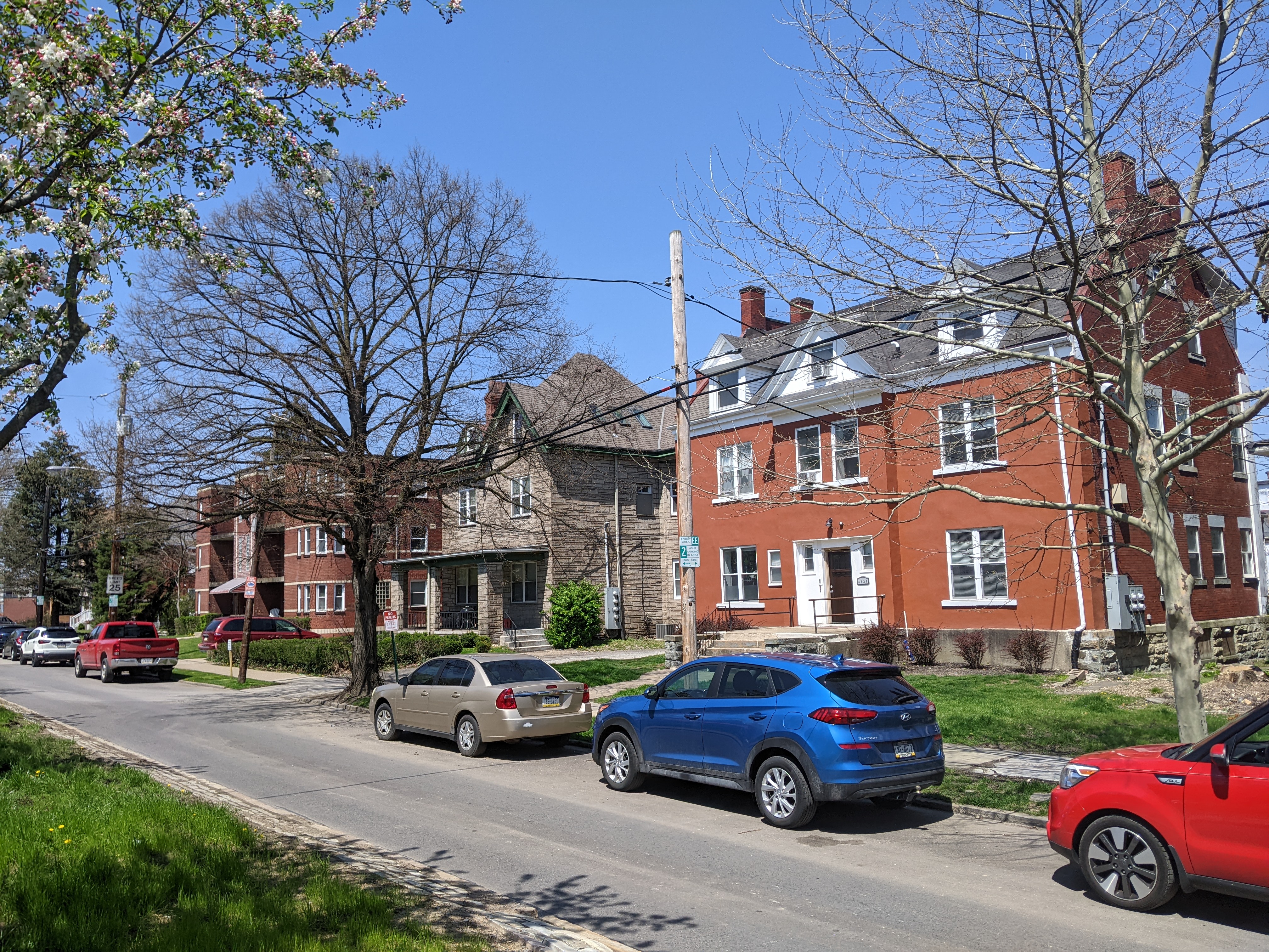
Point Breeze North is home to an eclectic mix of housing types (in the medium to large size range). “Flats” and apartment buildings are interspersed among large single-family dwellings and duplexes. A handful of small industrial sites are interspersed, taking advantage of the major railroad along the northeastern edge of the neighborhood. George Westinghouse, one of the Gilded Age tycoons of Pittsburgh, built his estate here, including his mansion “Solitude” and his laboratory. While much of this estate was later divided up into smaller lots, a large portion was turned into Westinghouse Park, a block-size public park with playground, picnic tables, lawns, and trees.

While the buildings in Point Breeze North have seen more stability than many other neighborhoods over the last 100 years, the definition of Point Breeze North has varied in that time. In 1974, the City designated this area as “Point Breeze” while the neighborhood we know today as Point Breeze was considered part of Squirrel Hill North at that time. Three years later, the Pittsburgh Neighborhood Alliance identified the two Point Breeze neighborhoods as a single neighborhood, although they acknowledged that due to resident self-identification, “Point Breeze North” was a distinct subneighborhood.

There is a story of racial relations in Point Breeze North that I have only begun to scratch the surface of. It is more subtle than the neighborhoods that experienced large-scale demolition through “urban renewal” or disinvestment, but it is just as important to understanding the history of Pittsburgh. In 1960, 4.8% of the neighborhood’s residents were Black. By 1970, 25.5% of residents were Black, prompting the City’s Department of City Planning to note “The area is now undergoing some change in its racial composition, and it is now a racially mixed neighborhood.” (1974)

That trend continued until 2000 when the neighborhood was majority minority (67.9% of residents were Black). Since then, while the neighborhood’s trend of overall population loss continued for the sixth decade, the demographics of that change shifted. Between 2000 and 2010, the neighborhood lost nearly 300 residents. However, that represents a loss of over 400 Black residents and a gain of nearly 100 white residents.

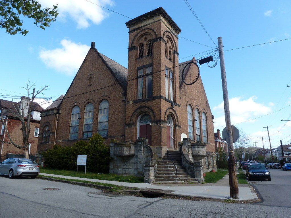
Despite the demographic changes to the neighborhood since a church building first showed up on the G.M. Hopkins maps in 1890, the Point Breeze Presbyterian Church is still an active congregation. The religious site at the eastern end of the neighborhood has not endured the changes over time.

Neighborhood Statistics (Out of 70 in this Series)

  • 51st largest by acreage
  • 53rd highest number of sites (multi-way tie)
  • 50th most sites/acre

Locations

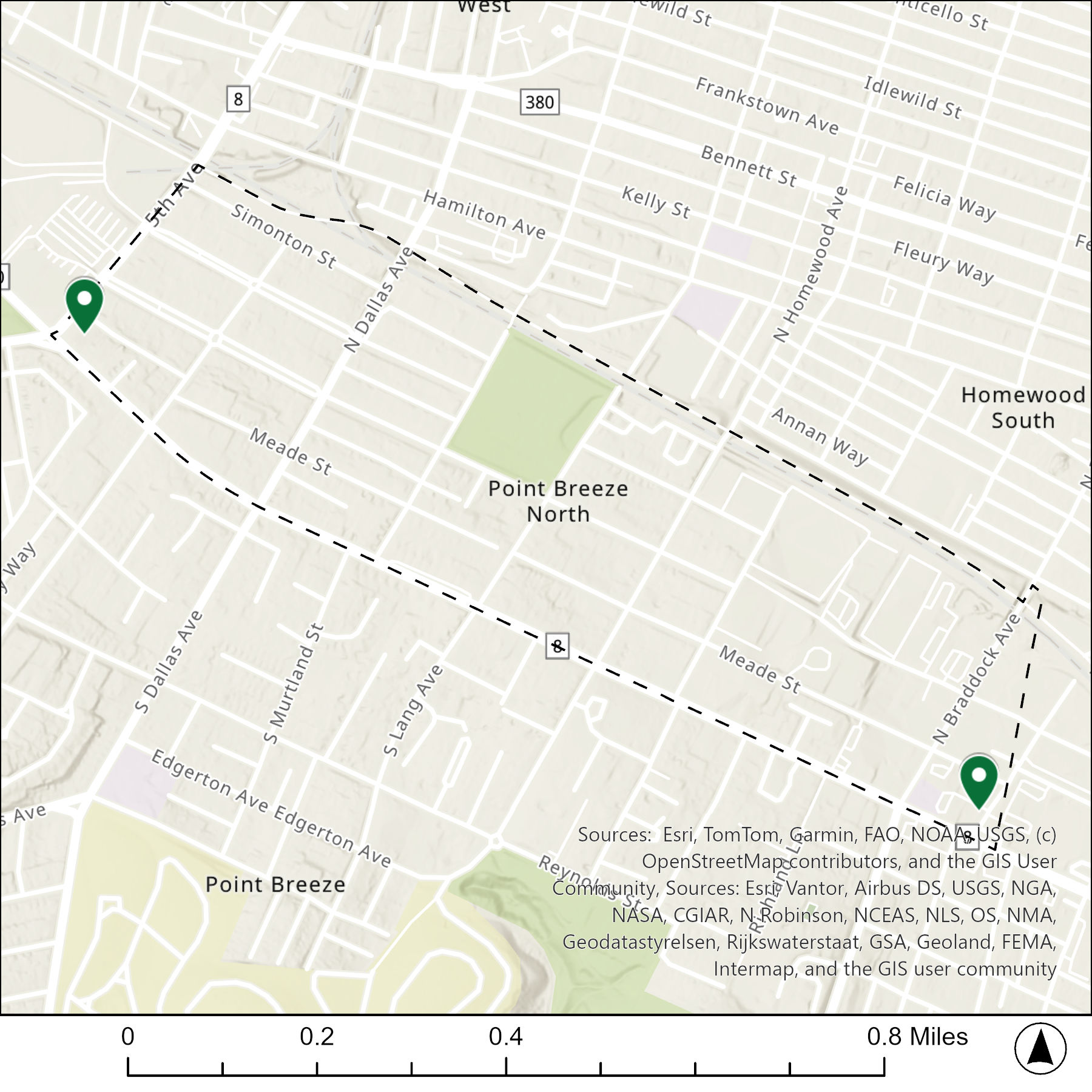
The map below shows the locations of the 2 congregations listed in the 1926 directory for Point Breeze North (the dotted line marks the neighborhood boundary).
What are they now?

The table below matches the 2 congregations listed in the 1926 directory with the current use of the site.

1926 Congregation NameBy 2026 the Congregation’s Building is:
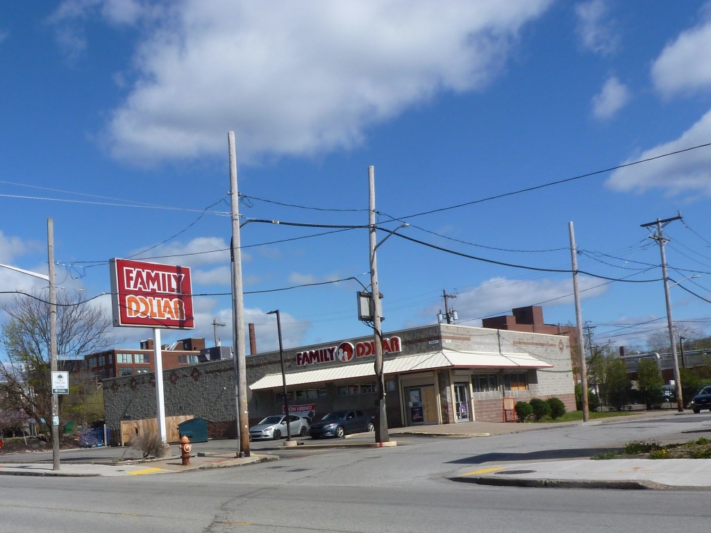
First Swedish Baptist Churchreplaced with a car-oriented retail store
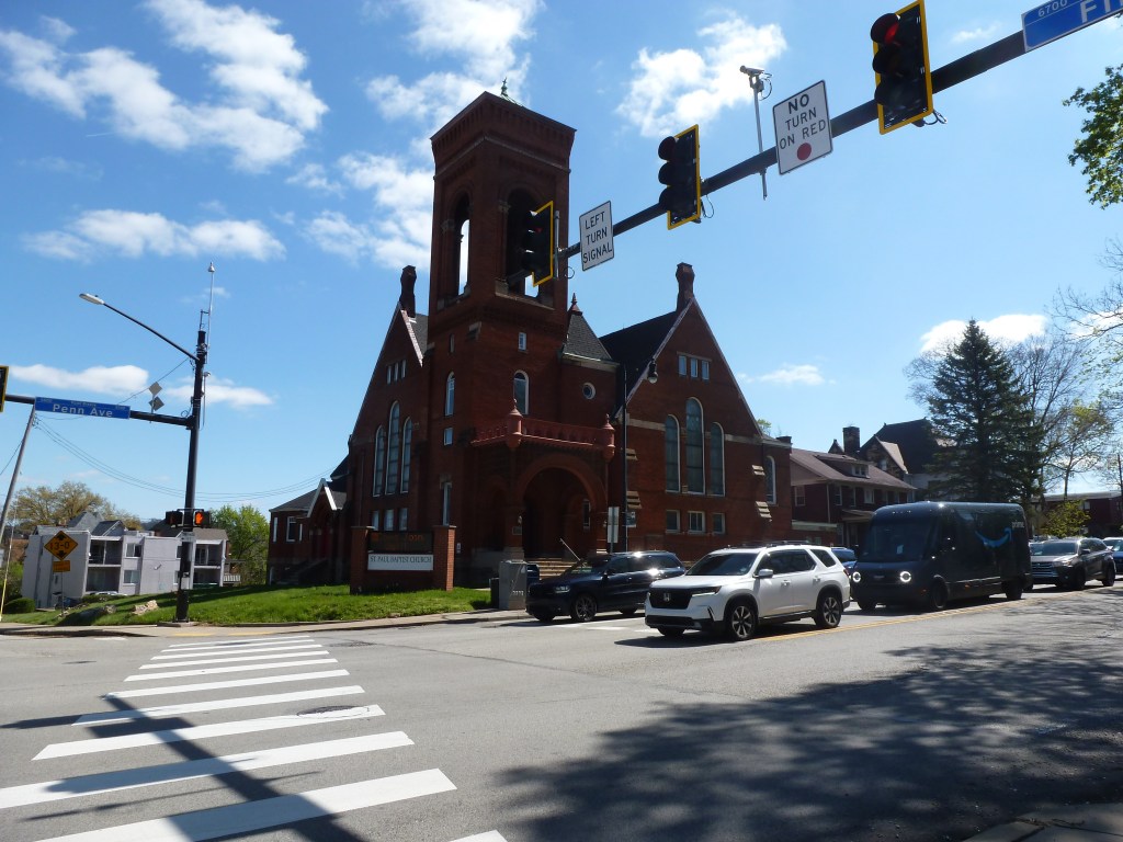
Point Breeze Presbyterian Churchstill Point Breeze Presbyterian Church

Photos


For more on this series, visit our introductory post.


Sources:

G. M. Hopkins & Co. Pittsburgh. Plate 31. 1886. https://historicpittsburgh.org/islandora/object/pitt%3A86v01p31

G. M. Hopkins & Co. East Liberty, Larimer, Point Breeze North, Homewood West. Plate 17. 1890. https://historicpittsburgh.org/islandora/object/pitt:20090624-hopkins-0020

G. M. Hopkins & Co. Point Breeze North, Homewood West, Homewood South, Wilkinsburg. Plate 18. 1890. https://historicpittsburgh.org/islandora/object/pitt:20090624-hopkins-0021

G. M. Hopkins & Co. Point Breeze, Point Breeze North. Plate 9. 1911. https://historicpittsburgh.org/islandora/object/pitt:20090514-hopkins-0011

Pittsburgh Department of City Planning. A Community Profile of Point Breeze. Pittsburgh, 1974. https://historicpittsburgh.org/islandora/object/pitt%3A31735070066307#page/1/mode/1up

Pittsburgh Department of City Planning. A Development and Renewal Program for Pittsburgh, Summary Documentation, Pittsburgh Community Renewal Program. Pittsburgh, 1970. https://pittsburgharchives.access.preservica.com/uncategorized/IO_d1f07da0-9303-4aee-a162-04c83a0eaaa0/

Pittsburgh Department of City Planning. Census: Pittsburgh. January 2006.

Pittsburgh Department of City planning. PGHSnap. City of Pittsburgh. 2011.

Pittsburgh Neighborhood Alliance. An Atlas of the Point Breeze Neighborhood of Pittsburgh, 1977. https://historicpittsburgh.org/islandora/object/pitt%3A31735070289164#page/1/mode/1up

Polk’s Pittsburgh City Directory, 1926. Pittsburgh: R. L. Polk & Co. https://digital.library.pitt.edu/islandora/object/pitt%3A31735056286846/viewer#page/4/mode/1up
Then & Now 1926-2026: Point Breeze Religious Buildings

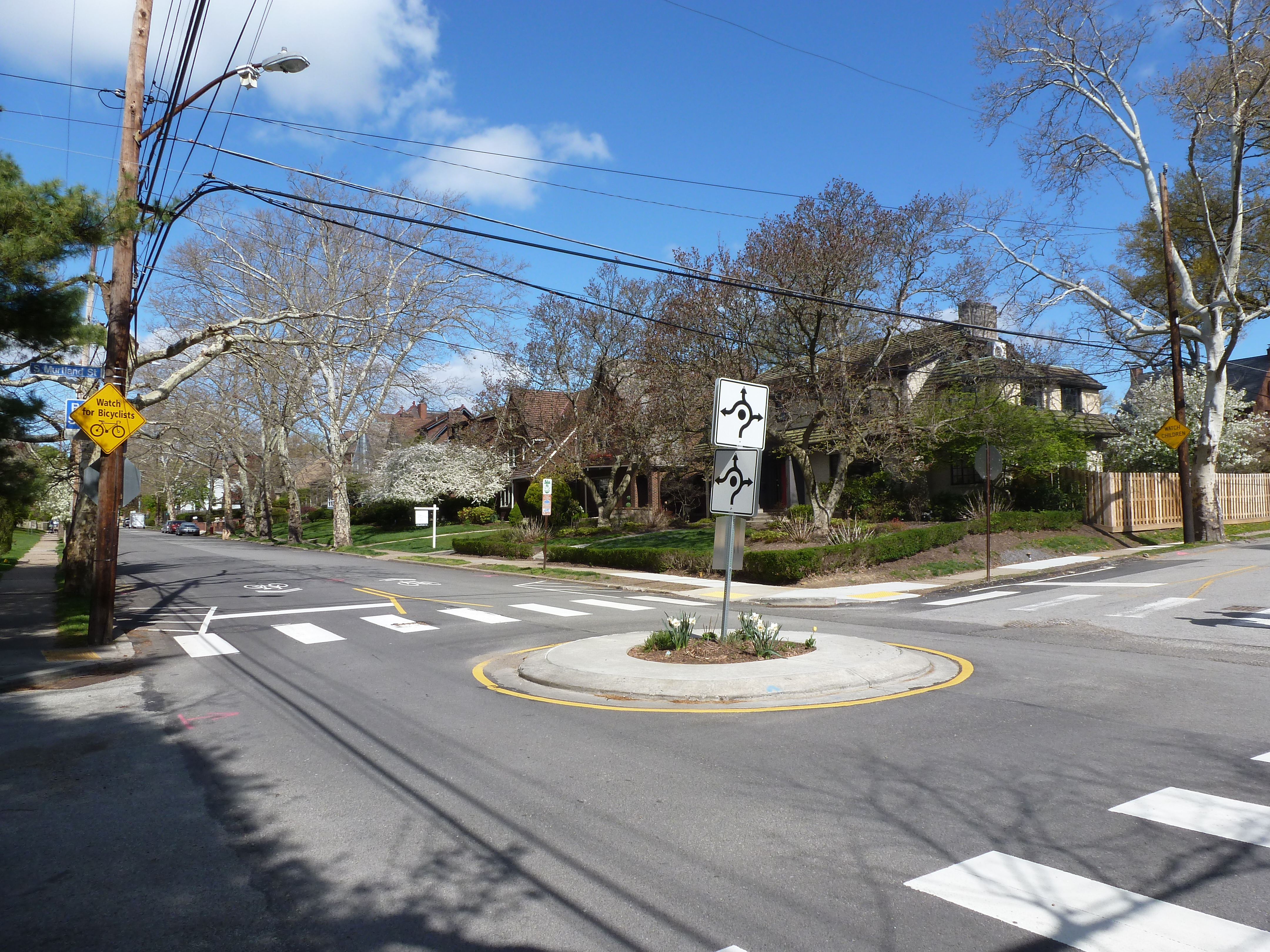
Reynolds Street at South Murtland Street

Point Breeze Neighborhood

When I think of Point Breeze, I picture wide, tree-lined streets with large houses on large lots. However, that is only a small portion of the neighborhood. The two religious sites from the 1926 directory sit in parts of the neighborhood across their respective streets from close-set, sometimes attached, modest houses. For the neighborhood context photo above, I picked a block that showcases neither of those conditions, instead featuring a wide, tree-lines street with moderate-sized houses and moderate-sized front yards, but small side yards.

Point Breeze’s high numbers of property-owning, white residents likely contributed to its relative stability compared to other parts of the city. No “urban renewal” projects targeted any parts of the neighborhood. Population loss started a decade later than most of the city and always stayed lower than the citywide average. In 1974, the City described this neighborhood together with today’s Squirrel Hill North as “residential in nature with a preponderance of single family owner occupied dwellings, many of them fine brick quality.” It remains a pleasant neighborhood for those who can afford it.

Both religious sites from 1926 remain active under the same congregation names.

Neighborhood Statistics (Out of 70 in this Series)

  • 12th largest by acreage
  • 53rd highest number of sites (multi-way tie)
  • 69th most sites/acre

Locations

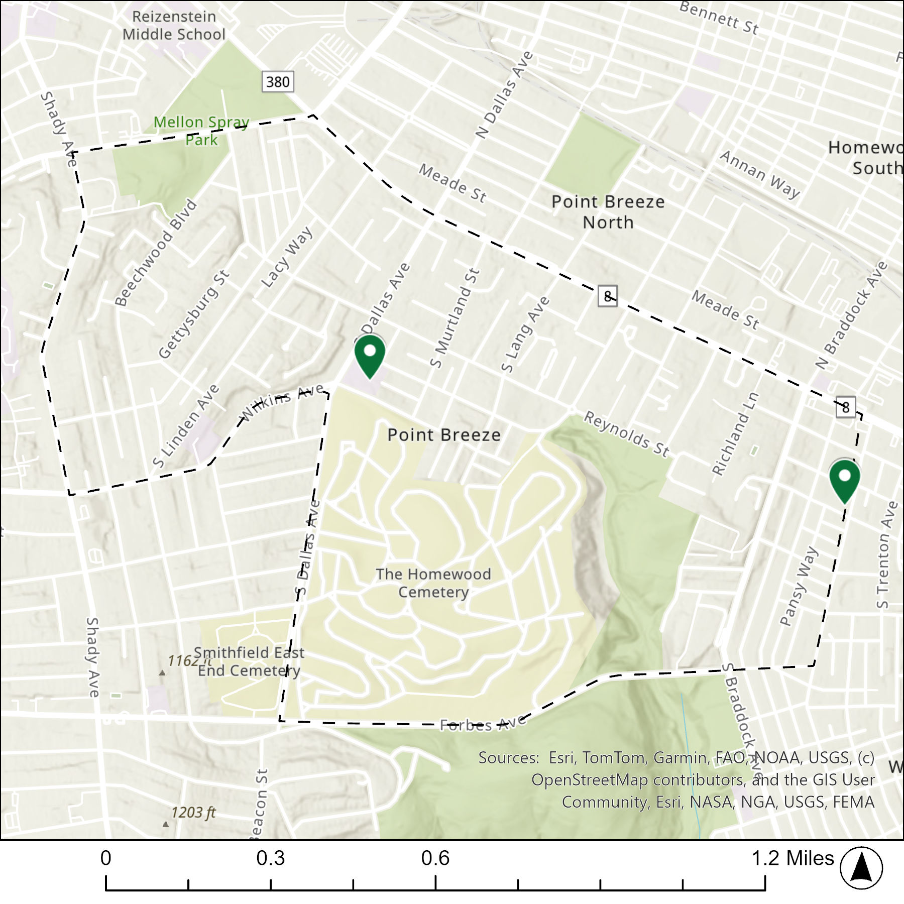
The map below shows the locations of the 2 congregations listed in the 1926 directory for Point Breeze (the dotted line marks the neighborhood boundary).

What are they now?

The table below matches the 2 congregations listed in the 1926 directory with the current use of the site.

1926 Congregation NameBy 2026 the Congregation’s Building is:
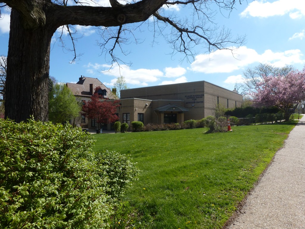
St. Bede’s Catholic Churchreplaced with the gym & activities center of a greatly expanded St. Bede’s Catholic Church campus
Waverly Presbyterian Churchstill Waverly Presbyterian Church

Photos


For more on this series, visit our introductory post.


Sources:

Pittsburgh Department of City Planning. A Community Profile of Squirrel Hill North of Forbes. Pittsburgh, 1974. https://historicpittsburgh.org/islandora/object/pitt%3A31735070066422#page/1/mode/1up

Pittsburgh Department of City Planning. A Development and Renewal Program for Pittsburgh, Summary Documentation, Pittsburgh Community Renewal Program. Pittsburgh, 1970. https://pittsburgharchives.access.preservica.com/uncategorized/IO_d1f07da0-9303-4aee-a162-04c83a0eaaa0/

Pittsburgh Department of City Planning. Census: Pittsburgh. January 2006.

Pittsburgh Department of City planning. PGHSnap. City of Pittsburgh. 2011.

Pittsburgh Neighborhood Alliance. An Atlas of the Point Breeze Neighborhood of Pittsburgh, 1977. https://historicpittsburgh.org/islandora/object/pitt%3A31735070289164#page/1/mode/1up

Polk’s Pittsburgh City Directory, 1926. Pittsburgh: R. L. Polk & Co. https://digital.library.pitt.edu/islandora/object/pitt%3A31735056286846/viewer#page/4/mode/1up
Street Trees: Alive or Dead

Street trees have a tough life. Between extensive pruning away from power, cable, and internet lines, baking in the radiant heat from the surrounding pavement, and (in winter climates) runoff from salt or sand, it is amazing any survive. Yet in some neighborhoods street trees are thriving while in others they are non-existent or barely hanging on.

Street trees first appeared in US cities in the 1840s and 1850s as part of a growing interest in landscape architecture. However, they soon encountered challenges. Fire insurance companies banned street trees in towns that relied on bucket brigades as the trees helped spread fires that decimated swaths of towns. Then, the street trees worst nemesis arrived – the overhead lines. First telephone companies then power companies pruned trees away from their lines. John R. Stilgoe in Outside Lies Magic notes that the resultant loss of street trees created a “nationwide uproar” by 1920. One hundred years later, this conflict between wires and trees is still unresolved.

As I traveled around Pittsburgh this spring and summer, I noticed that some neighborhoods seem to have found a way to maintain both old, large canopy street trees and overhead lines. Other neighborhoods appear to struggle to establish and maintain even understory or decorative trees. The pattern of where street trees are thriving versus where they aren’t appears to match the wealth of the neighborhood.

I first noticed this pattern as a child, though I couldn’t articulate it as such at the time. The Pennsylvania town where I partially grew up had a Green Street. The name made a strong impression on me at the time because half of Green Street was very aptly named. It had the oldest and thickest street tree canopy in town. The other half of the street, as I remember it, did not have a single street tree (or yard tree). This dichotomy fascinated me as a child.

Now, looking back on this memory with my urbanist eyes, it seems the perfect example of the correlation between wealth and street trees. The half of Green Street with the street trees was predominantly detached, single-family dwellings with large front, side, and rear yards. The half of Green Street without street trees was predominantly attached homes, possibly with some duplexes, and shallower front yards.

In Pittsburgh, the division is by neighborhood, not block. Neighborhoods like Squirrel Hill, Point Breeze, and Shadyside, which used to contain most of the city’s millionaires rows and continue to have housing values 3-4 times the city’s average, have old, well-established street trees that are somehow able to grow around the overhead lines. Neighborhoods like Homewood and the Hill District, which were victimized by Urban Renewal policies in the ‘50s and ‘60s and now have housing values two-thirds the city’s average, have few street trees, most of which were planted within the last ten years.