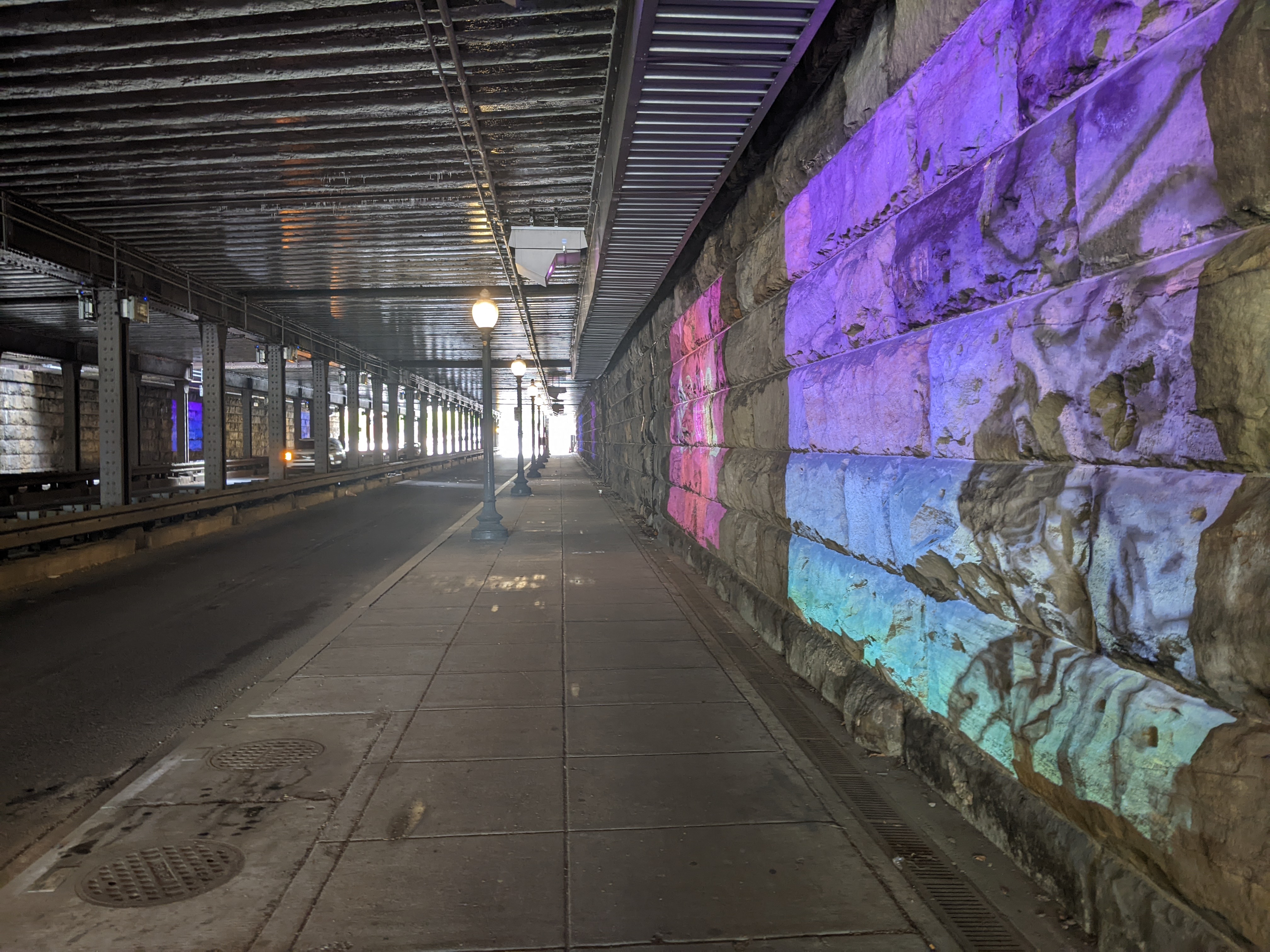
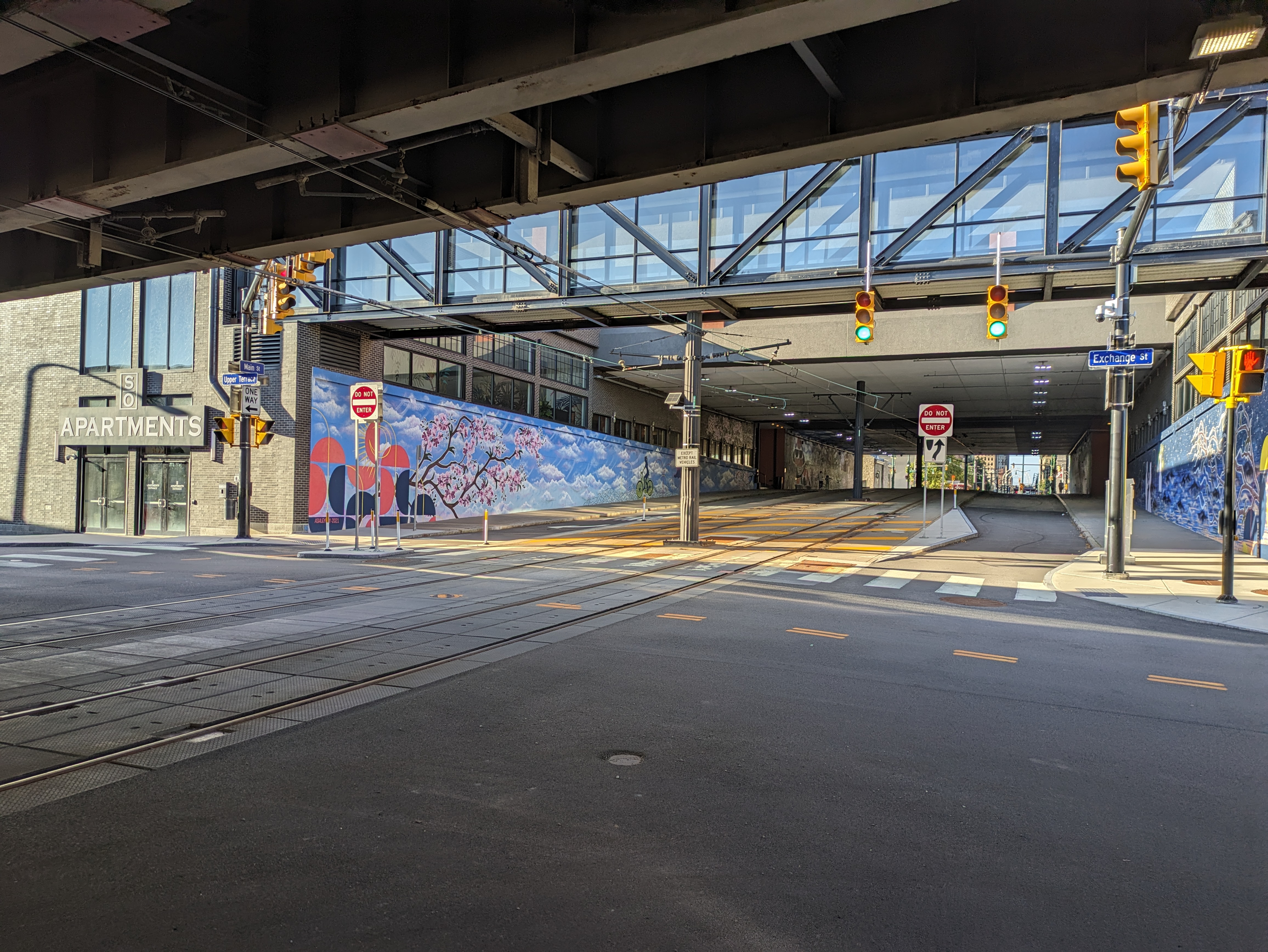
On Day 2 of my April 2025 Washington, DC, trip, I needed to take it easy. However, I couldn’t sit inside all day. On a short excursion near Union Station, I got uncomfortable as I approached the underbelly of the railroad bridge over K Street. My experience of similar structures in Pittsburgh is that they are dark, dirty, untended, and creepy. Bird droppings or bridge droppings are likely to land on you at any point.
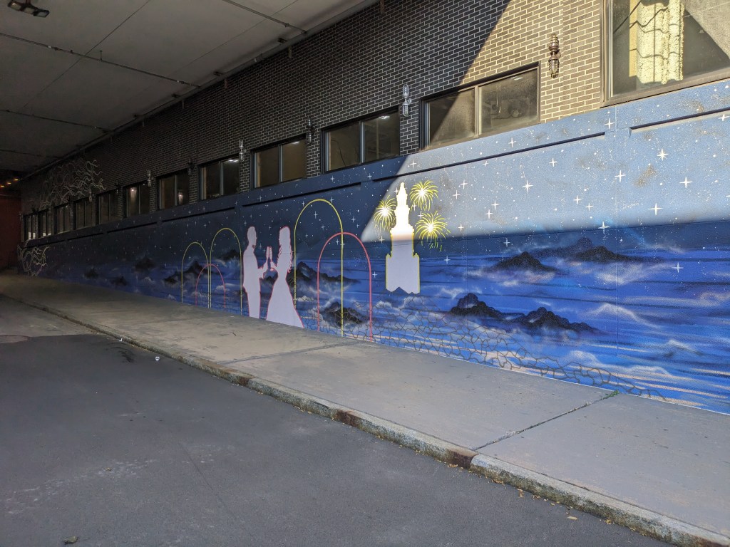
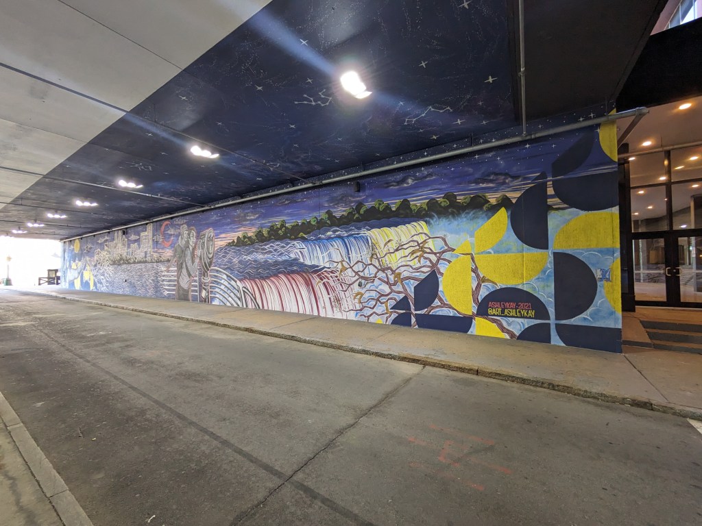
The underbelly of this bridge over K Street defied my expectations. A light mural created a welcoming and engaging experience that felt more like Buffalo’s Seneca One murals than the underbelly of Pittsburgh’s railroad bridges. Because light was used instead of paint, it lit up a dark place and incorporated engaging animation:
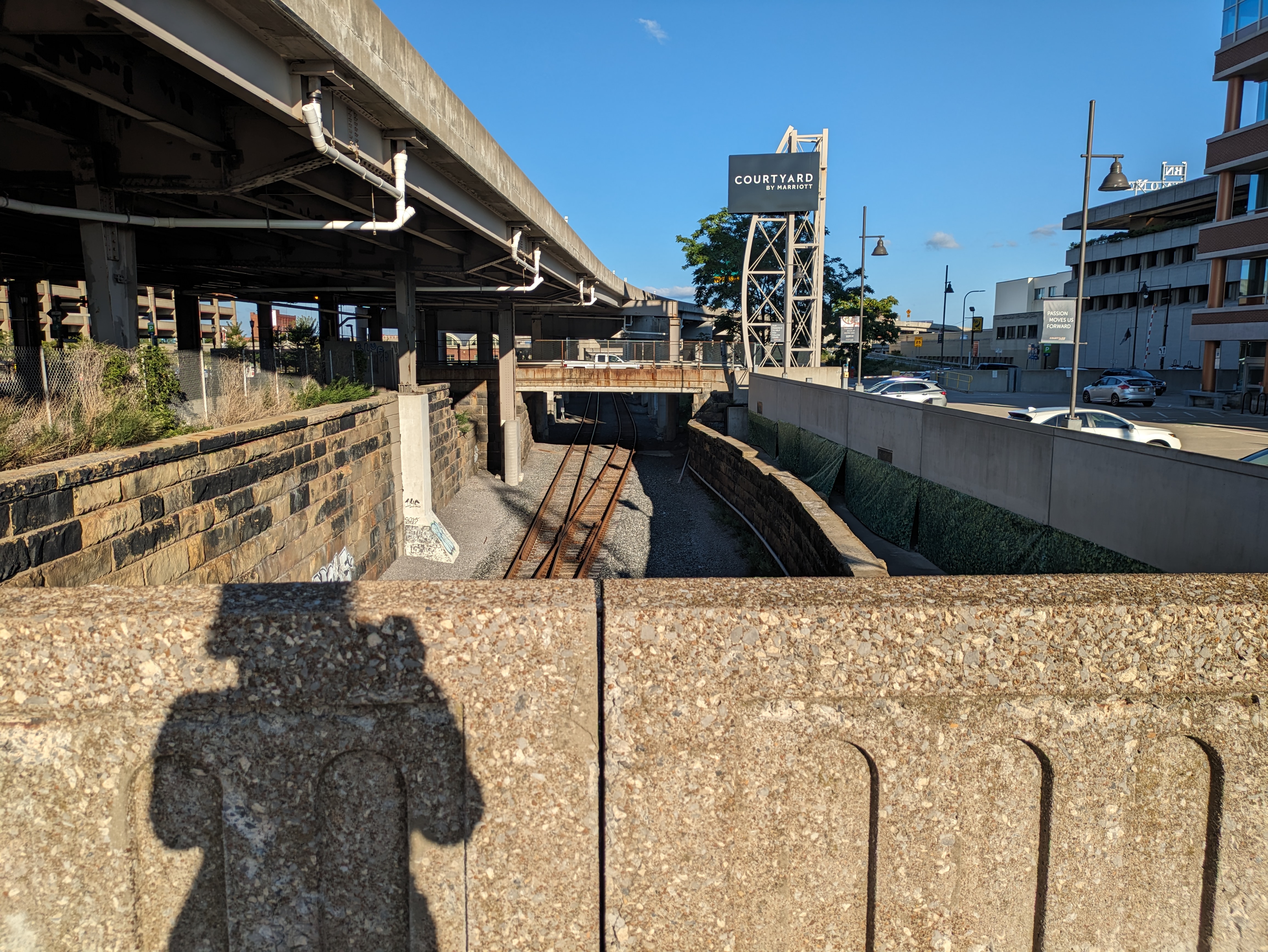
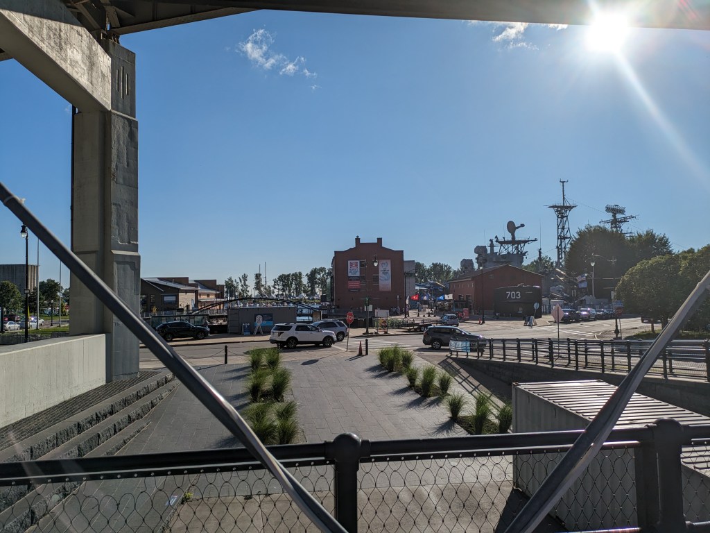
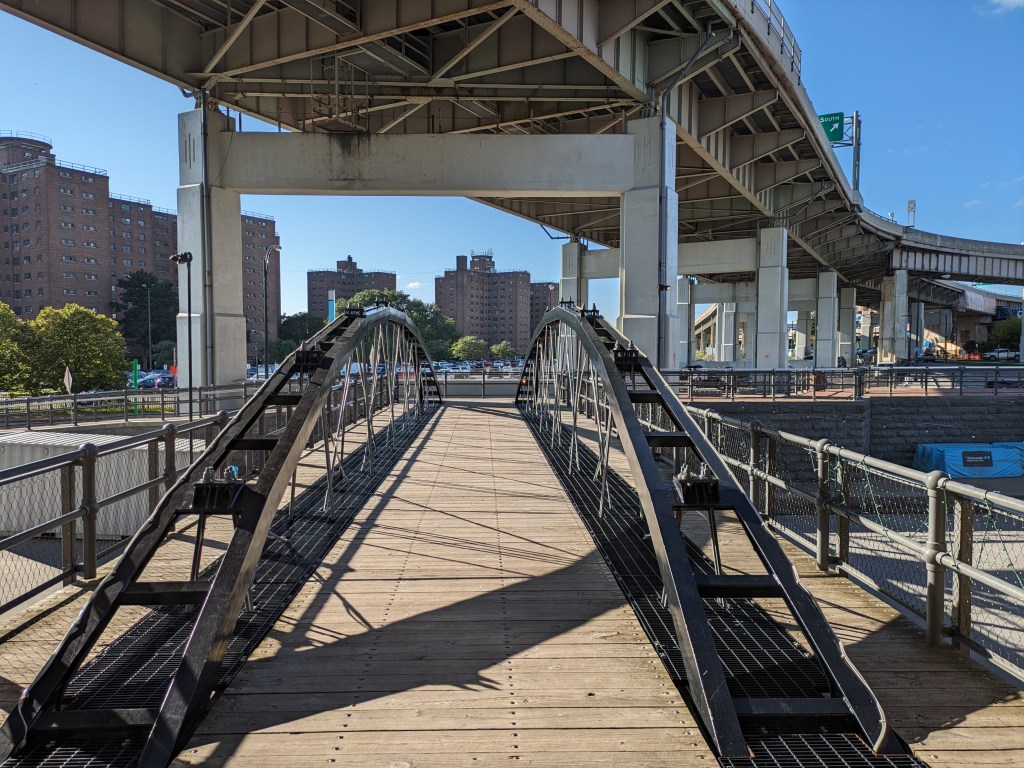
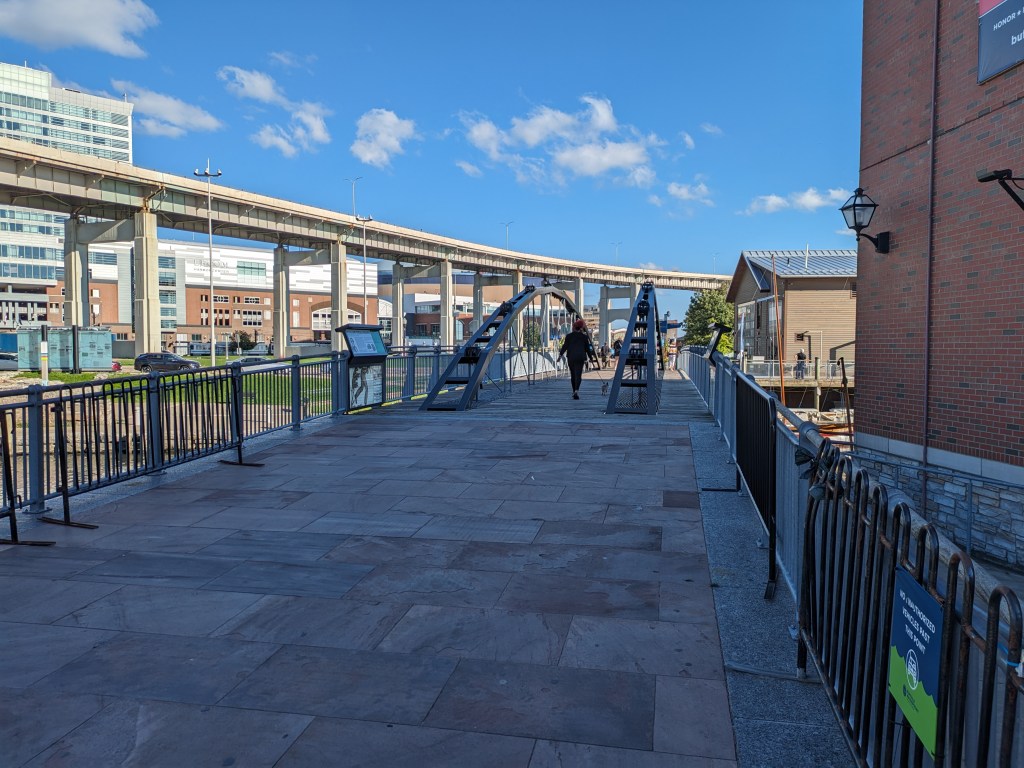
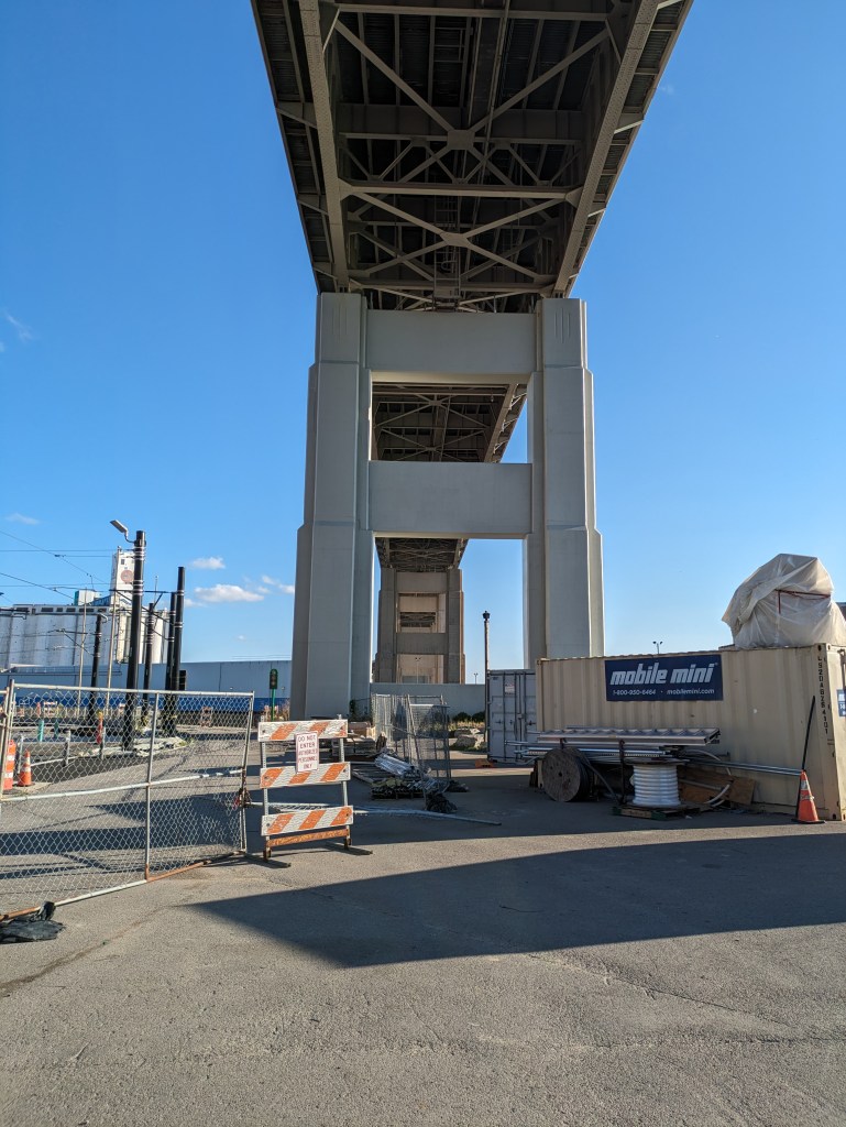
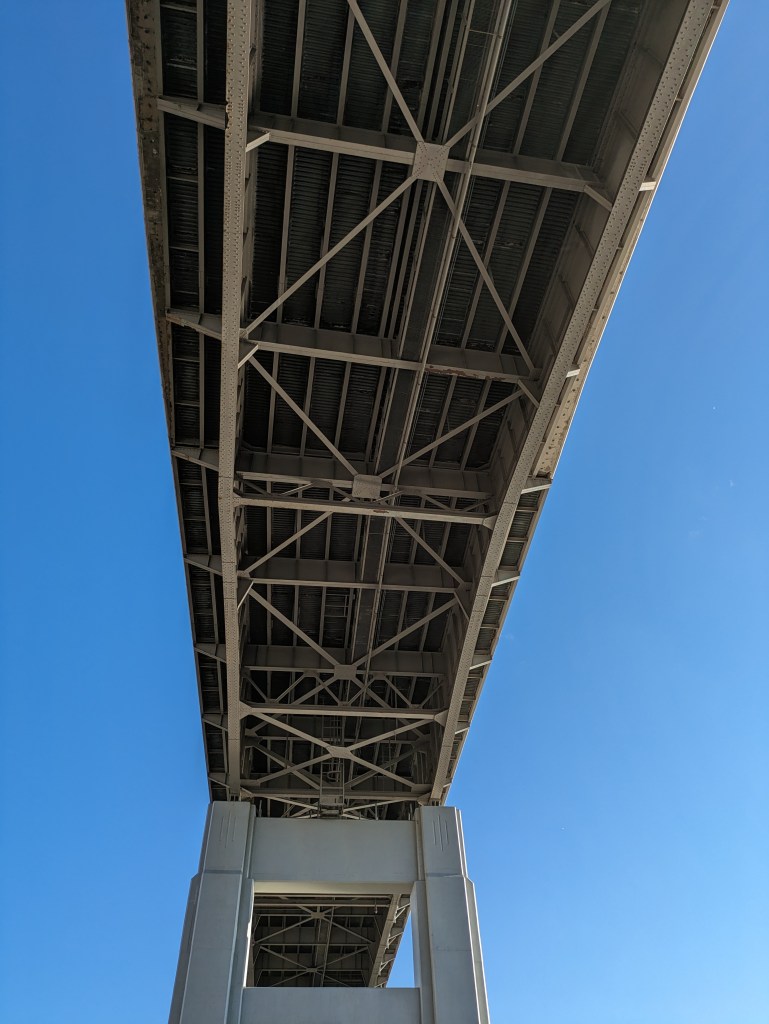
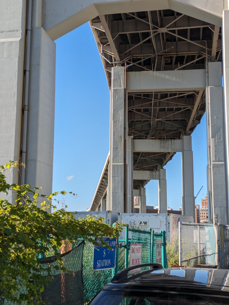
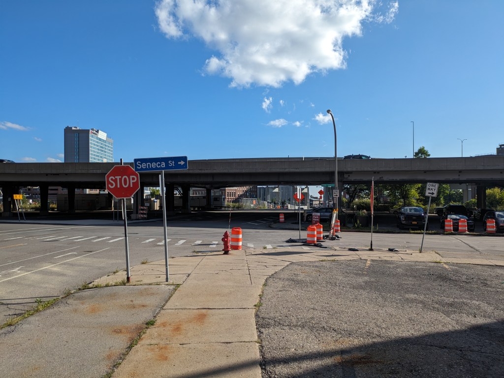
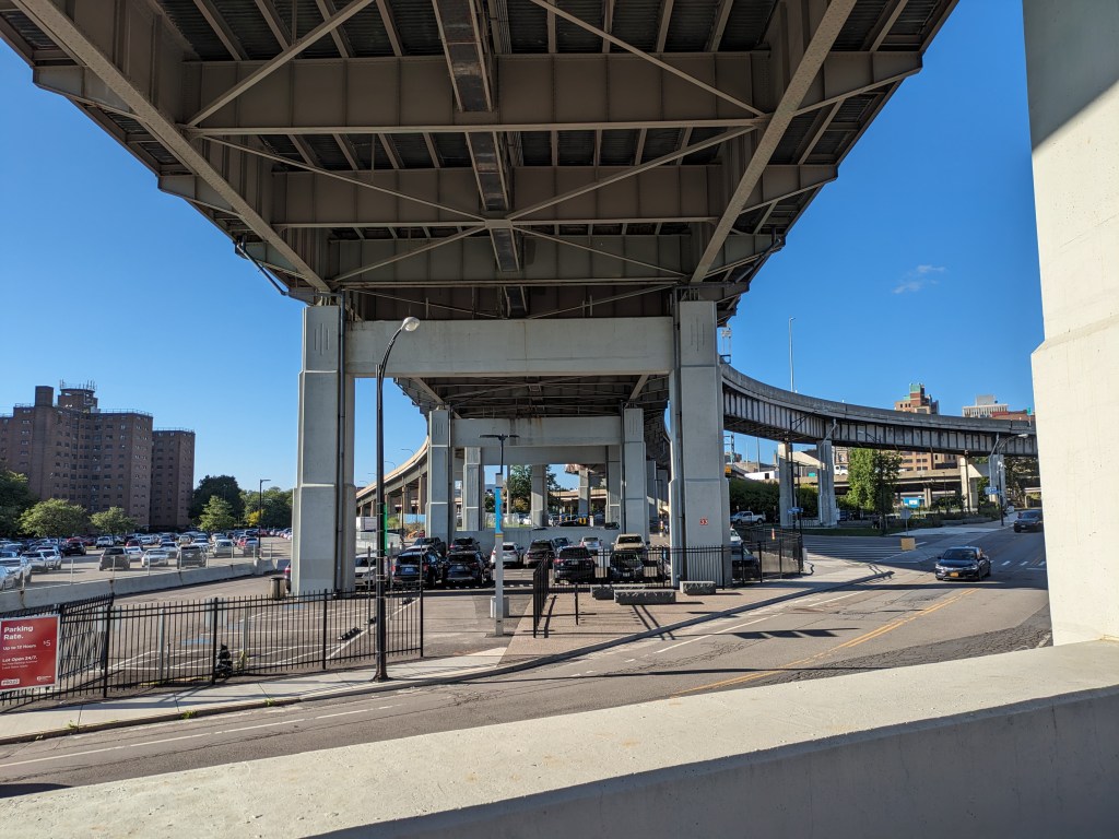
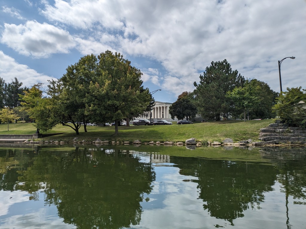
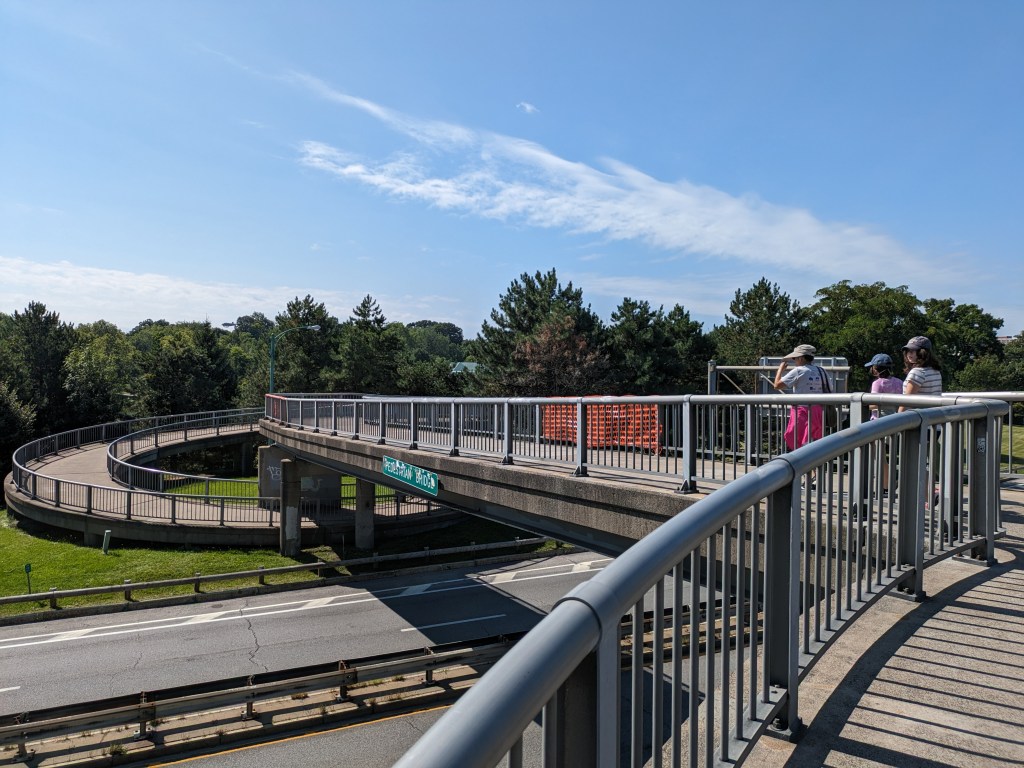
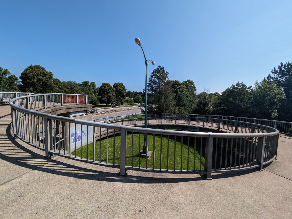
Chicago first drew my attention to how we layer our cities. I wasn’t thinking of this theme when I was in Buffalo, but when I reviewed my photos, this bridge-walking photo caught my eye as another iteration of city layering. Buffalo’s layering is more subtle than Chicago’s, but like Chicago, there are a variety of uses/activities at each level.
Underground
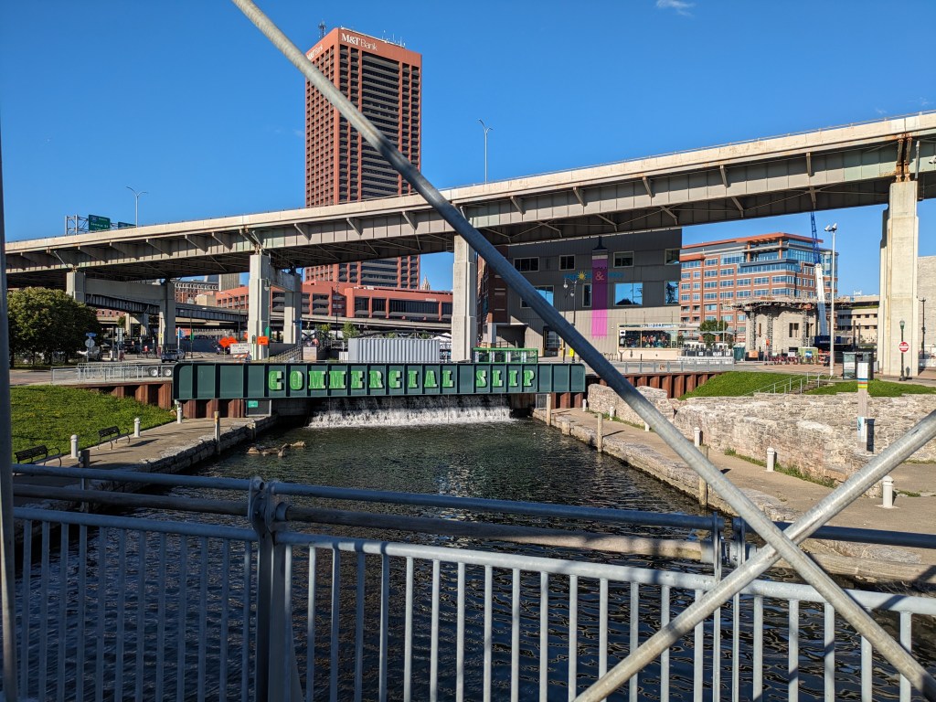
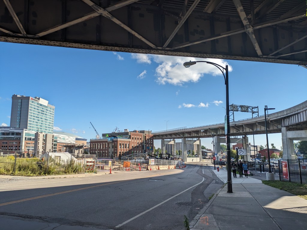
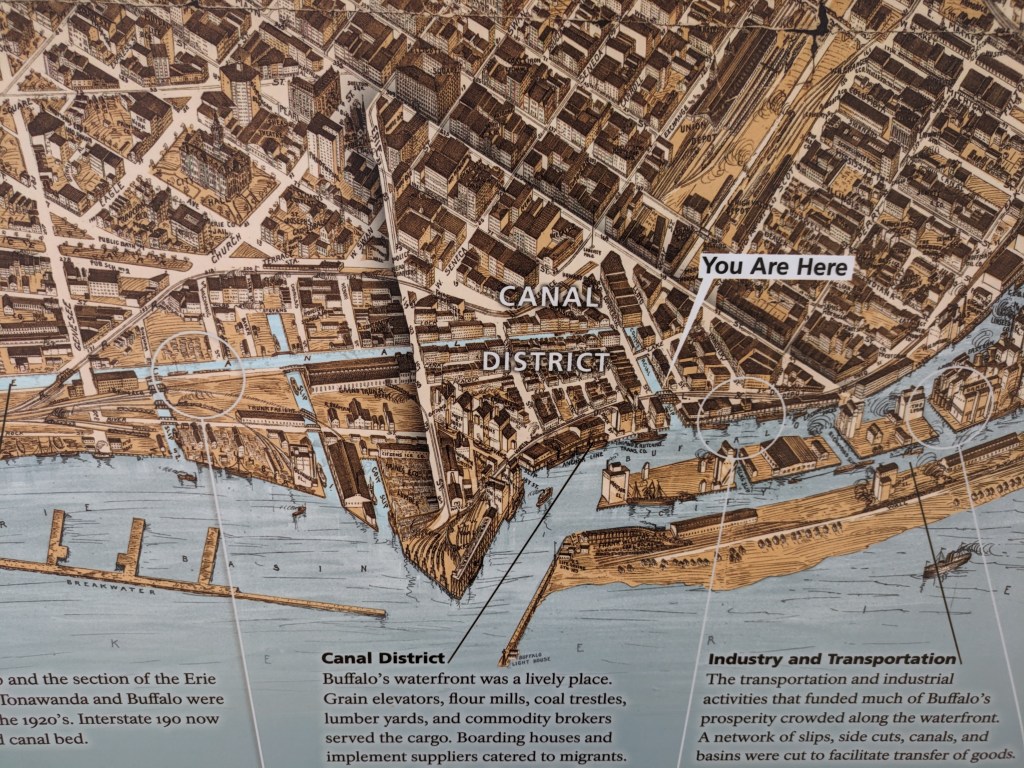
The underground layer in this photo is the railroad tracks, which appear to be the tracks the Amtrak uses as the station is nearby. At a similar elevation and a few blocks to the right, the Erie Canal and Lake Erie are other uses at this layer’s level. Part of the canal has been converted into a paved recreation area with skating rink. At the point where this picture is taken, the light rail system is at street level and immediately behind me, but toward the northern end of downtown, it slips underground. Exploration of other potential underground uses such as tunnels, parking garages, or businesses was beyond the scope of this trip.
Street Level
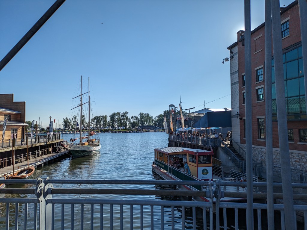
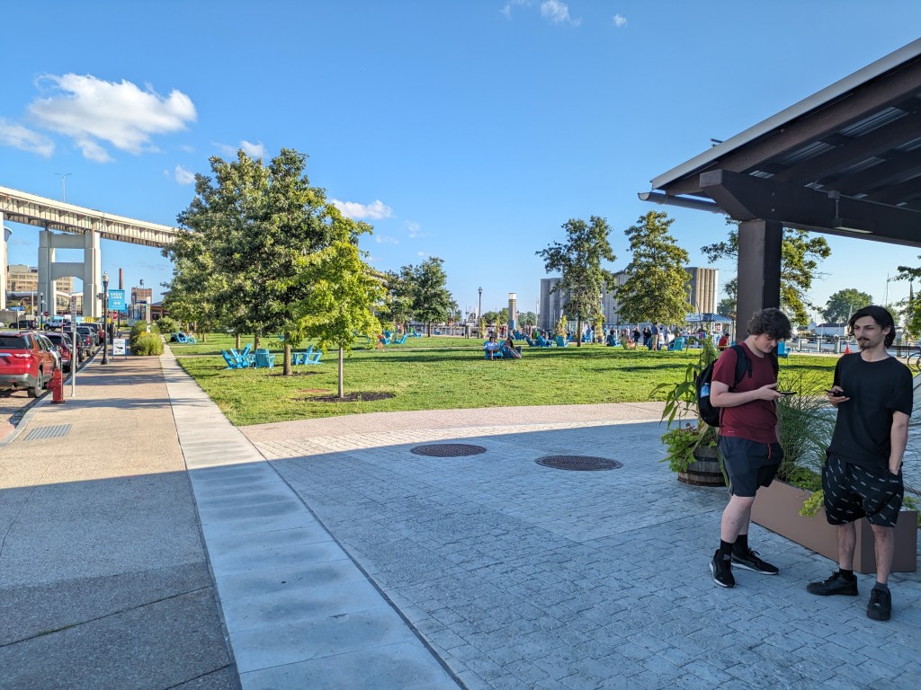
Again, where this photo was taken, the street level includes pedestrian, vehicular, and light transit activity. Although, when I was passing on a Sunday in the late afternoon approaching dinnertime, there was very little of any activity at this location. I had encountered a fair number of people enjoying the indoor and outdoor amenities at Canalside and once back in the heart of downtown there was some activity at street level. This point along the “barrier” to the waterfront felt a little like a no-man’s land.
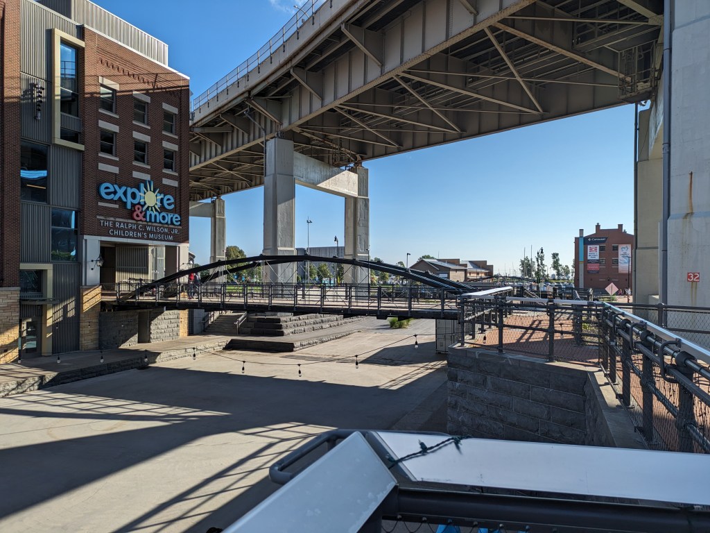
Pie in the Sky
In this picture, the upper layer of the city is the overpass (or bridge) for I-190. Just on the other side of the overpass the upper layer changes into the Seneca One office and apartment tower that straddles Main Street and has beautiful street-level murals. Downtown has many skyscrapers and other large buildings that contribute to the upper layer of the city, but the outstanding feature for me of Buffalo’s upper layer is the web of overpasses.
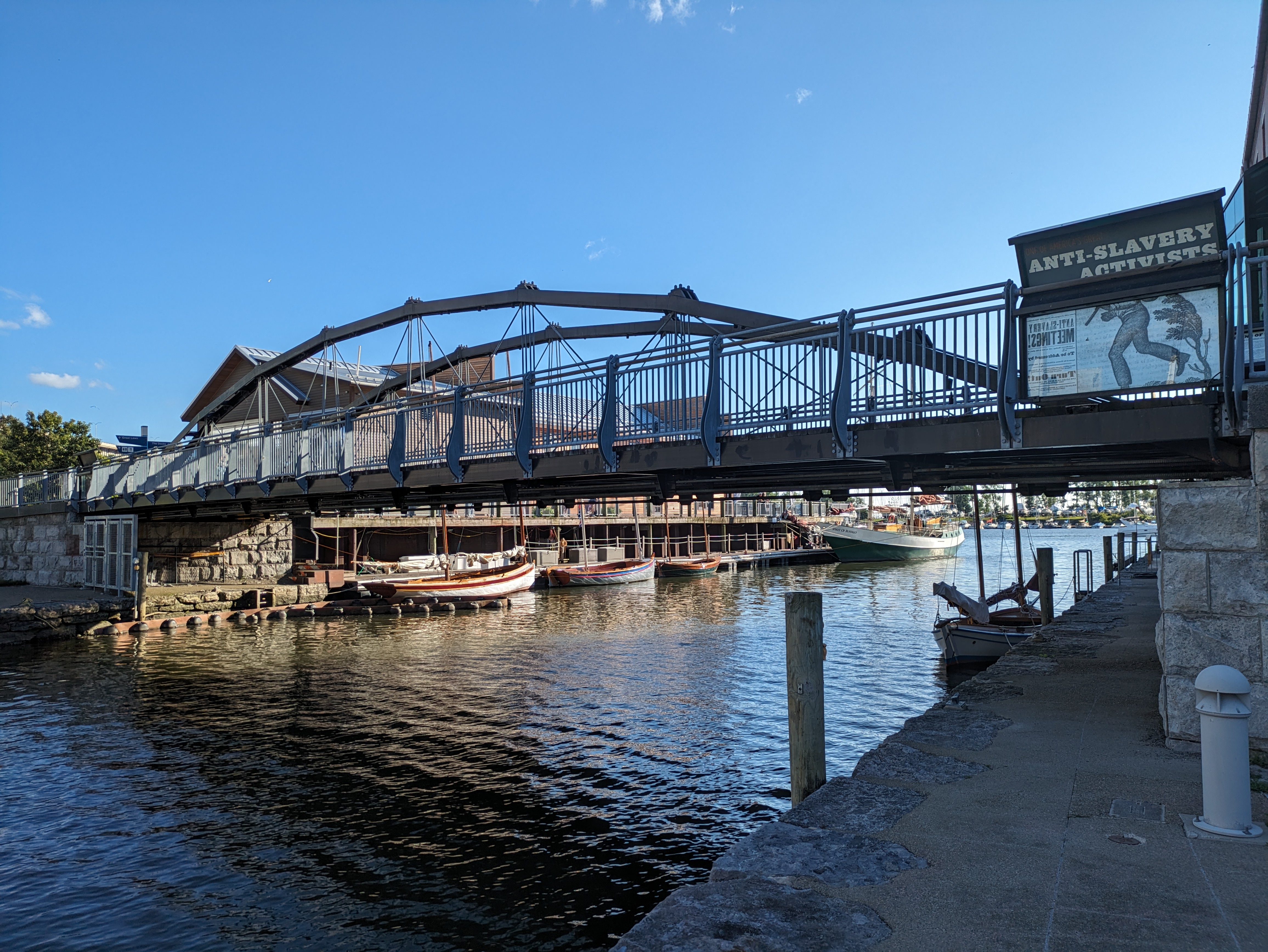
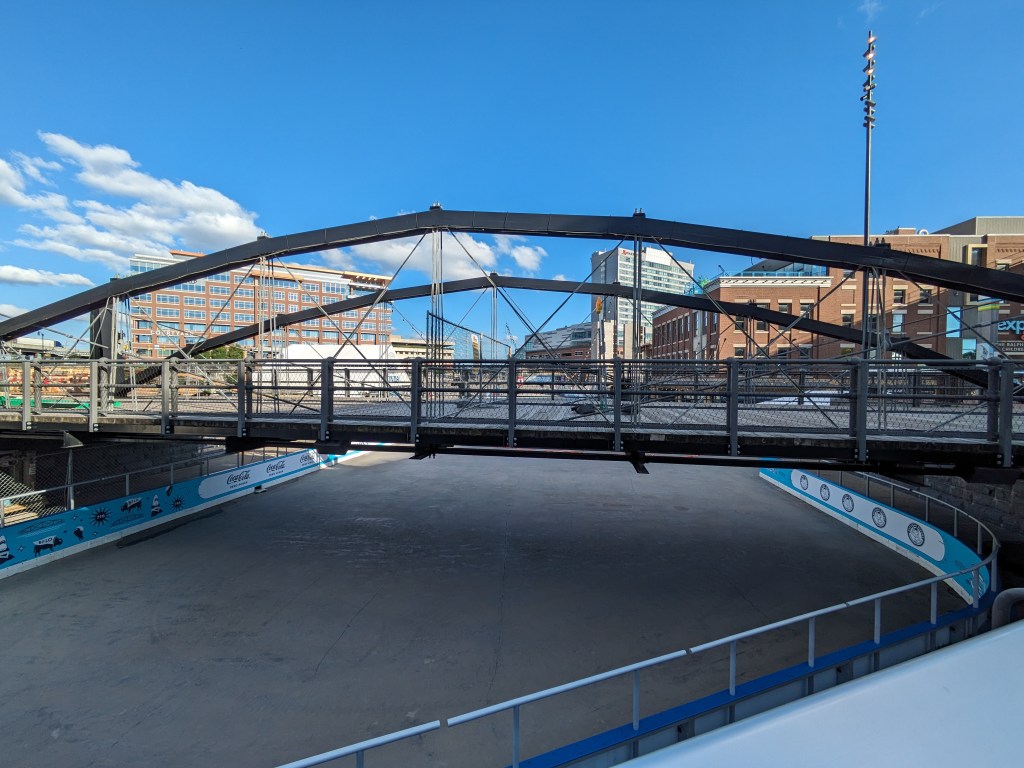
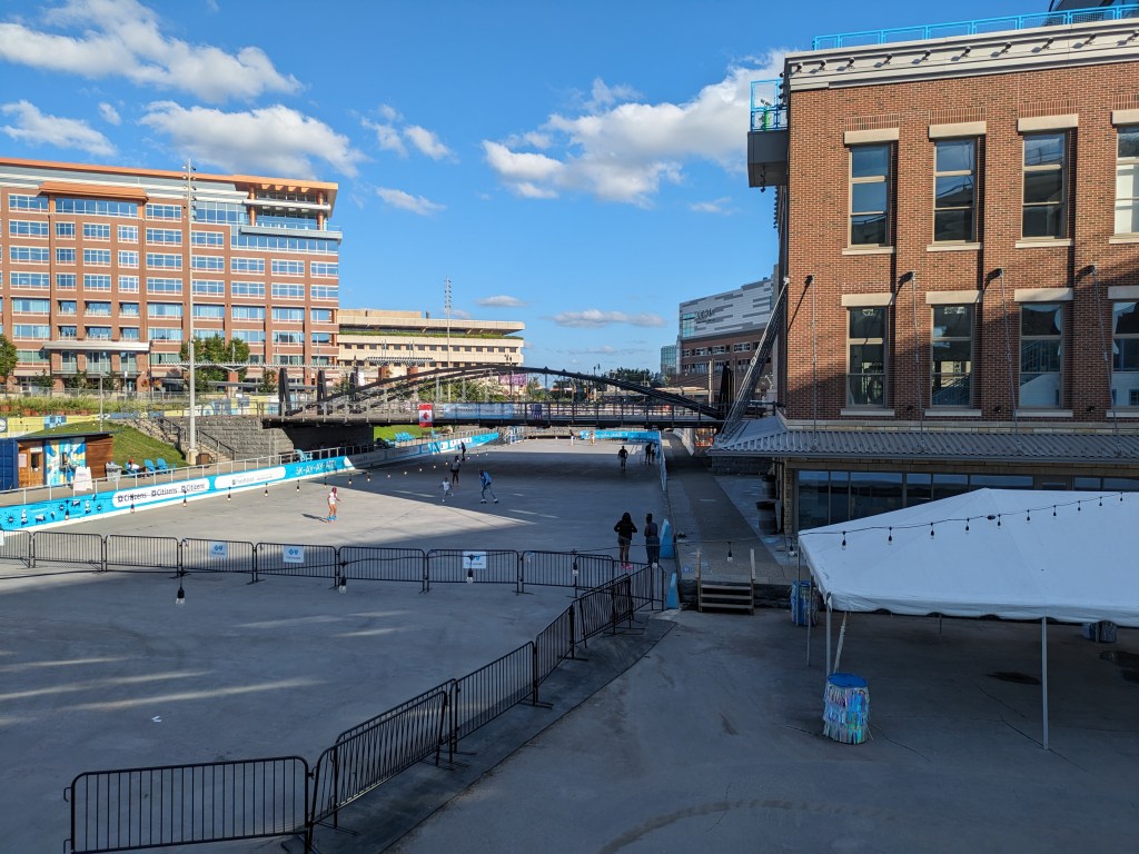
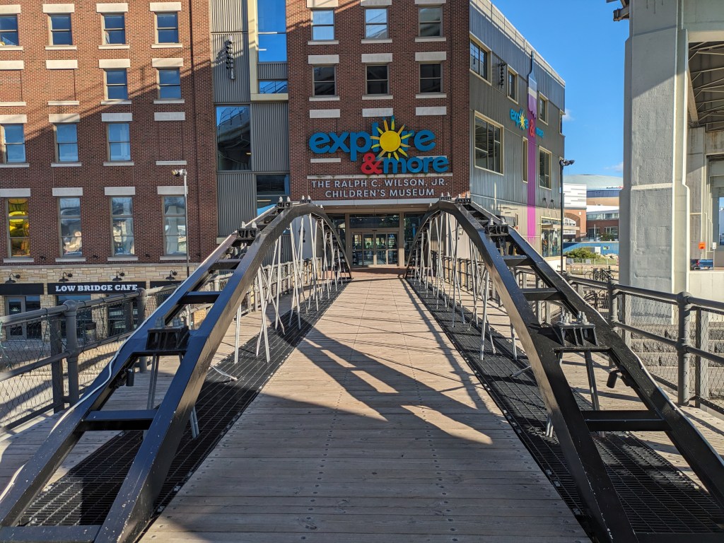
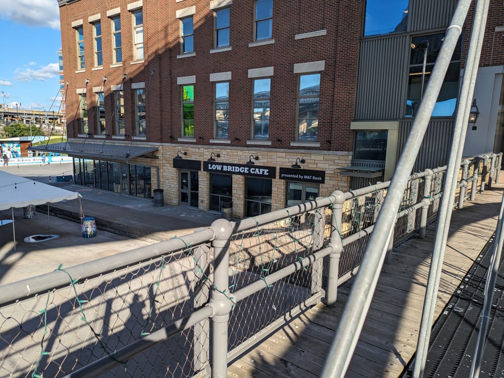
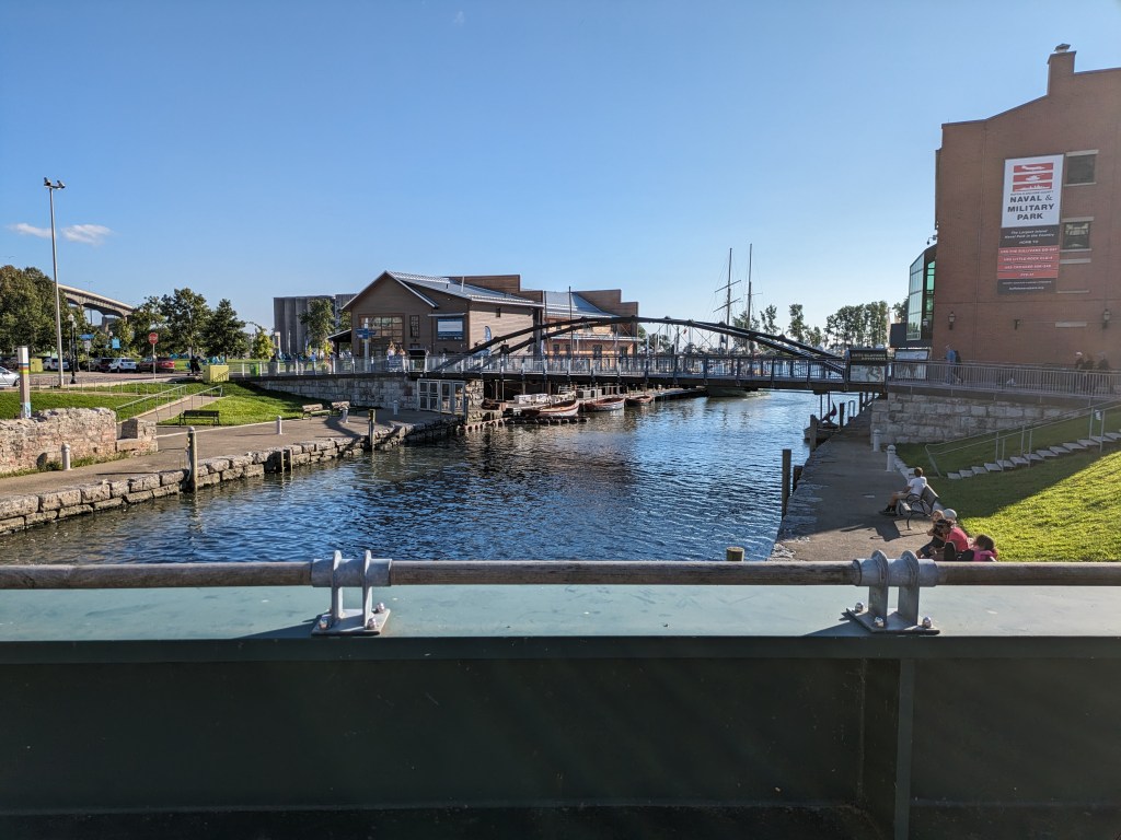
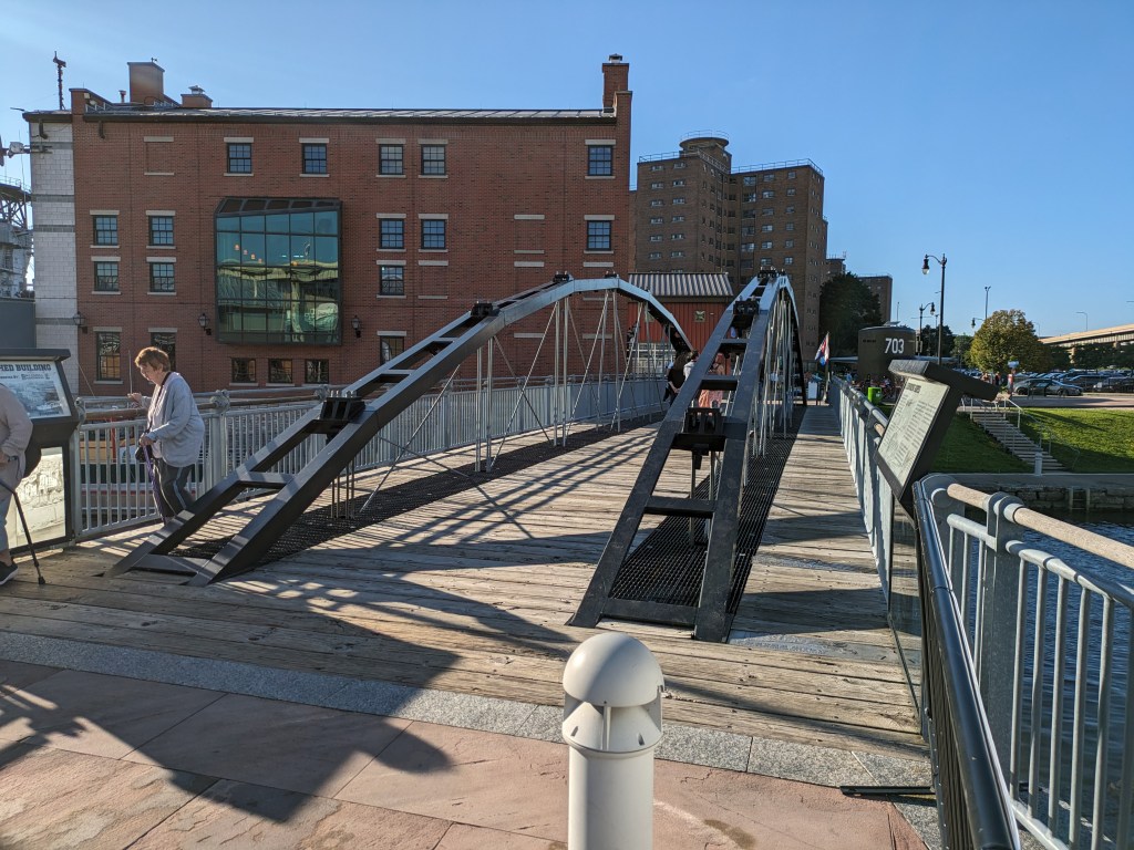
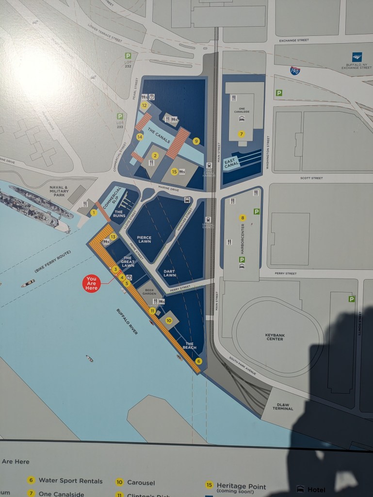
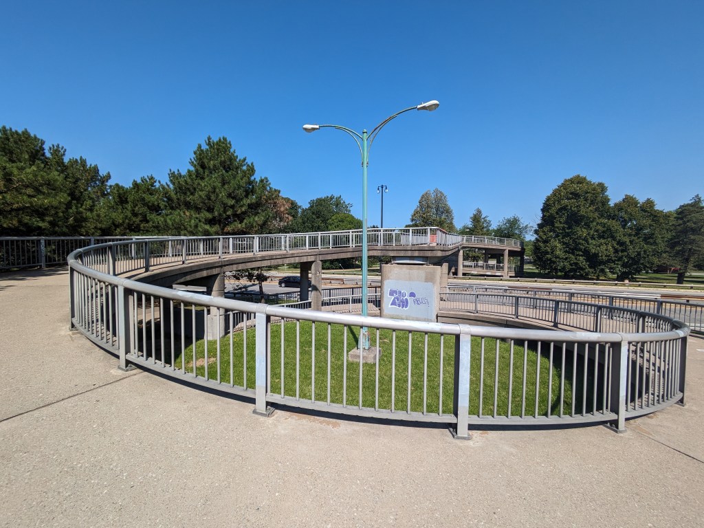
There are several pedestrian-only bridges at Canalside, Buffalo. They pass over the end of the Erie Canal, a portion of which has been paved over with a skating rink. When I was there, one of these bridges was closed due to construction and I couldn’t figure out how to get to another one. I did walk over two others of these pedestrian bridges – one over the paved portion and one over the water portion.
As I continue to explore the question “What is a Bridge?” I find that there is a structural, or form, perspective and a more philosophical, or function, perspective. In asking if the building in Chambersburg pictured above is a bridge, I earlier came to the conclusion that it is. That answer required searching beyond two standard dictionary definitions both of which required that the structure carry a path or roadway to qualify as a bridge. The Encyclopedia Britannica did not have that qualification and so I embraced their definition as I felt that this Chambersburg building and the backyards and buildings I discuss in Millvale should be called bridges. Structurally, these may be bridges, but philosophically are they bridges? Does a bridge need to allow movement across it to fulfill the purpose of a bridge?
Up to this point, I’ve been primarily focused on Merriam-Webster’s definition of bridge as a structure found in the built environment. There are many other definitions and types of bridges under their entry for “bridge,” starting with a time, place, or means of connection or transition. Other examples of “bridges” include the bridge of a nose, the bridge of a violin and other string instruments, the passage of music called a bridge that links two sections of the piece, a dental bridge, and a ship’s bridge. For each of these examples, the function of connection or transition seems to be the crucial part that makes them bridges.
In Buffalo, I also questioned the different between a structural bridge and a philosophical bridge. I proposed then that an overpass may be structurally a bridge, but philosophically if the primary purpose of the structure is to pass over instead of to connect then it is not a bridge.
Putting these ideas together, there is a difference between a structural bridge and the concept of a bridge. The Chambersburg and Millvale examples are structurally bridges, I believe, but their main purpose is to expand the buildable area. They are not intended to create connection and therefore they are not bridges.
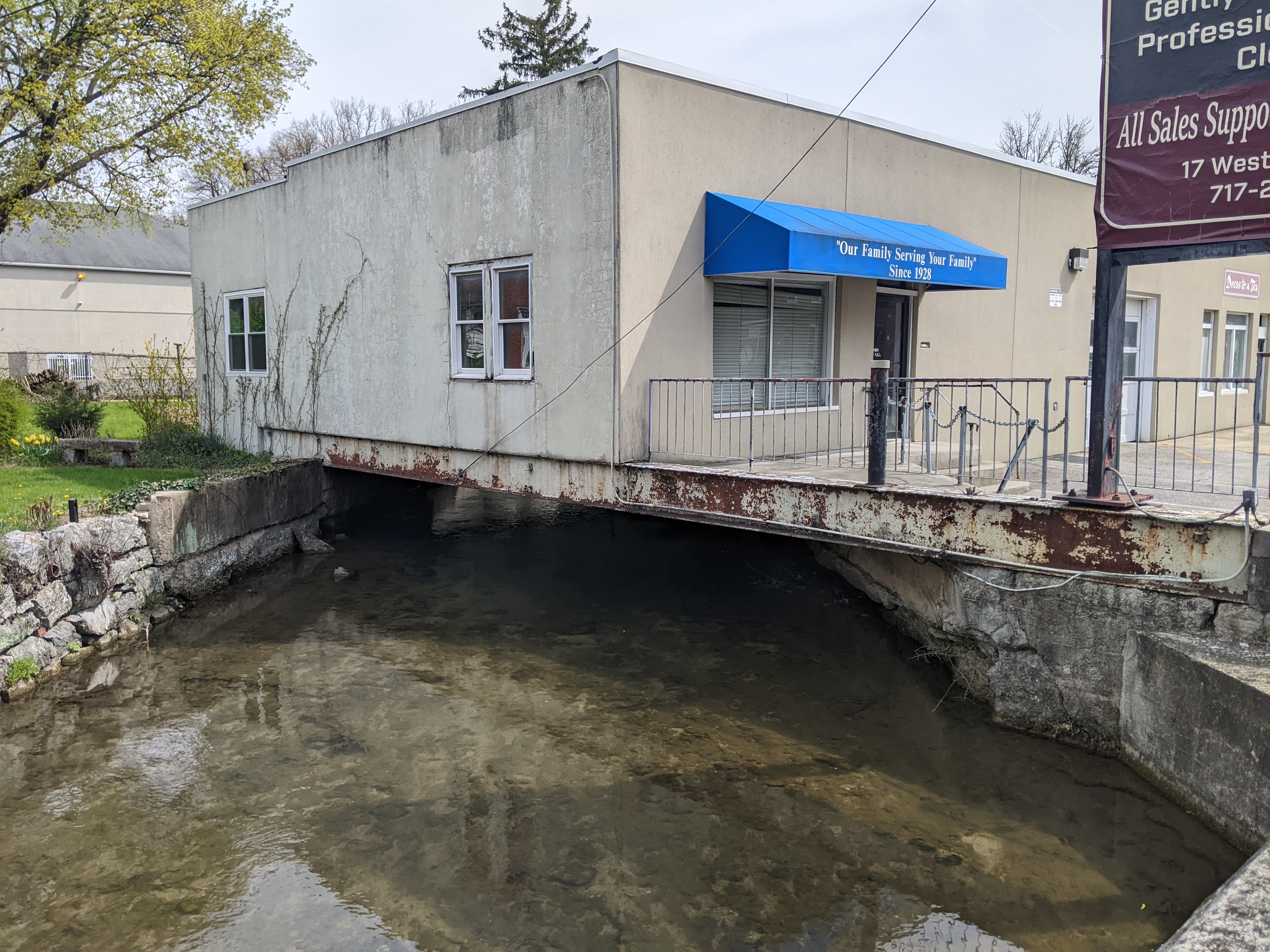
Millvale, PA, sits tucked in a valley that spills out into the Allegheny River at the far end of Pittsburgh’s 40th Street Bridge. Like all the valleys in this region, it formed over time by a stream cutting into the bed of the Allegheny Plateau. But when PennDOT announced the indefinite closure of two of Millvale’s bridges, I struggled to pinpoint their location. One of the two streets appeared to be nowhere near the streambed.
Then, in 2024, while I was primarily home-bound due to Long COVID and my mom sometimes took me along on her errands to help me get out of the house, she wanted to stop at a shop in Millvale. I thought I would sit in the car and wait for her, but as she was looking for a parking space, I noticed a barrier across one of the roads we passed with a sign that appeared to say “Bridge Closed.”
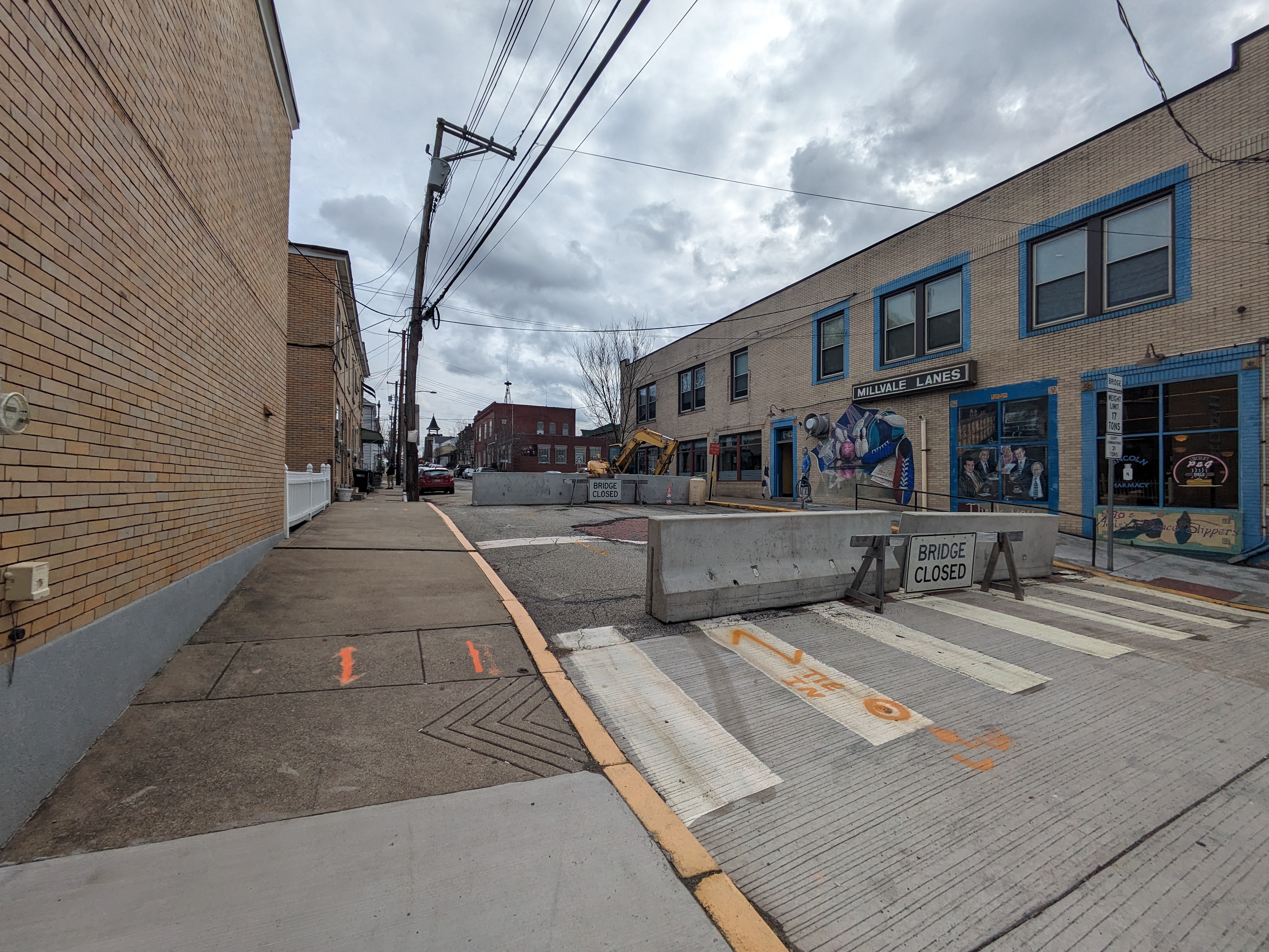
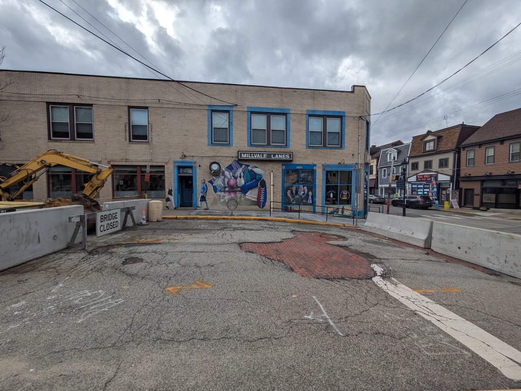
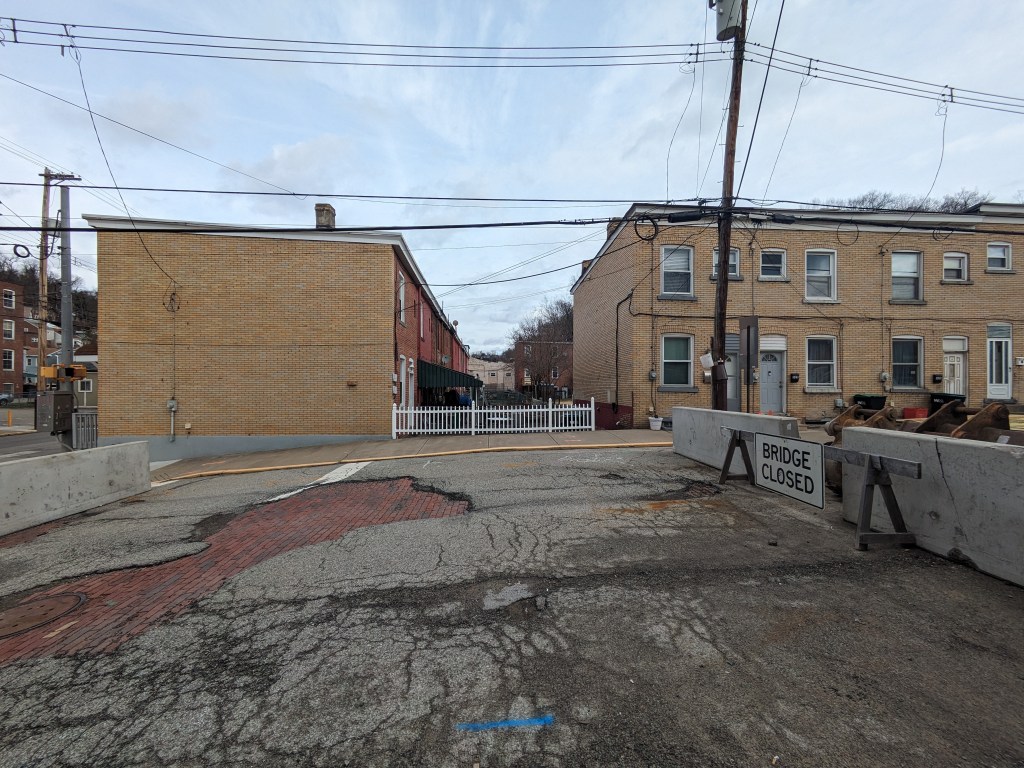
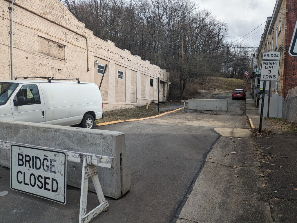
I investigated the closure while my mom went on her errand. Sure enough, on what looked like a street, just like all the other streets around, were jersey barriers marked with “Bridge Closed” signs (photo above). This street/bridge was the Lincoln Avenue Bridge that PennDOT had closed a year before. The only indication that this was a bridge was the “Bridge Closed” sign and the bridge weight limit sign on the right side of the bridge. A block over, Fremont Street had a similar barrier with “Bridge Closed” next to a bridge weight limit sign. Again, looking around from this bridge, it made perfect sense to me why I was unable to pinpoint its location on the map. (photos below)
While standing on the Liberty Avenue Bridge, it struck me if this road was a bridge, then what are the buildings and back yards on either side of the bridge in the direction of the pathway of Girty’s Run? Is the bowling alley a bridge? Is the back lawn of the adjacent houses a bridge? Do the people who live and play in these spaces know that they are on bridges?
I asked similar questions in Chicago as the ground shook beneath my feet with the passing of trucks and buses and as I walked over expansion joints. However, there wasn’t a river running underneath the Chicago ground-bridges. Those “bridges” enabled a variety of activities to happen while stacked one above the other as a solution to work with the density of the city.
In Millvale, the presence of bridges hidden in plain sight bothered me. I’ve heard over the years that Millvale has lots of trouble with flooding, in a region where flooding is common. That hearsay has left the impression that Millvale’s flooding is worse than average for the area. The municipal website includes directions for what to do when you hear the town siren give off flood warnings, which seems to support my impression. When I saw how much of the stream was buried under “bridges” made of roads, buildings, and backyards, it instantly made sense that flooding would be a major problem here.
Over my years of bridge-walking, I have come to see that intent is a part of the definition of what a bridge is. Most bridges seem to have the intent of connecting two (or more) points. However, in Buffalo, I encountered a bridge that the number one intent seems to be passing over an area. Millvale illustrates a third, vital component. The intent seems to go beyond just connecting two points (and passing over something, in this case, a stream). The intent here seems to include a demonstration that humans best nature . . . a demonstration that doesn’t appear to be working in this particular town.
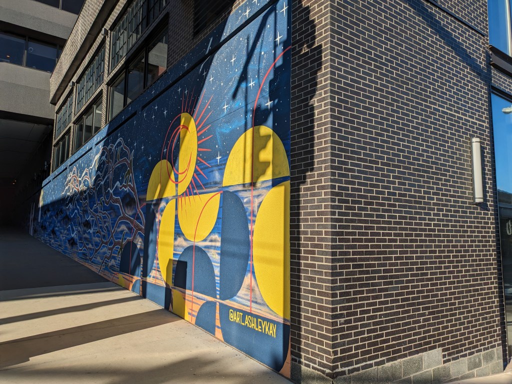
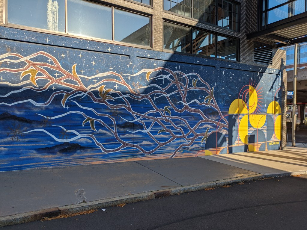
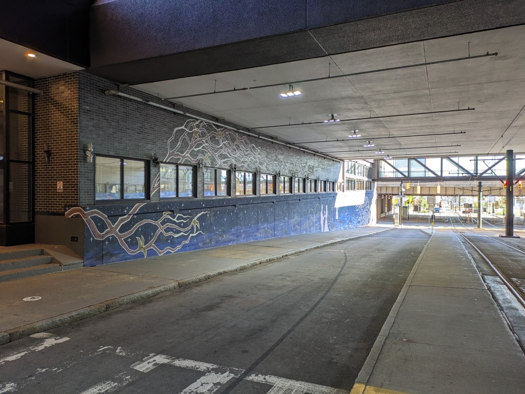
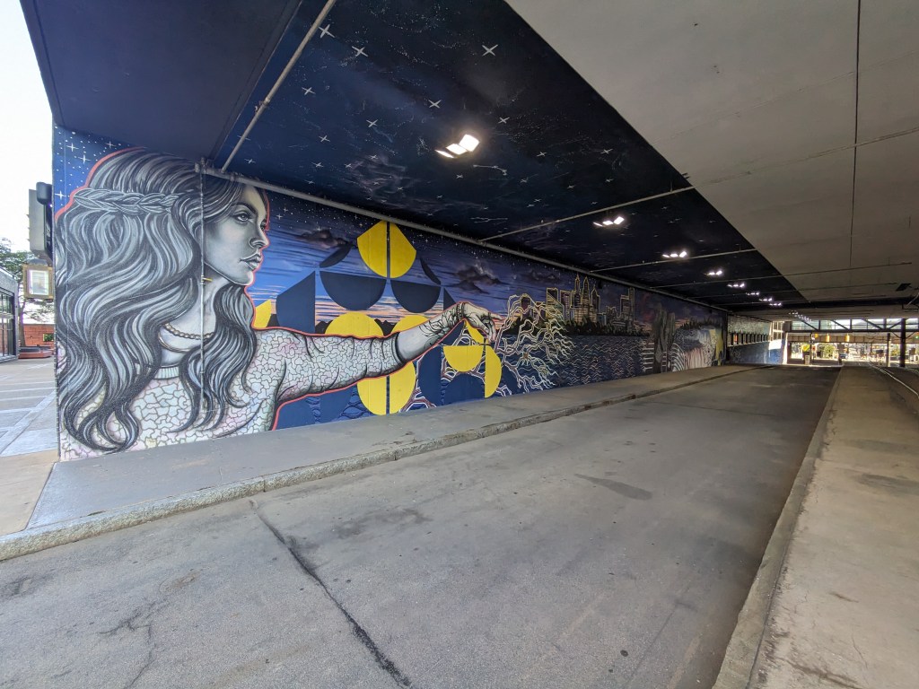
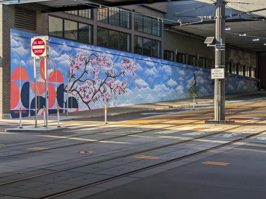
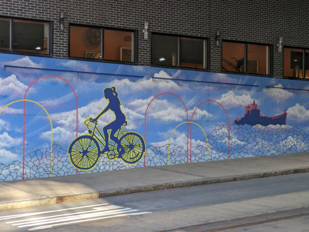
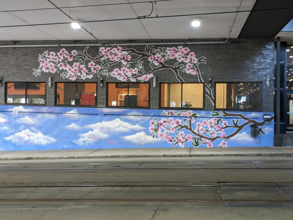
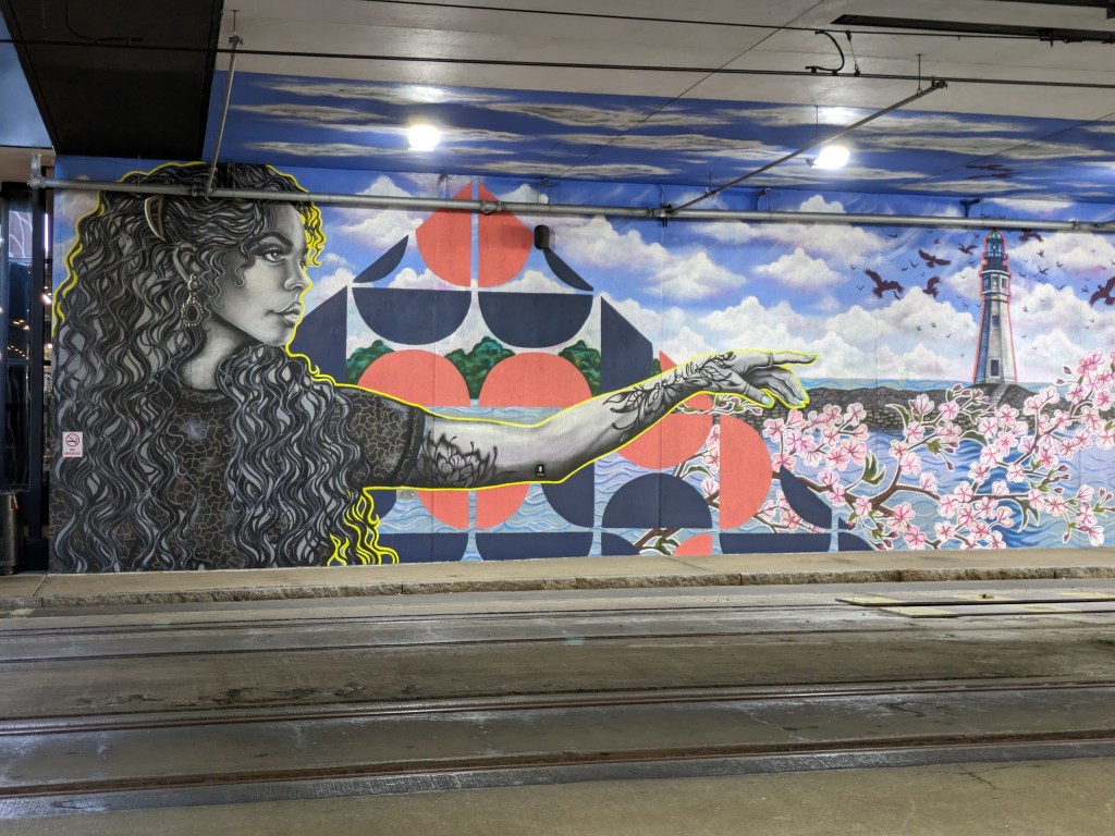
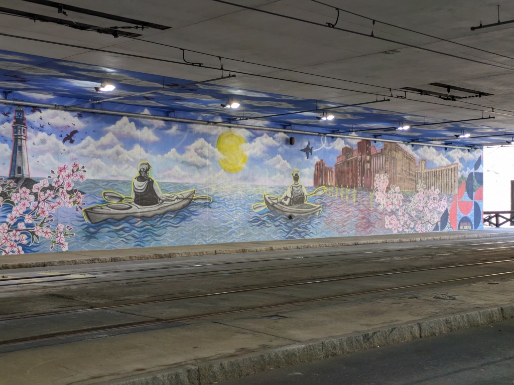
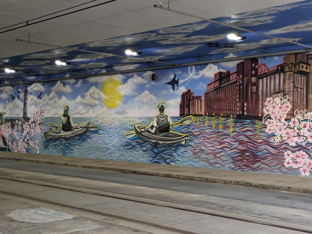
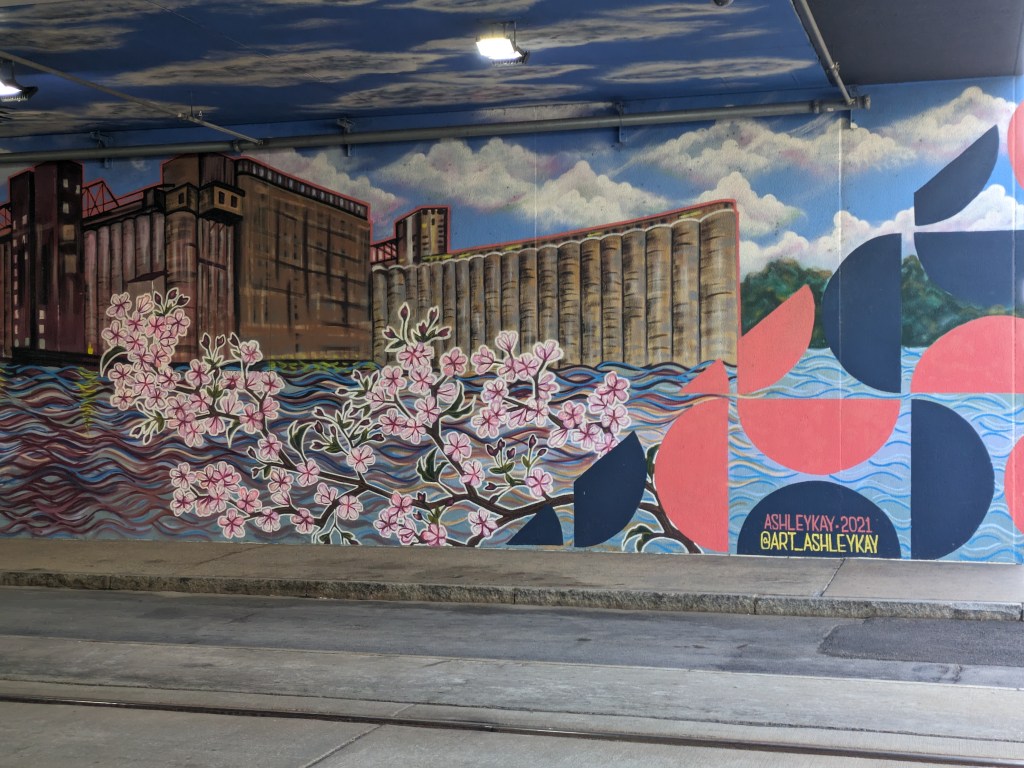
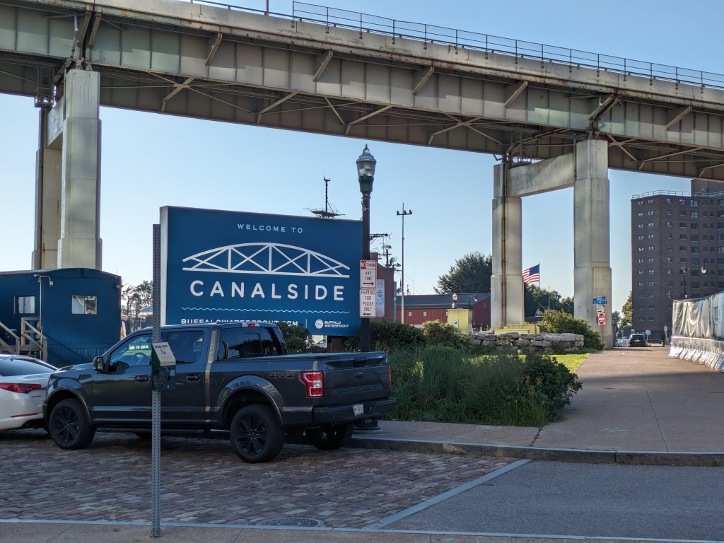
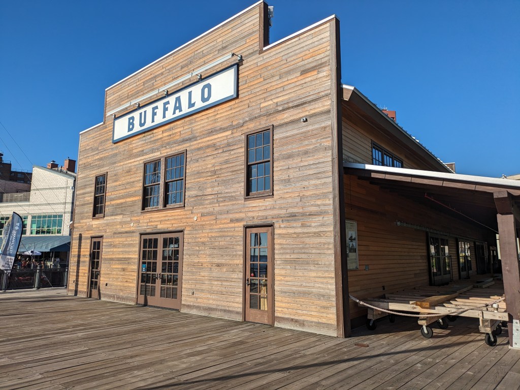
Walking around downtown Buffalo, I encountered several murals. They were all placed where the built environment would have otherwise created a drab or unpleasant experience. Three were on the sides of buildings bordered by parking lots. One was along both sides of the tunnel created by Seneca One, a 1970s tower built over Main Street. The mural along Main Street was particularly appealing. Usually walking along a road that passes underneath a building is a dark and dingy experience. This mural brightened up the space and created a distraction for the whole block. As Main Street is one of the possible pedestrian connections to the Canalside waterfront area, placing a mural here was a great decision to help make the approach more palatable. There are plenty more unpleasant places to pass before reaching the water.
I have dealt with the question of what is a bridge multiple times in the last decade. Buffalo adds to this philosophical conversation by combining the questions “what is a bridge?” and “what is the purpose of a bridge?” I’ve previous walked through what is the difference between a bridge and a ramp (Pittsburgh Edition I and Edition II), this time the nuance is “what is the difference between a bridge and an overpass?”
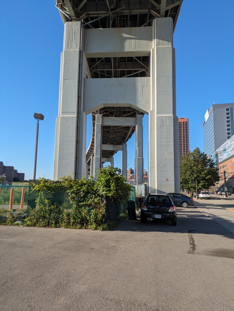
In Buffalo, the structure that carries Route 5 over what used to be largely industrial areas with some residential parts reads to me like an overpass. But sitting down to think it through, I realized that I may have to call it a bridge as well. It has all the structural components that are found in bridges: roadbed, spans, support. Yet, its purpose does not feel like a bridge.
While in Pittsburgh bridges divide the residents of the city, more typically bridges are about making connections. We use the term “bridge” metaphorically for building a connection. I see physical bridges as a structure that connects two (or more) points.
But Route 5 is not about connection, it is all about passing over. So can I call it a bridge?
I think an engineer would say yes. Since I started this philosophical debate of what is a bridge, the Fern Hollow Bridge in Pittsburgh collapsed, which led me to discover the Federal Highway Administration’s bridge database. It took a minute to figure out which dot on their map referred to Route 5’s structure, but I’m pretty sure it’s the one that is 1.38 miles long with 112 spans. The FHA, therefore, considers it a bridge.
From a structural viewpoint then, an overpass is a bridge; but from a philosophical one, an overpass may not be a bridge unless it is also a path of connection.
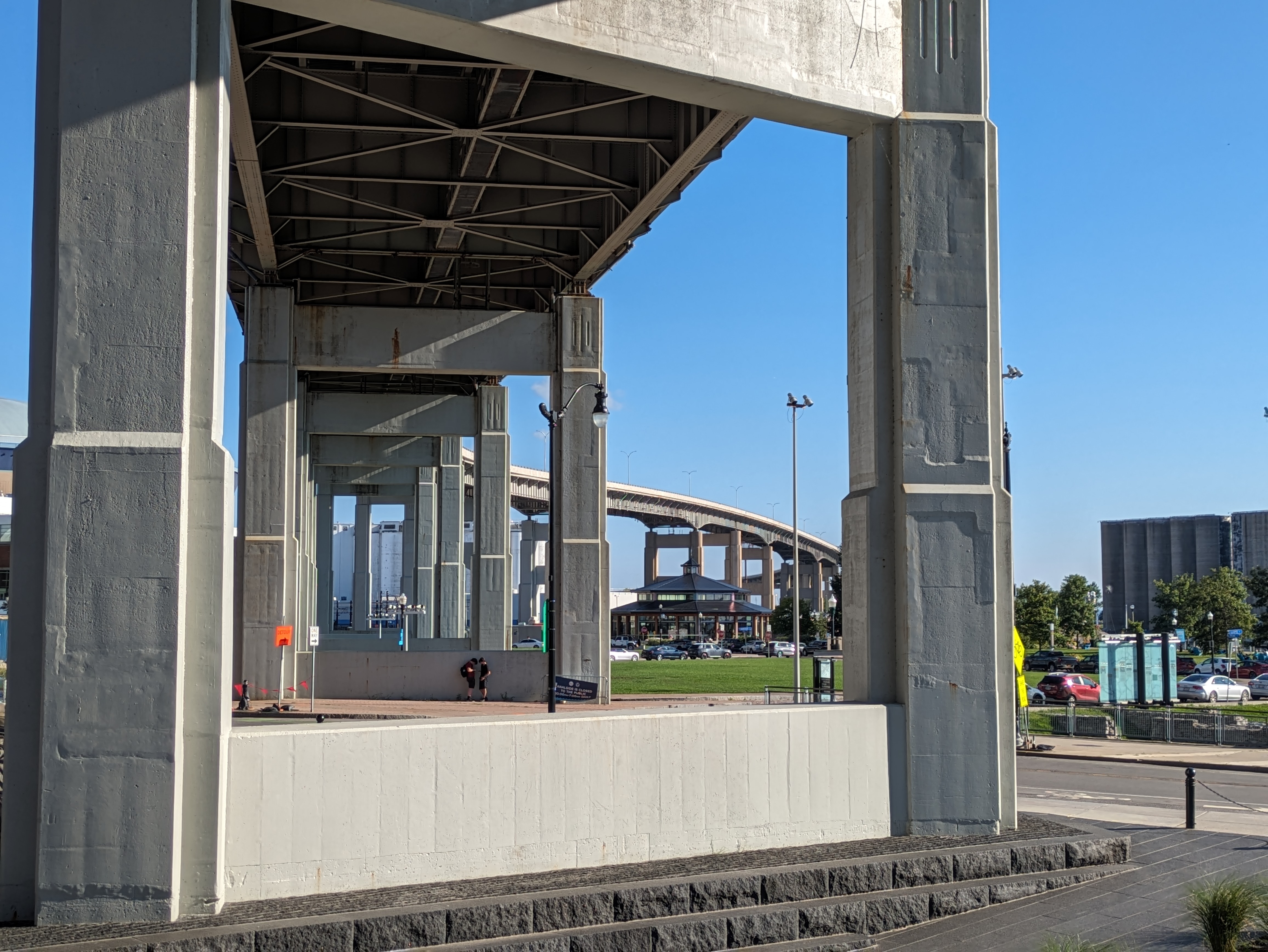
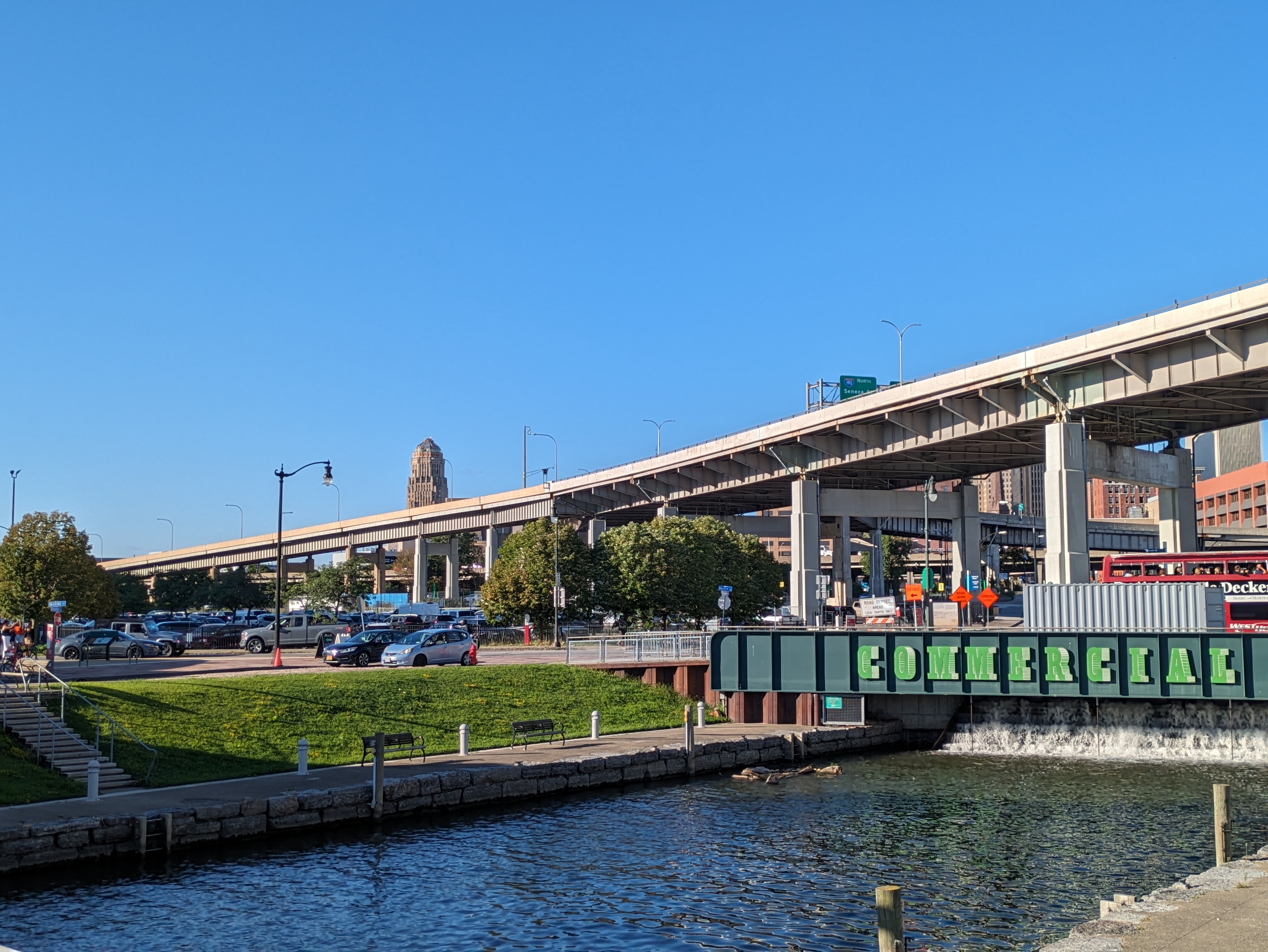
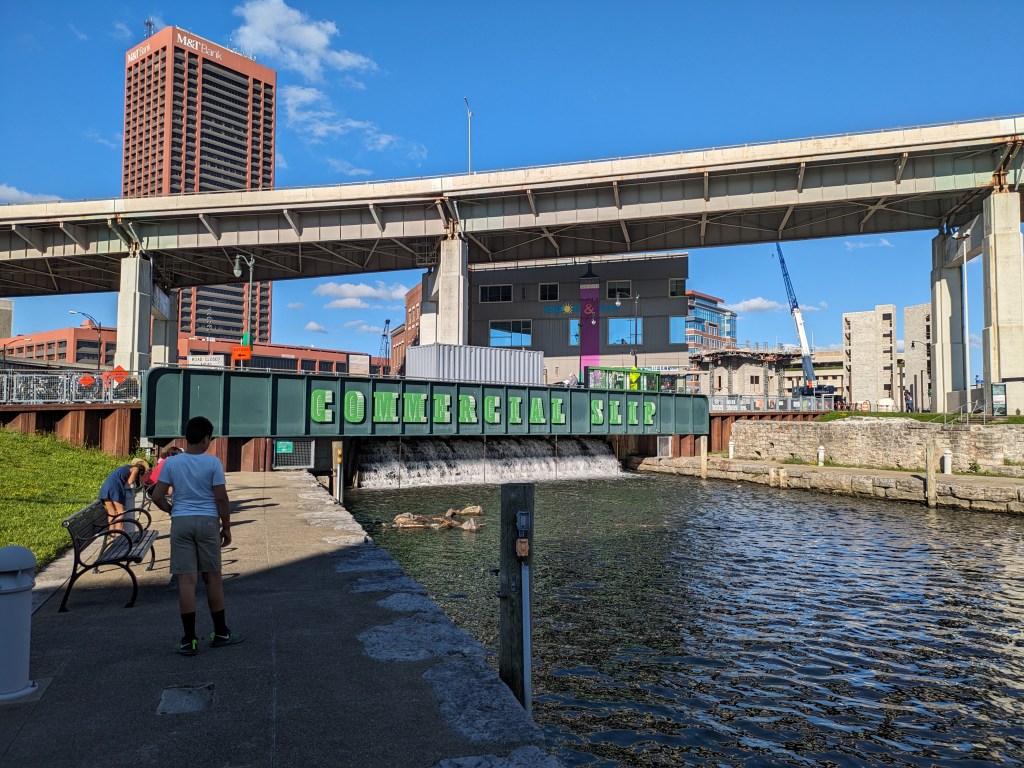
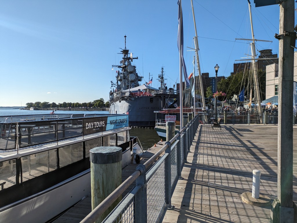
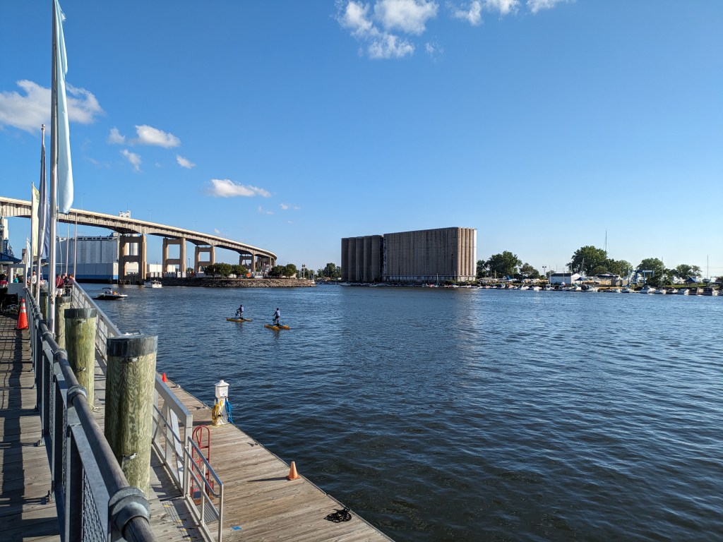
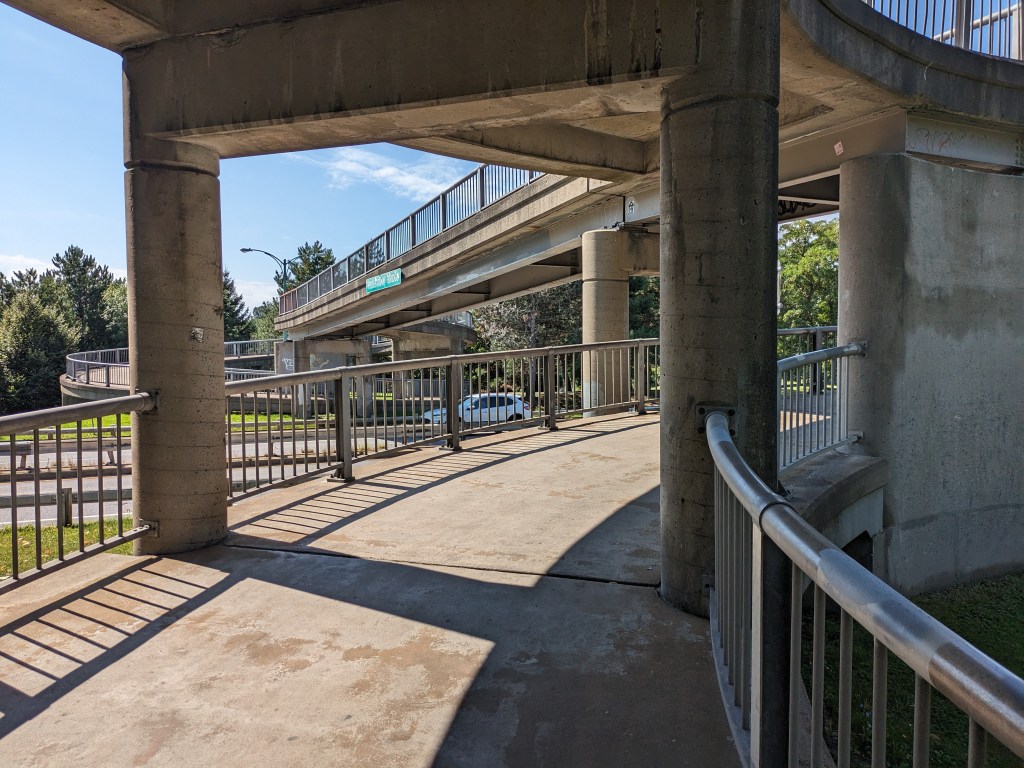
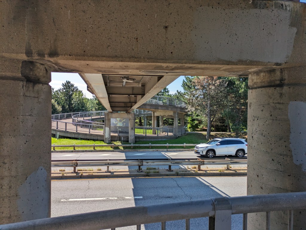
Waterfronts are often the reason why cities exist where they are. However, in the last 50-75 years, we have built barriers cutting ourselves off from these natural amenities. I’ve written about the experience of trying to reach waterfronts in Erie and Chicago. Buffalo echoes those experiences, but with a happier ending.
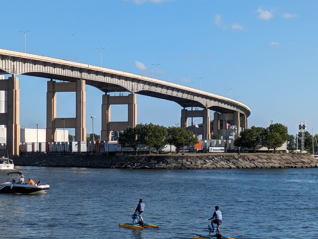
Before making an official urbantraipsing trip to Buffalo, I had encountered the freeways around the city multiple times. The flying roadway carrying Route 5 that starts near downtown and travels over a sizable portion of the industrial area along the waterfront is a memorable piece of infrastructure. And one that I had assumed would contribute to the cutting off of the waterfront from the city.
Route 5 and I-190 meet at the southwestern corner of downtown Buffalo creating a knot of an interchange and on/off ramps that block access between downtown and the waterfront. But, beyond that point of intersection, both roads are elevated leaving open multiple pathways underneath for pedestrians, cars, and transit. They still create a psychological barrier – it never feels welcoming to pass underneath overpasses like these – but the physical connection is there. And once you pass through the barrier, there is much to see and do at Canalside.
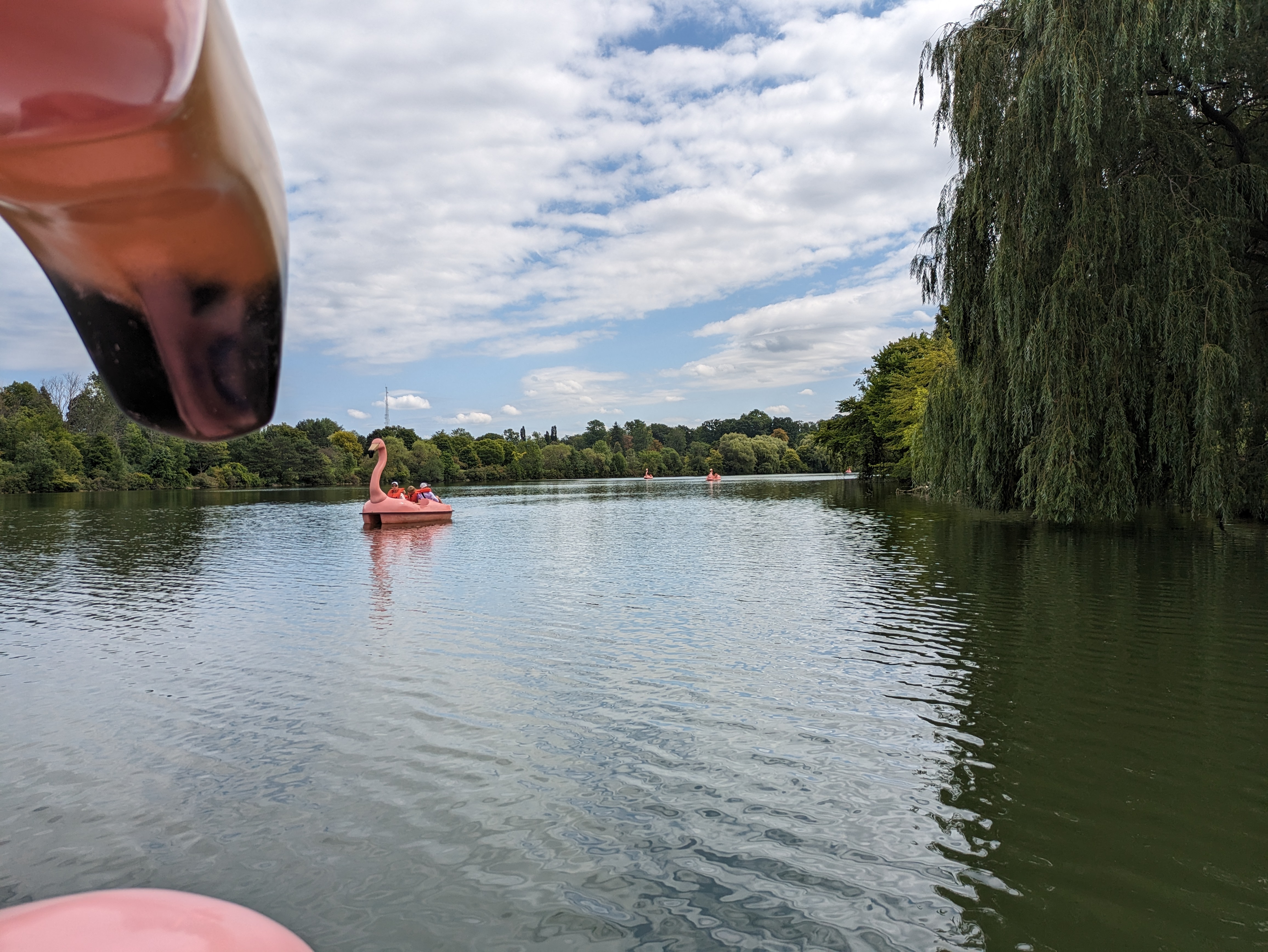
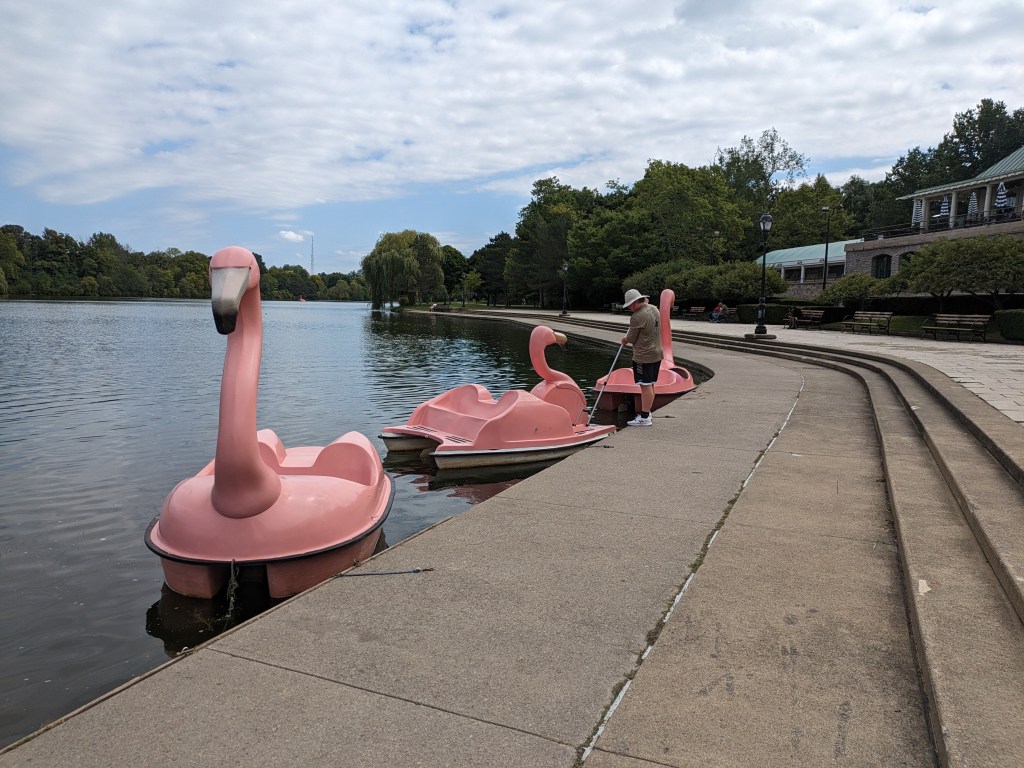
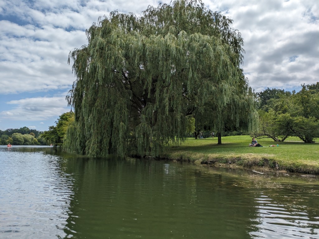
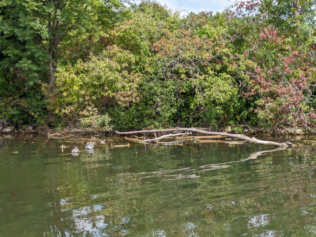
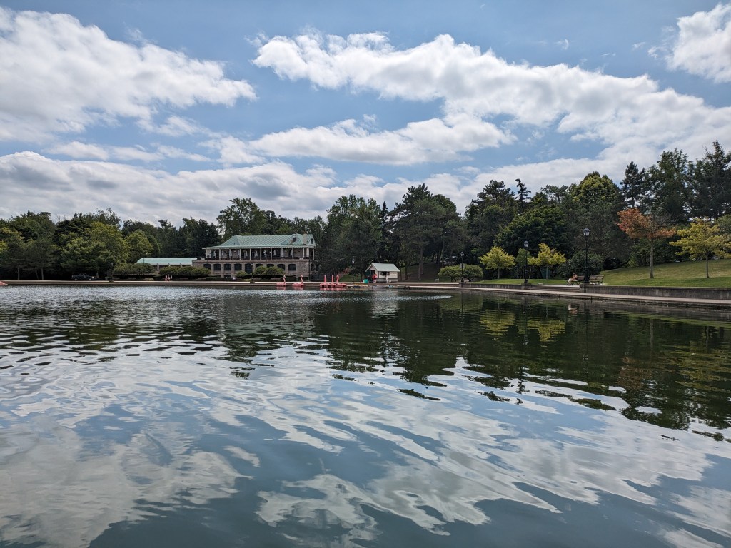
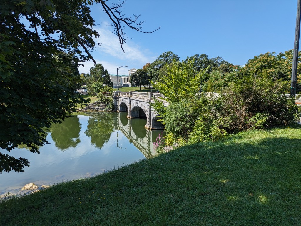
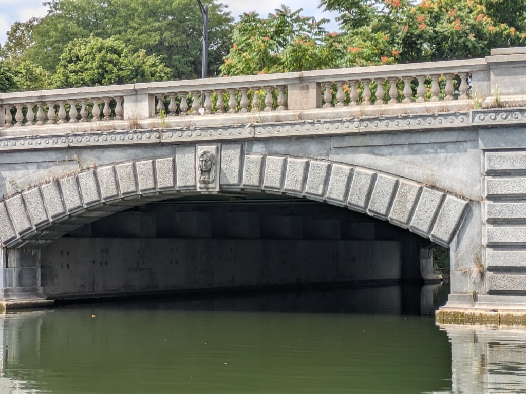
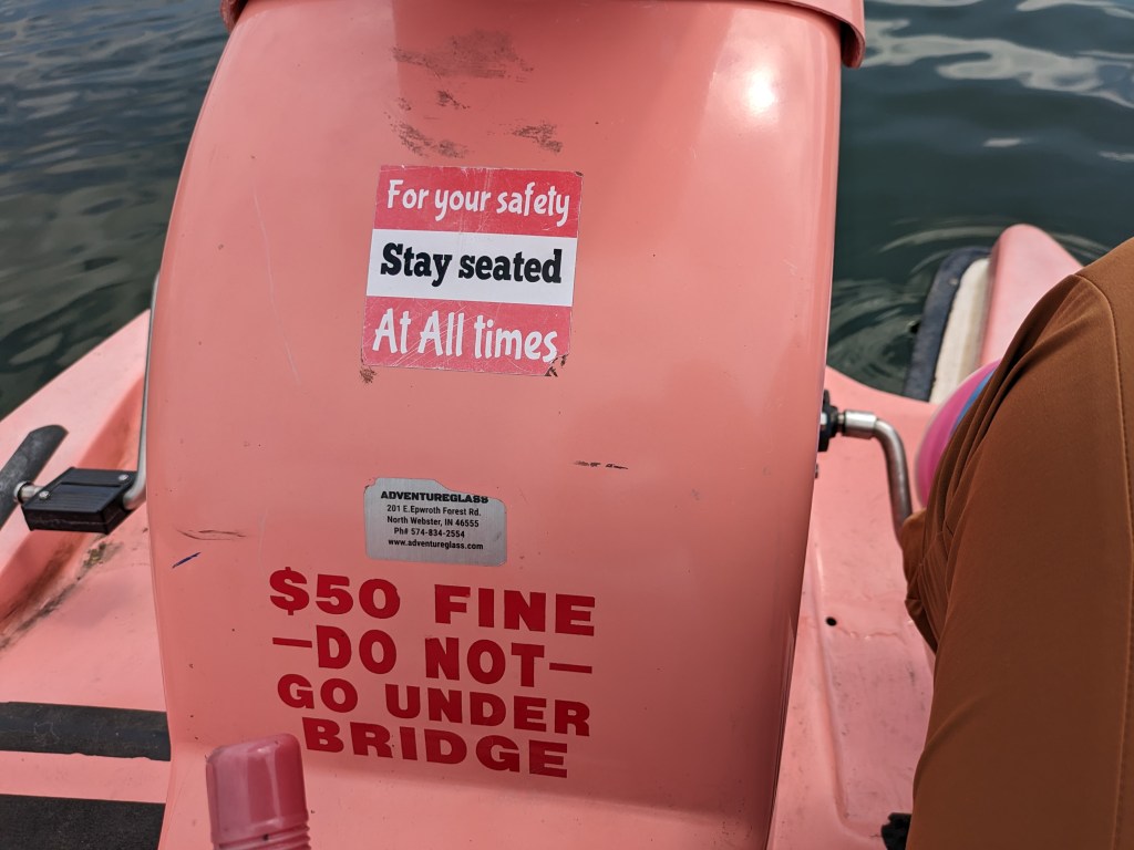
I took an enjoyable interlude in my wanderings in Buffalo’s Delaware Park that included getting the nice lake-eye views of the Lincoln Parkway Bridge I shared last month. I wonder if Frederick Law Olmsted ever imagined something like flamingo paddle boats as a potential use of the lake he designed. I don’t know if he would approve, but I had fun stepping out of the ordinary for a hour to view the lake and the park from the flamingo’s perspective. Below you can vicariously join me on the experience in a short video or in the sample of photos I took around the lake (including one with at least 4 turtles sunning themselves).
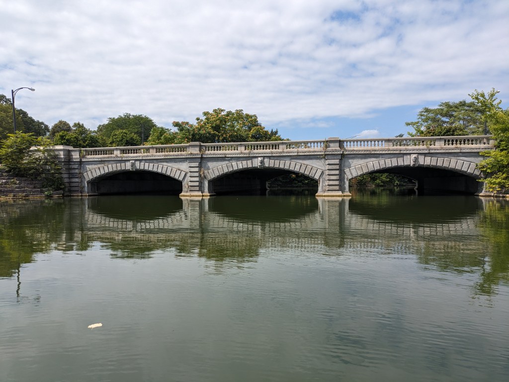
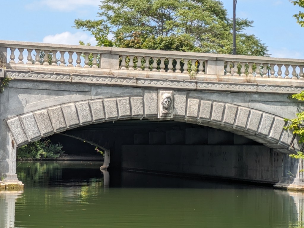
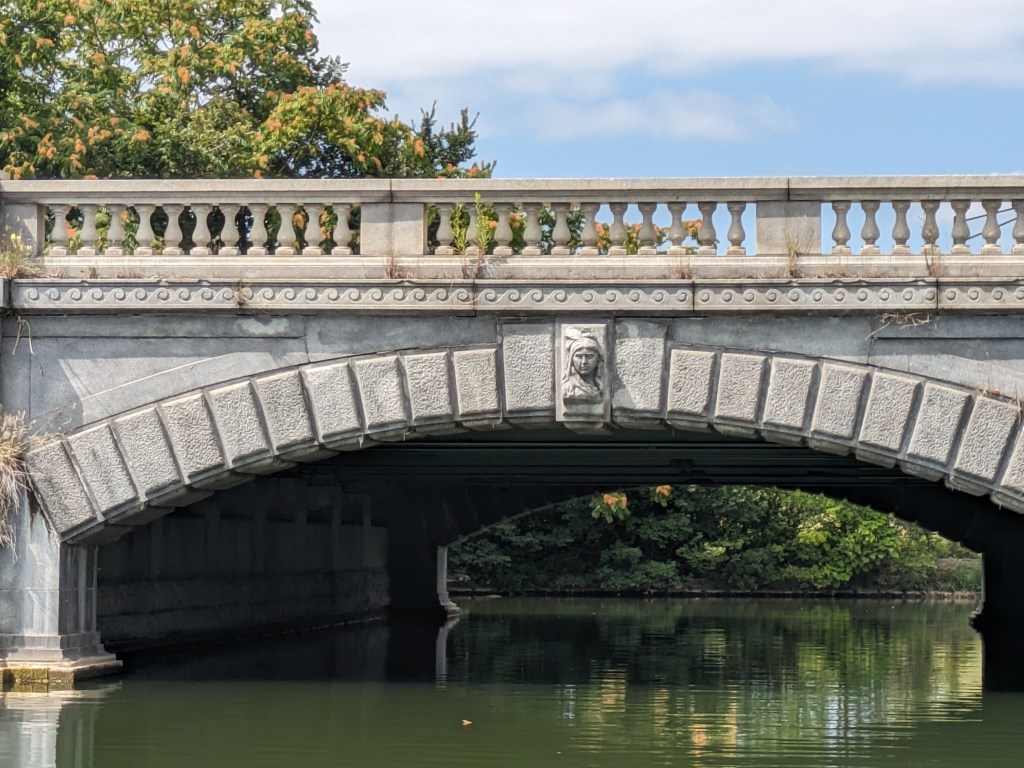
In my meanderings in Delaware Park as part of my exploration of World’s Fair sites, I walked over two interesting bridges: the Whirly-Twirly Bridge and the Lincoln Parkway Bridge. The Whirly-Twirly Bridge is the best named bridge of the 100+ bridges that I’ve encountered since I started walking bridges (even beating out the Big Dam Bridge). It also provides one of the few pedestrian links across the Scajaquada Expressway which divides Delaware Park. The Lincoln Parkway Bridge was built in 1900, perhaps as part of the 1901 Pan-American World’s Fair. If so, the story of this bridge gets drowned out in the attention paid to the temporary Triumphal Bridge with its massive pylons that lasted only as long as the fair. From my observation, the Lincoln Parkway Bridge is a nice, modest scale, stone arch bridge that acknowledges the indigenous people of the area in its sculpture. I was able to get a nice lake-eye view of these sculptures from a rented paddle boat that sadly included a prohibition on paddling underneath the bridge.