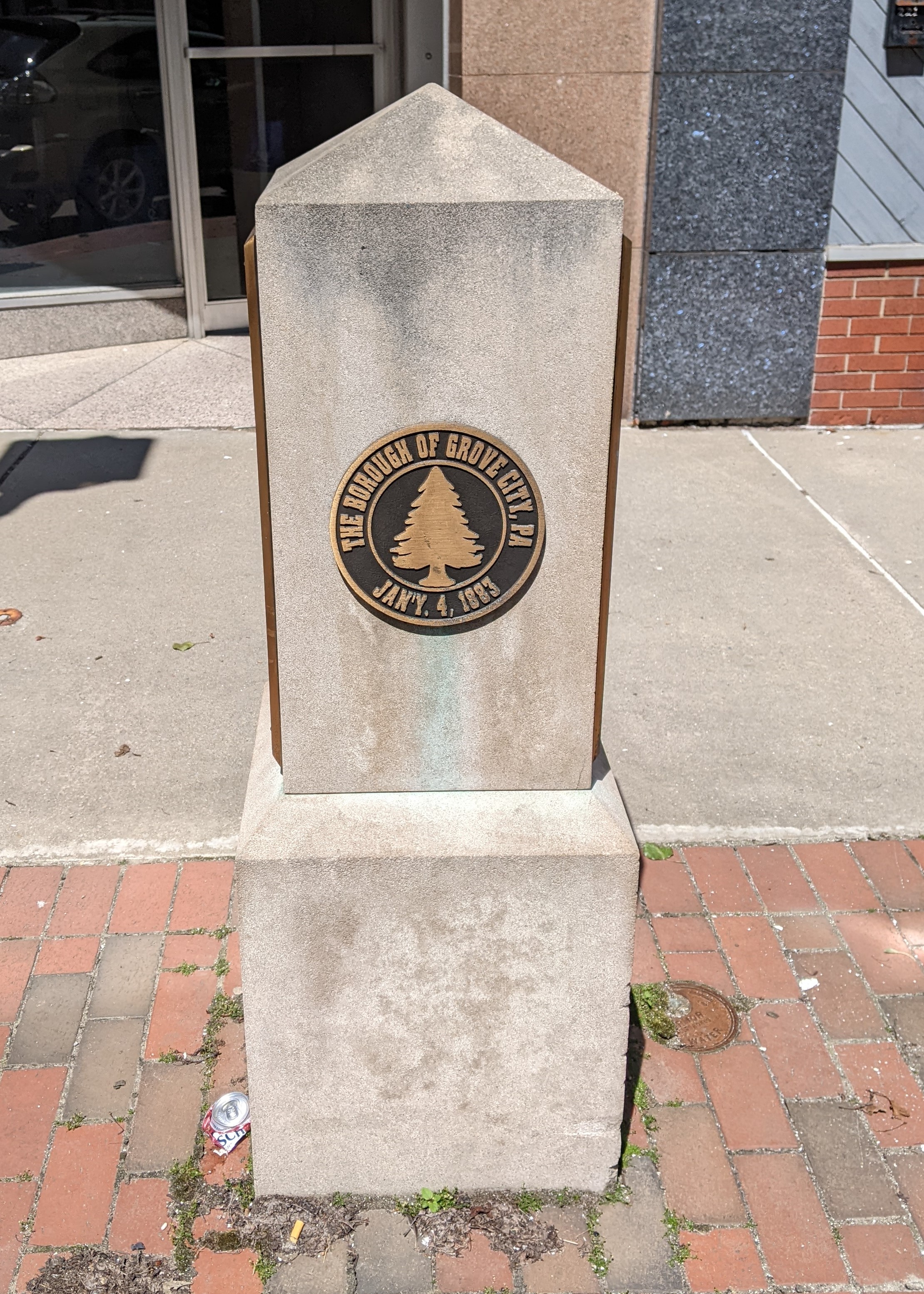
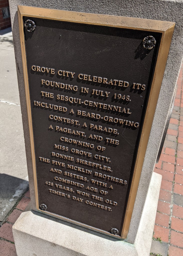
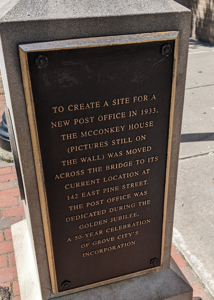
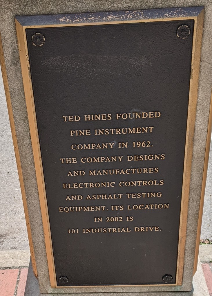
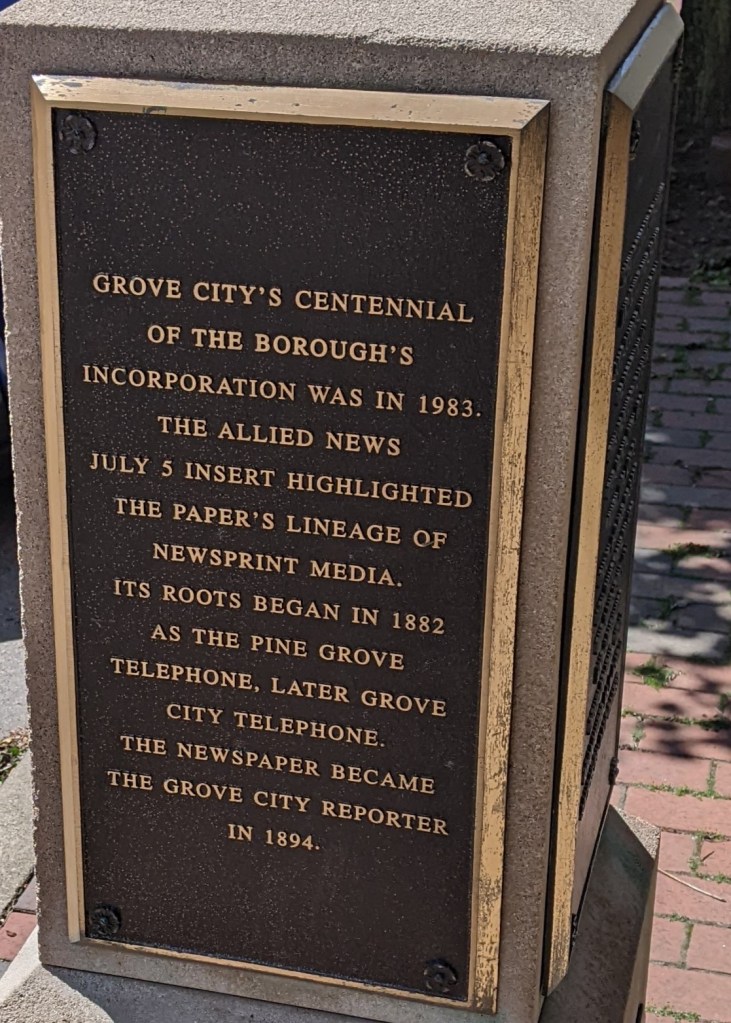
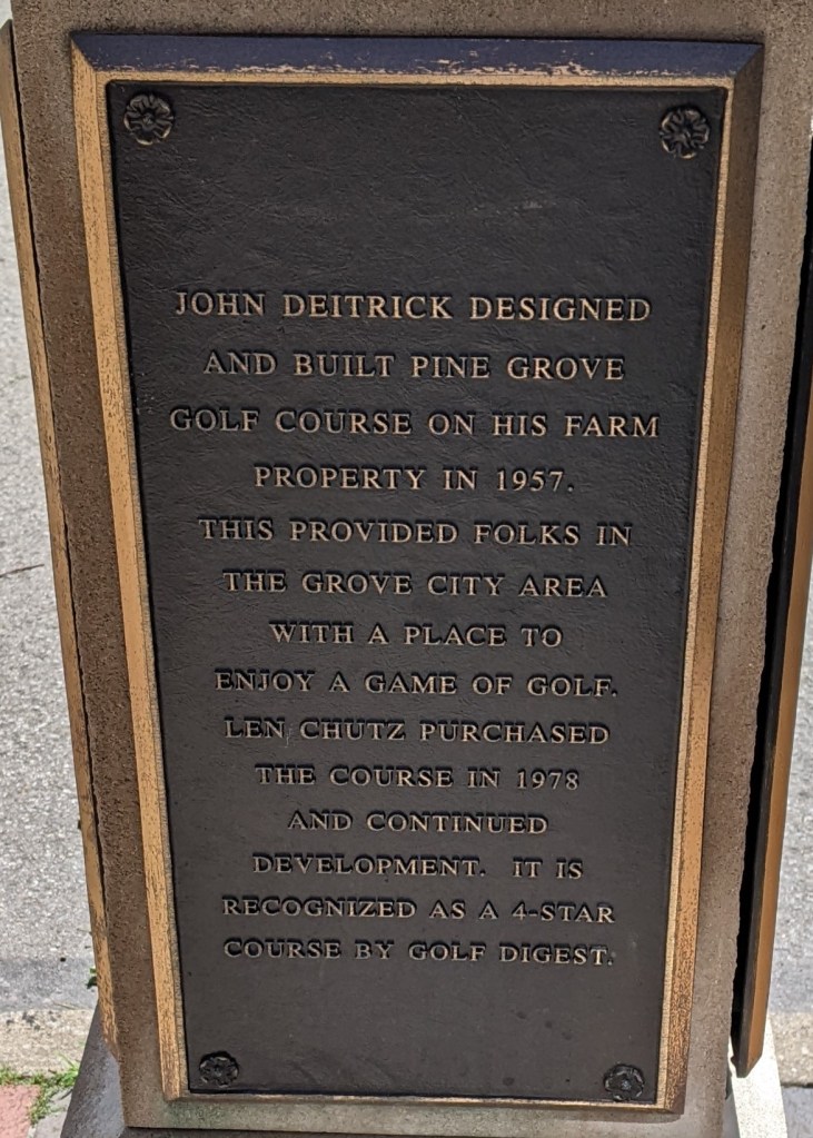
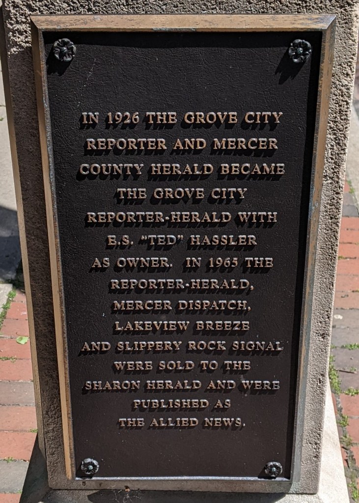
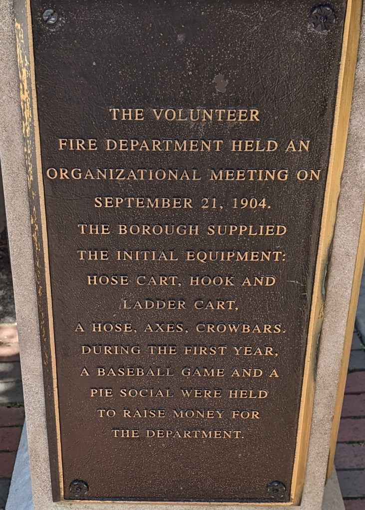
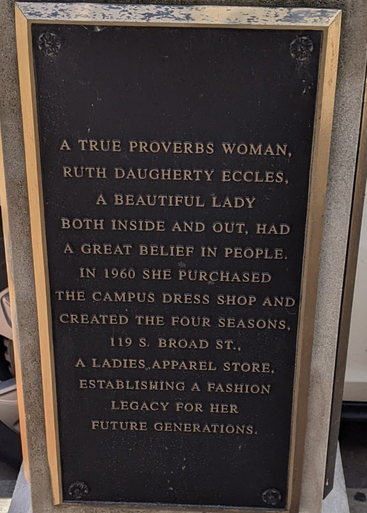
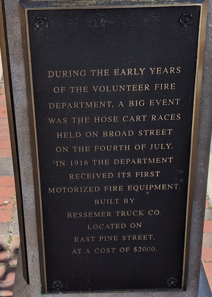
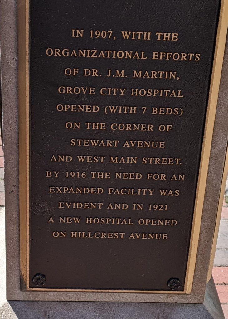
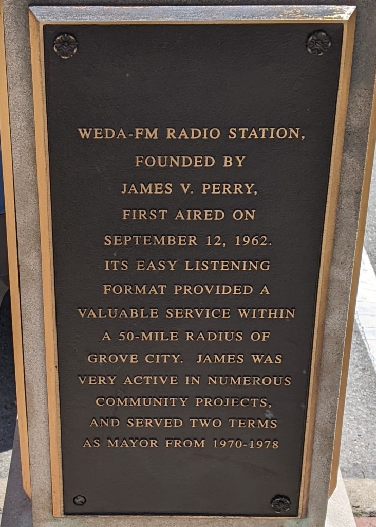
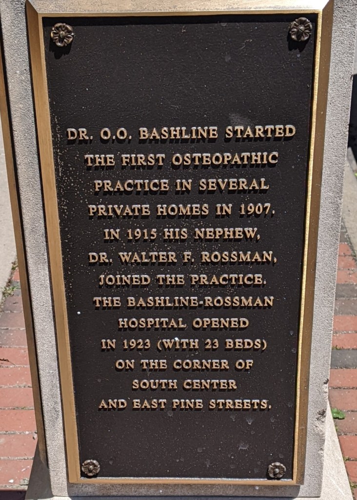
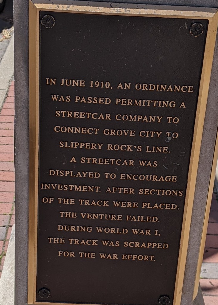
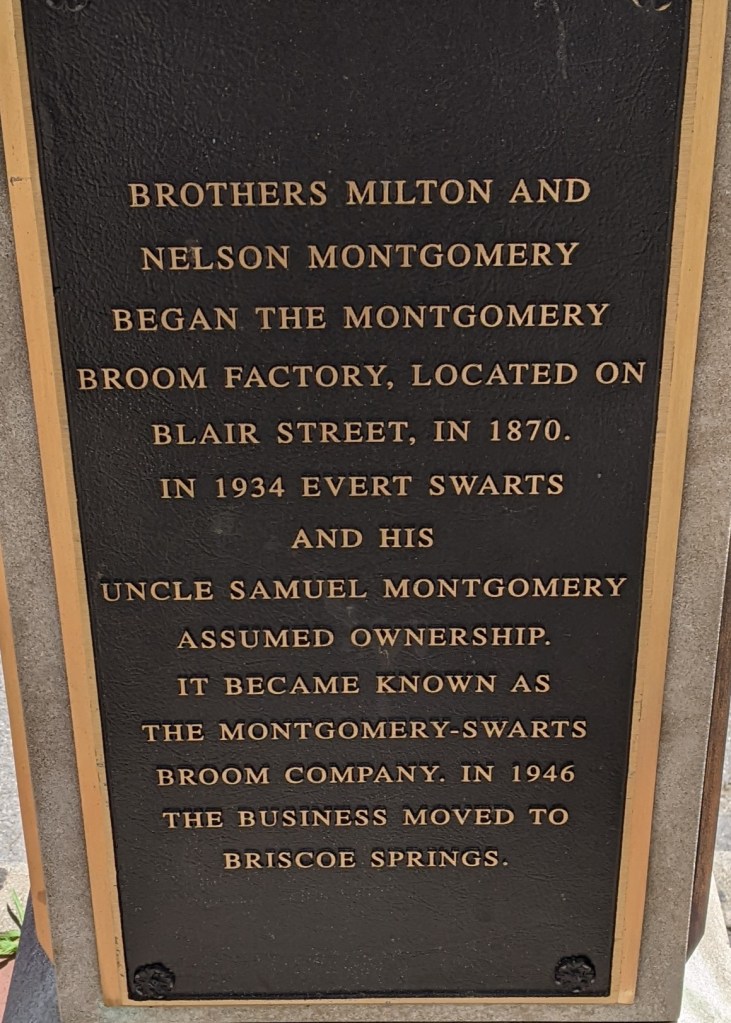
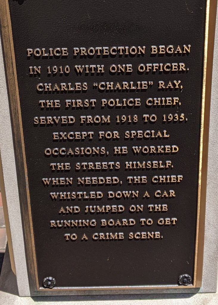
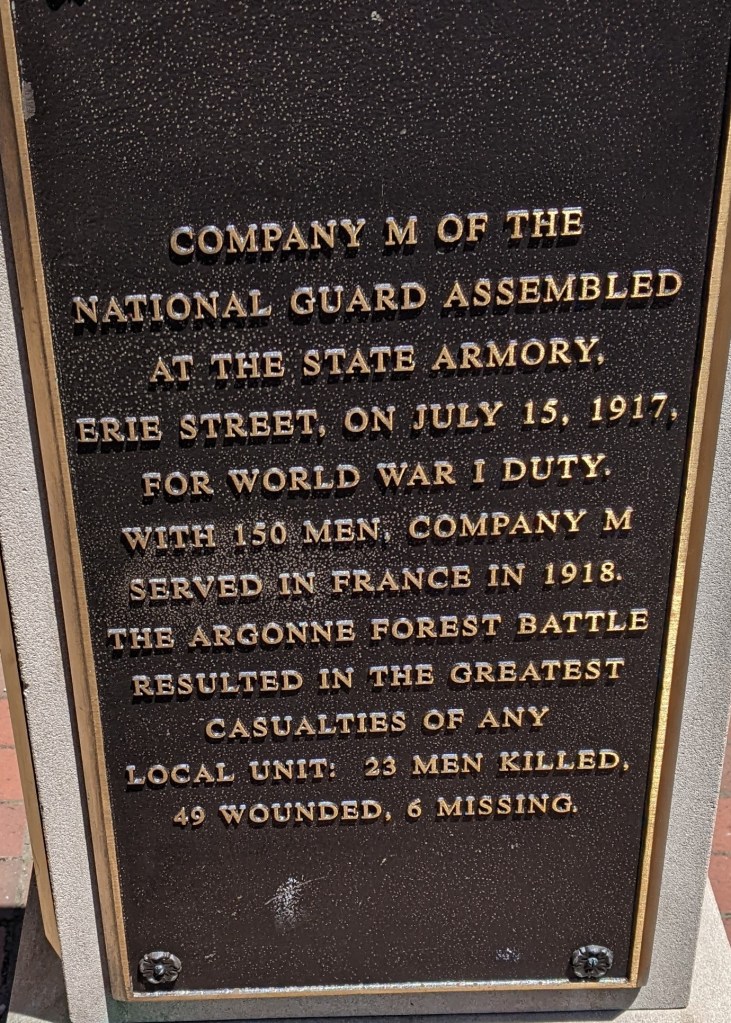
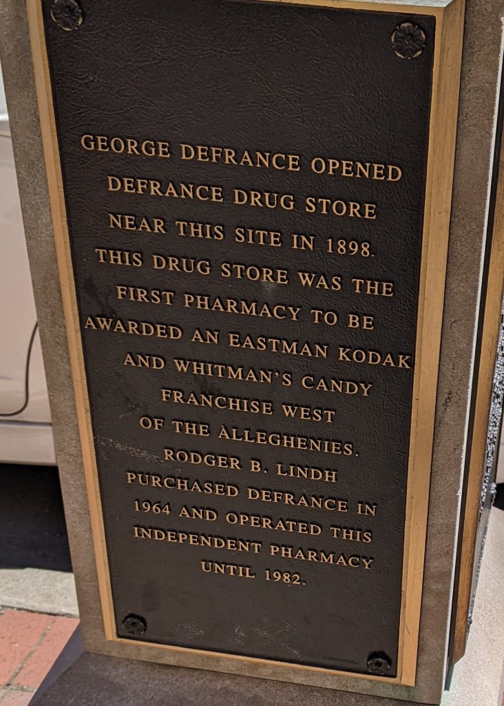
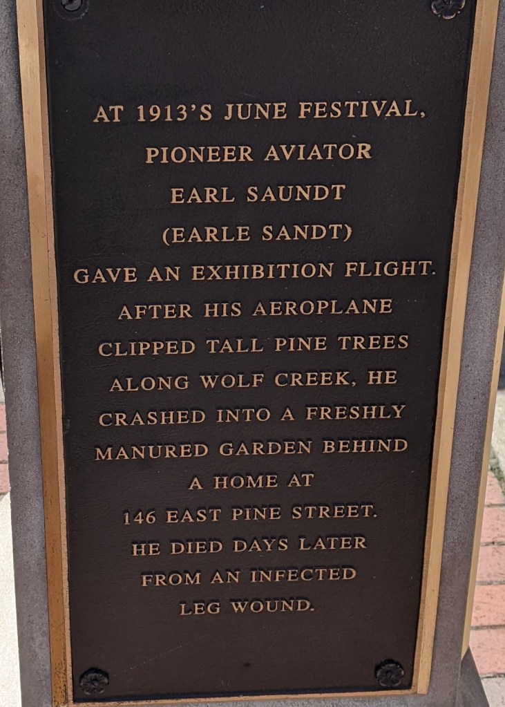
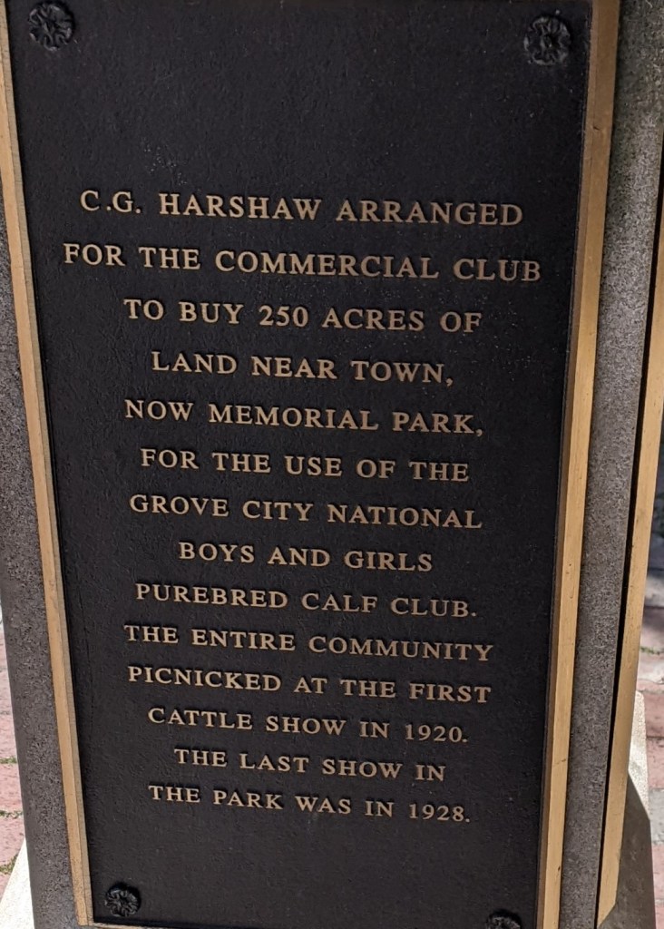
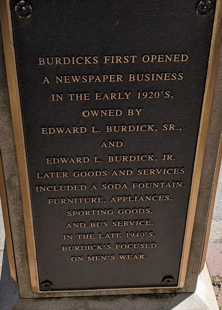
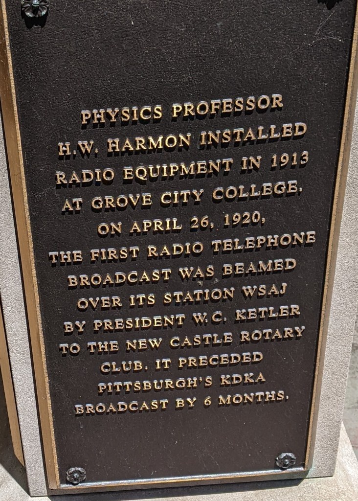
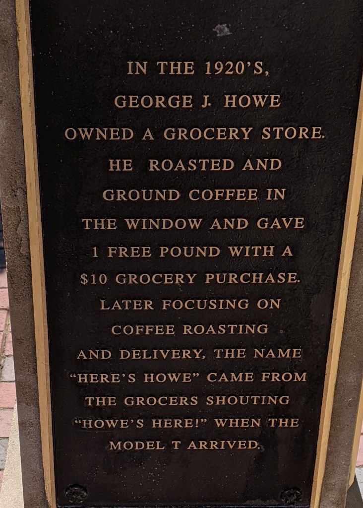
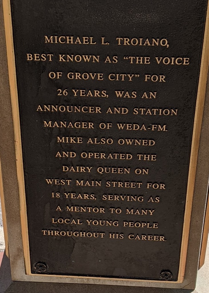
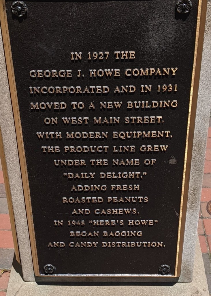
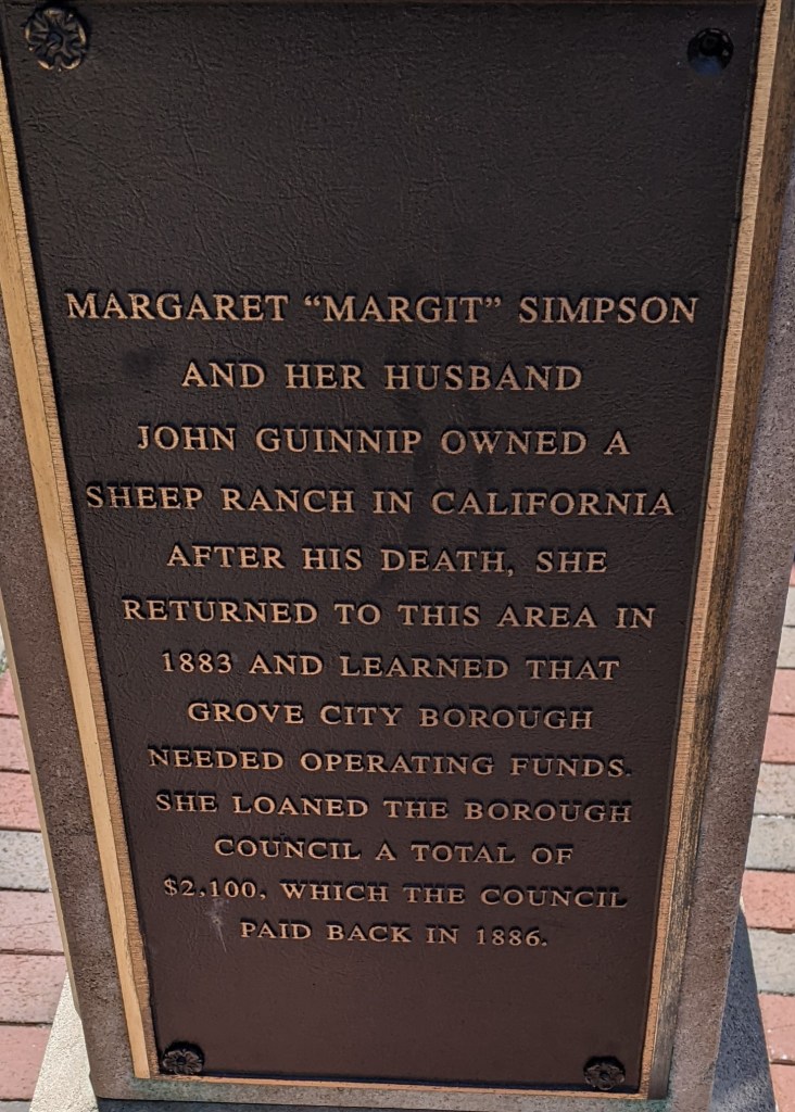
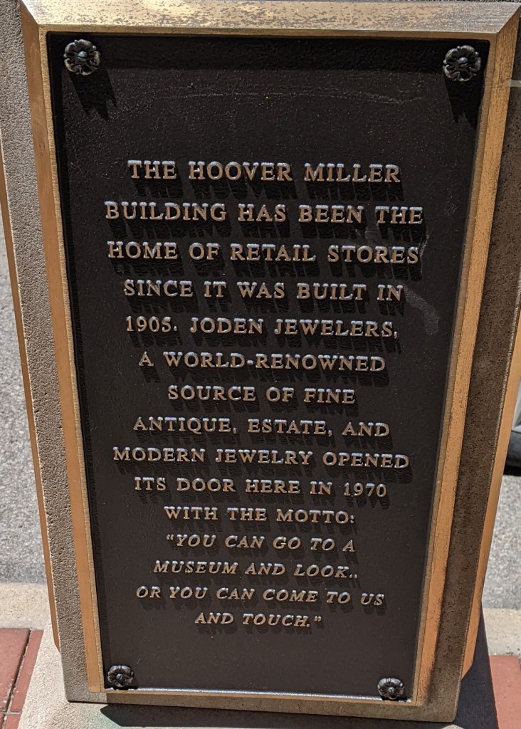
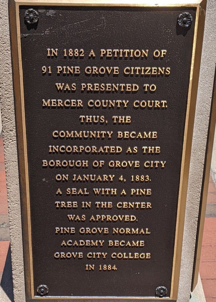
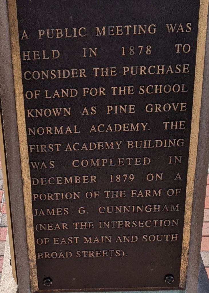
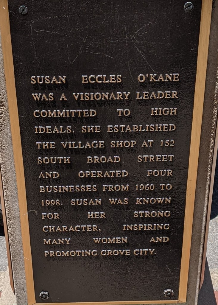
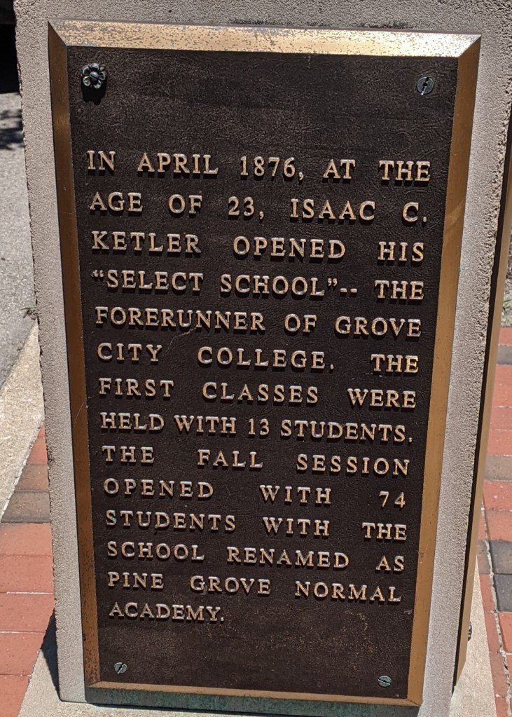
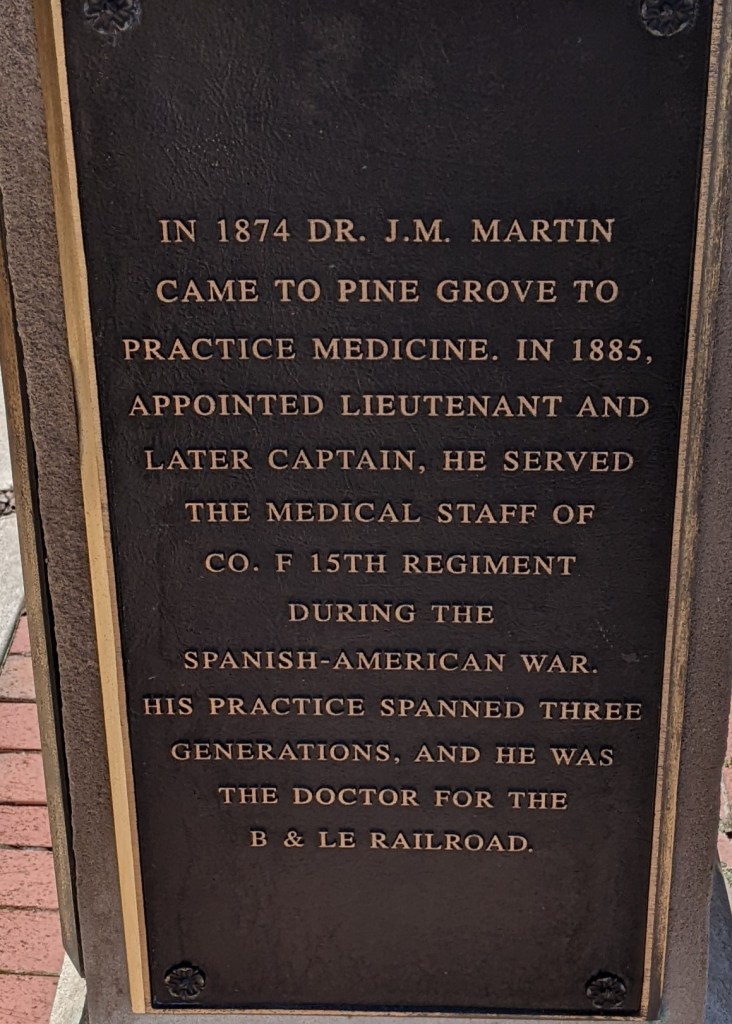
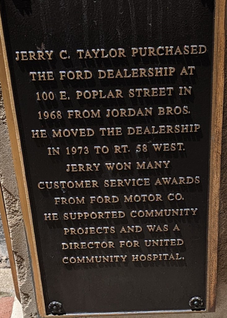
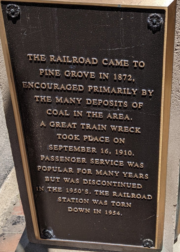
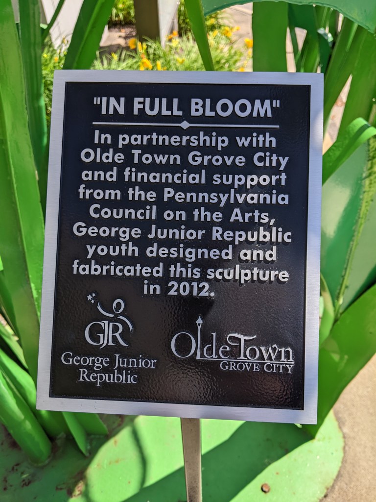
I didn’t have to go far to learn more about Grove City to flesh out the observations I made while walking the bridges. The Borough helpfully installed history markers along the historic business core of South Broad Street. I photographed 33 of the plaques, which I think is all, for anyone interested in virtually visiting these history markers. Of course, these could also be used in the debate over art vs. sign as they also fall into the nuanced mess of the grey area.
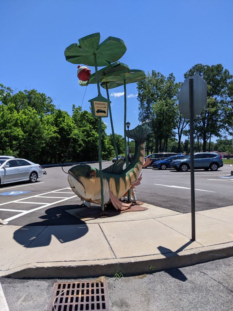
My day job for the last decade is working with zoning ordinances. *Yawn,* right? Except I find it surprisingly intriguing. For example, when I visited Grove City in 2022, I was in the middle of writing new model sign regulations for zoning. The puzzle pieces for this effort included incorporating Supreme Court rulings on the constitutionality of sign regulations and making the regulations easier to understand and follow.1 So signs were already on my mind when I encountered Grove City’s parking sculptures and my brain exploded.
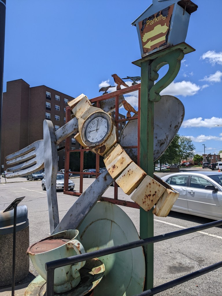
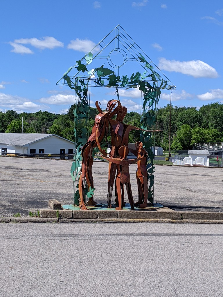
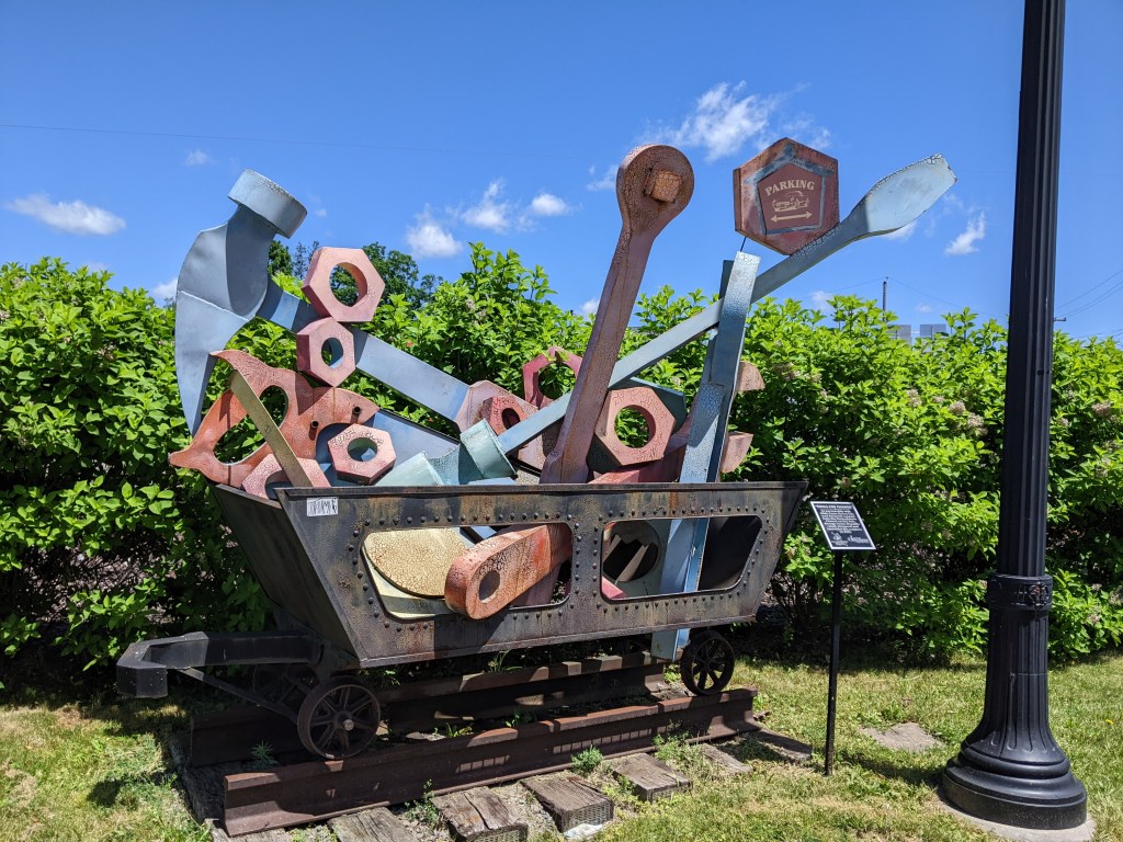
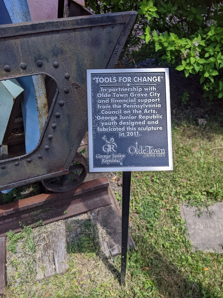
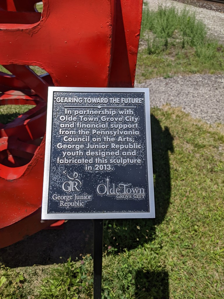
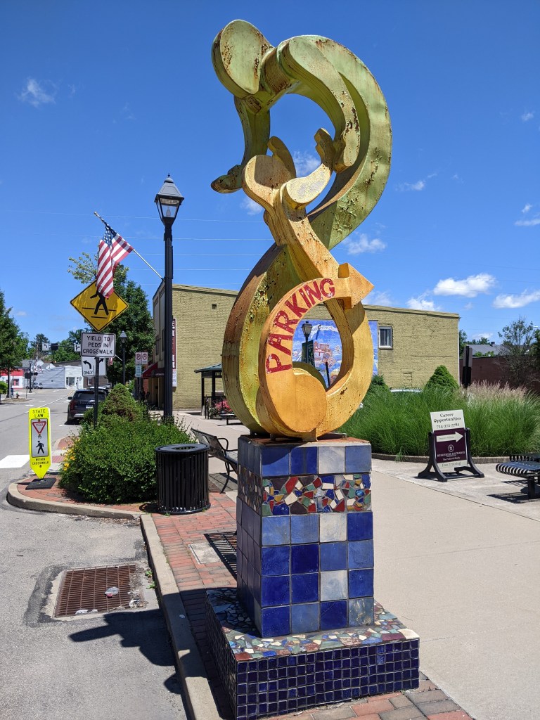
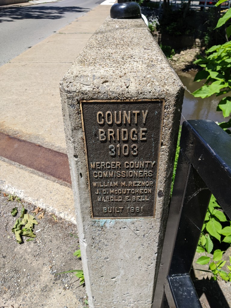
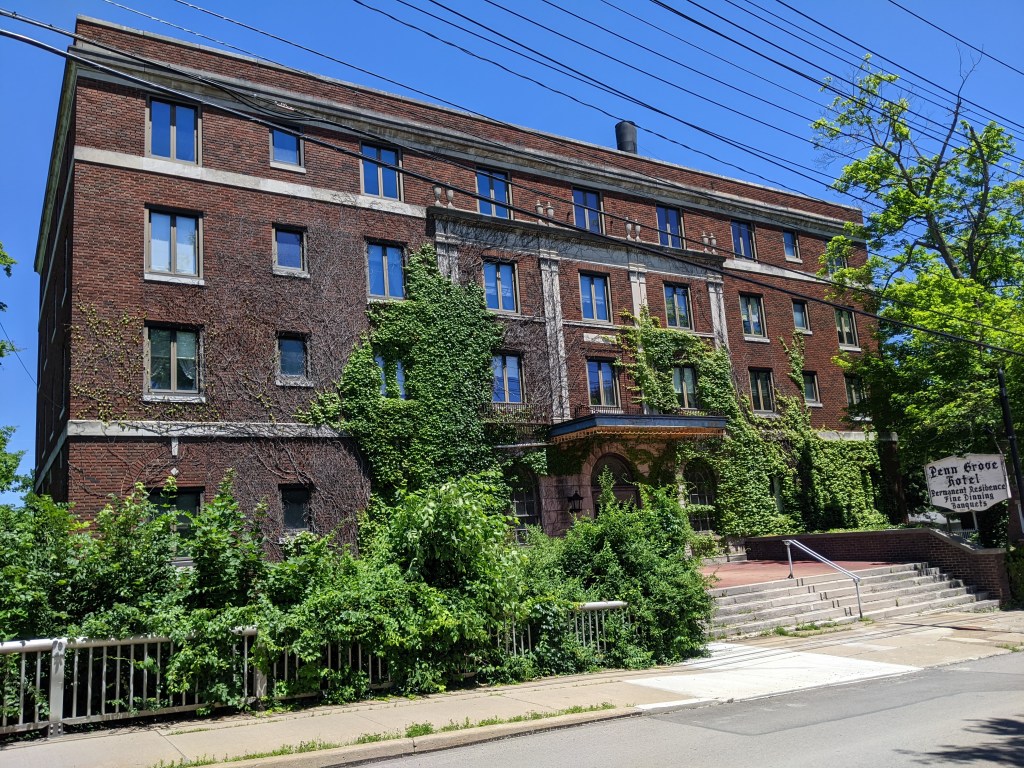
Besides the century-old battle between planners and billboard companies, the most difficult thing about sign regulations is the definition of sign. Art cannot be regulated by zoning, but signs can. However, there is a lot of grey between art and sign. Grove City exemplifies that grey area.
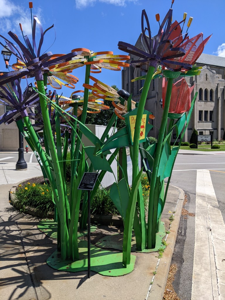
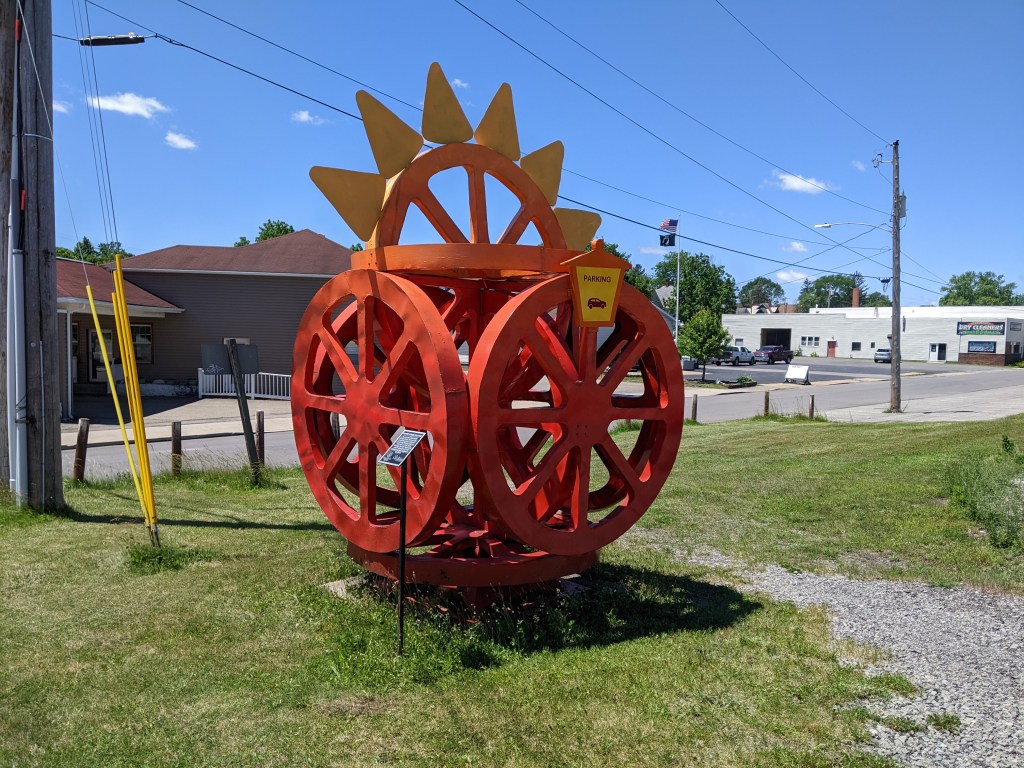
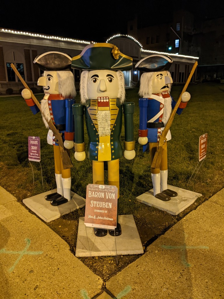
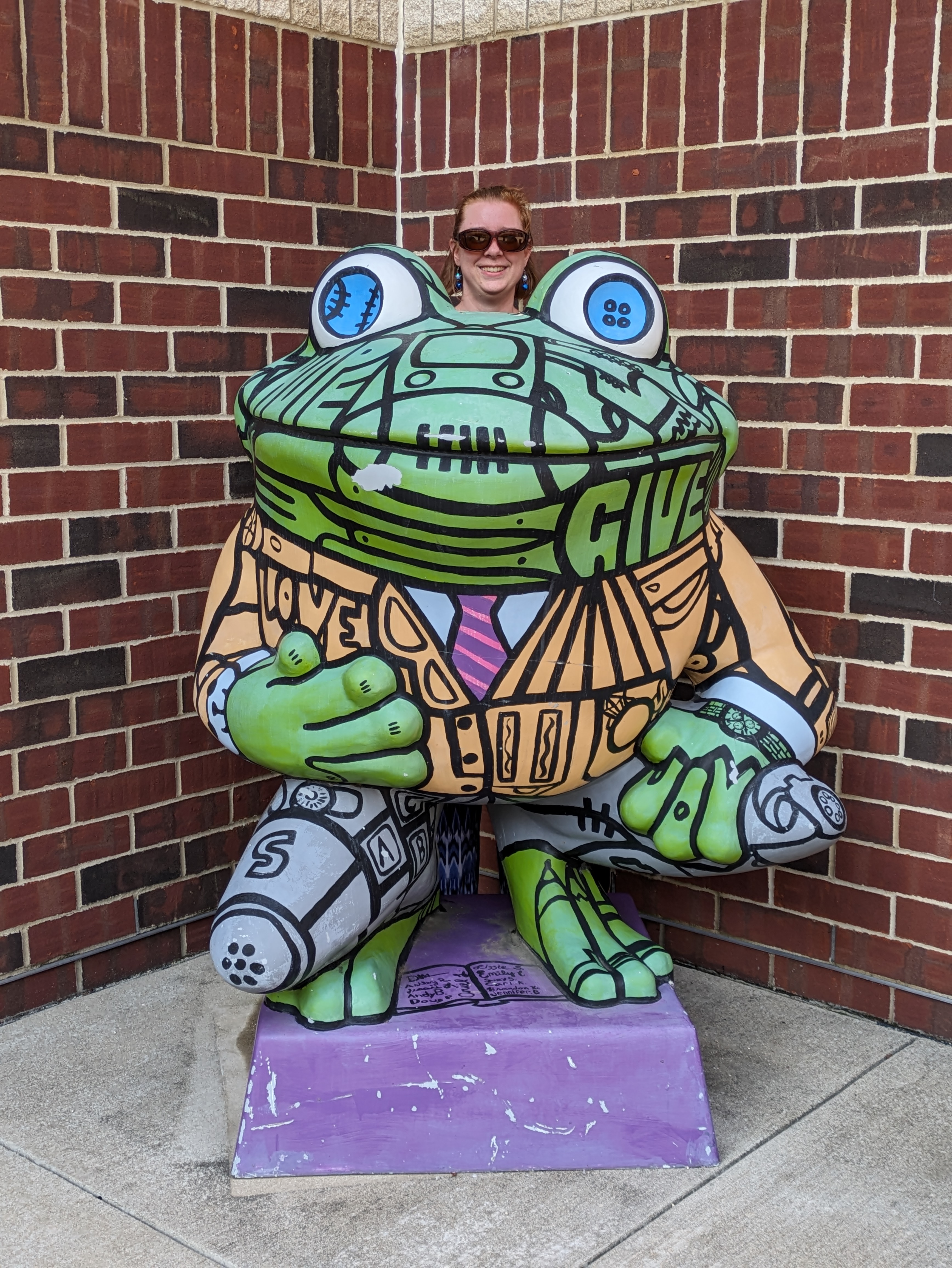
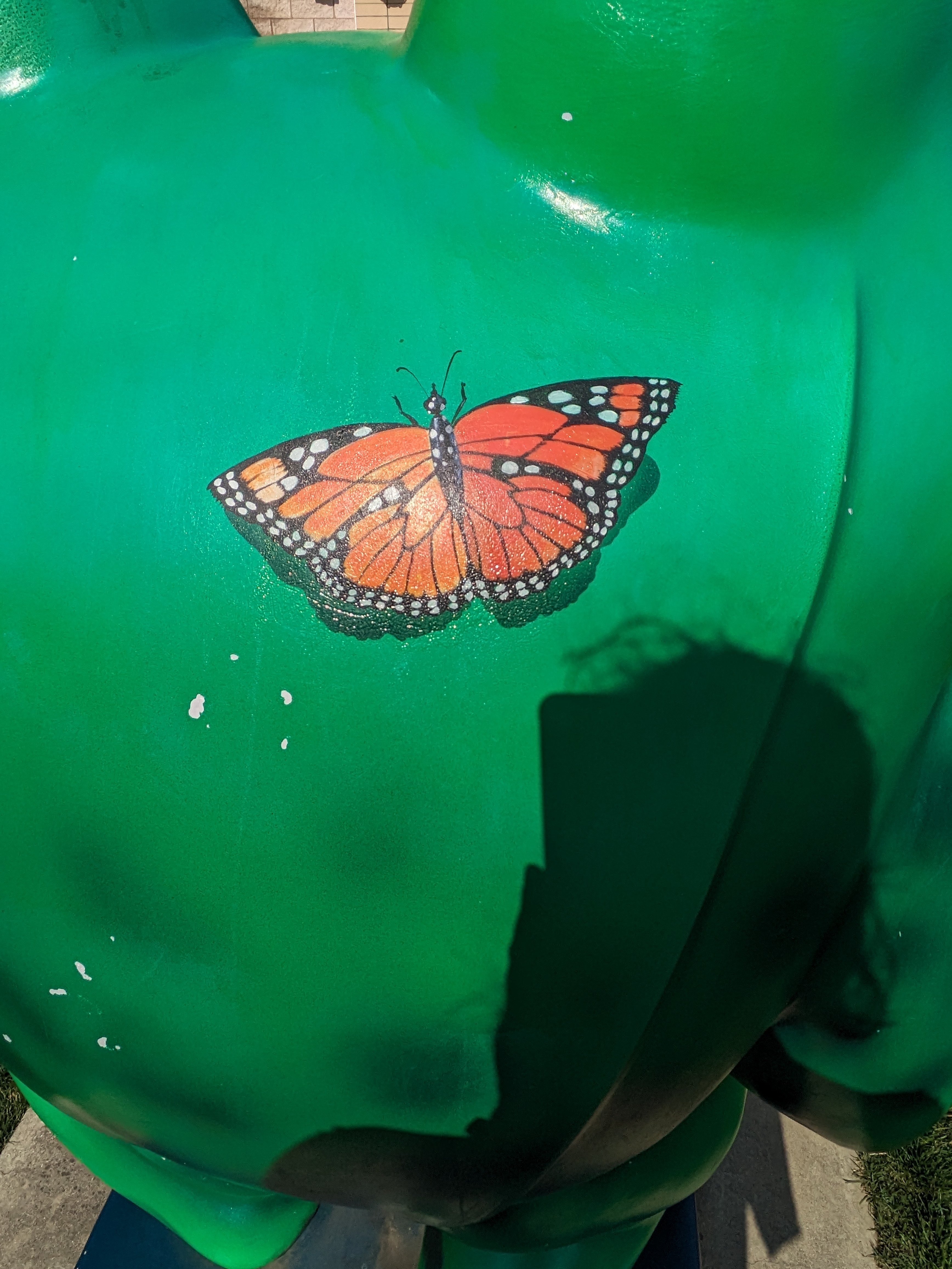
Grove City has a series of outdoor sculptures that incorporate directional signage for public parking areas. Based on a strict interpretation of Pittsburgh’s definition of sign (which interpretation frequently got me into arguments with my boss when I was zoning staff for Pittsburgh), the minute any component of a piece of artwork contains a sign, the whole piece of art becomes a sign (see Pittsburgh’s Zoning Ordinance Section 919.01.C.1). The phrase “or any structure designed to carry the above visual information” supports my interpretation that Grove City’s parking sculptures would not be permitted in Pittsburgh because they would not comply with the sign regulations.
Fortunately, Grove City’s zoning ordinance measures a sign only on the “separate individual letters, words, or graphic elements on the background” (see Grove City Zoning Ordinance Section 702, page 72 of 84 in the PDF). As the structure doesn’t count in the calculation of sign area in Grove City, I can now understand how parking sign sculptures could be created without violating their own ordinance.
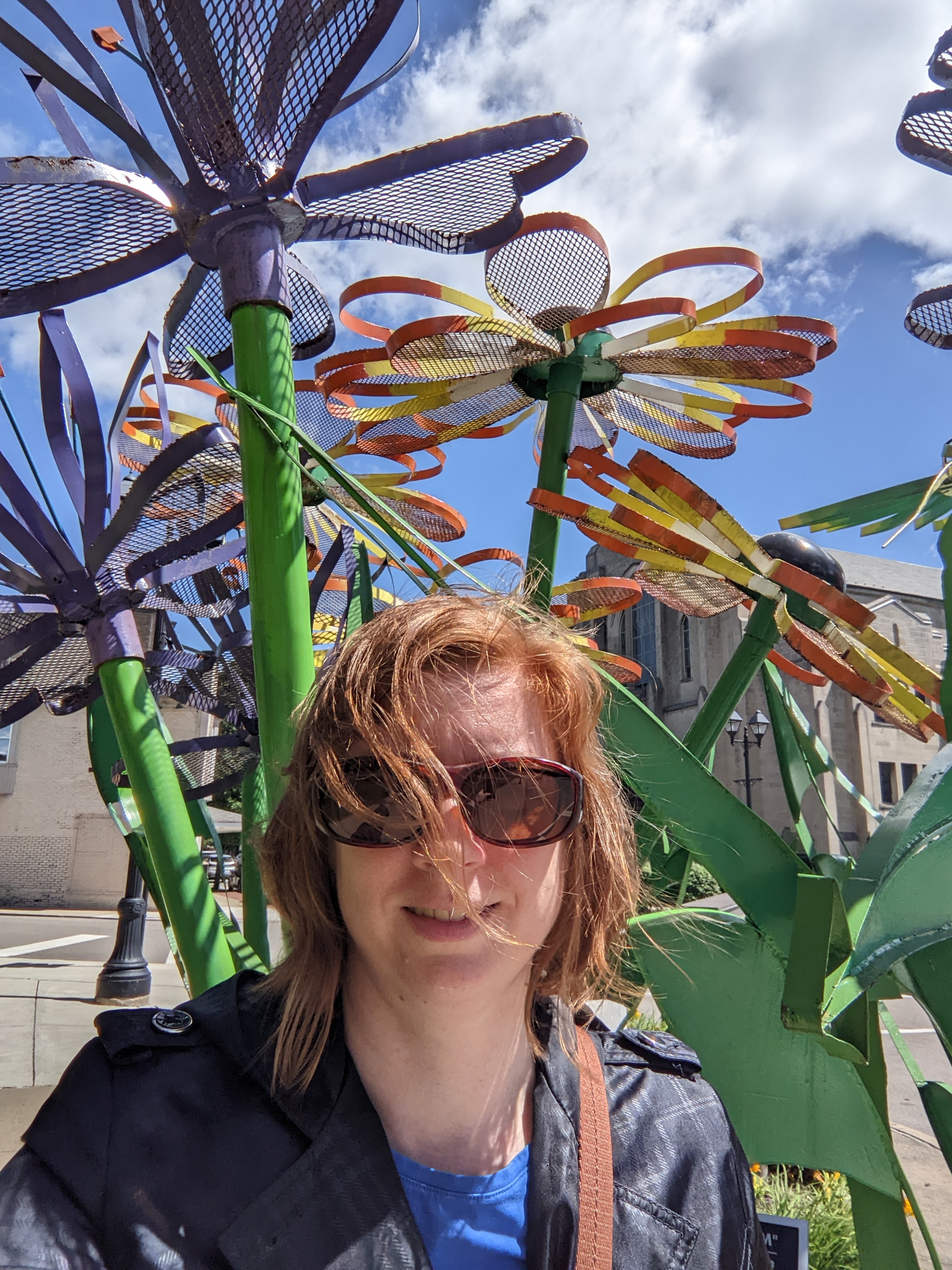
If you are a frequent visitor to urbantraipsing, you know I don’t typically take selfies. However, I did with the first parking sculpture I encountered in Grove City to provide a sense of scale. These are substantial structures. I am standing in the selfie…and, for those who don’t know me in person, I am 6 feet tall.
I succeeded in creating a model ordinance that balanced brevity with thoroughness and usability with constitutionality. Economy, PA, (Chapter 180, Article XIV) and McCandless, PA, (Article 1305) are two of the municipalities that have adopted this ordinance to their specific needs. ↩︎
I bought my first car in 2021. It ended up having a lot of problems. The first time I tried to drive to Erie, it started shaking like it was going to spontaneously break apart into a million pieces, just like a cartoon. Instead, it went into limp home mode and I turned around at the next exit, which was the middle of nowhere. After several repairs and a period of no further incidents, the following year I was ready to try again. But first, I tested the car to see if it could handle Rt. 79.
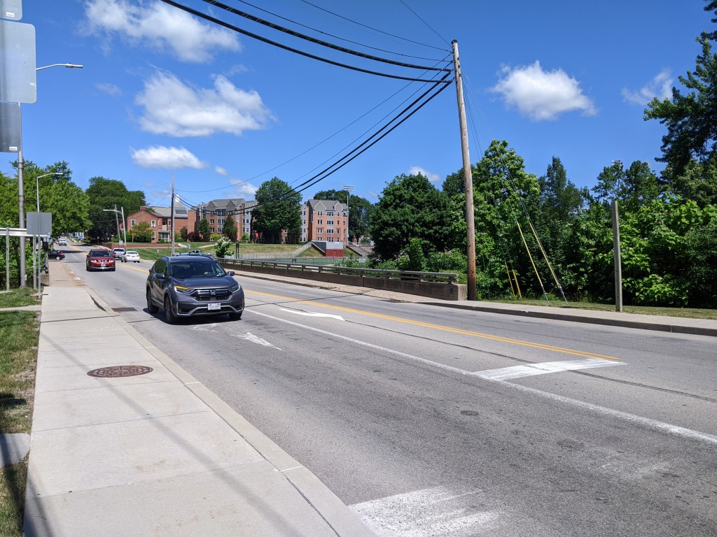
I knew of Grove City as an exit about halfway to Erie and as the closest outlet mall to Pittsburgh. I decided to aim for the actual Borough of Grove City1 as a destination to explore while testing my car’s ability to handle the speed limit and hills of Rt. 79. Naturally, since I arrived safely and knew nothing about the town, I set out to walk the bridges.
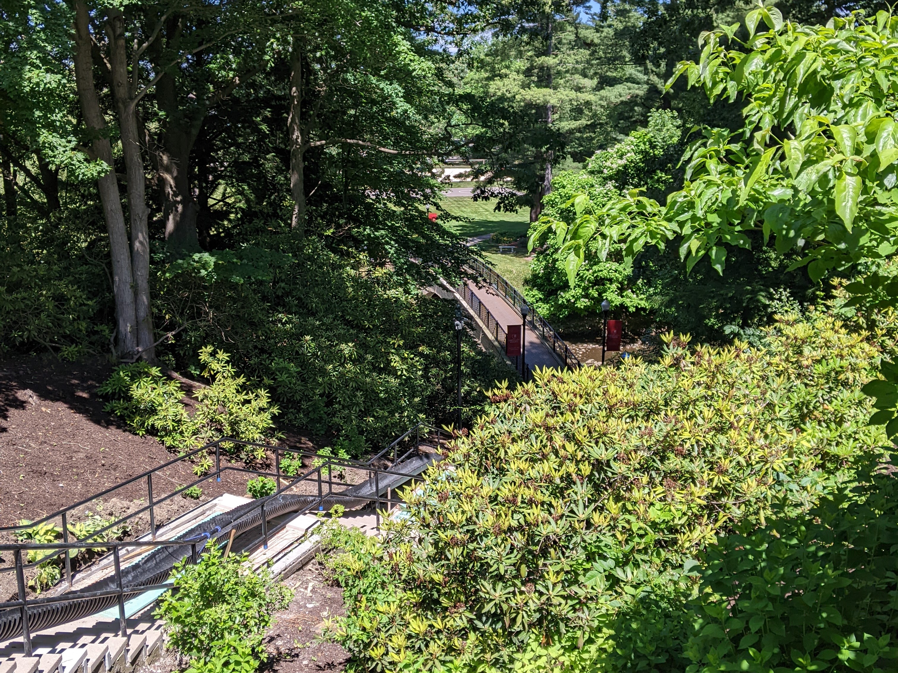
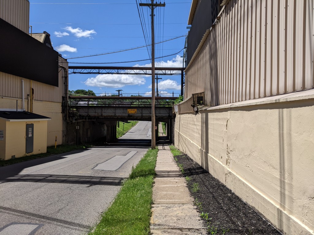
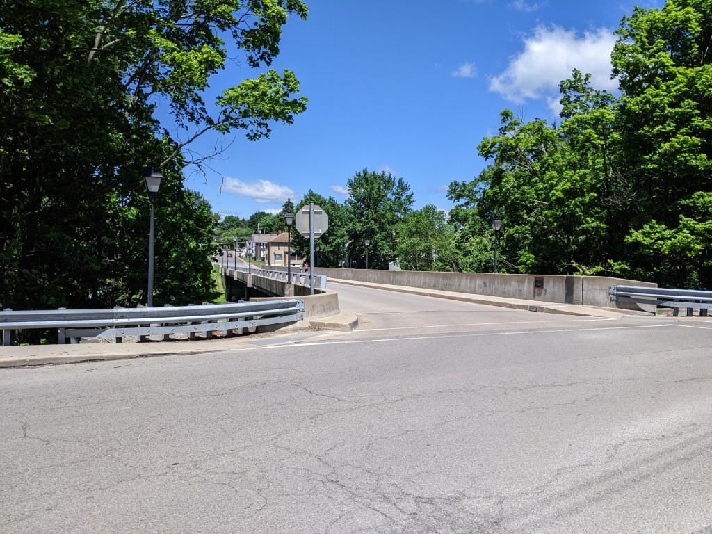
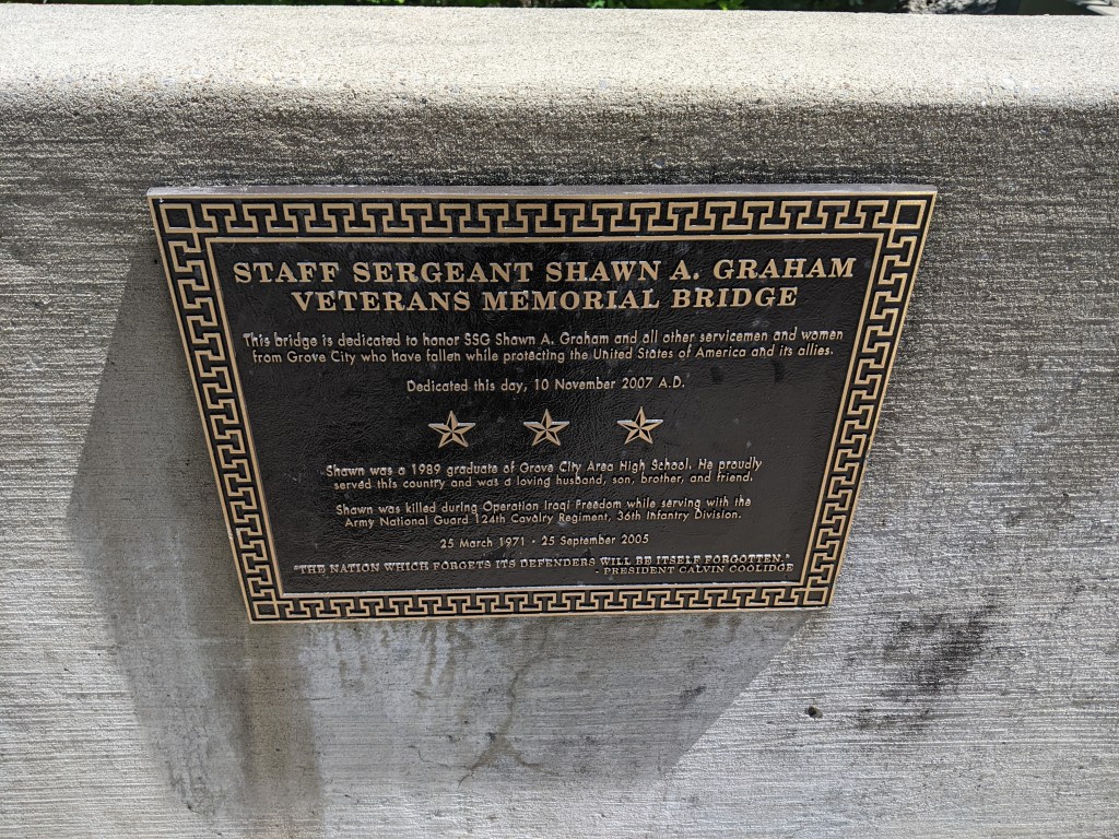
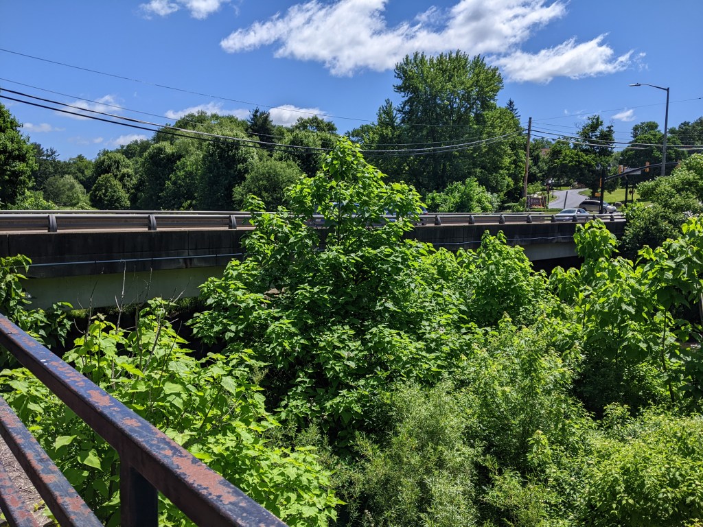
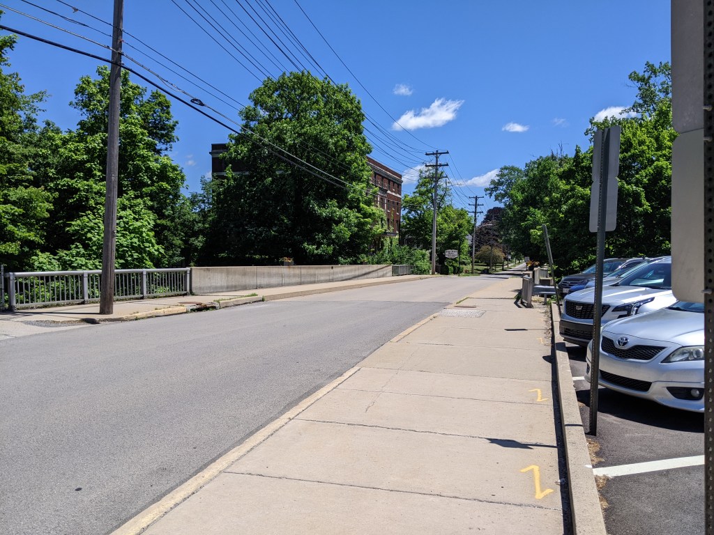
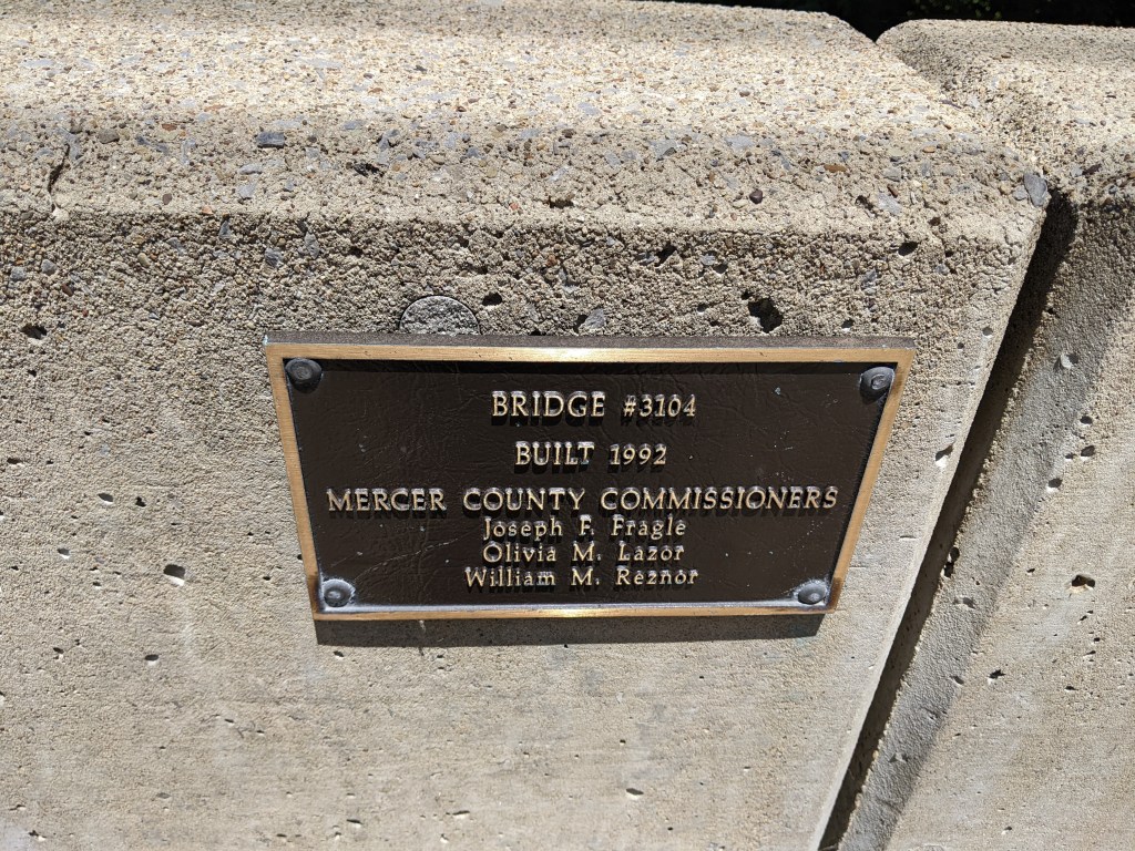
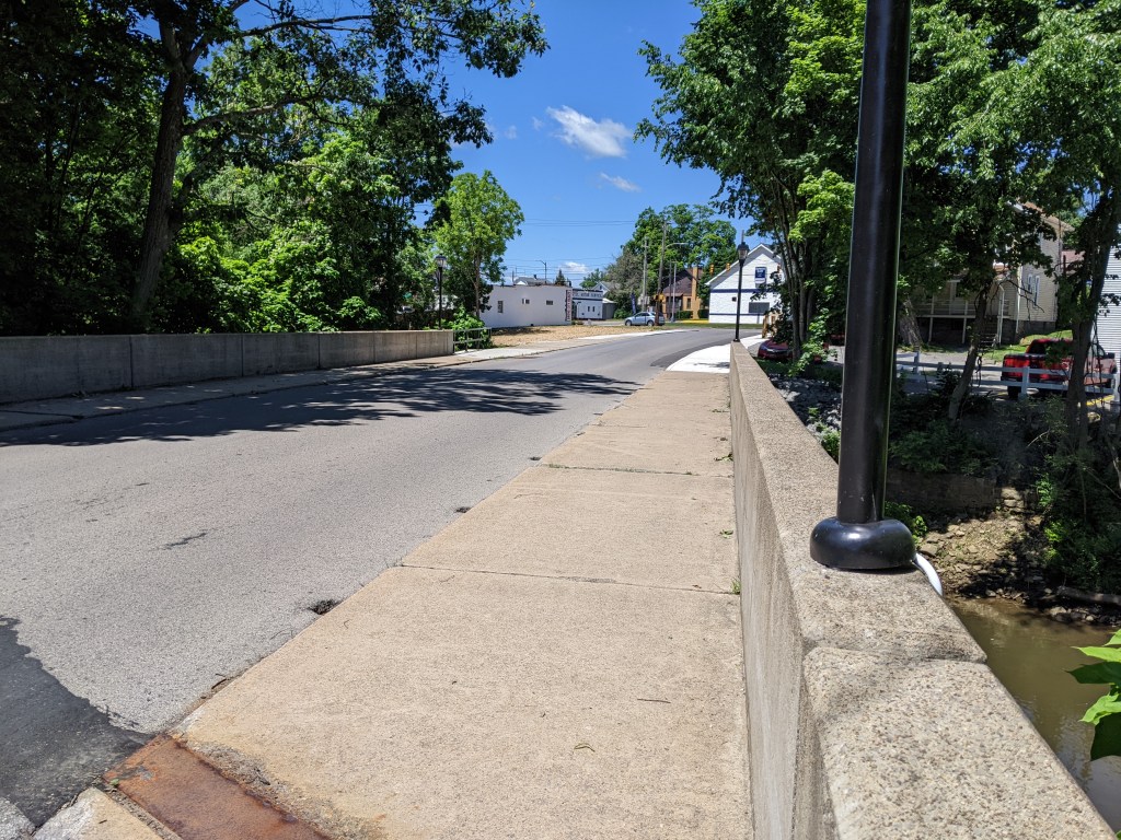
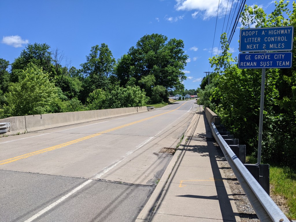
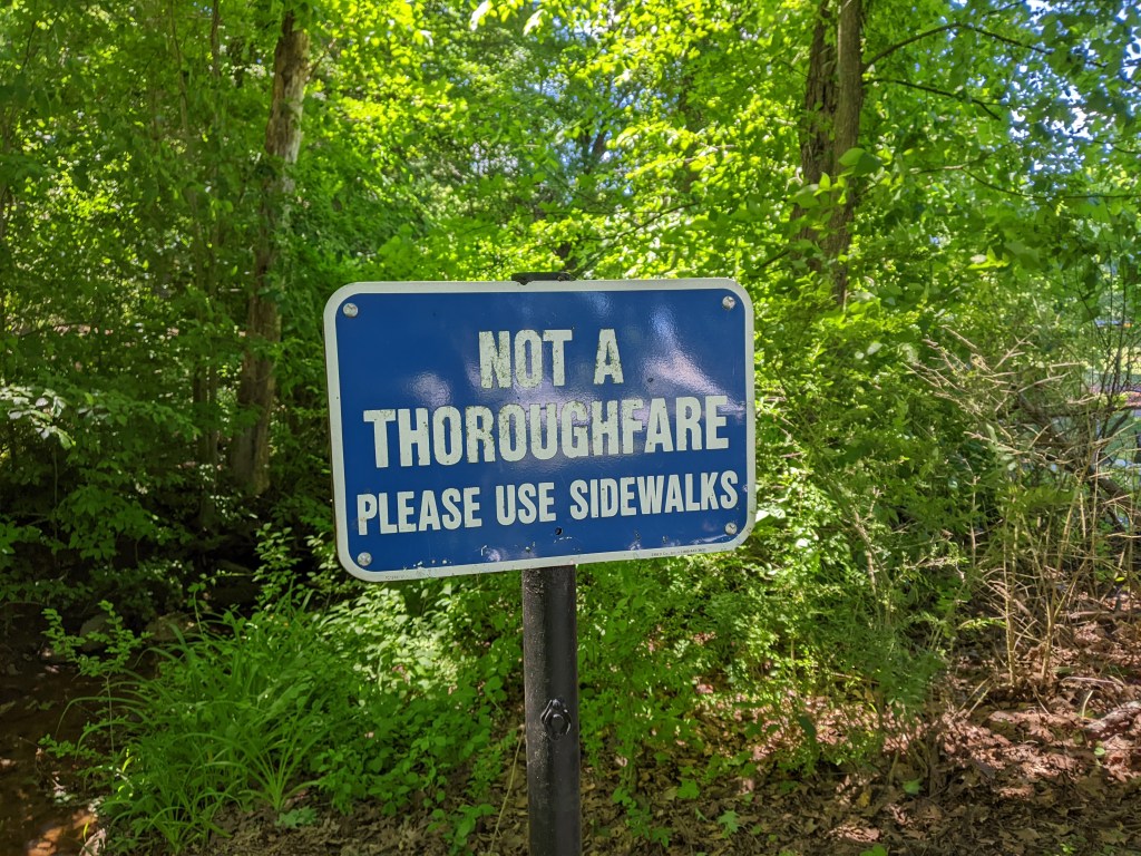
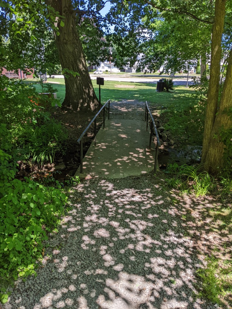
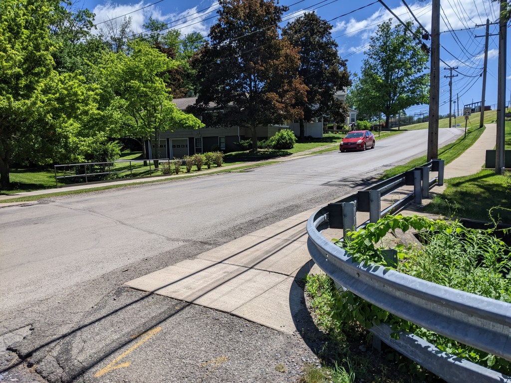
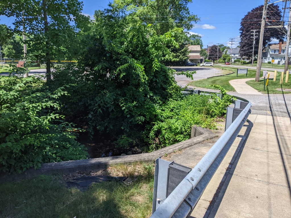
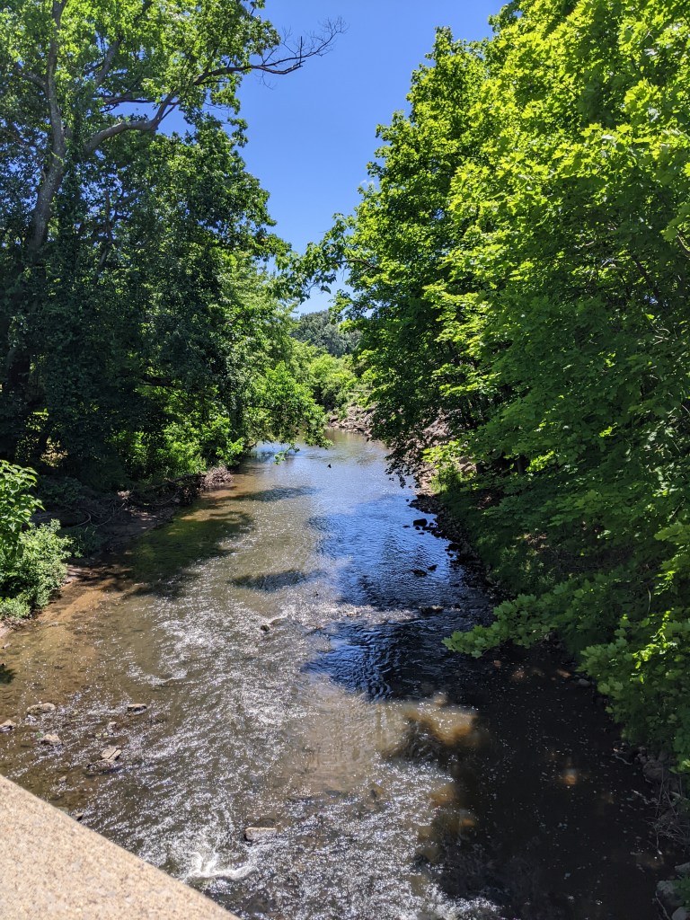
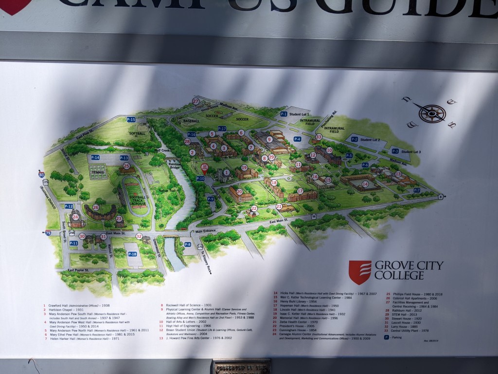
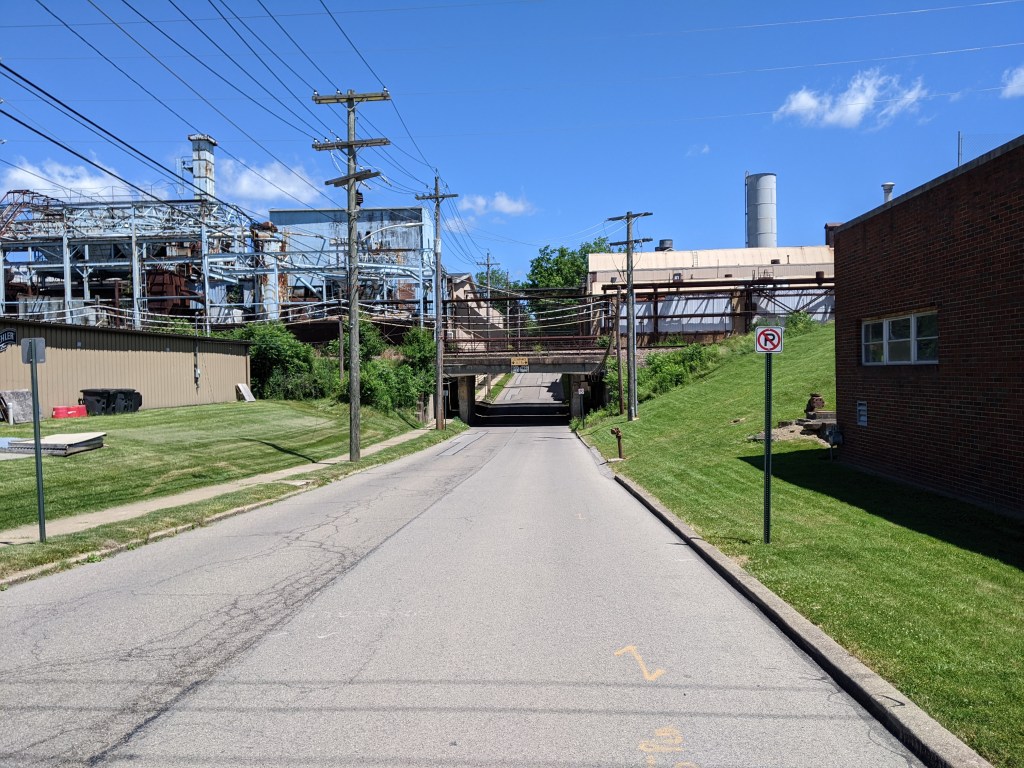
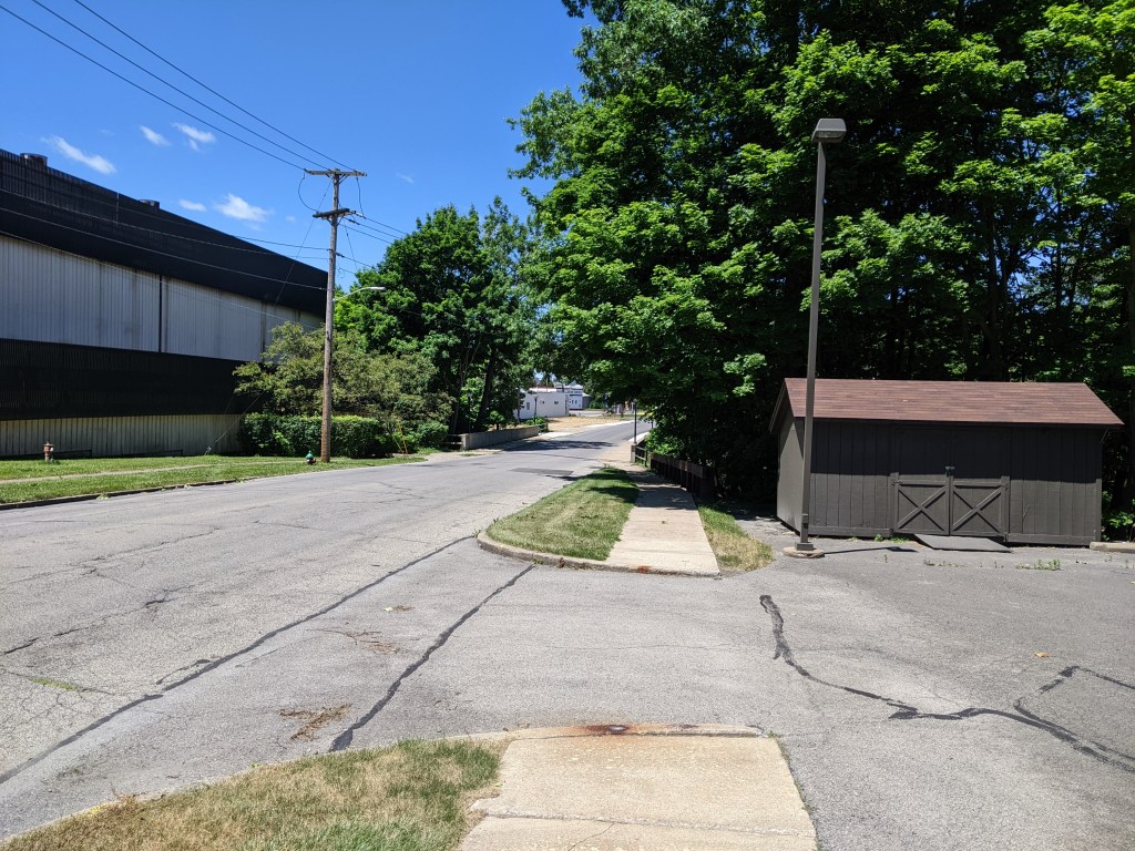
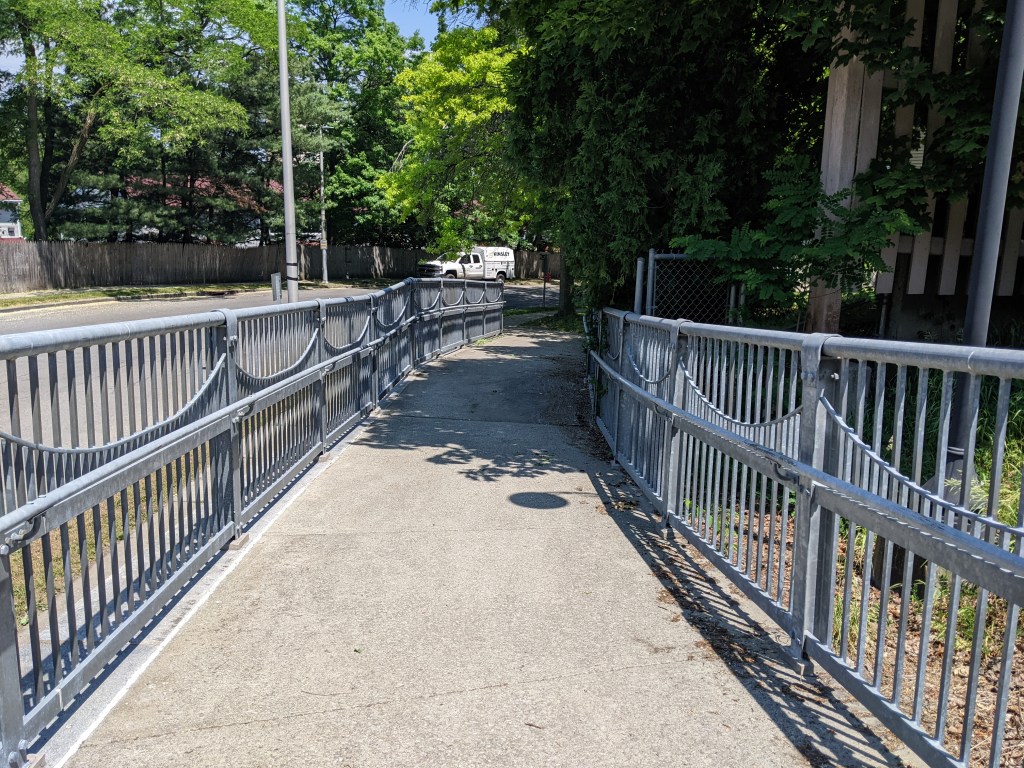
A town of 2.7 square miles and less than 8,000 residents, Grove City has several bridges over Wolf Creek and elsewhere. Unfortunately, the town’s premier pedestrian bridge, Rainbow Bridge (pictured above), was closed due to construction activities in the area. I discovered a second, unmapped pedestrian bridge over a small tributary to Wolf Creek, which I crossed only to see a sign on the other side claiming the bridge was not a throughway and directing people to use the sidewalks on the street to reach Grove City College’s main campus.
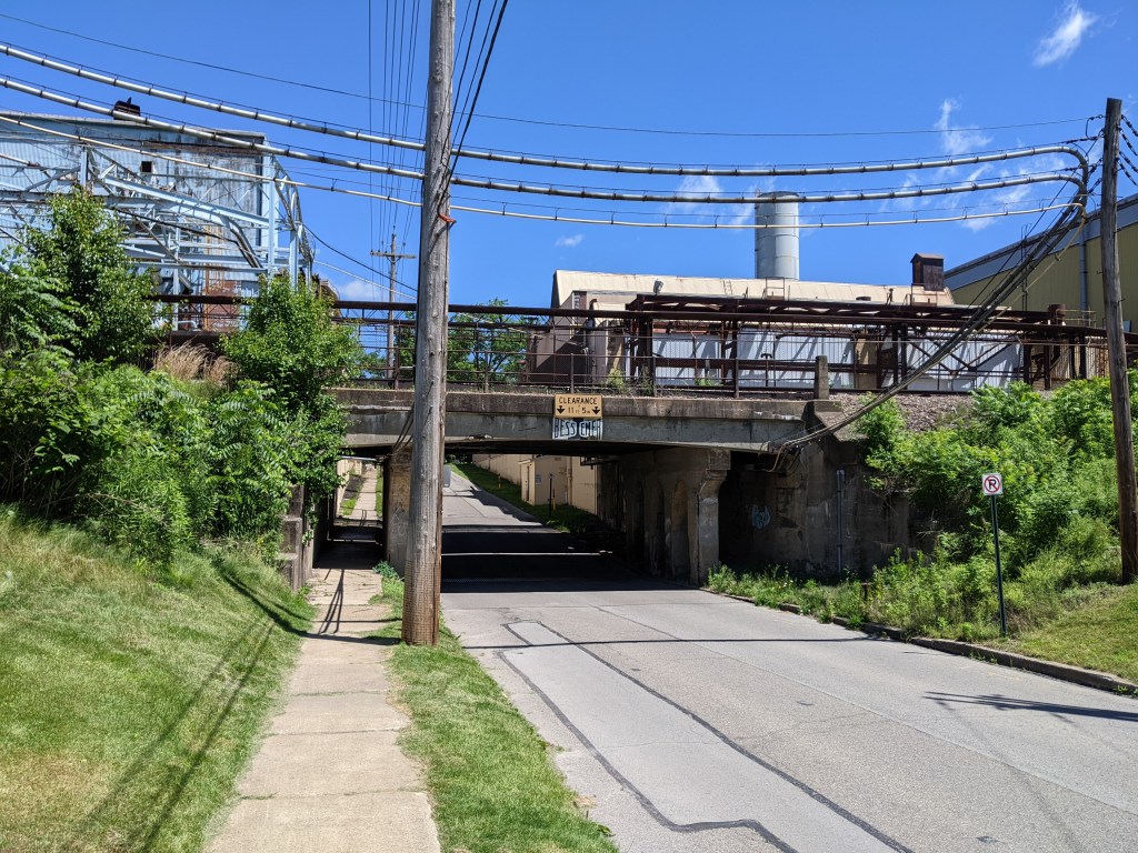
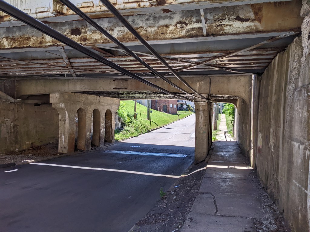
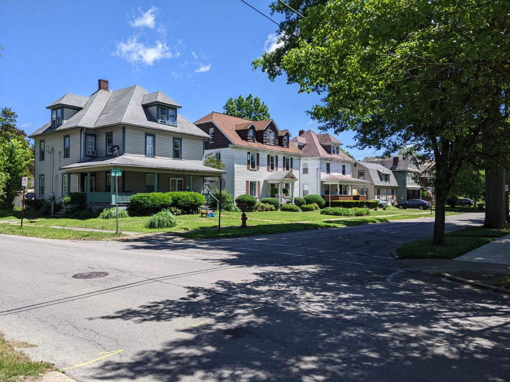
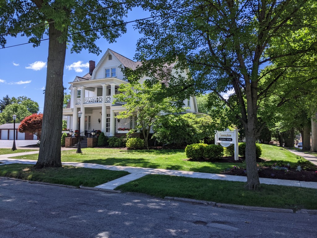
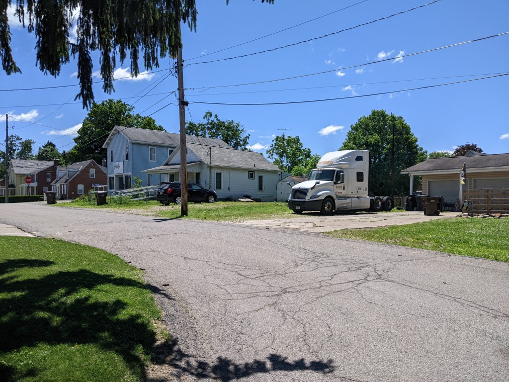
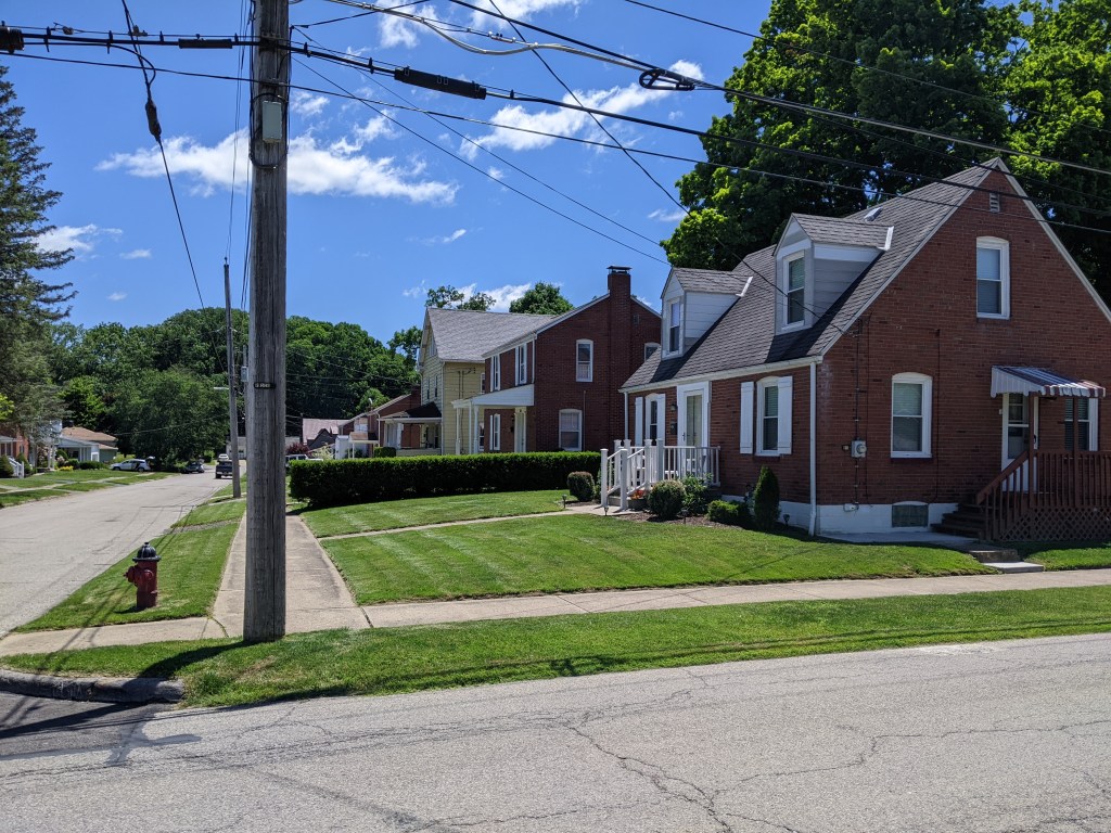
While the bridges themselves were structurally uninteresting, except for the Rainbow Bridge, I visited a throughout cross-section of town in walking them….which is the point of my bridge walking habit. My path took me through the college campus, the now less prominent industrial area, the large homes built for the boss class of the industries, the small homes built for the industrial workers, and the business district, both the car oriented portion and the historic portion. There are several bridgeless neighborhoods that I did not visit, but even without them, I learned a lot about the town in a short space of time.
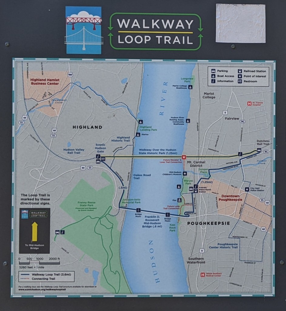
Grove City Bridges
Grove City Cross-Section
I don’t know if this is true in other states, but Pennsylvania lets municipalities of any size call themselves cities. ↩︎
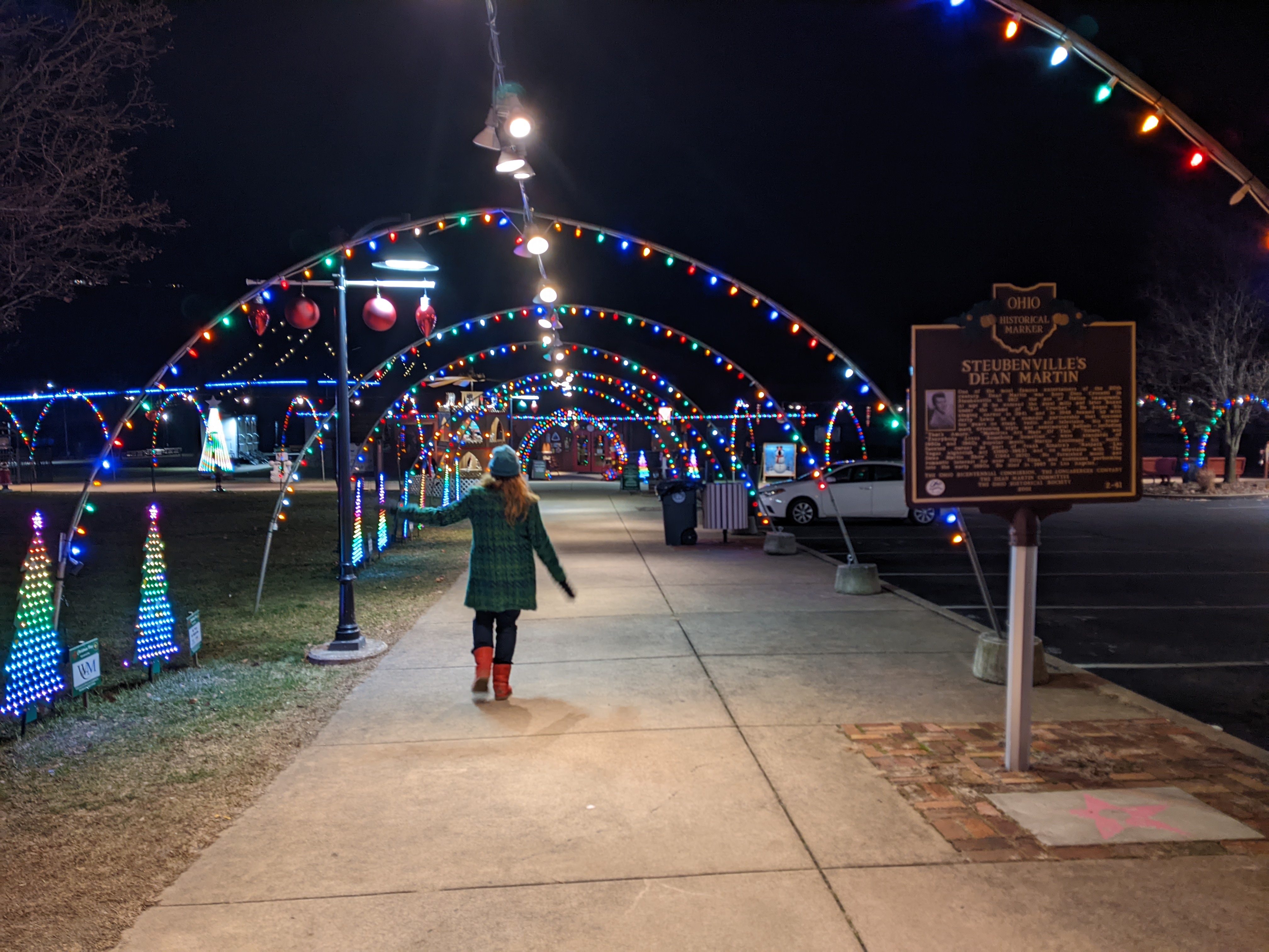
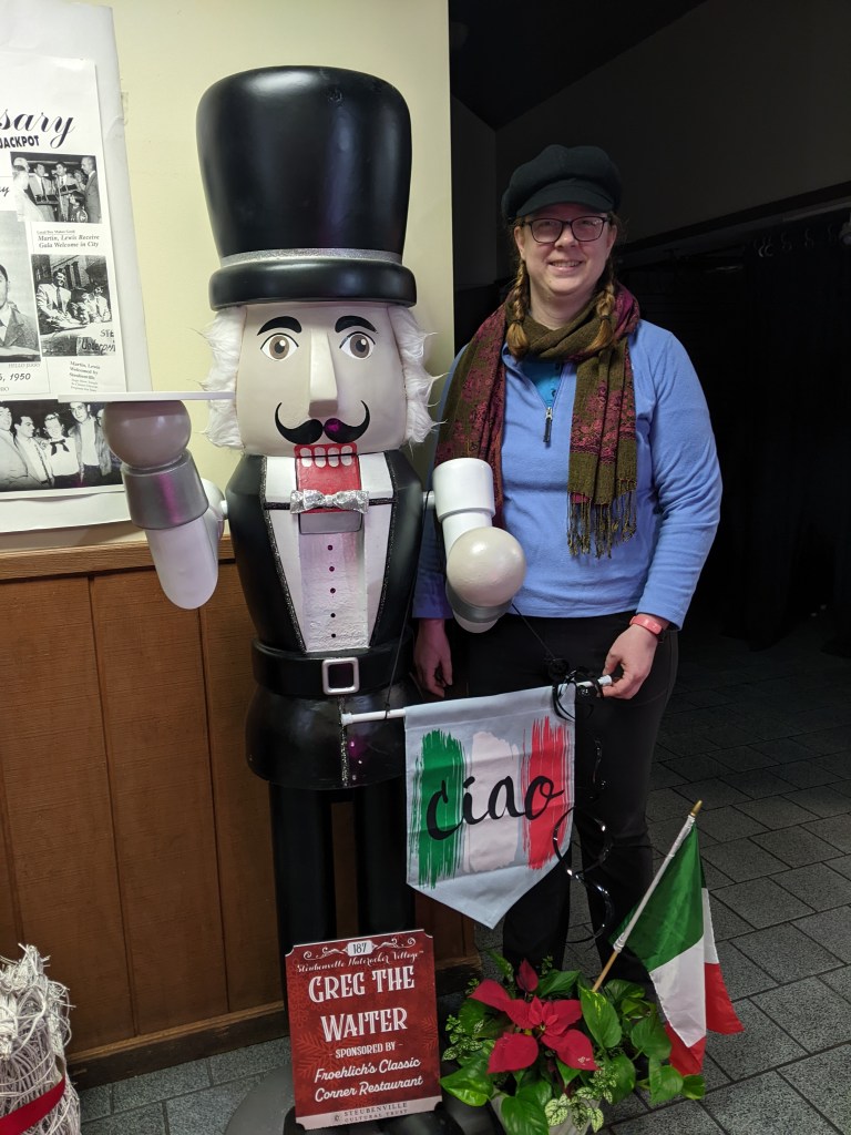
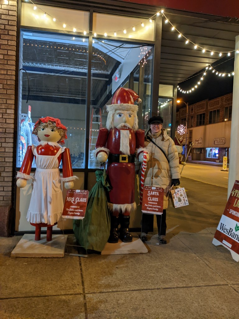
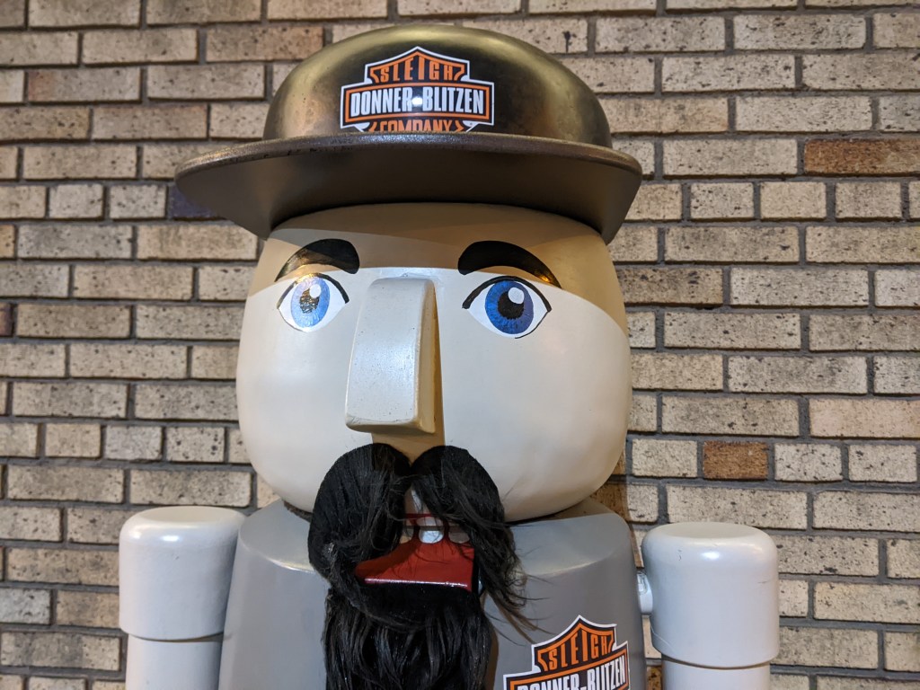
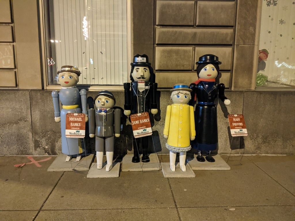
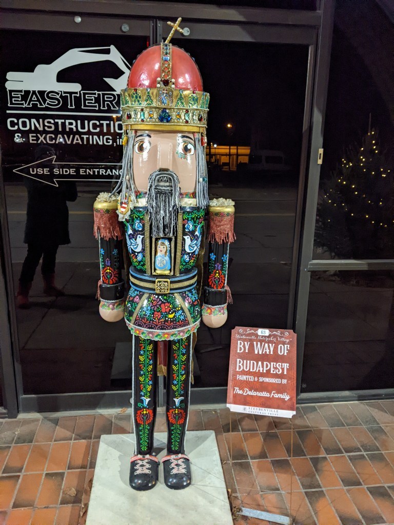
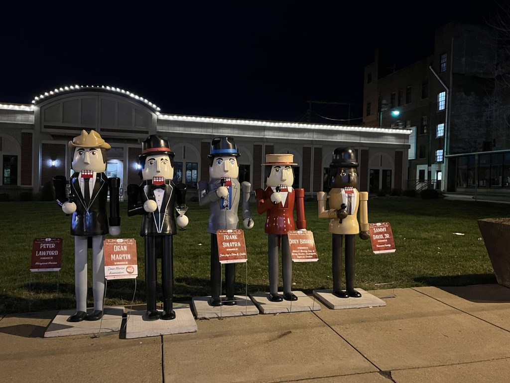
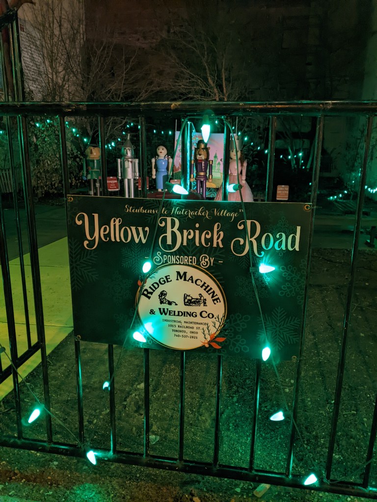
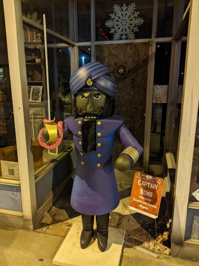
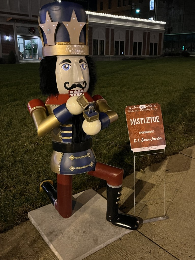
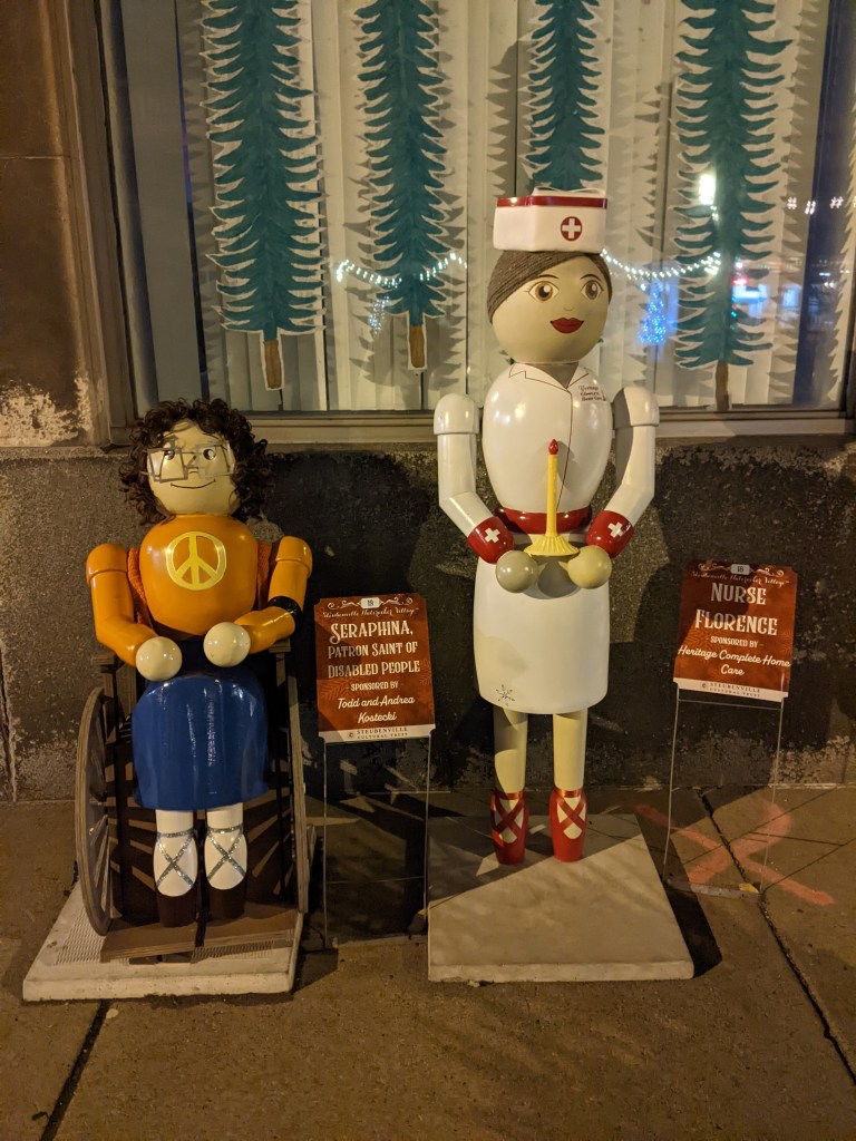
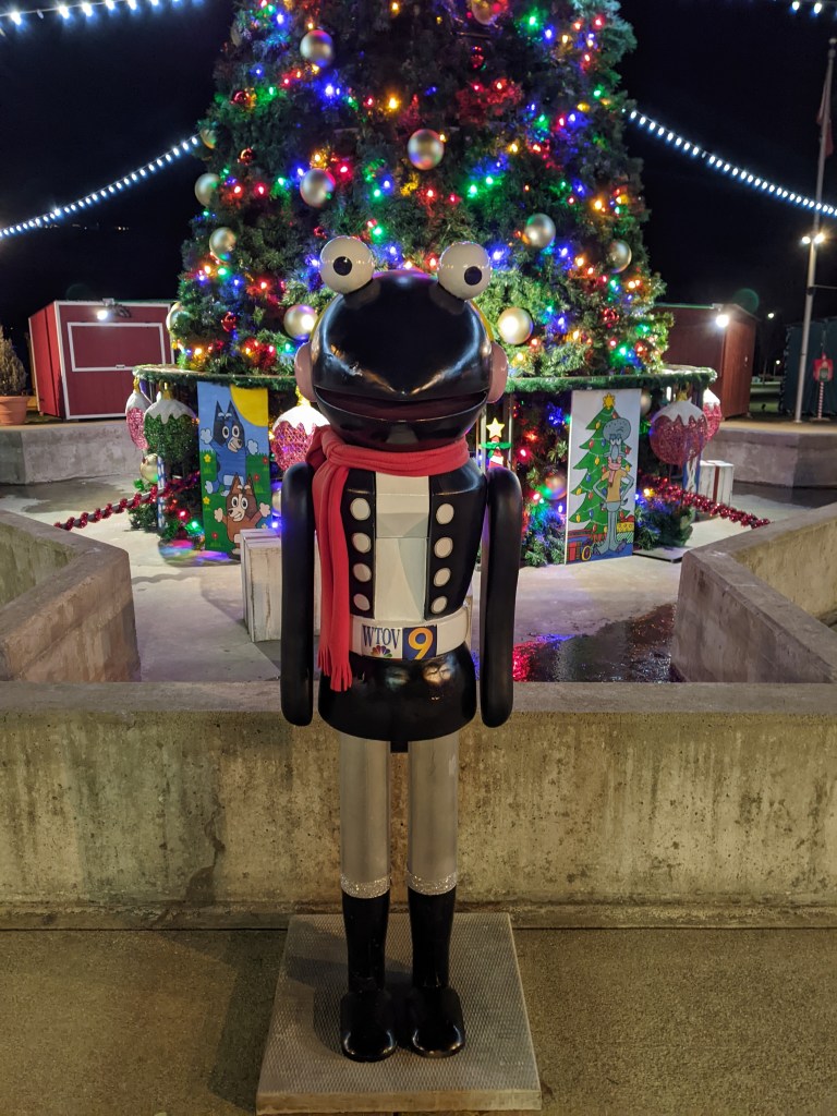
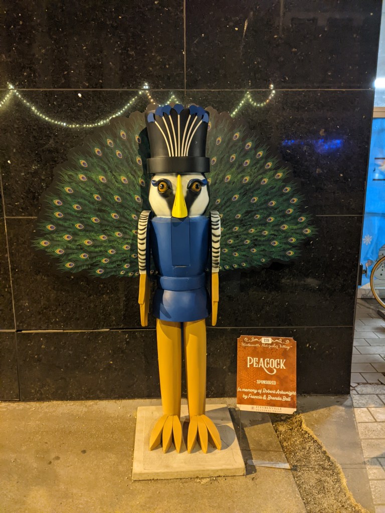
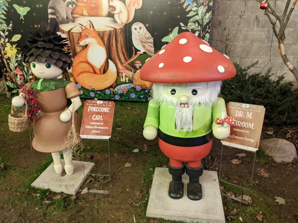
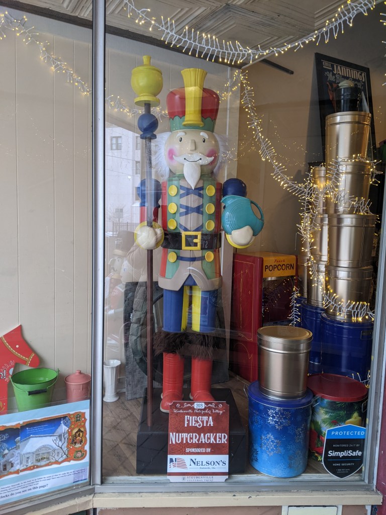
This season is the 10th anniversary of the Steubenville1 Nutcracker Village. Each year, the town of Steubenville, OH, sets out a growing number of human-sized nutcrackers each individually decorated. While they are advertised as 6-feet tall, there is some variation in their heights. A few, including “Santa Claus” and “Henry Harley Hank,” tower over the others. A few, including “Jane Banks” and “Michael Banks,” who I’m pretty sure are standing outside a bank, are eye-to-eye for children.
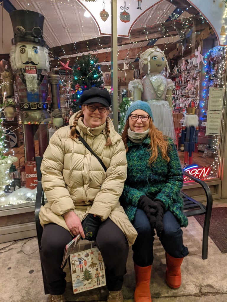
Over the course of the first three years of the Nutcracker Village 150 Nutcrackers were made. Today, there are over 200. (Learn more at the official website.) Shelly2 and I went on a mini-adventure after New Year’s to see these Nutcrackers and test how strong I am for traveling and for urbantraipsing after over a year with Long COVID. While I am tired and sore, it is a manageable level of fatigue, giving me hope that in 2025 I will be able to resume a moderate level of urbantraipsing and travel while continuing to share posts from previous trips.
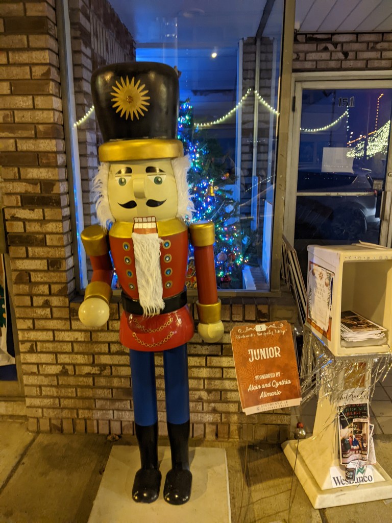
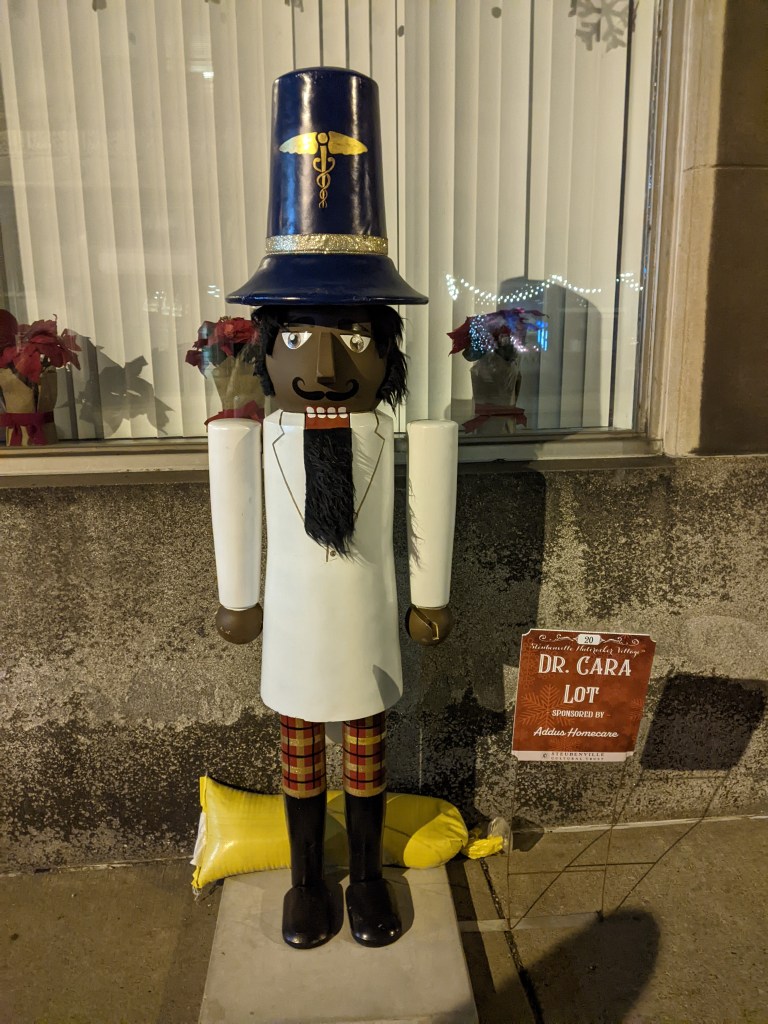
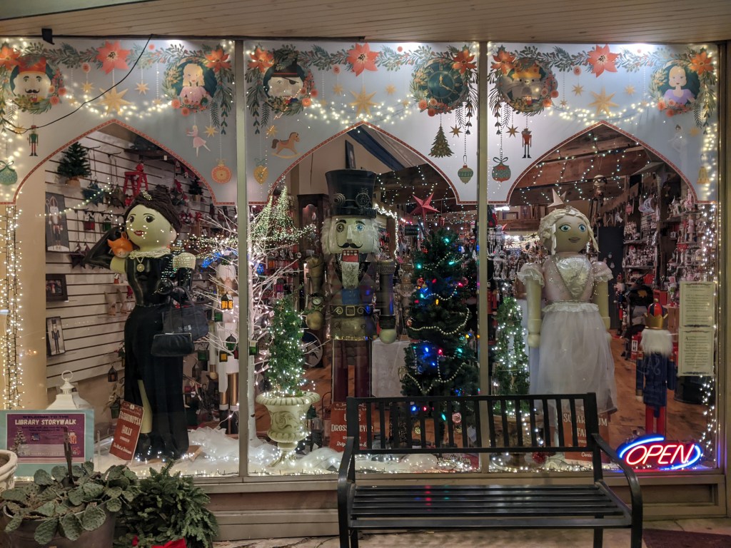
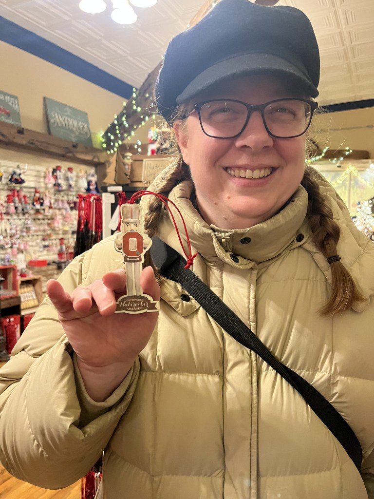
Between the two of us, Shelly and I photographed 145 of the nutcrackers and saw at least 40 more (we were cold and tired toward the end of our walk and passed by many without stopping to photograph them). Below I share a sampling of our favorite nutcrackers. There is quite a range of nutcrackers from the standard looking “Junior” to the punny “Dr. Cara Lot” and “Fashionutsa Holly,” the far left nutcracker in the window display, to the ornate “By Way of Budapest.” A wind storm that passed through the region a couple weeks ago damaged the Ohio State nutcracker, our waitress’s favorite, so we stopped at Drosselmeyer’s Nutcracker Shoppe where I posed with the ornament version of it.
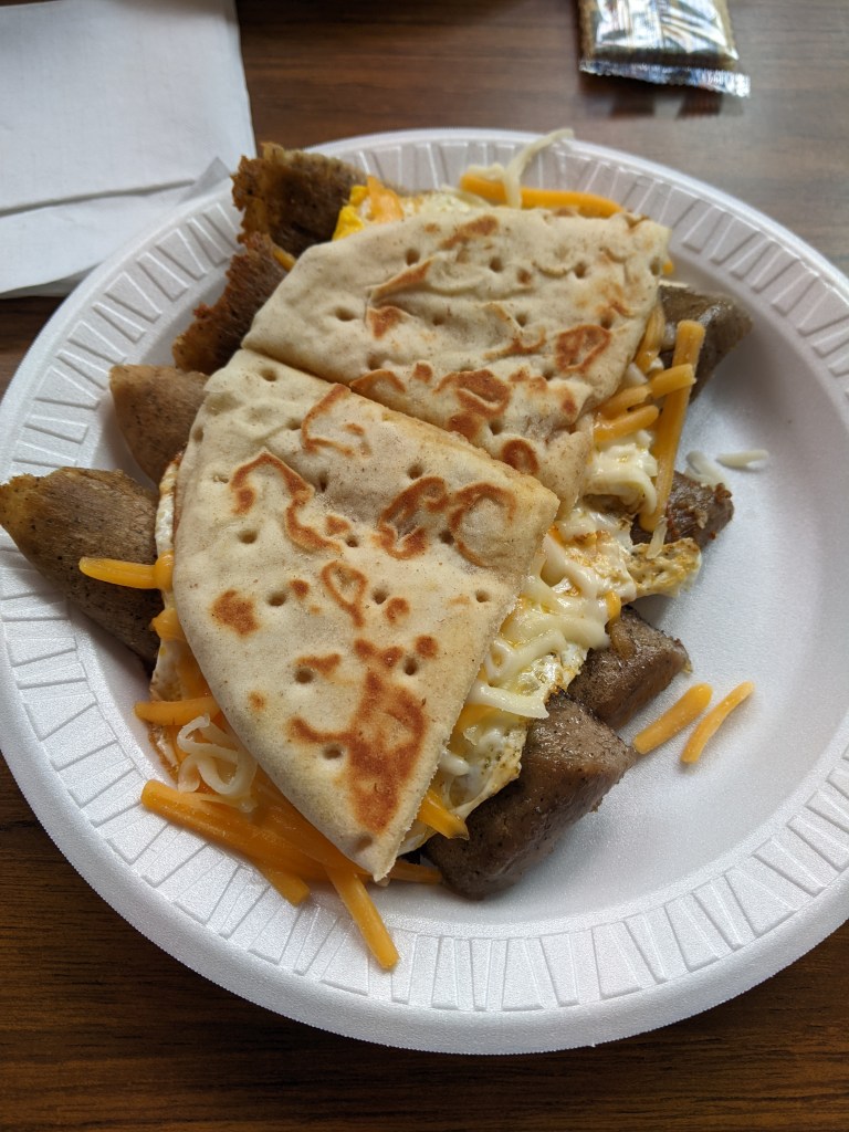
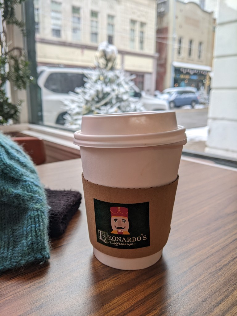
While Steubenville is only 45 miles from Pittsburgh, making this a very easy day trip adventure, we chose to spend the night. This enabled us to better manage my energy level and to explore more of the town. We enjoyed gyro, egg, and cheese pitas for breakfast from Yorgo’s Gyros & Potatoes and I got a mint chai pick-me-up from Leonardo’s Coffeehouse, the headquarters for the Nutcracker Village. I never would have thought that mint would go with chai, but it was a delicious combination.
This is my second urbantraipsing visit to Steubenville. In 2017, while Dad and I were exploring bridges along the Ohio River on our way to see the full eclipse in Tennessee, we stopped in Steubenville to walk the Market Street Bridge. ↩︎
Shelly is the host and executive producer of the podcast With Bowl and Spoon. We started traveling together the summer of 2023 when we went to Erie. She’s a fun travel companion and great at posing with the Steubenville nutcrackers and Erie frogs and fish. ↩︎
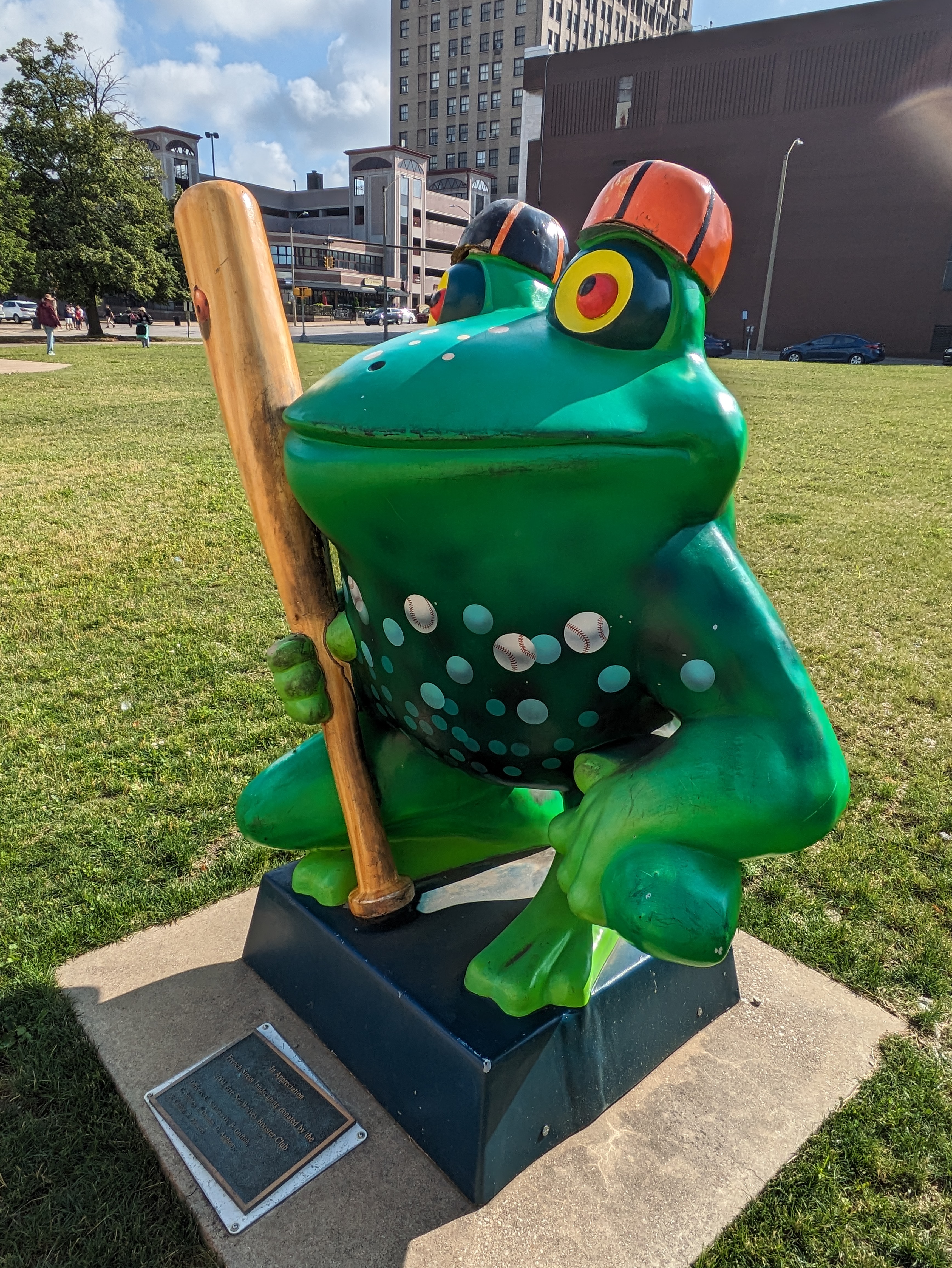
LeapFrog! was a fundraiser in Erie, PA, in 2004. In 2023, Amy H.’s map of Erie’s frogs helped us find “Thrifty Hopper” by Doug Vicary and Walnut Creek Middle School Student Artists in a courtyard off of French Street.
Bridge accidents is a common theme this year. The most significant was the collapse of Baltimore’s Francis Scott Key Bridge in March 2024 after being struck by a malfunctioning container ship. However, other accidents happened to bridges in the Pittsburgh area. Weeks after Baltimore’s bridge collapse, the Sewickley Bridge, a few miles downriver from Pittsburgh, closed for a day after being struck by runaway barges (WTAE, April 14, 2024). Then, in August, a dump truck struck an unused railroad bridge in Pittsburgh. The road underneath closed temporarily while the obsolete and now damaged bridge was removed. The adjacent, active railroad bridge remains. (WTAE, August 16, 2024)
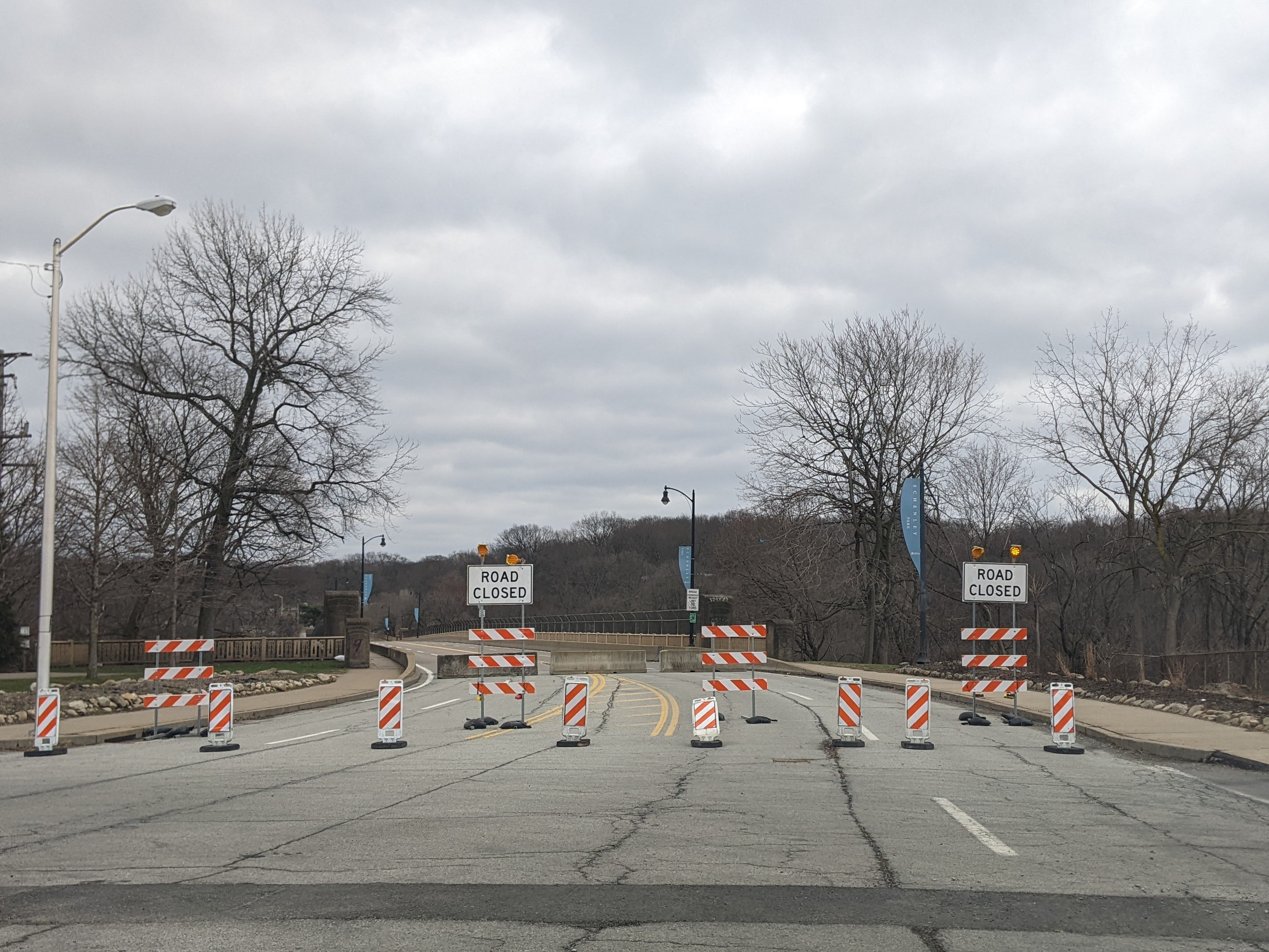
Meanwhile, Pittsburgh continues to preemptively close bridges or restrict traffic to reduce the chances of another bridge collapse. The most recent of these is the full closure of Panther Hollow Bridge announced October 19, 2024, with immediate effect. It is called a temporary closure while the City of Pittsburgh figures out what it needs to do for the bridge. (Mayor’s Press Release, October 19, 2024) Other recent “temporary closures” of Pittsburgh bridges have turned into sporadic periods of closure and opening (Swindell Bridge) or a years-long closure while funding is found and repairs are implemented (Charles Anderson Bridge).
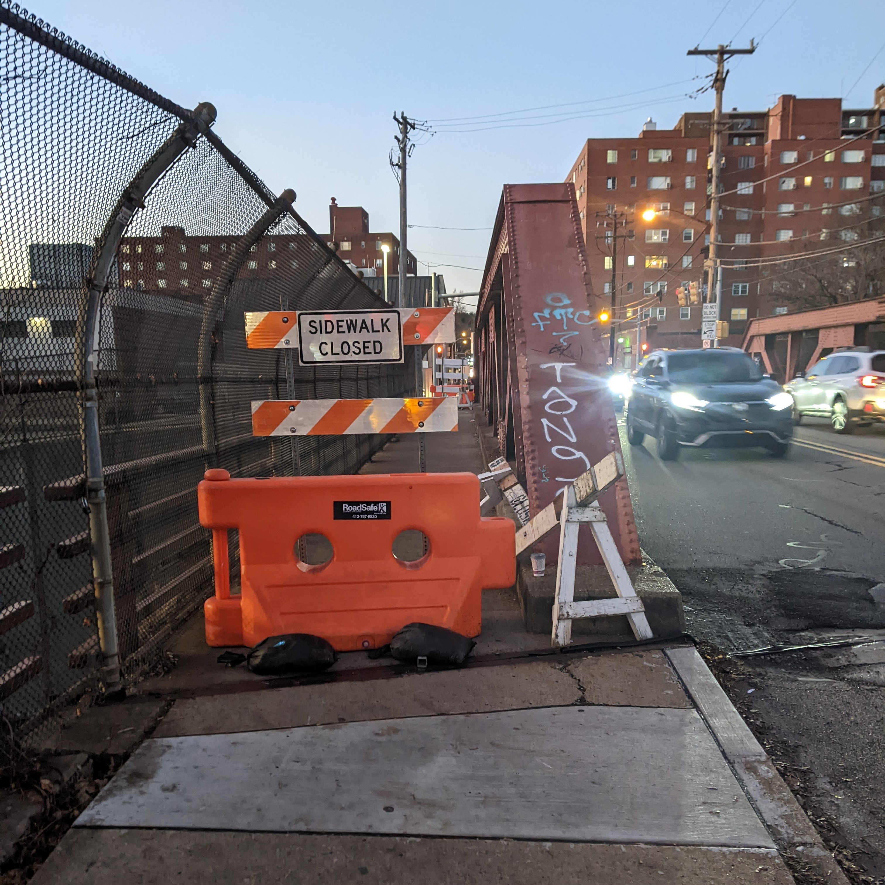
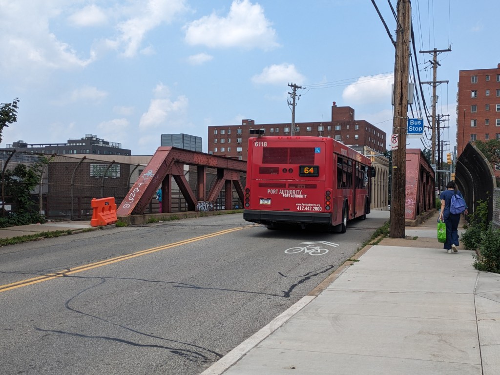
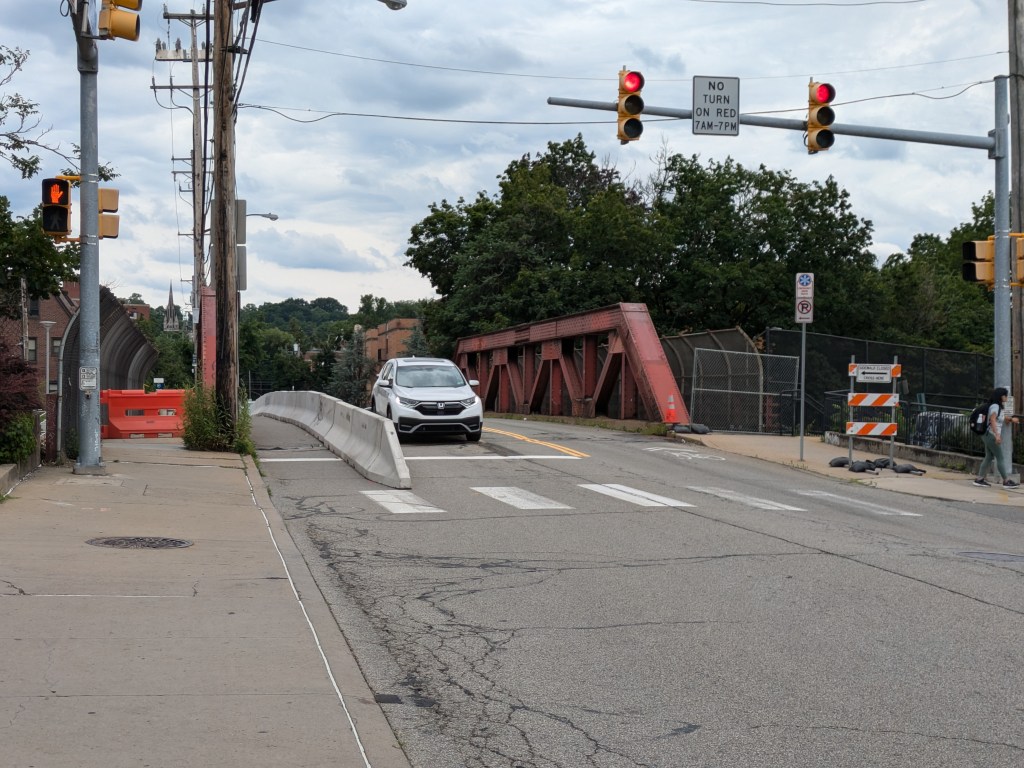
Another common restriction we are seeing in Pittsburgh bridges is sidewalk closures while vehicular traffic remains unaffected. Pittsburgh’s South Negley Avenue bridge is one of the bridges in town that is poised as a pending disaster. In acknowledging the structural issues of this bridge, the west sidewalk was closed in 2022. However, I noticed that by July 2023, the barriers on that sidewalk were pushed aside and it wasn’t clear if that was an official move or if pedestrians had taken matters into their own hands. Then, in June 2024, first the eastern sidewalk was closed with a temporary protected pedestrian pathway installed in the car lane (Mayor’s Press Release, June 6, 2024) and then, a week later, the western sidewalk was again closed (Mayor’s Press Release, June 17, 2024). Why this “safety” measure is helpful is beyond me as this bridge has been earmarked for replacement for years pending funding and access issues. Also, the Smithfield Street Bridge sidewalk always has rusted out holes showing the river flowing below that eventually get patched without closing the sidewalk.
Bridges are a vital connectors that enable us to move around as we live our lives. Frequently, we don’t even realize there’s a bridge there…at least not until there’s a bridge disaster. Over the last few years, there have been several bridge disasters, some due to accidents, like the collapse of Baltimore’s Francis Scott Key Bridge in March 2024 after being struck by a malfunctioning container ship, and some due to deferred maintenance, like the collapse of Pittsburgh’s Fern Hollow Bridge on an icy, cold morning in January 2022.
We have seen recently that when there is motivation, the missing links caused by bridge disasters can be repaired in record time. Pittsburgh’s Fern Hollow Bridge was completely rebuilt and opened to traffic 11 months after collapsing, instead of the usual multi-year process to design and build a new bridge. In Philadelphia, when an elevated section of I-95 collapsed after an accident in 2023, the repaired section reopened to traffic 12 days later, compared to 26 days for a similar situation in Oakland, CA. (PBS News, June 23, 2023)
Despite President Biden’s repeated request to Congress to expedite funds to replace Baltimore’s Francis Scott Key Bridge, Republicans in Congress are possibly motivated to delay so that President-elect Trump will get the credit for rebuilding this crucial transportation link. (Fox News Baltimore, November 8, 2024; WCBM, November 8, 2024) Unfortunately, Trump does not have a good track record for funding bridges.
It can be easy to overlook during the buzz of election season that there is often a delay between when a law is signed or a policy adopted and when the effects of that law or policy are felt. Bridges encapsulate that well. The memorable moments are when a bridge closes or collapses (typically viewed negatively) and when a bridge reopens (typically viewed positively). The moment when funds are allocated, the moment enabling a bridge to reopen at a later date, is not often remembered.
For example, it was front page news when the new Greenfield Bridge reopened in 2017, when Trump was President, but the funding that constructed the bridge was allocated when Obama was President. Similarly, the Charles Anderson Bridge has been closed to traffic for most of President Biden’s term in office, to the annoyance of many, but that is also when the funds were found to rehabilitate the bridge expanding the life of this historic bridge by decades. However, the reopening is projected to be in 2026, in the middle of Trump’s second term as President.
Assuming two years as the average time from funding to reopening on bridge reconstruction and rehabilitation projects, I pulled the Federal Highway Administration’s numbers for bridge construction and rehabilitation in Pittsburgh that would have been funded under the leadership of Presidents George W. Bush, Barack Obama, and Donald Trump. (FHWA InfoBridge) Given the delay between funding and completion, it is too early to measure the impact of funding under President Joseph Biden’s leadership.
Bush: 36 bridges total = 4.5 bridges per year
Obama: 76 bridges total = 9.5 bridges per year
Trump: 9 bridges total = 2.25 bridges per year
Bridge maintenance and repair rarely happens without support from federal funding. When the bipartisan infrastructure bill passed under President Biden’s leadership runs out of funds, or those funds get diverted to Project 2025, I am skeptical that new funding for bridges will be found under the leadership of President-elect Trump. Therefore, I expect more bridge disasters or, at the very least, more indefinite bridge closures in the coming years.
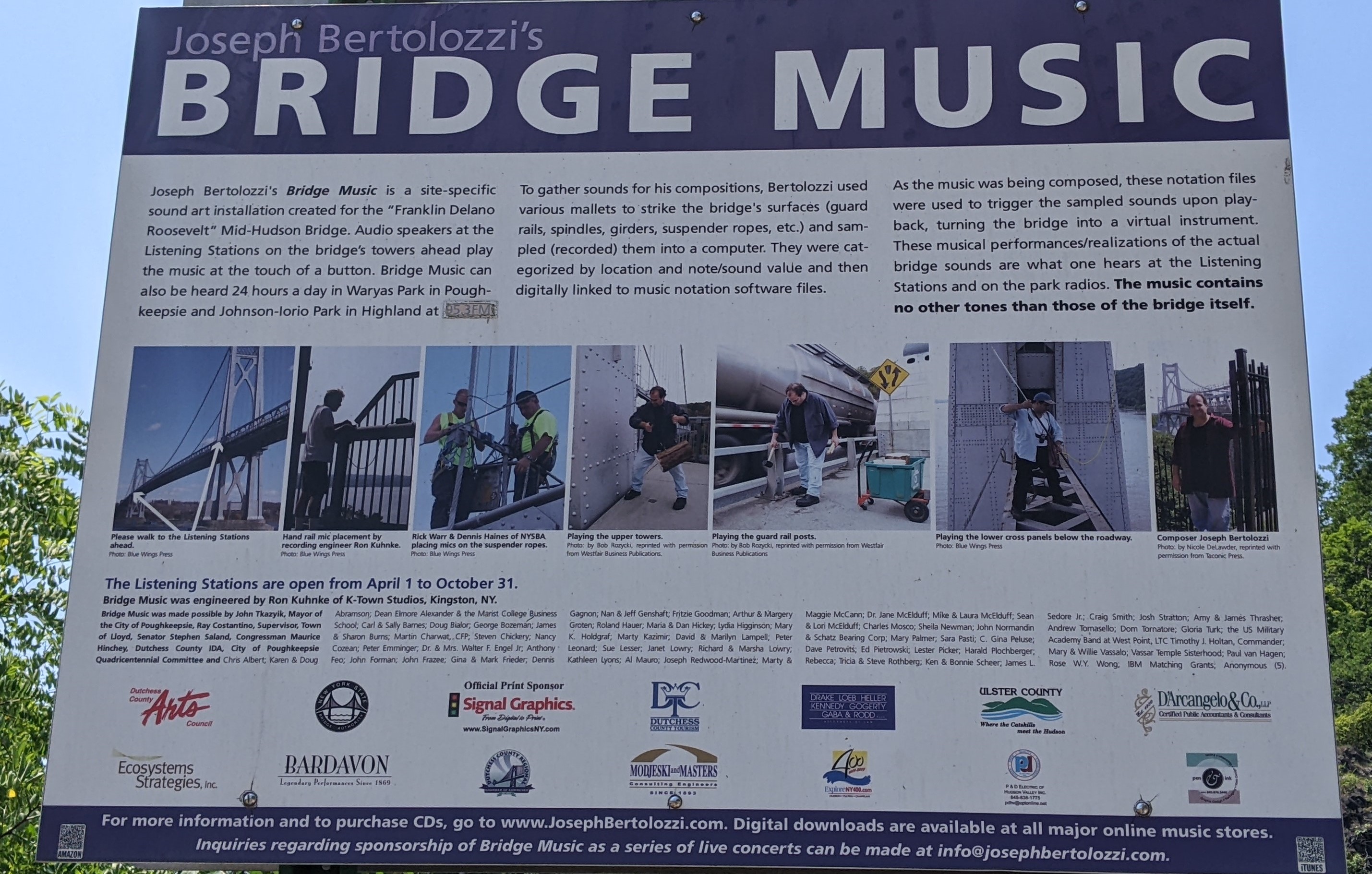
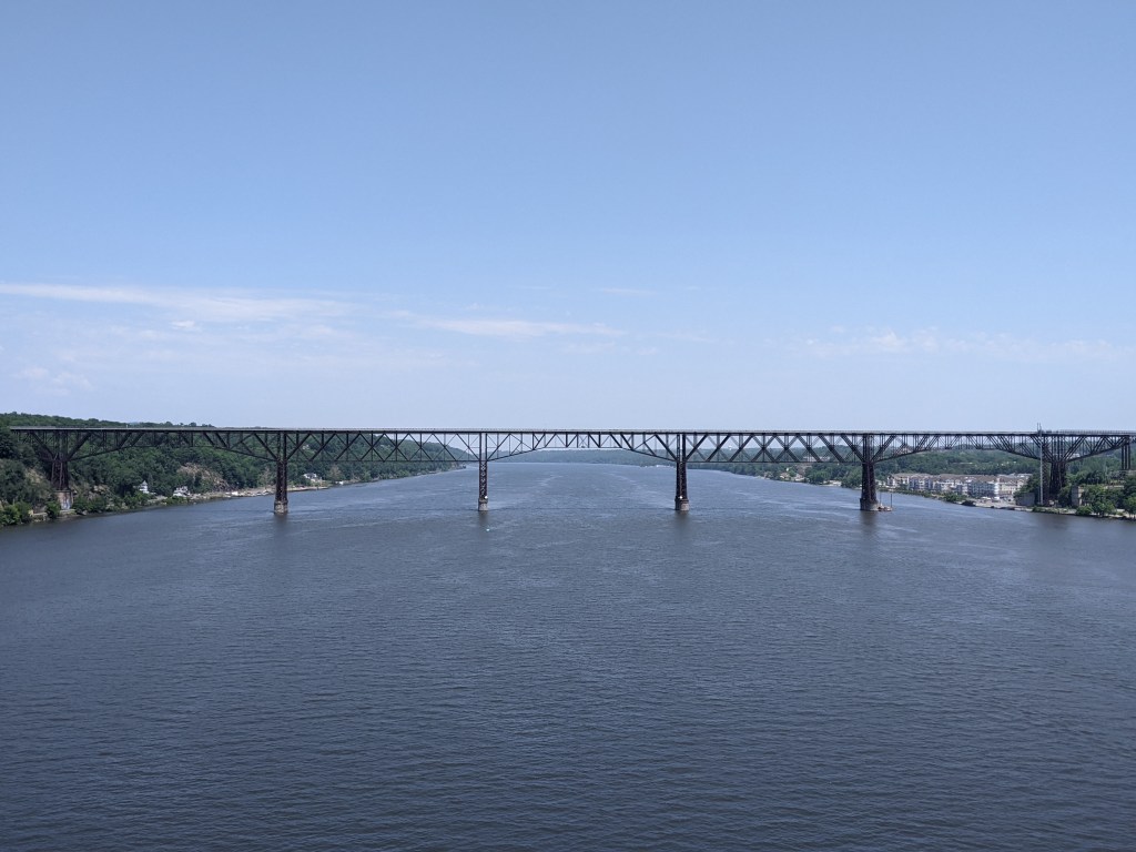
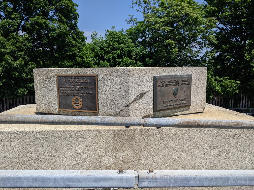
The Mid-Hudson Bridge has a unique additional feature. In 2009, Joseph Bertolozzi used the bridge as the sole instrument in his sound-art installation Bridge Music (see Bertolozzi’s official website for more information). There are two listening stations on the bridge, one at each pier, and those driving across the bridge can also access the music on their car radio. The full Bridge Music is available on CD and Bertolozzi has several YouTube videos of the music. Below is a sample of the music I captured in a video with views of the Hudson River and the two bridges (the Walkway Over the Hudson is the second bridge).
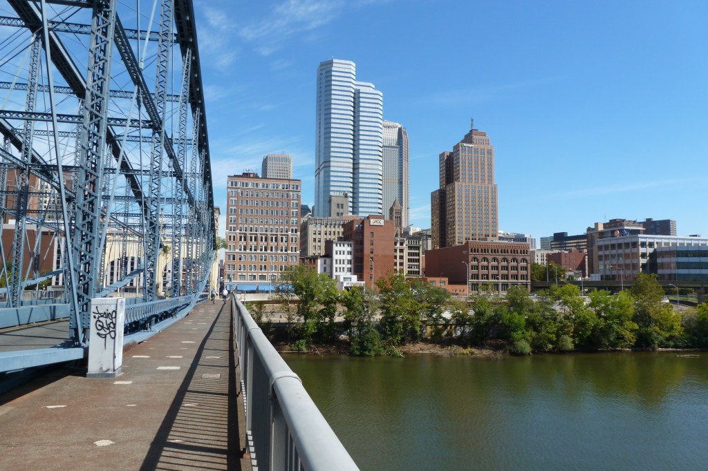
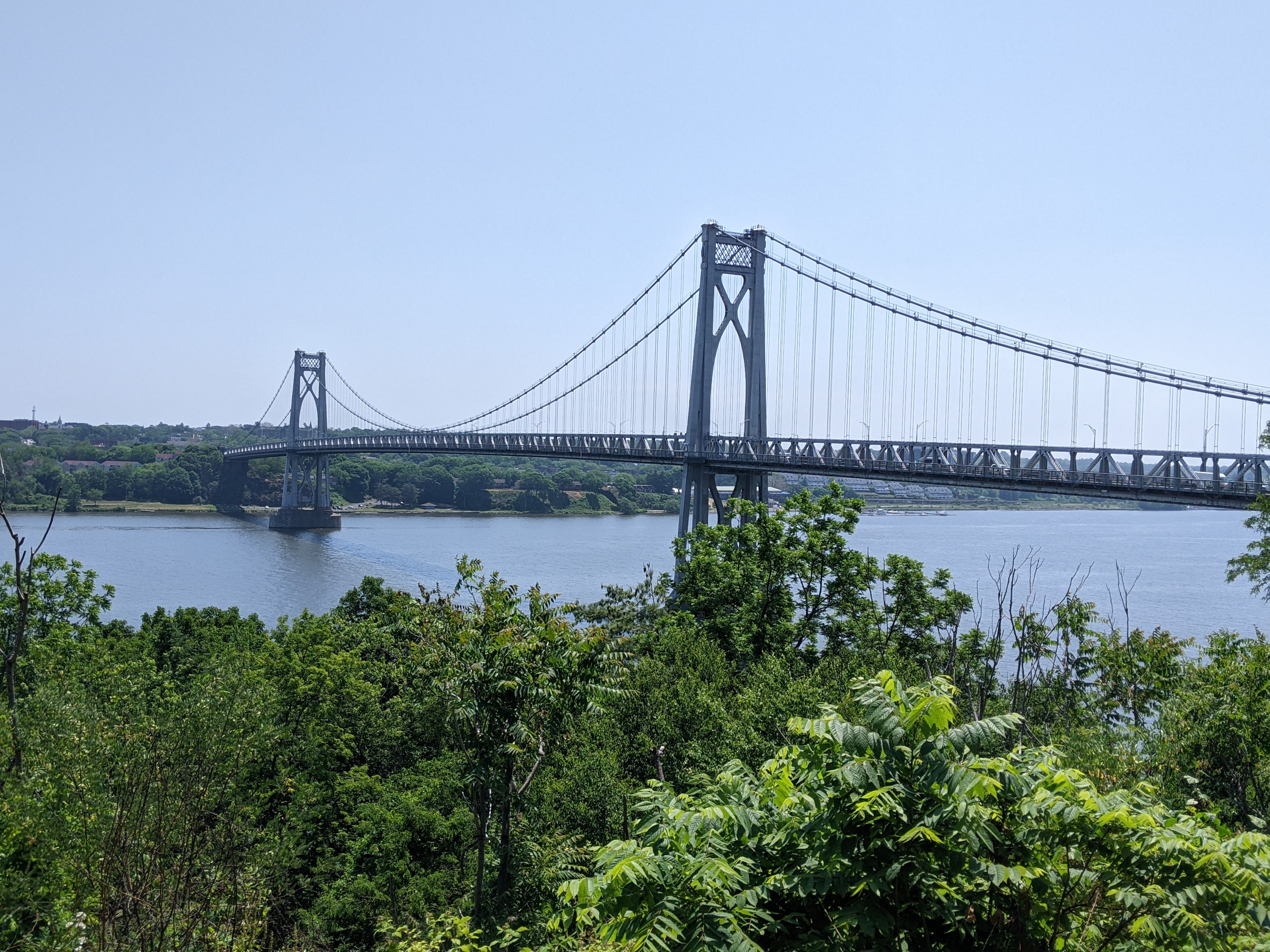
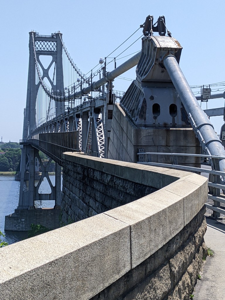
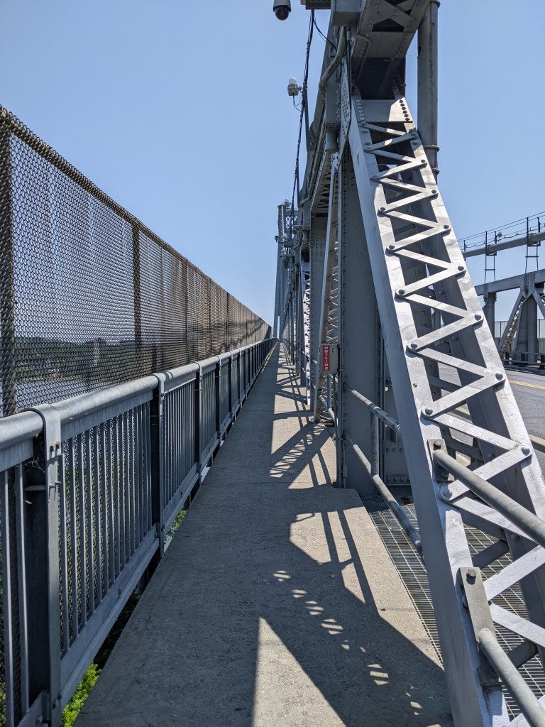
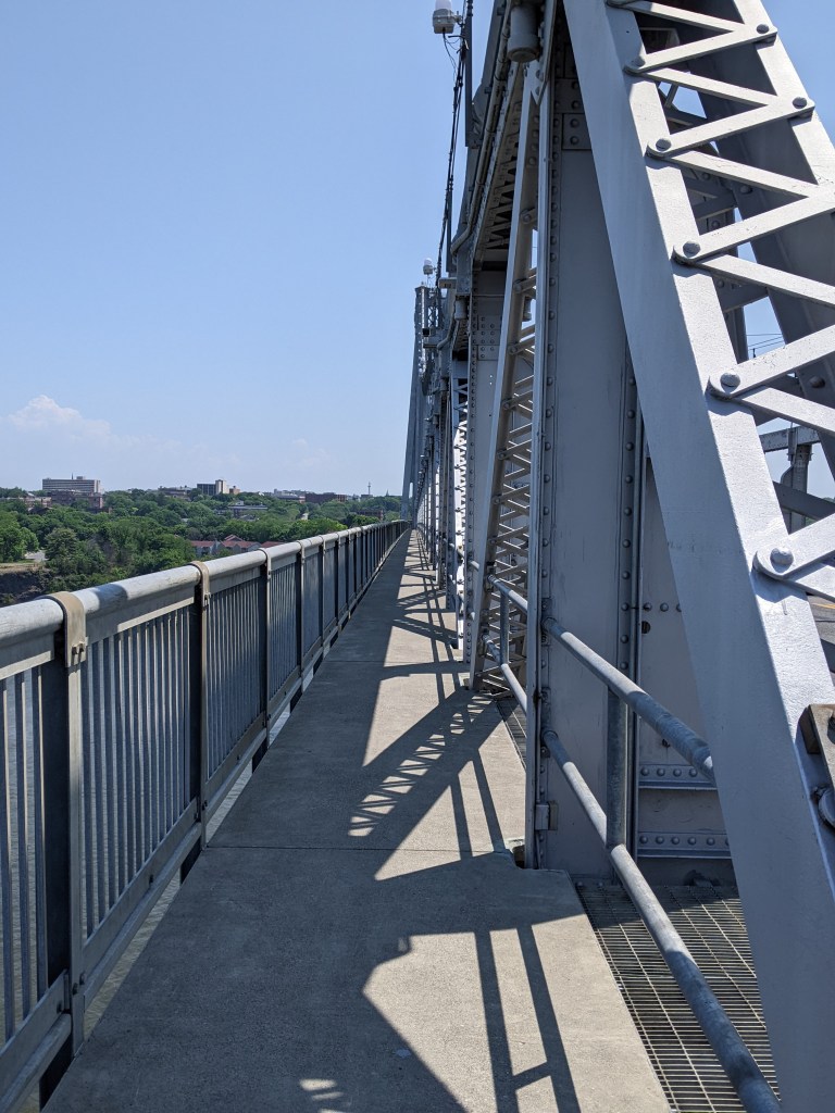
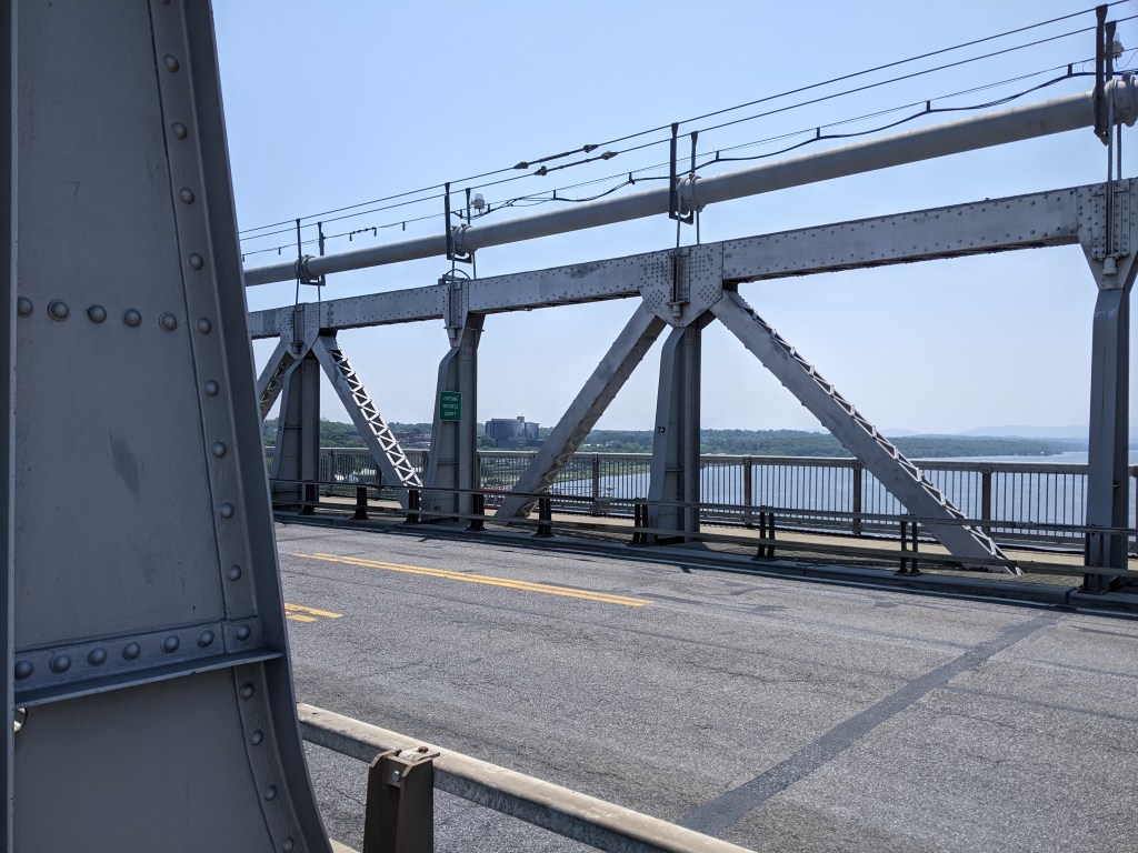
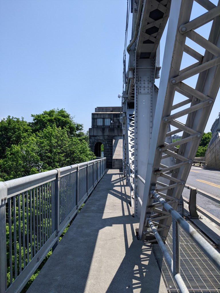
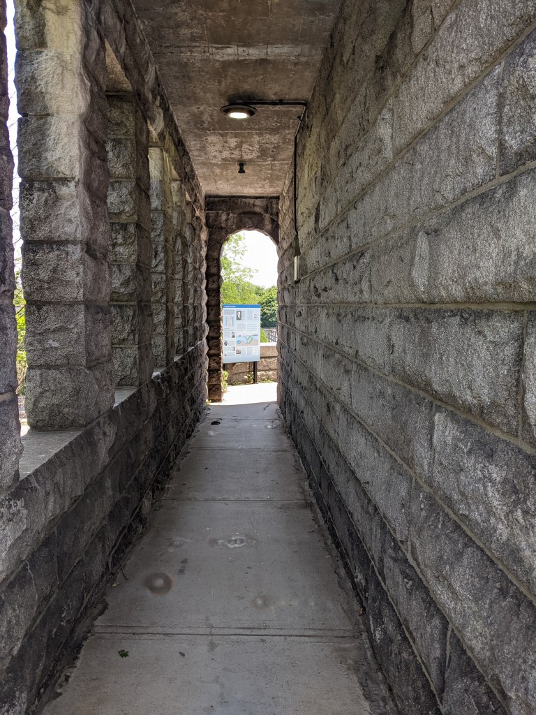
Half a mile downriver from the Walkway Over the Hudson (slightly closer as the crow flies) is the Mid-Hudson Bridge, so named for being halfway between New York and Albany. After being completely exposed to the noonday July sun on the Walkway Over the Hudson, I learned the relief of shade that can be had on a bridge, particularly when it incorporates some truss-like structure like the Mid-Hudson Bridge. I remember being completely in the shade while walking the Manhattan Bridge, but as that was in late December it had a completely different effect.
Taking in the Mid-Hudson Bridge added significantly to the length of my walk, but was worth it for the shade and the ability to add another bridge to my ever-growing list of walked bridges. I also encountered signs for “Bridge Music” on my way to this bridge which intrigued me and which I’ll explain further later.
Once again, additional fencing is provided on the portion of the bridge that crosses over the railroad tracks. Other than that pinch point and one or two other pinch points, my photographs suggest to me that this was a very pleasant bridge to walk. And overall, I think it was, but I was quite spooked by the number of signs warning pedestrians not to aggravate the nesting peregrine falcons on the piers. It wasn’t clear from these signs what behaviors would be sufficient to aggravate these predators, but I took the signs to mean that these birds were more sensitive than the ones found on tall buildings in Pittsburgh and curtailed my observations of and from the bridge accordingly.
I also tested out taking video of a portion of the walk of the bridge. This is something I have been considering as another way to share the experience of bridge walking with my readers. The video is below the sample of photographs. As I am holding my phone in my hand to take the video, there is a little bounce from my gait and some other slight stability issues.
LeapFrog! was a fundraiser in Erie, PA, in 2004. After searching for several frogs hidden inside buildings in 2023, it was refreshing to spot “One Hopper” by Ben Gibson as we rounded the corner at E 10th and French. Amy H.’s map of Erie’s frogs led us to this location.