Bygone Bridges of East Liberty

The winner of the 2024 Bridge Madness tournament, the East Liberty Station Pedestrian Bridge, faced stiff competition in the Final Four round from the Spahr Street Pedestrian Bridge. Both of these bridges are relatively new, constructed with funding sources from the Obama Administration. When I moved to Pittsburgh 15 years ago, neither of these bridges existed. There was no pedestrian connection at Spahr Street and the pedestrian bridges at East Liberty Station were boxed-in bridges with no greenery. (For a side-by-side comparison of the prior and current East Liberty Station bridges see their Then and Now post.) These are not the only changes to bridges in this area. In fact, I suggest that East Liberty has seen more bridge turn-over in the last 100 years than any other part of Pittsburgh.

G. M. Hopkins Map 1923 https://www.arcgis.com/apps/View/index.html?appid=63f24d1466f24695bf9dfc5bf6828126
Google Map 2024 https://www.google.com/maps/@40.4595742,-79.9247739,17z?entry=ttu

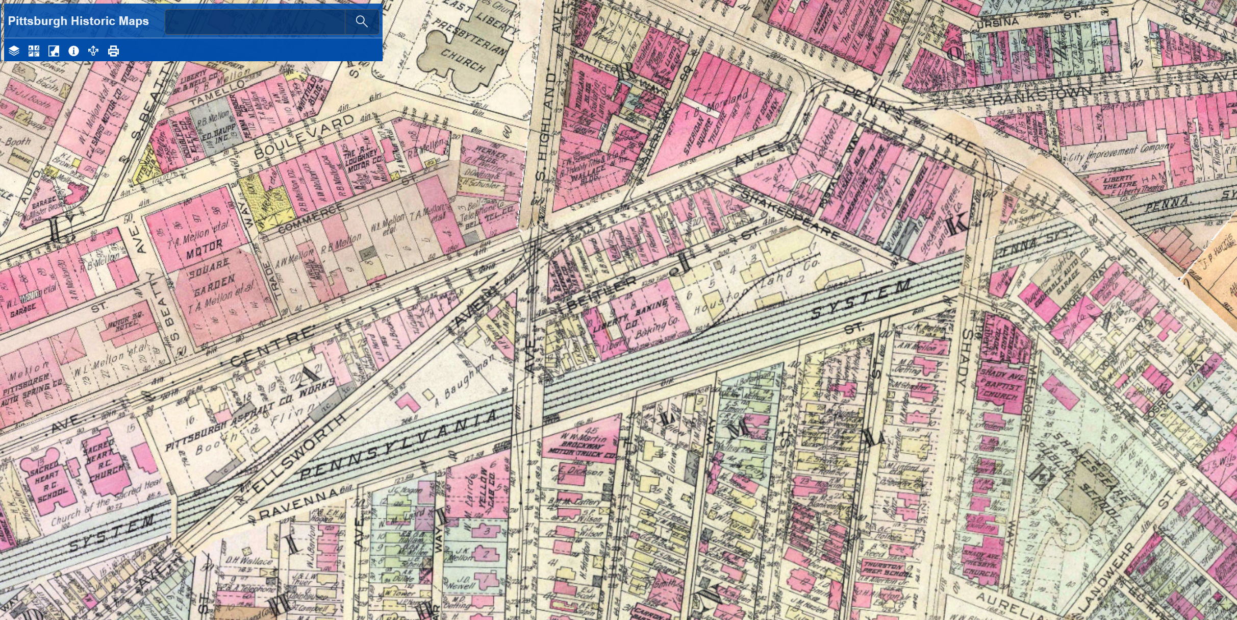
The Penn Avenue and South Highland Avenue Bridges have stayed fairly constant, at least as far as location is concerned. The South Highland Avenue Bridge was rebuilt and redesigned in the 15 years I’ve lived here. While the Spahr Street Pedestrian Bridge is new, the 1923 G. M. Hopkins map above shows that there used to be a pedestrian bridge at this same location. The historical precedent for a pedestrian bridge here may be another factor for why the bridge was located here and not further east where residents have been asking for a pedestrian bridge for years.

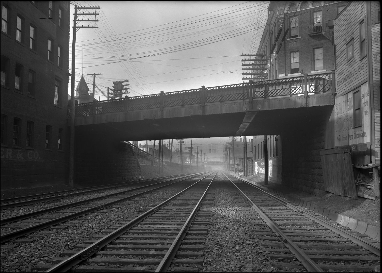
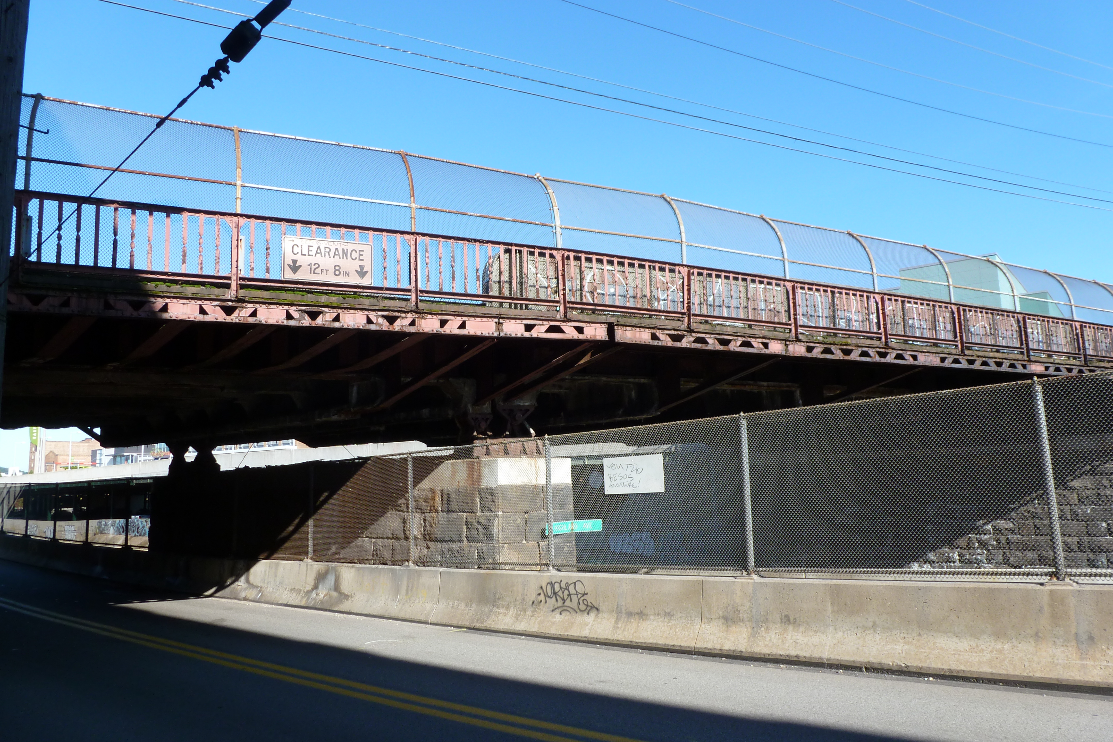
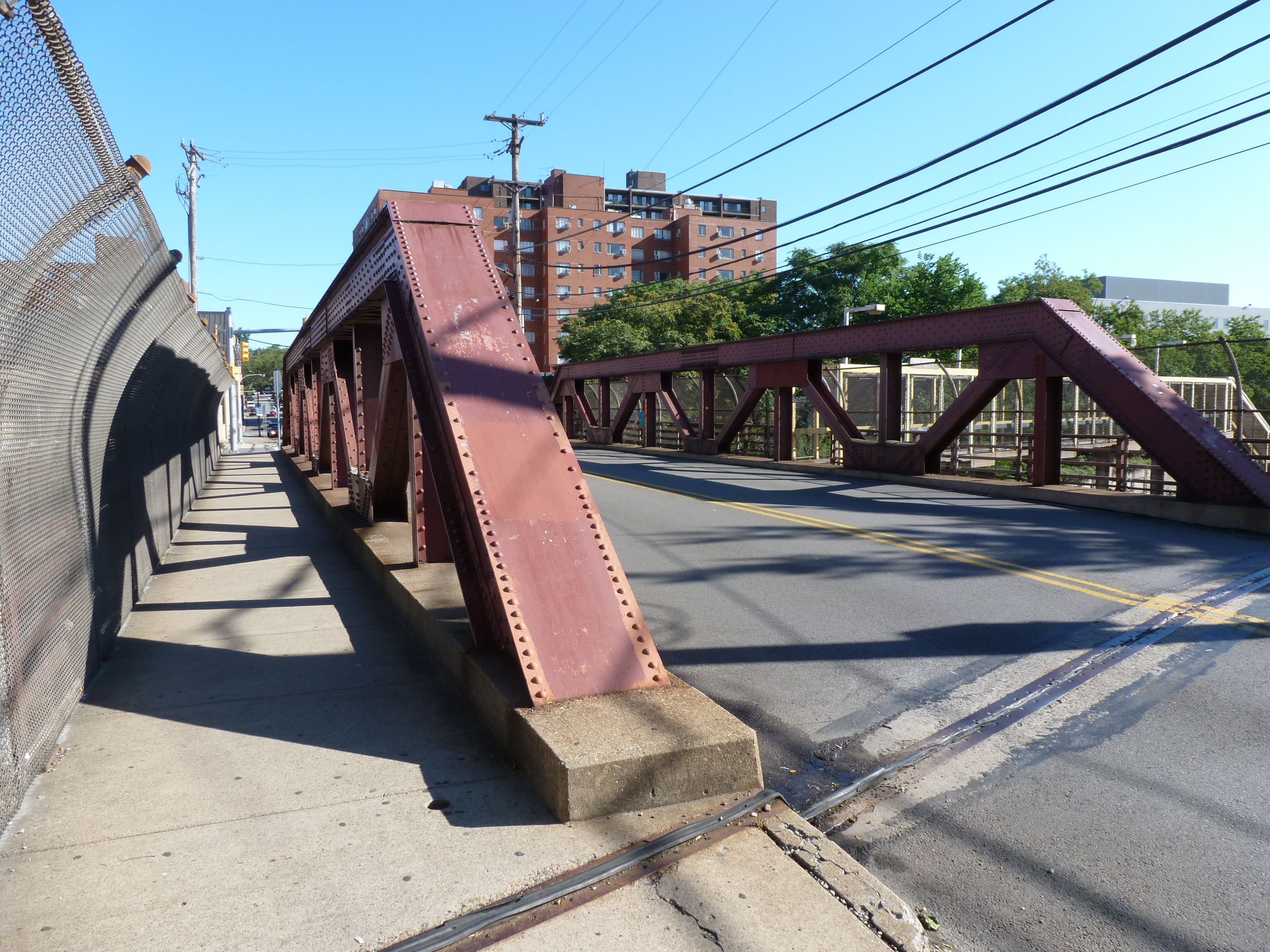
The other major bridge changes in this area are the former Ellsworth Avenue and Shady Avenue Bridges that show on the 1923 G. M. Hopkins map. Both of those are long gone. I assume they were casualties of the massive Urban Renewal of the neighborhood that significantly impacted the street grid of the area. The digital archives of Historic Pittsburgh include photos of these former bridges. The Shady Avenue Bridge seems to have been of a similar design to the former South Highland Avenue Bridge. The Ellsworth Avenue Bridge seems to have been of a similar design to the current South Negley Avenue Bridge that is just outside the map frame to the west. One key difference is that cages were added at some point to the South Highland and South Negley Bridges.

Pedestrian Bridges: Shadyside

When the pedestrian bridge I discuss in “Taking the Long Way Round” was in the process of being built, I was thinking it was the first pedestrian bridge in Pittsburgh.  When I started my project of walking the bridges in Pittsburgh, I realized what a ridiculous thought that was.  Pittsburgh has many pedestrian bridges, but until the new one was built, I never heard anyone talk about any pedestrian bridge in the city.  Many of these pedestrian bridges are not particularly attractive and are not in high traffic areas.

Shadyside has one of these hidden pedestrian bridges.  The bridge connects Graham Street across the busway and railroad tracks.  The only reason I know about this bridge is from riding buses on the busway.  Walking down Graham from Centre Ave (a busy corridor lined with businesses, churches and a hospital and used by several major bus routes and lots of cars), I was impressed how quiet and peaceful the residential area between Centre and the busway was.  That is until a train comes by.

As I walked across this bridge, I wondered why it was there.  There is a vehicular bridge with sidewalks on both sides across the busway a block in either direction.  There are eight other roads between this bridge and the Penn Ave Bridge that end at the busway and have neither a vehicular or pedestrian bridge connecting them to the other side of the busway.  In my walk, I speculated that perhaps it was put in to connect the residents on the north side of the busway to places of work on the southern.  This was based on the fact that there was a large building on the southern side that now houses the Shadyside Boys and Girls Club (photo below).

When I got home I went to PGHbridges.com, which I have used whenever I’ve had questions like this about the origin or design of Pittsburgh bridges.  However, for some reason this website ignores many of the bridges over the busway.  In looking up some of the bridges that PGHbridges.com misses, I found several other bridge websites that list and identify many of the bridges in the city, but none of them include the Graham Street Bridge, not even the National Bridge Inventory Database.

So I turned back to my favorite resource–the G.M. Hopkins maps.  I also went to the image collection on Historic Pittsburgh, the parent site for the Hopkins maps.  In the image collection I found one photo from 1908 of the bridge under construction.  The 1904 and 1911 maps show the area immediately adjacent to the bridge as all residential.  The building that is now the Boys and Girls Club does not exist.  All I’m left with is speculation at this point.  However, there is a school a few blocks from the southern end of the bridge and in between 1904 and 1911 another church was built a couple blocks north of the bridge.  There already was a large church a block from the site of the newer, smaller one.  Perhaps, the bridge was built to facilitate school students and church goers to get to their respective destinations.

Based on the way the bridge is depicted on the 1911 map and the 1939 map, I suspect the bridge may have been rebuilt since 1908.  At the very least the stairs were replaced.  The southern steps are drawn as coming straight out from the bridge to the road, but today the stairs are perpendicular to the line of the bridge and Graham Street.  The northern steps are drawn perpendicular to the bridge and facing the same direction the southern steps face today.  However, the steps I walked are switchback style, with the upper portion facing the opposite direction depicted on the 1939 map.