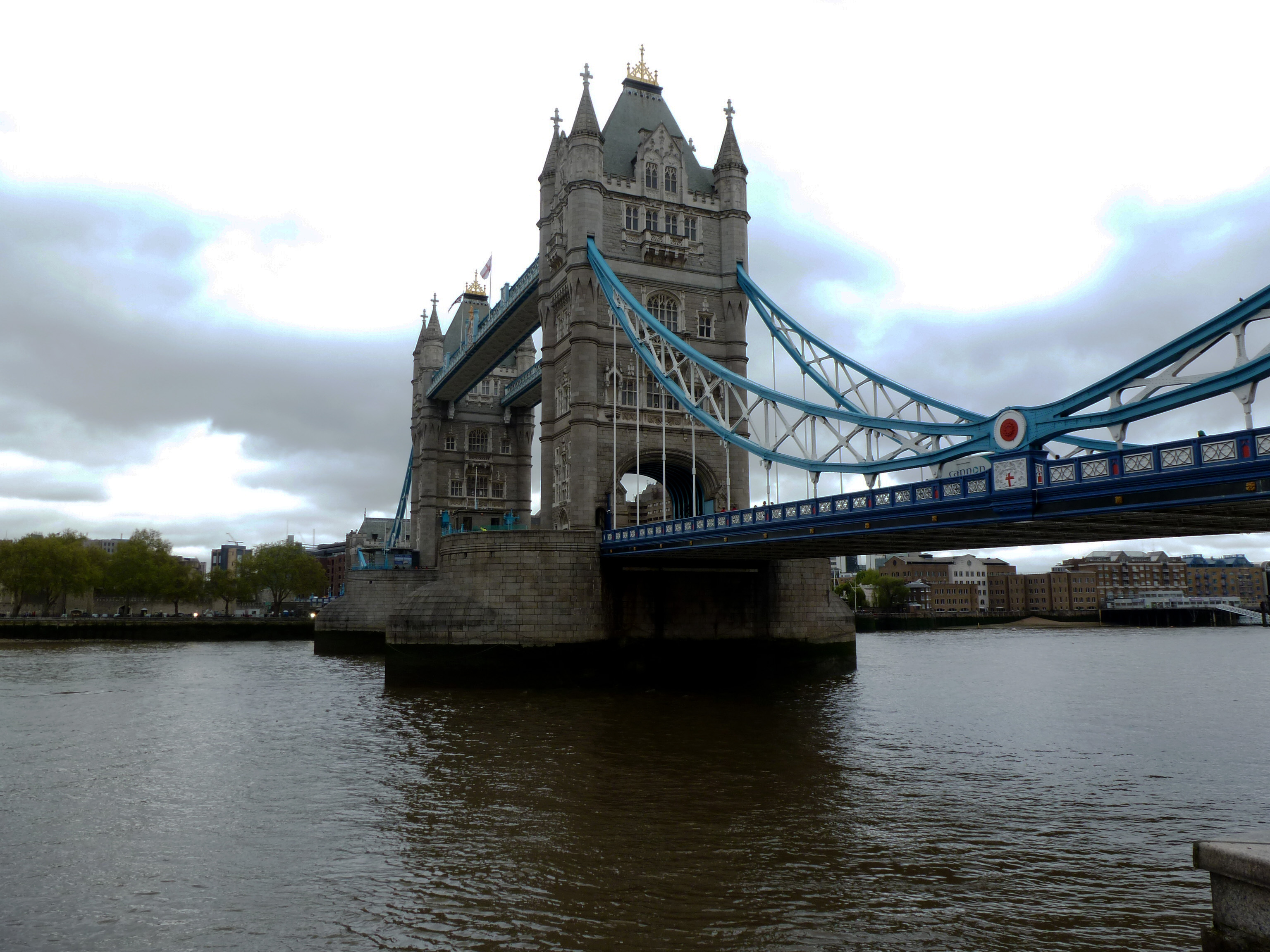
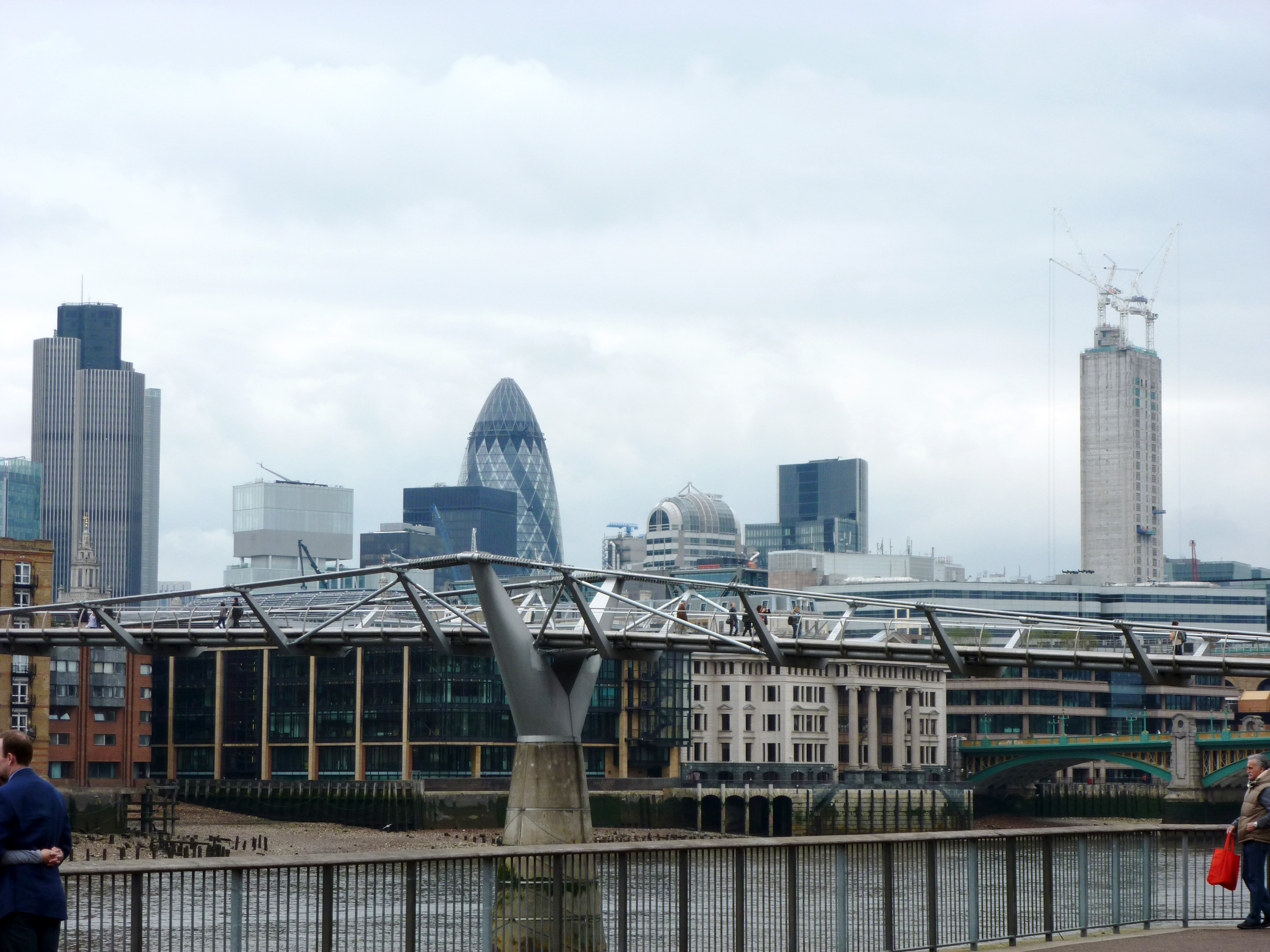
It’s a tie! Tower Bridge and Millennium Bridge each received 50% of the votes in the final round.
Thank you for participating in the 2026 Bridge Madness Tournament! I hope you had as much fun voting as I did watching the votes add up.
As a reminder, this year’s tournament featured bridges visited by urbantraipsing in London in 2012. Below are the completed brackets for Bridge Madness 2026. To learn more about the bridges, revisit the introduction which has links to posts on each bridge. Keep scrolling to see past winners and for an opportunity to send me feedback on Bridge Madness.
I’m already brainstorming for Bridge Madness 2027. Hope you come back!
Past Winners
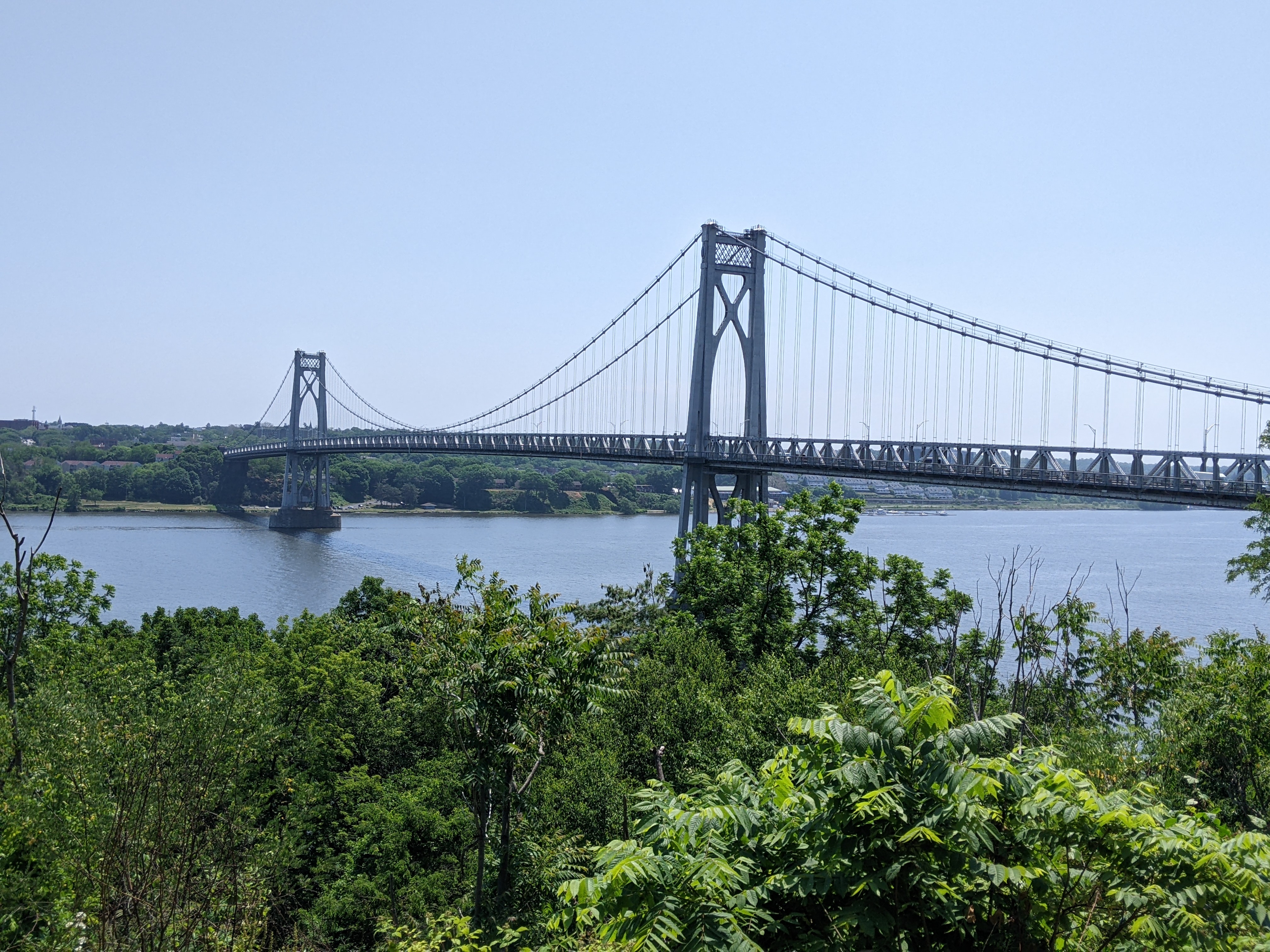
Bridge Madness 2025: National & International Suspension Bridges Winner – Mid-Hudson Bridge
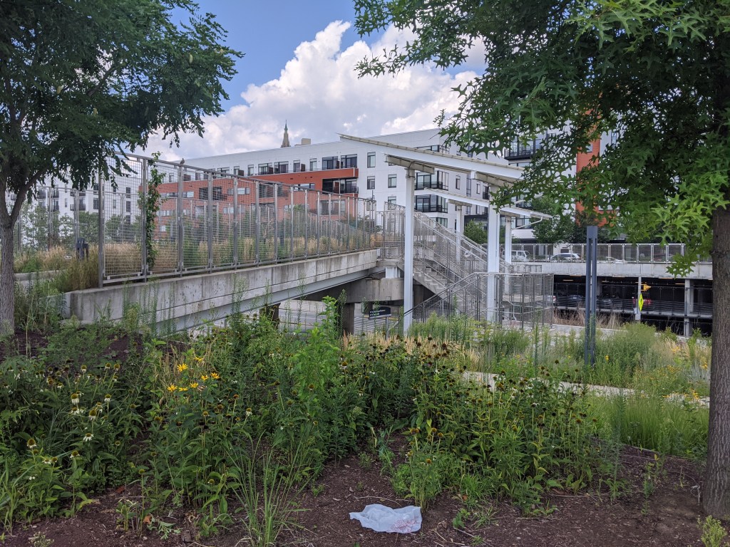
Bridge Madness 2024: Pittsburgh Pedestrian Bridges Winner – East Liberty Station Pedestrian Bridge
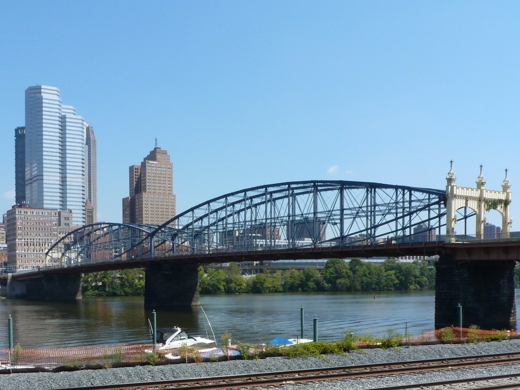
Bridge Madness 2023: Pittsburgh River Bridges Winner – Smithfield Street Bridge
After cataloguing the photos from my April 2025 bridge walking in Washington, DC,1 I revisited the photos from my prior trips to the city and was surprised to find this wasn’t the first time I had walked a bridge across the Potomac River.
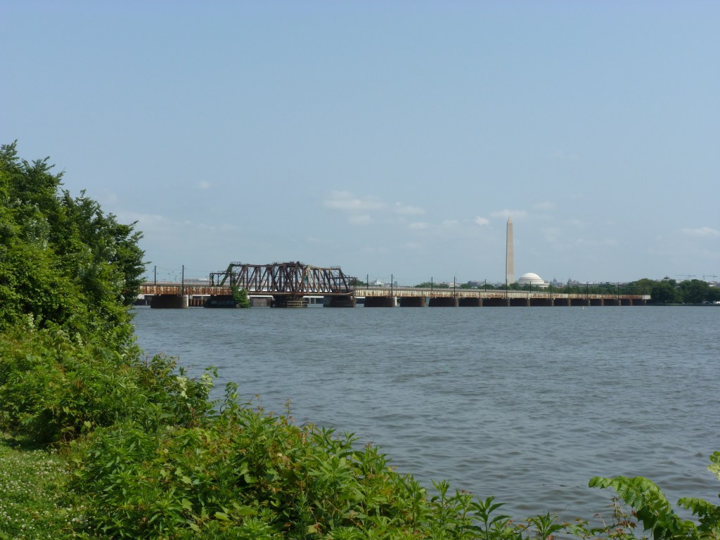
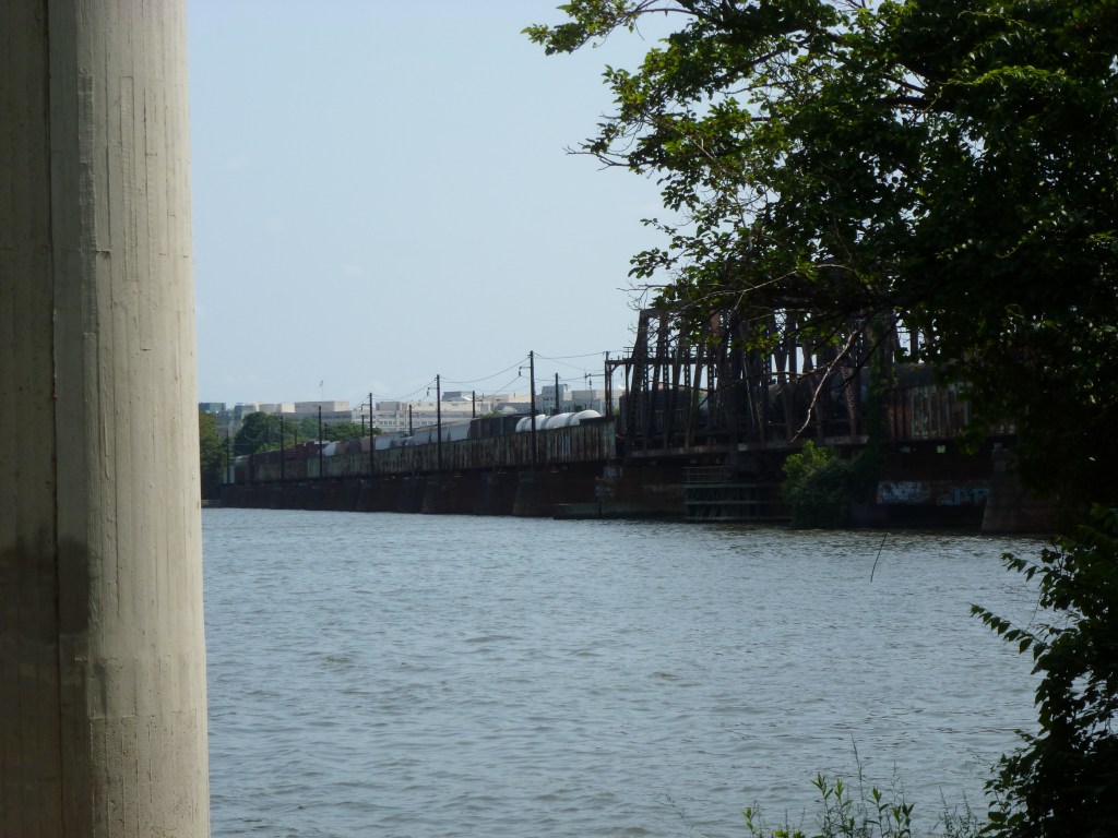
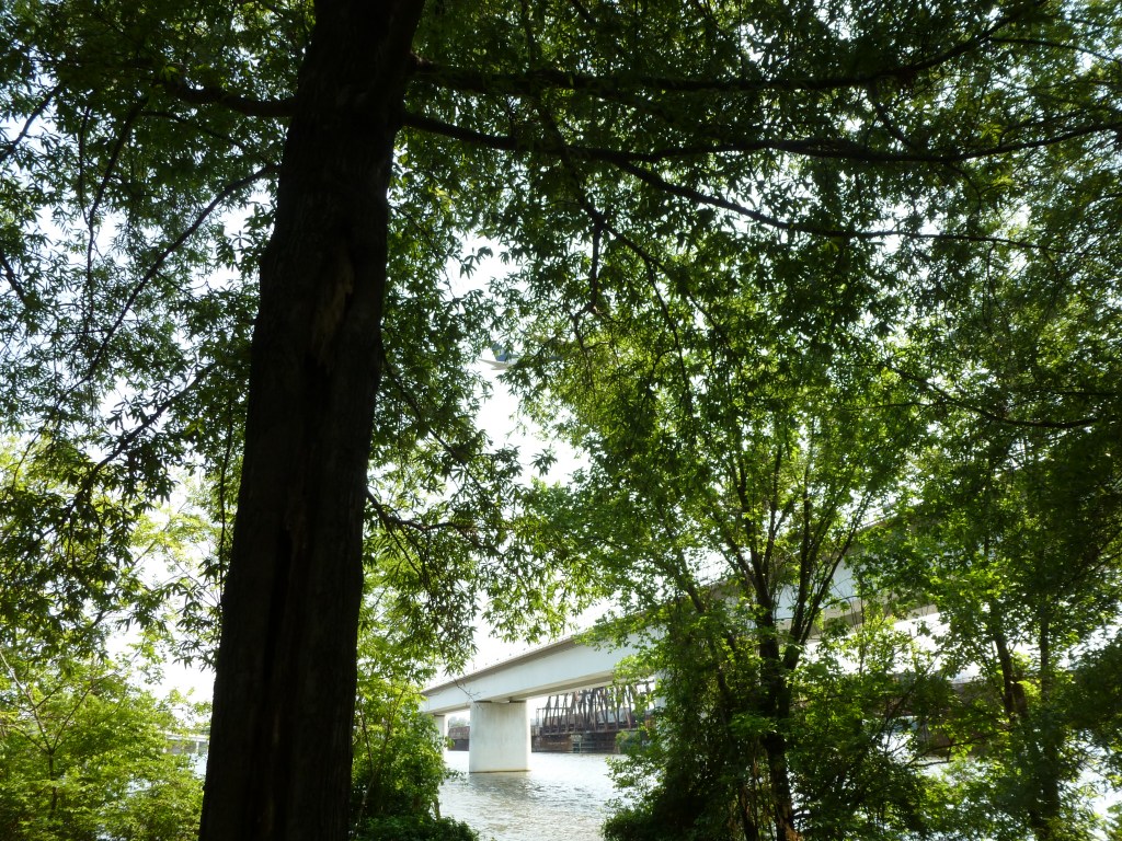
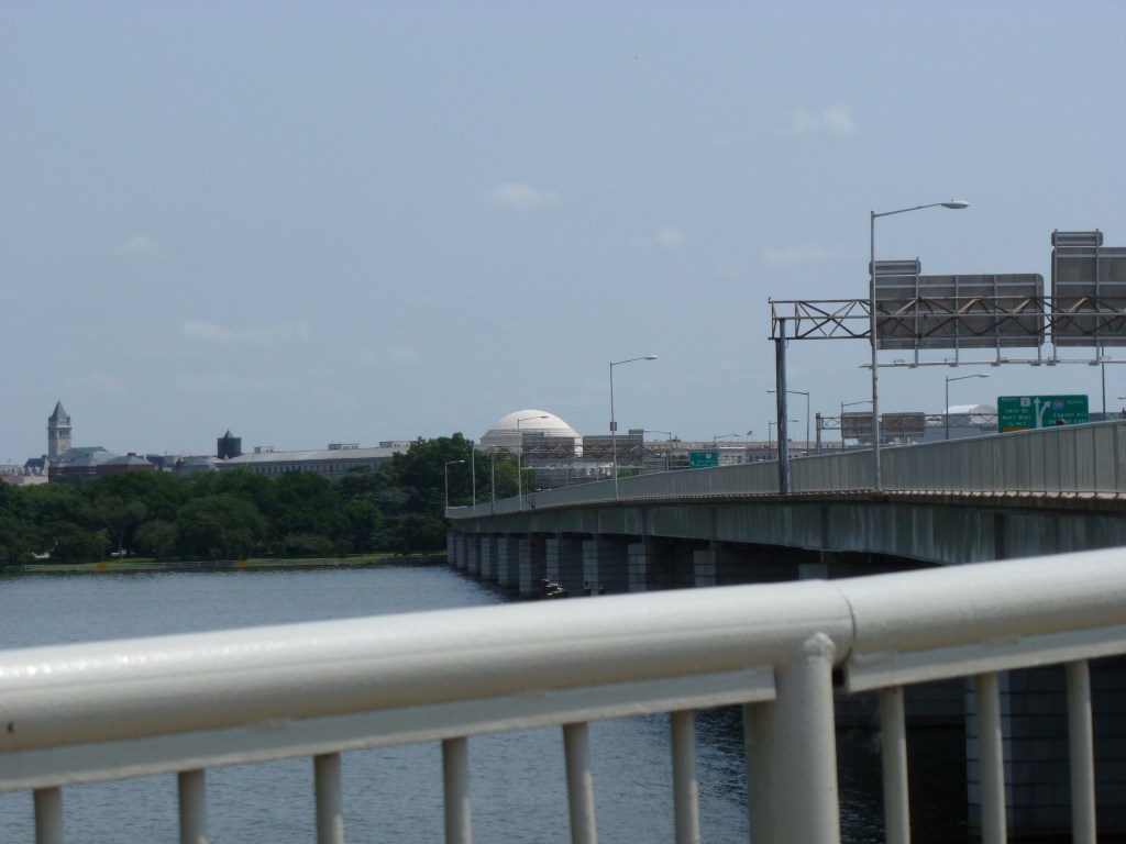
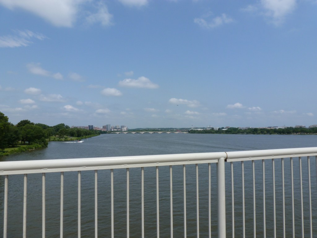
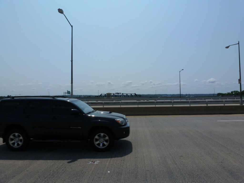
In May 2012, weeks after I had launched my bridge-walking career in London and days before I launched this blog, I was in Washington, DC, visiting my uncle. Based on my photos, I believe we rode the Metro and got off at the Crystal City stop. From there, we walked the Mount Vernon Trail passing over National Avenue/Smith Blvd by bridge and passing under the Long Bridge, Charles R. Fenwick Bridge, Arland D. Williams Jr. Memorial Bridge, 14th Street Bridge, and George Mason Memorial Bridge. We finished our bridge exploring by walking across the Potomac River on the George Mason Memorial Bridge.
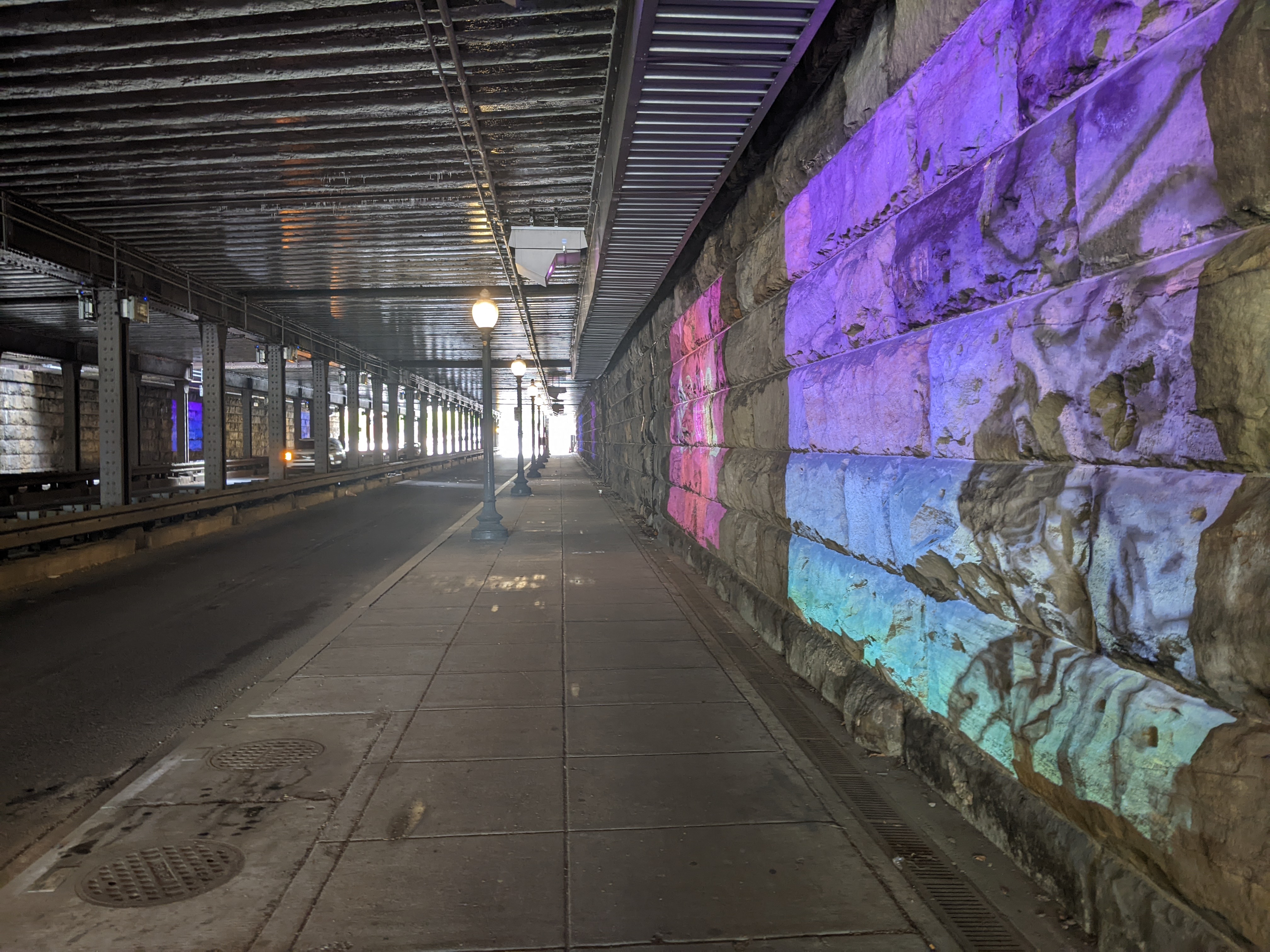
On Day 2 of my April 2025 Washington, DC, trip, I needed to take it easy. However, I couldn’t sit inside all day. On a short excursion near Union Station, I got uncomfortable as I approached the underbelly of the railroad bridge over K Street. My experience of similar structures in Pittsburgh is that they are dark, dirty, untended, and creepy. Bird droppings or bridge droppings are likely to land on you at any point.
The underbelly of this bridge over K Street defied my expectations. A light mural created a welcoming and engaging experience that felt more like Buffalo’s Seneca One murals than the underbelly of Pittsburgh’s railroad bridges. Because light was used instead of paint, it lit up a dark place and incorporated engaging animation:
While walking from the Rosslyn Metro Station to the Francis Scott Key Memorial Bridge over the Potomac, we walked over a surprise bridge. If we had chosen to walk over on the upriver side of the Francis Scott Key Memorial Bridge, I may have completely missed that we walked a bridge over I-66.
Gateway Park is a “cap” over the freeway and is both a park and a bridge. Unlike Pittsburgh’s CAP or Frankie Pace Park, Gateway Park was built in the 1980s at the same time as the freeway it covers. It also distinguishes itself from Pittsburgh’s park/bridge by appearing to be fully integrated with the surrounding city and having well-utilized programming.
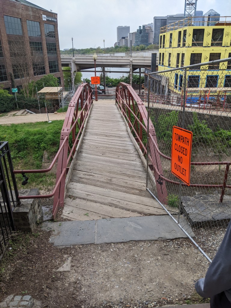
I couldn’t resist the temptation to walk across the C&O Canal, or what’s left of it. The climb down to this bridge from Georgetown and the Francis Scott Key Memorial Bridge included a very steep street and then some steps. Yet, this bridge is still significantly above the level of the river, approximately in line with the elevated freeway of Rt. 29.
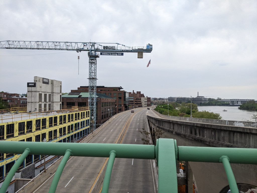
After walking the downward slope across this bridge and its ramp to the towpath level, we had to walk down a set of stairs to reach the level of the Georgetown Waterfront Park. As the sidewalk on Francis Scott Key Memorial Bridge is more than 60 ft above the water, the hike from the bridge to the waterfront park across the C&O Canal bridge is similar to climbing down and then up the stairs in a 6-7 story building.
There was an interesting mural along the stairs, and the park itself was beautiful, but the need to conserve my energy at this point limited the photos I took to the most important (the views of the Francis Scott Key Memorial Bridge and the underside of the elevated freeway shared in the Francis Scott Key Memorial Bridge post).
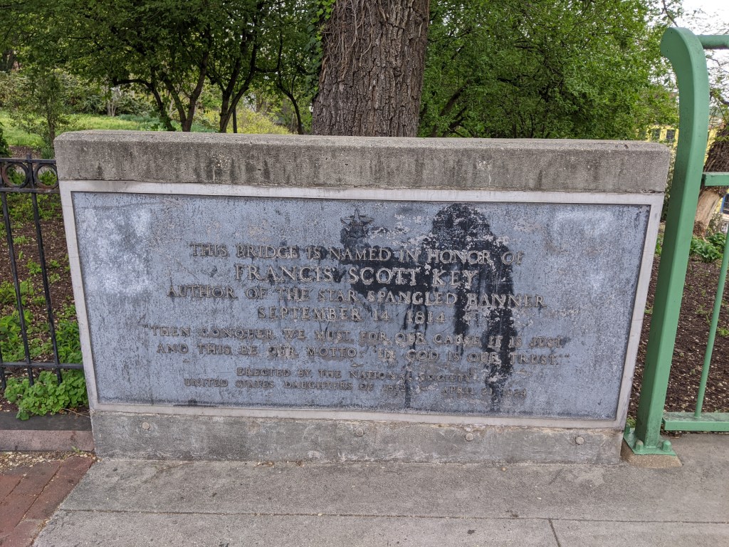
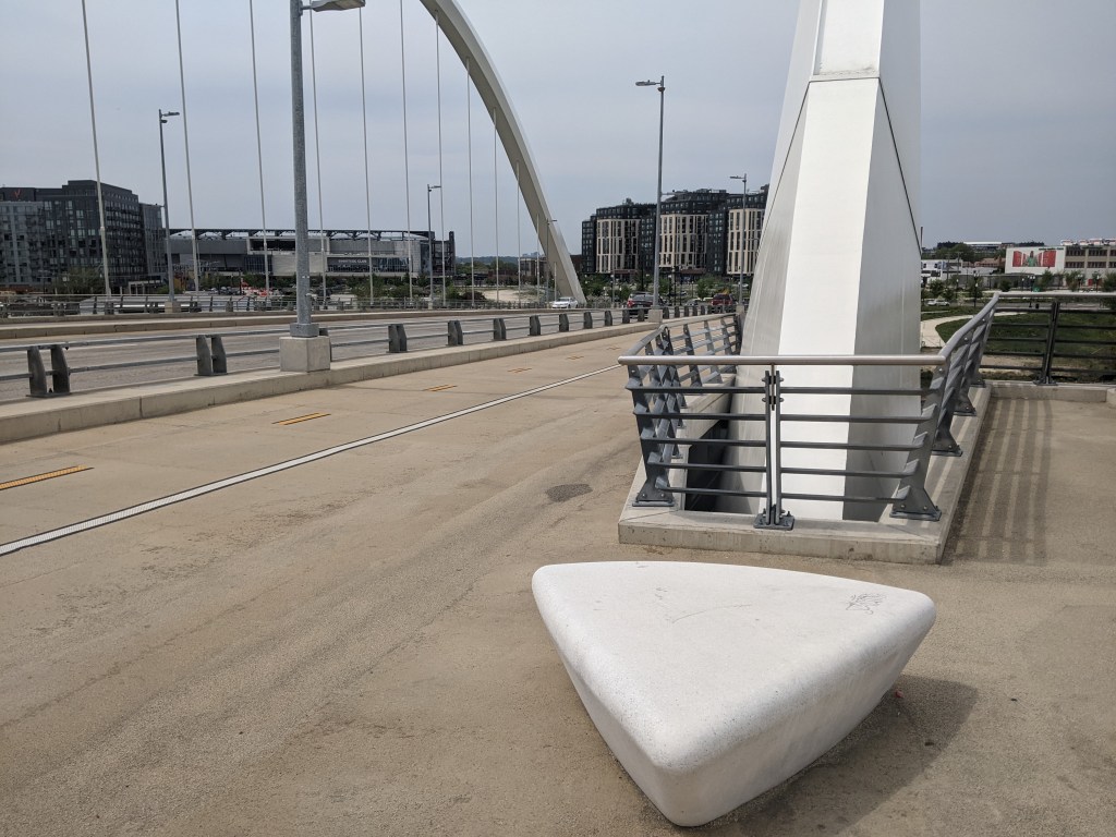
Knowing that wandering at will and walking as many bridges as possible was no longer a feasible option for me, my brother and I identified two must-see bridges for my weekend in DC: the Frederick Douglass Memorial Bridge and the Francis Scott Key Memorial Bridge.
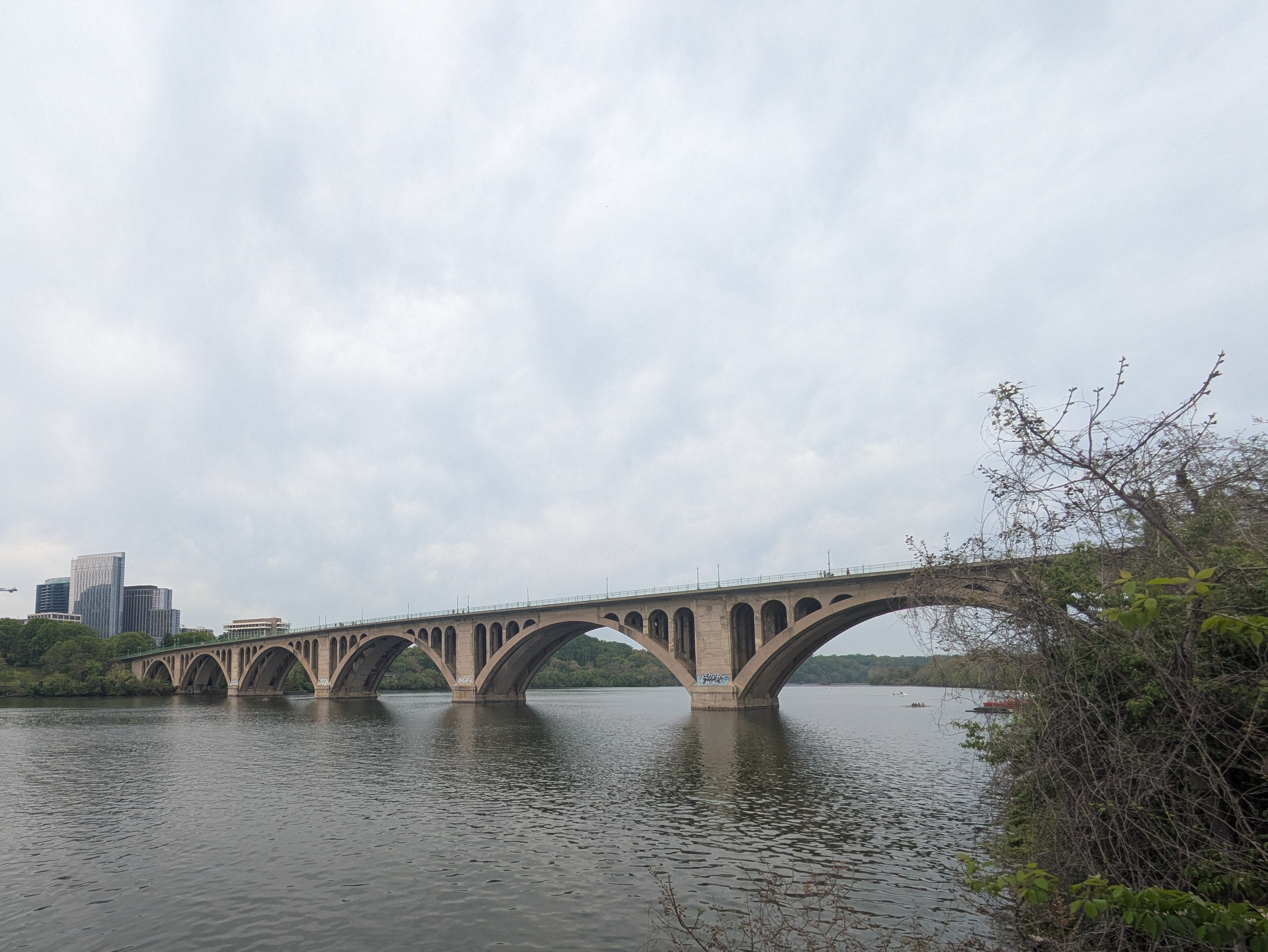
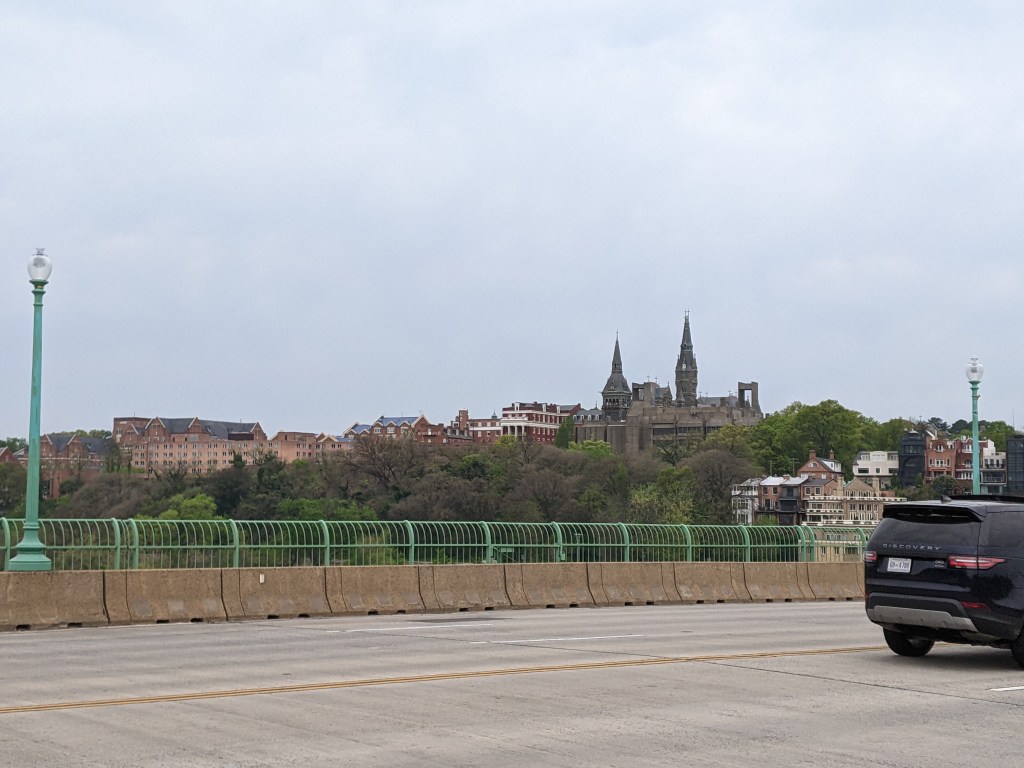
Not to be confused with Baltimore’s collapsed Francis Scott Key Bridge, the Francis Scott Key Memorial Bridge links Georgetown, DC, to the Rosslyn neighborhood of Arlington, VA.
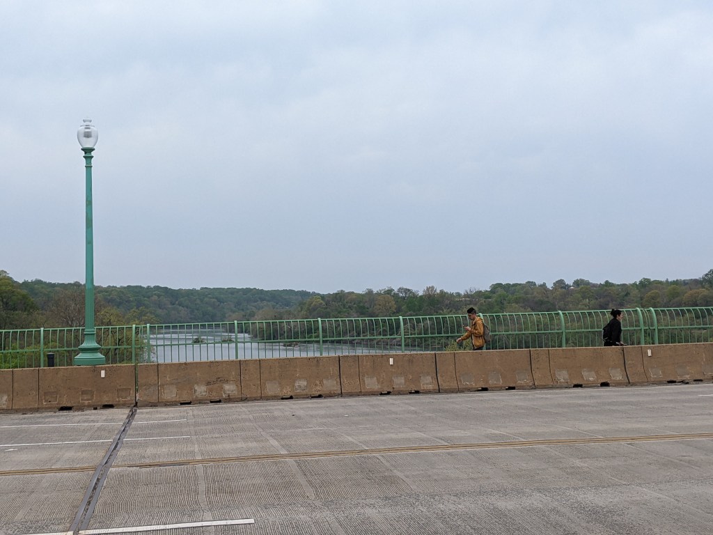
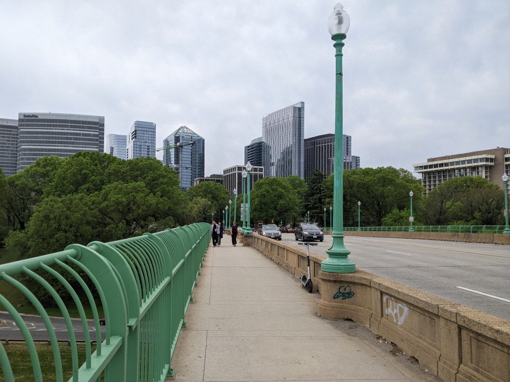
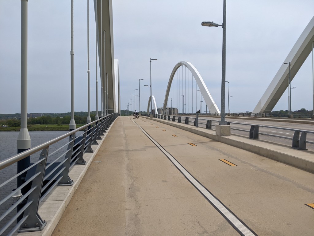
The Francis Scott Key Memorial Bridge is a curvilinear arch bridge carrying a six-lane highway with wide sidewalks on both sides over the Potomac River. It was built in 1917-1924. The width made it easy and comfortable to walk despite a high number of other pedestrians, bikes, and scooters on the sidewalk, and the speed of cars racing across.
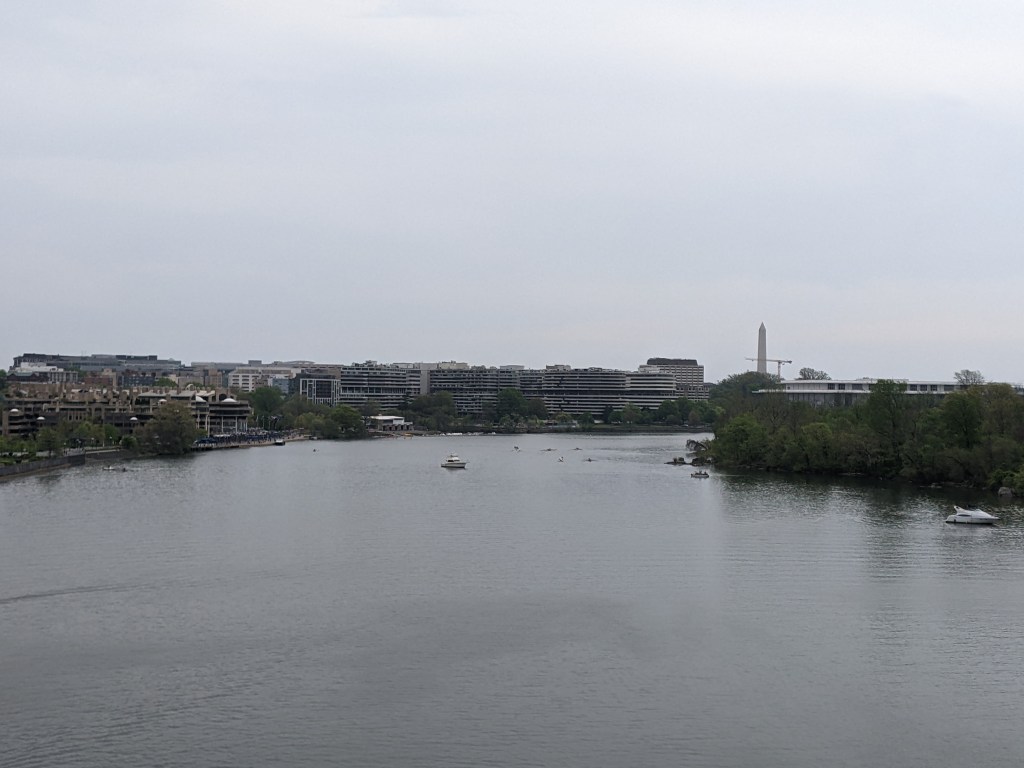
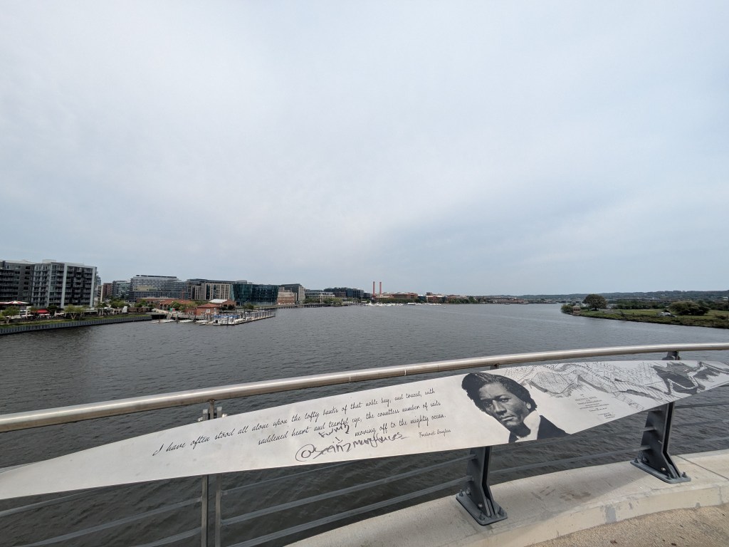
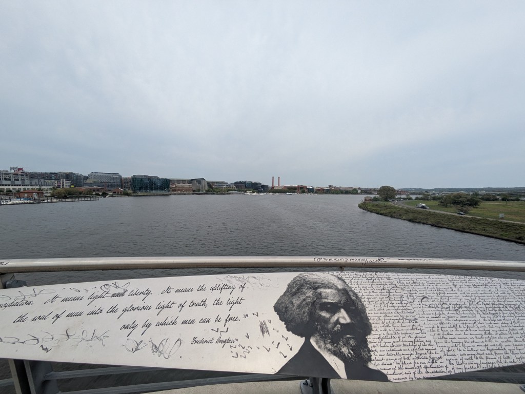
We walked along the downriver side, which provides ever changing views of downtown DC, the Kennedy Center, and the Washington Monument, thanks to the forested Theodore Roosevelt Island and nearly 90 degree bend in the river. This gave me plenty of excuses to pause, hydrate, rest, and take a photo.
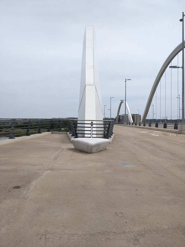
Georgetown and Rosslyn both sit high above the river, which meant the bridge is also elevated far above the river. It is high enough that an elevated freeway sits comfortably halfway between the bridge and the riverside ground level on the Georgetown side.
The goals of urbantraipsing and pacing for Long COVID were a delicate balance as we walked across the Francis Scott Key Memorial Bridge. There were several important decision points along the way. Option 1 was to walk only half-way across the bridge. I don’t like doing that for urbantraipsing and there was a coffee shop on the far end that was a good option for refilling my water bottle and taking a short rest. So we walked all the way across.
As we approached the Georgetown side, I was very tempted to climb down to the park near the level of the water. I could tell that this would be a great spot to get an establishing shot for the bridge, but the effort of climbing down and back up from there did not seem worth it . . . until I saw that in doing so, we would walk across a C&O Canal bridge. Adding another bridge to my collection along with the fact that we could sit by the riverside and rest before climbing back up tipped the balance of pros and cons in favor of going down.
Due to the placement of Metro stations, the only choice for getting back to the Metro and on to our next stop was to retrace our steps back across the bridge. By the time we did all that, it was lunchtime and I had nearly reached my daily step count.
For years, even before I started urbantraipsing, I thought nothing of walking from transit stop to transit stop, bridge to bridge, as I explore and encounter the expected and unexpected nooks and crannies of a city. That way of life came crashing to a devastating halt in the fall of 2023 when I developed Long COVID.
Six months passed.
And then a year.
The return to “normal” my doctors promised seemed increasingly unlikely. But a return to functional seemed within reach. The question remained: did urbantraipsing fall within this new functionality?
After a few local test excursions, I felt physically and mentally strong enough to test travel. In April 2025, I took a long-overdue trip to visit my brother in Washington, DC. On this trip, I encountered some great bridges and learned that, much like other activities, with modification and accommodation urbantraipsing is a way of life I can continue.
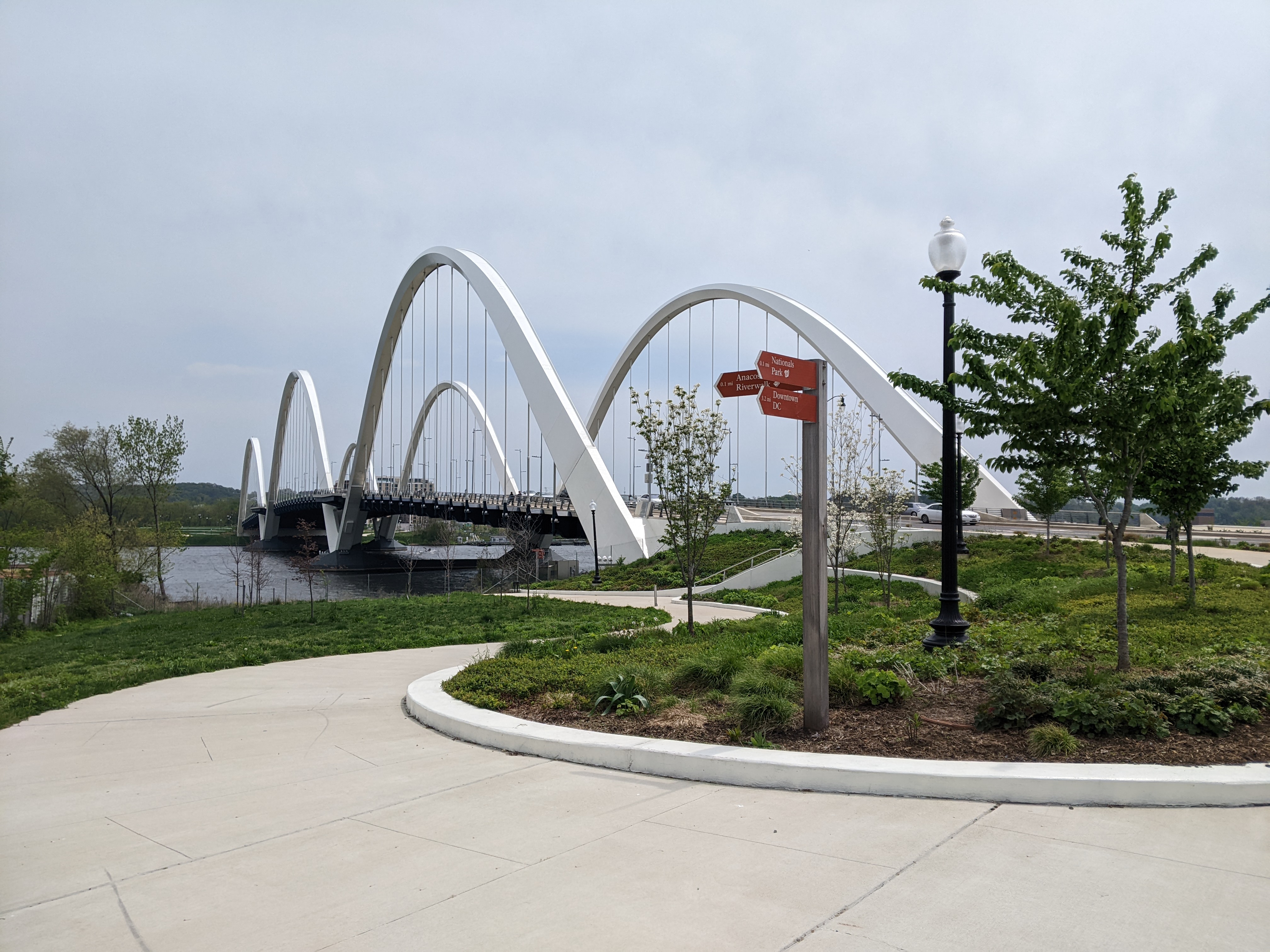
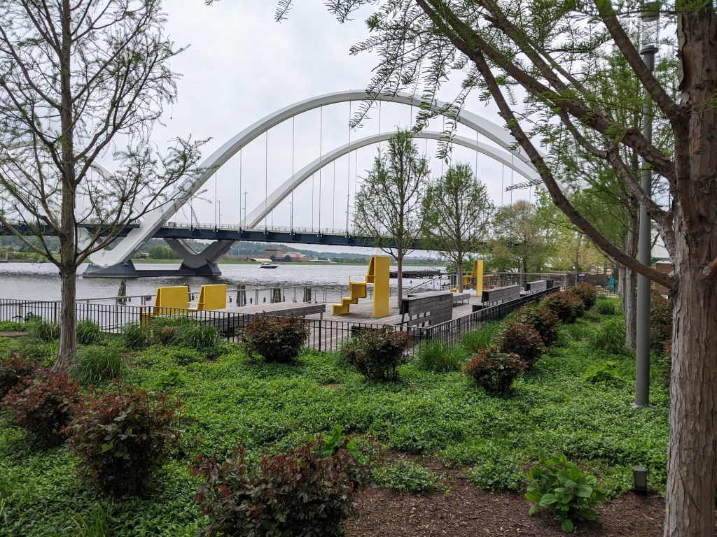
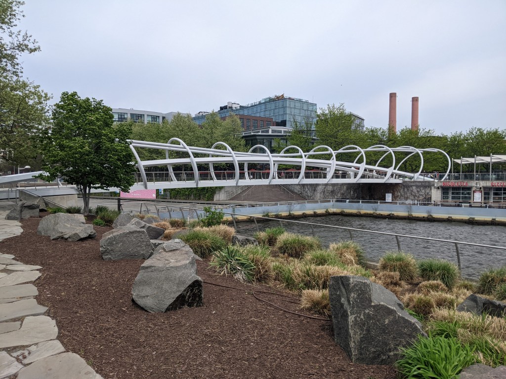
The open, through-arch Frederick Douglass Memorial Bridge was one of our expected encounters. I probably would have been ecstatic about the unexpected benches in the lookouts between the arches under previous circumstances. After all, it isn’t every day that you find a bench on a bridge. However, in the past, I probably would have just said “that’s cool,” photographed them, and moved on. Instead, I took full advantage of these seats for one of my rest and rehydration breaks. This slow down is the reason I spotted the Yard Park Bridge, a bridge I definitely needed to add to my collection.
Perhaps slowing down and being more intentional to accommodate my Long COVID needs will continue to add depth to my urbantraipsing experiences.
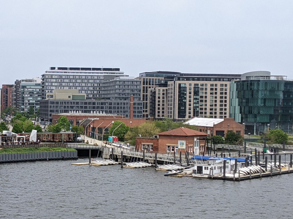
The Anacostia Riverwalk Trail crosses over the openings of several canal channels within a short distance from the Frederick Douglass Bridge in Washington, DC. The first canal opening that I walked over, I had no idea that I was walking on a bridge…like when I walked over the Grosvenor Canal in London. It wasn’t until I was checking out the views from the Frederick Douglass Bridge that I saw the opening for the canal underneath the path I had just walked. (First picture in the slide show below.)
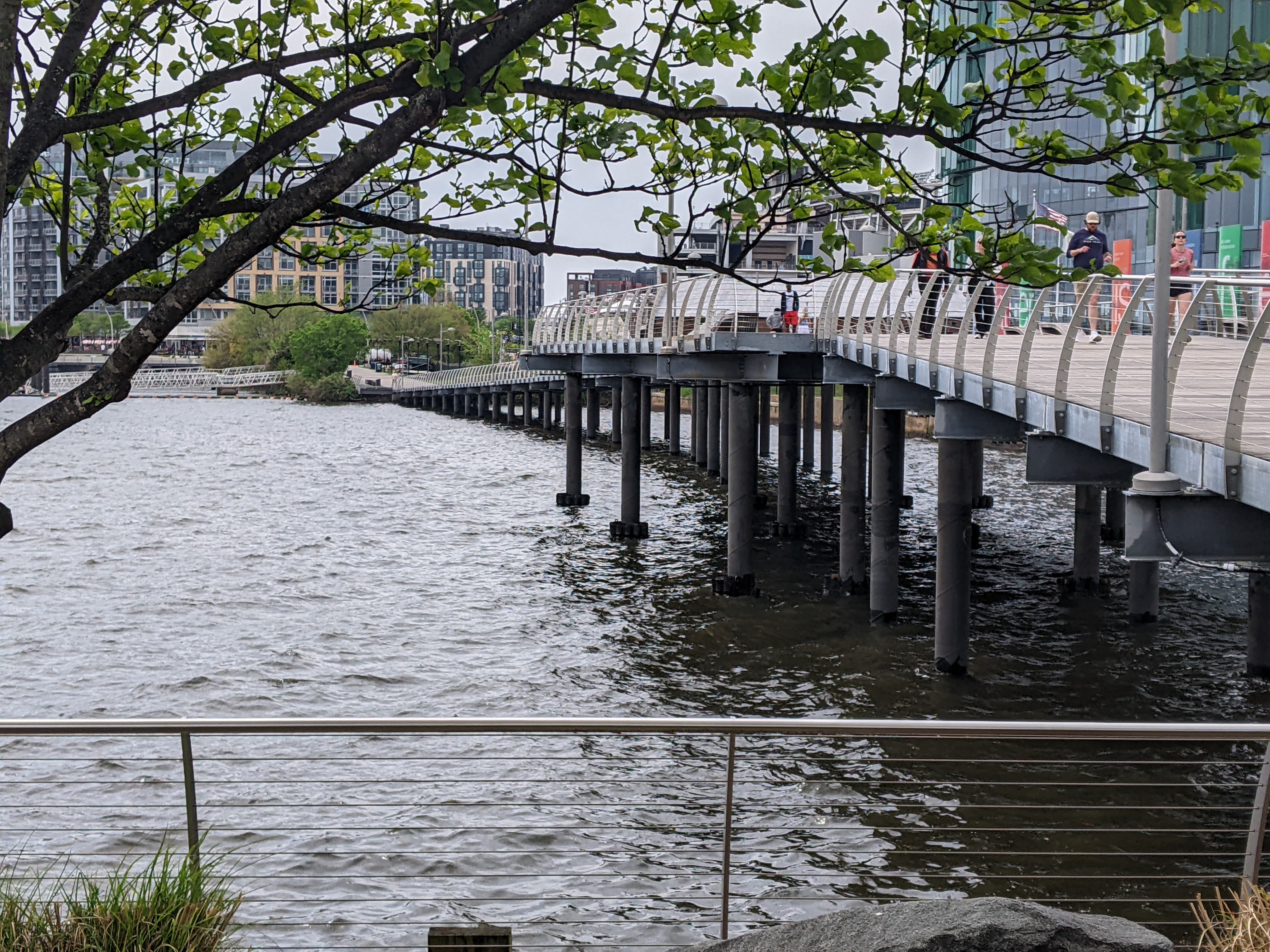
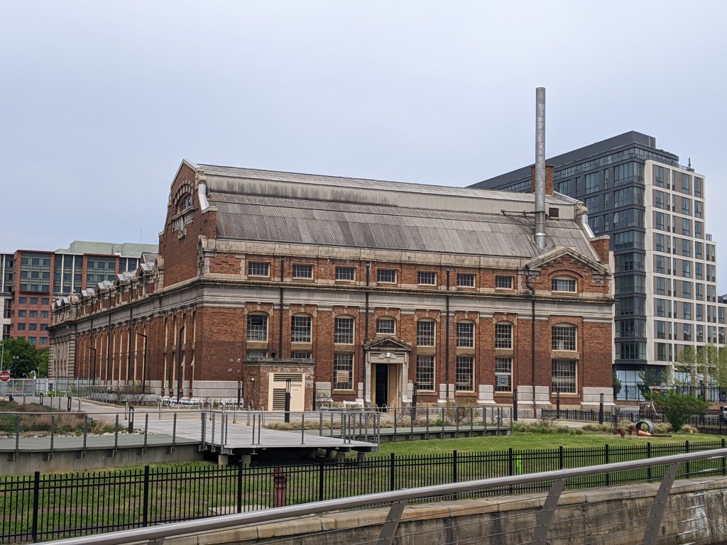
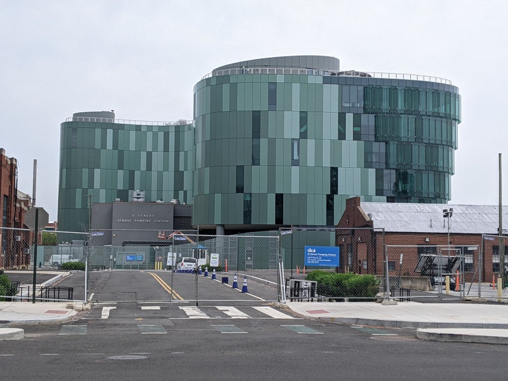
The bridge pictured above appears to have been over a canal that fed into or out of (or both?) the old O Street Pumping Station. This bridge was clearly visible as we walked passed it on our way to the Frederick Douglass. I was tempted to cross it (as a bridge walker, it is hard to walk passed a bridge and not over it), but I was tired and trying to conserve energy. However, once on the Frederick Douglass Bridge, I spotted another pedestrian bridge just beyond this one that I could not pass up the opportunity to walk, no matter how tired I was.
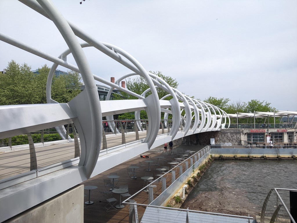
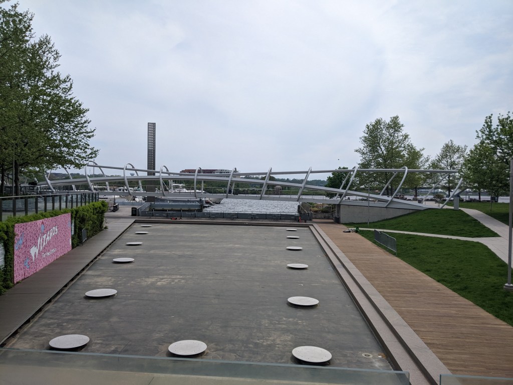
The Yard Park Bridge is a highly photogenic bridge, perhaps rivalling London’s Millennium Bridge. It crosses over what I think are the remnants of the Washington City Canal, most of which has been paved over. The paved portion visible from the Yard Park Bridge reminded me of the portions of the Erie Canal in Buffalo paved over for a skating rink and other recreational purposes.
Bridge over an unknown canal
Old O Street Pump Station
New O Street Pump Station
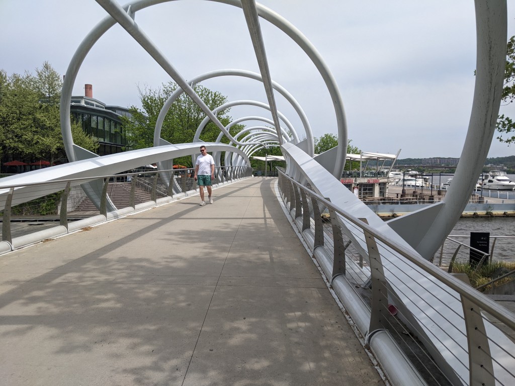
Yard Park Bridge exterior 1
Yard Park Bridge exterior 2
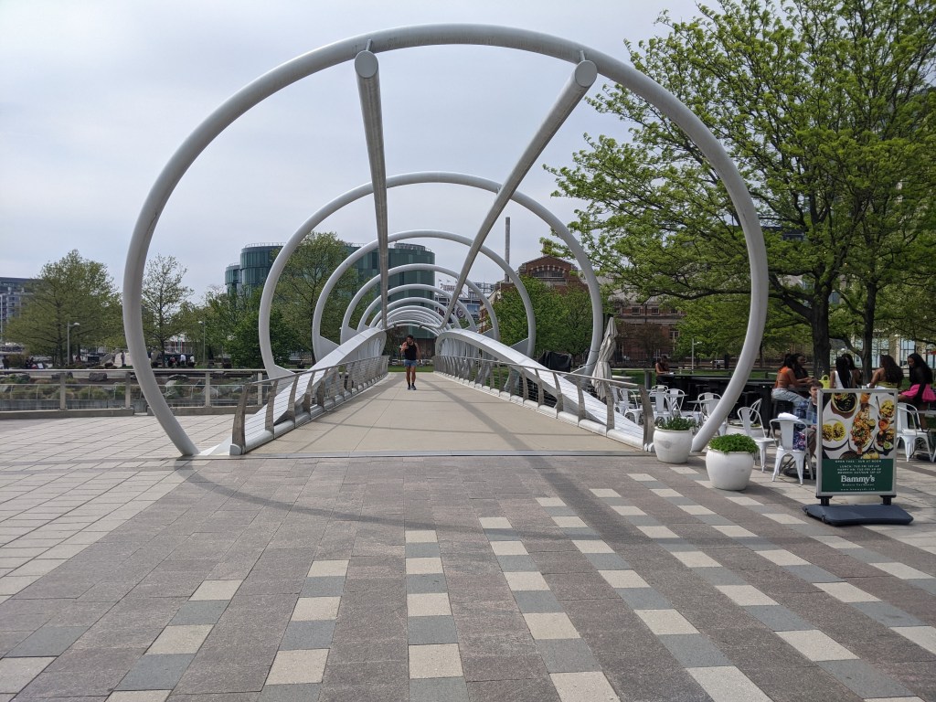
Inside the Yard Park Bridge
Yard Park Bridge opening
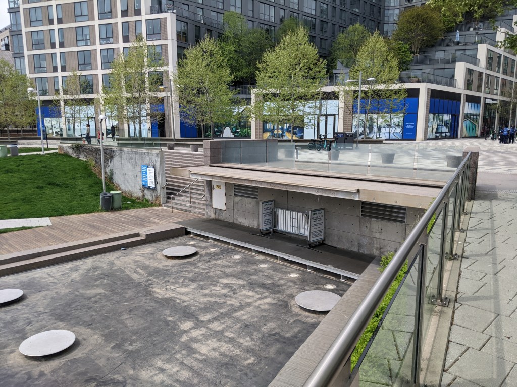
Paved-over vestiges of the Washington City Canal 1
Paved-over vestiges of the Washington City Canal 2
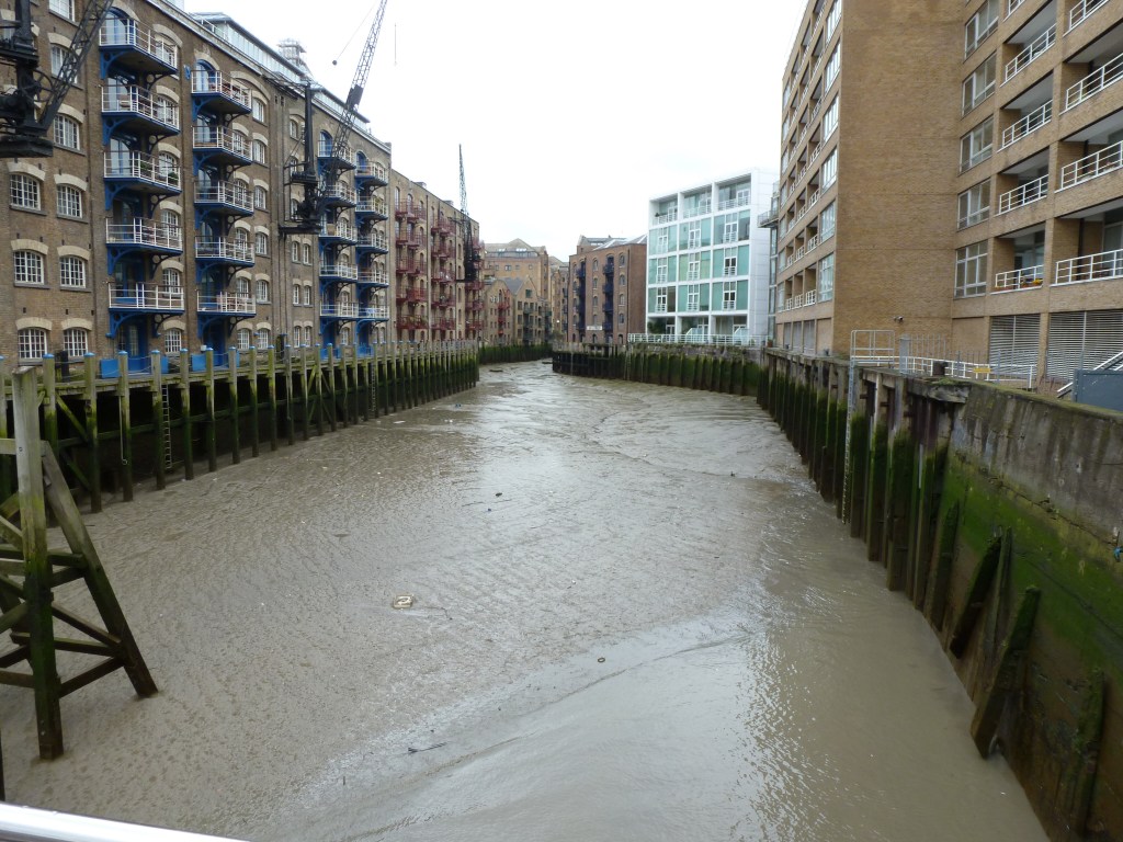
There are four docks or canals connecting into the River Thames along the stretch of the river through Central London that I walked in 2012. I walked bridges over three of these, though I was too distracted by other sites to photograph one of them. The one I missed was the Grosvenor Canal between the Chelsea and Grosvenor Bridges. I was busy photographing the former Battersea Power Station, Grosvenor Bridge, and the train yard next to the Grosvenor Bridge to notice that I walked another small bridge over the Grosvenor Canal. Returning to the site through Google Street View, it looks like the kind of bridge that you’d have to know was there to notice it.
I did notice when I was crossing the bridge across Ransome Dock (picture above), between the Battersea and Albert Bridges. Although, I hadn’t yet learned my lesson to always take an establishing shot of the bridge itself, not just the views from the bridge.
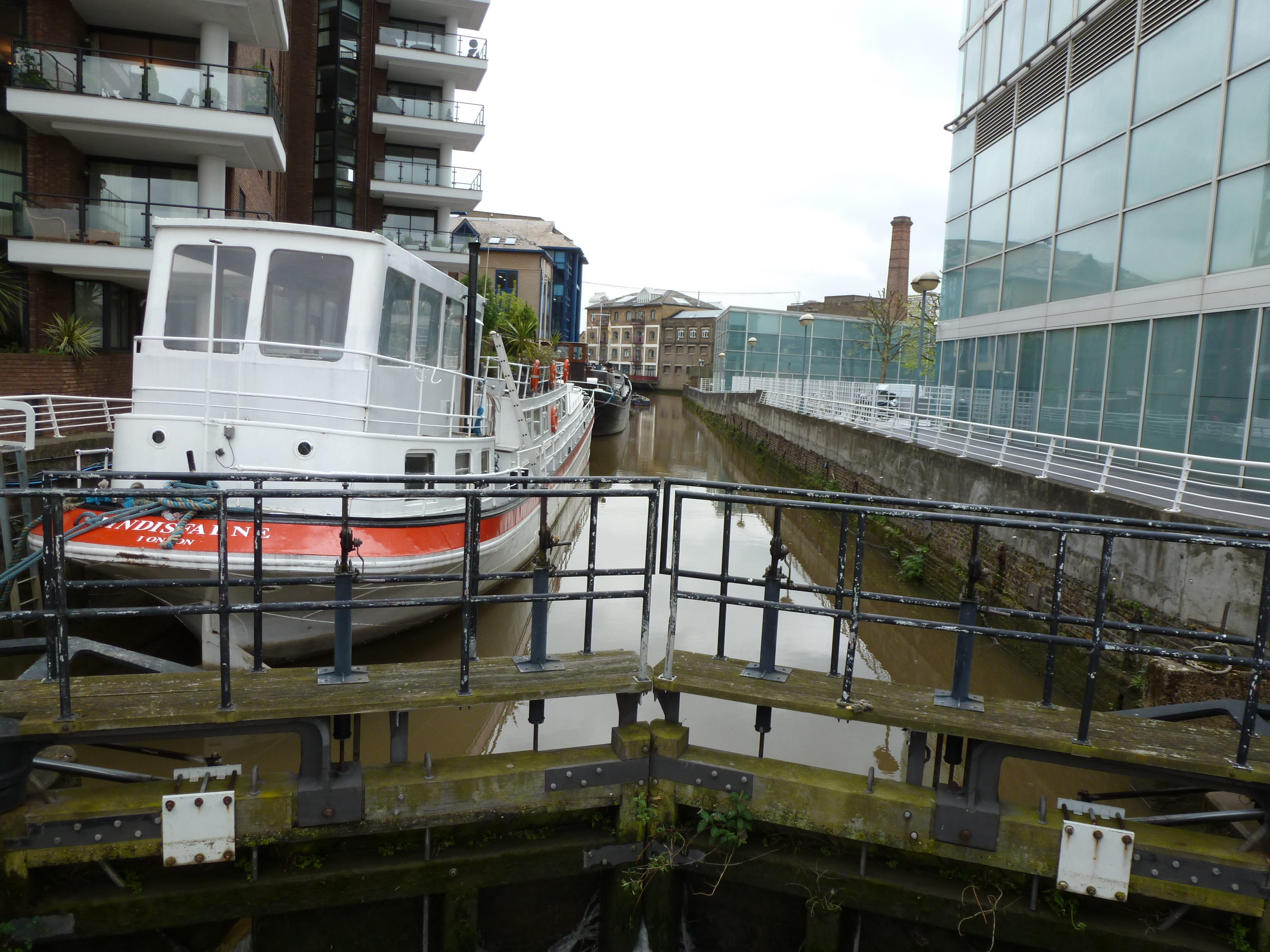
I also noticed when I walked across the Rolling Bridge over St. Saviour’s Dock (picture below), which is slightly downriver from the Tower Bridge. The structure of the bridge itself was fascinating enough that I did take a picture of it. It wasn’t until much later that I learned it truly is a unique bridge – the only draw bridge to curl up on itself.
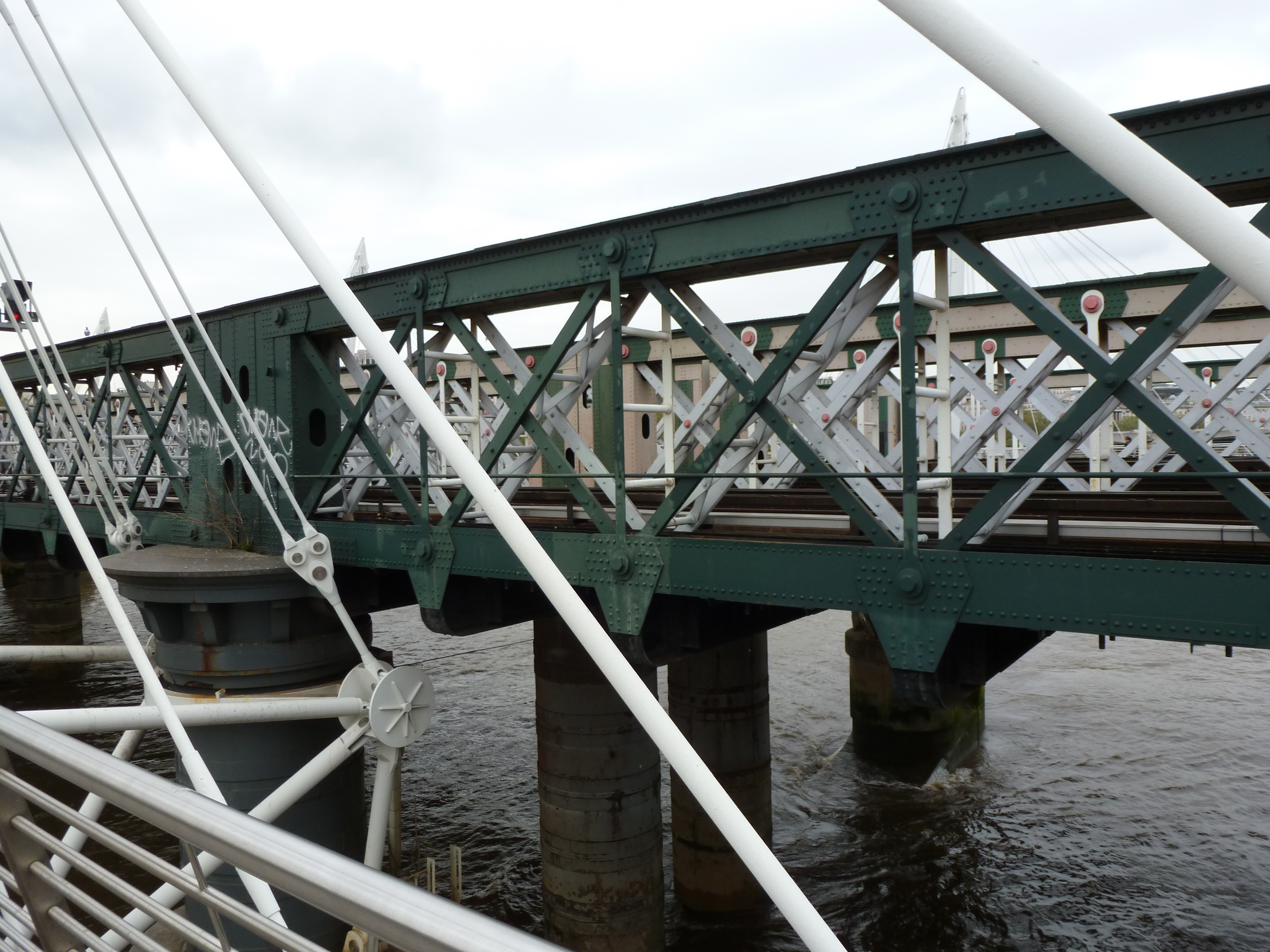
The Hungerford Bridge is unique among London bridges. It is a truss bridge, instead of the more typical deck arch bridges up and down the river. Also, it has a pedestrian bridge hanging off each side of it, collectively know as the Jubilee Bridges, that nearly hide the Hungerford Bridge from view, begging the question: how many is one bridge?