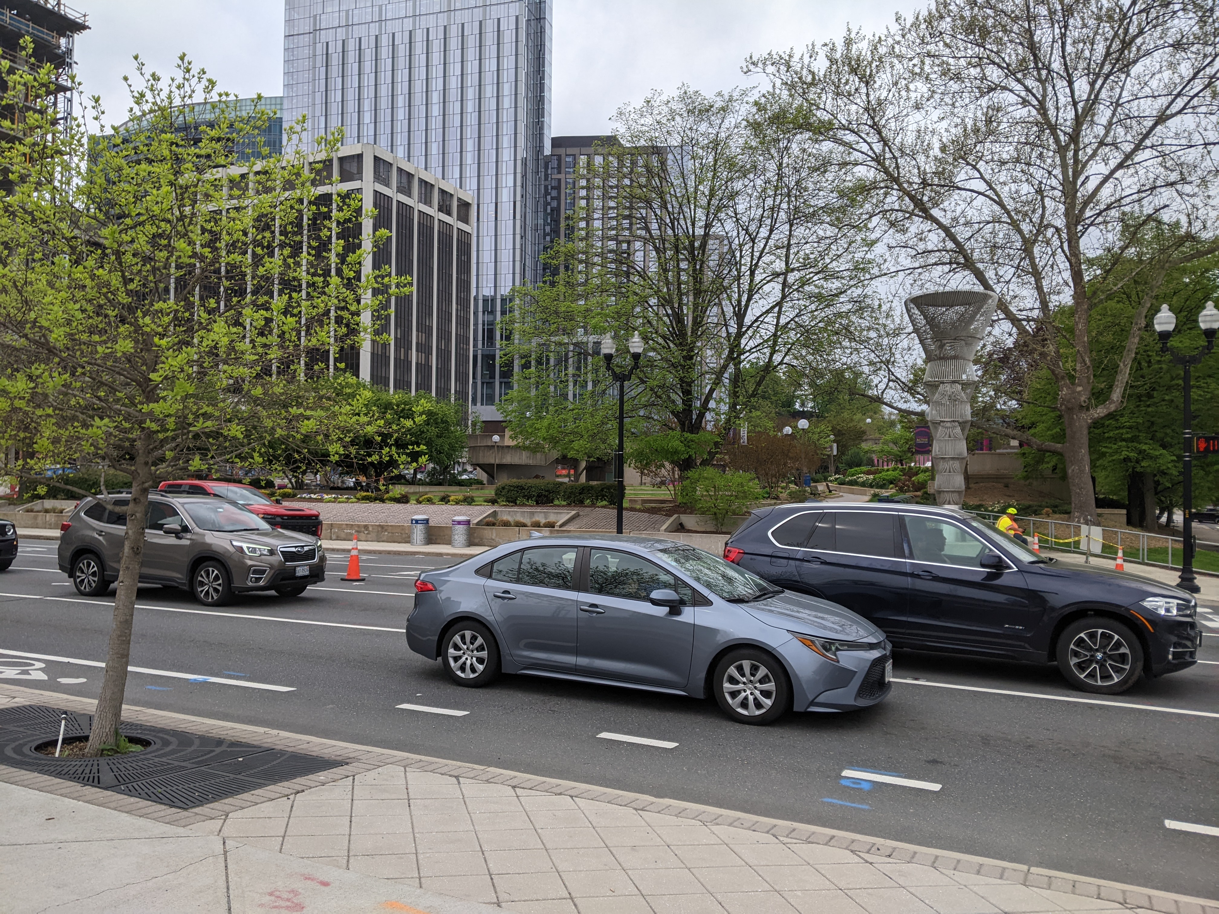
While walking from the Rosslyn Metro Station to the Francis Scott Key Memorial Bridge over the Potomac, we walked over a surprise bridge. If we had chosen to walk over on the upriver side of the Francis Scott Key Memorial Bridge, I may have completely missed that we walked a bridge over I-66.
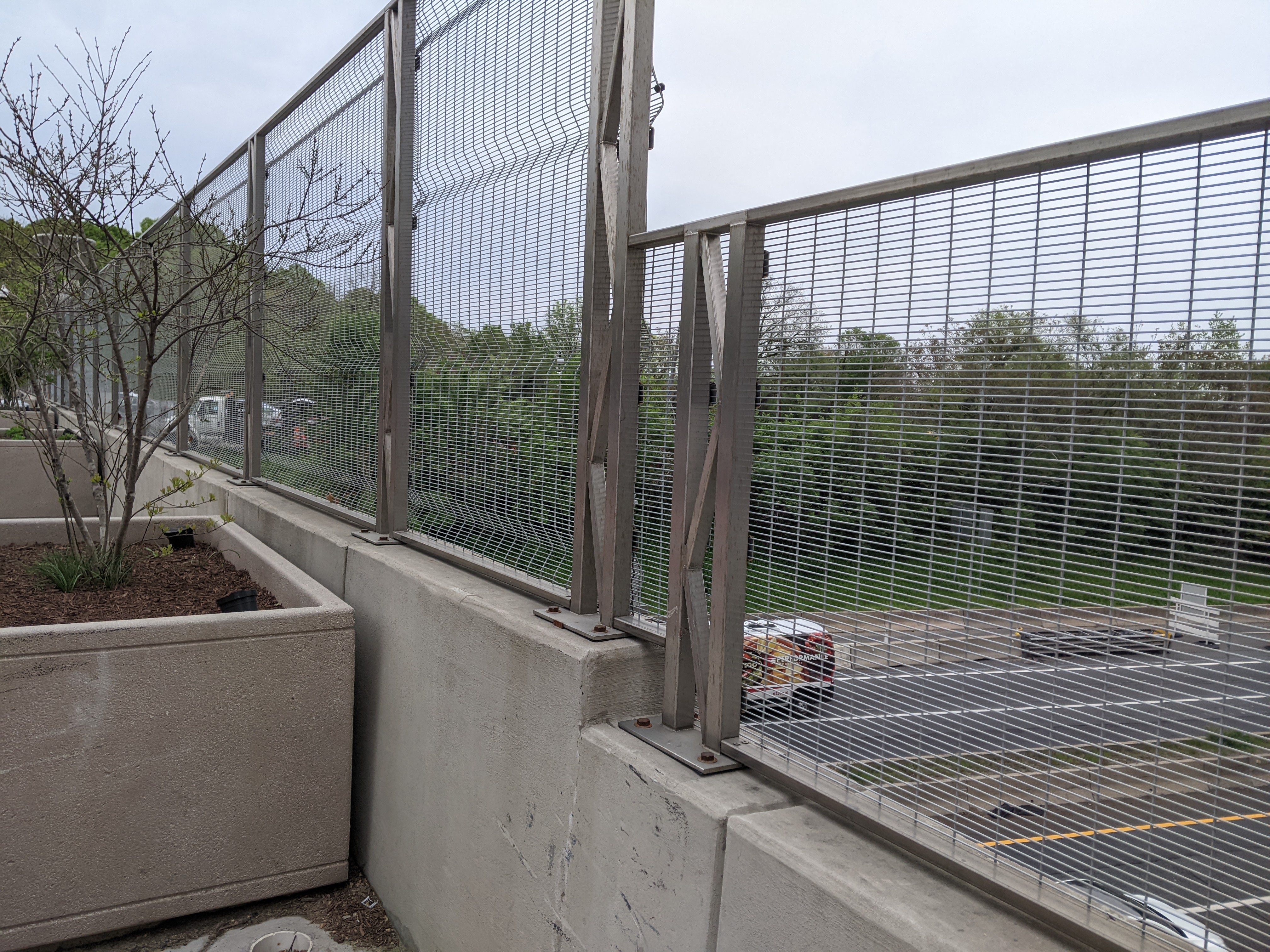
Gateway Park is a “cap” over the freeway and is both a park and a bridge. Unlike Pittsburgh’s CAP or Frankie Pace Park, Gateway Park was built in the 1980s at the same time as the freeway it covers. It also distinguishes itself from Pittsburgh’s park/bridge by appearing to be fully integrated with the surrounding city and having well-utilized programming.
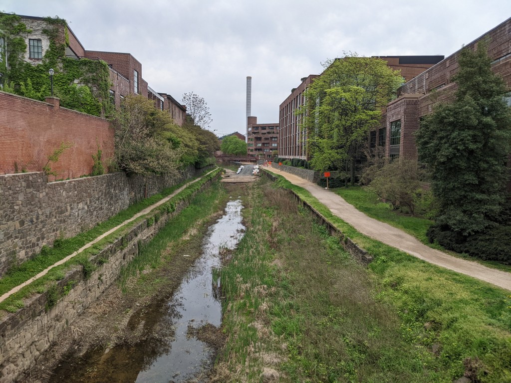
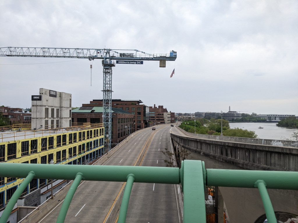
I couldn’t resist the temptation to walk across the C&O Canal, or what’s left of it. The climb down to this bridge from Georgetown and the Francis Scott Key Memorial Bridge included a very steep street and then some steps. Yet, this bridge is still significantly above the level of the river, approximately in line with the elevated freeway of Rt. 29.
After walking the downward slope across this bridge and its ramp to the towpath level, we had to walk down a set of stairs to reach the level of the Georgetown Waterfront Park. As the sidewalk on Francis Scott Key Memorial Bridge is more than 60 ft above the water, the hike from the bridge to the waterfront park across the C&O Canal bridge is similar to climbing down and then up the stairs in a 6-7 story building.
There was an interesting mural along the stairs, and the park itself was beautiful, but the need to conserve my energy at this point limited the photos I took to the most important (the views of the Francis Scott Key Memorial Bridge and the underside of the elevated freeway shared in the Francis Scott Key Memorial Bridge post).
Knowing that wandering at will and walking as many bridges as possible was no longer a feasible option for me, my brother and I identified two must-see bridges for my weekend in DC: the Frederick Douglass Memorial Bridge and the Francis Scott Key Memorial Bridge.
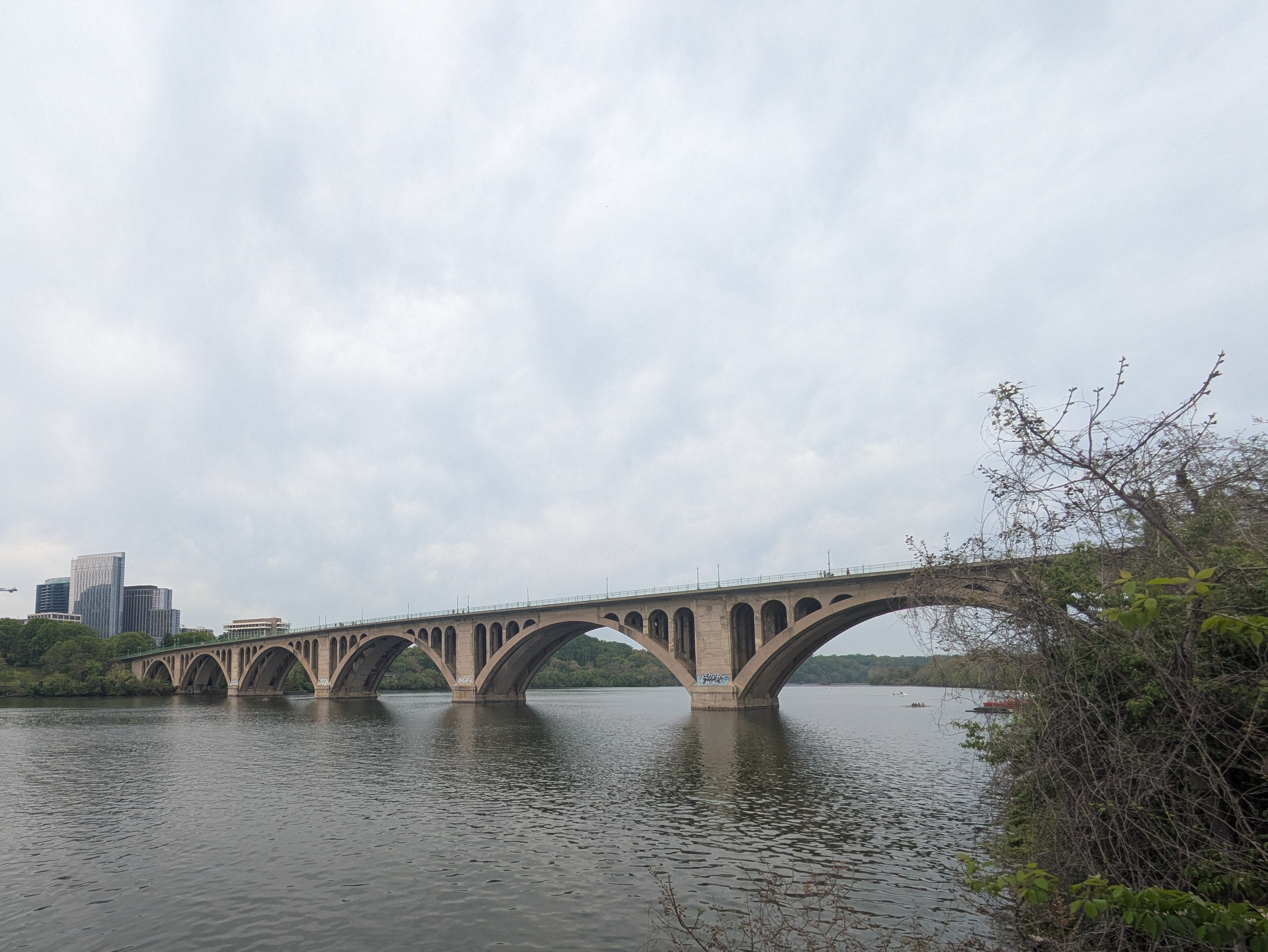
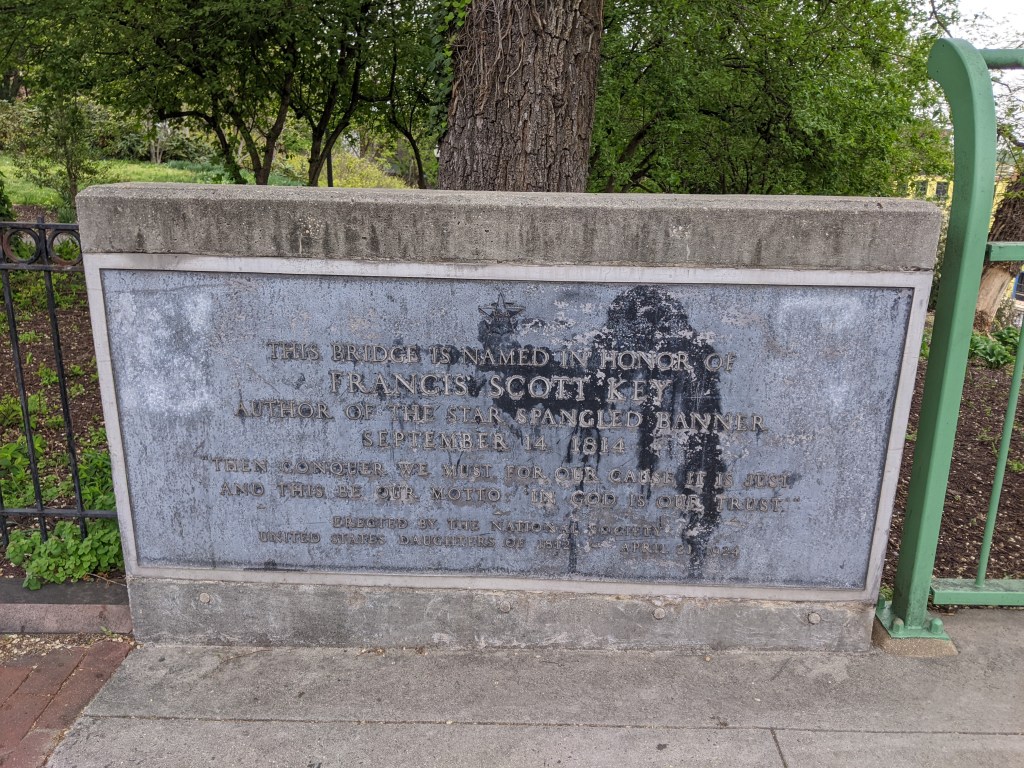
Not to be confused with Baltimore’s collapsed Francis Scott Key Bridge, the Francis Scott Key Memorial Bridge links Georgetown, DC, to the Rosslyn neighborhood of Arlington, VA.
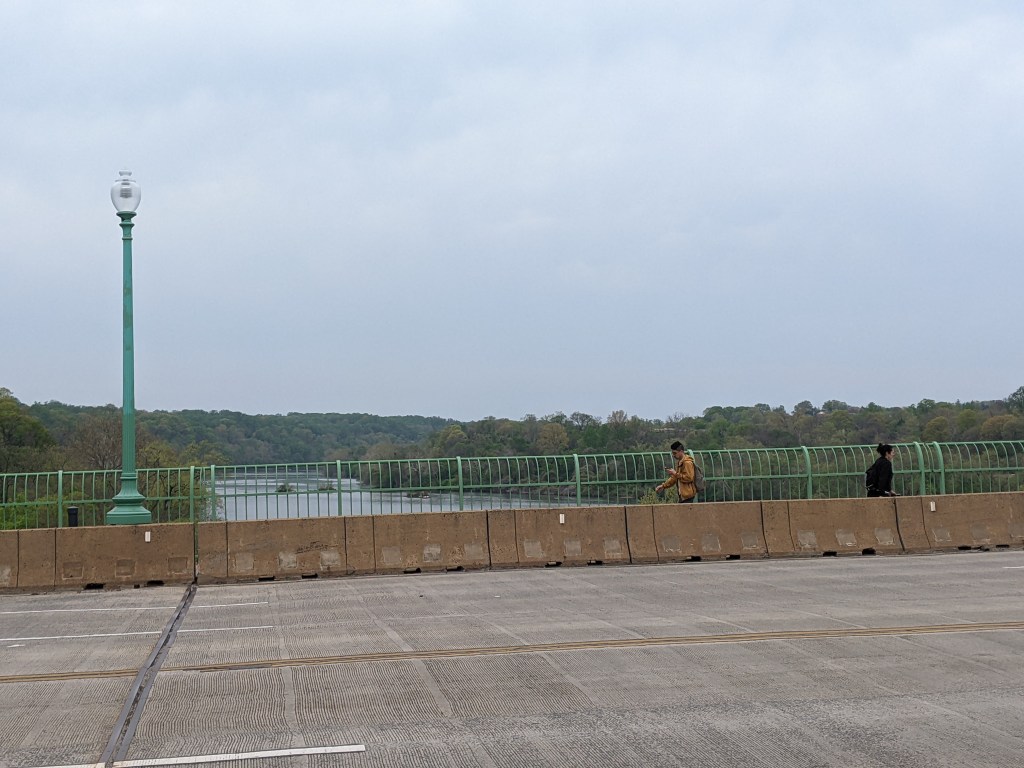
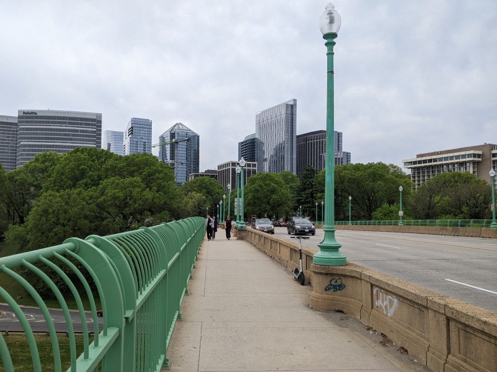
The Francis Scott Key Memorial Bridge is a curvilinear arch bridge carrying a six-lane highway with wide sidewalks on both sides over the Potomac River. It was built in 1917-1924. The width made it easy and comfortable to walk despite a high number of other pedestrians, bikes, and scooters on the sidewalk, and the speed of cars racing across.
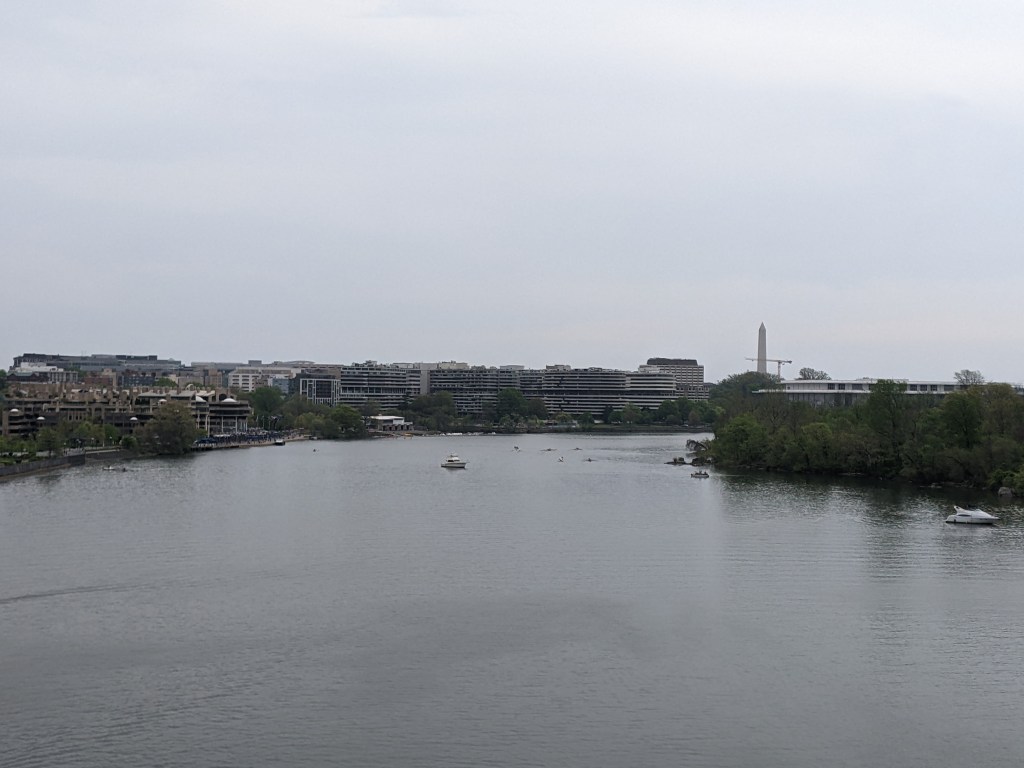
We walked along the downriver side, which provides ever changing views of downtown DC, the Kennedy Center, and the Washington Monument, thanks to the forested Theodore Roosevelt Island and nearly 90 degree bend in the river. This gave me plenty of excuses to pause, hydrate, rest, and take a photo.
Georgetown and Rosslyn both sit high above the river, which meant the bridge is also elevated far above the river. It is high enough that an elevated freeway sits comfortably halfway between the bridge and the riverside ground level on the Georgetown side.
The goals of urbantraipsing and pacing for Long COVID were a delicate balance as we walked across the Francis Scott Key Memorial Bridge. There were several important decision points along the way. Option 1 was to walk only half-way across the bridge. I don’t like doing that for urbantraipsing and there was a coffee shop on the far end that was a good option for refilling my water bottle and taking a short rest. So we walked all the way across.
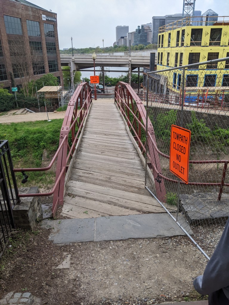
As we approached the Georgetown side, I was very tempted to climb down to the park near the level of the water. I could tell that this would be a great spot to get an establishing shot for the bridge, but the effort of climbing down and back up from there did not seem worth it . . . until I saw that in doing so, we would walk across a C&O Canal bridge. Adding another bridge to my collection along with the fact that we could sit by the riverside and rest before climbing back up tipped the balance of pros and cons in favor of going down.
Due to the placement of Metro stations, the only choice for getting back to the Metro and on to our next stop was to retrace our steps back across the bridge. By the time we did all that, it was lunchtime and I had nearly reached my daily step count.