

Arlington Neighborhood
Arlington Avenue follows the crest of a ridge with the Arlington neighborhood draped over the southern slope and the South Side Slopes neighborhood draped over the northern slope. While I didn’t encounter any friendly local residents on the street to be nebby with, the style and density of the neighborhood suggests that it is a similar age to Allentown. Presumably built largely before cars, when people could have commuted to the industries on the river flats by street car or incline.
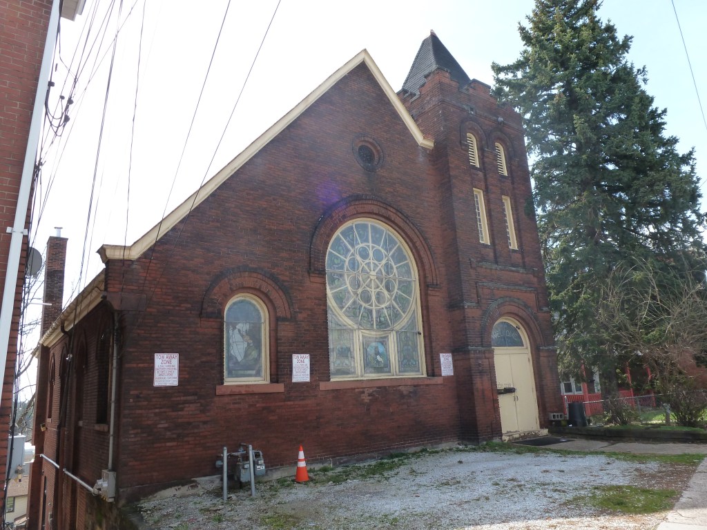
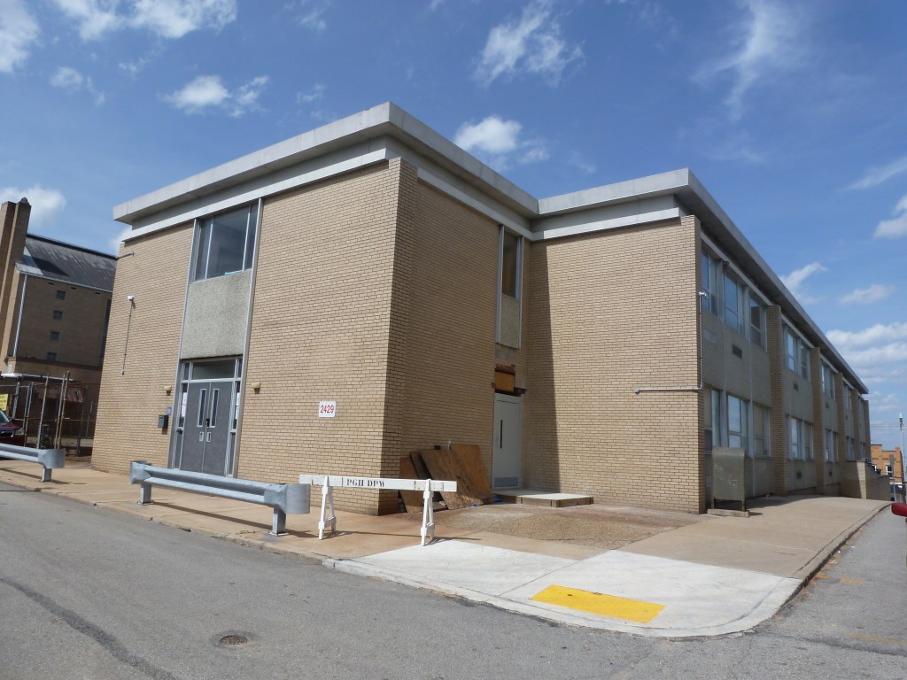
Neither of the two religious sites from the 1926 directory are still active. One was converted to a residential use. The site of the other one was replaced with a public school, though the congregation had moved to a newer church built next door. However, both the school and the church now sit vacant.
Neighborhood Statistics (Out of 70 in this Series)
- 33rd largest by acreage
- 53rd highest number of sites (multi-way tie)
- 58th most sites/acre
Locations
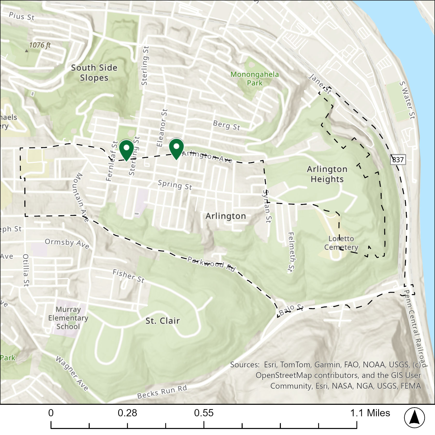
The map below shows the locations of the 2 congregations listed in the 1926 directory for Arlington (the dotted line marks the neighborhood boundary).
What are they now?
The table below matches the 2 congregations listed in the 1926 directory with the current use of the site.
| 1926 Congregation Name | By 2026 the Congregation’s Building is: |
| St. Henry Catholic Church | replaced with now vacant school |
| St. James Lutheran Evangalical Church | converted to residential |
Photos
For more on this series, visit our introductory post.
Sources:
Polk’s Pittsburgh City Directory, 1926. Pittsburgh: R. L. Polk & Co. https://digital.library.pitt.edu/islandora/object/pitt%3A31735056286846/viewer#page/4/mode/1up
