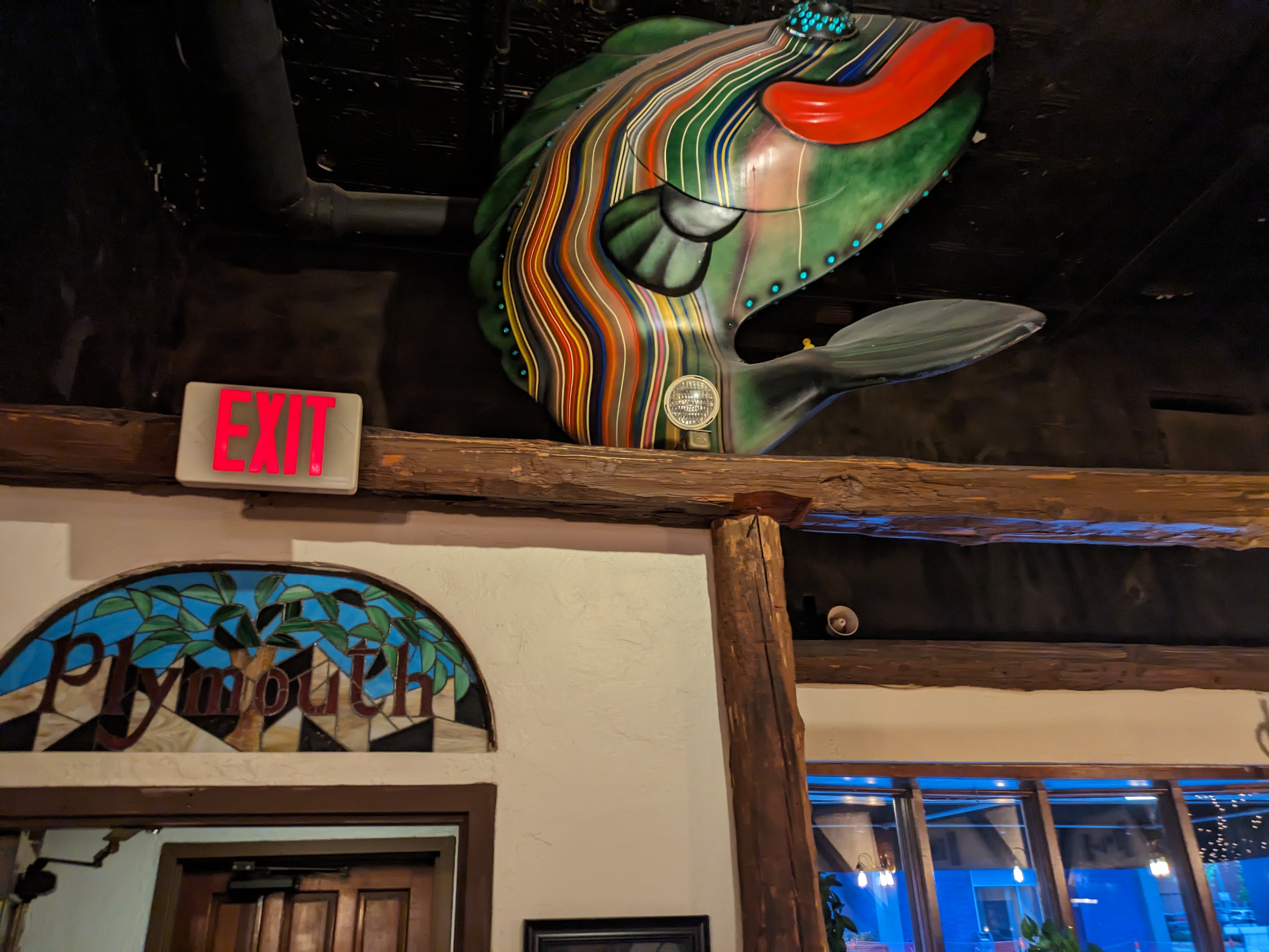
GoFish! was a fundraiser in Erie, PA, in 2001. Amy H.’s FourSquare map helped us identify the building where “‘The Teaching Fish’ Minds to Learn, Fins to Serve” by MC Gensheimer now lives (2023), but we had to ask for help multiple times once we were inside before one of the staff showed us where this fish was in the cafeteria.
As FourSquare isn’t available anymore, I have created my own maps for where I encountered Erie’s fish and frogs, plus statues in other cities: https://urbantraipsing.com/public-art-maps/
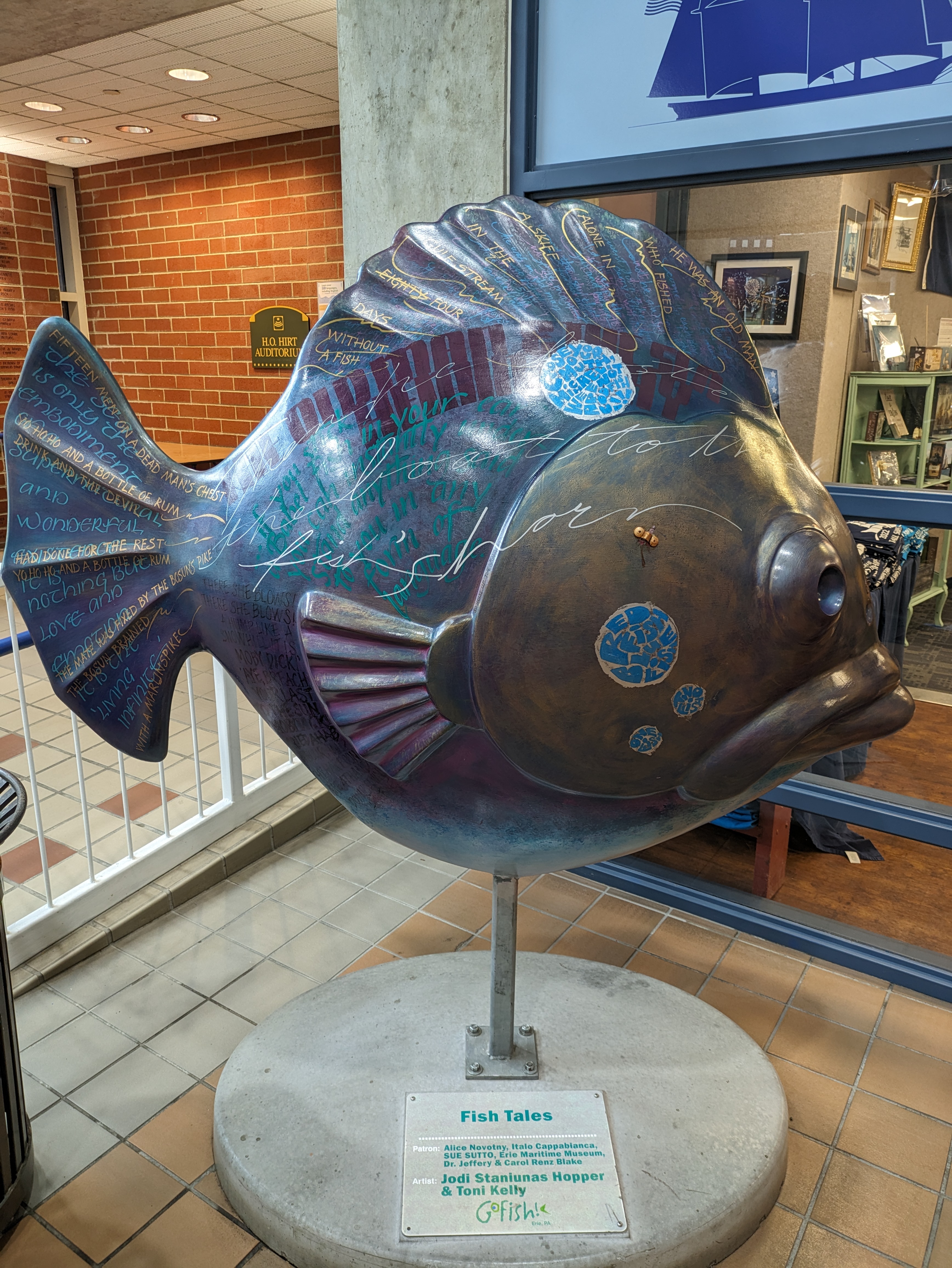
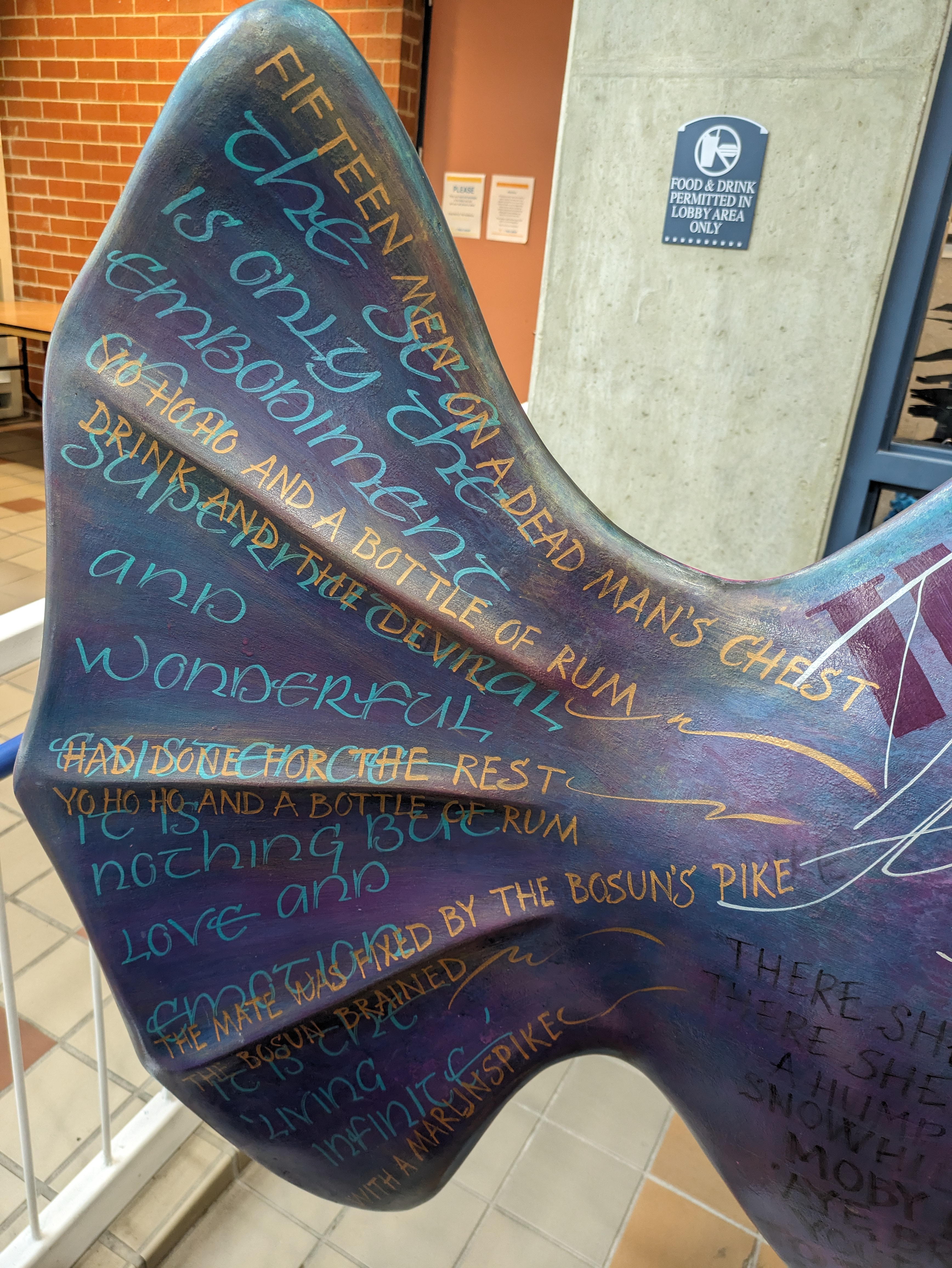
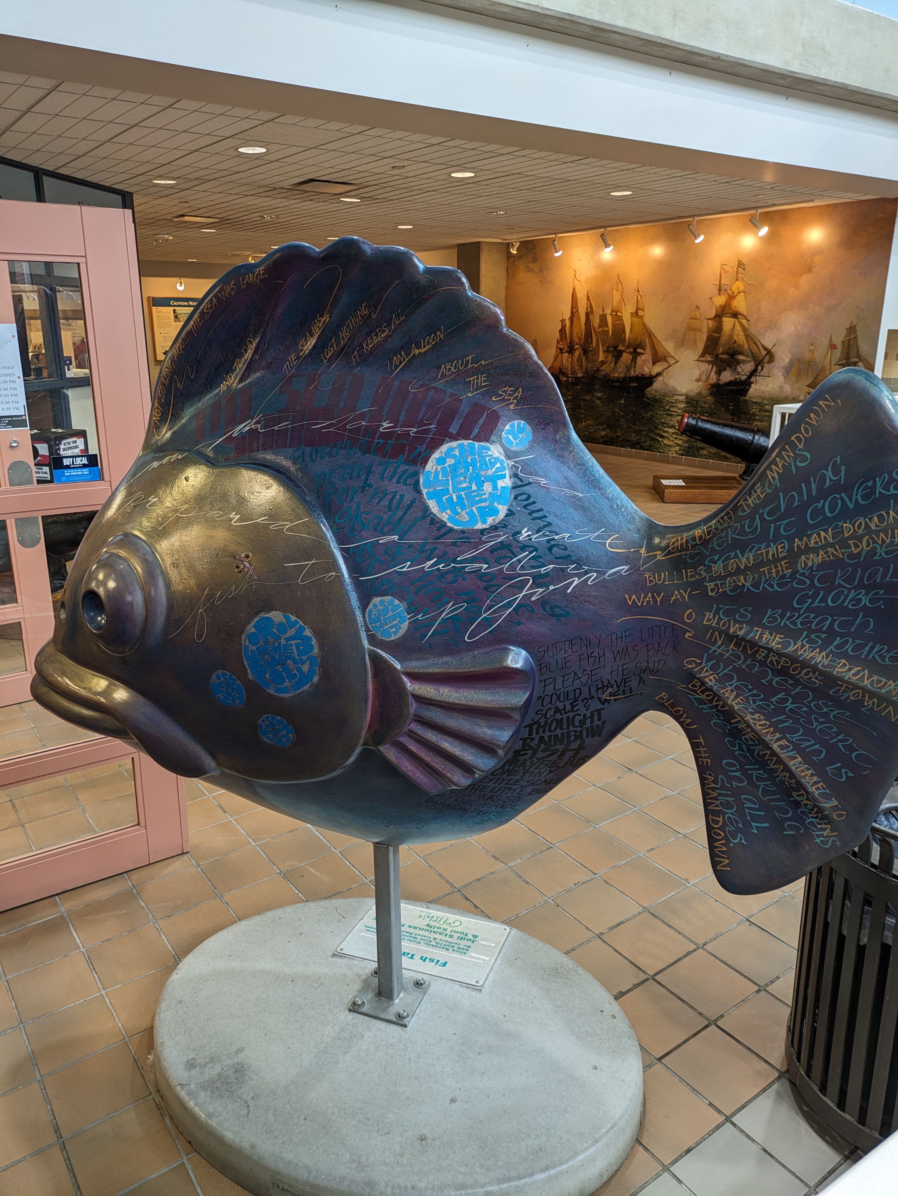
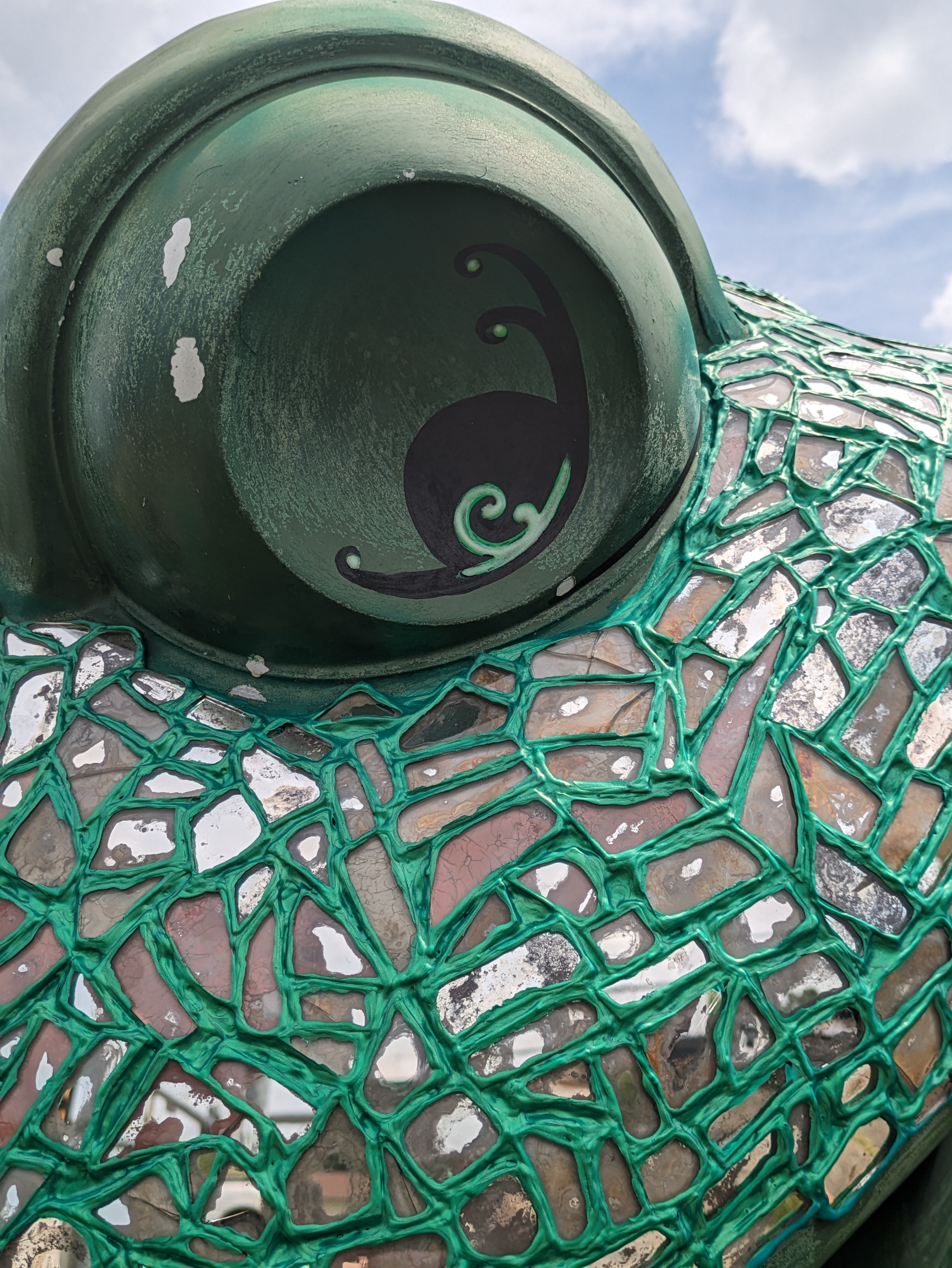
GoFish! was a fundraiser in Erie, PA, in 2001. “Fish Tales” by Jodi Staniunas Hopper & Toni Kelly must have had lasik surgery sometime between 2001 and 2023 as it no longer wears the glasses it had in 2001. Amy H.’s FourSquare map helped us find this one in the lobby of the Erie Maritime Museum, one of the original patrons of the fish. As FourSquare isn’t available anymore, I have created my own maps for where I encounter the fish and other statues: https://urbantraipsing.com/public-art-maps/
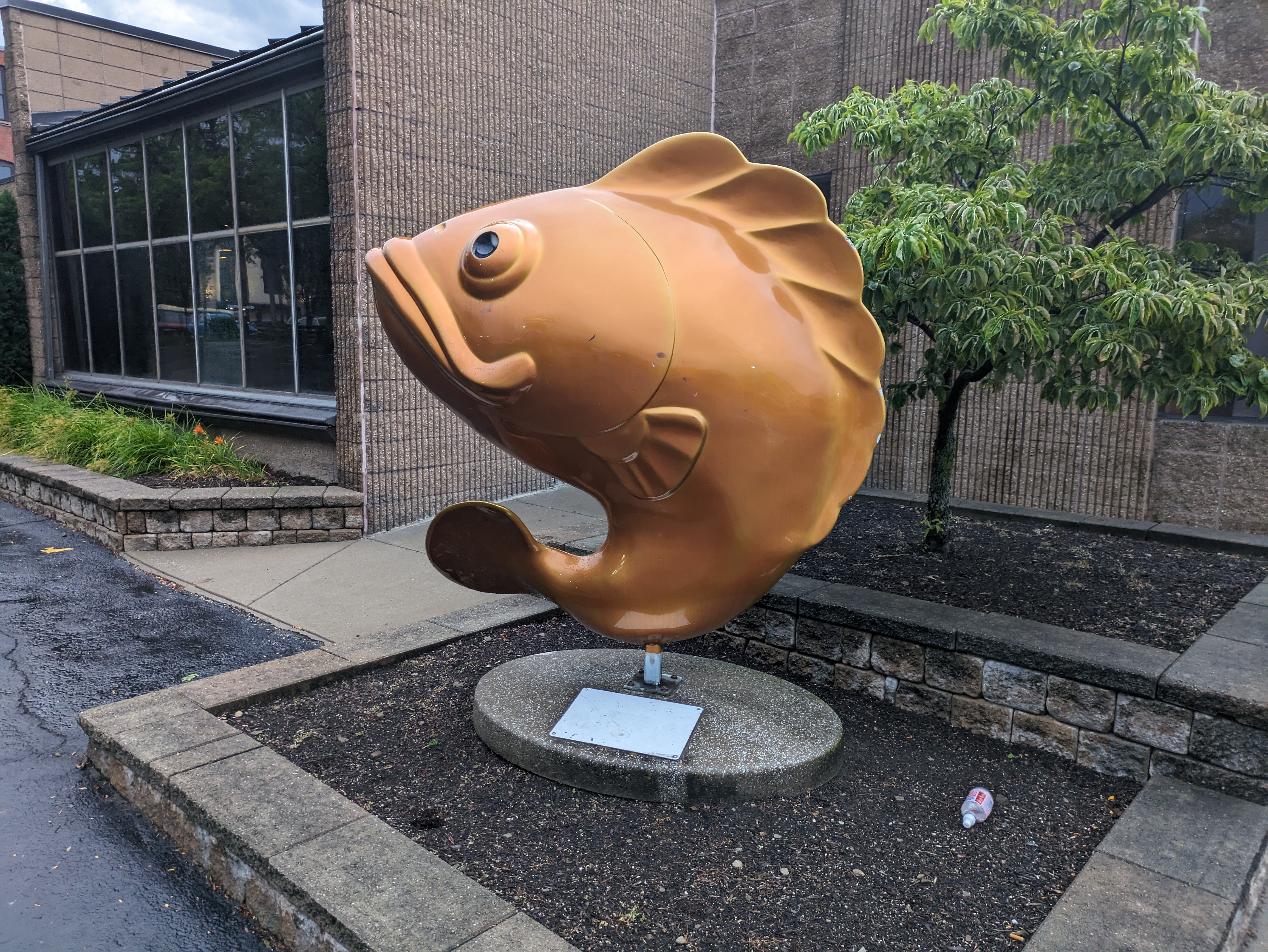
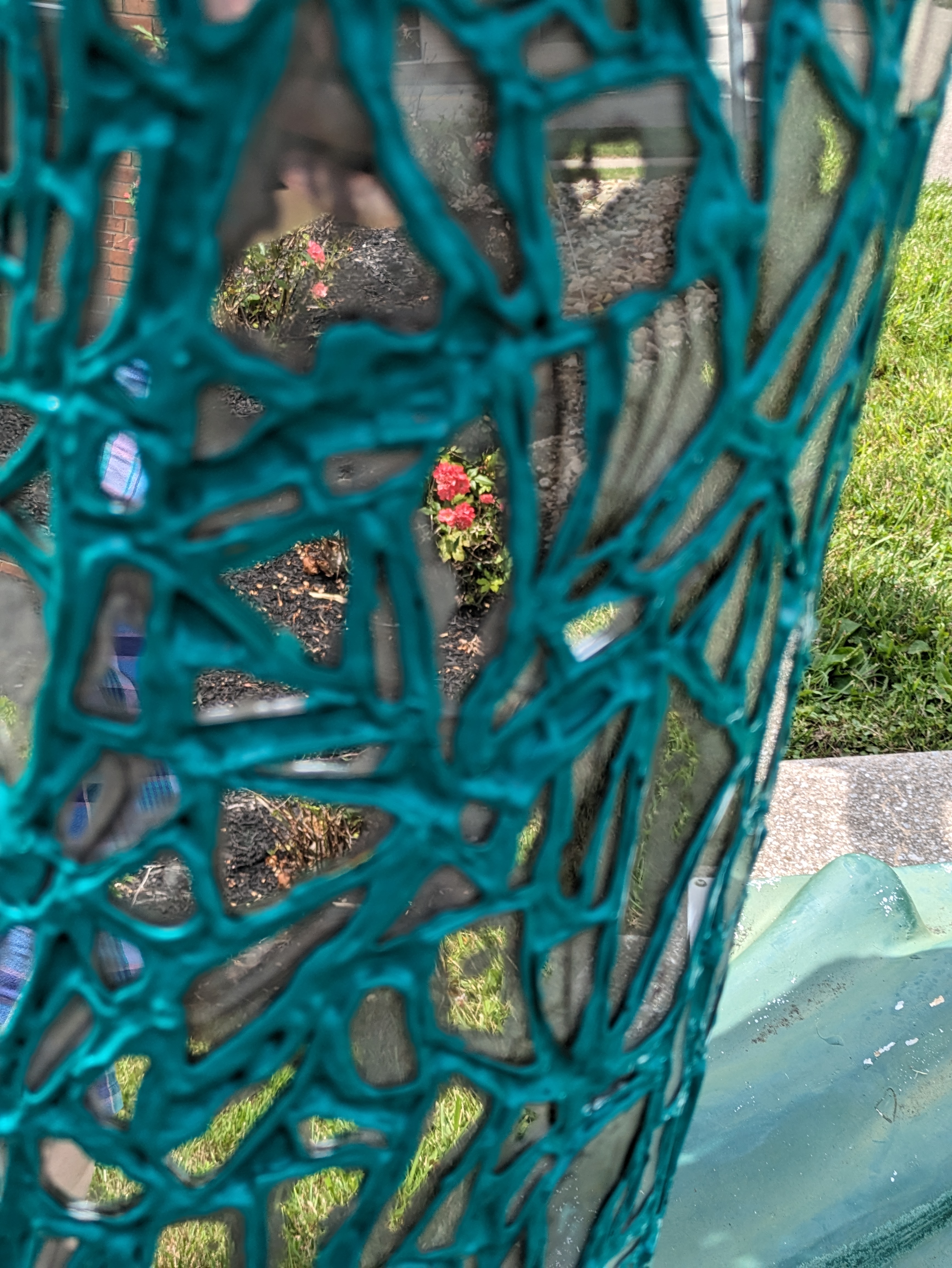
GoFish! was a fundraiser in Erie, PA, in 2001. I can’t find a match for this one in the “offishial” GoFish! book and the plaque underneath is too faded to read after 22 years in the sun and rain. Amy H.’s FourSquare map identified this one as “Goldfish.” Unfortunately, since FourSquare folded, I can no longer access her map. However, I have created my own which you can view on my new Public Art Maps page.
GoFish! was a fundraiser in Erie, PA, in 2001. “Lilly the Lip” by Rick & Susan James was the first of the fish and frogs that Shelly and I took photos of on our trip in 2023 armed with Amy H.’s maps. As it was after sunset, we were carded to enter the bar even though we only wanted a picture of a fish.
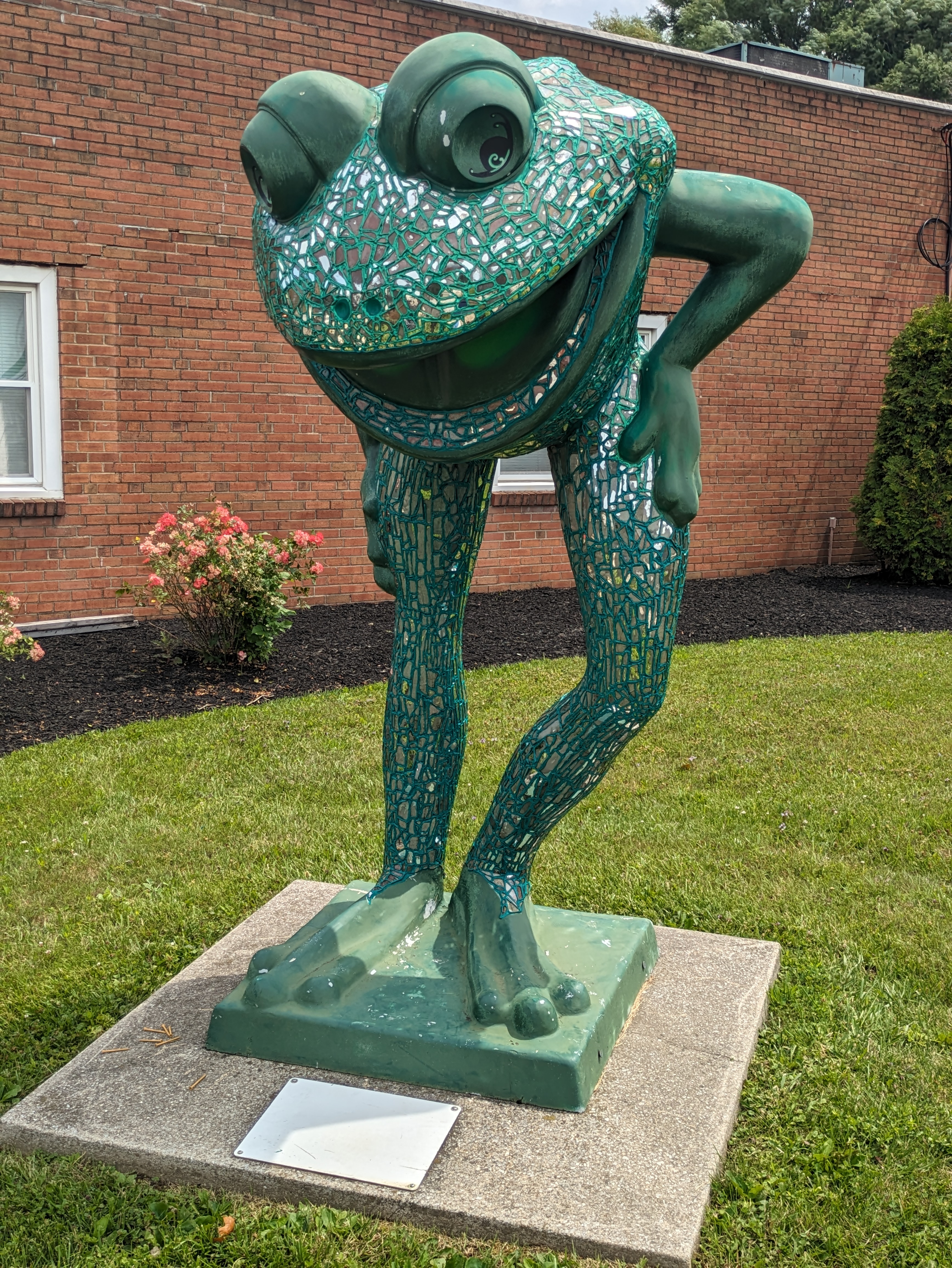
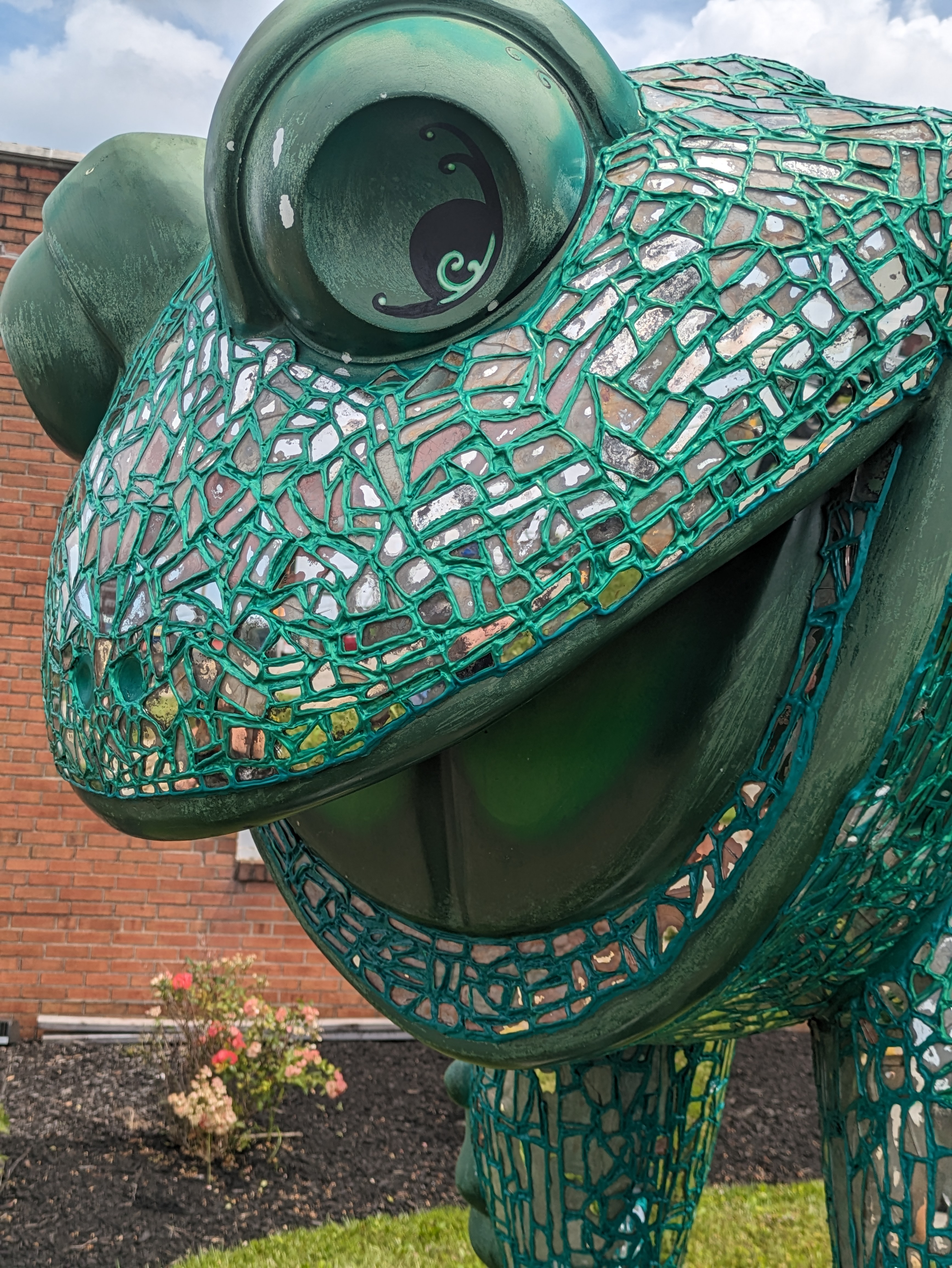
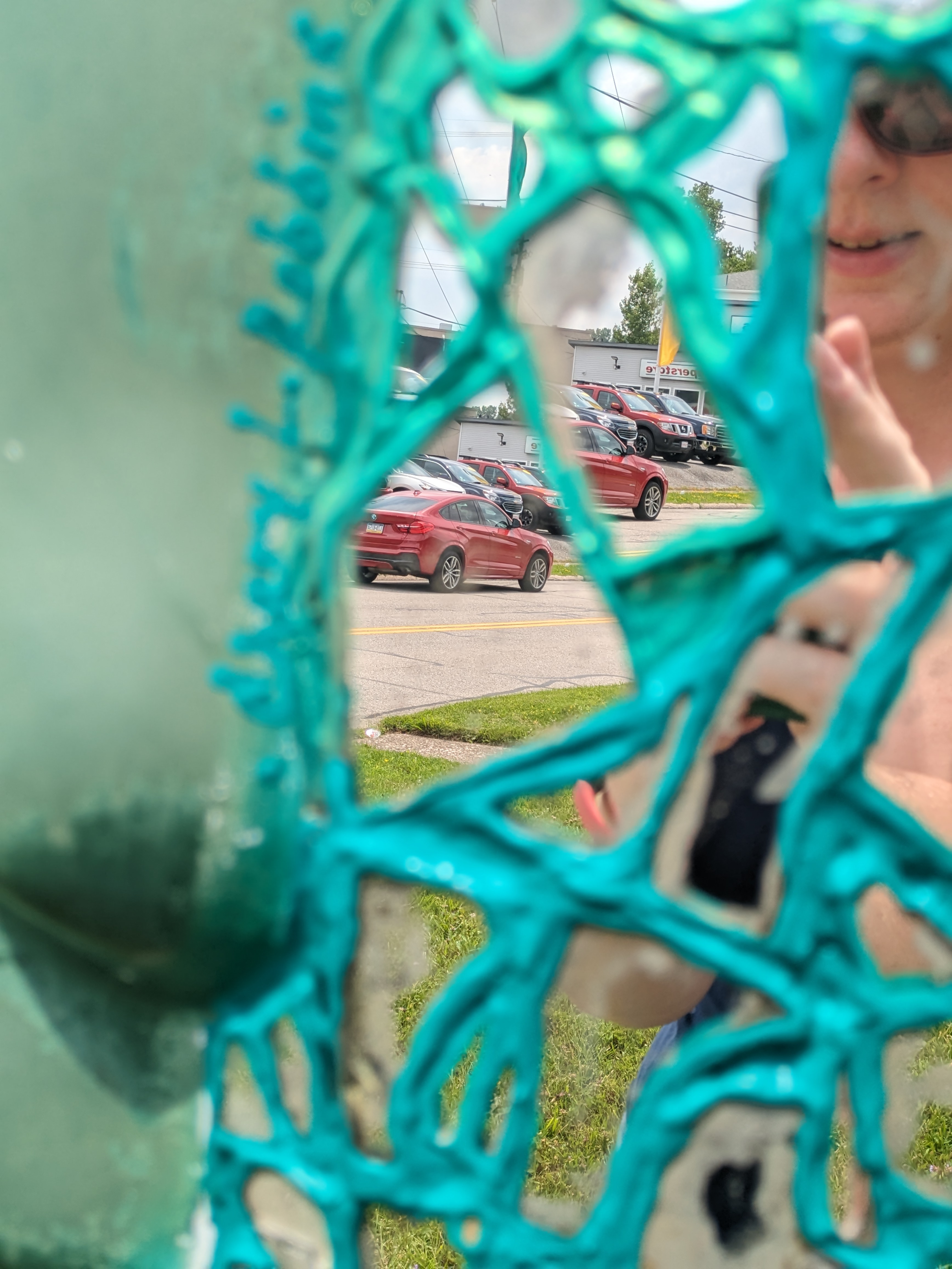
LeapFrog! was a fundraiser in Erie, PA, in 2004. For our final stop in our July 2023 search for frogs, we paused to reflect with “Leap into your Reflection” by Chary L. Robbins. Amy H.’s map was “toadally” helpful in aiding Shelly and I to find 12 more frogs to add to my collection started in 2012 and to revisit 2 frogs from that first trip.
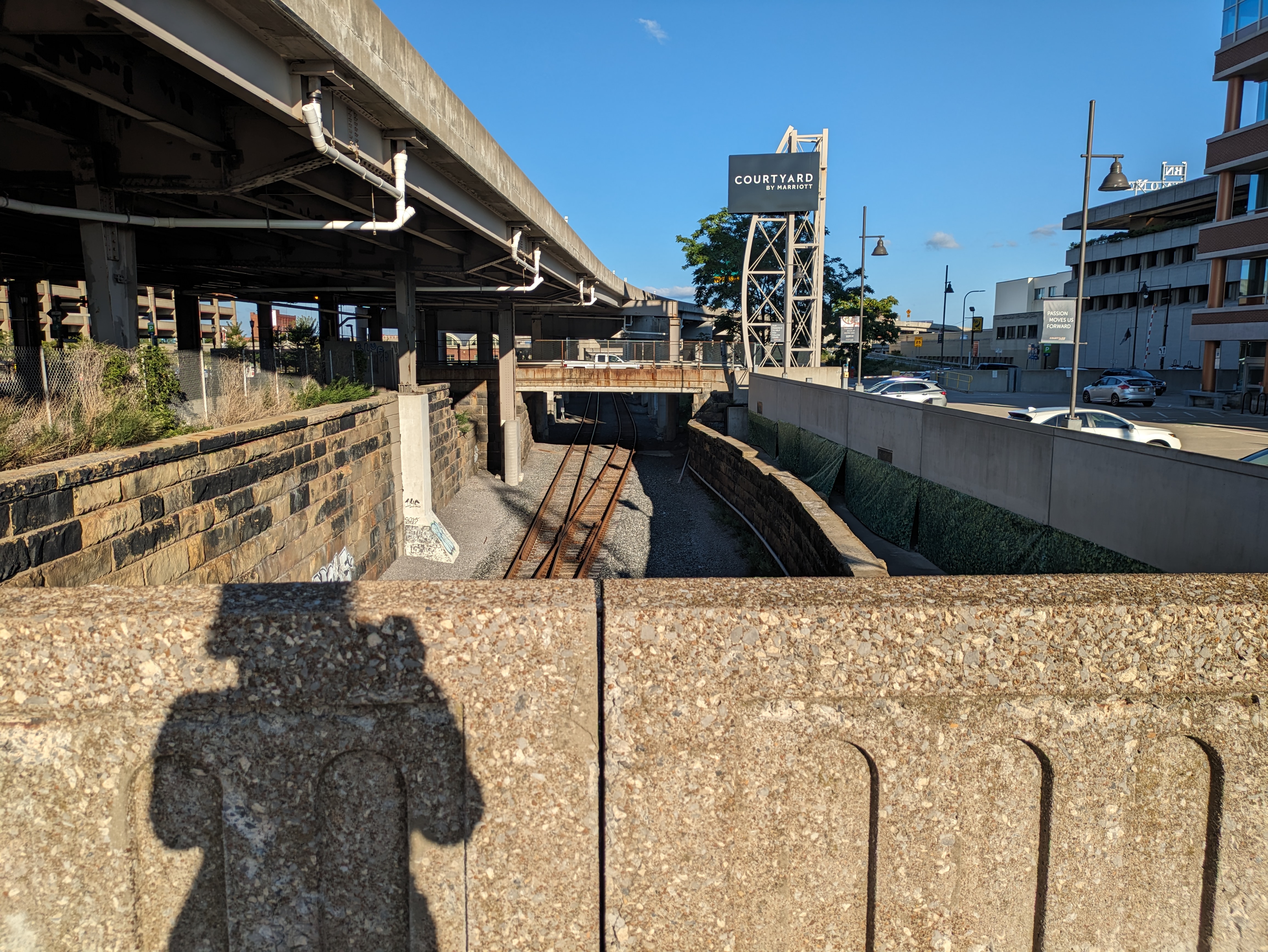
Chicago first drew my attention to how we layer our cities. I wasn’t thinking of this theme when I was in Buffalo, but when I reviewed my photos, this bridge-walking photo caught my eye as another iteration of city layering. Buffalo’s layering is more subtle than Chicago’s, but like Chicago, there are a variety of uses/activities at each level.
Underground
The underground layer in this photo is the railroad tracks, which appear to be the tracks the Amtrak uses as the station is nearby. At a similar elevation and a few blocks to the right, the Erie Canal and Lake Erie are other uses at this layer’s level. Part of the canal has been converted into a paved recreation area with skating rink. At the point where this picture is taken, the light rail system is at street level and immediately behind me, but toward the northern end of downtown, it slips underground. Exploration of other potential underground uses such as tunnels, parking garages, or businesses was beyond the scope of this trip.
Street Level
Again, where this photo was taken, the street level includes pedestrian, vehicular, and light transit activity. Although, when I was passing on a Sunday in the late afternoon approaching dinnertime, there was very little of any activity at this location. I had encountered a fair number of people enjoying the indoor and outdoor amenities at Canalside and once back in the heart of downtown there was some activity at street level. This point along the “barrier” to the waterfront felt a little like a no-man’s land.
Pie in the Sky
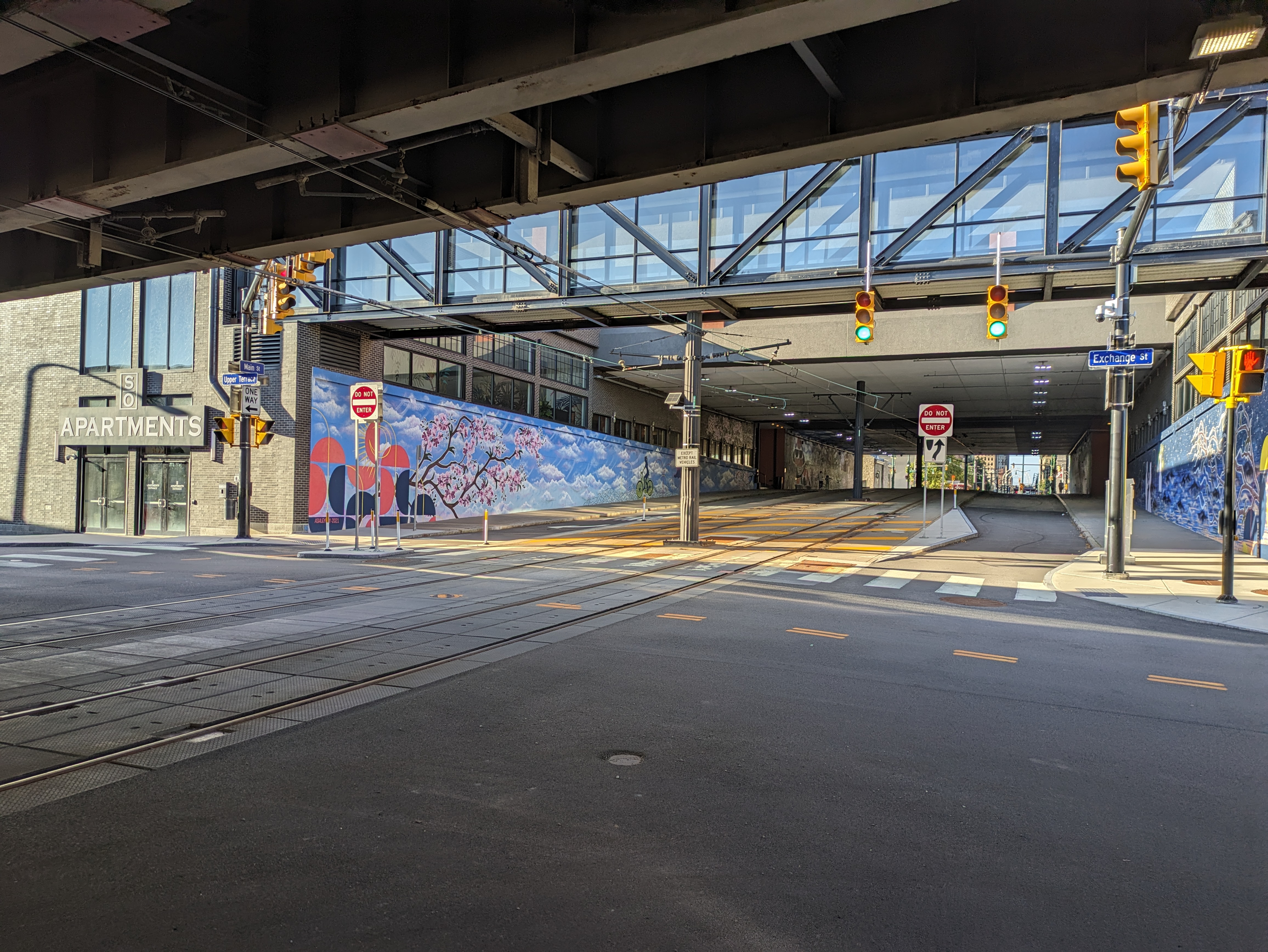
In this picture, the upper layer of the city is the overpass (or bridge) for I-190. Just on the other side of the overpass the upper layer changes into the Seneca One office and apartment tower that straddles Main Street and has beautiful street-level murals. Downtown has many skyscrapers and other large buildings that contribute to the upper layer of the city, but the outstanding feature for me of Buffalo’s upper layer is the web of overpasses.
LeapFrog! was a fundraiser in Erie, PA, in 2004. In 2023, I never would have thought to look here for a frog without Amy H.’s map. “Toadally Eriesistible” by Jeff Yonkers no longer has his/her/their map of Erie, but has gained a few more accessories.
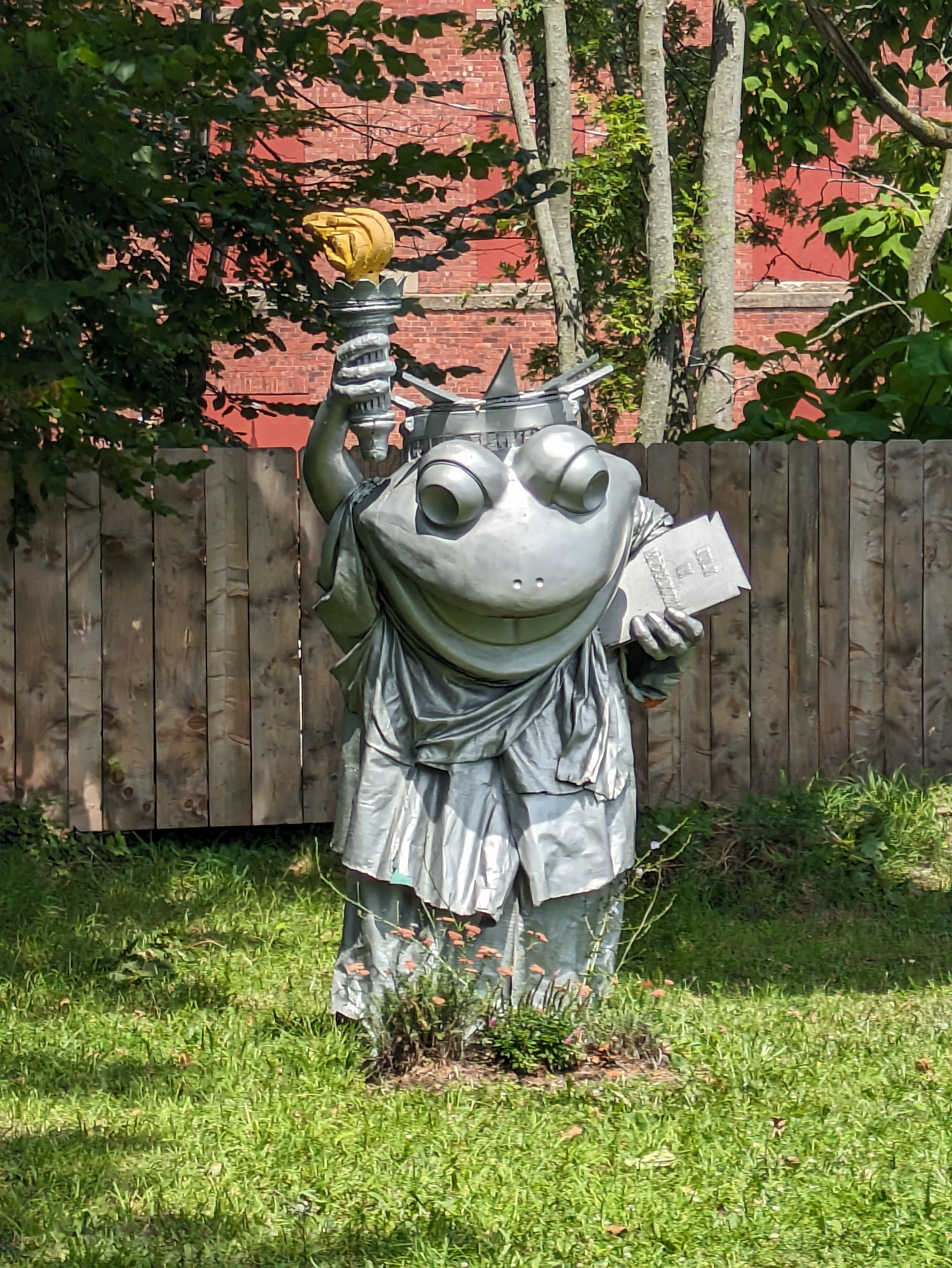
LeapFrog! was a fundraiser in Erie, PA, in 2004. In 2023, “‘Frog-on’-Liberty” by Meridian Creative Group Art Department was no longer on Liberty and was no longer green as shown in the official LeapFrog! book and earlier photos on Amy H.’s map.
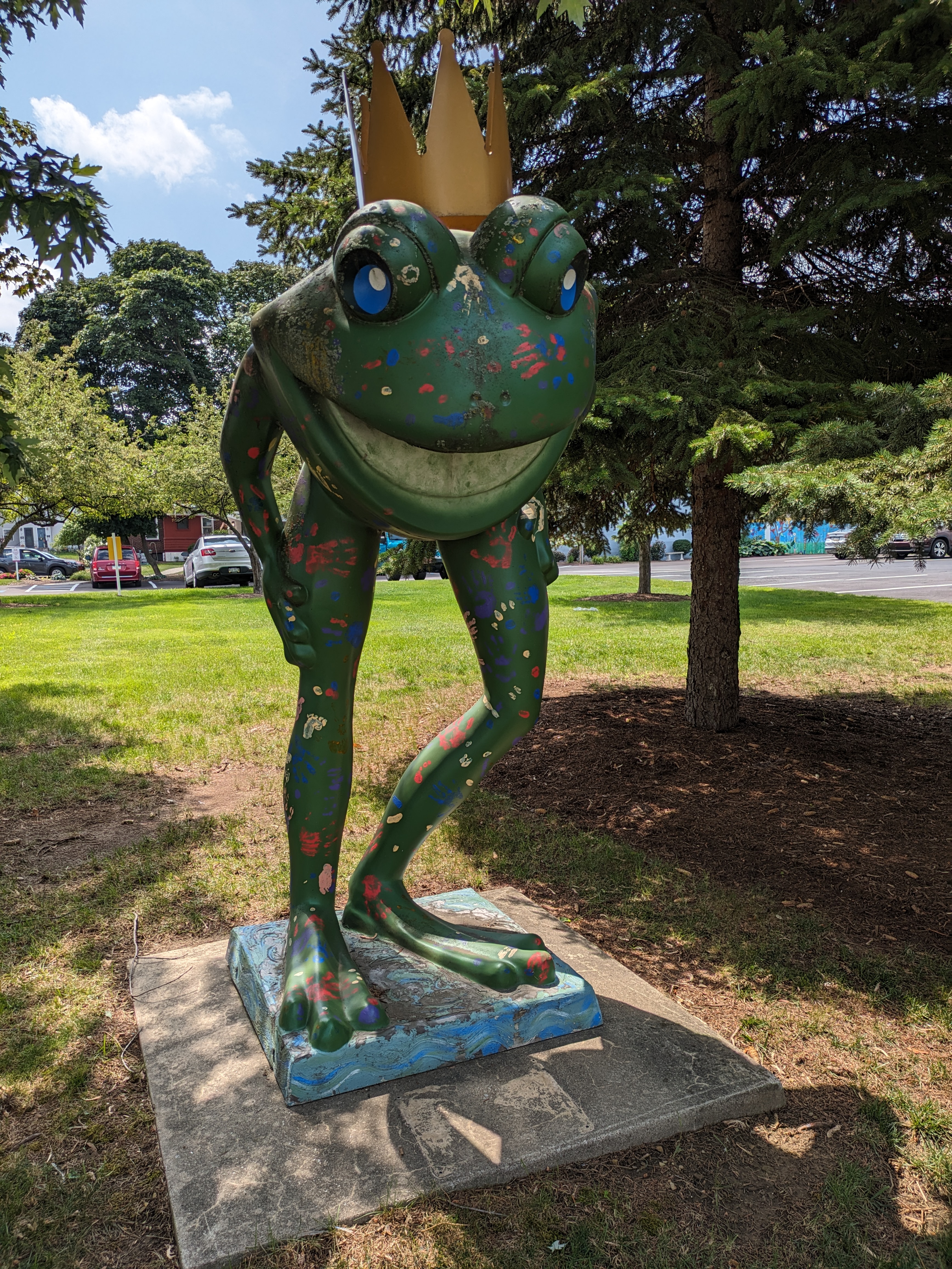
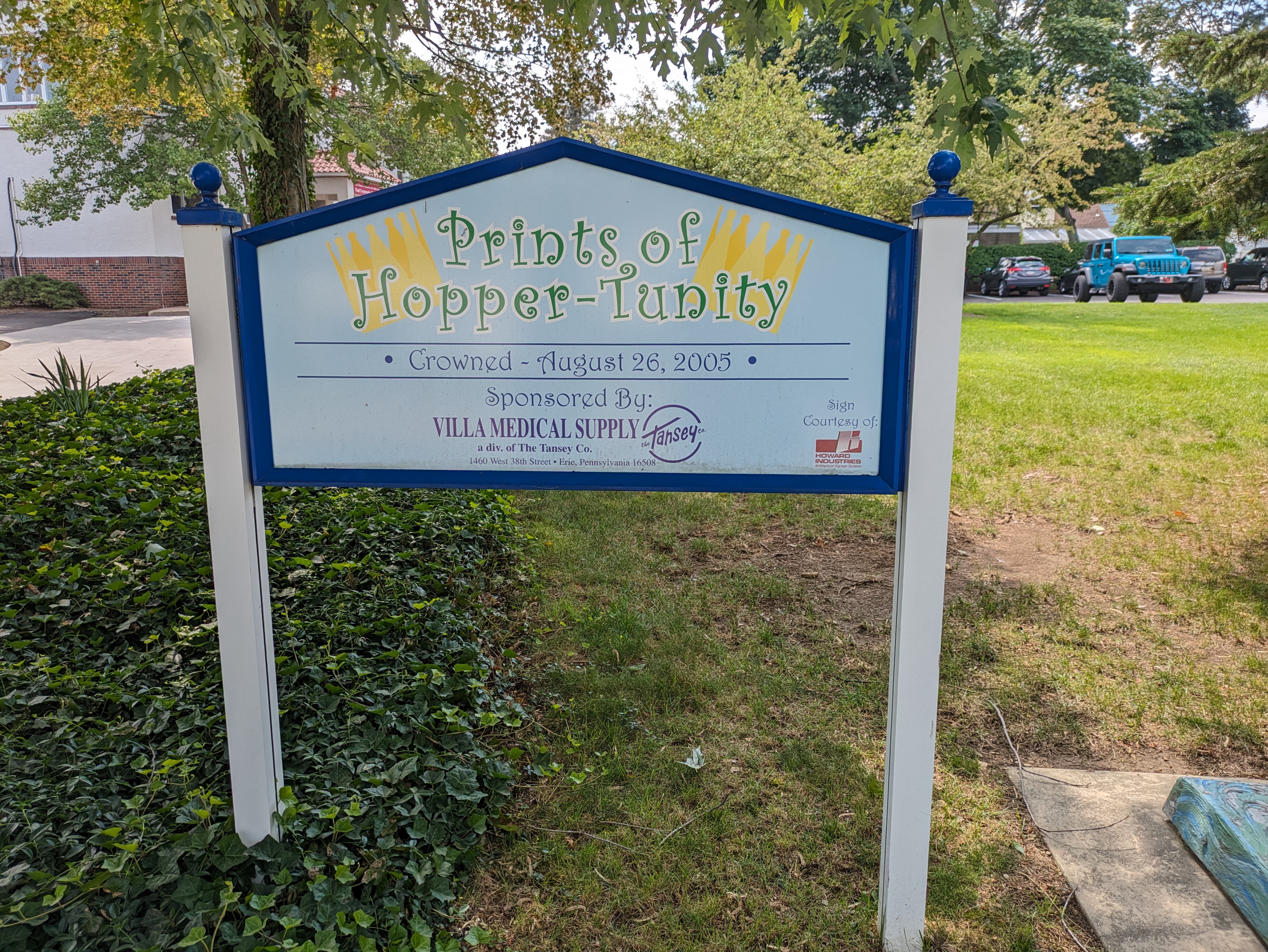
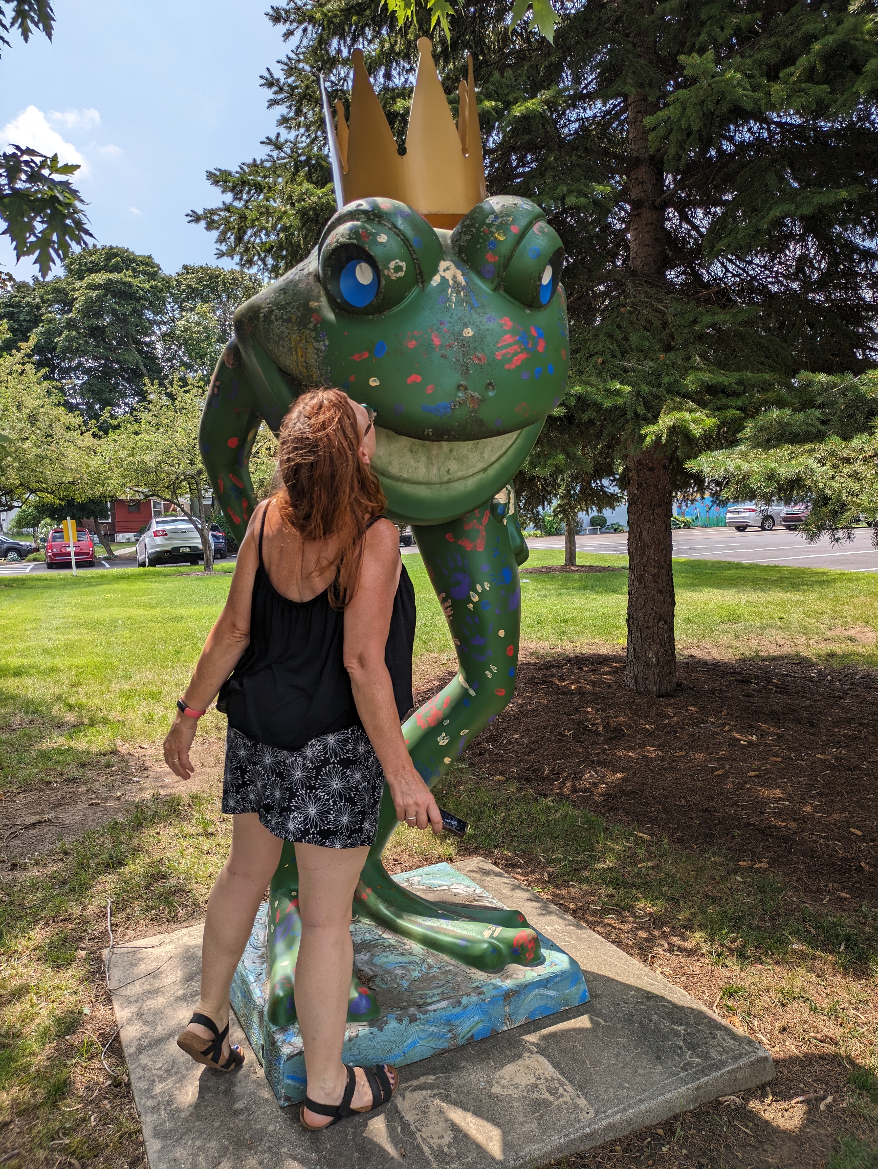
LeapFrog! was a fundraiser in Erie, PA, in 2004. The “Prints of Hopper-Tunity” was crowned in 2005, so it may not have been part of the original fundraiser. We stumbled upon the “Prints” while looking for another frog Amy H.’s map said was in the vicinity, but that one we didn’t find. The “Prints” did not change into a “Prince” when Shelly kissed him.
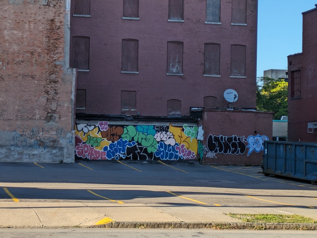
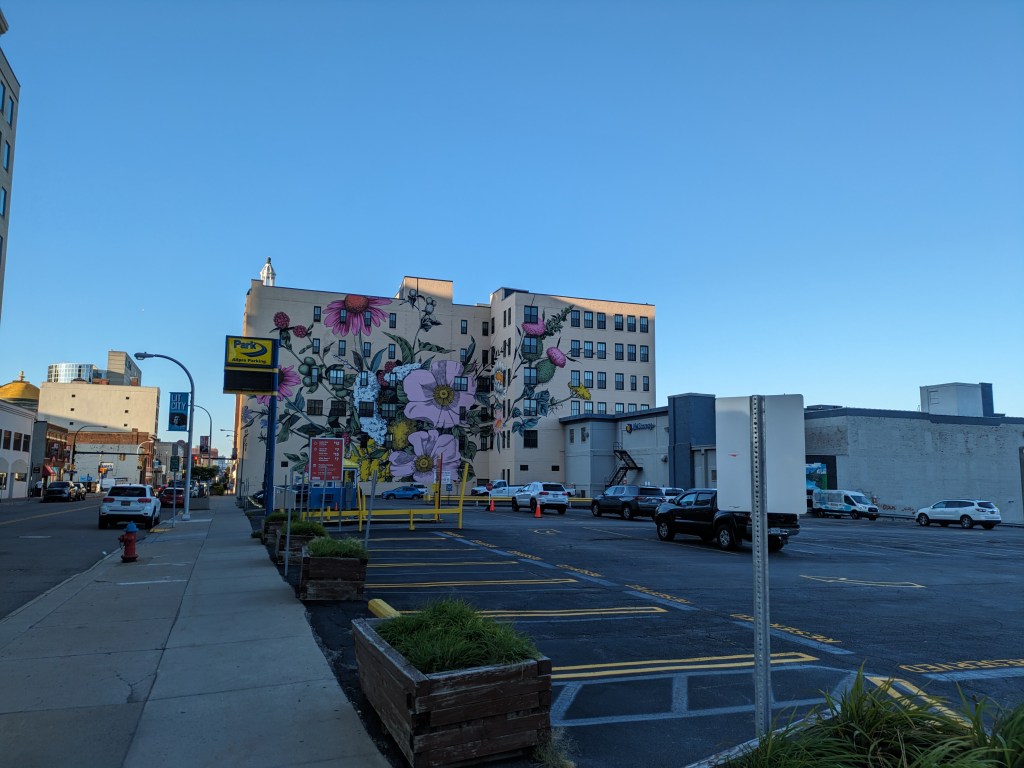
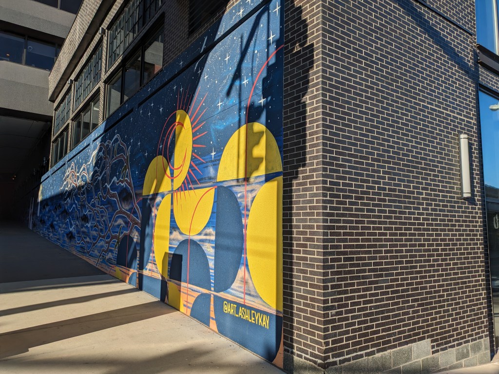
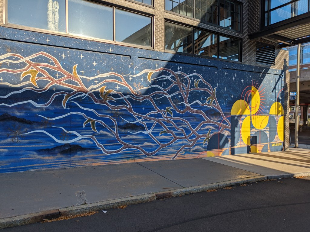
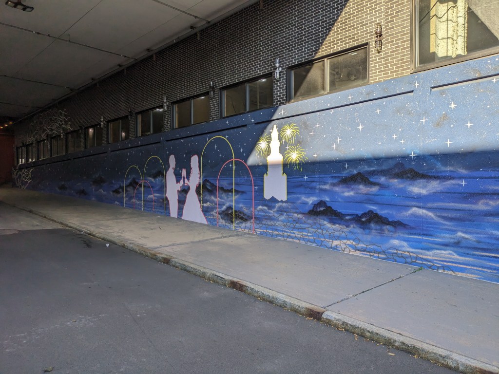
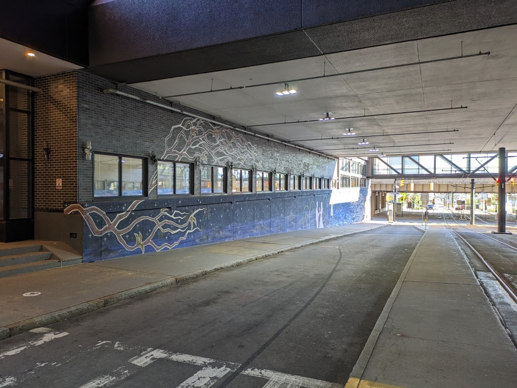
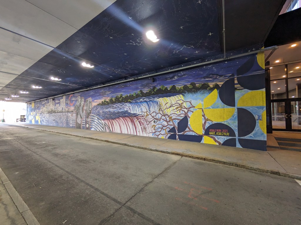
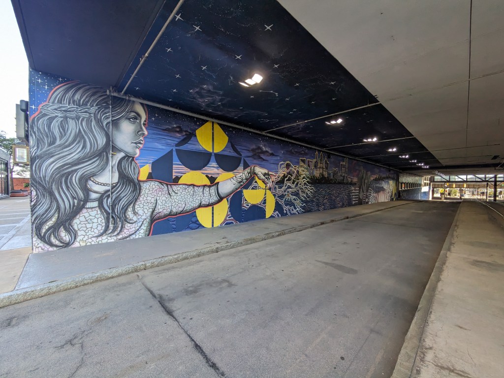
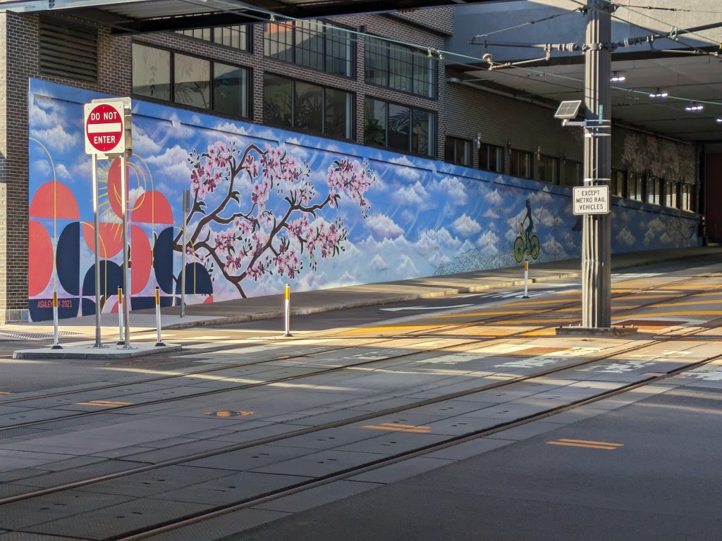
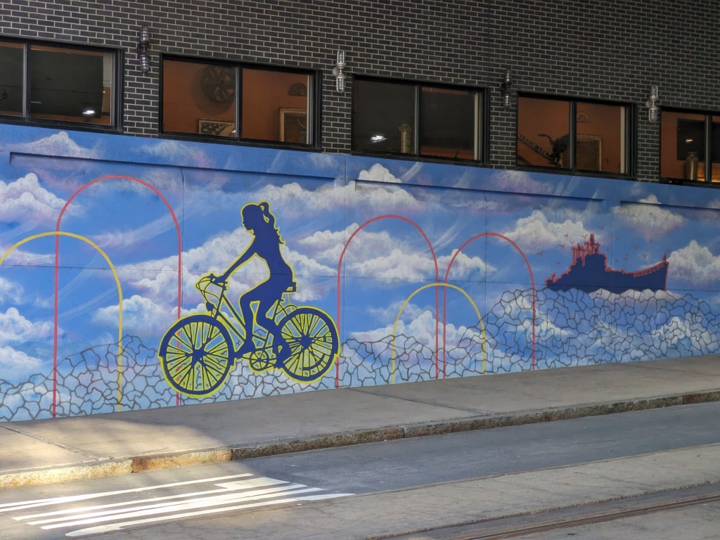
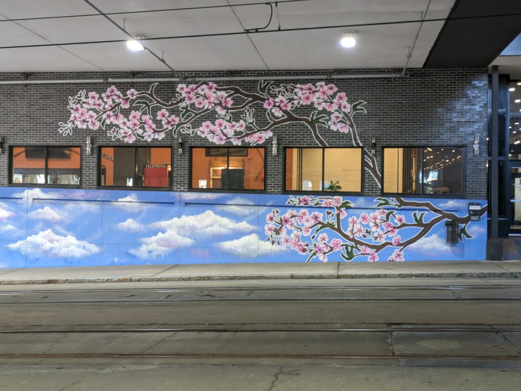
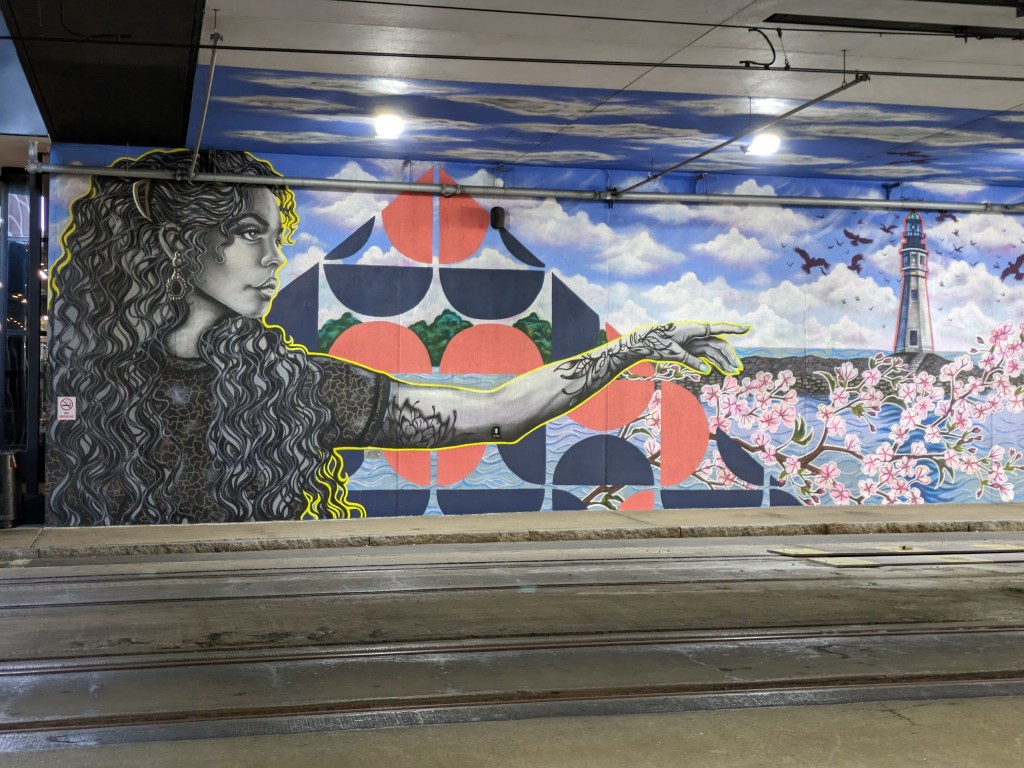
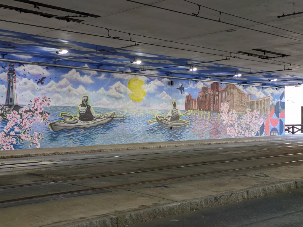
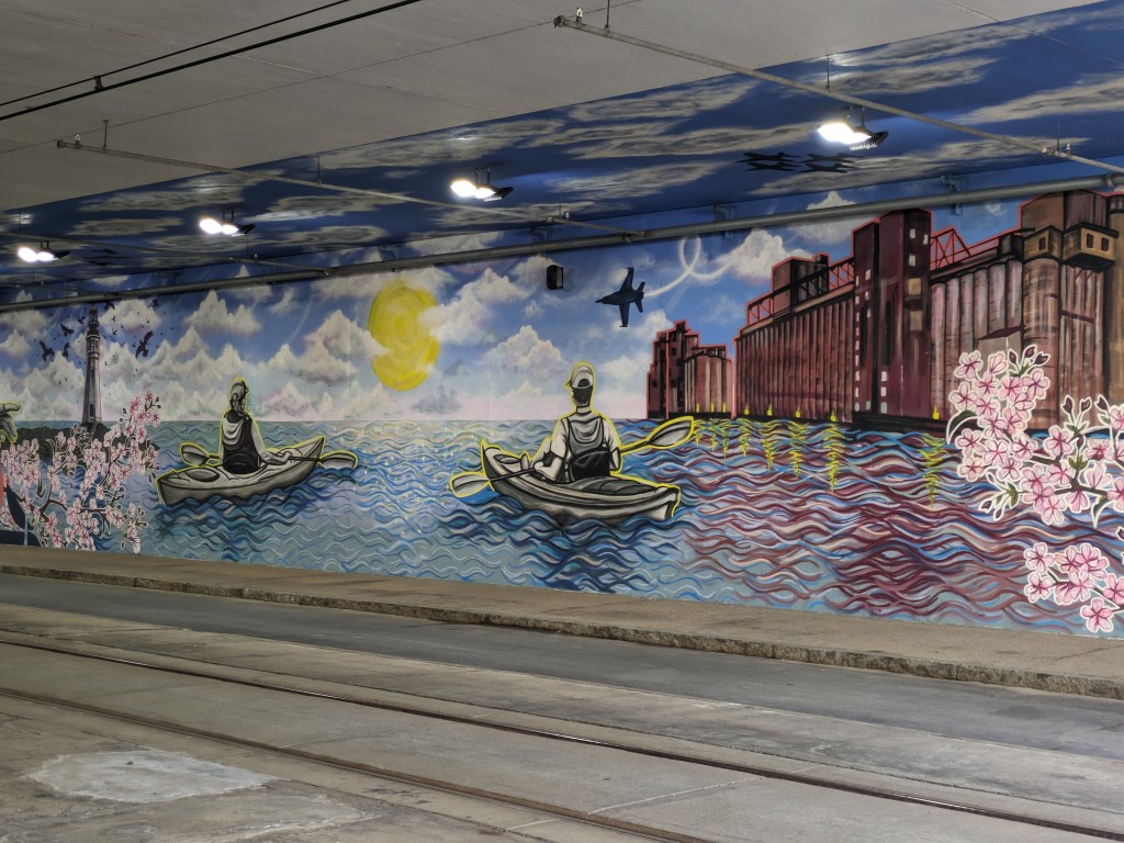
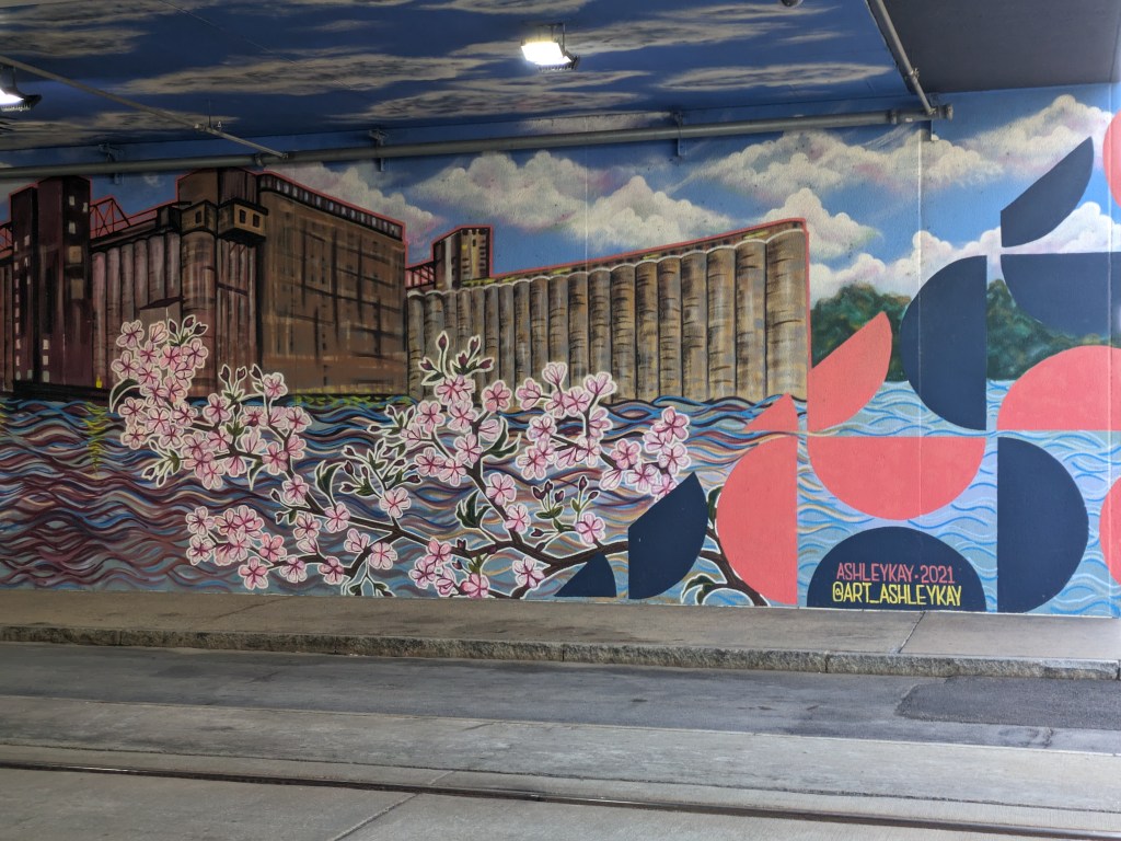
Walking around downtown Buffalo, I encountered several murals. They were all placed where the built environment would have otherwise created a drab or unpleasant experience. Three were on the sides of buildings bordered by parking lots. One was along both sides of the tunnel created by Seneca One, a 1970s tower built over Main Street. The mural along Main Street was particularly appealing. Usually walking along a road that passes underneath a building is a dark and dingy experience. This mural brightened up the space and created a distraction for the whole block. As Main Street is one of the possible pedestrian connections to the Canalside waterfront area, placing a mural here was a great decision to help make the approach more palatable. There are plenty more unpleasant places to pass before reaching the water.